Clifton is the largest city in Bosque County, in Central Texas in the United States. The city’s population was 3,442 at the 2010 census.
| Name: | Clifton city |
|---|---|
| LSAD Code: | 25 |
| LSAD Description: | city (suffix) |
| State: | Texas |
| County: | Bosque County |
| Elevation: | 673 ft (205 m) |
| Total Area: | 2.06 sq mi (5.34 km²) |
| Land Area: | 2.05 sq mi (5.31 km²) |
| Water Area: | 0.01 sq mi (0.03 km²) |
| Total Population: | 3,442 |
| Population Density: | 1,680.98/sq mi (649.02/km²) |
| ZIP code: | 76634, 76644 |
| Area code: | 254 |
| FIPS code: | 4815472 |
| GNISfeature ID: | 1332988 |
| Website: | www.cityofclifton.org |
Online Interactive Map
Click on ![]() to view map in "full screen" mode.
to view map in "full screen" mode.
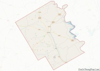
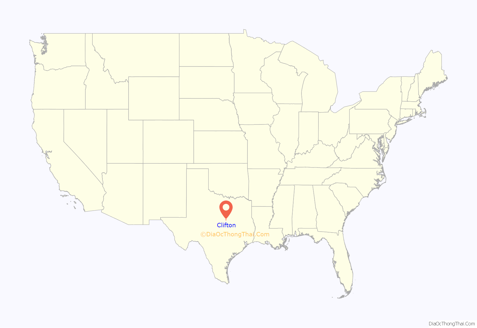
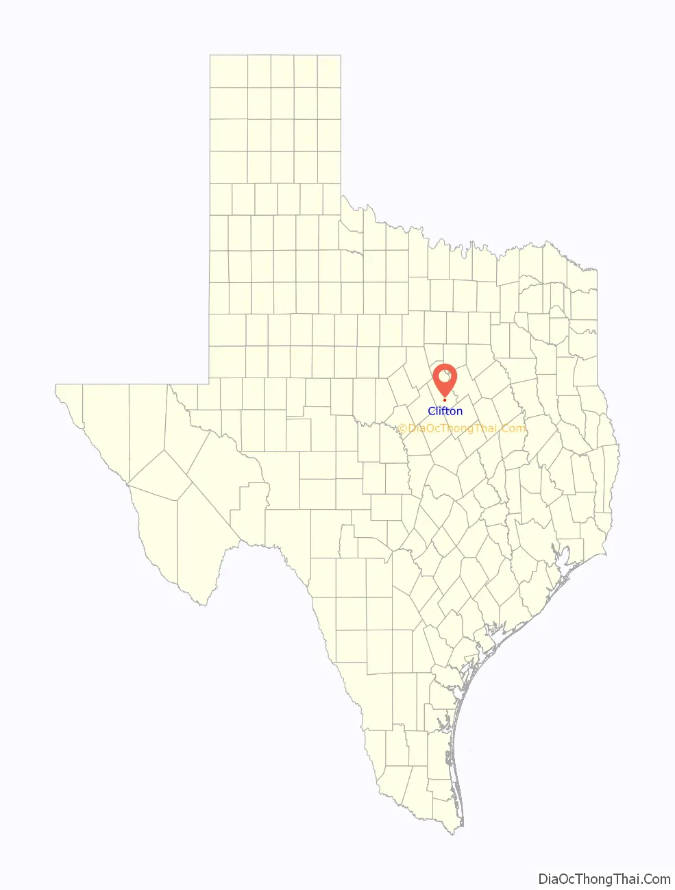
Clifton location map. Where is Clifton city?
History
Clifton was founded in the winter of 1852–1853, when the families of Frank Kell, Joseph A. Kemp, Samuel and Monroe Locker, and T. A. McSpadden settled in the vicinity. The town was named Cliff Town after the surrounding limestone cliffs. Over the years the name was altered to Clifton. The site was originally on the banks of Clear Branch. The Masonic lodge hall and a log schoolhouse were the first public buildings. The post office was established in 1859. The First Presbyterian Church of Clifton was organized in 1861 and is the county’s oldest church in continuous service. The Baptists built the first church building in Clifton in 1884–1885. After the Civil War, Joel Martin Stinnett (1806–1875), the grandfather of Joseph Kemp, built a flour mill powered by the Bosque River. In 1868, this mill was replaced by a limestone mill, which was converted to the electric power plant that provided the first electricity for Clifton homes and businesses. A three-story school known as Rock School was built about 1870 and served the community for more than twenty years. In 1893, a new building was constructed on property donated to the Clifton school system.
In 1880 the Gulf, Colorado and Santa Fe Railway built a station a mile south of Clifton. Merchants moved their businesses closer to the railroad station, and the town thrived as a business and trade center. The Merchant Exchange and Flour Mill, the first steam flour mill in the Bosque valley, was established in 1887 or 1888. The Clifton Record, a newspaper that began publishing in 1895 under the ownership of W. C. O’Brian, continued to serve the community. Clifton served as the county seat between 1890 and 1892. Clifton Lutheran College, later known as Clifton College, opened in 1896. The community was incorporated in 1901. An earlier attempt at incorporation in 1891 failed when the election results were declared invalid. A fire on December 23, 1906, destroyed a large portion of the business district, which was eventually rebuilt. The Clifton Volunteer Fire Department was organized in 1907. The town’s need for a hospital was met by Dr. V. D. Goodall and Dr. S. L. Witcher, who formed the Goodall-Witcher Hospital in 1938, which is still operating today along with the Clifton Clinic. The Lutheran Sunset Home for the elderly was established in Clifton in 1954. In 1991, the Bosque River flooded much of the town due to torrential rains. The town had an estimated population of 204 in 1904 and 3,542 in 2000. It now has a population of 3,442.
On December 21, 1929, a weather station near Clifton recorded 24 inches of snowfall. This is the greatest daily snowfall recorded for anywhere in Texas.
On January 15, 2017 an EF1 Tornado struck Clifton damaging at least 25 homes. Although no injuries were reported, the heaviest damage was in town near the intersection of Pecan and Avenue G.
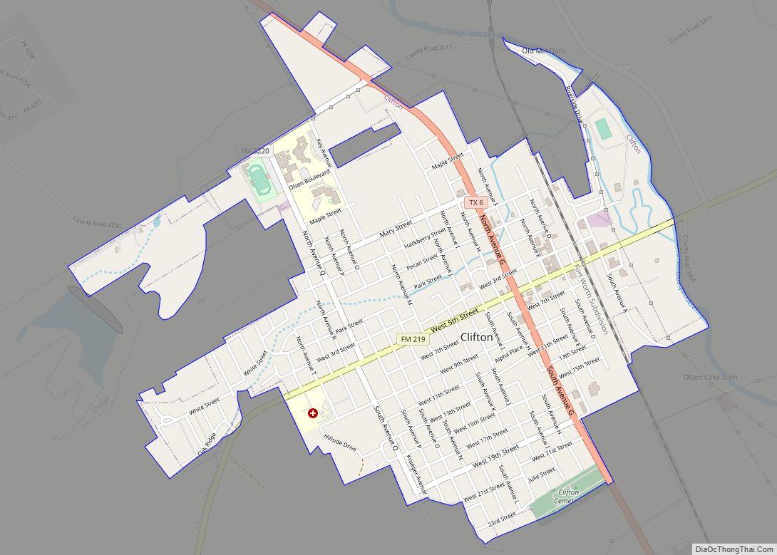
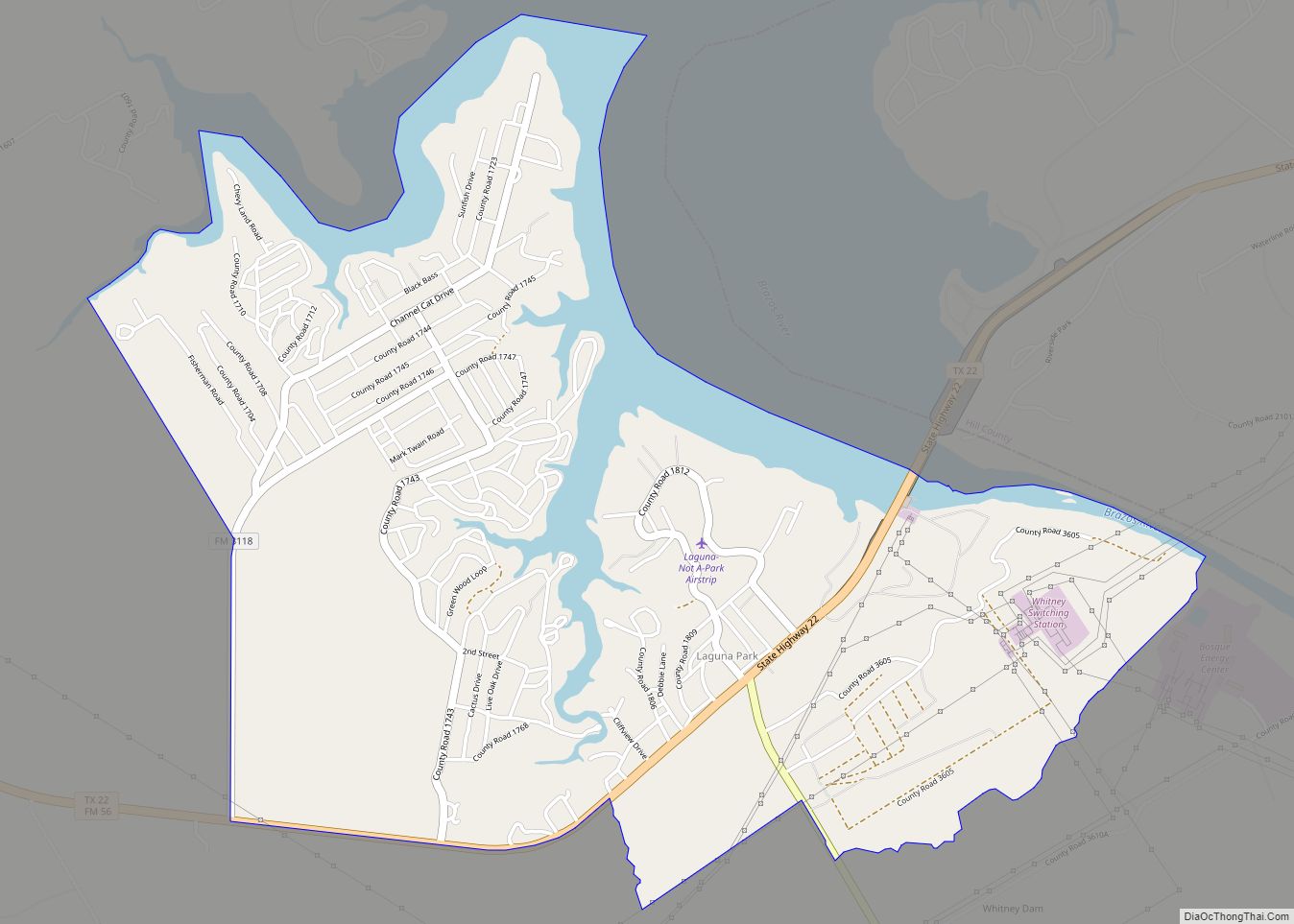
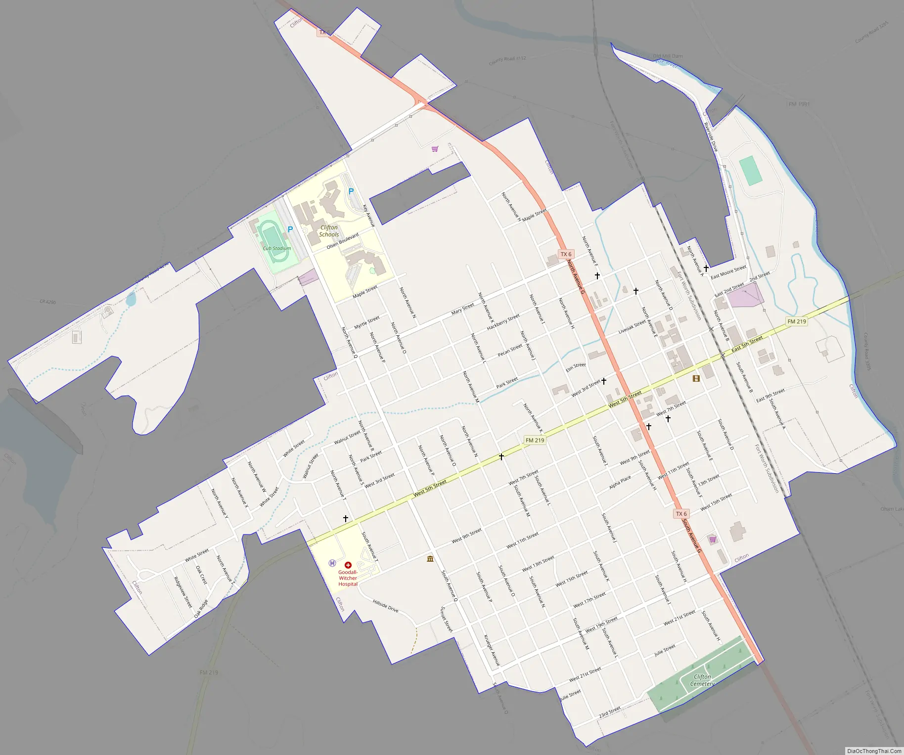
Clifton Road Map
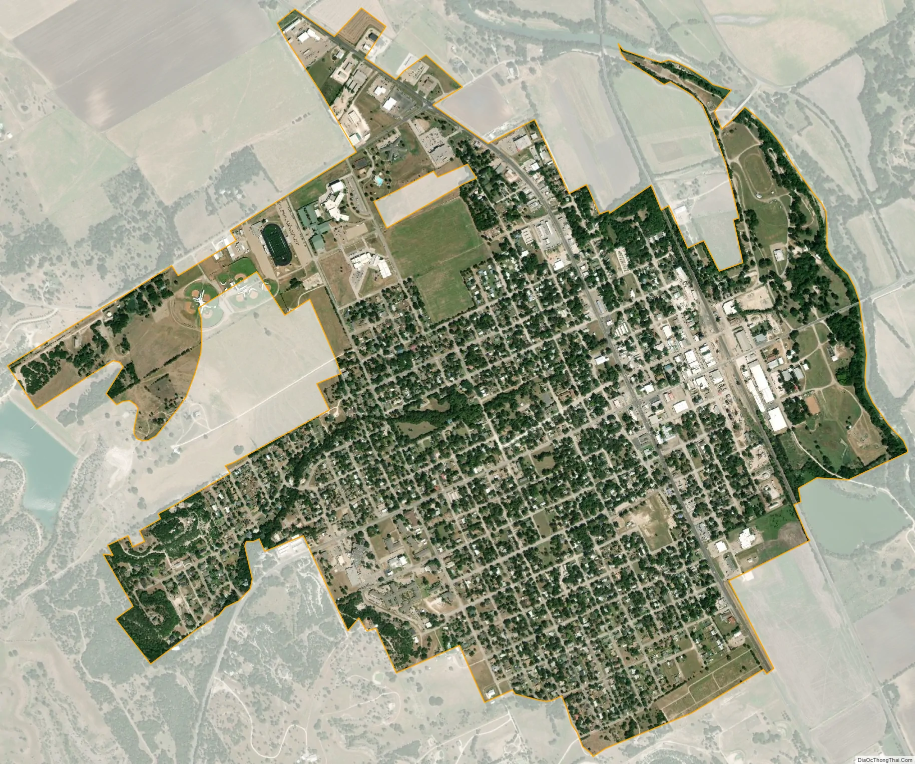
Clifton city Satellite Map
Geography
Clifton is located at 31°46′49″N 97°34′51″W / 31.78028°N 97.58083°W / 31.78028; -97.58083 (31.780275, –97.580825).
According to the United States Census Bureau, the city has a total area of 1.9 sq mi (4.9 km), all land.
See also
Map of Texas State and its subdivision:- Anderson
- Andrews
- Angelina
- Aransas
- Archer
- Armstrong
- Atascosa
- Austin
- Bailey
- Bandera
- Bastrop
- Baylor
- Bee
- Bell
- Bexar
- Blanco
- Borden
- Bosque
- Bowie
- Brazoria
- Brazos
- Brewster
- Briscoe
- Brooks
- Brown
- Burleson
- Burnet
- Caldwell
- Calhoun
- Callahan
- Cameron
- Camp
- Carson
- Cass
- Castro
- Chambers
- Cherokee
- Childress
- Clay
- Cochran
- Coke
- Coleman
- Collin
- Collingsworth
- Colorado
- Comal
- Comanche
- Concho
- Cooke
- Coryell
- Cottle
- Crane
- Crockett
- Crosby
- Culberson
- Dallam
- Dallas
- Dawson
- Deaf Smith
- Delta
- Denton
- Dewitt
- Dickens
- Dimmit
- Donley
- Duval
- Eastland
- Ector
- Edwards
- El Paso
- Ellis
- Erath
- Falls
- Fannin
- Fayette
- Fisher
- Floyd
- Foard
- Fort Bend
- Franklin
- Freestone
- Frio
- Gaines
- Galveston
- Garza
- Gillespie
- Glasscock
- Goliad
- Gonzales
- Gray
- Grayson
- Gregg
- Grimes
- Guadalupe
- Hale
- Hall
- Hamilton
- Hansford
- Hardeman
- Hardin
- Harris
- Harrison
- Hartley
- Haskell
- Hays
- Hemphill
- Henderson
- Hidalgo
- Hill
- Hockley
- Hood
- Hopkins
- Houston
- Howard
- Hudspeth
- Hunt
- Hutchinson
- Irion
- Jack
- Jackson
- Jasper
- Jeff Davis
- Jefferson
- Jim Hogg
- Jim Wells
- Johnson
- Jones
- Karnes
- Kaufman
- Kendall
- Kenedy
- Kent
- Kerr
- Kimble
- King
- Kinney
- Kleberg
- Knox
- La Salle
- Lamar
- Lamb
- Lampasas
- Lavaca
- Lee
- Leon
- Liberty
- Limestone
- Lipscomb
- Live Oak
- Llano
- Loving
- Lubbock
- Lynn
- Madison
- Marion
- Martin
- Mason
- Matagorda
- Maverick
- McCulloch
- McLennan
- McMullen
- Medina
- Menard
- Midland
- Milam
- Mills
- Mitchell
- Montague
- Montgomery
- Moore
- Morris
- Motley
- Nacogdoches
- Navarro
- Newton
- Nolan
- Nueces
- Ochiltree
- Oldham
- Orange
- Palo Pinto
- Panola
- Parker
- Parmer
- Pecos
- Polk
- Potter
- Presidio
- Rains
- Randall
- Reagan
- Real
- Red River
- Reeves
- Refugio
- Roberts
- Robertson
- Rockwall
- Runnels
- Rusk
- Sabine
- San Augustine
- San Jacinto
- San Patricio
- San Saba
- Schleicher
- Scurry
- Shackelford
- Shelby
- Sherman
- Smith
- Somervell
- Starr
- Stephens
- Sterling
- Stonewall
- Sutton
- Swisher
- Tarrant
- Taylor
- Terrell
- Terry
- Throckmorton
- Titus
- Tom Green
- Travis
- Trinity
- Tyler
- Upshur
- Upton
- Uvalde
- Val Verde
- Van Zandt
- Victoria
- Walker
- Waller
- Ward
- Washington
- Webb
- Wharton
- Wheeler
- Wichita
- Wilbarger
- Willacy
- Williamson
- Wilson
- Winkler
- Wise
- Wood
- Yoakum
- Young
- Zapata
- Zavala
- Alabama
- Alaska
- Arizona
- Arkansas
- California
- Colorado
- Connecticut
- Delaware
- District of Columbia
- Florida
- Georgia
- Hawaii
- Idaho
- Illinois
- Indiana
- Iowa
- Kansas
- Kentucky
- Louisiana
- Maine
- Maryland
- Massachusetts
- Michigan
- Minnesota
- Mississippi
- Missouri
- Montana
- Nebraska
- Nevada
- New Hampshire
- New Jersey
- New Mexico
- New York
- North Carolina
- North Dakota
- Ohio
- Oklahoma
- Oregon
- Pennsylvania
- Rhode Island
- South Carolina
- South Dakota
- Tennessee
- Texas
- Utah
- Vermont
- Virginia
- Washington
- West Virginia
- Wisconsin
- Wyoming