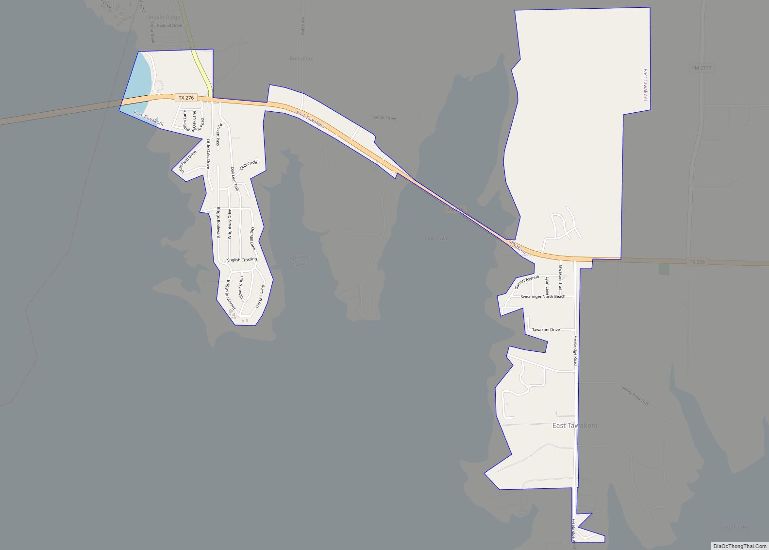
East Tawakoni (/təˈwɑːkəni/ tə-WAH-kə-nee) is a city in Rains County, Texas, United States. The population was 883 at the 2010 census. East Tawakoni is located on the east side of Lake Tawakoni, while its twin city West Tawakoni is located on the west side of the lake.
| Name: | East Tawakoni city |
|---|---|
| LSAD Code: | 25 |
| LSAD Description: | city (suffix) |
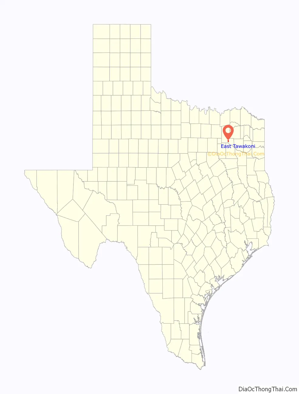
| State: | Texas |
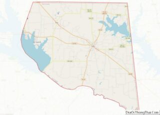
| County: | Rains County |
| Elevation: | 469 ft (143 m) |
| Total Area: | 1.83 sq mi (4.75 km²) |
| Land Area: | 1.78 sq mi (4.62 km²) |
| Water Area: | 0.05 sq mi (0.13 km²) |
| Total Population: | 883 |
| Population Density: | 552.44/sq mi (213.30/km²) |
| FIPS code: | 4822276 |
| GNISfeature ID: | 1335000 |
| Website: | http://cityofeasttawakoni.com/ |
Online Interactive Map
Click on ![]() to view map in "full screen" mode.
to view map in "full screen" mode.
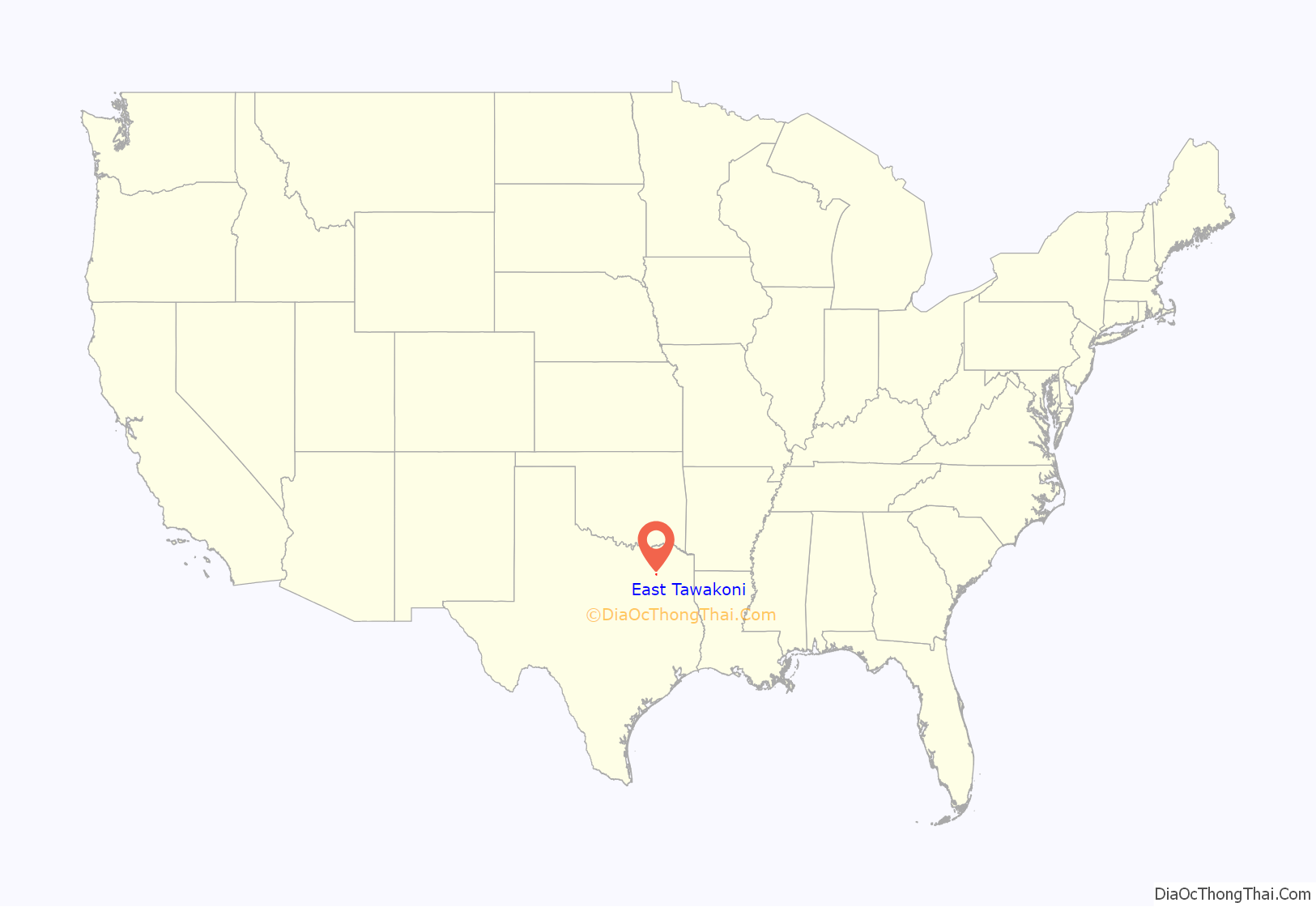
East Tawakoni location map. Where is East Tawakoni city?
History
Marketed as a relaxed rural community with easy access to Dallas, East Tawakoni was established on June 6, 1967 after an election in which 30 of 45 residents voted in favor of incorporation. A mayor (Grady A. Whitehead) and five aldermen (Raymond Briggs, A.L. Williams, D.A. “Doc” Vincent, A.O. Murphrey, and T.E. Bell) were elected on June 27, 1967. In a local option election held on February 6, 1968, residents voted 38–32 (54.3%–45.7%) in favor of selling alcoholic beverages. The move ended more than 60 years of Rains County being wholly “dry”. East Tawakoni had a population of 278 in 1970. That same year, a fire destroyed the city hall building and all of its records. City officials met in the garage of a local resident until a new building was constructed. The annexation of the Blue Heron Cove subdivision in 1986 doubled the size of East Tawakoni. By 1990, the city was home to 542 people. The population grew to 775 in 2000, a 43 percent increase over the 1990 figure.
East Tawakoni Road Map
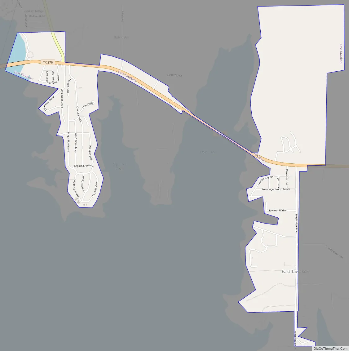
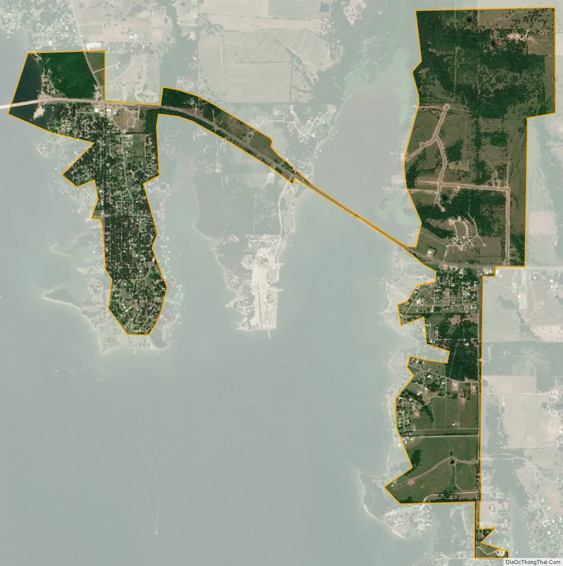
East Tawakoni city Satellite Map
Geography
East Tawakoni is located at 32°54′11″N 95°56′39″W / 32.90306°N 95.94417°W / 32.90306; -95.94417 (32.902922, –95.944247), along State Highway 276 in western Rains County. It is situated on the eastern shore of Lake Tawakoni, nine miles west of Emory.
According to the United States Census Bureau, the city has a total area of 1.9 square miles (4.9 km), of which, 1.8 square miles (4.7 km) of it is land and 0.04 square miles (0.10 km) of it (2.16%) is water.
See also
Map of Texas State and its subdivision:- Anderson
- Andrews
- Angelina
- Aransas
- Archer
- Armstrong
- Atascosa
- Austin
- Bailey
- Bandera
- Bastrop
- Baylor
- Bee
- Bell
- Bexar
- Blanco
- Borden
- Bosque
- Bowie
- Brazoria
- Brazos
- Brewster
- Briscoe
- Brooks
- Brown
- Burleson
- Burnet
- Caldwell
- Calhoun
- Callahan
- Cameron
- Camp
- Carson
- Cass
- Castro
- Chambers
- Cherokee
- Childress
- Clay
- Cochran
- Coke
- Coleman
- Collin
- Collingsworth
- Colorado
- Comal
- Comanche
- Concho
- Cooke
- Coryell
- Cottle
- Crane
- Crockett
- Crosby
- Culberson
- Dallam
- Dallas
- Dawson
- Deaf Smith
- Delta
- Denton
- Dewitt
- Dickens
- Dimmit
- Donley
- Duval
- Eastland
- Ector
- Edwards
- El Paso
- Ellis
- Erath
- Falls
- Fannin
- Fayette
- Fisher
- Floyd
- Foard
- Fort Bend
- Franklin
- Freestone
- Frio
- Gaines
- Galveston
- Garza
- Gillespie
- Glasscock
- Goliad
- Gonzales
- Gray
- Grayson
- Gregg
- Grimes
- Guadalupe
- Hale
- Hall
- Hamilton
- Hansford
- Hardeman
- Hardin
- Harris
- Harrison
- Hartley
- Haskell
- Hays
- Hemphill
- Henderson
- Hidalgo
- Hill
- Hockley
- Hood
- Hopkins
- Houston
- Howard
- Hudspeth
- Hunt
- Hutchinson
- Irion
- Jack
- Jackson
- Jasper
- Jeff Davis
- Jefferson
- Jim Hogg
- Jim Wells
- Johnson
- Jones
- Karnes
- Kaufman
- Kendall
- Kenedy
- Kent
- Kerr
- Kimble
- King
- Kinney
- Kleberg
- Knox
- La Salle
- Lamar
- Lamb
- Lampasas
- Lavaca
- Lee
- Leon
- Liberty
- Limestone
- Lipscomb
- Live Oak
- Llano
- Loving
- Lubbock
- Lynn
- Madison
- Marion
- Martin
- Mason
- Matagorda
- Maverick
- McCulloch
- McLennan
- McMullen
- Medina
- Menard
- Midland
- Milam
- Mills
- Mitchell
- Montague
- Montgomery
- Moore
- Morris
- Motley
- Nacogdoches
- Navarro
- Newton
- Nolan
- Nueces
- Ochiltree
- Oldham
- Orange
- Palo Pinto
- Panola
- Parker
- Parmer
- Pecos
- Polk
- Potter
- Presidio
- Rains
- Randall
- Reagan
- Real
- Red River
- Reeves
- Refugio
- Roberts
- Robertson
- Rockwall
- Runnels
- Rusk
- Sabine
- San Augustine
- San Jacinto
- San Patricio
- San Saba
- Schleicher
- Scurry
- Shackelford
- Shelby
- Sherman
- Smith
- Somervell
- Starr
- Stephens
- Sterling
- Stonewall
- Sutton
- Swisher
- Tarrant
- Taylor
- Terrell
- Terry
- Throckmorton
- Titus
- Tom Green
- Travis
- Trinity
- Tyler
- Upshur
- Upton
- Uvalde
- Val Verde
- Van Zandt
- Victoria
- Walker
- Waller
- Ward
- Washington
- Webb
- Wharton
- Wheeler
- Wichita
- Wilbarger
- Willacy
- Williamson
- Wilson
- Winkler
- Wise
- Wood
- Yoakum
- Young
- Zapata
- Zavala
- Alabama
- Alaska
- Arizona
- Arkansas
- California
- Colorado
- Connecticut
- Delaware
- District of Columbia
- Florida
- Georgia
- Hawaii
- Idaho
- Illinois
- Indiana
- Iowa
- Kansas
- Kentucky
- Louisiana
- Maine
- Maryland
- Massachusetts
- Michigan
- Minnesota
- Mississippi
- Missouri
- Montana
- Nebraska
- Nevada
- New Hampshire
- New Jersey
- New Mexico
- New York
- North Carolina
- North Dakota
- Ohio
- Oklahoma
- Oregon
- Pennsylvania
- Rhode Island
- South Carolina
- South Dakota
- Tennessee
- Texas
- Utah
- Vermont
- Virginia
- Washington
- West Virginia
- Wisconsin
- Wyoming