Electra is a city in Wichita County, Texas, United States. It is part of the Wichita Falls metropolitan statistical area. The population was 2,791 at the 2010 census., down from 3,168 in 2000. Electra claims the title of Pump Jack Capital of Texas, a title made official by the state in 2001, and has celebrated an annual Pump Jack Festival since 2002. It was named in honor of Electra Waggoner, an heiress to the Waggoner Ranch.
| Name: | Electra city |
|---|---|
| LSAD Code: | 25 |
| LSAD Description: | city (suffix) |
| State: | Texas |
| County: | Wichita County |
| Elevation: | 1,220 ft (372 m) |
| Total Area: | 3.08 sq mi (7.98 km²) |
| Land Area: | 3.08 sq mi (7.97 km²) |
| Water Area: | 0.00 sq mi (0.01 km²) |
| Total Population: | 2,791 |
| Population Density: | 887.23/sq mi (342.54/km²) |
| ZIP code: | 76360 |
| Area code: | 940 |
| FIPS code: | 4822984 |
| GNISfeature ID: | 1356894 |
| Website: | www.electratexas.org |
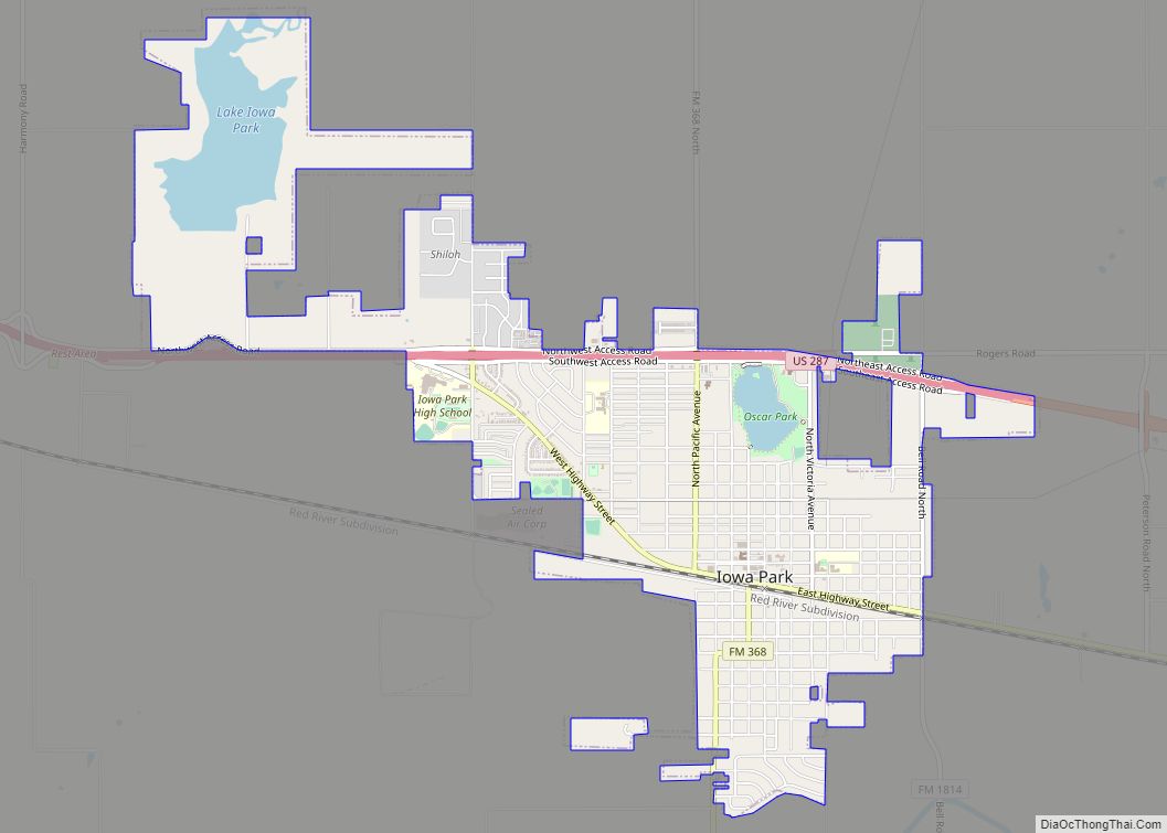
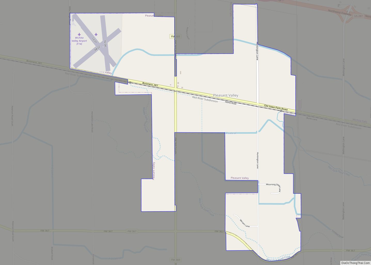
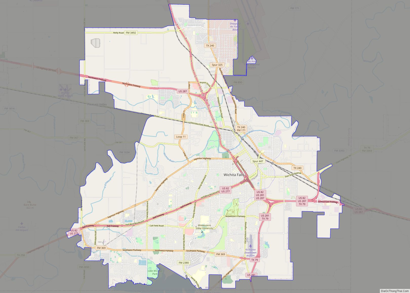
Online Interactive Map
Click on ![]() to view map in "full screen" mode.
to view map in "full screen" mode.
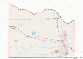
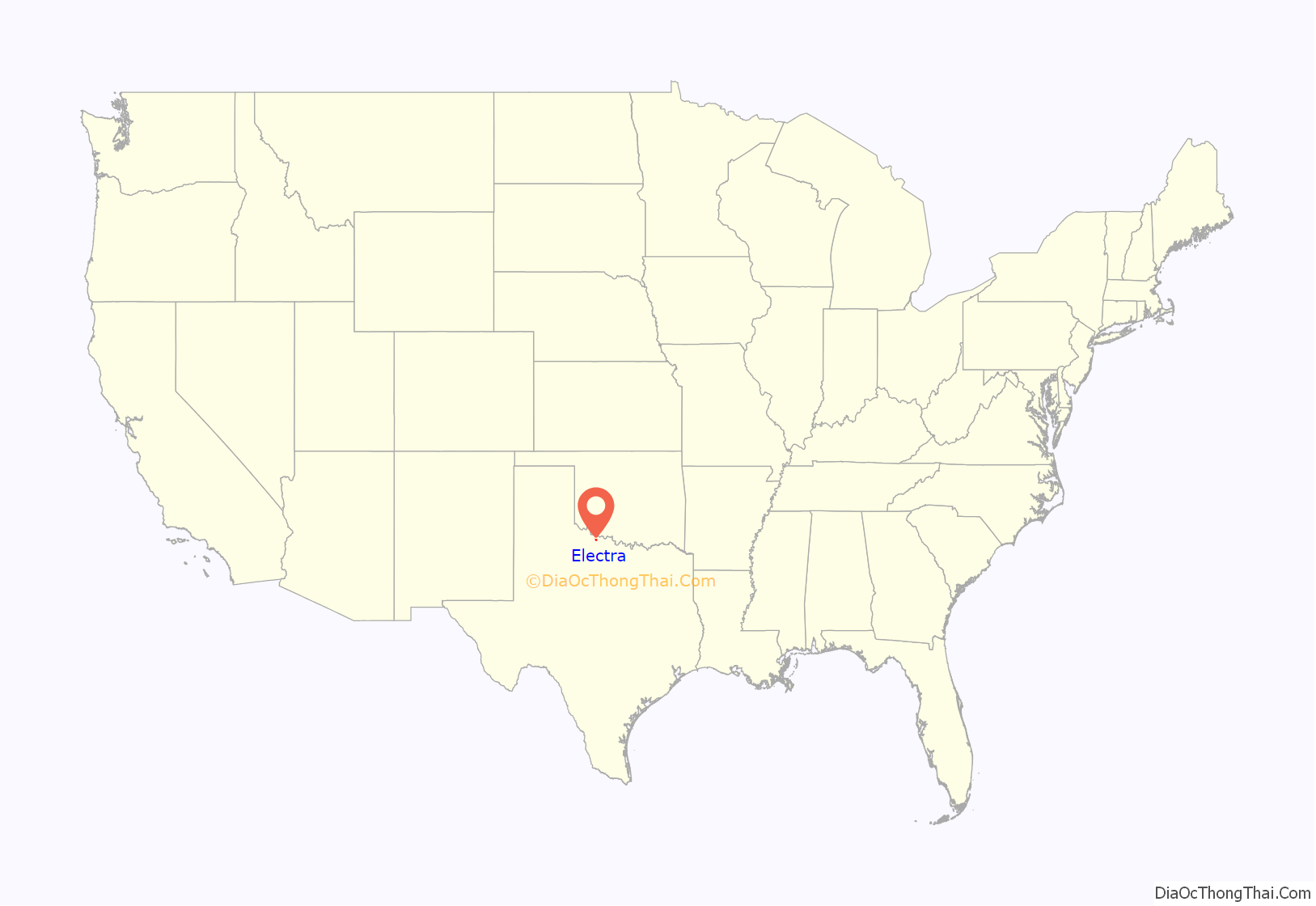
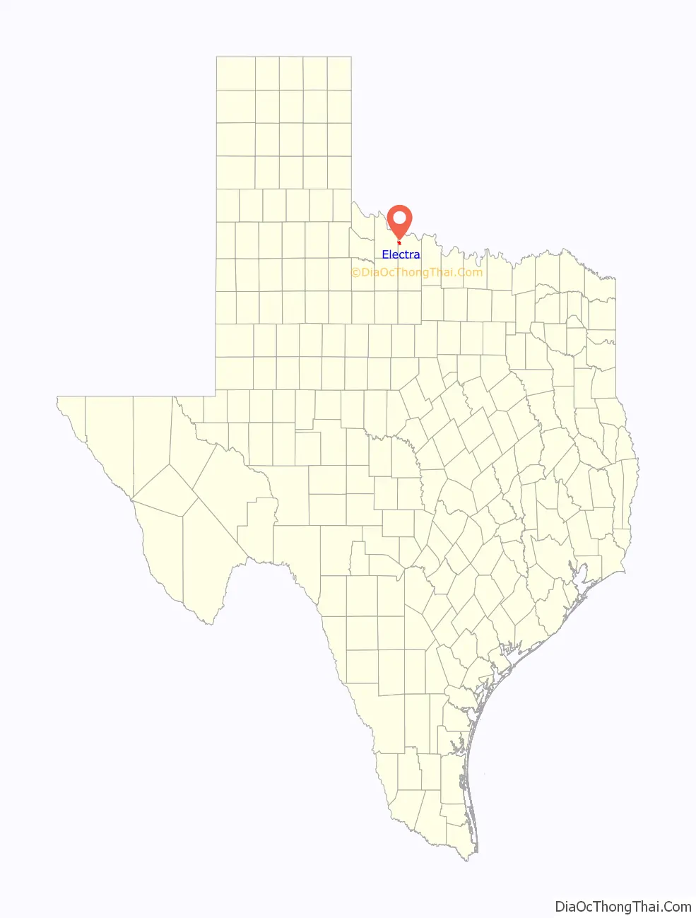
Electra location map. Where is Electra city?
History
Daniel Waggoner started a ranch in present-day Electra in 1852. Around 30 years later, the Fort Worth and Denver Railway was built, and its railroad tracks ran through the area. In 1885, Waggoner’s son, William Thomas Waggoner, successfully lobbied railroad executives to build a railroad station at the site. By this time, the Waggoner ranch covered a half-million acres. Until this time, the town was called Waggoner, but following the building of the station and a post office in 1889, it was dubbed Beaver Switch, after the nearby Beaver Creek. The opening of 56,000 acres (230 km) of land north of the railroad station brought more farmers to the area. The town was renamed again in 1907, this time after Waggoner’s daughter, Electra Waggoner.
Water can be scarce in this region of Texas, so Waggoner started drilling for water for the town’s new residents. Most of these drilling sites were befouled by crude oil, which made the water unfit for drinking. Three years later, a developer from Fort Worth named Solomon Williams bought the land from Waggoner. Soon thereafter, he annexed nearby land, subdivided the land, and placed advertisements in national media trying to increase the population. His efforts were successful, and the town grew from a population of 500 to 1,000 between 1907 and 1910. The Waggoner family still owns much of the same land they did in the beginning and still drills for oil there.
In 1911, the Electra Independent School District was created.
On 1 April 1911, the Clayco Oil gusher brought in an oil strike at a depth of 1,600 feet (490 m), producing 260 BOPD. Word spread quickly, and the population increased to over a 1000, with many more oil workers commuting from Wichita Falls. The town soon had brick buildings, cement sidewalks, and a telephone exchange.
In 1936, Electra had well over 6,000 residents, but by the 1960s, the population had decreased to just over 5,000. The Dallas-Fort Worth Metroplex was growing, and many people moved away. By 2000, Electra’s population had fallen to about 3,000.
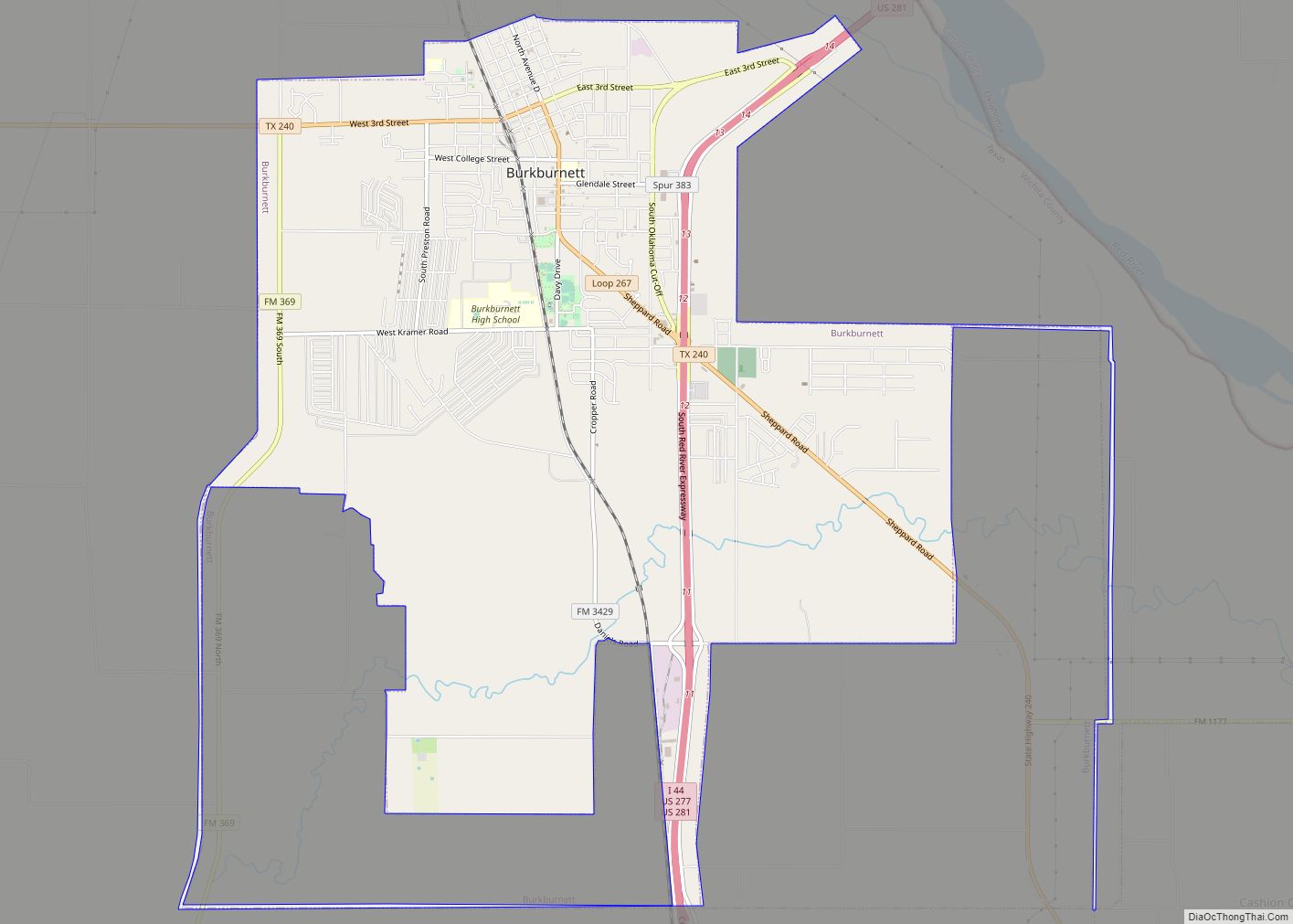
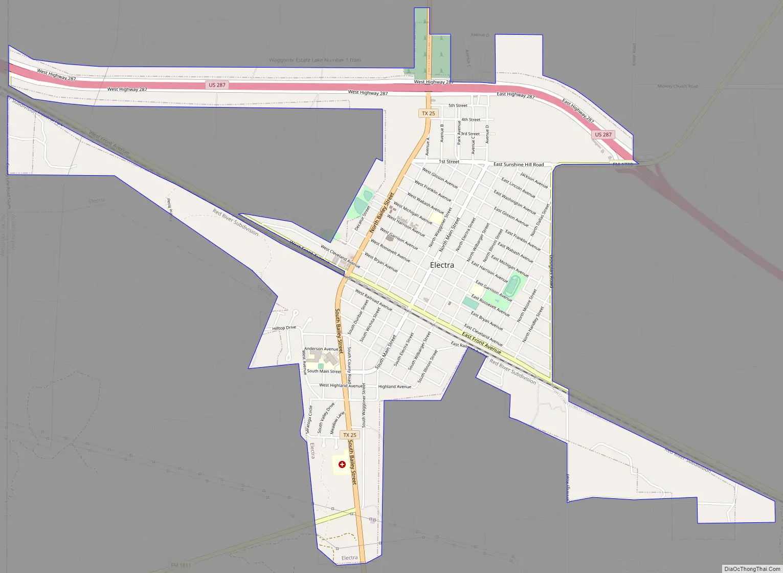
Electra Road Map
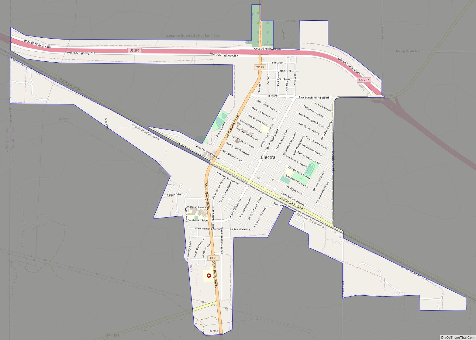
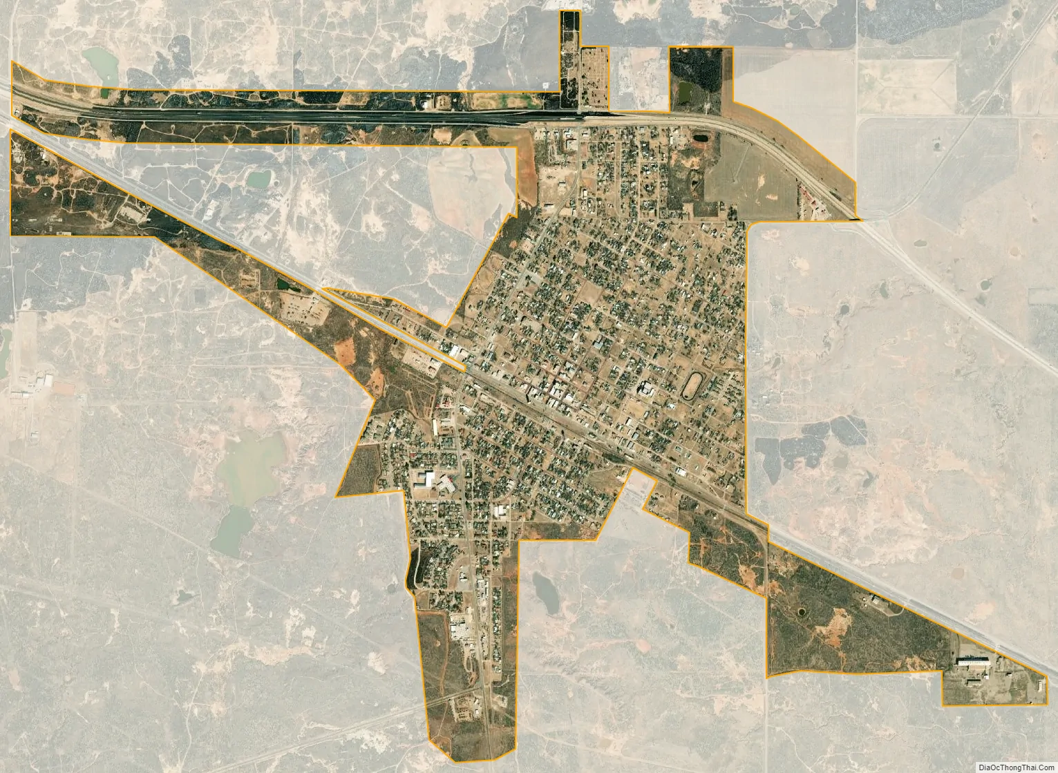
Electra city Satellite Map
Geography
Electra is located at 34°1′51″N 98°55′2″W / 34.03083°N 98.91722°W / 34.03083; -98.91722 (34.030809, –98.917281). According to the United States Census Bureau, the city has a total area of 2.4 mi (6.3 km), all of it land.
See also
Map of Texas State and its subdivision:- Anderson
- Andrews
- Angelina
- Aransas
- Archer
- Armstrong
- Atascosa
- Austin
- Bailey
- Bandera
- Bastrop
- Baylor
- Bee
- Bell
- Bexar
- Blanco
- Borden
- Bosque
- Bowie
- Brazoria
- Brazos
- Brewster
- Briscoe
- Brooks
- Brown
- Burleson
- Burnet
- Caldwell
- Calhoun
- Callahan
- Cameron
- Camp
- Carson
- Cass
- Castro
- Chambers
- Cherokee
- Childress
- Clay
- Cochran
- Coke
- Coleman
- Collin
- Collingsworth
- Colorado
- Comal
- Comanche
- Concho
- Cooke
- Coryell
- Cottle
- Crane
- Crockett
- Crosby
- Culberson
- Dallam
- Dallas
- Dawson
- Deaf Smith
- Delta
- Denton
- Dewitt
- Dickens
- Dimmit
- Donley
- Duval
- Eastland
- Ector
- Edwards
- El Paso
- Ellis
- Erath
- Falls
- Fannin
- Fayette
- Fisher
- Floyd
- Foard
- Fort Bend
- Franklin
- Freestone
- Frio
- Gaines
- Galveston
- Garza
- Gillespie
- Glasscock
- Goliad
- Gonzales
- Gray
- Grayson
- Gregg
- Grimes
- Guadalupe
- Hale
- Hall
- Hamilton
- Hansford
- Hardeman
- Hardin
- Harris
- Harrison
- Hartley
- Haskell
- Hays
- Hemphill
- Henderson
- Hidalgo
- Hill
- Hockley
- Hood
- Hopkins
- Houston
- Howard
- Hudspeth
- Hunt
- Hutchinson
- Irion
- Jack
- Jackson
- Jasper
- Jeff Davis
- Jefferson
- Jim Hogg
- Jim Wells
- Johnson
- Jones
- Karnes
- Kaufman
- Kendall
- Kenedy
- Kent
- Kerr
- Kimble
- King
- Kinney
- Kleberg
- Knox
- La Salle
- Lamar
- Lamb
- Lampasas
- Lavaca
- Lee
- Leon
- Liberty
- Limestone
- Lipscomb
- Live Oak
- Llano
- Loving
- Lubbock
- Lynn
- Madison
- Marion
- Martin
- Mason
- Matagorda
- Maverick
- McCulloch
- McLennan
- McMullen
- Medina
- Menard
- Midland
- Milam
- Mills
- Mitchell
- Montague
- Montgomery
- Moore
- Morris
- Motley
- Nacogdoches
- Navarro
- Newton
- Nolan
- Nueces
- Ochiltree
- Oldham
- Orange
- Palo Pinto
- Panola
- Parker
- Parmer
- Pecos
- Polk
- Potter
- Presidio
- Rains
- Randall
- Reagan
- Real
- Red River
- Reeves
- Refugio
- Roberts
- Robertson
- Rockwall
- Runnels
- Rusk
- Sabine
- San Augustine
- San Jacinto
- San Patricio
- San Saba
- Schleicher
- Scurry
- Shackelford
- Shelby
- Sherman
- Smith
- Somervell
- Starr
- Stephens
- Sterling
- Stonewall
- Sutton
- Swisher
- Tarrant
- Taylor
- Terrell
- Terry
- Throckmorton
- Titus
- Tom Green
- Travis
- Trinity
- Tyler
- Upshur
- Upton
- Uvalde
- Val Verde
- Van Zandt
- Victoria
- Walker
- Waller
- Ward
- Washington
- Webb
- Wharton
- Wheeler
- Wichita
- Wilbarger
- Willacy
- Williamson
- Wilson
- Winkler
- Wise
- Wood
- Yoakum
- Young
- Zapata
- Zavala
- Alabama
- Alaska
- Arizona
- Arkansas
- California
- Colorado
- Connecticut
- Delaware
- District of Columbia
- Florida
- Georgia
- Hawaii
- Idaho
- Illinois
- Indiana
- Iowa
- Kansas
- Kentucky
- Louisiana
- Maine
- Maryland
- Massachusetts
- Michigan
- Minnesota
- Mississippi
- Missouri
- Montana
- Nebraska
- Nevada
- New Hampshire
- New Jersey
- New Mexico
- New York
- North Carolina
- North Dakota
- Ohio
- Oklahoma
- Oregon
- Pennsylvania
- Rhode Island
- South Carolina
- South Dakota
- Tennessee
- Texas
- Utah
- Vermont
- Virginia
- Washington
- West Virginia
- Wisconsin
- Wyoming