Eustace is a city in Henderson County, Texas, United States. The population was 991 at the 2010 census, up from 798 at the 2000 census.
| Name: | Eustace city |
|---|---|
| LSAD Code: | 25 |
| LSAD Description: | city (suffix) |
| State: | Texas |
| County: | Henderson County |
| Elevation: | 423 ft (129 m) |
| Total Area: | 2.93 sq mi (7.58 km²) |
| Land Area: | 2.93 sq mi (7.58 km²) |
| Water Area: | 0.00 sq mi (0.00 km²) |
| Total Population: | 991 |
| Population Density: | 343.81/sq mi (132.74/km²) |
| ZIP code: | 75124 |
| Area code: | 430, 903 |
| FIPS code: | 4824828 |
| GNISfeature ID: | 1373681 |
| Website: | www.eustacetexas.org |
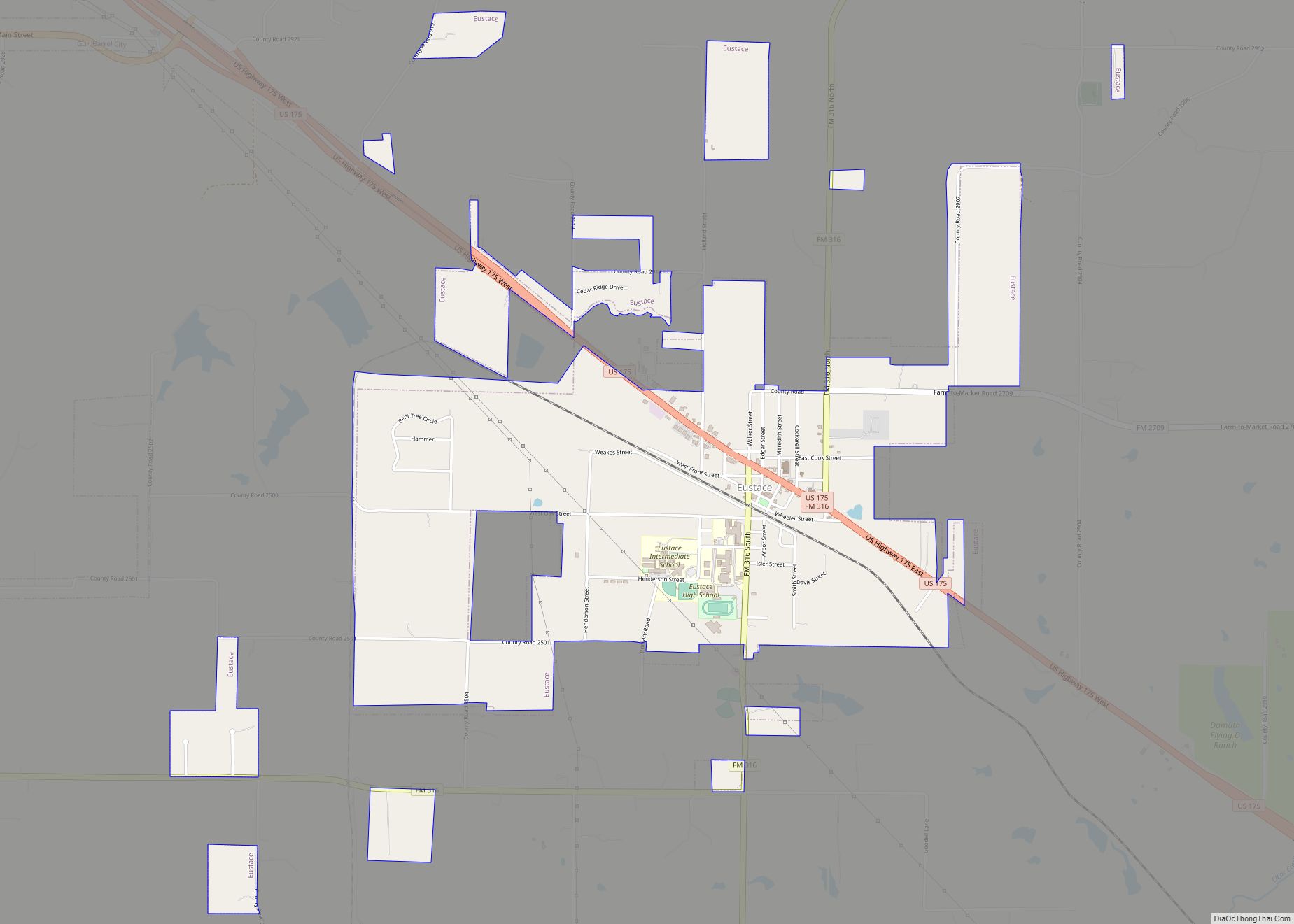
Online Interactive Map
Click on ![]() to view map in "full screen" mode.
to view map in "full screen" mode.
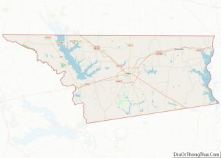
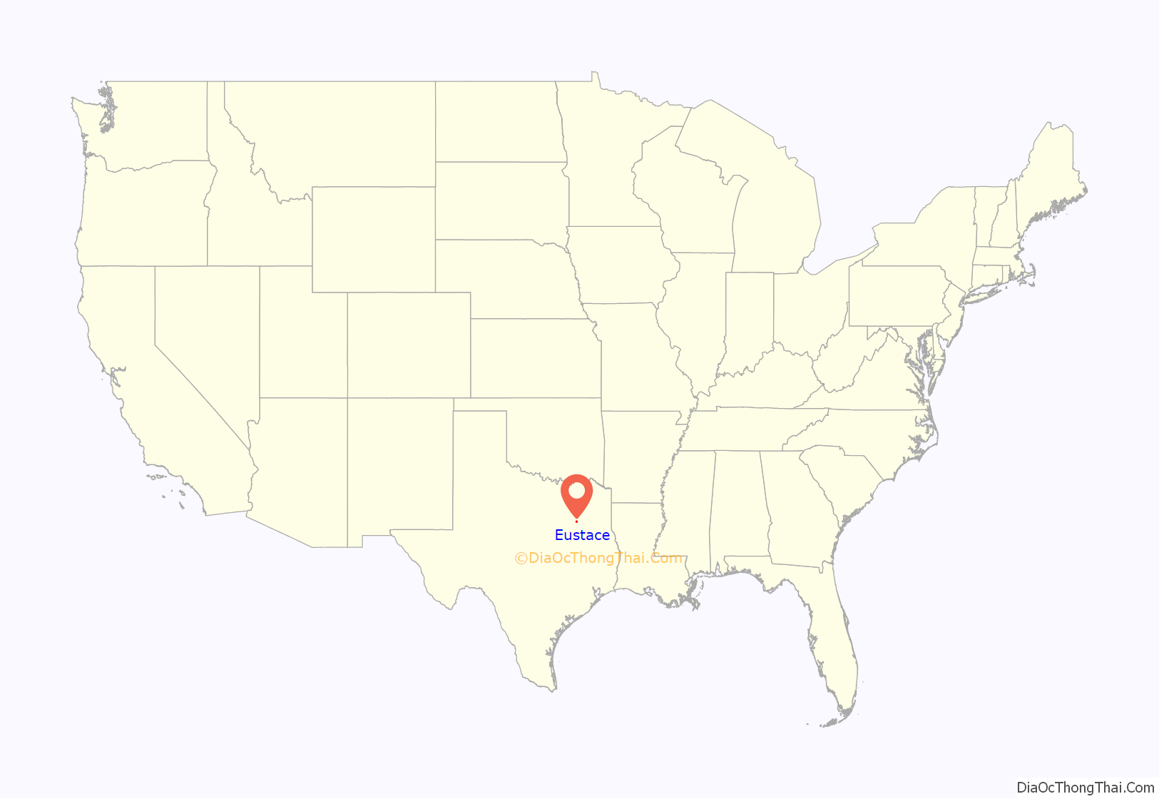
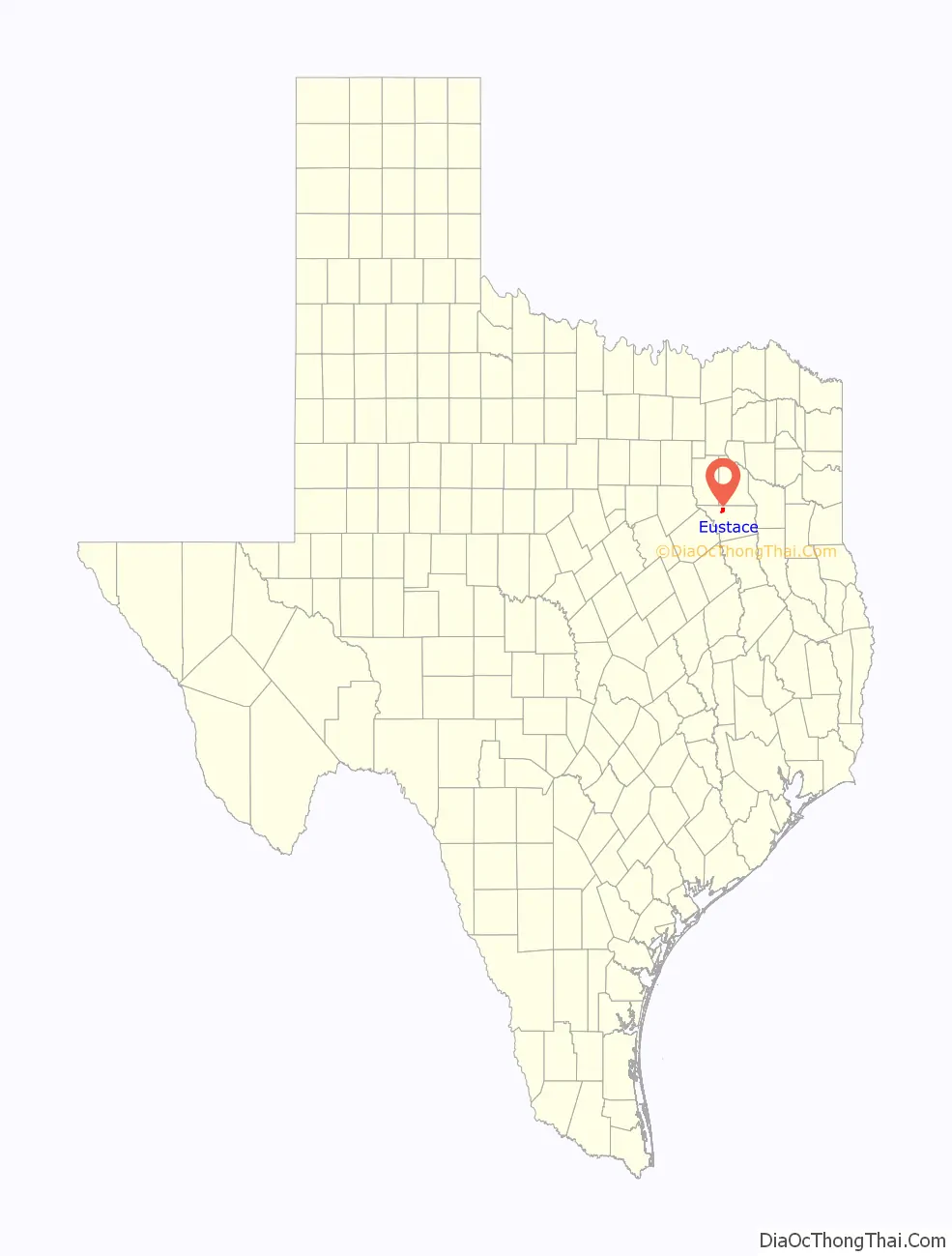
Eustace location map. Where is Eustace city?
History
Fire From Below
In November 2007, film crews led by actor/producer Andrew Stevens came to Eustace to film a movie called Fire from Below. The cast included Kevin Sorbo (Hercules) and Burton Gilliam (Blazing Saddles). Many Eustace locations were used, including a restaurant and gazebo on the town square, and a nearby private lake (dubbed “Lost Lake” in the film). Several Eustace residents were used as extras. According to the script, “Eustace” was retained as the name of the town setting depicted in the scenes shot in Eustace. Fire from Below was released in 2009.
2017 tornado
On April 29, 2017, a very large and destructive EF4 tornado struck the city of Eustace causing major damage. The tornado then tore through West Canton, where more possible EF3/EF4 damage occurred. No deaths were reported in this event, but Canton was devastated only minutes later by another tornado (rated EF3) which killed four people.
2021 Gas leak
On November 12, 2021, a Gas leak that was caused by stress to a gas line started a town evacuation. The gas leak started in the morning, and a smell was noticed by many Eustace residents. In the afternoon, mayor received a message saying it was a leak of a toxic gas. Many residents flew to towns nearby, such as Athens and Mabank. Later in the very early morning, mayor declared Eustace was back to normal.
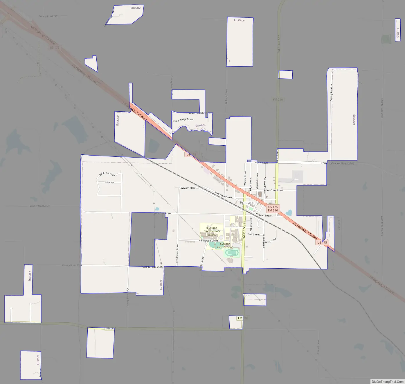
Eustace Road Map
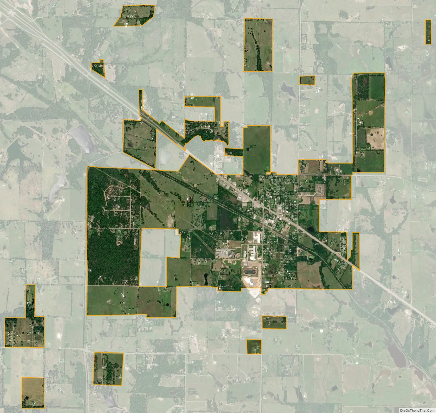
Eustace city Satellite Map
Geography
Eustace is located in northwestern Henderson County at 32°18′32″N 96°0′33″W / 32.30889°N 96.00917°W / 32.30889; -96.00917 (32.308801, –96.009098). U.S. Route 175 passes through the center of town, leading southeast 11 miles (18 km) to Athens, the county seat, and northwest 7 miles (11 km) to Mabank.
According to the United States Census Bureau, Eustace has a total area of 2.9 square miles (7.6 km), all of it land.
See also
Map of Texas State and its subdivision:- Anderson
- Andrews
- Angelina
- Aransas
- Archer
- Armstrong
- Atascosa
- Austin
- Bailey
- Bandera
- Bastrop
- Baylor
- Bee
- Bell
- Bexar
- Blanco
- Borden
- Bosque
- Bowie
- Brazoria
- Brazos
- Brewster
- Briscoe
- Brooks
- Brown
- Burleson
- Burnet
- Caldwell
- Calhoun
- Callahan
- Cameron
- Camp
- Carson
- Cass
- Castro
- Chambers
- Cherokee
- Childress
- Clay
- Cochran
- Coke
- Coleman
- Collin
- Collingsworth
- Colorado
- Comal
- Comanche
- Concho
- Cooke
- Coryell
- Cottle
- Crane
- Crockett
- Crosby
- Culberson
- Dallam
- Dallas
- Dawson
- Deaf Smith
- Delta
- Denton
- Dewitt
- Dickens
- Dimmit
- Donley
- Duval
- Eastland
- Ector
- Edwards
- El Paso
- Ellis
- Erath
- Falls
- Fannin
- Fayette
- Fisher
- Floyd
- Foard
- Fort Bend
- Franklin
- Freestone
- Frio
- Gaines
- Galveston
- Garza
- Gillespie
- Glasscock
- Goliad
- Gonzales
- Gray
- Grayson
- Gregg
- Grimes
- Guadalupe
- Hale
- Hall
- Hamilton
- Hansford
- Hardeman
- Hardin
- Harris
- Harrison
- Hartley
- Haskell
- Hays
- Hemphill
- Henderson
- Hidalgo
- Hill
- Hockley
- Hood
- Hopkins
- Houston
- Howard
- Hudspeth
- Hunt
- Hutchinson
- Irion
- Jack
- Jackson
- Jasper
- Jeff Davis
- Jefferson
- Jim Hogg
- Jim Wells
- Johnson
- Jones
- Karnes
- Kaufman
- Kendall
- Kenedy
- Kent
- Kerr
- Kimble
- King
- Kinney
- Kleberg
- Knox
- La Salle
- Lamar
- Lamb
- Lampasas
- Lavaca
- Lee
- Leon
- Liberty
- Limestone
- Lipscomb
- Live Oak
- Llano
- Loving
- Lubbock
- Lynn
- Madison
- Marion
- Martin
- Mason
- Matagorda
- Maverick
- McCulloch
- McLennan
- McMullen
- Medina
- Menard
- Midland
- Milam
- Mills
- Mitchell
- Montague
- Montgomery
- Moore
- Morris
- Motley
- Nacogdoches
- Navarro
- Newton
- Nolan
- Nueces
- Ochiltree
- Oldham
- Orange
- Palo Pinto
- Panola
- Parker
- Parmer
- Pecos
- Polk
- Potter
- Presidio
- Rains
- Randall
- Reagan
- Real
- Red River
- Reeves
- Refugio
- Roberts
- Robertson
- Rockwall
- Runnels
- Rusk
- Sabine
- San Augustine
- San Jacinto
- San Patricio
- San Saba
- Schleicher
- Scurry
- Shackelford
- Shelby
- Sherman
- Smith
- Somervell
- Starr
- Stephens
- Sterling
- Stonewall
- Sutton
- Swisher
- Tarrant
- Taylor
- Terrell
- Terry
- Throckmorton
- Titus
- Tom Green
- Travis
- Trinity
- Tyler
- Upshur
- Upton
- Uvalde
- Val Verde
- Van Zandt
- Victoria
- Walker
- Waller
- Ward
- Washington
- Webb
- Wharton
- Wheeler
- Wichita
- Wilbarger
- Willacy
- Williamson
- Wilson
- Winkler
- Wise
- Wood
- Yoakum
- Young
- Zapata
- Zavala
- Alabama
- Alaska
- Arizona
- Arkansas
- California
- Colorado
- Connecticut
- Delaware
- District of Columbia
- Florida
- Georgia
- Hawaii
- Idaho
- Illinois
- Indiana
- Iowa
- Kansas
- Kentucky
- Louisiana
- Maine
- Maryland
- Massachusetts
- Michigan
- Minnesota
- Mississippi
- Missouri
- Montana
- Nebraska
- Nevada
- New Hampshire
- New Jersey
- New Mexico
- New York
- North Carolina
- North Dakota
- Ohio
- Oklahoma
- Oregon
- Pennsylvania
- Rhode Island
- South Carolina
- South Dakota
- Tennessee
- Texas
- Utah
- Vermont
- Virginia
- Washington
- West Virginia
- Wisconsin
- Wyoming