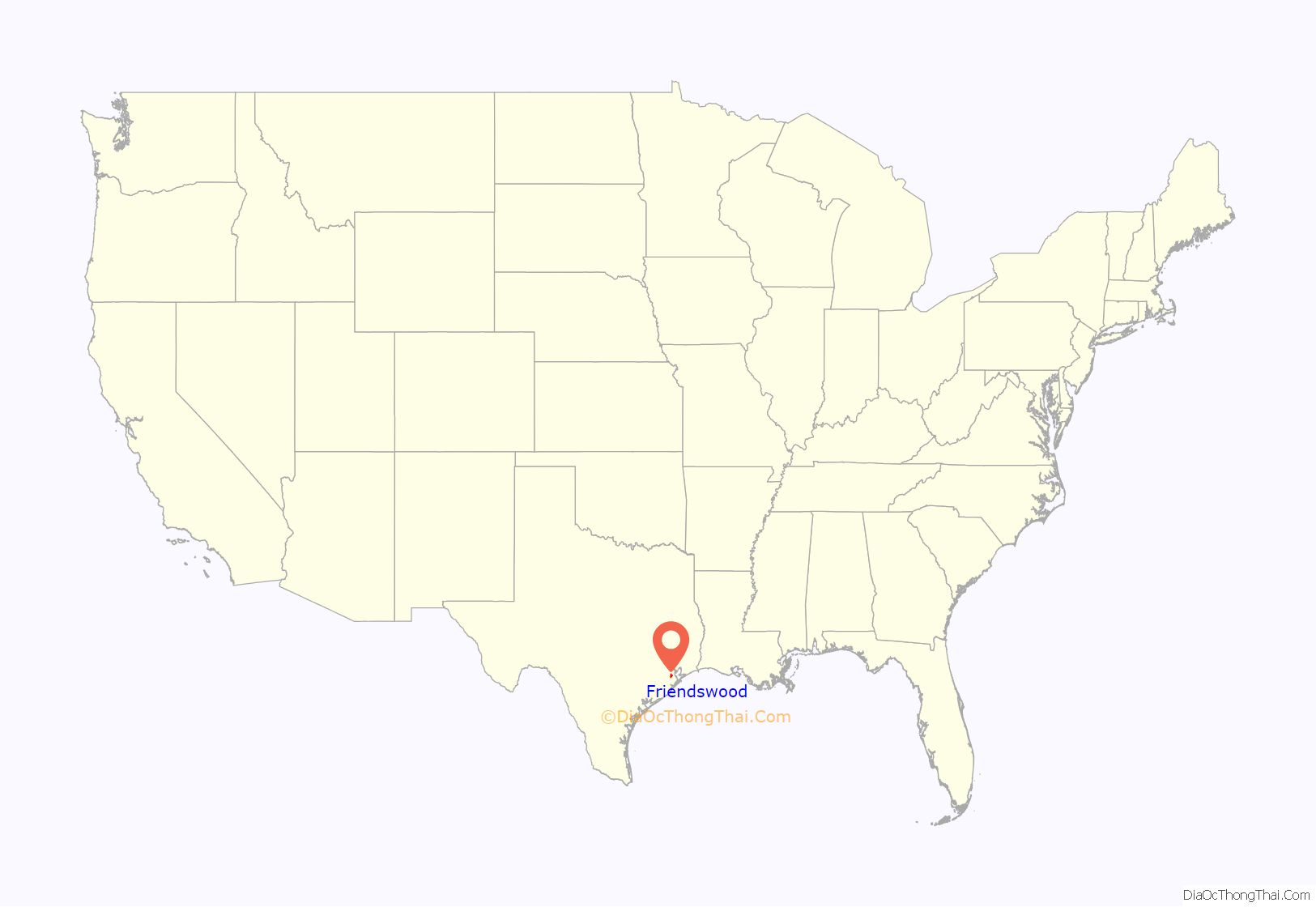
Friendswood is a city in the U.S. state of Texas. It is part of the Houston–The Woodlands–Sugar Land metropolitan area. The city lies in Galveston and Harris Counties. As of the 2010 census, the population of Friendswood was 35,805.
In 2007, CNN/Money magazine listed Friendswood as one of 100 “America’s Best Places to Live” for that year, making it one of 900 small towns recognized since the rankings first began in 2005.
| Name: | Friendswood city |
|---|---|
| LSAD Code: | 25 |
| LSAD Description: | city (suffix) |
| State: | Texas |
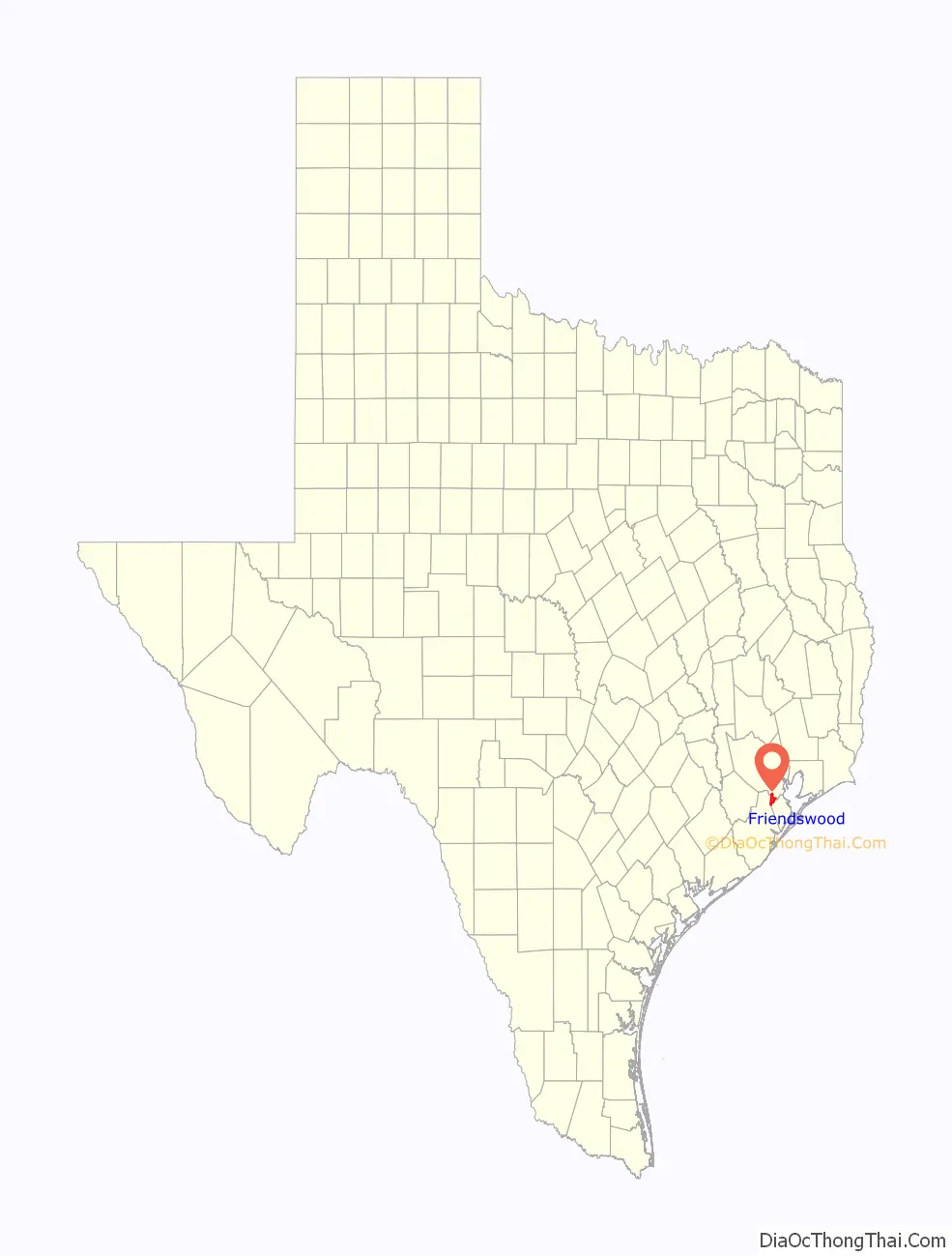
| County: | Galveston County, Harris County |
| Incorporated: | 1960 |
| Elevation: | 30 ft (9 m) |
| Total Area: | 20.90 sq mi (54.13 km²) |
| Land Area: | 20.76 sq mi (53.76 km²) |
| Water Area: | 0.14 sq mi (0.37 km²) |
| Total Population: | 35,805 |
| Population Density: | 1,941.03/sq mi (749.42/km²) |
| ZIP code: | 77546, 77549 |
| Area code: | 281/346/713/832 |
| FIPS code: | 4827648 |
| GNISfeature ID: | 1336252 |
| Website: | ci.Friendswood.TX.us |
Online Interactive Map
Click on ![]() to view map in "full screen" mode.
to view map in "full screen" mode.
Friendswood location map. Where is Friendswood city?
History
Friendswood, situated in the northwest corner of Galveston County, has the distinction of being the only permanent town in Texas that started as a Quaker colony. It was established in 1895 by a group of Quakers led by T. Hadley Lewis and Frank J. Brown. They were looking for a “promised land” to start a colony of the people who belonged to the religious denomination called Friends or Quakers.
From its founding, life in Friendswood revolved around church and school. After the small church and school building was demolished in the 1900 Storm, the two-dozen families living in Friendswood erected a large two-story frame structure for their church and school. The building, called The Academy, housed the school and sanctuary until a larger, stone building replaced it.
Through the 1940s, Friendswood was predominately a small, remote, farming Quaker community with less than 500 citizens. The economy depended largely on growing and preserving Magnolia figs. After 1950, it became increasingly a suburban bedroom community, as Houstonians discovered the idyllic country setting the farmlands were converted to subdivision home-sites. The community became a city when it incorporated in 1960.
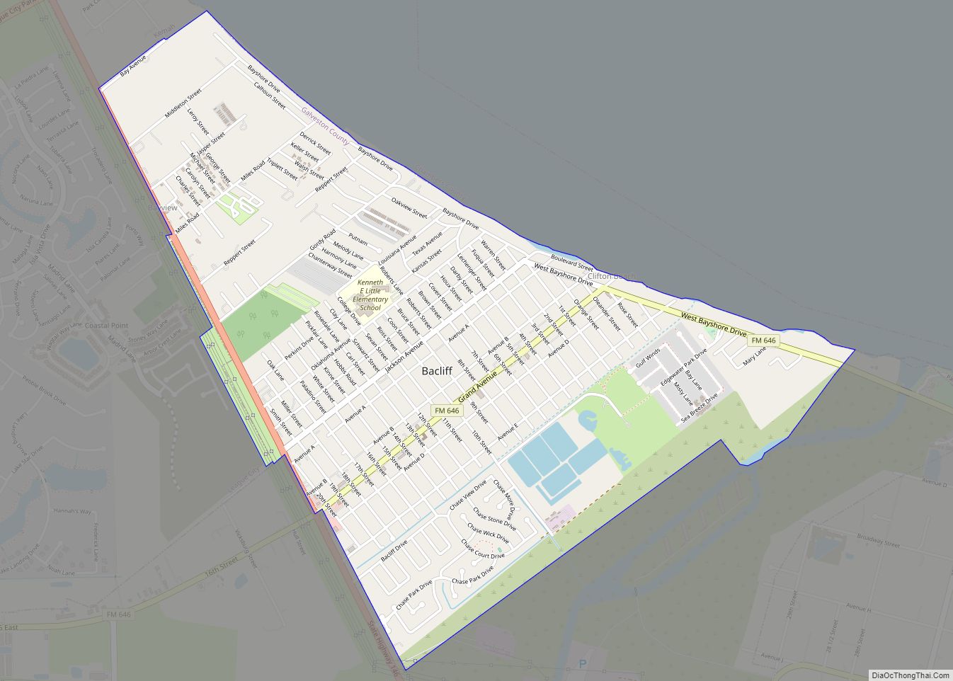
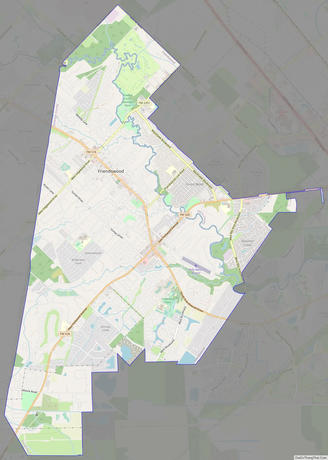
Friendswood Road Map
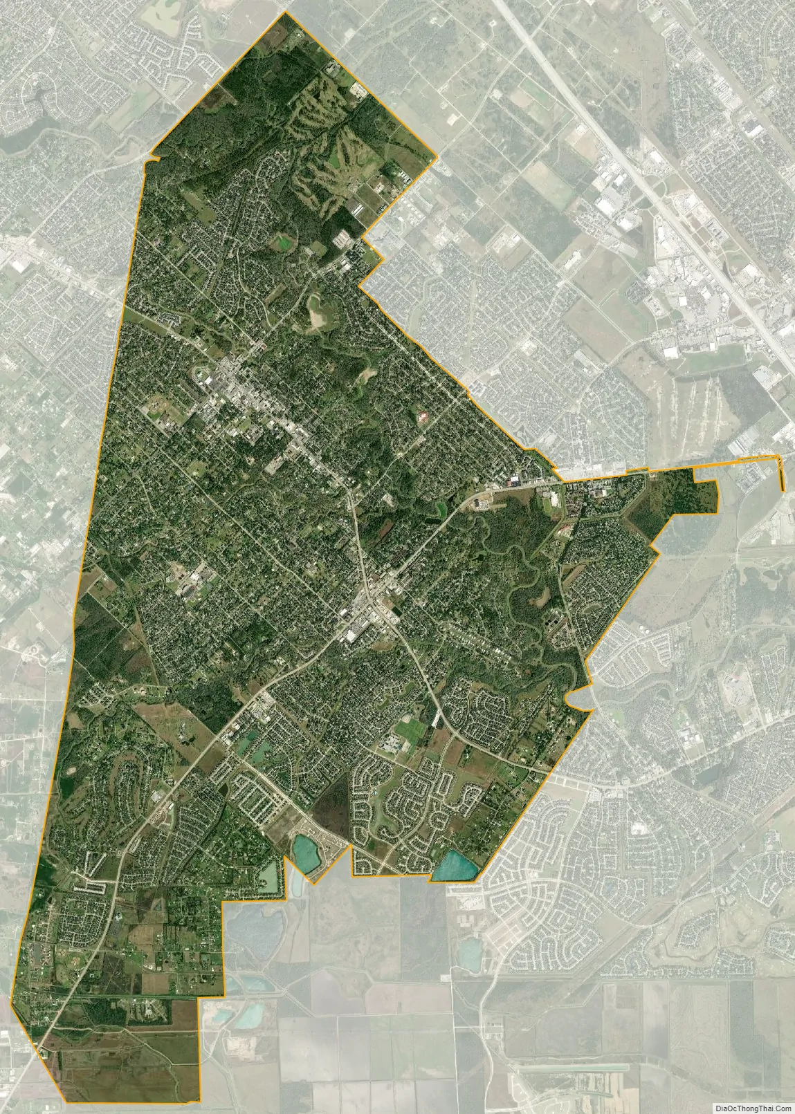
Friendswood city Satellite Map
Geography
Friendswood is located at 29°30′45″N 95°11′53″W / 29.51250°N 95.19806°W / 29.51250; -95.19806 (29.512532, –95.197933).
According to the United States Census Bureau, the city covers a total area of 54.1 square kilometres (20.9 sq mi), of which 53.7 square kilometres (20.7 sq mi) are land area and 0.15 square miles (0.4 km), or 0.69%, is covered by water.
See also
Map of Texas State and its subdivision:- Anderson
- Andrews
- Angelina
- Aransas
- Archer
- Armstrong
- Atascosa
- Austin
- Bailey
- Bandera
- Bastrop
- Baylor
- Bee
- Bell
- Bexar
- Blanco
- Borden
- Bosque
- Bowie
- Brazoria
- Brazos
- Brewster
- Briscoe
- Brooks
- Brown
- Burleson
- Burnet
- Caldwell
- Calhoun
- Callahan
- Cameron
- Camp
- Carson
- Cass
- Castro
- Chambers
- Cherokee
- Childress
- Clay
- Cochran
- Coke
- Coleman
- Collin
- Collingsworth
- Colorado
- Comal
- Comanche
- Concho
- Cooke
- Coryell
- Cottle
- Crane
- Crockett
- Crosby
- Culberson
- Dallam
- Dallas
- Dawson
- Deaf Smith
- Delta
- Denton
- Dewitt
- Dickens
- Dimmit
- Donley
- Duval
- Eastland
- Ector
- Edwards
- El Paso
- Ellis
- Erath
- Falls
- Fannin
- Fayette
- Fisher
- Floyd
- Foard
- Fort Bend
- Franklin
- Freestone
- Frio
- Gaines
- Galveston
- Garza
- Gillespie
- Glasscock
- Goliad
- Gonzales
- Gray
- Grayson
- Gregg
- Grimes
- Guadalupe
- Hale
- Hall
- Hamilton
- Hansford
- Hardeman
- Hardin
- Harris
- Harrison
- Hartley
- Haskell
- Hays
- Hemphill
- Henderson
- Hidalgo
- Hill
- Hockley
- Hood
- Hopkins
- Houston
- Howard
- Hudspeth
- Hunt
- Hutchinson
- Irion
- Jack
- Jackson
- Jasper
- Jeff Davis
- Jefferson
- Jim Hogg
- Jim Wells
- Johnson
- Jones
- Karnes
- Kaufman
- Kendall
- Kenedy
- Kent
- Kerr
- Kimble
- King
- Kinney
- Kleberg
- Knox
- La Salle
- Lamar
- Lamb
- Lampasas
- Lavaca
- Lee
- Leon
- Liberty
- Limestone
- Lipscomb
- Live Oak
- Llano
- Loving
- Lubbock
- Lynn
- Madison
- Marion
- Martin
- Mason
- Matagorda
- Maverick
- McCulloch
- McLennan
- McMullen
- Medina
- Menard
- Midland
- Milam
- Mills
- Mitchell
- Montague
- Montgomery
- Moore
- Morris
- Motley
- Nacogdoches
- Navarro
- Newton
- Nolan
- Nueces
- Ochiltree
- Oldham
- Orange
- Palo Pinto
- Panola
- Parker
- Parmer
- Pecos
- Polk
- Potter
- Presidio
- Rains
- Randall
- Reagan
- Real
- Red River
- Reeves
- Refugio
- Roberts
- Robertson
- Rockwall
- Runnels
- Rusk
- Sabine
- San Augustine
- San Jacinto
- San Patricio
- San Saba
- Schleicher
- Scurry
- Shackelford
- Shelby
- Sherman
- Smith
- Somervell
- Starr
- Stephens
- Sterling
- Stonewall
- Sutton
- Swisher
- Tarrant
- Taylor
- Terrell
- Terry
- Throckmorton
- Titus
- Tom Green
- Travis
- Trinity
- Tyler
- Upshur
- Upton
- Uvalde
- Val Verde
- Van Zandt
- Victoria
- Walker
- Waller
- Ward
- Washington
- Webb
- Wharton
- Wheeler
- Wichita
- Wilbarger
- Willacy
- Williamson
- Wilson
- Winkler
- Wise
- Wood
- Yoakum
- Young
- Zapata
- Zavala
- Alabama
- Alaska
- Arizona
- Arkansas
- California
- Colorado
- Connecticut
- Delaware
- District of Columbia
- Florida
- Georgia
- Hawaii
- Idaho
- Illinois
- Indiana
- Iowa
- Kansas
- Kentucky
- Louisiana
- Maine
- Maryland
- Massachusetts
- Michigan
- Minnesota
- Mississippi
- Missouri
- Montana
- Nebraska
- Nevada
- New Hampshire
- New Jersey
- New Mexico
- New York
- North Carolina
- North Dakota
- Ohio
- Oklahoma
- Oregon
- Pennsylvania
- Rhode Island
- South Carolina
- South Dakota
- Tennessee
- Texas
- Utah
- Vermont
- Virginia
- Washington
- West Virginia
- Wisconsin
- Wyoming