Fulshear (/ˈfʊlʃər/ FUUL-shər) is a city in northwest Fort Bend County, Texas, United States, and is located on the western edge of the Houston–The Woodlands–Sugar Land metropolitan area. The population was 16,856 as of the 2020 census.
| Name: | Fulshear city |
|---|---|
| LSAD Code: | 25 |
| LSAD Description: | city (suffix) |
| State: | Texas |
| County: | Fort Bend County |
| Elevation: | 131 ft (40 m) |
| Total Area: | 11.06 sq mi (28.65 km²) |
| Land Area: | 11.01 sq mi (28.52 km²) |
| Water Area: | 0.05 sq mi (0.14 km²) |
| Total Population: | 16,856 |
| Population Density: | 1,500/sq mi (590/km²) |
| ZIP code: | 77441 |
| Area code: | 281, 832, 713, 346 |
| FIPS code: | 4827876 |
| GNISfeature ID: | 1336299 |
| Website: | fulsheartexas.gov |
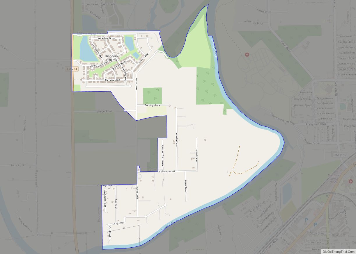
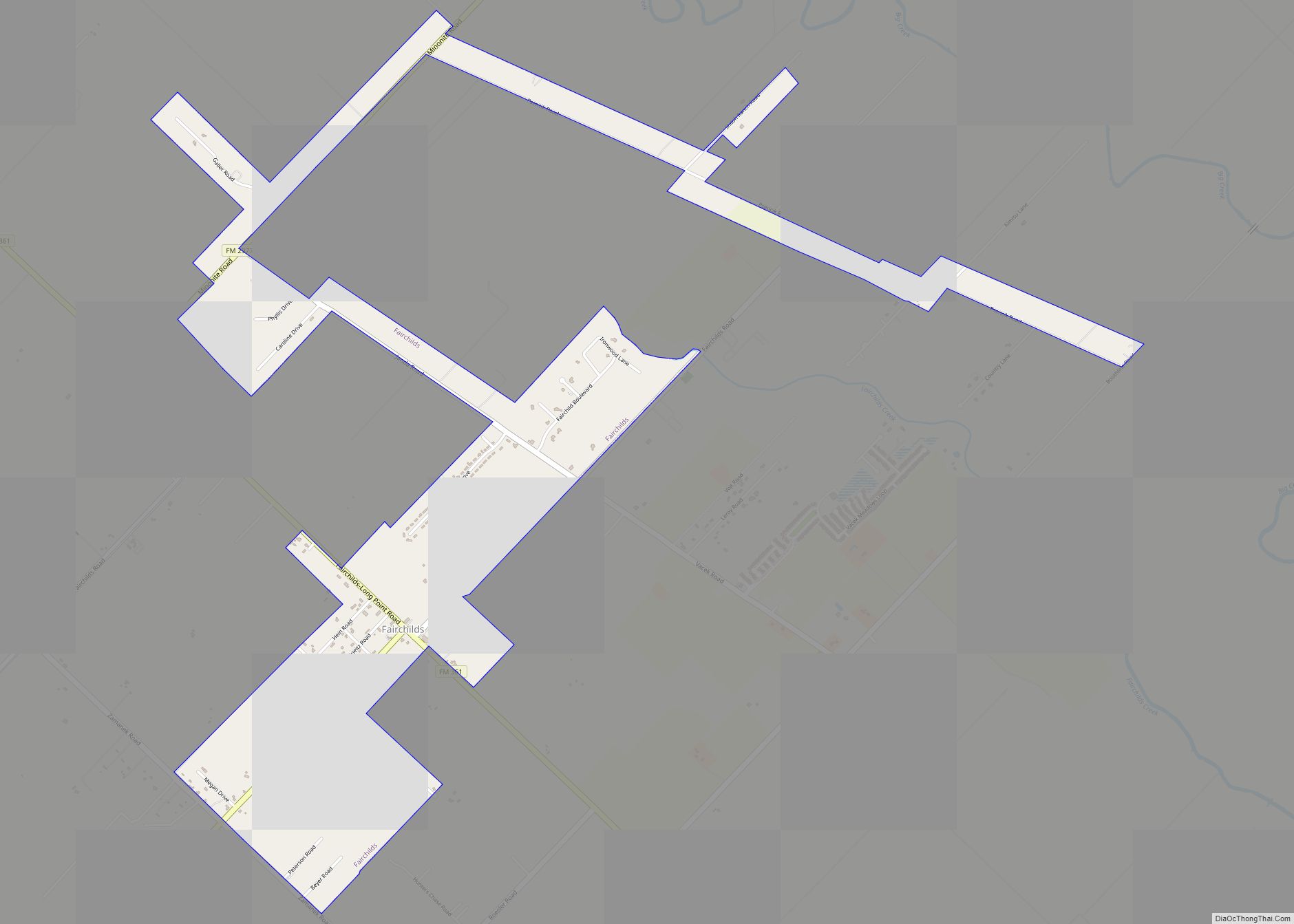
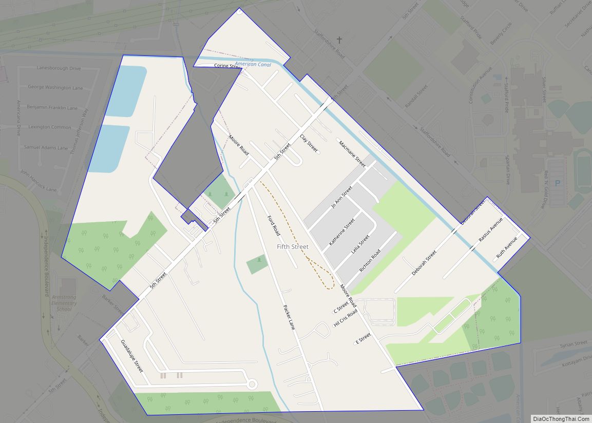
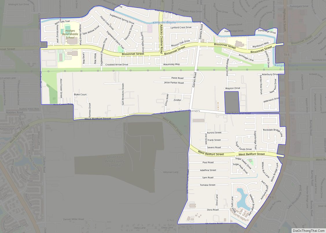
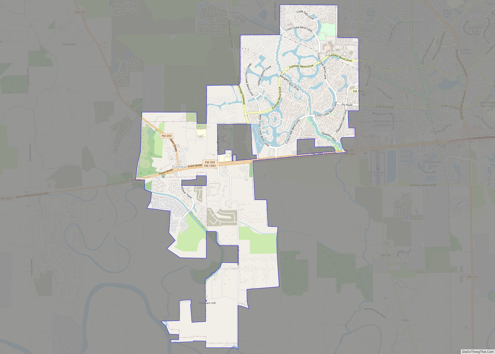
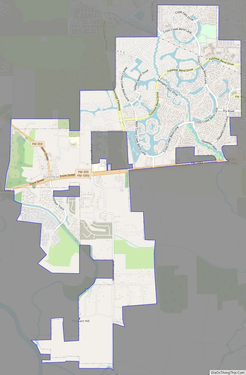
Online Interactive Map
Click on ![]() to view map in "full screen" mode.
to view map in "full screen" mode.
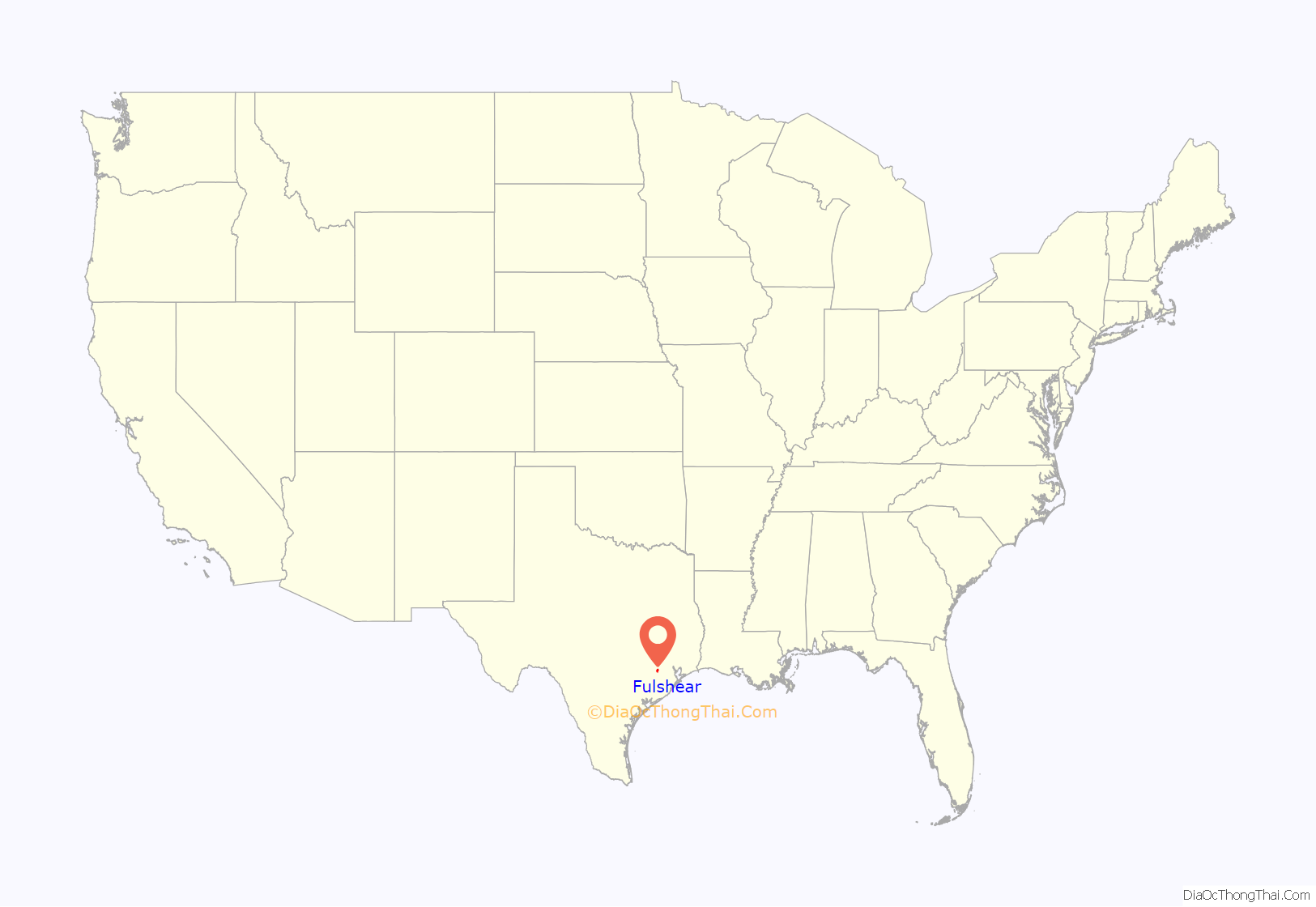
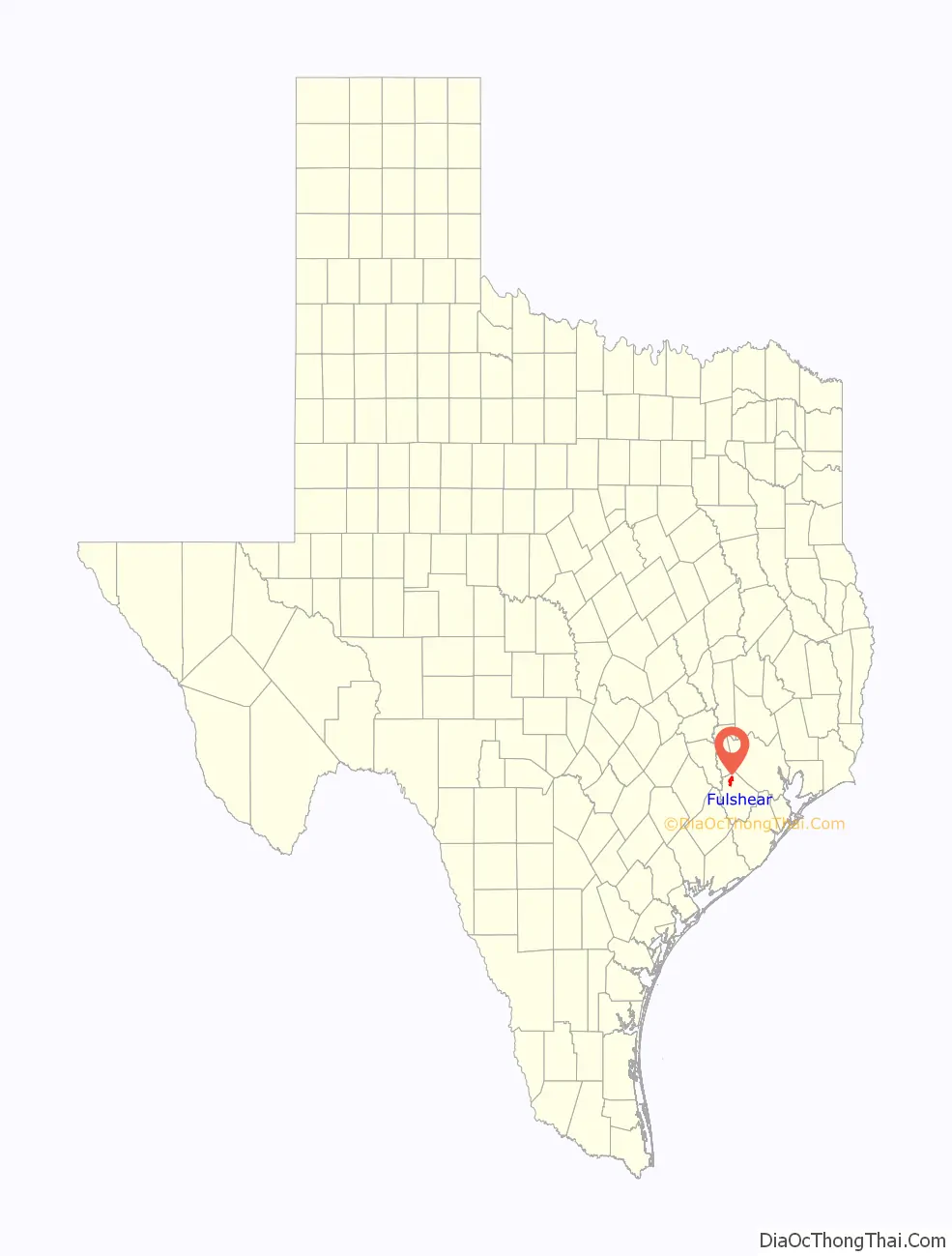
Fulshear location map. Where is Fulshear city?
History
Before Texas Independence
The history of Fulshear is closely intertwined with the historical events leading up to Texas Independence and eventual statehood within the United States of America. The small agricultural community traces its origins to the arrival of Churchill Fulshear, one of Stephen F. Austin’s original Old Three Hundred. He moved from Tennessee to Texas in the summer of 1824 with his wife, Betsy Summers, daughter, Mary, and three sons, Benjamin, Graves, and Churchill Fulshear, Jr.
As a man with considerable wealth and property, Churchill Fulshear Sr. obtained on July 16, 1824, a land grant from the Mexican government and Stephen F. Austin that allowed him and his family to settle in Austin’s colony. He established a slave plantation that raised cotton, corn, rice, pecans and livestock. Churchill Fulshear Sr. died on January 18, 1831, with the plantation ownership passed onto his youngest son, Churchill Fulshear, Jr., who added a cotton gin and flour mill which flourished well into the late 1880s.
During the Texas Revolution, Churchill Jr. and his two brothers, Graves and Benjamin, served as scouts for the Texan army as the Mexican army under the command of Antonio Lopez de Santa Anna pursued Sam Houston’s army and civilians who fled after Santa Anna’s victory at the 1836 Battle of the Alamo. The Fulshear area was on the route of both the Mexicans and the Texan soldiers. Churchill and his brothers scouted Santa Anna’s army as they crossed the Brazos River near their plantation on April 14, 1836.
According to one account, the Texan army trying to prevent Santa Anna and the Mexican army from crossing the Brazos River camped on the Fulshear plantation. They retreated when they learned that:
Texas Independence to the early 1900s
In the years after Texas Independence, Churchill Jr. expanded the plantation and commercial interests. This included a horse race track called “Churchill Downs” (not the same as the present-day Churchill Downs, which is in Kentucky) that he operated during the 1850s to 1870s in Pittsville, Texas, located several miles north of Fulsher. One of the most famous horses bred by Churchill Jr. was “Get-A-Way” (known as “Old Get”), which raced on numerous tracks throughout the United States and Europe. He also actively sold and purchased real estate, including the 654 acres sold to John Randon on May 10, 1844, for $4,000.
The old tombstones in the Fulshear Cemetery (previously called Union Chapel Cemetery Grounds) identify the names of some of the original pioneers who settled the Fulshear area: Andrews, Avery, Avis, Bains, Bond, Boone, Brasell, Bulwinkel, Cooper, Davis, Dozier, Edmonson, Everett, Gibson, Foster, Harris, Holmes, Hoskins, Huggins, Hunter, Jager, Kemp, Lovelace, Mayes, McElwee, McJunkin, McLeod, Miller, Nesbitt, Parker, Patton, Quinn, Rowles, Sass, Shieve, Sheriff, Simonton, Sparks, Thompson, Utley, Wade, Walker, Wilson, Wimberly, and Winner.
A significant historical development occurred in 1888 when Churchill Jr. granted the San Antonio and Aransas Pass (SA & AP) Railroad (SA&AP) the right of way through his plantation. The town of Fulshear grew around the railroad in the 1890s, a period that also saw the demise of other local communities which, like Pittsville, had rejected the SA & AP Railroad the right of way on their lands.
Churchill Fulshear Jr. died in 1892. In the same year, the Southern Pacific Railroad gained ownership of the SA & AP Railroad. In the decades following, the town established a public school district (1893), a Methodist church (1894) and business establishments that included a barber shop, doctor, drug store, blacksmith, saloon, hotel, and post office.
A Texas Historical Marker located in downtown Fulshear succinctly summarizes its 19th Century history:
While few historical records exist on the Civil War and the people of Fulshear, there are accounts that local landowners, surgeons, and commercial business men actively supported and enrolled in the Confederate Army during the US Civil War.
Two of the three active Fulshear cemeteries provide insights into the history of the non-white racial minorities. As was common practice prior to the US Civil War, plantation owners like Churchill Fulshear would build separate cemeteries based on race. In addition to farm labor, “Churchill Fulshear’s slaves were put to work making the bricks for the Fulshear plantation mansion, called Lake Hill.” Since the mid-1800s, minority families were buried either in the Fulshear Black Cemetery or the Fulshear Spanish Cemetery, which were originally part of the Fulshear family plantation. This includes many of the black sharecroppers who worked the land after the end of slavery in the United States. A Texas Historical Marker here gives the historical information of the Black Cemetery:
After the abolition of slavery with defeat of the Confederacy, many of the emancipated slaves became sharecroppers, which meant they rented land to farm it. Many grew cotton and potatoes, and supplemented their livelihood by raising chickens, eggs, and pigs as well as helping other farmers pick beans, potatoes, and peanuts. Many of these sharecroppers are buried in the Fulshear Black Cemetery. In 1995, Fulshear Mayor Viola Randle won a class-action lawsuit to legally define the Fulshear Black Cemetery as belonging to the Fulshear Black Cemetery Association and to prevent an attempt by a local property owner to restrict more burials in the cemetery.
The Spanish Cemetery, which was often referred to as the “Catholic Cemetery,” is just south of the Fulshear Cemetery and an estimated 300 grave sites.
Like elsewhere in Texas and the American South, the schools segregated based on race. The original “white-only” school house was built in 1893 that was later expanded into a two-story building in 1912. The segregated school for Mexican students was located nearby. Two “black-only” school houses were built in rural areas several miles to the south and northwest of town. These Fulshear schools were merged into the Lamar Consolidated Independent School District in 1948.
Boom and bust, 1900s–1970s
Fulshear remained a rural agricultural town with population ranging from 300 to 700 into the 1970s.
Incorporated city, 1977–present
The city was incorporated in 1977. The town served as a marketing center for locally produced rice, cotton, soybeans, corn, poultry, sorghum, pecan, horses and cattle. Growth in Fulshear exploded in the 2000s due to its proximity to Houston. Around 2008 the community had around 700 residents. In October 2013 the population went over 5,000. By that time, traffic was commonplace while historically it had not been. In May 2017, Fulshear was listed the richest small town in Texas on MSN.com.
Fulshear Road Map
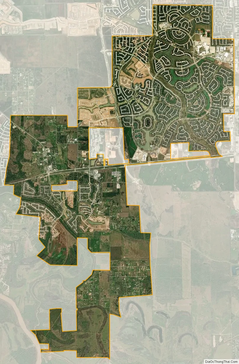
Fulshear city Satellite Map
Geography
Fulshear is located in northwestern Fort Bend County at 29°41′27″N 95°53′26″W / 29.69083°N 95.89056°W / 29.69083; -95.89056 (29.690824, –95.890531), 60 miles inland from the Gulf of Mexico. It is located at the intersection of FM 359 and FM 1093. Downtown Houston is 33 miles (53 km) to the east, and Wallis is 15 miles (24 km) to the west. Interstate 10 at Brookshire is 7 miles (11 km) to the north.
According to the United States Census Bureau, the city has a total area of 8.15 square miles (21.12 km), of which 8.09 square miles (20.95 km) are land and 0.066 square miles (0.17 km), or 0.79%, are covered by water. Fulshear has an extraterritorial jurisdiction (ETJ) of 37.11 square miles (96.1 km). Of the general-law cities in Texas, Fulshear has one of the largest ETJs.
Sediments deposited over time by the Brazos River have created rich soil, enabling many native trees to grow in the area, including oak, cottonwood, ash, and pecan. The growing season is very long (296 days) thanks to the county’s geographical proximity to the Gulf Coast, and temperatures are mild year-round. April, October and November are the most pleasant months in Fulshear; July and August are the least comfortable.
See also
Map of Texas State and its subdivision:- Anderson
- Andrews
- Angelina
- Aransas
- Archer
- Armstrong
- Atascosa
- Austin
- Bailey
- Bandera
- Bastrop
- Baylor
- Bee
- Bell
- Bexar
- Blanco
- Borden
- Bosque
- Bowie
- Brazoria
- Brazos
- Brewster
- Briscoe
- Brooks
- Brown
- Burleson
- Burnet
- Caldwell
- Calhoun
- Callahan
- Cameron
- Camp
- Carson
- Cass
- Castro
- Chambers
- Cherokee
- Childress
- Clay
- Cochran
- Coke
- Coleman
- Collin
- Collingsworth
- Colorado
- Comal
- Comanche
- Concho
- Cooke
- Coryell
- Cottle
- Crane
- Crockett
- Crosby
- Culberson
- Dallam
- Dallas
- Dawson
- Deaf Smith
- Delta
- Denton
- Dewitt
- Dickens
- Dimmit
- Donley
- Duval
- Eastland
- Ector
- Edwards
- El Paso
- Ellis
- Erath
- Falls
- Fannin
- Fayette
- Fisher
- Floyd
- Foard
- Fort Bend
- Franklin
- Freestone
- Frio
- Gaines
- Galveston
- Garza
- Gillespie
- Glasscock
- Goliad
- Gonzales
- Gray
- Grayson
- Gregg
- Grimes
- Guadalupe
- Hale
- Hall
- Hamilton
- Hansford
- Hardeman
- Hardin
- Harris
- Harrison
- Hartley
- Haskell
- Hays
- Hemphill
- Henderson
- Hidalgo
- Hill
- Hockley
- Hood
- Hopkins
- Houston
- Howard
- Hudspeth
- Hunt
- Hutchinson
- Irion
- Jack
- Jackson
- Jasper
- Jeff Davis
- Jefferson
- Jim Hogg
- Jim Wells
- Johnson
- Jones
- Karnes
- Kaufman
- Kendall
- Kenedy
- Kent
- Kerr
- Kimble
- King
- Kinney
- Kleberg
- Knox
- La Salle
- Lamar
- Lamb
- Lampasas
- Lavaca
- Lee
- Leon
- Liberty
- Limestone
- Lipscomb
- Live Oak
- Llano
- Loving
- Lubbock
- Lynn
- Madison
- Marion
- Martin
- Mason
- Matagorda
- Maverick
- McCulloch
- McLennan
- McMullen
- Medina
- Menard
- Midland
- Milam
- Mills
- Mitchell
- Montague
- Montgomery
- Moore
- Morris
- Motley
- Nacogdoches
- Navarro
- Newton
- Nolan
- Nueces
- Ochiltree
- Oldham
- Orange
- Palo Pinto
- Panola
- Parker
- Parmer
- Pecos
- Polk
- Potter
- Presidio
- Rains
- Randall
- Reagan
- Real
- Red River
- Reeves
- Refugio
- Roberts
- Robertson
- Rockwall
- Runnels
- Rusk
- Sabine
- San Augustine
- San Jacinto
- San Patricio
- San Saba
- Schleicher
- Scurry
- Shackelford
- Shelby
- Sherman
- Smith
- Somervell
- Starr
- Stephens
- Sterling
- Stonewall
- Sutton
- Swisher
- Tarrant
- Taylor
- Terrell
- Terry
- Throckmorton
- Titus
- Tom Green
- Travis
- Trinity
- Tyler
- Upshur
- Upton
- Uvalde
- Val Verde
- Van Zandt
- Victoria
- Walker
- Waller
- Ward
- Washington
- Webb
- Wharton
- Wheeler
- Wichita
- Wilbarger
- Willacy
- Williamson
- Wilson
- Winkler
- Wise
- Wood
- Yoakum
- Young
- Zapata
- Zavala
- Alabama
- Alaska
- Arizona
- Arkansas
- California
- Colorado
- Connecticut
- Delaware
- District of Columbia
- Florida
- Georgia
- Hawaii
- Idaho
- Illinois
- Indiana
- Iowa
- Kansas
- Kentucky
- Louisiana
- Maine
- Maryland
- Massachusetts
- Michigan
- Minnesota
- Mississippi
- Missouri
- Montana
- Nebraska
- Nevada
- New Hampshire
- New Jersey
- New Mexico
- New York
- North Carolina
- North Dakota
- Ohio
- Oklahoma
- Oregon
- Pennsylvania
- Rhode Island
- South Carolina
- South Dakota
- Tennessee
- Texas
- Utah
- Vermont
- Virginia
- Washington
- West Virginia
- Wisconsin
- Wyoming