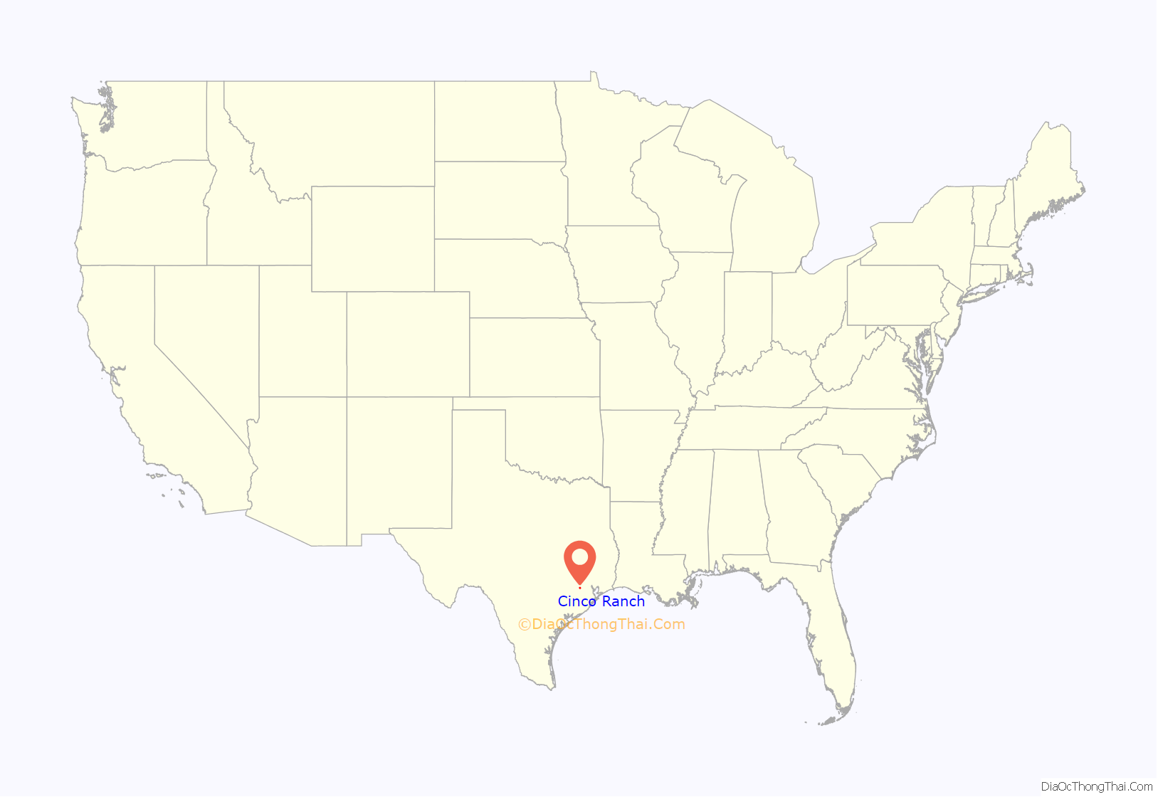
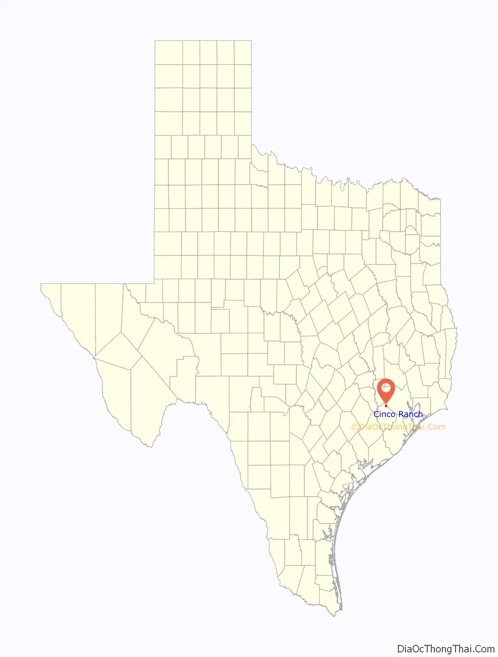
Cinco Ranch is a census-designated place and master-planned community located in the extraterritorial jurisdiction of the city of Houston within Fort Bend and Harris counties in the U.S. state of Texas. The population was 16,899 at the 2020 census. It lies about 25 miles (40 km) west of the Harris County seat of Houston and 10 miles (16 km) north of the Fort Bend County seat of Richmond. Cinco Ranch is considered to be part of the Greater Katy area and is roughly 10 miles southeast of the city of Katy.
| Name: | Cinco Ranch CDP |
|---|---|
| LSAD Code: | 57 |
| LSAD Description: | CDP (suffix) |
| State: | Texas |
| County: | Fort Bend County, Harris County |
| Elevation: | 112 ft (34 m) |
| Total Area: | 4.9 sq mi (12.8 km²) |
| Land Area: | 4.9 sq mi (12.8 km²) |
| Water Area: | 0.0 sq mi (0.0 km²) |
| Total Population: | 16,899 |
| Population Density: | 3,400/sq mi (1,300/km²) |
| FIPS code: | 4814929 |
| GNISfeature ID: | 1852694 |
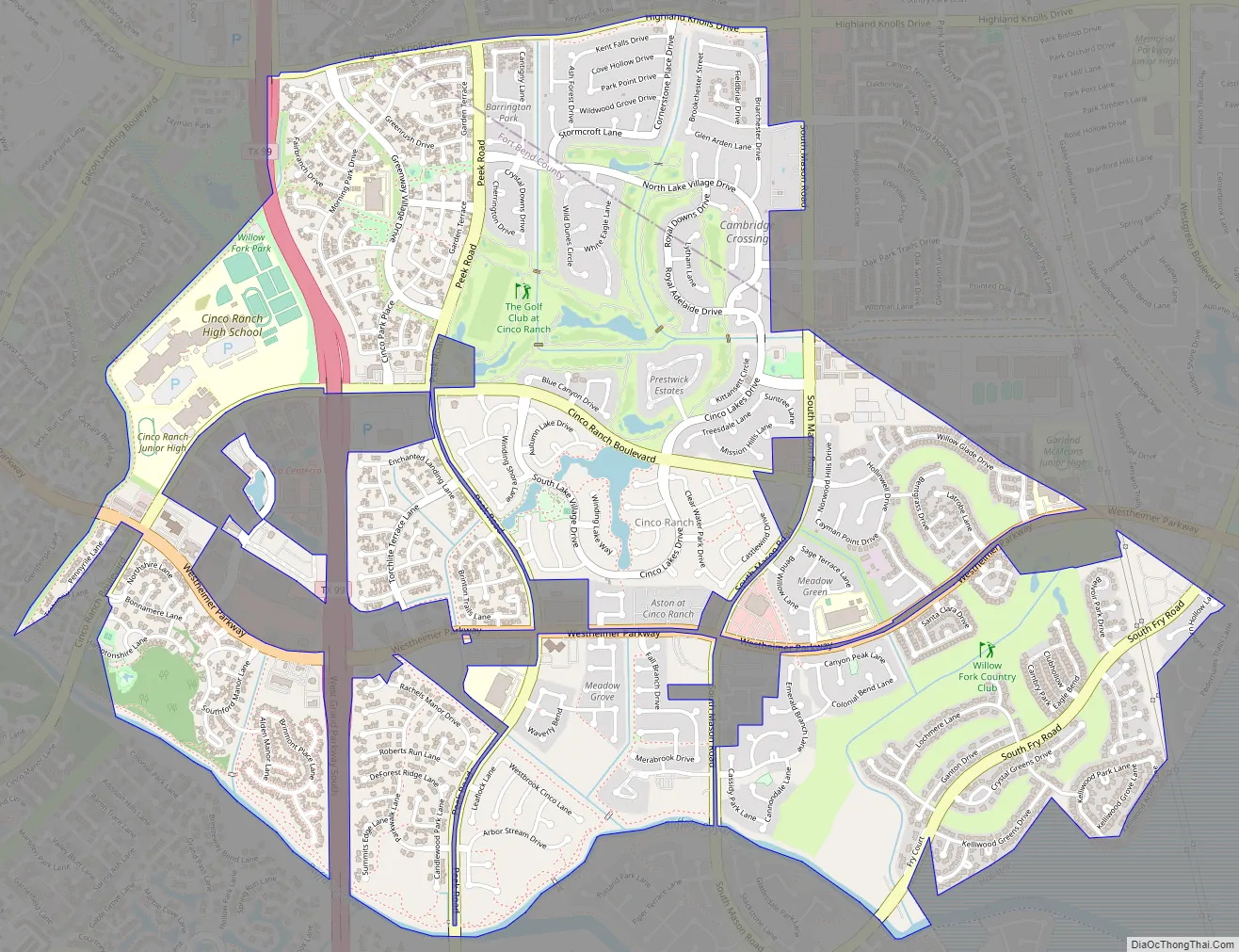
Online Interactive Map
Click on ![]() to view map in "full screen" mode.
to view map in "full screen" mode.
Cinco Ranch location map. Where is Cinco Ranch CDP?
History
The Cinco Ranch community goes back to before Texas became a republic. In the 1820s, pioneer Moses Austin was granted by the Spanish government the authority to settle 300 families in the valleys of the Brazos and Colorado rivers. He died before he was able to accomplish this, but his son Stephen F. Austin was able to complete his father’s wishes, even under the newly established Mexican government. One of the men who moved into these 300 slots of land (each one over 4,000 acres/16 km) was Randolph Foster, whose land spread across Fort Bend and Waller counties and upon which wild horses, deer, Native Americans and buffalo lived.
Foster’s daughter married Thomas Blakeley, cattleman and future sheriff of Fort Bend County. Their son, Bassett Blakeley, took after his father and grandfather and soon grew into a cowboy and cattleman. Bassett Blakeley owned 15,000 acres (61 km) of land and 14,000 head of Brahman cattle, along with his grandfather’s land. The cowhands of his Blakeley Ranch annually drove 10,000 head of cattle to the railheads in Kansas.
In 1937, Blakeley sold the working ranch to William Wheless, who convinced four of his friends, J.S. Abercrombie, W.B. Pryon, H.G. Nelms and R.A Ramos—all, like him, wealthy from oil—to become his partners at the ranch. In a nod to its Spanish roots perhaps, they called it Cinco Ranch (cinco means “five” in Spanish). Only the Wheless family lived on the ranch, but all of the families visited on many holidays and weekends, making use of a huge clubhouse complete with two bedroom wings. The ranch was not merely involved in cattle—it also had several acres of rice—for years, the main output of Katy, Texas—and peanut production.
In February 1984, the largest raw land transaction in the history of Houston took place when Cinco Ranch Venture, consisting of U. S. Home, the Mischer Corporation, and American General Corporation, purchased Cinco Ranch for a 5,000-acre (20 km) master-planned development. American General eventually bought out the other partners. In 1997, Cinco Ranch and other American General land development assets were purchased by Terrabrook, a wholly owned subsidiary of real estate investor Westbrook Partners. In 2003, Cinco Ranch and other Terrabrook developments were purchased by San Diego-based Newland Real Estate, LLC(Newland). Also in 2003, Newland purchased 1,828 acres (7.40 km) west of the Grand Parkway (SH-99) and contiguous to Cinco Ranch. This acquisition along with several smaller parcels that were subsequently purchased by Newland ultimately increased the size of Cinco Ranch to approximately 7,600 acres (31 km). In 2010, Newland purchased an additional 492 acres (1.99 km) for future Cinco Ranch expansion. This land is located at the intersection of FM 1463 and Corbitt Road, and is not contiguous with the rest of Cinco Ranch. Cinco Ranch now totals 8,092 acres (32.75 km) and is expected to have over 14,000 homes at build-out, which is currently projected to be around 2016.
Cinco Ranch Road Map
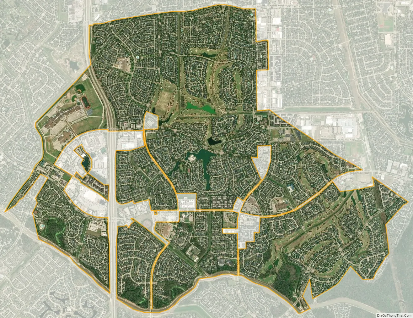
Cinco Ranch city Satellite Map
Geography
Cinco Ranch is located at 29°44′29″N 95°45′30″W / 29.74139°N 95.75833°W / 29.74139; -95.75833 (29.741522, -95.758343).
According to the United States Census Bureau, the CDP has a total area of 4.9 square miles (12.8 km). None of the area is covered with water.
See also
Map of Texas State and its subdivision:- Anderson
- Andrews
- Angelina
- Aransas
- Archer
- Armstrong
- Atascosa
- Austin
- Bailey
- Bandera
- Bastrop
- Baylor
- Bee
- Bell
- Bexar
- Blanco
- Borden
- Bosque
- Bowie
- Brazoria
- Brazos
- Brewster
- Briscoe
- Brooks
- Brown
- Burleson
- Burnet
- Caldwell
- Calhoun
- Callahan
- Cameron
- Camp
- Carson
- Cass
- Castro
- Chambers
- Cherokee
- Childress
- Clay
- Cochran
- Coke
- Coleman
- Collin
- Collingsworth
- Colorado
- Comal
- Comanche
- Concho
- Cooke
- Coryell
- Cottle
- Crane
- Crockett
- Crosby
- Culberson
- Dallam
- Dallas
- Dawson
- Deaf Smith
- Delta
- Denton
- Dewitt
- Dickens
- Dimmit
- Donley
- Duval
- Eastland
- Ector
- Edwards
- El Paso
- Ellis
- Erath
- Falls
- Fannin
- Fayette
- Fisher
- Floyd
- Foard
- Fort Bend
- Franklin
- Freestone
- Frio
- Gaines
- Galveston
- Garza
- Gillespie
- Glasscock
- Goliad
- Gonzales
- Gray
- Grayson
- Gregg
- Grimes
- Guadalupe
- Hale
- Hall
- Hamilton
- Hansford
- Hardeman
- Hardin
- Harris
- Harrison
- Hartley
- Haskell
- Hays
- Hemphill
- Henderson
- Hidalgo
- Hill
- Hockley
- Hood
- Hopkins
- Houston
- Howard
- Hudspeth
- Hunt
- Hutchinson
- Irion
- Jack
- Jackson
- Jasper
- Jeff Davis
- Jefferson
- Jim Hogg
- Jim Wells
- Johnson
- Jones
- Karnes
- Kaufman
- Kendall
- Kenedy
- Kent
- Kerr
- Kimble
- King
- Kinney
- Kleberg
- Knox
- La Salle
- Lamar
- Lamb
- Lampasas
- Lavaca
- Lee
- Leon
- Liberty
- Limestone
- Lipscomb
- Live Oak
- Llano
- Loving
- Lubbock
- Lynn
- Madison
- Marion
- Martin
- Mason
- Matagorda
- Maverick
- McCulloch
- McLennan
- McMullen
- Medina
- Menard
- Midland
- Milam
- Mills
- Mitchell
- Montague
- Montgomery
- Moore
- Morris
- Motley
- Nacogdoches
- Navarro
- Newton
- Nolan
- Nueces
- Ochiltree
- Oldham
- Orange
- Palo Pinto
- Panola
- Parker
- Parmer
- Pecos
- Polk
- Potter
- Presidio
- Rains
- Randall
- Reagan
- Real
- Red River
- Reeves
- Refugio
- Roberts
- Robertson
- Rockwall
- Runnels
- Rusk
- Sabine
- San Augustine
- San Jacinto
- San Patricio
- San Saba
- Schleicher
- Scurry
- Shackelford
- Shelby
- Sherman
- Smith
- Somervell
- Starr
- Stephens
- Sterling
- Stonewall
- Sutton
- Swisher
- Tarrant
- Taylor
- Terrell
- Terry
- Throckmorton
- Titus
- Tom Green
- Travis
- Trinity
- Tyler
- Upshur
- Upton
- Uvalde
- Val Verde
- Van Zandt
- Victoria
- Walker
- Waller
- Ward
- Washington
- Webb
- Wharton
- Wheeler
- Wichita
- Wilbarger
- Willacy
- Williamson
- Wilson
- Winkler
- Wise
- Wood
- Yoakum
- Young
- Zapata
- Zavala
- Alabama
- Alaska
- Arizona
- Arkansas
- California
- Colorado
- Connecticut
- Delaware
- District of Columbia
- Florida
- Georgia
- Hawaii
- Idaho
- Illinois
- Indiana
- Iowa
- Kansas
- Kentucky
- Louisiana
- Maine
- Maryland
- Massachusetts
- Michigan
- Minnesota
- Mississippi
- Missouri
- Montana
- Nebraska
- Nevada
- New Hampshire
- New Jersey
- New Mexico
- New York
- North Carolina
- North Dakota
- Ohio
- Oklahoma
- Oregon
- Pennsylvania
- Rhode Island
- South Carolina
- South Dakota
- Tennessee
- Texas
- Utah
- Vermont
- Virginia
- Washington
- West Virginia
- Wisconsin
- Wyoming


