Galena Park is a city in Harris County, Texas, United States, within the Houston–Sugar Land–Baytown metropolitan area. The population was 10,740 at the 2020 census.
| Name: | Galena Park city |
|---|---|
| LSAD Code: | 25 |
| LSAD Description: | city (suffix) |
| State: | Texas |
| County: | Harris County |
| Elevation: | 7 ft (2 m) |
| Total Area: | 4.92 sq mi (12.74 km²) |
| Land Area: | 4.80 sq mi (12.44 km²) |
| Water Area: | 0.12 sq mi (0.30 km²) |
| Total Population: | 10,740 |
| Population Density: | 2,239.18/sq mi (864.58/km²) |
| ZIP code: | 77547 |
| FIPS code: | 4827996 |
| GNISfeature ID: | 1377177 |
| Website: | www.cityofgalenapark-tx.gov |
Online Interactive Map
Click on ![]() to view map in "full screen" mode.
to view map in "full screen" mode.
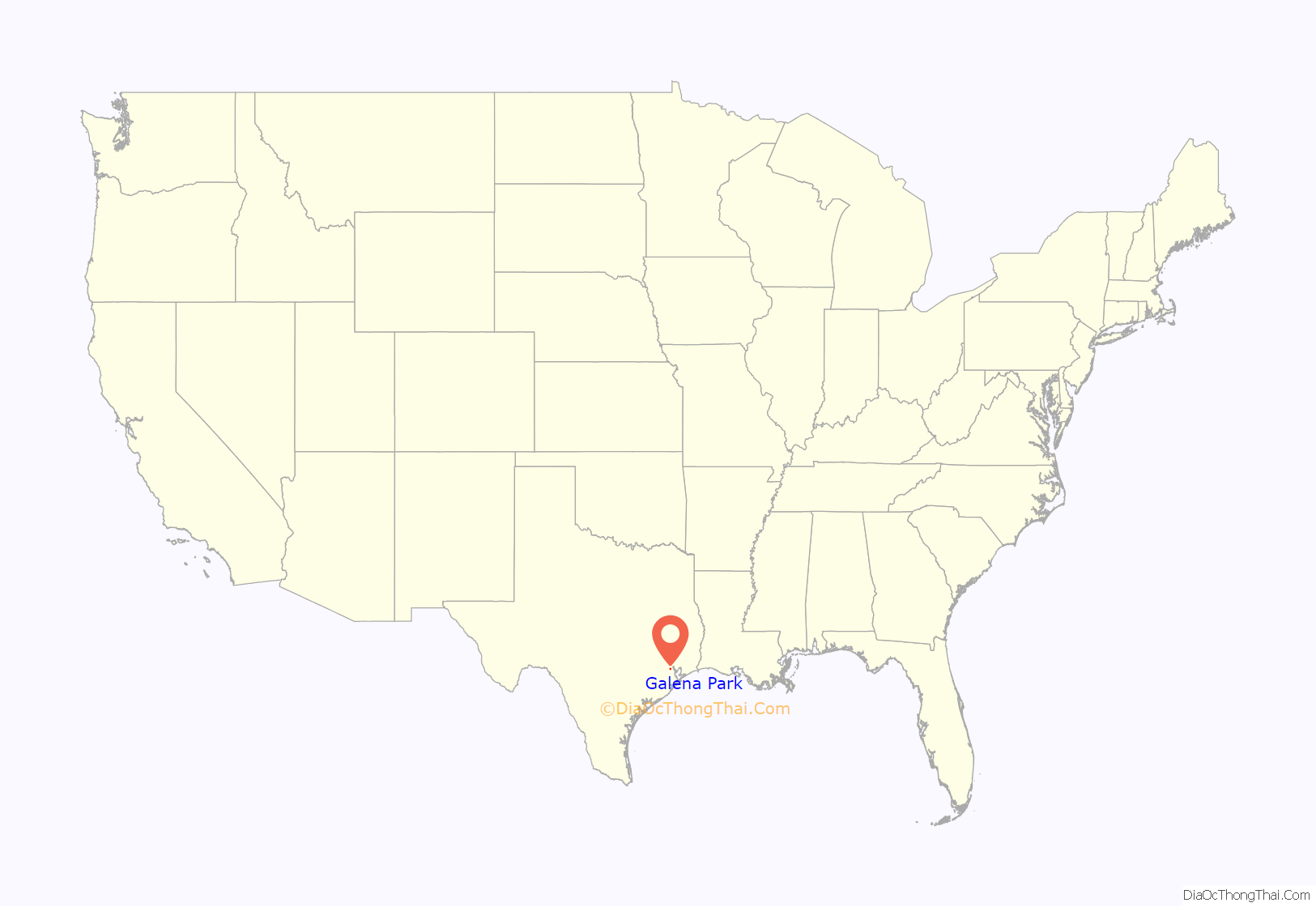
Galena Park location map. Where is Galena Park city?
History
Issac Batterson and his family settled in the area in 1833; it was a part of the Ezekiel Thomas survey. The area of Galena Park began as the settlement of Clinton in 1835. The center of what would become Galena Park was a 1,000-acre (400 ha) tract that Batterson purchased from the estate of Ezekiel Thomas. The settlement originally served as a farming and ranching community, but in the 1880s transformed into a railroad center along the new Port of Houston. With the coming of the petrochemical industry in the early 1900s, Clinton again transformed into a refinery center.
Clinton attempted to establish a post office in 1935, but the request was denied, as another Clinton, Texas, had established the name. The settlement’s name was changed to Galena Park after the Galena Signal Oil Company of Texas, which built the first refinery there. Galena Park’s original name survives today as the name of a major street in the city, Clinton Drive. Because of the 1935 incorporation, Houston did not incorporate Galena Park’s territory into its city limits, while Houston annexed surrounding areas that were unincorporated. By the late 1930s Houston was growing as a port, so Galena Park expanded. Since the 1940s, area residents considered the city to be a part of greater Houston.
The economy of Galena Park began to suffer in the early 1980s, when cranes used to haul ship cargo were reduced; prior to the early 1980s, a team of workers, known on the docks as longshoremen, took up to one week to unload cargo off a ship. Many lived in the Galena Park area and contributed to its local economy. The use of cranes, however, led to ships unloading all cargo in less than one day. The 1980s also hit Galena Park’s economy with layoffs from the steel mills as the U.S. steel contracted due to overseas competition. The economy further decreased after the September 11, 2001 attacks, when seaport administrators tightened security rules that governed whether sailors could leave ships docked at port.
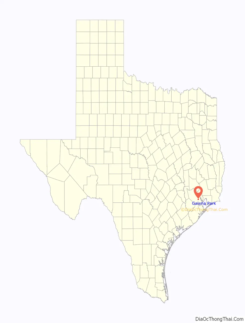
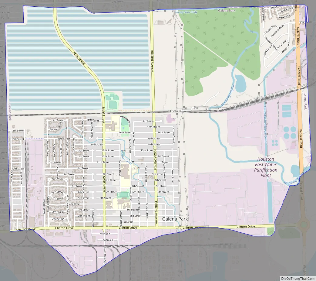
Galena Park Road Map
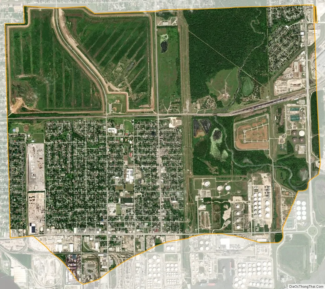
Galena Park city Satellite Map
Geography
Galena Park is located at 29°44′20″N 95°14′14″W / 29.73889°N 95.23722°W / 29.73889; -95.23722 (29.738928, –95.237211).
According to the United States Census Bureau, the city has a total area of 5.0 square miles (13 km), all of it land.
The city is east of the 610 Loop, north of the Houston Ship Channel, and adjacent to the City of Jacinto City, as well as the Clinton Park neighborhood of Houston. Clinton Drive is the main arterial road for Galena Park and traffic to and from the ship channel and the Port of Houston uses this road. The area around Galena Park includes freeways, freight railway, and heavy industry.
The border between Galena Park, previously an all-white city and Clinton Park, an African-American neighborhood, is barricaded as of 2008. Rafael Longoria and Susan Rogers of the Rice Design Alliance said in 2008 that the barricade “provides a stark example of how the prevailing segregationist sentiments of the era [are] still in evidence.”
See also
Map of Texas State and its subdivision:- Anderson
- Andrews
- Angelina
- Aransas
- Archer
- Armstrong
- Atascosa
- Austin
- Bailey
- Bandera
- Bastrop
- Baylor
- Bee
- Bell
- Bexar
- Blanco
- Borden
- Bosque
- Bowie
- Brazoria
- Brazos
- Brewster
- Briscoe
- Brooks
- Brown
- Burleson
- Burnet
- Caldwell
- Calhoun
- Callahan
- Cameron
- Camp
- Carson
- Cass
- Castro
- Chambers
- Cherokee
- Childress
- Clay
- Cochran
- Coke
- Coleman
- Collin
- Collingsworth
- Colorado
- Comal
- Comanche
- Concho
- Cooke
- Coryell
- Cottle
- Crane
- Crockett
- Crosby
- Culberson
- Dallam
- Dallas
- Dawson
- Deaf Smith
- Delta
- Denton
- Dewitt
- Dickens
- Dimmit
- Donley
- Duval
- Eastland
- Ector
- Edwards
- El Paso
- Ellis
- Erath
- Falls
- Fannin
- Fayette
- Fisher
- Floyd
- Foard
- Fort Bend
- Franklin
- Freestone
- Frio
- Gaines
- Galveston
- Garza
- Gillespie
- Glasscock
- Goliad
- Gonzales
- Gray
- Grayson
- Gregg
- Grimes
- Guadalupe
- Hale
- Hall
- Hamilton
- Hansford
- Hardeman
- Hardin
- Harris
- Harrison
- Hartley
- Haskell
- Hays
- Hemphill
- Henderson
- Hidalgo
- Hill
- Hockley
- Hood
- Hopkins
- Houston
- Howard
- Hudspeth
- Hunt
- Hutchinson
- Irion
- Jack
- Jackson
- Jasper
- Jeff Davis
- Jefferson
- Jim Hogg
- Jim Wells
- Johnson
- Jones
- Karnes
- Kaufman
- Kendall
- Kenedy
- Kent
- Kerr
- Kimble
- King
- Kinney
- Kleberg
- Knox
- La Salle
- Lamar
- Lamb
- Lampasas
- Lavaca
- Lee
- Leon
- Liberty
- Limestone
- Lipscomb
- Live Oak
- Llano
- Loving
- Lubbock
- Lynn
- Madison
- Marion
- Martin
- Mason
- Matagorda
- Maverick
- McCulloch
- McLennan
- McMullen
- Medina
- Menard
- Midland
- Milam
- Mills
- Mitchell
- Montague
- Montgomery
- Moore
- Morris
- Motley
- Nacogdoches
- Navarro
- Newton
- Nolan
- Nueces
- Ochiltree
- Oldham
- Orange
- Palo Pinto
- Panola
- Parker
- Parmer
- Pecos
- Polk
- Potter
- Presidio
- Rains
- Randall
- Reagan
- Real
- Red River
- Reeves
- Refugio
- Roberts
- Robertson
- Rockwall
- Runnels
- Rusk
- Sabine
- San Augustine
- San Jacinto
- San Patricio
- San Saba
- Schleicher
- Scurry
- Shackelford
- Shelby
- Sherman
- Smith
- Somervell
- Starr
- Stephens
- Sterling
- Stonewall
- Sutton
- Swisher
- Tarrant
- Taylor
- Terrell
- Terry
- Throckmorton
- Titus
- Tom Green
- Travis
- Trinity
- Tyler
- Upshur
- Upton
- Uvalde
- Val Verde
- Van Zandt
- Victoria
- Walker
- Waller
- Ward
- Washington
- Webb
- Wharton
- Wheeler
- Wichita
- Wilbarger
- Willacy
- Williamson
- Wilson
- Winkler
- Wise
- Wood
- Yoakum
- Young
- Zapata
- Zavala
- Alabama
- Alaska
- Arizona
- Arkansas
- California
- Colorado
- Connecticut
- Delaware
- District of Columbia
- Florida
- Georgia
- Hawaii
- Idaho
- Illinois
- Indiana
- Iowa
- Kansas
- Kentucky
- Louisiana
- Maine
- Maryland
- Massachusetts
- Michigan
- Minnesota
- Mississippi
- Missouri
- Montana
- Nebraska
- Nevada
- New Hampshire
- New Jersey
- New Mexico
- New York
- North Carolina
- North Dakota
- Ohio
- Oklahoma
- Oregon
- Pennsylvania
- Rhode Island
- South Carolina
- South Dakota
- Tennessee
- Texas
- Utah
- Vermont
- Virginia
- Washington
- West Virginia
- Wisconsin
- Wyoming


