Ganado (/ɡəˈneɪdoʊ/ gə-NAY-doh) is a city in Jackson County, Texas, United States. The population was 1,975 at the 2020 census.
| Name: | Ganado city |
|---|---|
| LSAD Code: | 25 |
| LSAD Description: | city (suffix) |
| State: | Texas |
| County: | Jackson County |
| Incorporated: | 1909 |
| Elevation: | 66 ft (20 m) |
| Total Area: | 1.17 sq mi (3.03 km²) |
| Land Area: | 1.17 sq mi (3.02 km²) |
| Water Area: | 0.00 sq mi (0.01 km²) |
| Total Population: | 1,975 |
| Population Density: | 1,763.95/sq mi (681.18/km²) |
| ZIP code: | 77962 |
| Area code: | 361 |
| FIPS code: | 4828080 |
| GNISfeature ID: | 1357846 |
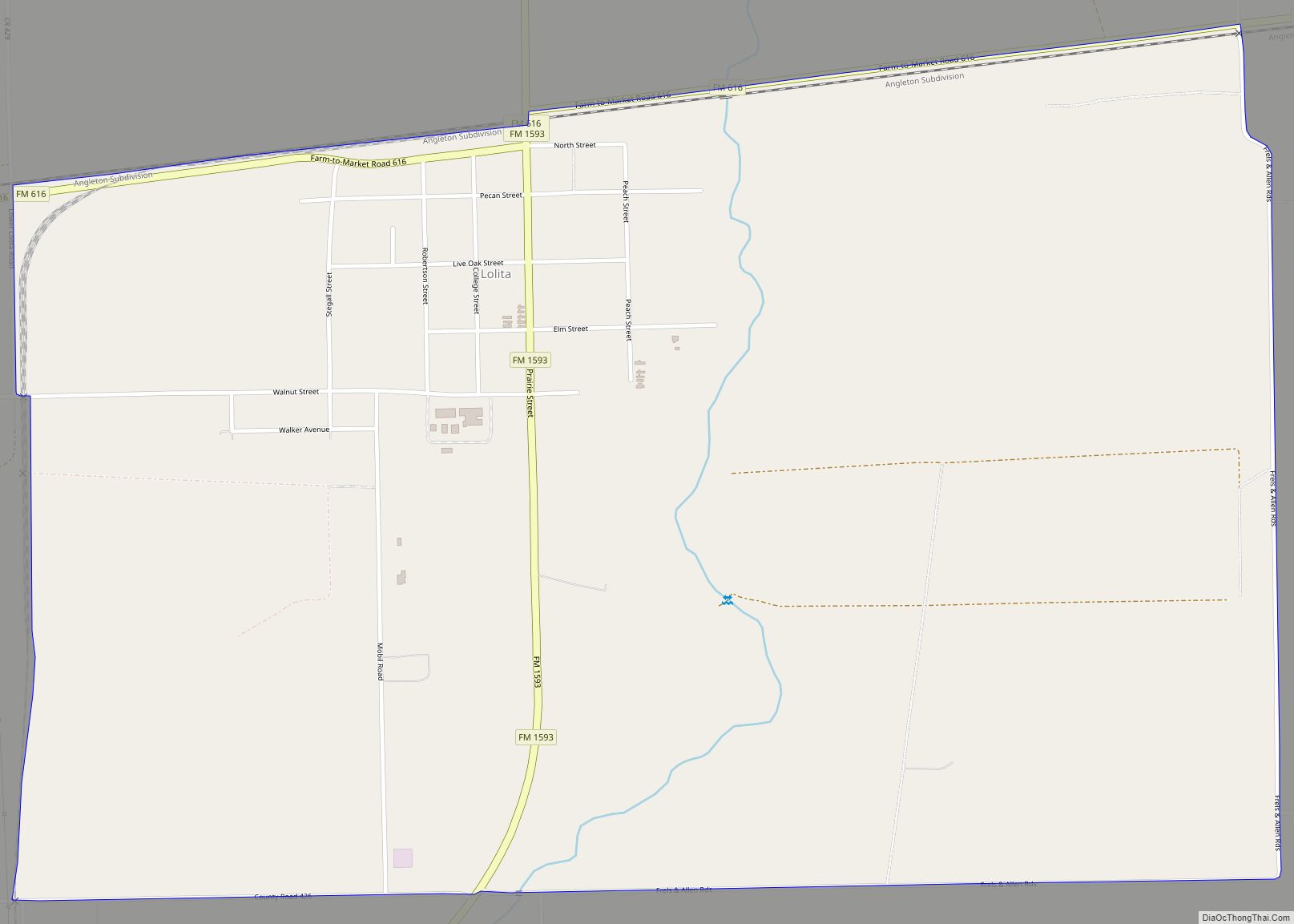
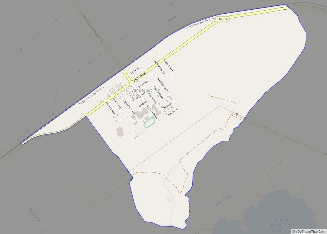
Online Interactive Map
Click on ![]() to view map in "full screen" mode.
to view map in "full screen" mode.
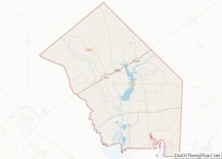
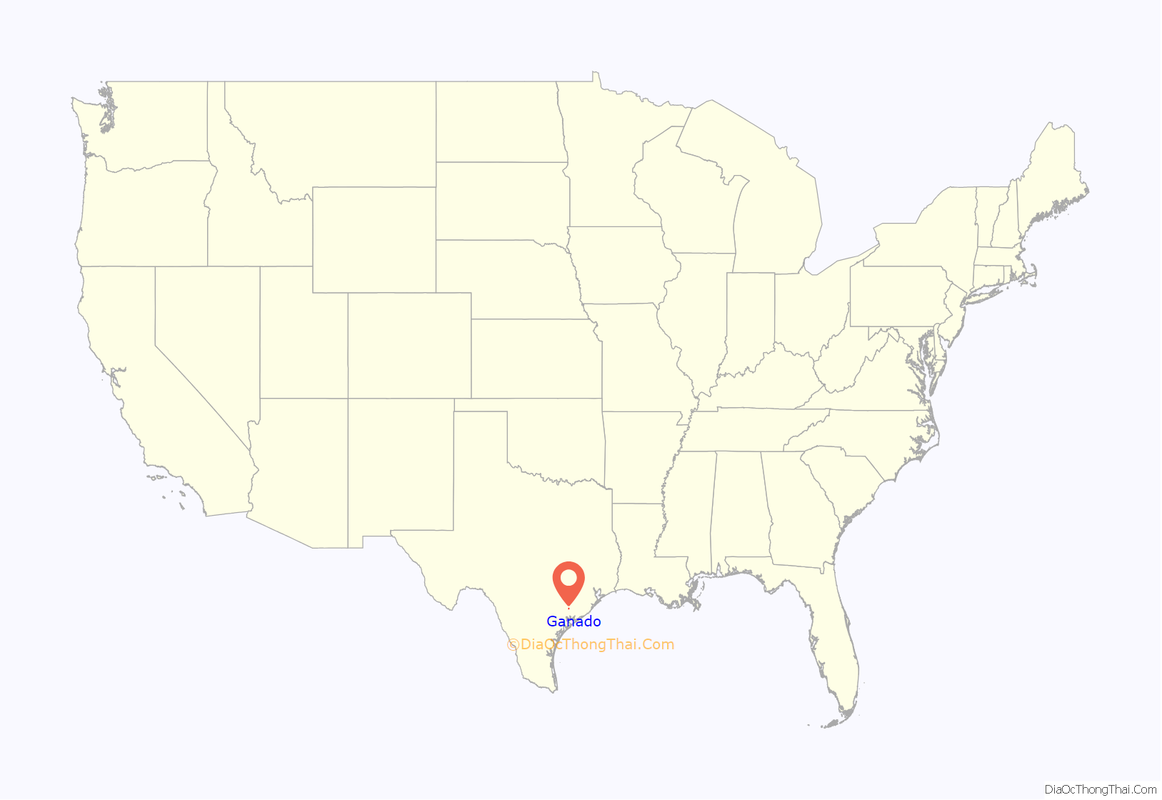
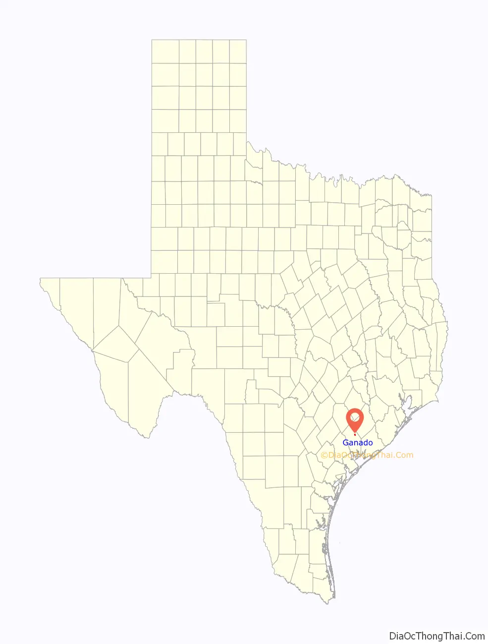
Ganado location map. Where is Ganado city?
History
The City of Ganado was a ranching community when it was first settled. Most settlers lived near Mustang Creek and traveled to Texana, Victoria and Indianola for supplies. Jackson County’s “second city,” Ganado was originally known as Mustang Settlement, after nearby Mustang Creek. Cattle ranching was the primary economic engine and herds were driven to Louisiana for sale and later to Kansas City. That came to an abrupt end with the coming of the railroad in 1882. As the story goes, a railroad official looked out the window of a train car and saw a large herd of cattle. He decided the area should be called Ganado, which means “herd” in Spanish. Thus Ganado was named in 1882.
Scandinavian immigrants bought land and began farming in 1891. A second wave of immigration brought Germans and Bohemians in the 1880s and 1890s. Jim McFarland moved his general store from its earlier location on McFarland Creek to a site in town. After McFarland died, Thomas Babcock-who was also the town’s first postmaster, bought the remaining stock and continued a store in the building. Babcock’s establishment, later known as the Old Texas House, provided supplies to local ranchers. Soon afterwards, Babcock also established the first residence and first cotton gin in Ganado. In 1891 T. N. Mauritz opened the first bank in Ganado. By 1909 the town had sixty businesses. When the railroad was built through, Ganado grew almost overnight into a bustling city. New homes, hotels, and businesses sprang up quickly. The city incorporated in 1909.
By 1914 the town was thriving with a rice mill and storage facilities, 750 citizens, a school district and a weekly newspaper. By 1937, Main Street was paved, concrete sidewalks were added and water lines were installed. By 1950 the population had increased to 1,253.
The Little School of the 400 was created in 1957 to meet the educational needs of Spanish-speaking children in Texas who were being discriminated against for their lack of knowledge of the English language. The goal of the program was to teach 400 basic English words to help Spanish-speaking children to manage instruction given in English in the regular public educational system. Under the leadership of Felix Tijerina, LULAC Council 60, of Houston, Texas, chose Ganado to be its first community to pilot the program. The program went on to become very successful and the state of Texas adopted it as their own. It later became a precursor to the national Head Start Program.
In 1963, a municipal bond was overwhelmingly approved for $60,000. This bond would be separated into two parts: $44,000 for a new city hall and $16,000 for new fire truck and equipment. The Council at that time were Mayor W.W. Brandes, Councilmen Dr. C.L. Bishop and J.B. Housson. The open house for new building was on May 3, 1964. In 1988 forty-three businesses served 1,770 citizens. In 1990 the population was 1,701, increasing to 1,915 in the 2000 Census. As of the 2010 Census, the population is 2,003. Many descendants of the early pioneer families still live in the city today [1].
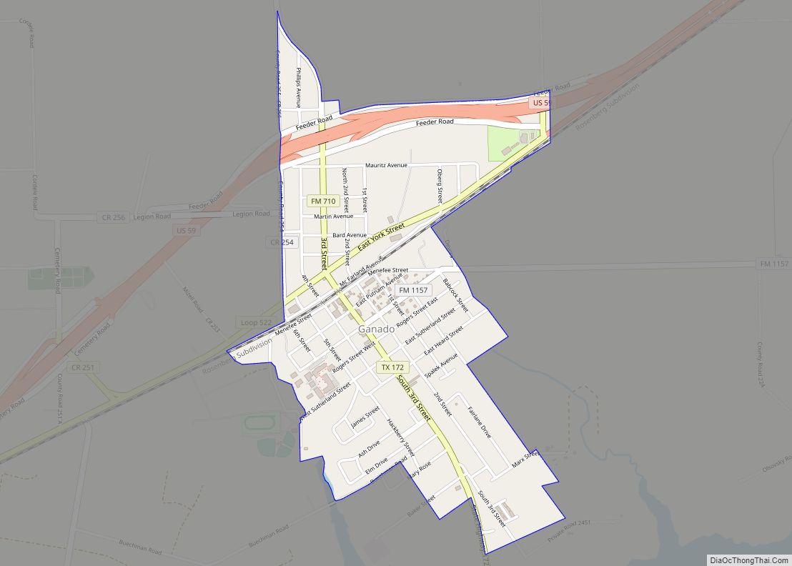
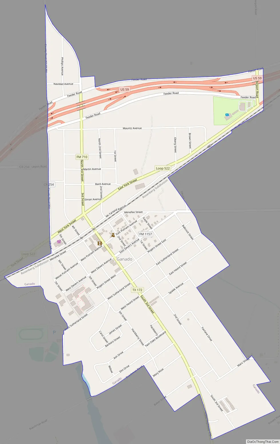
Ganado Road Map
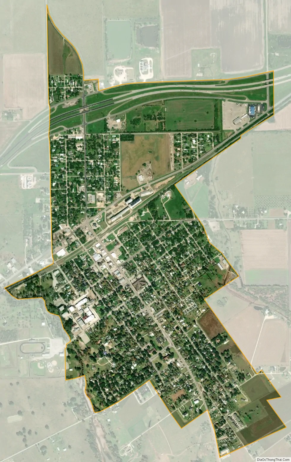
Ganado city Satellite Map
Geography
Ganado is located at 29°2′28″N 96°30′44″W / 29.04111°N 96.51222°W / 29.04111; -96.51222 (29.041111, –96.512136), approximately 35 miles northeast of Victoria.
According to the United States Census Bureau, the city has a total area of 1.2 square miles (3.1 km), all of it land.
See also
Map of Texas State and its subdivision:- Anderson
- Andrews
- Angelina
- Aransas
- Archer
- Armstrong
- Atascosa
- Austin
- Bailey
- Bandera
- Bastrop
- Baylor
- Bee
- Bell
- Bexar
- Blanco
- Borden
- Bosque
- Bowie
- Brazoria
- Brazos
- Brewster
- Briscoe
- Brooks
- Brown
- Burleson
- Burnet
- Caldwell
- Calhoun
- Callahan
- Cameron
- Camp
- Carson
- Cass
- Castro
- Chambers
- Cherokee
- Childress
- Clay
- Cochran
- Coke
- Coleman
- Collin
- Collingsworth
- Colorado
- Comal
- Comanche
- Concho
- Cooke
- Coryell
- Cottle
- Crane
- Crockett
- Crosby
- Culberson
- Dallam
- Dallas
- Dawson
- Deaf Smith
- Delta
- Denton
- Dewitt
- Dickens
- Dimmit
- Donley
- Duval
- Eastland
- Ector
- Edwards
- El Paso
- Ellis
- Erath
- Falls
- Fannin
- Fayette
- Fisher
- Floyd
- Foard
- Fort Bend
- Franklin
- Freestone
- Frio
- Gaines
- Galveston
- Garza
- Gillespie
- Glasscock
- Goliad
- Gonzales
- Gray
- Grayson
- Gregg
- Grimes
- Guadalupe
- Hale
- Hall
- Hamilton
- Hansford
- Hardeman
- Hardin
- Harris
- Harrison
- Hartley
- Haskell
- Hays
- Hemphill
- Henderson
- Hidalgo
- Hill
- Hockley
- Hood
- Hopkins
- Houston
- Howard
- Hudspeth
- Hunt
- Hutchinson
- Irion
- Jack
- Jackson
- Jasper
- Jeff Davis
- Jefferson
- Jim Hogg
- Jim Wells
- Johnson
- Jones
- Karnes
- Kaufman
- Kendall
- Kenedy
- Kent
- Kerr
- Kimble
- King
- Kinney
- Kleberg
- Knox
- La Salle
- Lamar
- Lamb
- Lampasas
- Lavaca
- Lee
- Leon
- Liberty
- Limestone
- Lipscomb
- Live Oak
- Llano
- Loving
- Lubbock
- Lynn
- Madison
- Marion
- Martin
- Mason
- Matagorda
- Maverick
- McCulloch
- McLennan
- McMullen
- Medina
- Menard
- Midland
- Milam
- Mills
- Mitchell
- Montague
- Montgomery
- Moore
- Morris
- Motley
- Nacogdoches
- Navarro
- Newton
- Nolan
- Nueces
- Ochiltree
- Oldham
- Orange
- Palo Pinto
- Panola
- Parker
- Parmer
- Pecos
- Polk
- Potter
- Presidio
- Rains
- Randall
- Reagan
- Real
- Red River
- Reeves
- Refugio
- Roberts
- Robertson
- Rockwall
- Runnels
- Rusk
- Sabine
- San Augustine
- San Jacinto
- San Patricio
- San Saba
- Schleicher
- Scurry
- Shackelford
- Shelby
- Sherman
- Smith
- Somervell
- Starr
- Stephens
- Sterling
- Stonewall
- Sutton
- Swisher
- Tarrant
- Taylor
- Terrell
- Terry
- Throckmorton
- Titus
- Tom Green
- Travis
- Trinity
- Tyler
- Upshur
- Upton
- Uvalde
- Val Verde
- Van Zandt
- Victoria
- Walker
- Waller
- Ward
- Washington
- Webb
- Wharton
- Wheeler
- Wichita
- Wilbarger
- Willacy
- Williamson
- Wilson
- Winkler
- Wise
- Wood
- Yoakum
- Young
- Zapata
- Zavala
- Alabama
- Alaska
- Arizona
- Arkansas
- California
- Colorado
- Connecticut
- Delaware
- District of Columbia
- Florida
- Georgia
- Hawaii
- Idaho
- Illinois
- Indiana
- Iowa
- Kansas
- Kentucky
- Louisiana
- Maine
- Maryland
- Massachusetts
- Michigan
- Minnesota
- Mississippi
- Missouri
- Montana
- Nebraska
- Nevada
- New Hampshire
- New Jersey
- New Mexico
- New York
- North Carolina
- North Dakota
- Ohio
- Oklahoma
- Oregon
- Pennsylvania
- Rhode Island
- South Carolina
- South Dakota
- Tennessee
- Texas
- Utah
- Vermont
- Virginia
- Washington
- West Virginia
- Wisconsin
- Wyoming