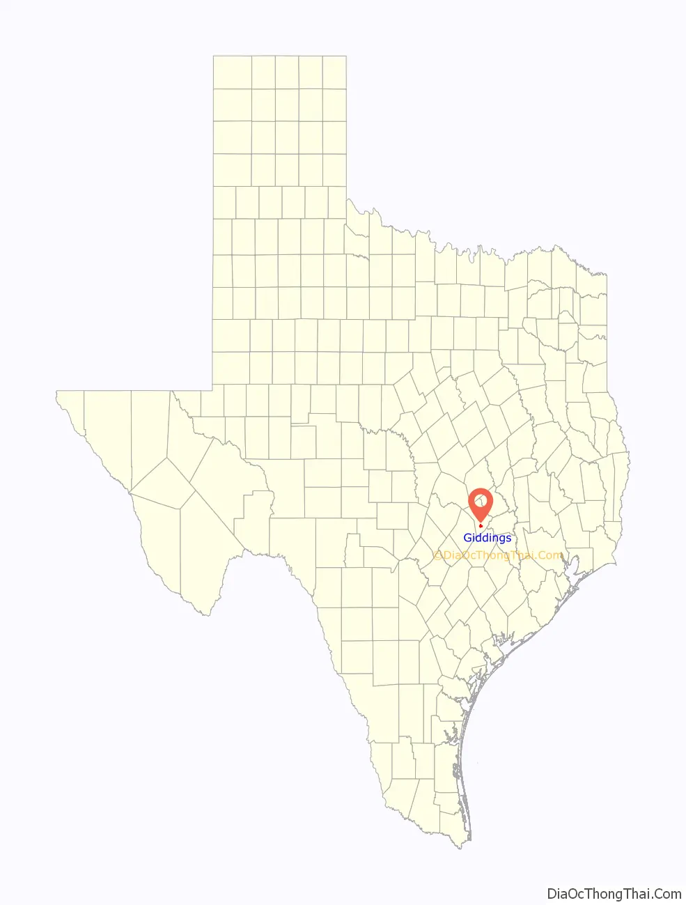
Giddings is the county seat of Lee County, Texas, United States situated on the intersection of U.S. Highway 77 and U.S. Route 290. Its population was 4,969 at the 2020 census.
| Name: | Giddings city |
|---|---|
| LSAD Code: | 25 |
| LSAD Description: | city (suffix) |
| State: | Texas |
| County: | Lee County |
| Elevation: | 505 ft (154 m) |
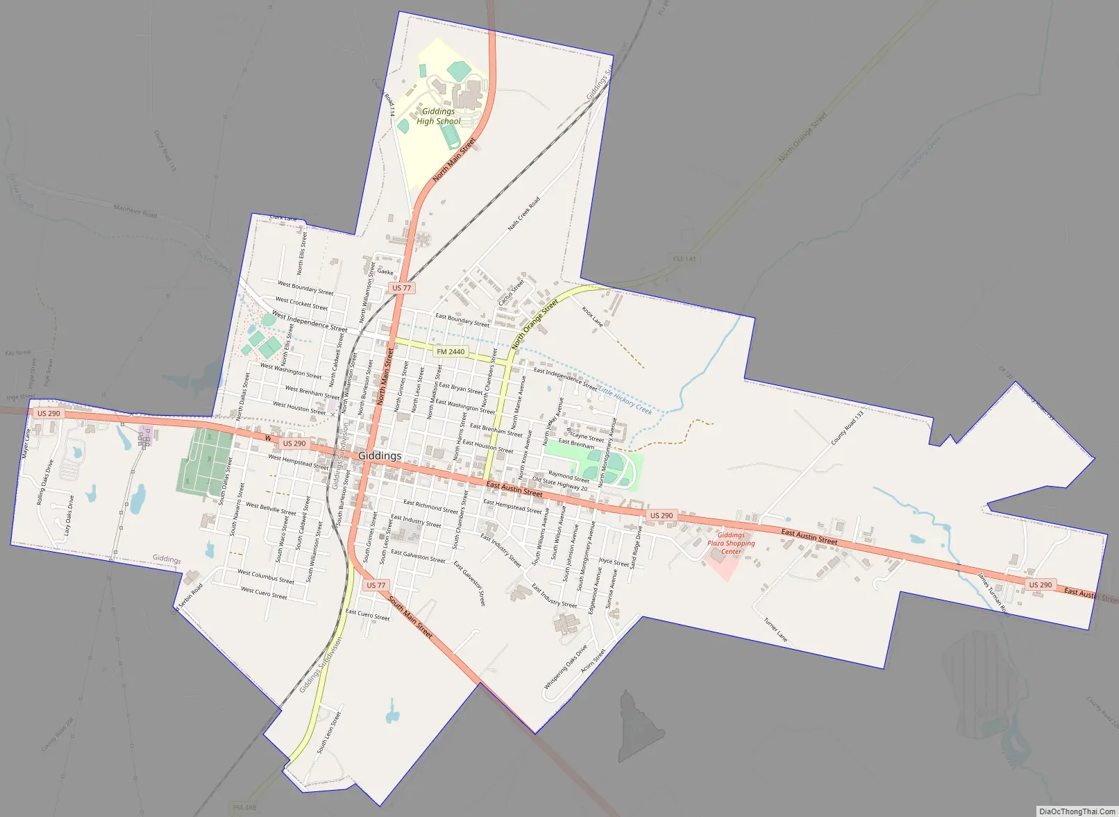
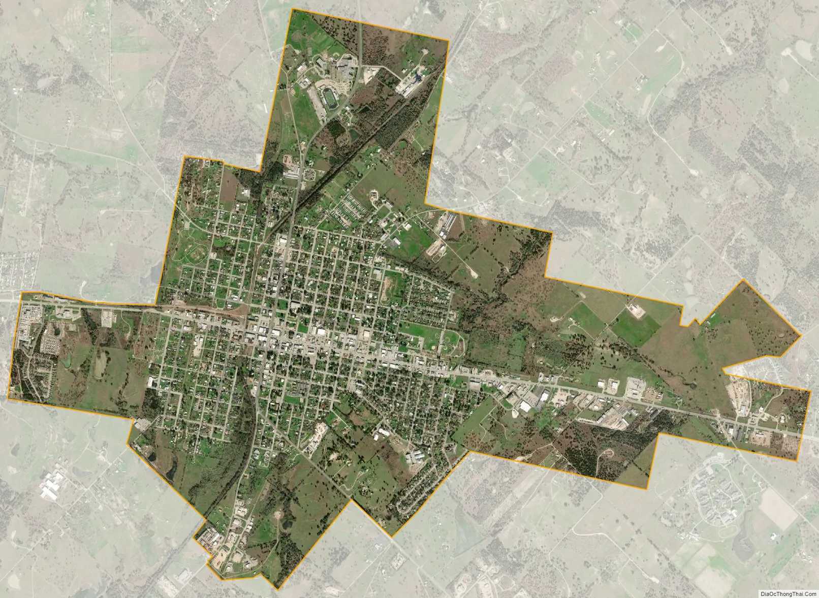
| Total Area: | 5.31 sq mi (13.75 km²) |
| Land Area: | 5.28 sq mi (13.67 km²) |
| Water Area: | 0.03 sq mi (0.08 km²) |
| Total Population: | 4,969 |
| Population Density: | 966.27/sq mi (373.10/km²) |
| ZIP code: | 78942 |
| Area code: | 979 |
| FIPS code: | 4829432 |
| GNISfeature ID: | 1336515 |
| Website: | www.giddings.net |
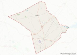
Online Interactive Map
Click on ![]() to view map in "full screen" mode.
to view map in "full screen" mode.
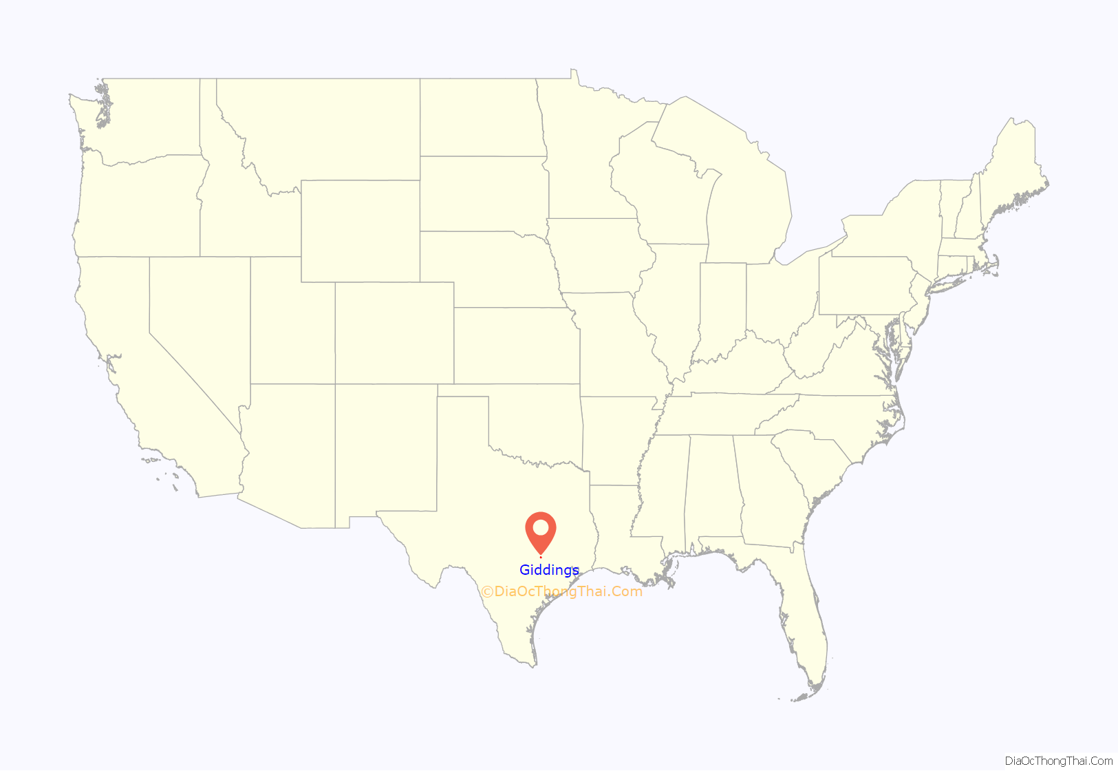
Giddings location map. Where is Giddings city?
History
The land where the city of Giddings now stands was part of the land granted to Stephen F. Austin in 1821 for a colony in Spanish Texas, and later became part of the Robertson Colony.
The city itself was founded in 1871 when the Houston and Texas Central Railway came to the area. It probably took its name from local magnate Jabez Deming Giddings, who was instrumental in bringing the railway to the area. He had come to the area from Pennsylvania in 1838 to claim the land bounty of his brother Giles A. Giddings, killed at the Battle of San Jacinto. Another theory is that the city was named after Jabez’s brother Dewitt Clinton Giddings.
Early settlers in the new town were mostly pioneers from the surrounding communities, such as Old Evergreen and Shady Grove. The majority of these people were ethnically British Isles natives, but a sizable minority were Wendish families from the Serbin area. They would later establish the German-language newspaper Deutsches Volksblatt.
A syndicate headed by William Marsh Rice owned the whole townsite and sold property to settlers. Later, Rice Institute (now Rice University) in Houston had control and sold the lots.
Wide streets were a distinguishing characteristic of the town; the two main thoroughfares (Main and Austin Streets) were 100 feet (30 m) wide, and other streets were 80 feet (24 m) wide. The town’s first church, established in 1871, was Methodist. J. D. Giddings Masonic Lodge, chartered in Evergreen in 1865, moved to Giddings, and early churches and a public school met in its building. Soon after the Civil War, freed slaves from farms and plantations settled in Giddings. Classes for more than 50 black students were held in a church in 1883, and the first black public school was built in 1887.
Giddings became the county seat when Lee County was established in 1874. Early businesses included the Granger store, a blacksmith shop and saloon, a millinery shop, a saddle and harness shop, and an oil mill. Brick buildings came in 1875. The courthouse built in 1878 burned and was replaced in 1899. Fletcher House, built in 1879 by August W. Schubert, was sold to the Missouri Synod of the Immanuel Lutheran Church in 1894 to house Concordia Lutheran College. By 1890, the town was part of a rich cotton-growing area with access to the San Antonio and Aransas Pass Railway, several gins, an opera house, newspapers, and a population estimated at 1,000. The First National Bank was opened in 1890 and was still in operation more than a century later. The town was incorporated in 1913 and had a population of 2,000 by 1914.
In the early 1980s, the oil-laden Austin chalk that underlies the town was tapped, and the area experienced an oil boom. Some 300 oil-related businesses located in the town, and many oil rigs were operating in outlying areas. In the late 1980s, however, the oil activities decreased almost to a standstill. The population of Giddings in 1988 was 5,178. In 1990, local businesses included a hospital, a medical clinic, a dialysis clinic, a chiropractic clinic, two nursing homes, a library, motels, restaurants, two newspapers, a peanut mill, Invader Boat Manufacturing Company, and Nutrena-Cargill Mills. Nineteen churches were in the city.
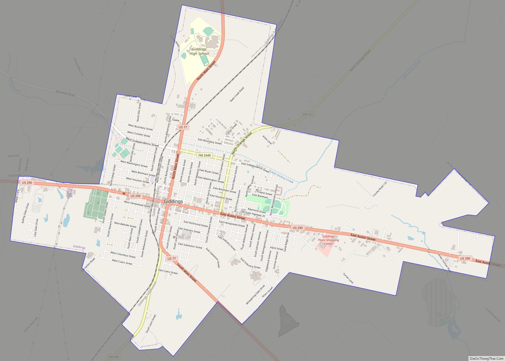
Giddings Road Map
Giddings city Satellite Map
Geography
Giddings is located at 30°10′59″N 96°56′5″W / 30.18306°N 96.93472°W / 30.18306; -96.93472 (30.183116, –96.934614).
According to the United States Census Bureau, the city has a total area of 5.2 square miles (13 km), of which 0.04 square miles (0.10 km) (0.58%) is covered by water.
Climate
The climate in this area is characterized by relatively high temperatures and evenly distributed precipitation throughout the year. The Köppen climate classification describes the weather as humid subtropical, Cfa.
See also
Map of Texas State and its subdivision:- Anderson
- Andrews
- Angelina
- Aransas
- Archer
- Armstrong
- Atascosa
- Austin
- Bailey
- Bandera
- Bastrop
- Baylor
- Bee
- Bell
- Bexar
- Blanco
- Borden
- Bosque
- Bowie
- Brazoria
- Brazos
- Brewster
- Briscoe
- Brooks
- Brown
- Burleson
- Burnet
- Caldwell
- Calhoun
- Callahan
- Cameron
- Camp
- Carson
- Cass
- Castro
- Chambers
- Cherokee
- Childress
- Clay
- Cochran
- Coke
- Coleman
- Collin
- Collingsworth
- Colorado
- Comal
- Comanche
- Concho
- Cooke
- Coryell
- Cottle
- Crane
- Crockett
- Crosby
- Culberson
- Dallam
- Dallas
- Dawson
- Deaf Smith
- Delta
- Denton
- Dewitt
- Dickens
- Dimmit
- Donley
- Duval
- Eastland
- Ector
- Edwards
- El Paso
- Ellis
- Erath
- Falls
- Fannin
- Fayette
- Fisher
- Floyd
- Foard
- Fort Bend
- Franklin
- Freestone
- Frio
- Gaines
- Galveston
- Garza
- Gillespie
- Glasscock
- Goliad
- Gonzales
- Gray
- Grayson
- Gregg
- Grimes
- Guadalupe
- Hale
- Hall
- Hamilton
- Hansford
- Hardeman
- Hardin
- Harris
- Harrison
- Hartley
- Haskell
- Hays
- Hemphill
- Henderson
- Hidalgo
- Hill
- Hockley
- Hood
- Hopkins
- Houston
- Howard
- Hudspeth
- Hunt
- Hutchinson
- Irion
- Jack
- Jackson
- Jasper
- Jeff Davis
- Jefferson
- Jim Hogg
- Jim Wells
- Johnson
- Jones
- Karnes
- Kaufman
- Kendall
- Kenedy
- Kent
- Kerr
- Kimble
- King
- Kinney
- Kleberg
- Knox
- La Salle
- Lamar
- Lamb
- Lampasas
- Lavaca
- Lee
- Leon
- Liberty
- Limestone
- Lipscomb
- Live Oak
- Llano
- Loving
- Lubbock
- Lynn
- Madison
- Marion
- Martin
- Mason
- Matagorda
- Maverick
- McCulloch
- McLennan
- McMullen
- Medina
- Menard
- Midland
- Milam
- Mills
- Mitchell
- Montague
- Montgomery
- Moore
- Morris
- Motley
- Nacogdoches
- Navarro
- Newton
- Nolan
- Nueces
- Ochiltree
- Oldham
- Orange
- Palo Pinto
- Panola
- Parker
- Parmer
- Pecos
- Polk
- Potter
- Presidio
- Rains
- Randall
- Reagan
- Real
- Red River
- Reeves
- Refugio
- Roberts
- Robertson
- Rockwall
- Runnels
- Rusk
- Sabine
- San Augustine
- San Jacinto
- San Patricio
- San Saba
- Schleicher
- Scurry
- Shackelford
- Shelby
- Sherman
- Smith
- Somervell
- Starr
- Stephens
- Sterling
- Stonewall
- Sutton
- Swisher
- Tarrant
- Taylor
- Terrell
- Terry
- Throckmorton
- Titus
- Tom Green
- Travis
- Trinity
- Tyler
- Upshur
- Upton
- Uvalde
- Val Verde
- Van Zandt
- Victoria
- Walker
- Waller
- Ward
- Washington
- Webb
- Wharton
- Wheeler
- Wichita
- Wilbarger
- Willacy
- Williamson
- Wilson
- Winkler
- Wise
- Wood
- Yoakum
- Young
- Zapata
- Zavala
- Alabama
- Alaska
- Arizona
- Arkansas
- California
- Colorado
- Connecticut
- Delaware
- District of Columbia
- Florida
- Georgia
- Hawaii
- Idaho
- Illinois
- Indiana
- Iowa
- Kansas
- Kentucky
- Louisiana
- Maine
- Maryland
- Massachusetts
- Michigan
- Minnesota
- Mississippi
- Missouri
- Montana
- Nebraska
- Nevada
- New Hampshire
- New Jersey
- New Mexico
- New York
- North Carolina
- North Dakota
- Ohio
- Oklahoma
- Oregon
- Pennsylvania
- Rhode Island
- South Carolina
- South Dakota
- Tennessee
- Texas
- Utah
- Vermont
- Virginia
- Washington
- West Virginia
- Wisconsin
- Wyoming