Hollywood Park is a town in Bexar County, Texas, United States. The population was 3,130 at the 2020 census. It is an enclave within far north central San Antonio and is part of the San Antonio Metropolitan Statistical Area.
| Name: | Hollywood Park town |
|---|---|
| LSAD Code: | 43 |
| LSAD Description: | town (suffix) |
| State: | Texas |
| County: | Bexar County |
| Elevation: | 961 ft (293 m) |
| Total Area: | 1.45 sq mi (3.75 km²) |
| Land Area: | 1.45 sq mi (3.75 km²) |
| Water Area: | 0.00 sq mi (0.01 km²) |
| Total Population: | 3,130 |
| Population Density: | 2,311.20/sq mi (892.38/km²) |
| ZIP code: | 78232 |
| Area code: | 210, 726 (planned) |
| FIPS code: | 4834628 |
| GNISfeature ID: | 1337969 |
| Website: | http://www.hollywoodpark-tx.gov/ |
Online Interactive Map
Click on ![]() to view map in "full screen" mode.
to view map in "full screen" mode.
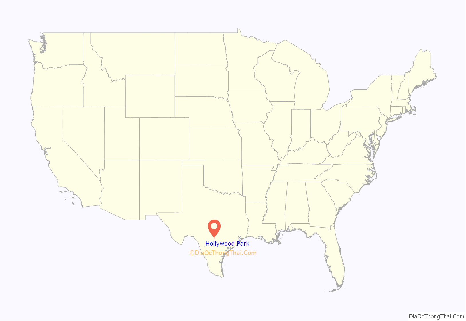
Hollywood Park location map. Where is Hollywood Park town?
History
The Town of Hollywood Park was officially incorporated on December 7, 1955, after residents were concerned about losing the neighborhood’s autonomy to San Antonio. The community has a distinctly rural feel and residents often build homes they intend to live in for the rest of their lives. Many of the community’s leaders of today are the children and grandchildren of some of the original residents.
The Police Department was established in 1955 soon after the town was incorporated. John Nelson was hired as its first Police Chief. The police car was a Ford Fairlane 500. Shortly thereafter, a few volunteer part-time policemen joined the force. When the town was formed, water hoses had to stay connected at each residence and ready to use in case of a fire. In 1958, a group of men joined and a couple of volunteers attended the Firefighters School at Texas A&M University, and the Hollywood Park Volunteer Fire Department was founded. That year all the firemen had was a small pump unit. Robert Oakes, as general chairman, and many volunteers organized the first Hollywood Park Volunteer Fire Department Benefit Barbeque held June 22, 1968, at Raymond Russell Park. Volunteers prepared all the food. 746 people went through the serving line. The event was held for many years at Raymond Russell Park with games for the entire family and a live band. Funds were raised for equipment and to purchase 20 new two-way portable alerting units. Fred T. Keepers, Jr. was Fire Chief from 1967 to 1978. By 1969, eighteen dedicated volunteers provided protection for the 612 residents of Hollywood Park, Hill Country Village, as well as over a large area of ranchlands in the northernmost sections of Bexar County. The City provided the firemen with bright yellow uniforms, but they got no other compensation for their duty. The largest fire occurred in August 1968 when a grass fire erupted near Hwy 281 and burned off 3,000 acres. By 1973, there were 29 volunteers. A new Rescue Unit was purchased through fund raising projects and donations.
In 1971, Mr. Voigt—a rancher who owned the land the town was built on—donated $10,000 to the Town of Hollywood Park to build the Voigt Center, naming Alverne Halloran as custodian, until the town matched funds to begin building. The 3,000 sq. ft. recreation building was finally built in 1974, and the grand opening and dedication was held on October 20, 1974. This was a day of fun and entertainment with games, food and drink offered. The City Council designated this day as “E.E.Voigt Day” in honor of the occasion. Mayor Felix Forshage opened the ceremony. Mr. Voigt introduced his family and spoke of the origin of the park. Tennis courts and a covered picnic area were built in 1975 with an additional $5,000 donation from Mr. Voigt for the tennis courts. A children’s playground was added later.
In addition to the homes originally built in Hollywood Park, two additional sections were added later to include The Gardens of Hollywood Park and The Enclave of Hollywood Park.
Hollywood Park Road Map
Hollywood Park city Satellite Map
Geography
Hollywood Park is located about 15 miles north of downtown San Antonio.
According to the United States Census Bureau, the town has a total area of 1.5 square miles (3.9 km), all of it land.
See also
Map of Texas State and its subdivision:- Anderson
- Andrews
- Angelina
- Aransas
- Archer
- Armstrong
- Atascosa
- Austin
- Bailey
- Bandera
- Bastrop
- Baylor
- Bee
- Bell
- Bexar
- Blanco
- Borden
- Bosque
- Bowie
- Brazoria
- Brazos
- Brewster
- Briscoe
- Brooks
- Brown
- Burleson
- Burnet
- Caldwell
- Calhoun
- Callahan
- Cameron
- Camp
- Carson
- Cass
- Castro
- Chambers
- Cherokee
- Childress
- Clay
- Cochran
- Coke
- Coleman
- Collin
- Collingsworth
- Colorado
- Comal
- Comanche
- Concho
- Cooke
- Coryell
- Cottle
- Crane
- Crockett
- Crosby
- Culberson
- Dallam
- Dallas
- Dawson
- Deaf Smith
- Delta
- Denton
- Dewitt
- Dickens
- Dimmit
- Donley
- Duval
- Eastland
- Ector
- Edwards
- El Paso
- Ellis
- Erath
- Falls
- Fannin
- Fayette
- Fisher
- Floyd
- Foard
- Fort Bend
- Franklin
- Freestone
- Frio
- Gaines
- Galveston
- Garza
- Gillespie
- Glasscock
- Goliad
- Gonzales
- Gray
- Grayson
- Gregg
- Grimes
- Guadalupe
- Hale
- Hall
- Hamilton
- Hansford
- Hardeman
- Hardin
- Harris
- Harrison
- Hartley
- Haskell
- Hays
- Hemphill
- Henderson
- Hidalgo
- Hill
- Hockley
- Hood
- Hopkins
- Houston
- Howard
- Hudspeth
- Hunt
- Hutchinson
- Irion
- Jack
- Jackson
- Jasper
- Jeff Davis
- Jefferson
- Jim Hogg
- Jim Wells
- Johnson
- Jones
- Karnes
- Kaufman
- Kendall
- Kenedy
- Kent
- Kerr
- Kimble
- King
- Kinney
- Kleberg
- Knox
- La Salle
- Lamar
- Lamb
- Lampasas
- Lavaca
- Lee
- Leon
- Liberty
- Limestone
- Lipscomb
- Live Oak
- Llano
- Loving
- Lubbock
- Lynn
- Madison
- Marion
- Martin
- Mason
- Matagorda
- Maverick
- McCulloch
- McLennan
- McMullen
- Medina
- Menard
- Midland
- Milam
- Mills
- Mitchell
- Montague
- Montgomery
- Moore
- Morris
- Motley
- Nacogdoches
- Navarro
- Newton
- Nolan
- Nueces
- Ochiltree
- Oldham
- Orange
- Palo Pinto
- Panola
- Parker
- Parmer
- Pecos
- Polk
- Potter
- Presidio
- Rains
- Randall
- Reagan
- Real
- Red River
- Reeves
- Refugio
- Roberts
- Robertson
- Rockwall
- Runnels
- Rusk
- Sabine
- San Augustine
- San Jacinto
- San Patricio
- San Saba
- Schleicher
- Scurry
- Shackelford
- Shelby
- Sherman
- Smith
- Somervell
- Starr
- Stephens
- Sterling
- Stonewall
- Sutton
- Swisher
- Tarrant
- Taylor
- Terrell
- Terry
- Throckmorton
- Titus
- Tom Green
- Travis
- Trinity
- Tyler
- Upshur
- Upton
- Uvalde
- Val Verde
- Van Zandt
- Victoria
- Walker
- Waller
- Ward
- Washington
- Webb
- Wharton
- Wheeler
- Wichita
- Wilbarger
- Willacy
- Williamson
- Wilson
- Winkler
- Wise
- Wood
- Yoakum
- Young
- Zapata
- Zavala
- Alabama
- Alaska
- Arizona
- Arkansas
- California
- Colorado
- Connecticut
- Delaware
- District of Columbia
- Florida
- Georgia
- Hawaii
- Idaho
- Illinois
- Indiana
- Iowa
- Kansas
- Kentucky
- Louisiana
- Maine
- Maryland
- Massachusetts
- Michigan
- Minnesota
- Mississippi
- Missouri
- Montana
- Nebraska
- Nevada
- New Hampshire
- New Jersey
- New Mexico
- New York
- North Carolina
- North Dakota
- Ohio
- Oklahoma
- Oregon
- Pennsylvania
- Rhode Island
- South Carolina
- South Dakota
- Tennessee
- Texas
- Utah
- Vermont
- Virginia
- Washington
- West Virginia
- Wisconsin
- Wyoming
