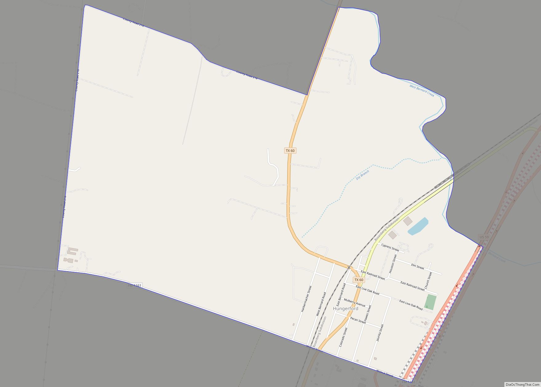
Hungerford is a census-designated place (CDP) in northeastern Wharton County, Texas, United States. U.S. Route 59, Texas State Highway 60, and Farm to Market Road 1161 intersect in the community. The Kansas City Southern Railway Co. passes through Hungerford. The population was 347 at the 2010 census. It is located on what in the 1820s was part of colonist Alexander Jackson’s land grant north of George E. Quinan’s home. By the 1870s, the Quinan settlement grew up a short distance away, but its residents moved to the new town when the railroad came through Hungerford.
| Name: | Hungerford CDP |
|---|---|
| LSAD Code: | 57 |
| LSAD Description: | CDP (suffix) |
| State: | Texas |
| County: | Wharton County |
| Elevation: | 105 ft (32 m) |
| Total Area: | 1.8 sq mi (4.7 km²) |
| Land Area: | 1.8 sq mi (4.7 km²) |
| Water Area: | 0.0 sq mi (0.0 km²) |
| Total Population: | 347 |
| Population Density: | 190/sq mi (74/km²) |
| ZIP code: | 77448 |
| Area code: | 979 |
| FIPS code: | 4835420 |
| GNISfeature ID: | 1338297 |
Online Interactive Map
Click on ![]() to view map in "full screen" mode.
to view map in "full screen" mode.
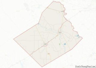
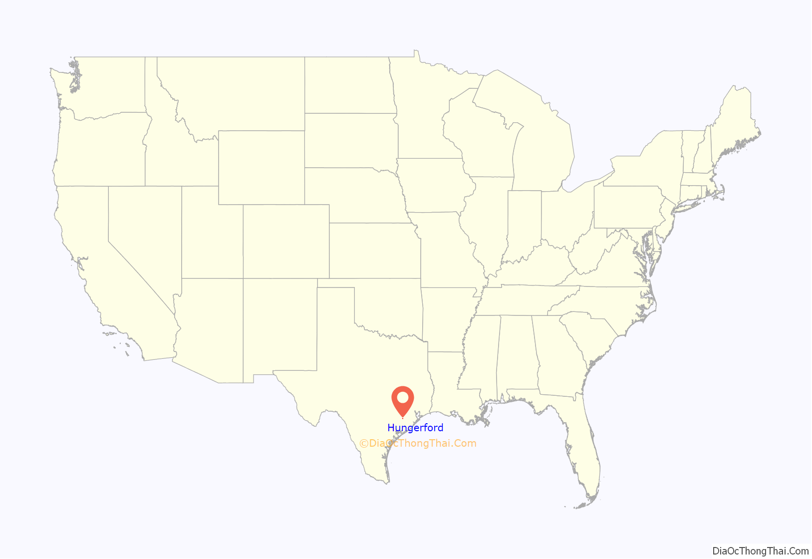
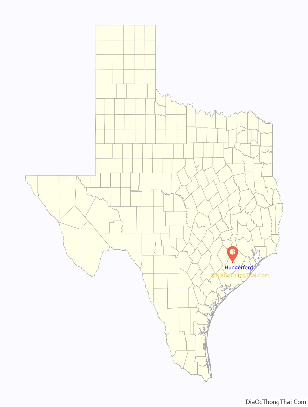
Hungerford location map. Where is Hungerford CDP?
History
Alexander Jackson was one of the Old Three Hundred colonists from the United States who accepted land grants from Stephen F. Austin. The Alexander Jackson league was a strip of land which was bounded on the southwest by the Colorado River just northwest of present-day Wharton and ran northeast beyond West Bernard Creek. After the Texas Revolution, the Republic of Texas set up a short-lived ordnance depot called Post West Bernard Station at a location 3.5 miles (5.6 km) northwest of present-day Hungerford. Its purpose was to recondition weapons captured at the Battle of San Jacinto and to watch for a possible invasion by the Mexican army.
In 1872 the village of Quinan was founded about 0.25 miles (0.4 km) west of present-day Hungerford. The Quinan post office was established in 1874 in the general store owned by John C. Habermacher, who also served as postmaster. Habermacher was once a member of Edwin Booth’s acting troupe. His wife Annie Thatcher was Alexander Jackson’s granddaughter. In 1882 the New York, Texas and Mexican Railway was built through the newly surveyed town of Hungerford which was in the adjacent George W. Singleton league. Most of Quinan’s businesses moved to the railroad, followed by the post office in 1883. The new town was named after Daniel E. Hungerford, who was the father-in-law of the railroad’s major investor John William Mackay.
In 1885, Hungerford boasted 200 residents, several churches, a steam cotton gin, a gristmill, and a school. In 1908 the town became the headquarters for the J. D. Hudgins Ranch. In 1926 the Strouhal Tire Recapping Company opened in Hungerford. That year, the town had 13 businesses, including three general stores. Five different area schools counted a total of 259 black students, 189 white students, and 13 teachers. The 1927 poll tax enumerated 85 white voters and 64 black voters. In 1961 the population was 450 and 18 commercial establishments were in town. By that year, the train no longer stopped at Hungerford. In 1973, the local school district stopped operating and its students were absorbed by four nearby districts.
In the 1980s there were 500 residents and most business was seasonal: hunting and harvesting cotton, grain, and pecans. In 1980 the Teen Challenge of South Texas New Life Rehabilitation Center bought the former black school. Between its opening and 1990, its enrollment increased from 150 to 250. In 2018 it was the Straightway Training Center, a Christian-based drug and alcohol rehabilitation program. In 1986, the Texas Historical Commission located four markers in Hungerford. In the late 1980s, U.S. Route 59 was rerouted to bypass Hungerford. In 2000 the population was 645.
New York, Texas & Mexican Railroad historical marker
Post West Bernard Station historical marker
Quinan Community historical marker
J. D. Hudgins Ranch historical marker
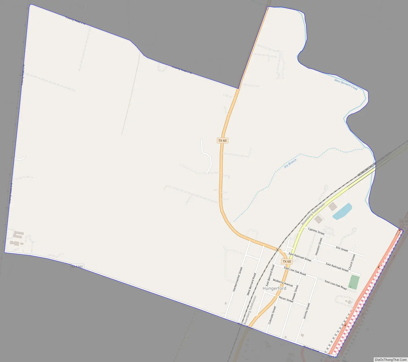
Hungerford Road Map
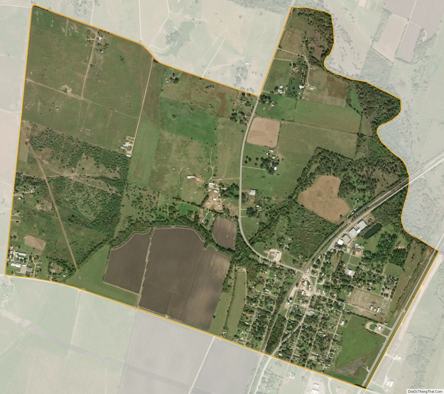
Hungerford city Satellite Map
Geography
Hungerford is located at 29°23′57″N 96°4′37″W / 29.39917°N 96.07694°W / 29.39917; -96.07694 (29.399122, -96.077019).
According to the United States Census Bureau, the CDP has a total area of 1.8 square miles (4.7 km), all of it land.
See also
Map of Texas State and its subdivision:- Anderson
- Andrews
- Angelina
- Aransas
- Archer
- Armstrong
- Atascosa
- Austin
- Bailey
- Bandera
- Bastrop
- Baylor
- Bee
- Bell
- Bexar
- Blanco
- Borden
- Bosque
- Bowie
- Brazoria
- Brazos
- Brewster
- Briscoe
- Brooks
- Brown
- Burleson
- Burnet
- Caldwell
- Calhoun
- Callahan
- Cameron
- Camp
- Carson
- Cass
- Castro
- Chambers
- Cherokee
- Childress
- Clay
- Cochran
- Coke
- Coleman
- Collin
- Collingsworth
- Colorado
- Comal
- Comanche
- Concho
- Cooke
- Coryell
- Cottle
- Crane
- Crockett
- Crosby
- Culberson
- Dallam
- Dallas
- Dawson
- Deaf Smith
- Delta
- Denton
- Dewitt
- Dickens
- Dimmit
- Donley
- Duval
- Eastland
- Ector
- Edwards
- El Paso
- Ellis
- Erath
- Falls
- Fannin
- Fayette
- Fisher
- Floyd
- Foard
- Fort Bend
- Franklin
- Freestone
- Frio
- Gaines
- Galveston
- Garza
- Gillespie
- Glasscock
- Goliad
- Gonzales
- Gray
- Grayson
- Gregg
- Grimes
- Guadalupe
- Hale
- Hall
- Hamilton
- Hansford
- Hardeman
- Hardin
- Harris
- Harrison
- Hartley
- Haskell
- Hays
- Hemphill
- Henderson
- Hidalgo
- Hill
- Hockley
- Hood
- Hopkins
- Houston
- Howard
- Hudspeth
- Hunt
- Hutchinson
- Irion
- Jack
- Jackson
- Jasper
- Jeff Davis
- Jefferson
- Jim Hogg
- Jim Wells
- Johnson
- Jones
- Karnes
- Kaufman
- Kendall
- Kenedy
- Kent
- Kerr
- Kimble
- King
- Kinney
- Kleberg
- Knox
- La Salle
- Lamar
- Lamb
- Lampasas
- Lavaca
- Lee
- Leon
- Liberty
- Limestone
- Lipscomb
- Live Oak
- Llano
- Loving
- Lubbock
- Lynn
- Madison
- Marion
- Martin
- Mason
- Matagorda
- Maverick
- McCulloch
- McLennan
- McMullen
- Medina
- Menard
- Midland
- Milam
- Mills
- Mitchell
- Montague
- Montgomery
- Moore
- Morris
- Motley
- Nacogdoches
- Navarro
- Newton
- Nolan
- Nueces
- Ochiltree
- Oldham
- Orange
- Palo Pinto
- Panola
- Parker
- Parmer
- Pecos
- Polk
- Potter
- Presidio
- Rains
- Randall
- Reagan
- Real
- Red River
- Reeves
- Refugio
- Roberts
- Robertson
- Rockwall
- Runnels
- Rusk
- Sabine
- San Augustine
- San Jacinto
- San Patricio
- San Saba
- Schleicher
- Scurry
- Shackelford
- Shelby
- Sherman
- Smith
- Somervell
- Starr
- Stephens
- Sterling
- Stonewall
- Sutton
- Swisher
- Tarrant
- Taylor
- Terrell
- Terry
- Throckmorton
- Titus
- Tom Green
- Travis
- Trinity
- Tyler
- Upshur
- Upton
- Uvalde
- Val Verde
- Van Zandt
- Victoria
- Walker
- Waller
- Ward
- Washington
- Webb
- Wharton
- Wheeler
- Wichita
- Wilbarger
- Willacy
- Williamson
- Wilson
- Winkler
- Wise
- Wood
- Yoakum
- Young
- Zapata
- Zavala
- Alabama
- Alaska
- Arizona
- Arkansas
- California
- Colorado
- Connecticut
- Delaware
- District of Columbia
- Florida
- Georgia
- Hawaii
- Idaho
- Illinois
- Indiana
- Iowa
- Kansas
- Kentucky
- Louisiana
- Maine
- Maryland
- Massachusetts
- Michigan
- Minnesota
- Mississippi
- Missouri
- Montana
- Nebraska
- Nevada
- New Hampshire
- New Jersey
- New Mexico
- New York
- North Carolina
- North Dakota
- Ohio
- Oklahoma
- Oregon
- Pennsylvania
- Rhode Island
- South Carolina
- South Dakota
- Tennessee
- Texas
- Utah
- Vermont
- Virginia
- Washington
- West Virginia
- Wisconsin
- Wyoming