Jersey Village is a city in west-central Harris County, Texas, United States, located at U.S. Highway 290, Farm to Market Road 529, and the Southern Pacific Railroad. The city is located in the Houston–Sugar Land–Baytown metropolitan area. The population was 7,921 at the 2020 census.
| Name: | Jersey Village city |
|---|---|
| LSAD Code: | 25 |
| LSAD Description: | city (suffix) |
| State: | Texas |
| County: | Harris County |
| Incorporated: | April 16, 1956 |
| Elevation: | 110 ft (33.5 m) |
| Total Area: | 3.43 sq mi (8.88 km²) |
| Land Area: | 3.38 sq mi (8.75 km²) |
| Water Area: | 0.05 sq mi (0.13 km²) |
| Total Population: | 7,921 |
| Population Density: | 2,335.70/sq mi (901.70/km²) |
| ZIP code: | 77040, 77041, 77065 |
| Area code: | 713 |
| FIPS code: | 4837612 |
| GNISfeature ID: | 1360232 |
| Website: | www.jerseyvillagetx.com |
Online Interactive Map
Click on ![]() to view map in "full screen" mode.
to view map in "full screen" mode.
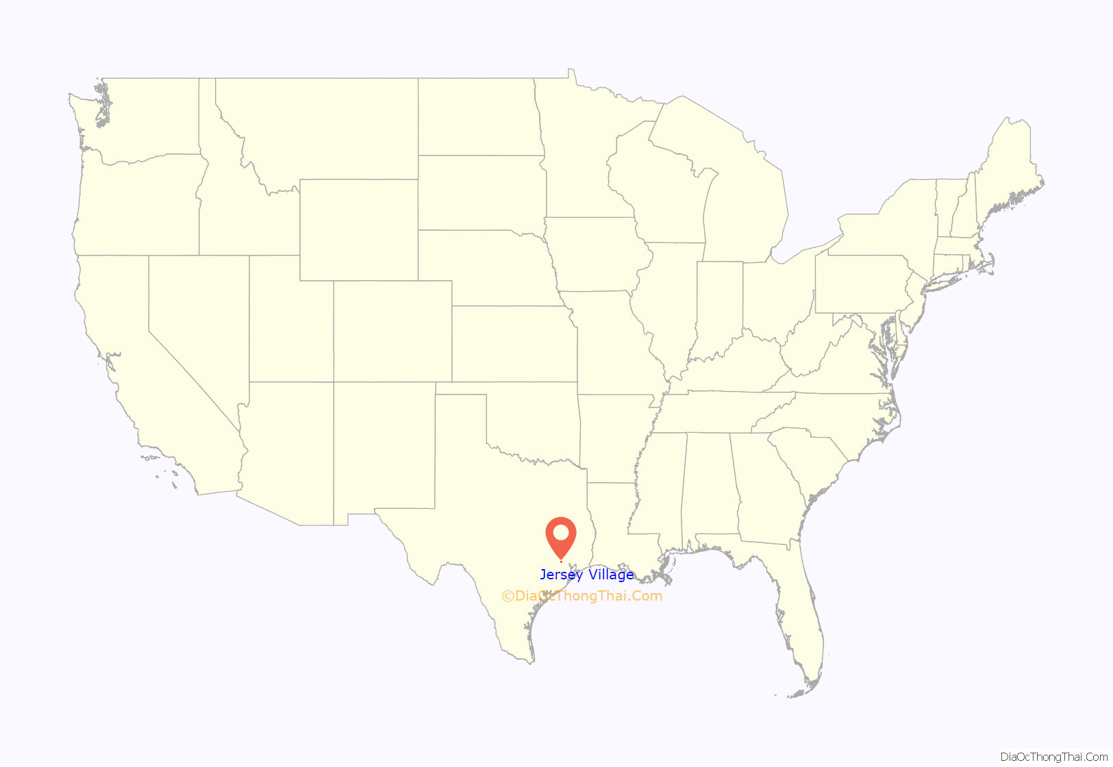
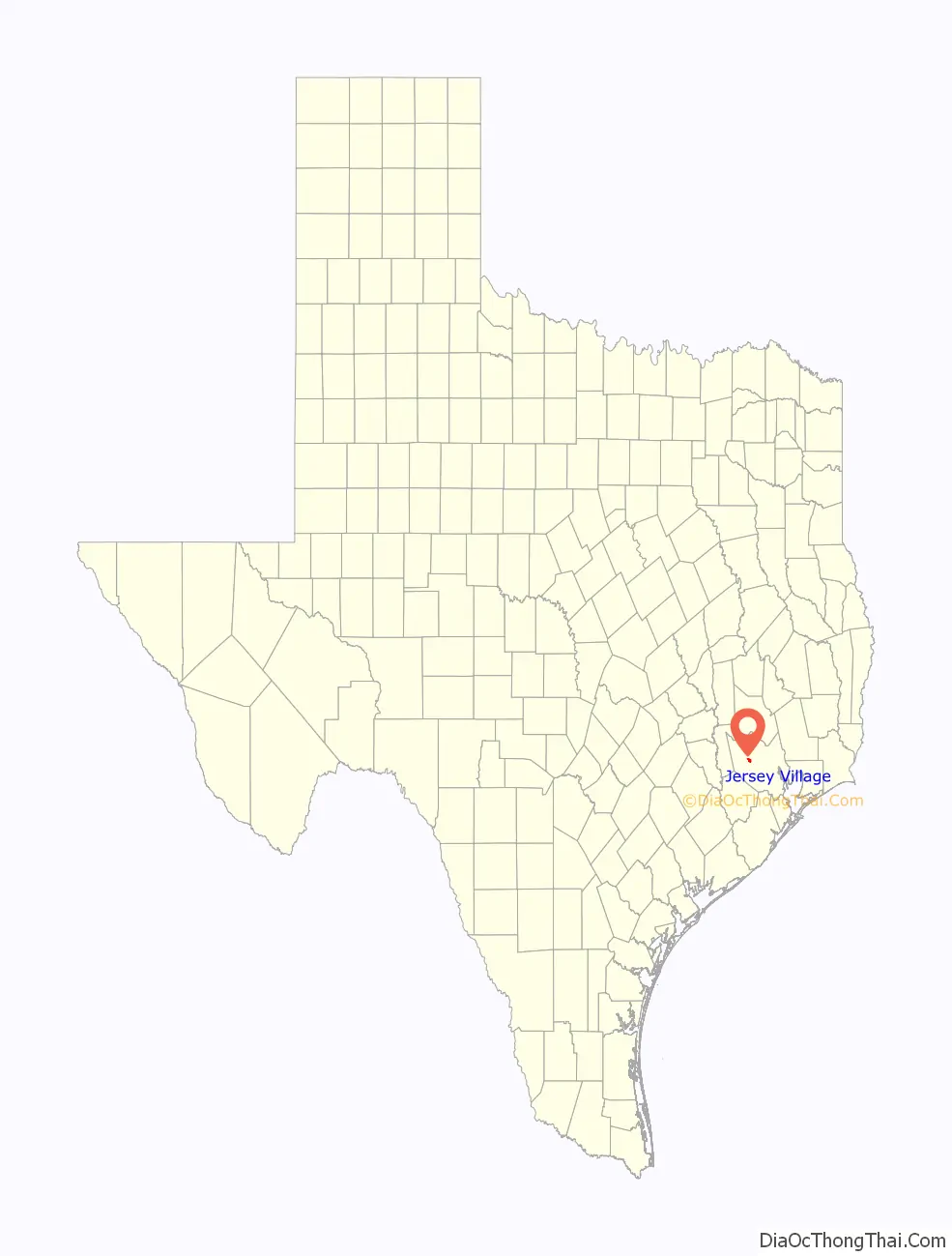
Jersey Village location map. Where is Jersey Village city?
History
The 1936 Harris County highway map indicated several residences in the area. Clark W. Henry owned 1,236 acres (5.00 km) of land on which he operated F&M Dairy and raised Jersey cattle. Henry discontinued his dairy when his health declined, and he gave the land up so a residential community could be built in 1953. Henry and LeRoy Kennedy, members of the Garden Oaks Baptist Church, began developing the community in February 1954. At first the city had 5 miles (8 km) of streets and drainage, gas, sewage, and water services. Several houses were established along Jersey Drive. The first family moved to the subdivision in late October 1954. The community developed a school, a park, and an 18-hole golf course. Jersey Village incorporated on April 16, 1956, with all 58 votes in favor of incorporation and a volunteer police force. Because of the incorporation, Houston did not incorporate Jersey Village’s territory into its city limits.
In 1961 Jersey Village had 493 residents. On July 6, 1972, Leonard Rauch gave Jersey Village a city hall building; as of 2008 the building is used for the fire department and public works departments. In 1977 the city passed a bond issue, leading it to construct a new city hall, a city garage, a park pavilion, and an expansion of the fire department building. In 1980 the city had 966 residents. In 1982 this figure increased to 4,084. In August 1986 officials announced that the city passed a home rule charter with a passing vote of 306–36. Under a home rule charter Jersey Village gained more taxation and governing powers than it had as a general law city. In 1988 the population increased to 5,143. In 1990 Jersey Village had 4,938 residents.
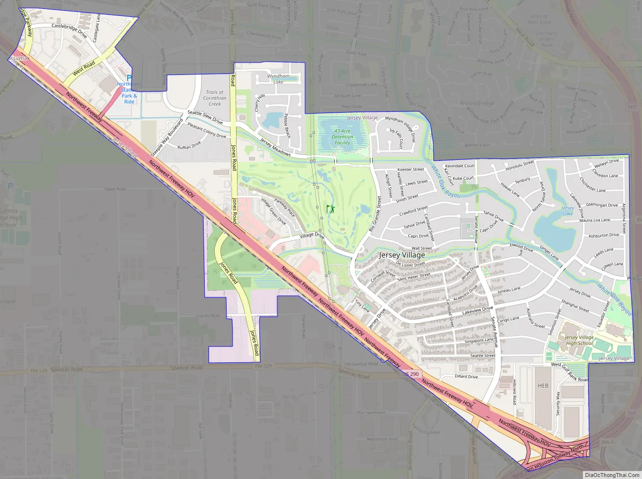
Jersey Village Road Map
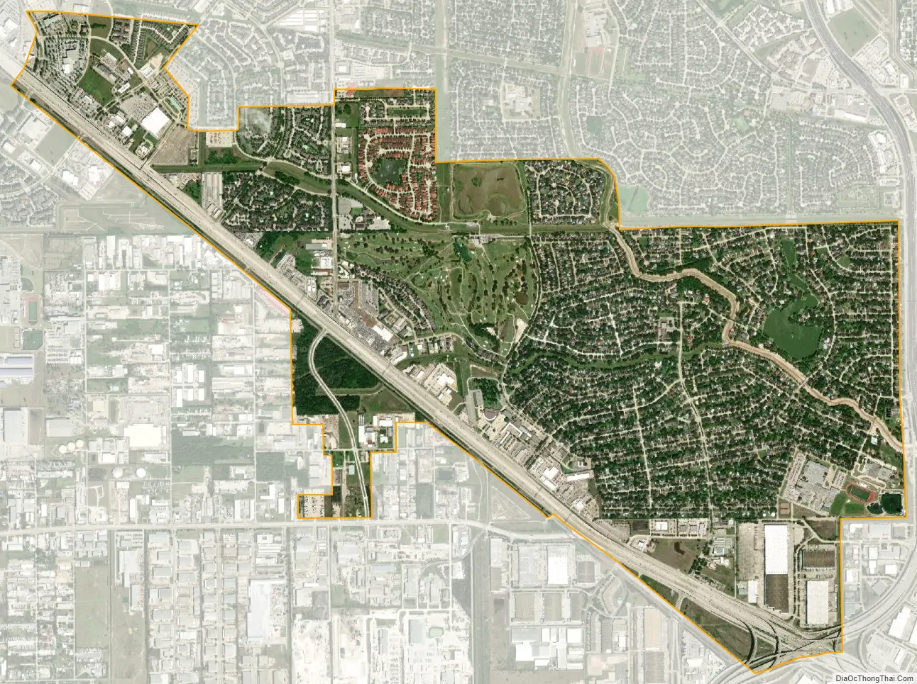
Jersey Village city Satellite Map
Geography
Jersey Village is located at 29°53′26″N 95°34′7″W / 29.89056°N 95.56861°W / 29.89056; -95.56861 (29.890569, –95.568579).
According to the United States Census Bureau, the city has a total area of 3.5 square miles (9.1 km), of which 3.4 square miles (8.8 km) is land and 0.04 square miles (0.10 km), or 0.87%, is water.
See also
Map of Texas State and its subdivision:- Anderson
- Andrews
- Angelina
- Aransas
- Archer
- Armstrong
- Atascosa
- Austin
- Bailey
- Bandera
- Bastrop
- Baylor
- Bee
- Bell
- Bexar
- Blanco
- Borden
- Bosque
- Bowie
- Brazoria
- Brazos
- Brewster
- Briscoe
- Brooks
- Brown
- Burleson
- Burnet
- Caldwell
- Calhoun
- Callahan
- Cameron
- Camp
- Carson
- Cass
- Castro
- Chambers
- Cherokee
- Childress
- Clay
- Cochran
- Coke
- Coleman
- Collin
- Collingsworth
- Colorado
- Comal
- Comanche
- Concho
- Cooke
- Coryell
- Cottle
- Crane
- Crockett
- Crosby
- Culberson
- Dallam
- Dallas
- Dawson
- Deaf Smith
- Delta
- Denton
- Dewitt
- Dickens
- Dimmit
- Donley
- Duval
- Eastland
- Ector
- Edwards
- El Paso
- Ellis
- Erath
- Falls
- Fannin
- Fayette
- Fisher
- Floyd
- Foard
- Fort Bend
- Franklin
- Freestone
- Frio
- Gaines
- Galveston
- Garza
- Gillespie
- Glasscock
- Goliad
- Gonzales
- Gray
- Grayson
- Gregg
- Grimes
- Guadalupe
- Hale
- Hall
- Hamilton
- Hansford
- Hardeman
- Hardin
- Harris
- Harrison
- Hartley
- Haskell
- Hays
- Hemphill
- Henderson
- Hidalgo
- Hill
- Hockley
- Hood
- Hopkins
- Houston
- Howard
- Hudspeth
- Hunt
- Hutchinson
- Irion
- Jack
- Jackson
- Jasper
- Jeff Davis
- Jefferson
- Jim Hogg
- Jim Wells
- Johnson
- Jones
- Karnes
- Kaufman
- Kendall
- Kenedy
- Kent
- Kerr
- Kimble
- King
- Kinney
- Kleberg
- Knox
- La Salle
- Lamar
- Lamb
- Lampasas
- Lavaca
- Lee
- Leon
- Liberty
- Limestone
- Lipscomb
- Live Oak
- Llano
- Loving
- Lubbock
- Lynn
- Madison
- Marion
- Martin
- Mason
- Matagorda
- Maverick
- McCulloch
- McLennan
- McMullen
- Medina
- Menard
- Midland
- Milam
- Mills
- Mitchell
- Montague
- Montgomery
- Moore
- Morris
- Motley
- Nacogdoches
- Navarro
- Newton
- Nolan
- Nueces
- Ochiltree
- Oldham
- Orange
- Palo Pinto
- Panola
- Parker
- Parmer
- Pecos
- Polk
- Potter
- Presidio
- Rains
- Randall
- Reagan
- Real
- Red River
- Reeves
- Refugio
- Roberts
- Robertson
- Rockwall
- Runnels
- Rusk
- Sabine
- San Augustine
- San Jacinto
- San Patricio
- San Saba
- Schleicher
- Scurry
- Shackelford
- Shelby
- Sherman
- Smith
- Somervell
- Starr
- Stephens
- Sterling
- Stonewall
- Sutton
- Swisher
- Tarrant
- Taylor
- Terrell
- Terry
- Throckmorton
- Titus
- Tom Green
- Travis
- Trinity
- Tyler
- Upshur
- Upton
- Uvalde
- Val Verde
- Van Zandt
- Victoria
- Walker
- Waller
- Ward
- Washington
- Webb
- Wharton
- Wheeler
- Wichita
- Wilbarger
- Willacy
- Williamson
- Wilson
- Winkler
- Wise
- Wood
- Yoakum
- Young
- Zapata
- Zavala
- Alabama
- Alaska
- Arizona
- Arkansas
- California
- Colorado
- Connecticut
- Delaware
- District of Columbia
- Florida
- Georgia
- Hawaii
- Idaho
- Illinois
- Indiana
- Iowa
- Kansas
- Kentucky
- Louisiana
- Maine
- Maryland
- Massachusetts
- Michigan
- Minnesota
- Mississippi
- Missouri
- Montana
- Nebraska
- Nevada
- New Hampshire
- New Jersey
- New Mexico
- New York
- North Carolina
- North Dakota
- Ohio
- Oklahoma
- Oregon
- Pennsylvania
- Rhode Island
- South Carolina
- South Dakota
- Tennessee
- Texas
- Utah
- Vermont
- Virginia
- Washington
- West Virginia
- Wisconsin
- Wyoming


