Katy is a city in the U.S. state of Texas within the Greater Katy area, itself forming the western part of the Greater Houston metropolitan area. Homes and businesses may have Katy postal addresses without being in the City of Katy. The city of Katy is approximately centered at the tripoint of Harris, Fort Bend, and Waller counties. Katy had a population of 21,894 at the 2020 U.S. census, up from 14,102 in 2010.
First formally settled in the mid-1890s, Katy was a railroad town along the Missouri–Kansas–Texas (MKT) Railroad which ran parallel to U.S. Route 90 (today Interstate 10) into downtown Houston. The fertile floodplain of Buffalo Bayou, which has its source near Katy, and its tributaries made Katy and other communities in the surrounding prairie an attractive location for rice farming. Beginning in the 1960s, the rapid growth of Houston moved westward along the new Interstate 10 corridor, bringing Katy into its environs. Today, Katy lies at the center of a broader area known as Greater Katy, which has become heavily urbanized.
While largely subsumed into Greater Houston, the town of Katy is still notable for Katy Mills Mall, the Katy Independent School District, and its historic town square along the former right-of-way of the MKT railroad.
| Name: | Katy city |
|---|---|
| LSAD Code: | 25 |
| LSAD Description: | city (suffix) |
| State: | Texas |
| County: | Fort Bend County, Harris County, Waller County |
| Incorporated: | 1945 |
| Elevation: | 141 ft (43 m) |
| Total Area: | 14.57 sq mi (37.75 km²) |
| Land Area: | 14.54 sq mi (37.67 km²) |
| Water Area: | 0.03 sq mi (0.08 km²) |
| Total Population: | 21,894 |
| Population Density: | 1,494.02/sq mi (576.84/km²) |
| Area code: | 281 |
| FIPS code: | 4838476 |
| GNISfeature ID: | 1338960 |
| Website: | cityofkaty.com |
Online Interactive Map
Click on ![]() to view map in "full screen" mode.
to view map in "full screen" mode.
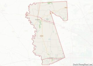
Katy location map. Where is Katy city?


History
In the early 1800s Katy was known as “Cane Island”, named for the creek that runs through the area, a branch of Buffalo Bayou. The creek was filled with tall cane, not native to the area. It was presumed to have been planted by either the Karankawa Indians or Spanish explorers to aid in fur trapping until the 1820s.
In 1845 James J. Crawford received a land grant that included this area. The hot summers and thick clay soil made it difficult to attract settlers to the area. Freed slaves and their families including Thomas (Mary) Robinson and Milto McGinnis, along with Mr. Crawford, Peter Black, and John Sills were the only recorded residents of Cane Island in 1875.
In 1895, James Oliver Thomas laid out a town, and in January 1896 the town of Katy was named through Thomas’s post office application. The name “Katy” was derived from the MKT Railroad Company, which was commonly referred to as “the K-T” (also its stock exchange symbol). This common designation soon evolved into “the Katy”, and since the railroad company and its trains held a key depot station located today’s city, the general location came to be known as Katy.
The anticipations of prosperity would bring growth to the new town which was developed around the original train stop and railroad tracks. By the early 1900s many families had come by train and wagon to establish Katy. Cotton and peanuts and corn were the first successful crops, but rice soon became the primary commodity crop. Katy later became known for rice farming; the first concrete rice driers in the state of Texas were built here in 1944 and still stand as landmarks. The farming community well supported local businesses as several hotels, stores, livery stables and saloons were prospering.
On September 8, 1900, the town’s early efforts were swept clean by the Great Galveston Hurricane of 1900, the deadliest hurricane in U.S. history. All but three of the original Katy homes were lost in the storm–The Wright House, The Featherson House, and The Morrison-Freeman House. Despite this, three major homes were built in the immediate aftermath of the hurricane and another six more over the following decade. Cane Island was rebuilt quickly and continued to grow.
Humble Oil opens the Katy Gas Field in 1943, which goes on to become one of the principal suppliers of allied forces and eventually becomes one of the most productive gas fields in the State of Texas. Today, what was Humble Oil is now Exxon which continues to operate and oversee the expansive underground pipeline network in the region.
In 1945 the City of Katy was incorporated as a municipality. C. L. Baird was the first mayor. The city’s limits were determined by finding the area that contained the most residents and was reasonably sized so that it could be managed by city services.
The construction and opening of Interstate 10 in 1966 allowed for rapid development of the area, as Houston expanded westward. This section was widened in 2008 to an average of 26 lanes, and in some areas 30 lanes total including 6 feeder and 4 HOV lanes for roughly 22 miles, making it the widest freeway in the world.
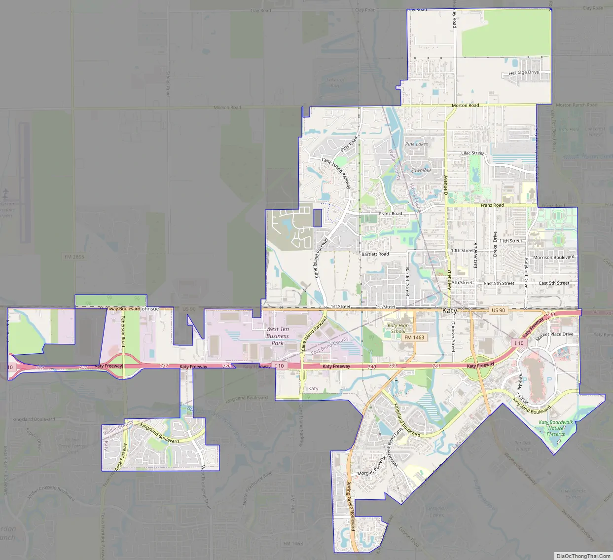
Katy Road Map
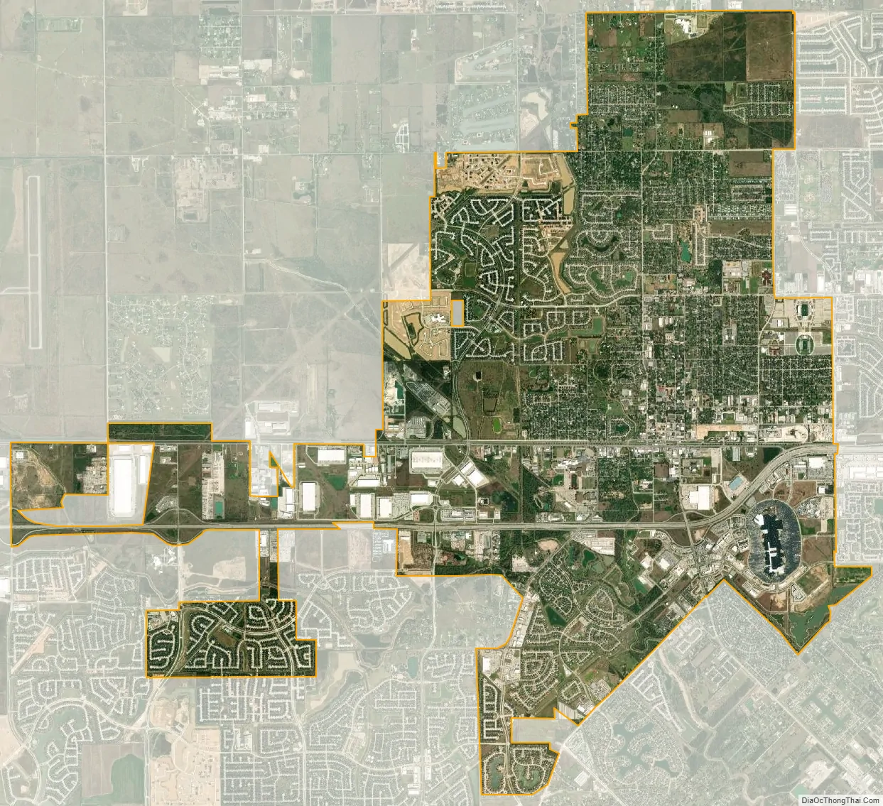
Katy city Satellite Map
Geography
The City of Katy is located at the three-border junction of Harris, Fort Bend, and Waller counties, along Interstate 10, 29 miles (47 km) west of downtown Houston and 22 miles (35 km) east of Sealy. According to the United States Census Bureau, the city of Katy has a total area of 11.3 square miles (29.3 km), of which 11.2 square miles (29.1 km) is land and 0.04 square miles (0.1 km), or 0.38%, is water.
Katy is often further defined as either “Old Towne Katy” or “Greater Katy”. Old Towne Katy refers to the portion of Katy that was incorporated in 1945. Its boundaries, as defined by the Katy Independent School Divisions zoning, run just south of Kingsland Blvd, stretching across Interstate 10 to Morton Road. Katy Fort Bend Road and Cane Island Creek act as the east and west boundaries, The Greater Katy area includes the city of Katy plus large sections of unincorporated land surrounding the city corresponding to the boundaries of the 181 sq mi (470 km) Katy Independent School District.
Greater Katy includes communities such as Cinco Ranch, Green Trails, Grayson Lakes, Seven Meadows, Pine Mill Ranch, Silver Ranch Firethorne, Grand Lakes, and Young Ranch. It also encompasses suburban developments from the 1970s and 1980s, such as Memorial Parkway, Kelliwood and Nottingham Country.
Old Towne Katy’s new residential communities include Pin Oak Village, The Falls at Green Meadows, Cane Island and The Enclave. Large developments underway have included new residential communities boarding the east border of Mary Joe Peckham Park and the Katy Boardwalk. The City of Katy’s government has also placed a large focus on the downtown redevelopment plan which included the new city hall building and an upcoming downtown green space. Further projects included Typhoon Texas Water Park, Katy Independent School District’s Legacy Football Stadium, Katy Independent School District’s Rhodes Stadium, Momentum Indoor Climbing Center, REI Climb Store and the YMCA at Katy Main Street.
The City of Houston’s extraterritorial jurisdiction stretches well west of Katy. This means that a few unincorporated lands in the Katy area could be annexed by the City of Houston at some time in the future, though it is unlikely since Houston is unable to provide basic services to these isolated areas. The city of Katy’s extraterritorial jurisdiction, meanwhile, is limited to parcels of land west and north of the city itself.
Climate
The climate in this area is characterized by hot, humid summers and generally mild to cool winters. According to the Köppen climate classification system, Katy has a humid subtropical climate, abbreviated “Cfa” on climate maps. The area is located in the Western Gulf Coastal Grasslands, or the coastal prairie.
See also
Map of Texas State and its subdivision:- Anderson
- Andrews
- Angelina
- Aransas
- Archer
- Armstrong
- Atascosa
- Austin
- Bailey
- Bandera
- Bastrop
- Baylor
- Bee
- Bell
- Bexar
- Blanco
- Borden
- Bosque
- Bowie
- Brazoria
- Brazos
- Brewster
- Briscoe
- Brooks
- Brown
- Burleson
- Burnet
- Caldwell
- Calhoun
- Callahan
- Cameron
- Camp
- Carson
- Cass
- Castro
- Chambers
- Cherokee
- Childress
- Clay
- Cochran
- Coke
- Coleman
- Collin
- Collingsworth
- Colorado
- Comal
- Comanche
- Concho
- Cooke
- Coryell
- Cottle
- Crane
- Crockett
- Crosby
- Culberson
- Dallam
- Dallas
- Dawson
- Deaf Smith
- Delta
- Denton
- Dewitt
- Dickens
- Dimmit
- Donley
- Duval
- Eastland
- Ector
- Edwards
- El Paso
- Ellis
- Erath
- Falls
- Fannin
- Fayette
- Fisher
- Floyd
- Foard
- Fort Bend
- Franklin
- Freestone
- Frio
- Gaines
- Galveston
- Garza
- Gillespie
- Glasscock
- Goliad
- Gonzales
- Gray
- Grayson
- Gregg
- Grimes
- Guadalupe
- Hale
- Hall
- Hamilton
- Hansford
- Hardeman
- Hardin
- Harris
- Harrison
- Hartley
- Haskell
- Hays
- Hemphill
- Henderson
- Hidalgo
- Hill
- Hockley
- Hood
- Hopkins
- Houston
- Howard
- Hudspeth
- Hunt
- Hutchinson
- Irion
- Jack
- Jackson
- Jasper
- Jeff Davis
- Jefferson
- Jim Hogg
- Jim Wells
- Johnson
- Jones
- Karnes
- Kaufman
- Kendall
- Kenedy
- Kent
- Kerr
- Kimble
- King
- Kinney
- Kleberg
- Knox
- La Salle
- Lamar
- Lamb
- Lampasas
- Lavaca
- Lee
- Leon
- Liberty
- Limestone
- Lipscomb
- Live Oak
- Llano
- Loving
- Lubbock
- Lynn
- Madison
- Marion
- Martin
- Mason
- Matagorda
- Maverick
- McCulloch
- McLennan
- McMullen
- Medina
- Menard
- Midland
- Milam
- Mills
- Mitchell
- Montague
- Montgomery
- Moore
- Morris
- Motley
- Nacogdoches
- Navarro
- Newton
- Nolan
- Nueces
- Ochiltree
- Oldham
- Orange
- Palo Pinto
- Panola
- Parker
- Parmer
- Pecos
- Polk
- Potter
- Presidio
- Rains
- Randall
- Reagan
- Real
- Red River
- Reeves
- Refugio
- Roberts
- Robertson
- Rockwall
- Runnels
- Rusk
- Sabine
- San Augustine
- San Jacinto
- San Patricio
- San Saba
- Schleicher
- Scurry
- Shackelford
- Shelby
- Sherman
- Smith
- Somervell
- Starr
- Stephens
- Sterling
- Stonewall
- Sutton
- Swisher
- Tarrant
- Taylor
- Terrell
- Terry
- Throckmorton
- Titus
- Tom Green
- Travis
- Trinity
- Tyler
- Upshur
- Upton
- Uvalde
- Val Verde
- Van Zandt
- Victoria
- Walker
- Waller
- Ward
- Washington
- Webb
- Wharton
- Wheeler
- Wichita
- Wilbarger
- Willacy
- Williamson
- Wilson
- Winkler
- Wise
- Wood
- Yoakum
- Young
- Zapata
- Zavala
- Alabama
- Alaska
- Arizona
- Arkansas
- California
- Colorado
- Connecticut
- Delaware
- District of Columbia
- Florida
- Georgia
- Hawaii
- Idaho
- Illinois
- Indiana
- Iowa
- Kansas
- Kentucky
- Louisiana
- Maine
- Maryland
- Massachusetts
- Michigan
- Minnesota
- Mississippi
- Missouri
- Montana
- Nebraska
- Nevada
- New Hampshire
- New Jersey
- New Mexico
- New York
- North Carolina
- North Dakota
- Ohio
- Oklahoma
- Oregon
- Pennsylvania
- Rhode Island
- South Carolina
- South Dakota
- Tennessee
- Texas
- Utah
- Vermont
- Virginia
- Washington
- West Virginia
- Wisconsin
- Wyoming