Kirby is a city in Bexar County, Texas, United States. It is an enclave of San Antonio and is part of the San Antonio metropolitan statistical area. Founded as an agricultural settlement along the Southern Pacific railroad, the city was transformed into a suburban community upon its incorporation in 1955. It is known as the “Hobo Capital of Texas.”
| Name: | Kirby city |
|---|---|
| LSAD Code: | 25 |
| LSAD Description: | city (suffix) |
| State: | Texas |
| County: | Bexar County |
| Elevation: | 689 ft (210 m) |
| Total Area: | 2.00 sq mi (5.18 km²) |
| Land Area: | 2.00 sq mi (5.18 km²) |
| Water Area: | 0.00 sq mi (0.00 km²) |
| Total Population: | 8,142 |
| Population Density: | 4,361.50/sq mi (1,683.85/km²) |
| ZIP code: | 78219 |
| Area code: | 210, 726 (planned) |
| FIPS code: | 4839448 |
| GNISfeature ID: | 1339154 |
| Website: | kirbytx.org |
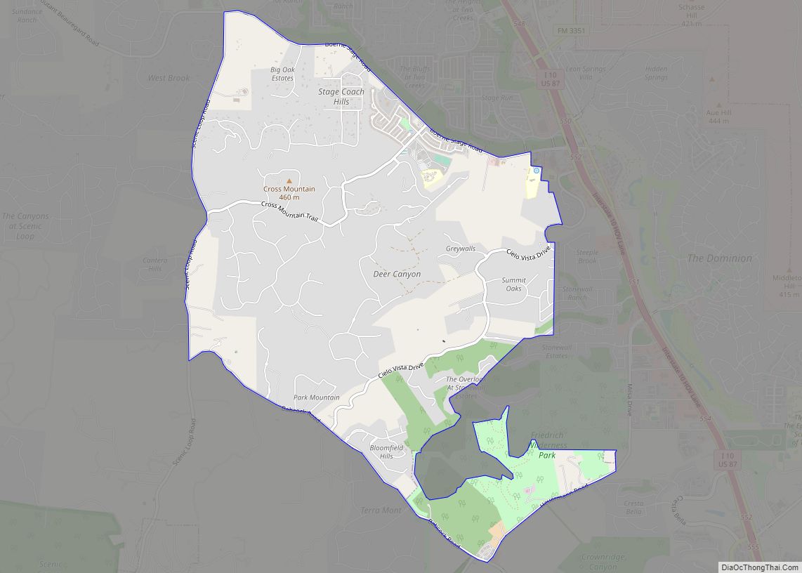
Online Interactive Map
Click on ![]() to view map in "full screen" mode.
to view map in "full screen" mode.
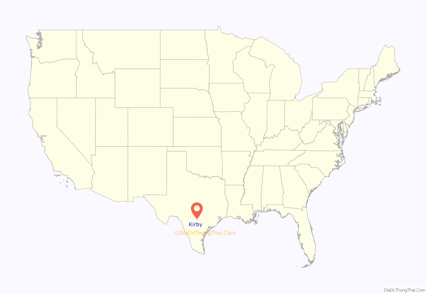
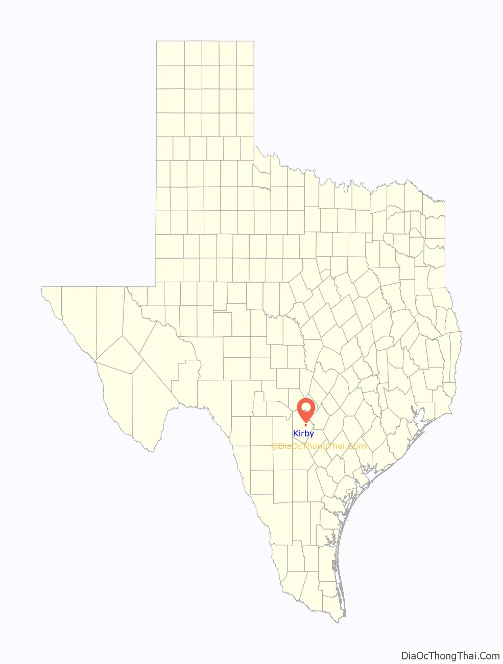
Kirby location map. Where is Kirby city?
History
Kirby was founded as an agricultural community by German immigrants in the early 1900s. Its name derived from the Kirby yard of the Southern Pacific Railroad that crossed through the town. In 1920, the population was around 18 people, made up of mostly farmers. At this time, German was a commonly spoken language.
In the 1950s, the composition of the city shifted from mostly agricultural to military as individuals settled in homes to commute to work at Randolph AFB. The population grew to 600 at this point, and German was less commonly spoken. In 1955, the city was incorporated. A two-year-long drought began in 1957, which ultimately caused many farm failures. Unable to make a profit, the farmers decided to sell their land to the city. Homes and roads were constructed on the purchased land, and the city was further transformed into the suburban area it is today.
Hobo festival
Because of the presence of the railroad and the influx of drifters, Kirby received the nickname the “Hobo Capital of Texas.” Officials discovered this fact in 2007 and planned for a “Hobo festival.”
The city held its first annual “hobo festival” during the first weekend of May 2008, including a “hobo parade” through the streets and the crowning of a hobo King and Queen. Through the years, musical acts such as Wade Hayes and Darrell McCall performed at the event. It continued annually until 2019, when officials cancelled it due to some residents’ dislike of the term “hobo”. Other residents have vowed to bring back the festival in the future. The state of the festival has become a political issue in the city.
Kirby Road Map
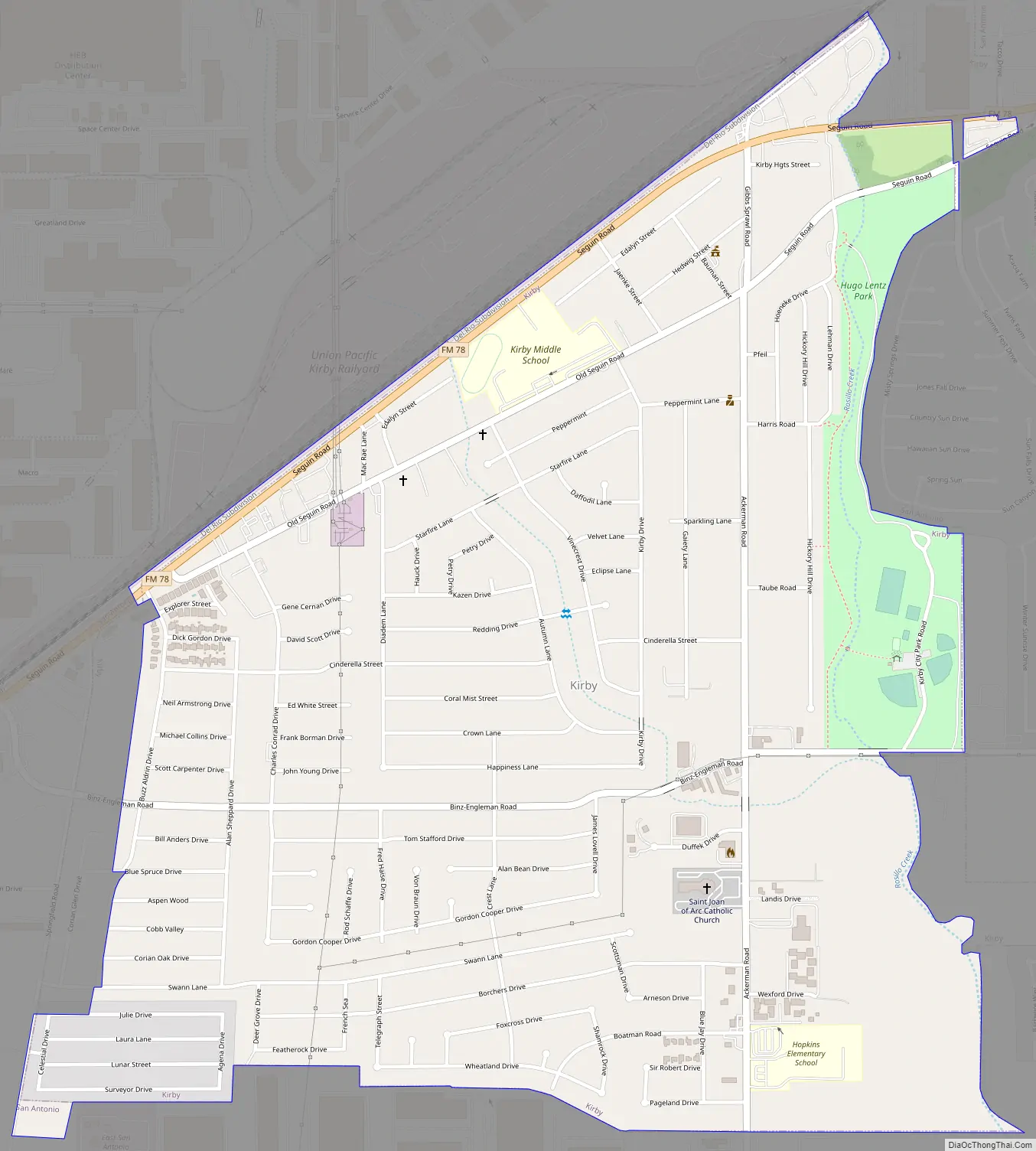
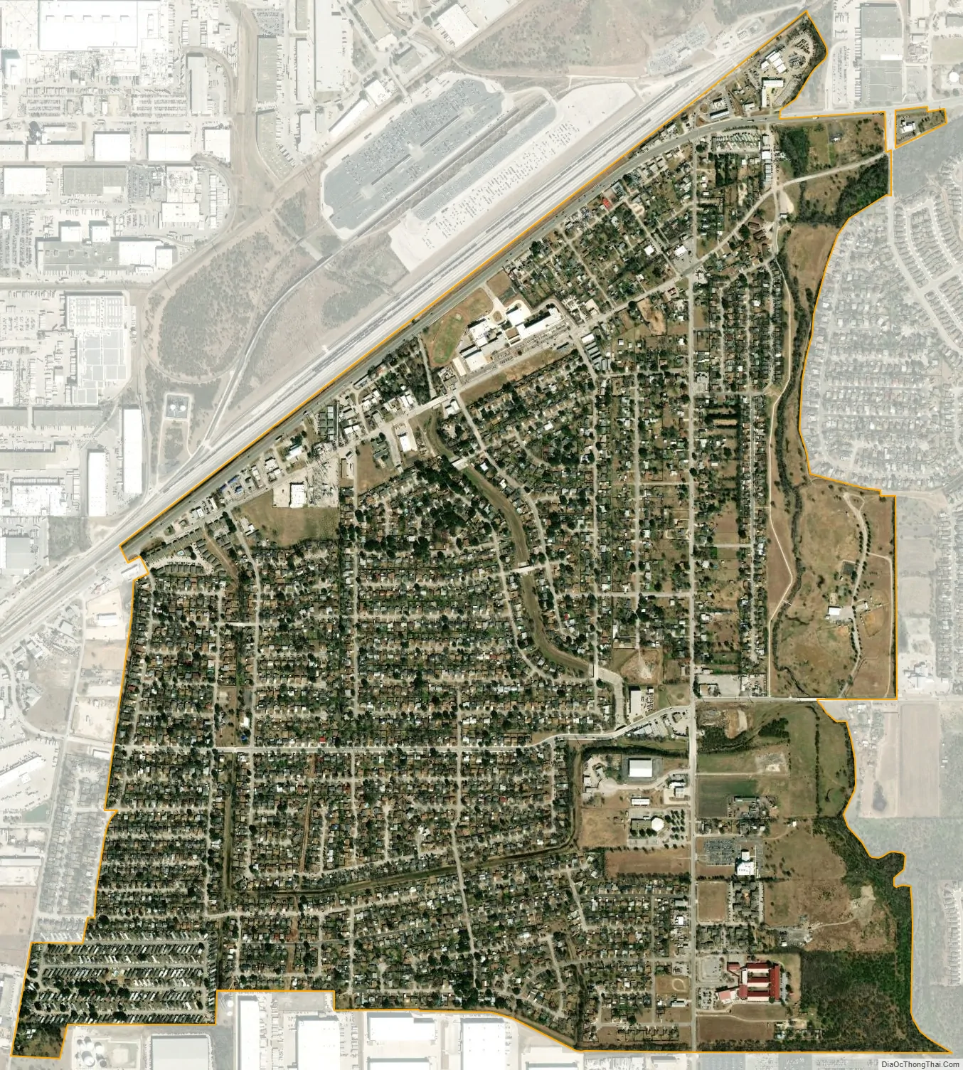
Kirby city Satellite Map
Geography
Kirby is located at 29°27′40″N 98°23′20″W / 29.46111°N 98.38889°W / 29.46111; -98.38889 (29.461032, –98.388763).
According to the United States Census Bureau, the city has a total area of 1.9 square miles (4.9 km), of which 0.04 square miles (0.10 km) of it (1.58%) is covered by water.
See also
Map of Texas State and its subdivision:- Anderson
- Andrews
- Angelina
- Aransas
- Archer
- Armstrong
- Atascosa
- Austin
- Bailey
- Bandera
- Bastrop
- Baylor
- Bee
- Bell
- Bexar
- Blanco
- Borden
- Bosque
- Bowie
- Brazoria
- Brazos
- Brewster
- Briscoe
- Brooks
- Brown
- Burleson
- Burnet
- Caldwell
- Calhoun
- Callahan
- Cameron
- Camp
- Carson
- Cass
- Castro
- Chambers
- Cherokee
- Childress
- Clay
- Cochran
- Coke
- Coleman
- Collin
- Collingsworth
- Colorado
- Comal
- Comanche
- Concho
- Cooke
- Coryell
- Cottle
- Crane
- Crockett
- Crosby
- Culberson
- Dallam
- Dallas
- Dawson
- Deaf Smith
- Delta
- Denton
- Dewitt
- Dickens
- Dimmit
- Donley
- Duval
- Eastland
- Ector
- Edwards
- El Paso
- Ellis
- Erath
- Falls
- Fannin
- Fayette
- Fisher
- Floyd
- Foard
- Fort Bend
- Franklin
- Freestone
- Frio
- Gaines
- Galveston
- Garza
- Gillespie
- Glasscock
- Goliad
- Gonzales
- Gray
- Grayson
- Gregg
- Grimes
- Guadalupe
- Hale
- Hall
- Hamilton
- Hansford
- Hardeman
- Hardin
- Harris
- Harrison
- Hartley
- Haskell
- Hays
- Hemphill
- Henderson
- Hidalgo
- Hill
- Hockley
- Hood
- Hopkins
- Houston
- Howard
- Hudspeth
- Hunt
- Hutchinson
- Irion
- Jack
- Jackson
- Jasper
- Jeff Davis
- Jefferson
- Jim Hogg
- Jim Wells
- Johnson
- Jones
- Karnes
- Kaufman
- Kendall
- Kenedy
- Kent
- Kerr
- Kimble
- King
- Kinney
- Kleberg
- Knox
- La Salle
- Lamar
- Lamb
- Lampasas
- Lavaca
- Lee
- Leon
- Liberty
- Limestone
- Lipscomb
- Live Oak
- Llano
- Loving
- Lubbock
- Lynn
- Madison
- Marion
- Martin
- Mason
- Matagorda
- Maverick
- McCulloch
- McLennan
- McMullen
- Medina
- Menard
- Midland
- Milam
- Mills
- Mitchell
- Montague
- Montgomery
- Moore
- Morris
- Motley
- Nacogdoches
- Navarro
- Newton
- Nolan
- Nueces
- Ochiltree
- Oldham
- Orange
- Palo Pinto
- Panola
- Parker
- Parmer
- Pecos
- Polk
- Potter
- Presidio
- Rains
- Randall
- Reagan
- Real
- Red River
- Reeves
- Refugio
- Roberts
- Robertson
- Rockwall
- Runnels
- Rusk
- Sabine
- San Augustine
- San Jacinto
- San Patricio
- San Saba
- Schleicher
- Scurry
- Shackelford
- Shelby
- Sherman
- Smith
- Somervell
- Starr
- Stephens
- Sterling
- Stonewall
- Sutton
- Swisher
- Tarrant
- Taylor
- Terrell
- Terry
- Throckmorton
- Titus
- Tom Green
- Travis
- Trinity
- Tyler
- Upshur
- Upton
- Uvalde
- Val Verde
- Van Zandt
- Victoria
- Walker
- Waller
- Ward
- Washington
- Webb
- Wharton
- Wheeler
- Wichita
- Wilbarger
- Willacy
- Williamson
- Wilson
- Winkler
- Wise
- Wood
- Yoakum
- Young
- Zapata
- Zavala
- Alabama
- Alaska
- Arizona
- Arkansas
- California
- Colorado
- Connecticut
- Delaware
- District of Columbia
- Florida
- Georgia
- Hawaii
- Idaho
- Illinois
- Indiana
- Iowa
- Kansas
- Kentucky
- Louisiana
- Maine
- Maryland
- Massachusetts
- Michigan
- Minnesota
- Mississippi
- Missouri
- Montana
- Nebraska
- Nevada
- New Hampshire
- New Jersey
- New Mexico
- New York
- North Carolina
- North Dakota
- Ohio
- Oklahoma
- Oregon
- Pennsylvania
- Rhode Island
- South Carolina
- South Dakota
- Tennessee
- Texas
- Utah
- Vermont
- Virginia
- Washington
- West Virginia
- Wisconsin
- Wyoming