Kyle is a city in Hays County, Texas, United States. Its population grew from 28,016 in 2010 to 45,697 in 2020, making it one of Texas’s fastest-growing cities.
| Name: | Kyle city |
|---|---|
| LSAD Code: | 25 |
| LSAD Description: | city (suffix) |
| State: | Texas |
| County: | Hays County |
| Elevation: | 728 ft (222 m) |
| Total Area: | 31.27 sq mi (80.99 km²) |
| Land Area: | 31.07 sq mi (80.48 km²) |
| Water Area: | 0.20 sq mi (0.51 km²) |
| Total Population: | 45,697 |
| Population Density: | 1,500/sq mi (560/km²) |
| ZIP code: | 78640 |
| Area code: | 512 & 737 |
| FIPS code: | 4839952 |
| GNISfeature ID: | 1339257 |
| Website: | www.cityofkyle.com |
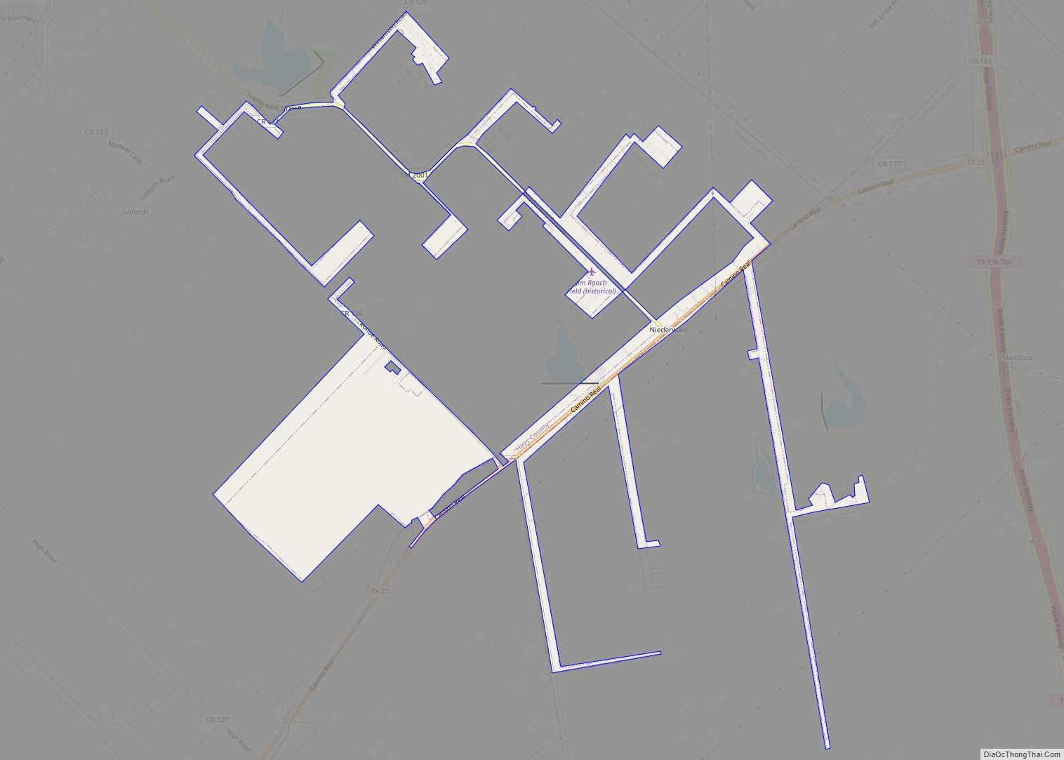
Online Interactive Map
Click on ![]() to view map in "full screen" mode.
to view map in "full screen" mode.
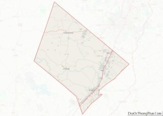
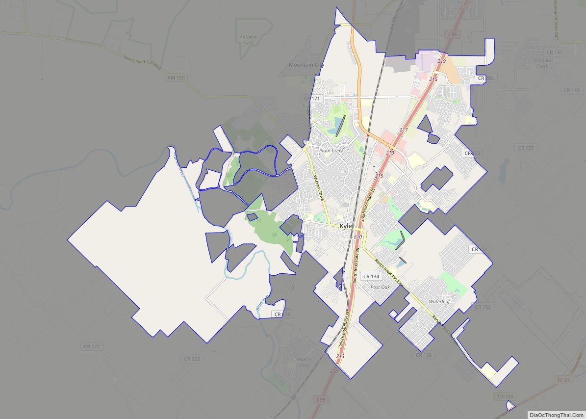
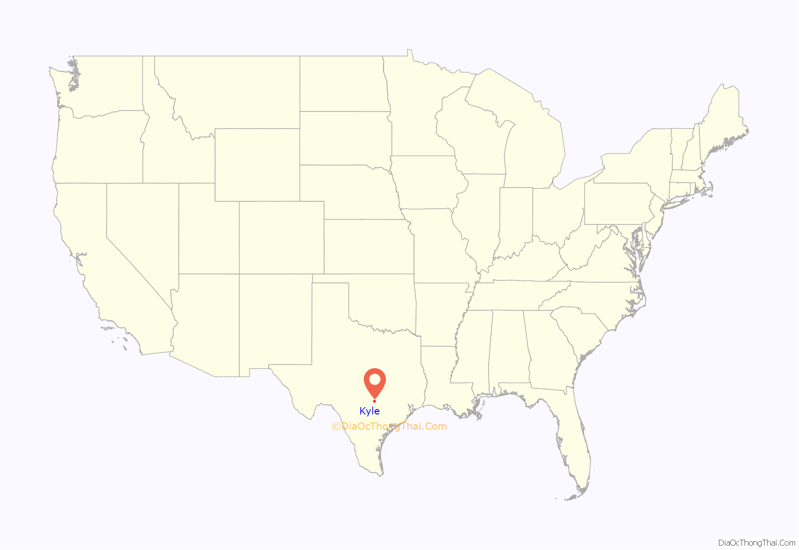
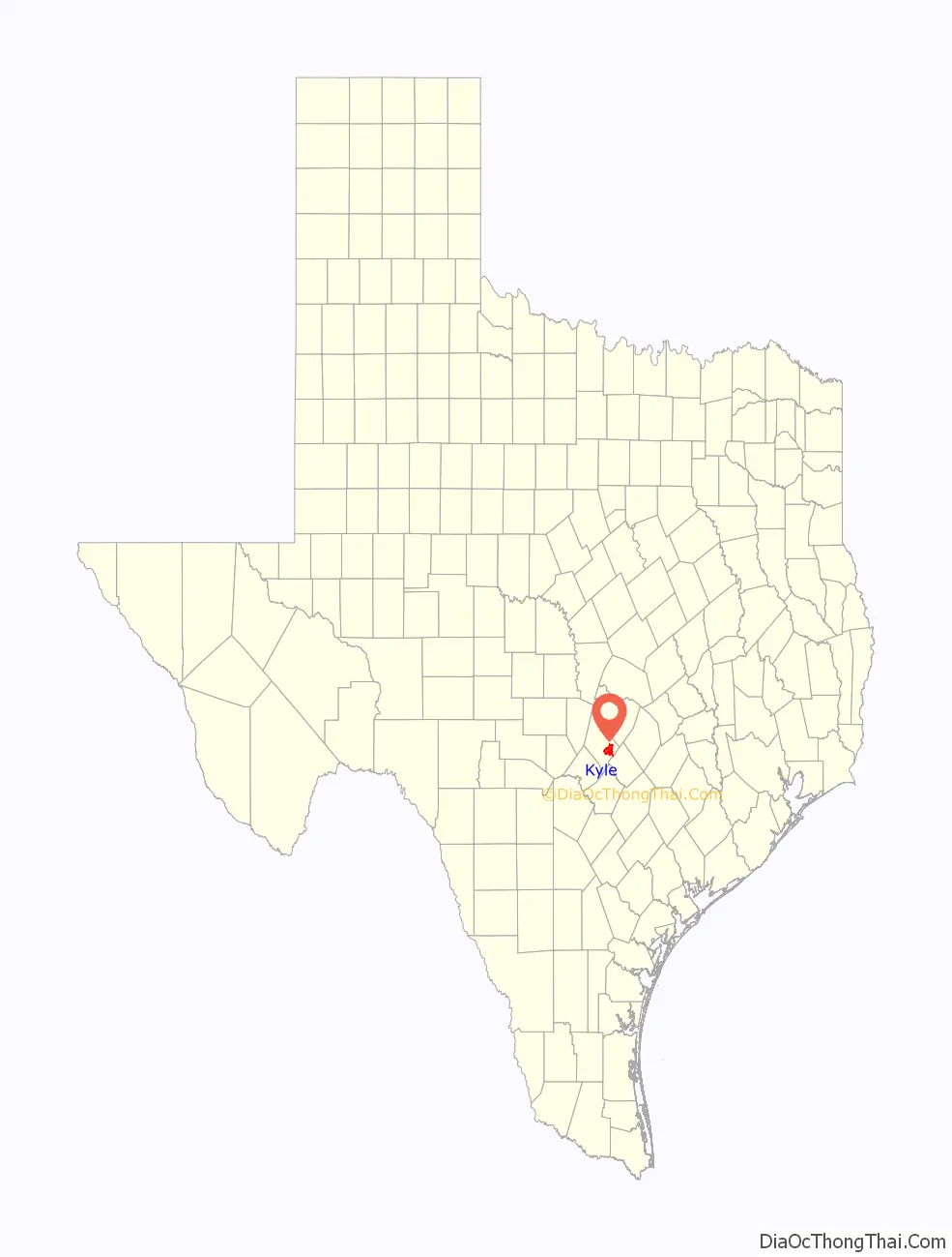
Kyle location map. Where is Kyle city?
History
The town was established on July 24, 1880, when David E. Moore and Fergus Kyle (for whom the town was named) deeded 200 acres for a townsite to the International-Great Northern Railroad. The new town drew residents and businesses from Mountain City, three miles west, and Blanco, four miles west. Tom Martin operated the first business in Kyle. The community’s population exceeded 500 by 1882, but later declined. Kyle was incorporated in 1928 as a general-law city with a mayor and five council members. In 1937, Mary Kyle Hartson, daughter of Fergus Kyle, was elected mayor by a write-in vote. In the early 1940s, Kyle was noted as the only Texas town with an all-woman government.
From 1892 to 1901, Kyle was the childhood home of Pulitzer Prize-winning author Katherine Anne Porter. Many of her most famous short stories, such as “Noon Wine”, are set in locations in and around Kyle. Her former home is now a writer’s residence open to the public by appointment. The Katherine Anne Porter Literary Center hosts readings by visiting writers.
Kyle Road Map
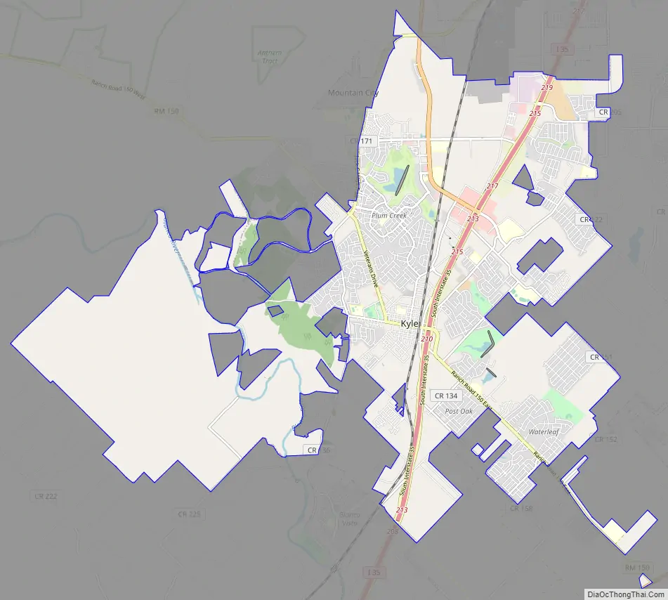
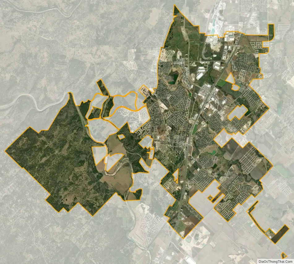
Kyle city Satellite Map
Geography
Kyle is in eastern Hays County at 29°59′21″N 97°52′33″W / 29.989080°N 97.875947°W / 29.989080; -97.875947 (29.989080, –97.875947). It is bordered to the south by San Marcos and to the northwest by Mountain City. Kyle is 21 mi (34 km) southwest of downtown Austin and 58 mi (93 km) northeast of San Antonio on Interstate 35.
According to the United States Census Bureau, the city has an area of 19.3 square miles (50.0 km), of which 19.1 sq mi (49.4 km) is land and 0.2 sq mi (0.5 km), 1.06%, is covered by water. The Blanco River runs through the western side of the city, while the central and eastern parts of the city drain east to Plum Creek. Both waterways are tributaries of the San Marcos River.
See also
Map of Texas State and its subdivision:- Anderson
- Andrews
- Angelina
- Aransas
- Archer
- Armstrong
- Atascosa
- Austin
- Bailey
- Bandera
- Bastrop
- Baylor
- Bee
- Bell
- Bexar
- Blanco
- Borden
- Bosque
- Bowie
- Brazoria
- Brazos
- Brewster
- Briscoe
- Brooks
- Brown
- Burleson
- Burnet
- Caldwell
- Calhoun
- Callahan
- Cameron
- Camp
- Carson
- Cass
- Castro
- Chambers
- Cherokee
- Childress
- Clay
- Cochran
- Coke
- Coleman
- Collin
- Collingsworth
- Colorado
- Comal
- Comanche
- Concho
- Cooke
- Coryell
- Cottle
- Crane
- Crockett
- Crosby
- Culberson
- Dallam
- Dallas
- Dawson
- Deaf Smith
- Delta
- Denton
- Dewitt
- Dickens
- Dimmit
- Donley
- Duval
- Eastland
- Ector
- Edwards
- El Paso
- Ellis
- Erath
- Falls
- Fannin
- Fayette
- Fisher
- Floyd
- Foard
- Fort Bend
- Franklin
- Freestone
- Frio
- Gaines
- Galveston
- Garza
- Gillespie
- Glasscock
- Goliad
- Gonzales
- Gray
- Grayson
- Gregg
- Grimes
- Guadalupe
- Hale
- Hall
- Hamilton
- Hansford
- Hardeman
- Hardin
- Harris
- Harrison
- Hartley
- Haskell
- Hays
- Hemphill
- Henderson
- Hidalgo
- Hill
- Hockley
- Hood
- Hopkins
- Houston
- Howard
- Hudspeth
- Hunt
- Hutchinson
- Irion
- Jack
- Jackson
- Jasper
- Jeff Davis
- Jefferson
- Jim Hogg
- Jim Wells
- Johnson
- Jones
- Karnes
- Kaufman
- Kendall
- Kenedy
- Kent
- Kerr
- Kimble
- King
- Kinney
- Kleberg
- Knox
- La Salle
- Lamar
- Lamb
- Lampasas
- Lavaca
- Lee
- Leon
- Liberty
- Limestone
- Lipscomb
- Live Oak
- Llano
- Loving
- Lubbock
- Lynn
- Madison
- Marion
- Martin
- Mason
- Matagorda
- Maverick
- McCulloch
- McLennan
- McMullen
- Medina
- Menard
- Midland
- Milam
- Mills
- Mitchell
- Montague
- Montgomery
- Moore
- Morris
- Motley
- Nacogdoches
- Navarro
- Newton
- Nolan
- Nueces
- Ochiltree
- Oldham
- Orange
- Palo Pinto
- Panola
- Parker
- Parmer
- Pecos
- Polk
- Potter
- Presidio
- Rains
- Randall
- Reagan
- Real
- Red River
- Reeves
- Refugio
- Roberts
- Robertson
- Rockwall
- Runnels
- Rusk
- Sabine
- San Augustine
- San Jacinto
- San Patricio
- San Saba
- Schleicher
- Scurry
- Shackelford
- Shelby
- Sherman
- Smith
- Somervell
- Starr
- Stephens
- Sterling
- Stonewall
- Sutton
- Swisher
- Tarrant
- Taylor
- Terrell
- Terry
- Throckmorton
- Titus
- Tom Green
- Travis
- Trinity
- Tyler
- Upshur
- Upton
- Uvalde
- Val Verde
- Van Zandt
- Victoria
- Walker
- Waller
- Ward
- Washington
- Webb
- Wharton
- Wheeler
- Wichita
- Wilbarger
- Willacy
- Williamson
- Wilson
- Winkler
- Wise
- Wood
- Yoakum
- Young
- Zapata
- Zavala
- Alabama
- Alaska
- Arizona
- Arkansas
- California
- Colorado
- Connecticut
- Delaware
- District of Columbia
- Florida
- Georgia
- Hawaii
- Idaho
- Illinois
- Indiana
- Iowa
- Kansas
- Kentucky
- Louisiana
- Maine
- Maryland
- Massachusetts
- Michigan
- Minnesota
- Mississippi
- Missouri
- Montana
- Nebraska
- Nevada
- New Hampshire
- New Jersey
- New Mexico
- New York
- North Carolina
- North Dakota
- Ohio
- Oklahoma
- Oregon
- Pennsylvania
- Rhode Island
- South Carolina
- South Dakota
- Tennessee
- Texas
- Utah
- Vermont
- Virginia
- Washington
- West Virginia
- Wisconsin
- Wyoming