Lakeway is a city in Travis County, Texas, United States. The population was 19,189 at the 2020 census; up from 11,391 in 2010. The city is located next to Lake Travis. It is an exurb in Greater Austin.
| Name: | Lakeway city |
|---|---|
| LSAD Code: | 25 |
| LSAD Description: | city (suffix) |
| State: | Texas |
| County: | Travis County |
| Elevation: | 823 ft (251 m) |
| Total Area: | 13.39 sq mi (34.68 km²) |
| Land Area: | 12.64 sq mi (32.73 km²) |
| Water Area: | 0.75 sq mi (1.95 km²) |
| Total Population: | 19,189 |
| Population Density: | 1,264.7/sq mi (488.29/km²) |
| Area code: | 512 |
| FIPS code: | 4840984 |
| GNISfeature ID: | 1339552 |
| Website: | www.lakeway-tx.gov |
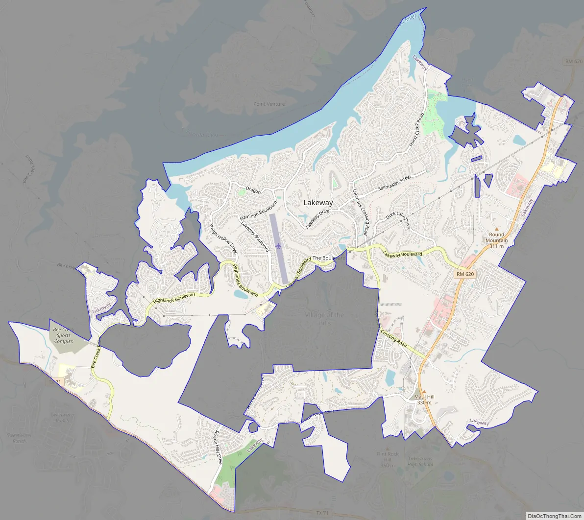
Online Interactive Map
Click on ![]() to view map in "full screen" mode.
to view map in "full screen" mode.
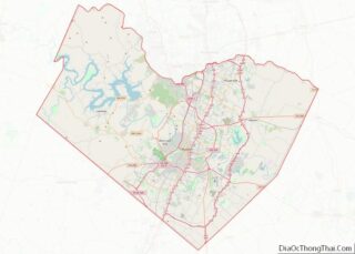
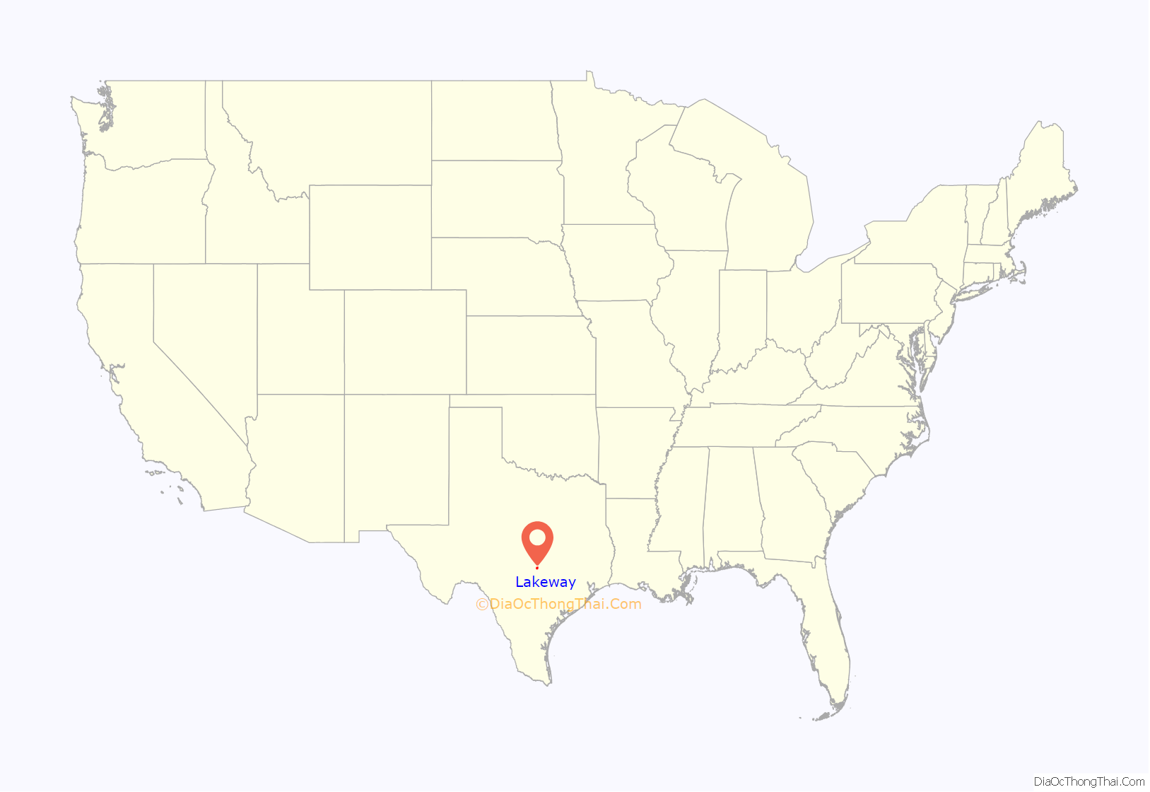
Lakeway location map. Where is Lakeway city?
History
The town of Lakeway was founded on the site of a 2,700-acre ranch owned by Houston oilman and rancher Jack (Jake) Josey. In early 1962 three Houston business men associated with the Gulfmont Hotel Company—G. Flint Sawtelle, John H. Crooker, Jr., and Lee Blocker—obtained a sixty-day option to purchase the land and plan a hotel and resort community. The name Lakeway was a natural sequel to Gulfmont’s Fairway Motor Hotel in McAllen, Texas, so named because it overlooked the fairway of a golf course. Construction of the hotel began in October 1962 and the grand opening was July 12, 1963. Around the same time the Lakeway Land Company was formed with Flint Sawtelle as president, for the development of real estate. In July 1974 a substantial majority of resident and nonresident property owners voted to incorporate with the consent of the city of Austin, and the 1,200-acre village of Lakeway resulted.
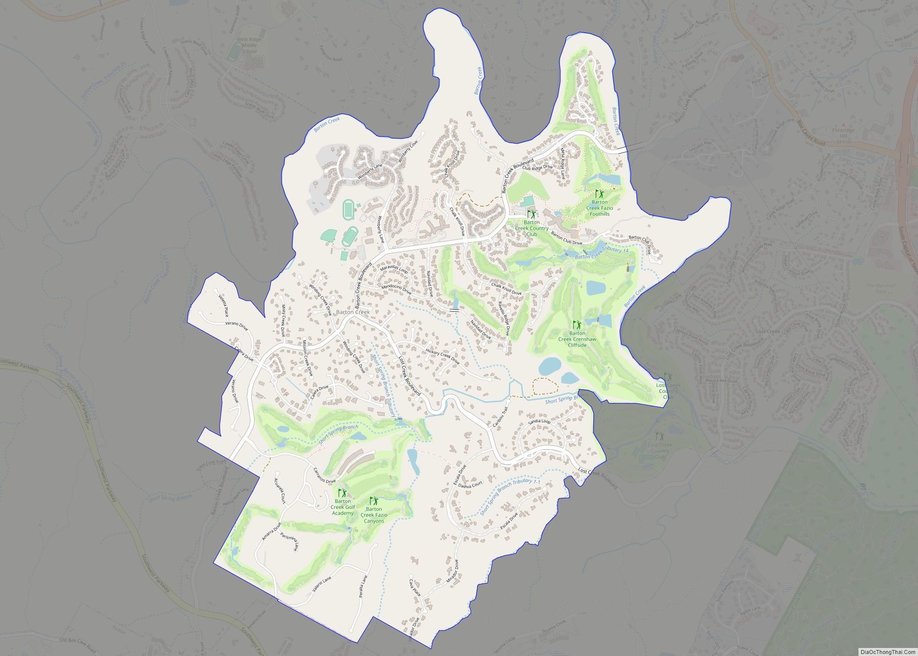
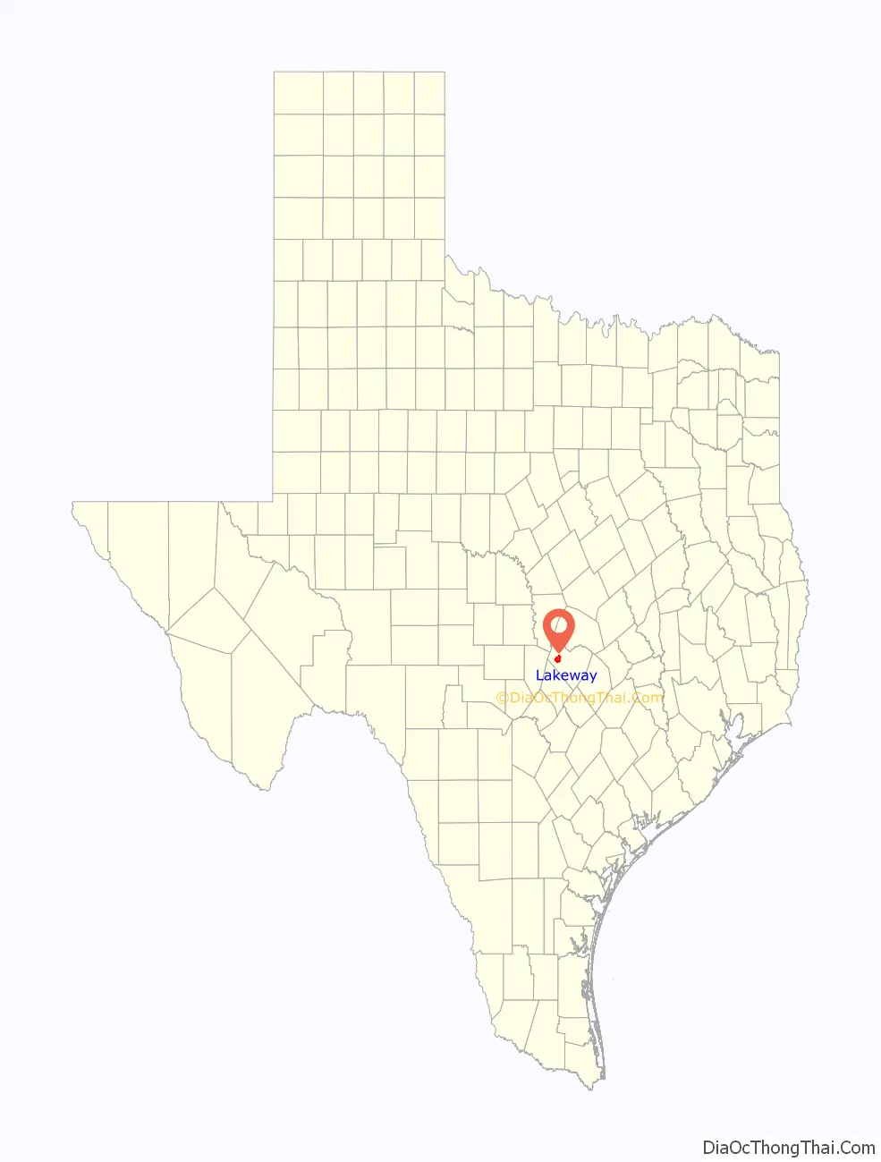
Lakeway Road Map
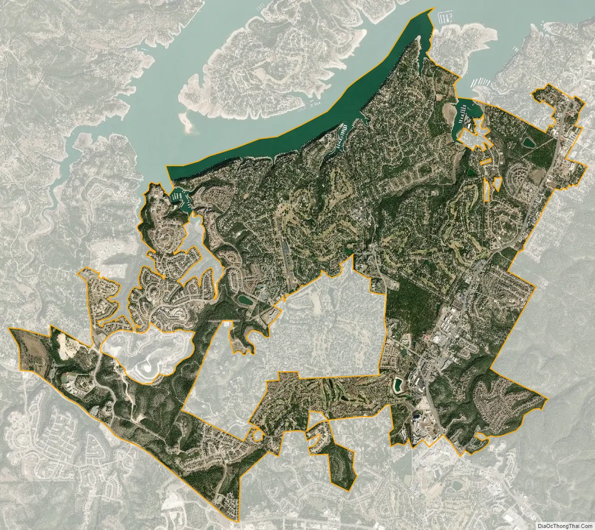
Lakeway city Satellite Map
Geography
Lakeway is located at 30°21′55″N 97°58′34″W / 30.365307°N 97.976154°W / 30.365307; -97.976154 (30.365307, –97.976154), 16 miles (26 km) west of Austin.
Hurst Creek runs directly through Lakeway and empties into Lake Travis, directly north of Lakeway.
According to Lakeway’s GIS Analyst, the city has a total area of 13.37 square miles (21.51 km), of which, 13.07 square miles (15.0 km) of it is land and 0.3 square miles (0.7 km) of it (4.45%) is water.
See also
Map of Texas State and its subdivision:- Anderson
- Andrews
- Angelina
- Aransas
- Archer
- Armstrong
- Atascosa
- Austin
- Bailey
- Bandera
- Bastrop
- Baylor
- Bee
- Bell
- Bexar
- Blanco
- Borden
- Bosque
- Bowie
- Brazoria
- Brazos
- Brewster
- Briscoe
- Brooks
- Brown
- Burleson
- Burnet
- Caldwell
- Calhoun
- Callahan
- Cameron
- Camp
- Carson
- Cass
- Castro
- Chambers
- Cherokee
- Childress
- Clay
- Cochran
- Coke
- Coleman
- Collin
- Collingsworth
- Colorado
- Comal
- Comanche
- Concho
- Cooke
- Coryell
- Cottle
- Crane
- Crockett
- Crosby
- Culberson
- Dallam
- Dallas
- Dawson
- Deaf Smith
- Delta
- Denton
- Dewitt
- Dickens
- Dimmit
- Donley
- Duval
- Eastland
- Ector
- Edwards
- El Paso
- Ellis
- Erath
- Falls
- Fannin
- Fayette
- Fisher
- Floyd
- Foard
- Fort Bend
- Franklin
- Freestone
- Frio
- Gaines
- Galveston
- Garza
- Gillespie
- Glasscock
- Goliad
- Gonzales
- Gray
- Grayson
- Gregg
- Grimes
- Guadalupe
- Hale
- Hall
- Hamilton
- Hansford
- Hardeman
- Hardin
- Harris
- Harrison
- Hartley
- Haskell
- Hays
- Hemphill
- Henderson
- Hidalgo
- Hill
- Hockley
- Hood
- Hopkins
- Houston
- Howard
- Hudspeth
- Hunt
- Hutchinson
- Irion
- Jack
- Jackson
- Jasper
- Jeff Davis
- Jefferson
- Jim Hogg
- Jim Wells
- Johnson
- Jones
- Karnes
- Kaufman
- Kendall
- Kenedy
- Kent
- Kerr
- Kimble
- King
- Kinney
- Kleberg
- Knox
- La Salle
- Lamar
- Lamb
- Lampasas
- Lavaca
- Lee
- Leon
- Liberty
- Limestone
- Lipscomb
- Live Oak
- Llano
- Loving
- Lubbock
- Lynn
- Madison
- Marion
- Martin
- Mason
- Matagorda
- Maverick
- McCulloch
- McLennan
- McMullen
- Medina
- Menard
- Midland
- Milam
- Mills
- Mitchell
- Montague
- Montgomery
- Moore
- Morris
- Motley
- Nacogdoches
- Navarro
- Newton
- Nolan
- Nueces
- Ochiltree
- Oldham
- Orange
- Palo Pinto
- Panola
- Parker
- Parmer
- Pecos
- Polk
- Potter
- Presidio
- Rains
- Randall
- Reagan
- Real
- Red River
- Reeves
- Refugio
- Roberts
- Robertson
- Rockwall
- Runnels
- Rusk
- Sabine
- San Augustine
- San Jacinto
- San Patricio
- San Saba
- Schleicher
- Scurry
- Shackelford
- Shelby
- Sherman
- Smith
- Somervell
- Starr
- Stephens
- Sterling
- Stonewall
- Sutton
- Swisher
- Tarrant
- Taylor
- Terrell
- Terry
- Throckmorton
- Titus
- Tom Green
- Travis
- Trinity
- Tyler
- Upshur
- Upton
- Uvalde
- Val Verde
- Van Zandt
- Victoria
- Walker
- Waller
- Ward
- Washington
- Webb
- Wharton
- Wheeler
- Wichita
- Wilbarger
- Willacy
- Williamson
- Wilson
- Winkler
- Wise
- Wood
- Yoakum
- Young
- Zapata
- Zavala
- Alabama
- Alaska
- Arizona
- Arkansas
- California
- Colorado
- Connecticut
- Delaware
- District of Columbia
- Florida
- Georgia
- Hawaii
- Idaho
- Illinois
- Indiana
- Iowa
- Kansas
- Kentucky
- Louisiana
- Maine
- Maryland
- Massachusetts
- Michigan
- Minnesota
- Mississippi
- Missouri
- Montana
- Nebraska
- Nevada
- New Hampshire
- New Jersey
- New Mexico
- New York
- North Carolina
- North Dakota
- Ohio
- Oklahoma
- Oregon
- Pennsylvania
- Rhode Island
- South Carolina
- South Dakota
- Tennessee
- Texas
- Utah
- Vermont
- Virginia
- Washington
- West Virginia
- Wisconsin
- Wyoming