Latexo (/ləˈtɛksoʊ/ lə-TEK-soh) is a city in Houston County, Texas, United States. Its population was 322 at the 2010 census.
| Name: | Latexo city |
|---|---|
| LSAD Code: | 25 |
| LSAD Description: | city (suffix) |
| State: | Texas |
| County: | Houston County |
| Elevation: | 397 ft (121 m) |
| Total Area: | 0.98 sq mi (2.54 km²) |
| Land Area: | 0.98 sq mi (2.54 km²) |
| Water Area: | 0.00 sq mi (0.00 km²) |
| Total Population: | 322 |
| Population Density: | 319.76/sq mi (123.51/km²) |
| ZIP code: | 75849 |
| Area code: | 936 |
| FIPS code: | 4841644 |
| GNISfeature ID: | 1360972 |
Online Interactive Map
Click on ![]() to view map in "full screen" mode.
to view map in "full screen" mode.
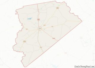
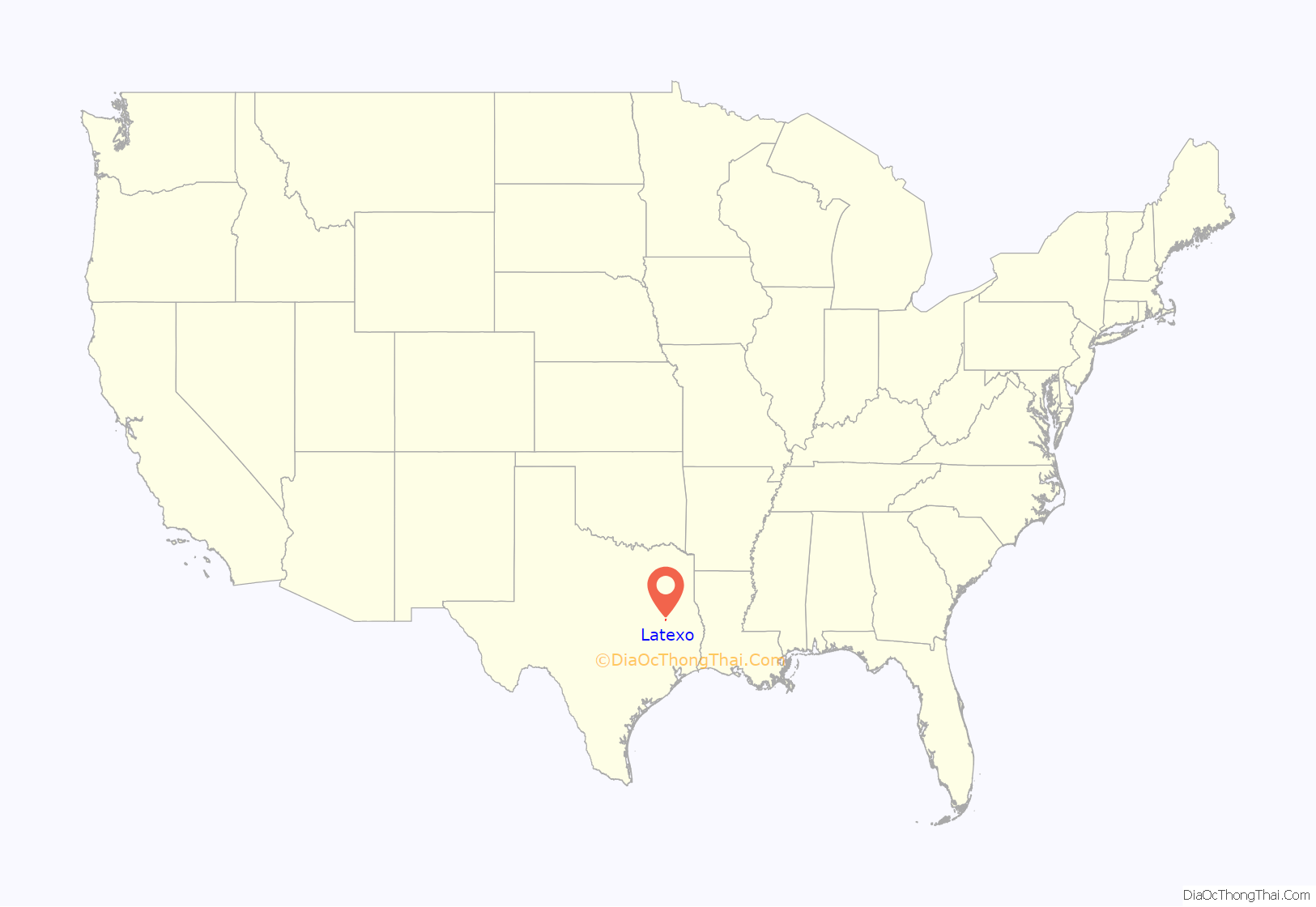
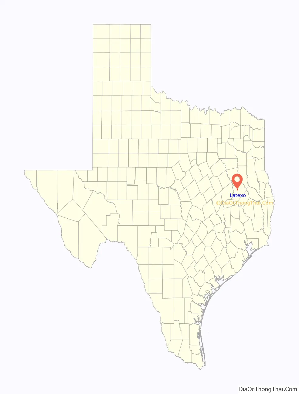
Latexo location map. Where is Latexo city?
History
Just after 1900, the Louisiana Texas Orchard Company purchased 3,000 acres (12 km) surrounding the settlement and platted a town named “Latexo”, an acronym of the company’s name. Five schools have been built over the years in the community and the city of Latexo.
The first Bethel school building was on a dirt road that ran parallel with the railroad tracks, about 500 feet (150 m) south of the railroad crossing at the north end of the city. This building was later occupied as the home of Cleveland Willis. The second Bethel school built in the community was located on a street that went east from what was at that time the main road that ran south along the railroad tracks. This site in the 1960s and later years was known as the home site of the Stokes Reed family. This building was later sold (around 1930) to the Baptist Church and was used as such for many years.
The third site of the school was located about two houses east of the second site and was the location of what was referred to as the old Ed Burton home, but was the Bill McKinney home in 1961, and later the Clifford Price home. The third school was moved in 1930 to the present location. Two new buildings have been built on the same school property, replacing the previous building.
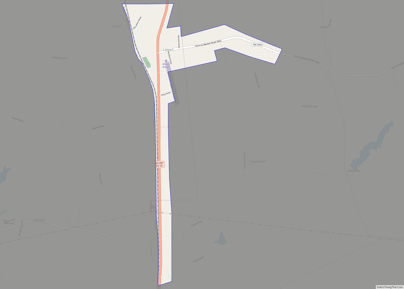
Latexo Road Map

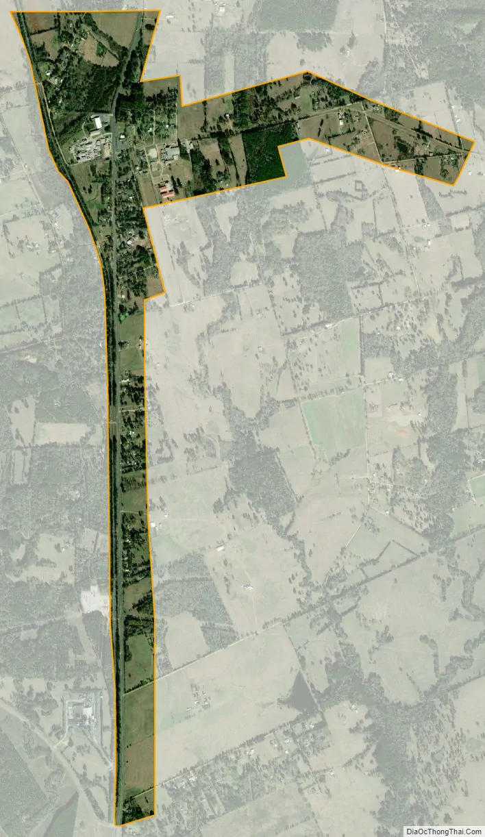
Latexo city Satellite Map
Geography
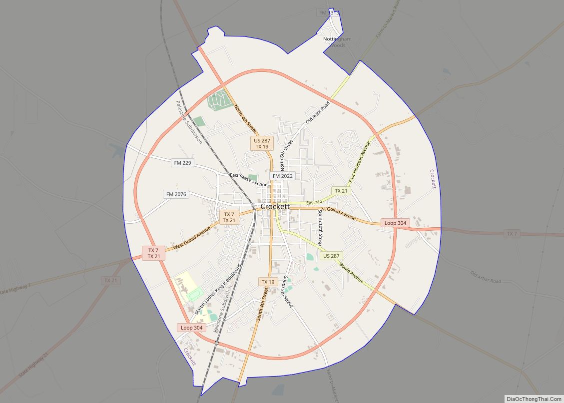
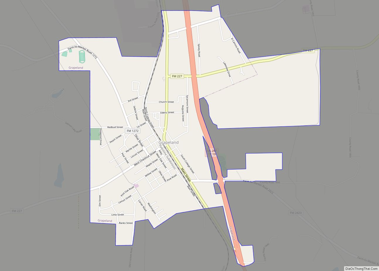
Latexo is located north of the center of Houston County at 31°23′21″N 95°28′29″W / 31.38917°N 95.47472°W / 31.38917; -95.47472 (31.389285, –95.474699). U.S. Route 287 is the main road through the city, leading south 5 miles (8 km) to Crockett, the county seat, and north 7 miles (11 km) to Grapeland.
According to the United States Census Bureau, the city has a total area of 0.97 square miles (2.5 km), all of it land.
See also
Map of Texas State and its subdivision:- Anderson
- Andrews
- Angelina
- Aransas
- Archer
- Armstrong
- Atascosa
- Austin
- Bailey
- Bandera
- Bastrop
- Baylor
- Bee
- Bell
- Bexar
- Blanco
- Borden
- Bosque
- Bowie
- Brazoria
- Brazos
- Brewster
- Briscoe
- Brooks
- Brown
- Burleson
- Burnet
- Caldwell
- Calhoun
- Callahan
- Cameron
- Camp
- Carson
- Cass
- Castro
- Chambers
- Cherokee
- Childress
- Clay
- Cochran
- Coke
- Coleman
- Collin
- Collingsworth
- Colorado
- Comal
- Comanche
- Concho
- Cooke
- Coryell
- Cottle
- Crane
- Crockett
- Crosby
- Culberson
- Dallam
- Dallas
- Dawson
- Deaf Smith
- Delta
- Denton
- Dewitt
- Dickens
- Dimmit
- Donley
- Duval
- Eastland
- Ector
- Edwards
- El Paso
- Ellis
- Erath
- Falls
- Fannin
- Fayette
- Fisher
- Floyd
- Foard
- Fort Bend
- Franklin
- Freestone
- Frio
- Gaines
- Galveston
- Garza
- Gillespie
- Glasscock
- Goliad
- Gonzales
- Gray
- Grayson
- Gregg
- Grimes
- Guadalupe
- Hale
- Hall
- Hamilton
- Hansford
- Hardeman
- Hardin
- Harris
- Harrison
- Hartley
- Haskell
- Hays
- Hemphill
- Henderson
- Hidalgo
- Hill
- Hockley
- Hood
- Hopkins
- Houston
- Howard
- Hudspeth
- Hunt
- Hutchinson
- Irion
- Jack
- Jackson
- Jasper
- Jeff Davis
- Jefferson
- Jim Hogg
- Jim Wells
- Johnson
- Jones
- Karnes
- Kaufman
- Kendall
- Kenedy
- Kent
- Kerr
- Kimble
- King
- Kinney
- Kleberg
- Knox
- La Salle
- Lamar
- Lamb
- Lampasas
- Lavaca
- Lee
- Leon
- Liberty
- Limestone
- Lipscomb
- Live Oak
- Llano
- Loving
- Lubbock
- Lynn
- Madison
- Marion
- Martin
- Mason
- Matagorda
- Maverick
- McCulloch
- McLennan
- McMullen
- Medina
- Menard
- Midland
- Milam
- Mills
- Mitchell
- Montague
- Montgomery
- Moore
- Morris
- Motley
- Nacogdoches
- Navarro
- Newton
- Nolan
- Nueces
- Ochiltree
- Oldham
- Orange
- Palo Pinto
- Panola
- Parker
- Parmer
- Pecos
- Polk
- Potter
- Presidio
- Rains
- Randall
- Reagan
- Real
- Red River
- Reeves
- Refugio
- Roberts
- Robertson
- Rockwall
- Runnels
- Rusk
- Sabine
- San Augustine
- San Jacinto
- San Patricio
- San Saba
- Schleicher
- Scurry
- Shackelford
- Shelby
- Sherman
- Smith
- Somervell
- Starr
- Stephens
- Sterling
- Stonewall
- Sutton
- Swisher
- Tarrant
- Taylor
- Terrell
- Terry
- Throckmorton
- Titus
- Tom Green
- Travis
- Trinity
- Tyler
- Upshur
- Upton
- Uvalde
- Val Verde
- Van Zandt
- Victoria
- Walker
- Waller
- Ward
- Washington
- Webb
- Wharton
- Wheeler
- Wichita
- Wilbarger
- Willacy
- Williamson
- Wilson
- Winkler
- Wise
- Wood
- Yoakum
- Young
- Zapata
- Zavala
- Alabama
- Alaska
- Arizona
- Arkansas
- California
- Colorado
- Connecticut
- Delaware
- District of Columbia
- Florida
- Georgia
- Hawaii
- Idaho
- Illinois
- Indiana
- Iowa
- Kansas
- Kentucky
- Louisiana
- Maine
- Maryland
- Massachusetts
- Michigan
- Minnesota
- Mississippi
- Missouri
- Montana
- Nebraska
- Nevada
- New Hampshire
- New Jersey
- New Mexico
- New York
- North Carolina
- North Dakota
- Ohio
- Oklahoma
- Oregon
- Pennsylvania
- Rhode Island
- South Carolina
- South Dakota
- Tennessee
- Texas
- Utah
- Vermont
- Virginia
- Washington
- West Virginia
- Wisconsin
- Wyoming