Lott is a city in Falls County, Texas, United States. As of the 2020 census, the city population was 644.
| Name: | Lott city |
|---|---|
| LSAD Code: | 25 |
| LSAD Description: | city (suffix) |
| State: | Texas |
| County: | Falls County |
| Elevation: | 522 ft (159 m) |
| Total Area: | 1.02 sq mi (2.65 km²) |
| Land Area: | 1.01 sq mi (2.62 km²) |
| Water Area: | 0.01 sq mi (0.04 km²) |
| Total Population: | 644 |
| Population Density: | 734.65/sq mi (283.60/km²) |
| ZIP code: | 76656 |
| Area code: | 254 |
| FIPS code: | 4844176 |
| GNISfeature ID: | 1361858 |
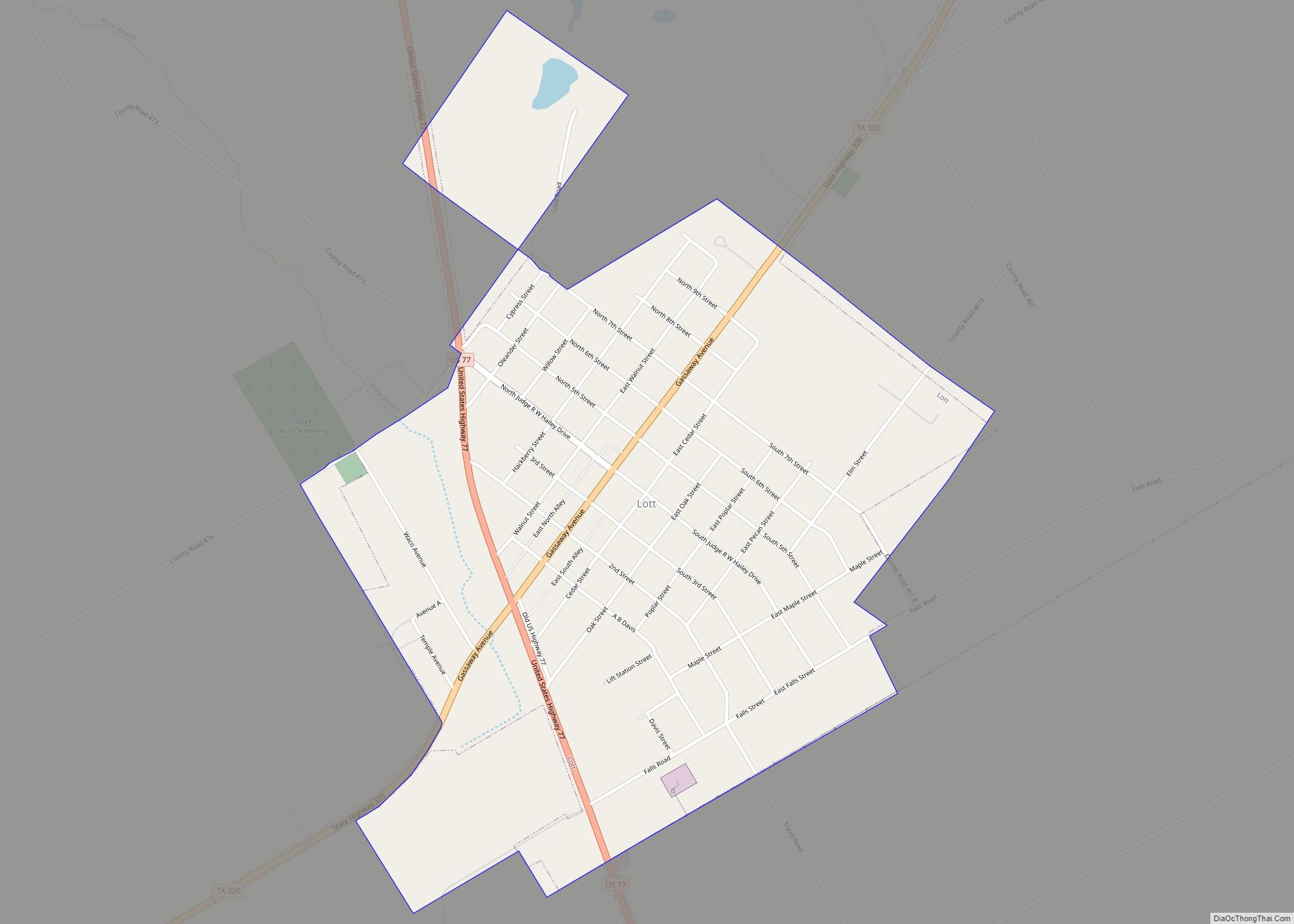
Online Interactive Map
Click on ![]() to view map in "full screen" mode.
to view map in "full screen" mode.
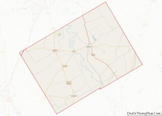
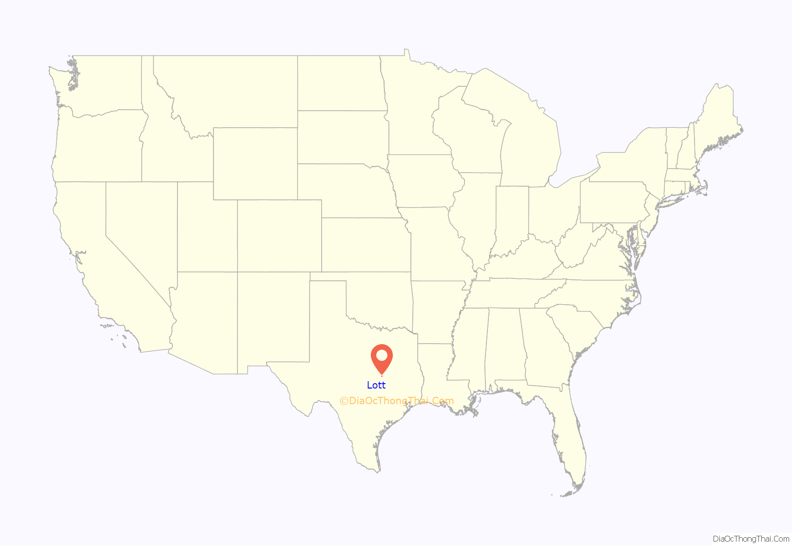
Lott location map. Where is Lott city?

History
The Texas Townsite Company bought the land in 1889. When the San Antonio and Aransas Pass Railway was built through the area in 1890, Lott was founded; it was named in honor of Uriah Lott, president of the railroad. A post office was established at the settlement in 1890, with S. J. Crump as postmaster. When the community was incorporated by unanimous vote later that year, its population was estimated at more than 200. By 1892 Lott had Baptist, Methodist, and Presbyterian churches, two cotton gins and gristmills, a weekly newspaper, and 350 residents. Its population estimates were as high as 1,200 by the end of the 1890s. Lott continued to prosper throughout the first part of the 20th century when the town developed into a well-known speed trap, securing the town’s primary revenue source to the present day. The First National Bank of Lott was established in 1903, and the Lott State Bank was chartered in 1909. Local businesses did well, and residents were optimistic about the community’s future growth. Lott’s economy received an additional boost in the 1920s when State Highway 44 (later U.S. 77) built through the community. The Great Depression, however, brought significant changes. In 1933, the First National Bank of Lott went into receivership and did not reopen. During the mid-1930s, many local families had to accept government relief to make ends meet, although the Public Works Administration and the Works Progress provided some residents with jobs on street and water works.
Cotton and corn were for many years the staple crops of area farmers, but government subsidies encouraged diversification into stock raising and truck farming. The population of the community was reported as 921 in the 1930s; it rose to 1,021 in the 1940s, but fell to 956 by the early 1950s. Lott lost its rail service in 1967, when the Southern Pacific abandoned the section of track between Waco and Rosebud. Population estimates for Lott fluctuated between 750 and 950 residents from the 1960s through the 1980s, and the number of businesses fell steadily, from 45 in the 1940s to 12 in the 1980s. Thirteen businesses and 828 residents were reported in Lott at the end of the 1980s. In 1990, its population was estimated at 775.
In June 2015, a TV station reported that the cities of Calvert, Franklin, Hearne, and Lott in a “Texas Triangle” were using their police departments to issue numerous speeding tickets to turn their municipal court into a “cash cow”.
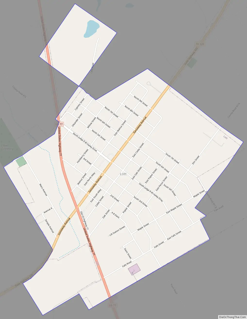
Lott Road Map
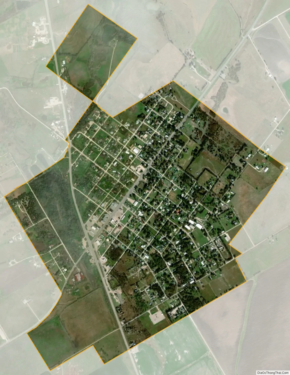
Lott city Satellite Map
Geography
Lott is located southwest of the center of Falls County at 31°12′N 97°2′W / 31.200°N 97.033°W / 31.200; -97.033 (31.2070, –97.0329), on high ground between the north-flowing Little Deer Creek and the south-flowing Cottonwood Creek, both tributaries of the Brazos River.
U.S. Route 77 passes through the city, leading north 26 miles (42 km) to Waco and south 25 miles (40 km) to Cameron. Texas State Highway 320 crosses US 77 at the west edge of downtown; it leads northeast 11 miles (18 km) to Marlin and southwest 14 miles (23 km) to Zabcikville.
According to the United States Census Bureau, the city of Lott has a total area of 1.0 square mile (2.7 km), of which 0.02 square miles (0.04 km), or 1.40%, is water.
See also
Map of Texas State and its subdivision:- Anderson
- Andrews
- Angelina
- Aransas
- Archer
- Armstrong
- Atascosa
- Austin
- Bailey
- Bandera
- Bastrop
- Baylor
- Bee
- Bell
- Bexar
- Blanco
- Borden
- Bosque
- Bowie
- Brazoria
- Brazos
- Brewster
- Briscoe
- Brooks
- Brown
- Burleson
- Burnet
- Caldwell
- Calhoun
- Callahan
- Cameron
- Camp
- Carson
- Cass
- Castro
- Chambers
- Cherokee
- Childress
- Clay
- Cochran
- Coke
- Coleman
- Collin
- Collingsworth
- Colorado
- Comal
- Comanche
- Concho
- Cooke
- Coryell
- Cottle
- Crane
- Crockett
- Crosby
- Culberson
- Dallam
- Dallas
- Dawson
- Deaf Smith
- Delta
- Denton
- Dewitt
- Dickens
- Dimmit
- Donley
- Duval
- Eastland
- Ector
- Edwards
- El Paso
- Ellis
- Erath
- Falls
- Fannin
- Fayette
- Fisher
- Floyd
- Foard
- Fort Bend
- Franklin
- Freestone
- Frio
- Gaines
- Galveston
- Garza
- Gillespie
- Glasscock
- Goliad
- Gonzales
- Gray
- Grayson
- Gregg
- Grimes
- Guadalupe
- Hale
- Hall
- Hamilton
- Hansford
- Hardeman
- Hardin
- Harris
- Harrison
- Hartley
- Haskell
- Hays
- Hemphill
- Henderson
- Hidalgo
- Hill
- Hockley
- Hood
- Hopkins
- Houston
- Howard
- Hudspeth
- Hunt
- Hutchinson
- Irion
- Jack
- Jackson
- Jasper
- Jeff Davis
- Jefferson
- Jim Hogg
- Jim Wells
- Johnson
- Jones
- Karnes
- Kaufman
- Kendall
- Kenedy
- Kent
- Kerr
- Kimble
- King
- Kinney
- Kleberg
- Knox
- La Salle
- Lamar
- Lamb
- Lampasas
- Lavaca
- Lee
- Leon
- Liberty
- Limestone
- Lipscomb
- Live Oak
- Llano
- Loving
- Lubbock
- Lynn
- Madison
- Marion
- Martin
- Mason
- Matagorda
- Maverick
- McCulloch
- McLennan
- McMullen
- Medina
- Menard
- Midland
- Milam
- Mills
- Mitchell
- Montague
- Montgomery
- Moore
- Morris
- Motley
- Nacogdoches
- Navarro
- Newton
- Nolan
- Nueces
- Ochiltree
- Oldham
- Orange
- Palo Pinto
- Panola
- Parker
- Parmer
- Pecos
- Polk
- Potter
- Presidio
- Rains
- Randall
- Reagan
- Real
- Red River
- Reeves
- Refugio
- Roberts
- Robertson
- Rockwall
- Runnels
- Rusk
- Sabine
- San Augustine
- San Jacinto
- San Patricio
- San Saba
- Schleicher
- Scurry
- Shackelford
- Shelby
- Sherman
- Smith
- Somervell
- Starr
- Stephens
- Sterling
- Stonewall
- Sutton
- Swisher
- Tarrant
- Taylor
- Terrell
- Terry
- Throckmorton
- Titus
- Tom Green
- Travis
- Trinity
- Tyler
- Upshur
- Upton
- Uvalde
- Val Verde
- Van Zandt
- Victoria
- Walker
- Waller
- Ward
- Washington
- Webb
- Wharton
- Wheeler
- Wichita
- Wilbarger
- Willacy
- Williamson
- Wilson
- Winkler
- Wise
- Wood
- Yoakum
- Young
- Zapata
- Zavala
- Alabama
- Alaska
- Arizona
- Arkansas
- California
- Colorado
- Connecticut
- Delaware
- District of Columbia
- Florida
- Georgia
- Hawaii
- Idaho
- Illinois
- Indiana
- Iowa
- Kansas
- Kentucky
- Louisiana
- Maine
- Maryland
- Massachusetts
- Michigan
- Minnesota
- Mississippi
- Missouri
- Montana
- Nebraska
- Nevada
- New Hampshire
- New Jersey
- New Mexico
- New York
- North Carolina
- North Dakota
- Ohio
- Oklahoma
- Oregon
- Pennsylvania
- Rhode Island
- South Carolina
- South Dakota
- Tennessee
- Texas
- Utah
- Vermont
- Virginia
- Washington
- West Virginia
- Wisconsin
- Wyoming