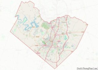
Manchaca (/ˈmænʃæk/ MAN-shak) is an unincorporated community and census-designated place (CDP) in Travis County, Texas, United States. It is located 10 miles (16 km) southwest of downtown Austin. This was a new CDP for the 2010 census with a population of 1,133.
| Name: | Manchaca CDP |
|---|---|
| LSAD Code: | 57 |
| LSAD Description: | CDP (suffix) |
| State: | Texas |
| County: | Travis County |
| Total Area: | 1.9 sq mi (4.9 km²) |
| Land Area: | 1.9 sq mi (4.9 km²) |
| Water Area: | 0.0 sq mi (0.0 km²) |
| Total Population: | 1,133 |
| Population Density: | 600/sq mi (230/km²) |
| ZIP code: | 78652 |
| FIPS code: | 4846308 |
Online Interactive Map
Click on ![]() to view map in "full screen" mode.
to view map in "full screen" mode.
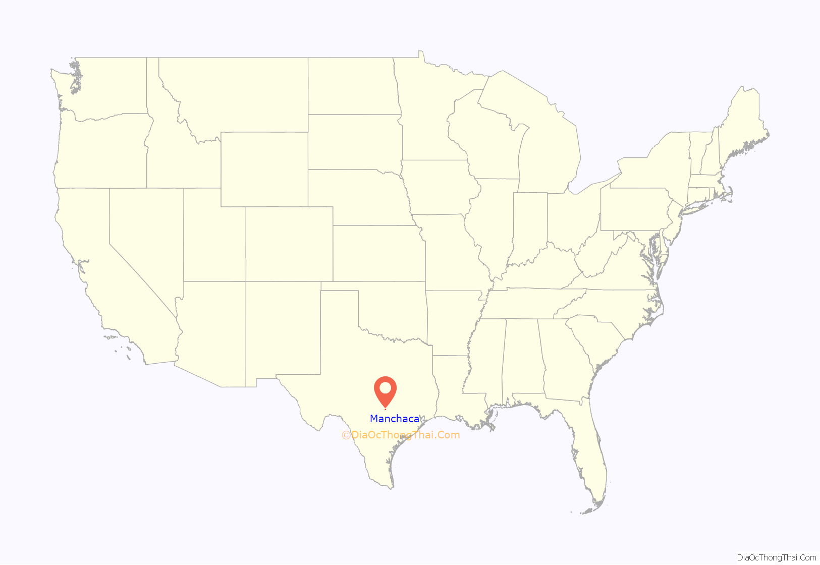
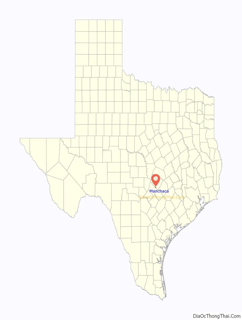
Manchaca location map. Where is Manchaca CDP?
History
Early development around Manchaca probably stemmed from the springs in the area. Manchaca Springs are a stopping place along a portion of the Old San Antonio Road and later the Chisholm Trail.
Over time there has been much conjecture as to the origin of the name “Manchaca”. One school holds that “Manchaca” is derived from the Choctaw word imashaka, meaning “behind it” or “to the rear.” There are two areas in Louisiana that carry that name: Manchac Pass and Bayou Manchac. However, another theory holds that Manchaca Springs was named for Tejano army officer José Antonio Menchaca. The current pronunciation of the name ‘Manchaca’ stems from simple Anglicization.
The springs are referred to as “Manshack Springs” in a collection of memoirs written by an early Anglo settler describing life in 1840s Texas, Recollections of Early Texas: Memoirs of John Holland Jenkins. Thomas Falconer, an English explorer who passed through the area in 1841 referred to the springs as “Manjack’s Springs” in his manuscripts. Early maps and newspaper articles indicate the spelling was “Manchac Springs,” orthography corroborated by maps produced by noted Tejano land agent Jacob de Cordova in 1849 currently housed at the Texas General Land Office in Downtown Austin.
An early owner of Manchaca Springs was Washington D. Miller, a South Carolina native who went on to serve as a Republic of Texas congressman, private secretary to Sam Houston and after Texas joined the Union, Secretary of State of Texas. The first post office to serve the area was the Manchac House post office that opened two miles south of the present-day location of Manchaca in 1851. The office closed the following year. Also in 1852, Miller negotiated the sale of the springs to Virginia native Adolphus Weir who ran a stagecoach stop on the property. Descendants of the Weir family retained land in the area until well into the 20th century.
A second post office, located at the present-day site of Manchaca, operated from June 1874 to May 1875. Afterwards area residents received mail in the unincorporated community of Onion Creek. The area began to grow when the International-Great Northern Railroad opened in 1880; a third post office, called Manchaca, opened. By 1884 the 75-resident community was a shipping point for cotton, grain, lumber, and posts. In the 1890s a Methodist church, hotel, and a school had opened. The common school district serving Manchaca, had three grade schools noted on a 1932 Travis County Engineering Department map housed at the Perry–Castañeda Library at the University of Texas; one for White students located on what is today the northeast corner of FM 1626 and Manchaca Road, one grade school for African American students located at what is today 753 FM 1626, and one grade school for Mexican American students located just off Polk Road near the railroad tracks. These schools became the focus of the community. The district joined forces with the Oak Hill district to form a new high school district in 1961. AISD annexed the entire high school district in 1967.
By January 1903, Manchaca’s population reached 100 and was home to four businesses: The Blackwell General Store, A. G. Matthews as Blacksmith, R. E. Summerrow General Store, and the Summerrow & Carpenter Cotton Gin. The community had 200 people by the 1960s. In the 1970s the number of residents decreased to 36. Local development increased by the mid-1980s, and accelerated through the early 2000s.
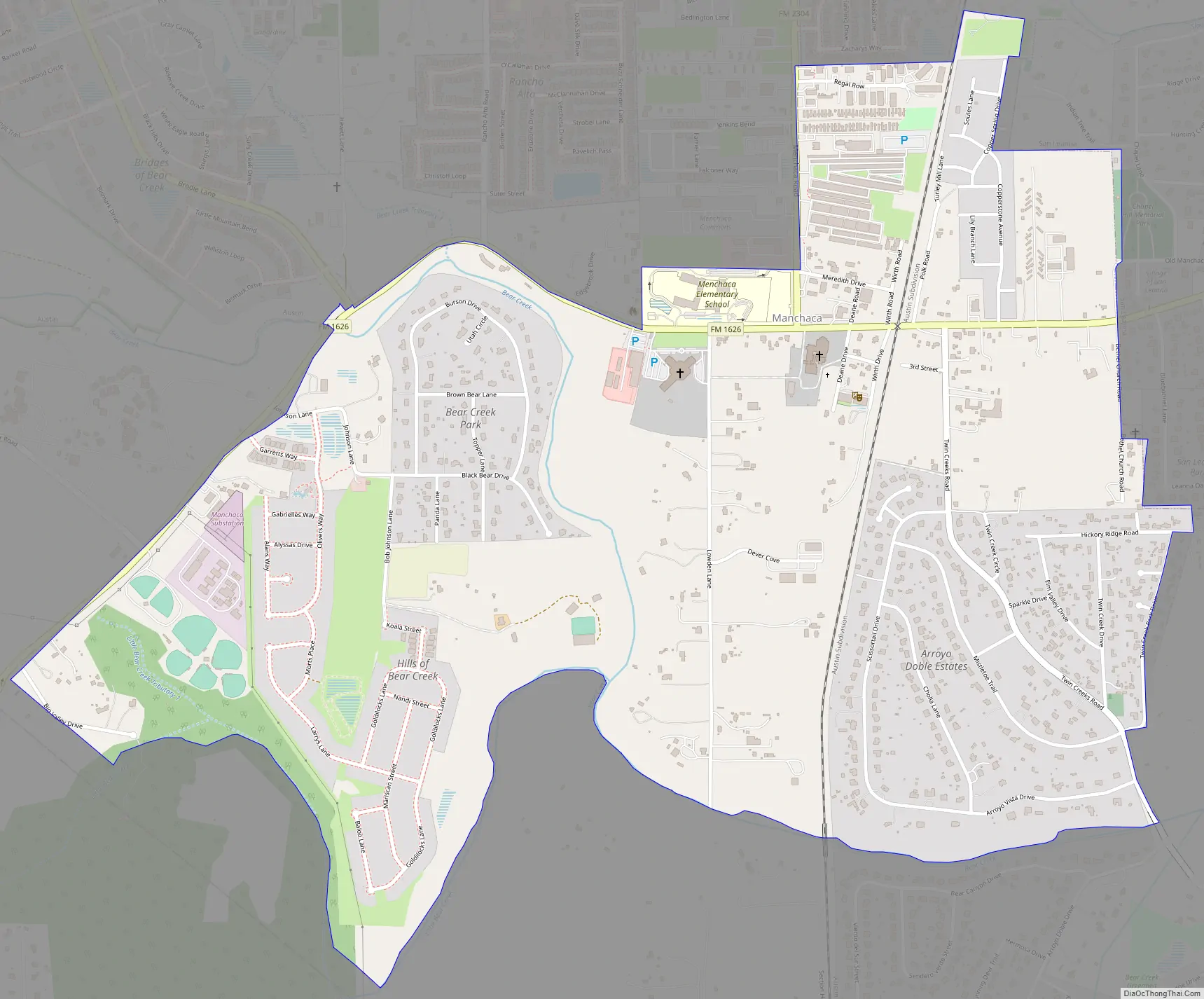
Manchaca Road Map
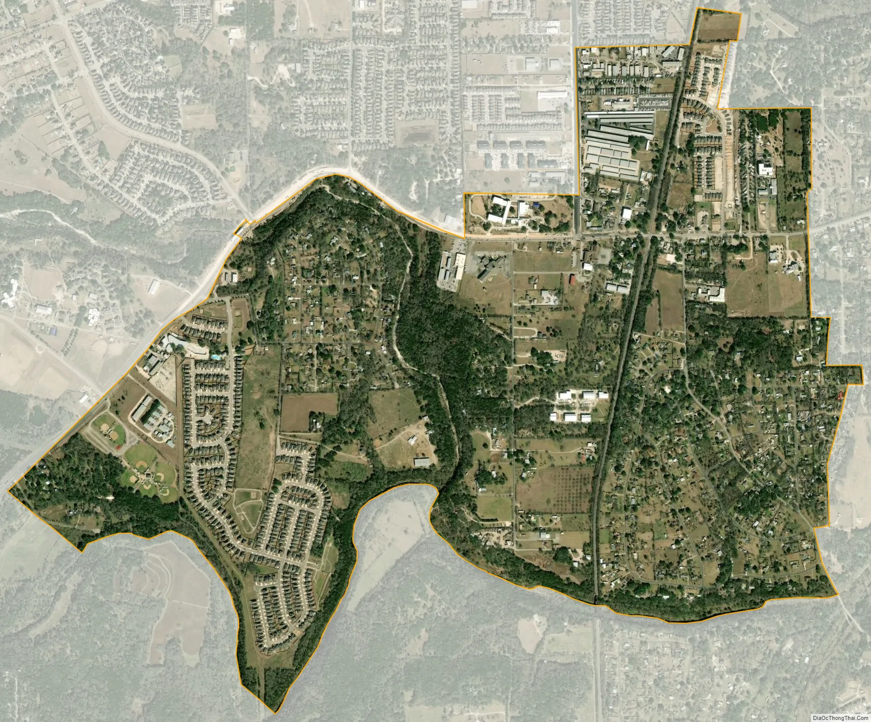
Manchaca city Satellite Map
Geography
Manchaca is located at 30°8′7″N 97°50′11″W / 30.13528°N 97.83639°W / 30.13528; -97.83639 (30.135304, -97.836263). The CDP has a total area of 1.9 square miles (4.9 km), all land.
See also
Map of Texas State and its subdivision:- Anderson
- Andrews
- Angelina
- Aransas
- Archer
- Armstrong
- Atascosa
- Austin
- Bailey
- Bandera
- Bastrop
- Baylor
- Bee
- Bell
- Bexar
- Blanco
- Borden
- Bosque
- Bowie
- Brazoria
- Brazos
- Brewster
- Briscoe
- Brooks
- Brown
- Burleson
- Burnet
- Caldwell
- Calhoun
- Callahan
- Cameron
- Camp
- Carson
- Cass
- Castro
- Chambers
- Cherokee
- Childress
- Clay
- Cochran
- Coke
- Coleman
- Collin
- Collingsworth
- Colorado
- Comal
- Comanche
- Concho
- Cooke
- Coryell
- Cottle
- Crane
- Crockett
- Crosby
- Culberson
- Dallam
- Dallas
- Dawson
- Deaf Smith
- Delta
- Denton
- Dewitt
- Dickens
- Dimmit
- Donley
- Duval
- Eastland
- Ector
- Edwards
- El Paso
- Ellis
- Erath
- Falls
- Fannin
- Fayette
- Fisher
- Floyd
- Foard
- Fort Bend
- Franklin
- Freestone
- Frio
- Gaines
- Galveston
- Garza
- Gillespie
- Glasscock
- Goliad
- Gonzales
- Gray
- Grayson
- Gregg
- Grimes
- Guadalupe
- Hale
- Hall
- Hamilton
- Hansford
- Hardeman
- Hardin
- Harris
- Harrison
- Hartley
- Haskell
- Hays
- Hemphill
- Henderson
- Hidalgo
- Hill
- Hockley
- Hood
- Hopkins
- Houston
- Howard
- Hudspeth
- Hunt
- Hutchinson
- Irion
- Jack
- Jackson
- Jasper
- Jeff Davis
- Jefferson
- Jim Hogg
- Jim Wells
- Johnson
- Jones
- Karnes
- Kaufman
- Kendall
- Kenedy
- Kent
- Kerr
- Kimble
- King
- Kinney
- Kleberg
- Knox
- La Salle
- Lamar
- Lamb
- Lampasas
- Lavaca
- Lee
- Leon
- Liberty
- Limestone
- Lipscomb
- Live Oak
- Llano
- Loving
- Lubbock
- Lynn
- Madison
- Marion
- Martin
- Mason
- Matagorda
- Maverick
- McCulloch
- McLennan
- McMullen
- Medina
- Menard
- Midland
- Milam
- Mills
- Mitchell
- Montague
- Montgomery
- Moore
- Morris
- Motley
- Nacogdoches
- Navarro
- Newton
- Nolan
- Nueces
- Ochiltree
- Oldham
- Orange
- Palo Pinto
- Panola
- Parker
- Parmer
- Pecos
- Polk
- Potter
- Presidio
- Rains
- Randall
- Reagan
- Real
- Red River
- Reeves
- Refugio
- Roberts
- Robertson
- Rockwall
- Runnels
- Rusk
- Sabine
- San Augustine
- San Jacinto
- San Patricio
- San Saba
- Schleicher
- Scurry
- Shackelford
- Shelby
- Sherman
- Smith
- Somervell
- Starr
- Stephens
- Sterling
- Stonewall
- Sutton
- Swisher
- Tarrant
- Taylor
- Terrell
- Terry
- Throckmorton
- Titus
- Tom Green
- Travis
- Trinity
- Tyler
- Upshur
- Upton
- Uvalde
- Val Verde
- Van Zandt
- Victoria
- Walker
- Waller
- Ward
- Washington
- Webb
- Wharton
- Wheeler
- Wichita
- Wilbarger
- Willacy
- Williamson
- Wilson
- Winkler
- Wise
- Wood
- Yoakum
- Young
- Zapata
- Zavala
- Alabama
- Alaska
- Arizona
- Arkansas
- California
- Colorado
- Connecticut
- Delaware
- District of Columbia
- Florida
- Georgia
- Hawaii
- Idaho
- Illinois
- Indiana
- Iowa
- Kansas
- Kentucky
- Louisiana
- Maine
- Maryland
- Massachusetts
- Michigan
- Minnesota
- Mississippi
- Missouri
- Montana
- Nebraska
- Nevada
- New Hampshire
- New Jersey
- New Mexico
- New York
- North Carolina
- North Dakota
- Ohio
- Oklahoma
- Oregon
- Pennsylvania
- Rhode Island
- South Carolina
- South Dakota
- Tennessee
- Texas
- Utah
- Vermont
- Virginia
- Washington
- West Virginia
- Wisconsin
- Wyoming