Manor (/ˈmeɪnər/ MAY-nər) is a city in Travis County, Texas, United States. Manor is located 12 miles northeast of Austin and is part of the Austin-Round Rock metropolitan area. The population was 13,652 at the 2020 census. Manor is one of the faster-growing suburbs of Austin. The city was the 7th fastest growing suburb in America in 2018 by Realtor.com and the 17th best small suburb to live in by U.S. News and World Report in 2019.
| Name: | Manor city |
|---|---|
| LSAD Code: | 25 |
| LSAD Description: | city (suffix) |
| State: | Texas |
| County: | Travis County |
| Founded: | 1872 |
| Incorporated: | 1913 |
| Elevation: | 531 ft (162 m) |
| Total Area: | 9.83 sq mi (25.45 km²) |
| Land Area: | 9.80 sq mi (25.39 km²) |
| Water Area: | 0.02 sq mi (0.06 km²) |
| Total Population: | 13,652 |
| Population Density: | 1,393.06/sq mi (537.86/km²) |
| ZIP code: | 78653 |
| Area code: | 512 and 737 |
| FIPS code: | 4846440 |
| GNISfeature ID: | 1340895 |
| Website: | cityofmanor.org |
Online Interactive Map
Click on ![]() to view map in "full screen" mode.
to view map in "full screen" mode.
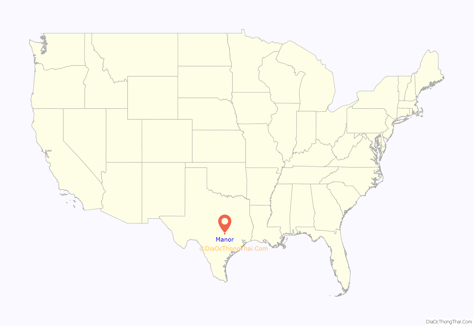
Manor location map. Where is Manor city?
History
Manor was named for James B. Manor who settled on Gilleland Creek west of present-day downtown Manor.
A school for boys began operation northwest of the present Manor High School complex in 1854 and was followed in 1858 by a school for girls near the present Manor Elementary School. A post office was reestablished in the Manor home in 1859 under the name of Grassdale with James Manor serving as Post Master. A mercantile store was built in 1868 the present cemetery and was followed by a second store in 1869.
In late 1871 as the Houston and Texas Central Railway constructed the first railroad link to the Texas capital James Manor made a donation of right-of-way which brought the line through what is now the town. The inaugural train arrived in Austin on Christmas Day 1871. The following year the community of Manor was laid out and named. It was incorporated as a town in March 1913 and converted to a general law city in 1921 with expectations of continued growth. Following two devastating fires that destroyed most of the business district, coupled with the decline of cotton production after the arrival of the boll weevil, Manor remained a small city throughout most of the twentieth century.
In 2013 Rita Johnse was elected mayor as the first female Hispanic. In 2019 Dr. Larry Wallace Jr. was elected as the first African-American mayor.
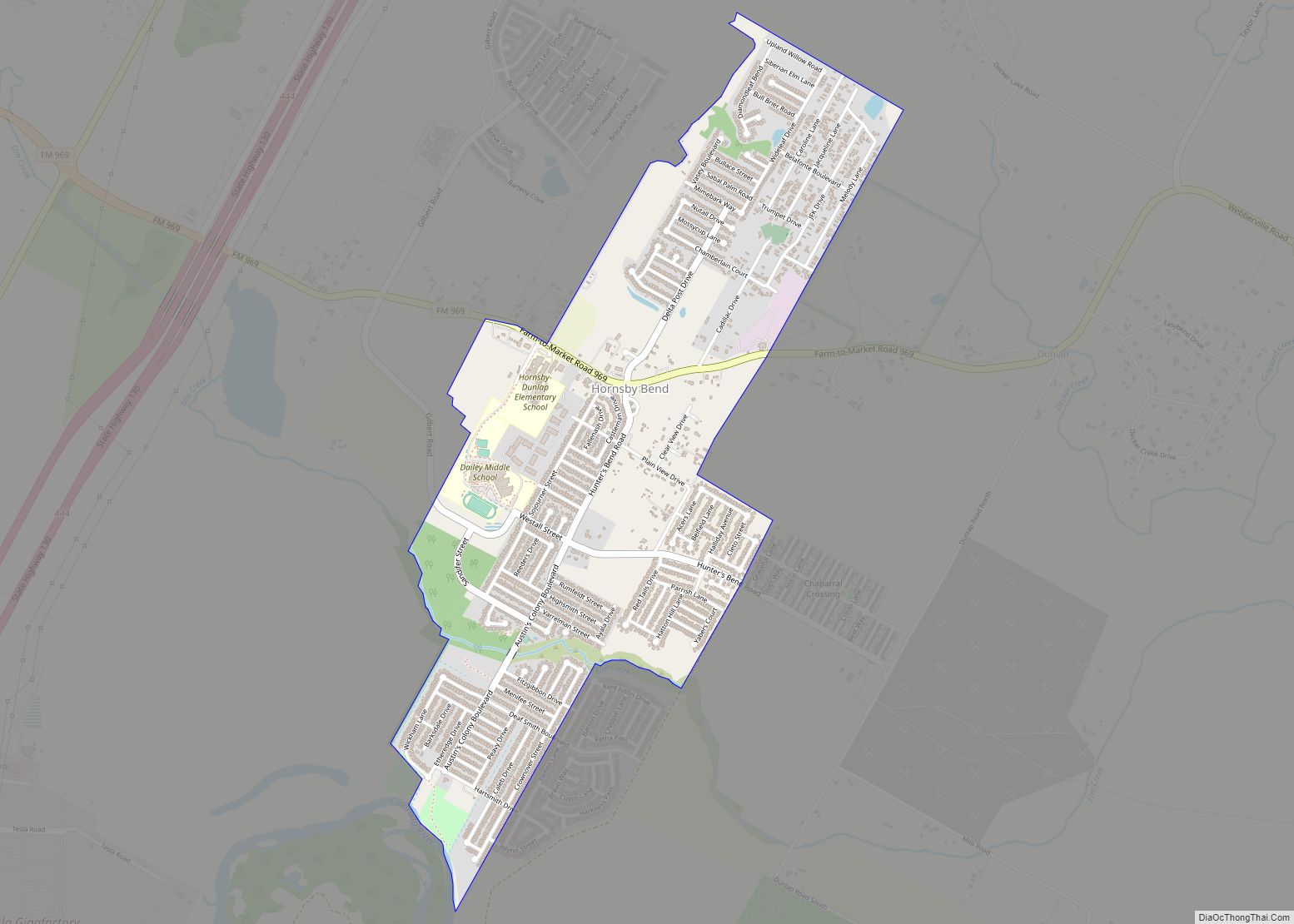
Manor Road Map
Manor city Satellite Map
Geography
Manor is located along US Hwy. 290 at 30°20′35″N 97°33′24″W / 30.343071°N 97.556710°W / 30.343071; -97.556710 (30.343071, –97.556710), 12 miles (19 km) east of downtown Austin. According to the United States Census Bureau, the city has a total area of 7.35 square miles (18.48 km), all of it land.
See also
Map of Texas State and its subdivision:- Anderson
- Andrews
- Angelina
- Aransas
- Archer
- Armstrong
- Atascosa
- Austin
- Bailey
- Bandera
- Bastrop
- Baylor
- Bee
- Bell
- Bexar
- Blanco
- Borden
- Bosque
- Bowie
- Brazoria
- Brazos
- Brewster
- Briscoe
- Brooks
- Brown
- Burleson
- Burnet
- Caldwell
- Calhoun
- Callahan
- Cameron
- Camp
- Carson
- Cass
- Castro
- Chambers
- Cherokee
- Childress
- Clay
- Cochran
- Coke
- Coleman
- Collin
- Collingsworth
- Colorado
- Comal
- Comanche
- Concho
- Cooke
- Coryell
- Cottle
- Crane
- Crockett
- Crosby
- Culberson
- Dallam
- Dallas
- Dawson
- Deaf Smith
- Delta
- Denton
- Dewitt
- Dickens
- Dimmit
- Donley
- Duval
- Eastland
- Ector
- Edwards
- El Paso
- Ellis
- Erath
- Falls
- Fannin
- Fayette
- Fisher
- Floyd
- Foard
- Fort Bend
- Franklin
- Freestone
- Frio
- Gaines
- Galveston
- Garza
- Gillespie
- Glasscock
- Goliad
- Gonzales
- Gray
- Grayson
- Gregg
- Grimes
- Guadalupe
- Hale
- Hall
- Hamilton
- Hansford
- Hardeman
- Hardin
- Harris
- Harrison
- Hartley
- Haskell
- Hays
- Hemphill
- Henderson
- Hidalgo
- Hill
- Hockley
- Hood
- Hopkins
- Houston
- Howard
- Hudspeth
- Hunt
- Hutchinson
- Irion
- Jack
- Jackson
- Jasper
- Jeff Davis
- Jefferson
- Jim Hogg
- Jim Wells
- Johnson
- Jones
- Karnes
- Kaufman
- Kendall
- Kenedy
- Kent
- Kerr
- Kimble
- King
- Kinney
- Kleberg
- Knox
- La Salle
- Lamar
- Lamb
- Lampasas
- Lavaca
- Lee
- Leon
- Liberty
- Limestone
- Lipscomb
- Live Oak
- Llano
- Loving
- Lubbock
- Lynn
- Madison
- Marion
- Martin
- Mason
- Matagorda
- Maverick
- McCulloch
- McLennan
- McMullen
- Medina
- Menard
- Midland
- Milam
- Mills
- Mitchell
- Montague
- Montgomery
- Moore
- Morris
- Motley
- Nacogdoches
- Navarro
- Newton
- Nolan
- Nueces
- Ochiltree
- Oldham
- Orange
- Palo Pinto
- Panola
- Parker
- Parmer
- Pecos
- Polk
- Potter
- Presidio
- Rains
- Randall
- Reagan
- Real
- Red River
- Reeves
- Refugio
- Roberts
- Robertson
- Rockwall
- Runnels
- Rusk
- Sabine
- San Augustine
- San Jacinto
- San Patricio
- San Saba
- Schleicher
- Scurry
- Shackelford
- Shelby
- Sherman
- Smith
- Somervell
- Starr
- Stephens
- Sterling
- Stonewall
- Sutton
- Swisher
- Tarrant
- Taylor
- Terrell
- Terry
- Throckmorton
- Titus
- Tom Green
- Travis
- Trinity
- Tyler
- Upshur
- Upton
- Uvalde
- Val Verde
- Van Zandt
- Victoria
- Walker
- Waller
- Ward
- Washington
- Webb
- Wharton
- Wheeler
- Wichita
- Wilbarger
- Willacy
- Williamson
- Wilson
- Winkler
- Wise
- Wood
- Yoakum
- Young
- Zapata
- Zavala
- Alabama
- Alaska
- Arizona
- Arkansas
- California
- Colorado
- Connecticut
- Delaware
- District of Columbia
- Florida
- Georgia
- Hawaii
- Idaho
- Illinois
- Indiana
- Iowa
- Kansas
- Kentucky
- Louisiana
- Maine
- Maryland
- Massachusetts
- Michigan
- Minnesota
- Mississippi
- Missouri
- Montana
- Nebraska
- Nevada
- New Hampshire
- New Jersey
- New Mexico
- New York
- North Carolina
- North Dakota
- Ohio
- Oklahoma
- Oregon
- Pennsylvania
- Rhode Island
- South Carolina
- South Dakota
- Tennessee
- Texas
- Utah
- Vermont
- Virginia
- Washington
- West Virginia
- Wisconsin
- Wyoming
