Prosper is a town in Collin and Denton counties in the U.S. state of Texas. Prosper is located within the Dallas-Fort Worth-Arlington metropolitan area. As of the 2010 census, its population was 9,423; as of 2020, its population was 30,174.
| Name: | Prosper town |
|---|---|
| LSAD Code: | 43 |
| LSAD Description: | town (suffix) |
| State: | Texas |
| County: | Collin County, Denton County |
| Elevation: | 682 ft (208 m) |
| Total Area: | 25.45 sq mi (65.92 km²) |
| Land Area: | 25.23 sq mi (65.34 km²) |
| Water Area: | 0.22 sq mi (0.58 km²) |
| Total Population: | 30,174 |
| Population Density: | 974.31/sq mi (376.18/km²) |
| ZIP code: | 75078 |
| Area code: | 214, 469, 945, 972 |
| FIPS code: | 4859696 |
| GNISfeature ID: | 1344593 |
| Website: | www.prospertx.gov |
Online Interactive Map
Click on ![]() to view map in "full screen" mode.
to view map in "full screen" mode.
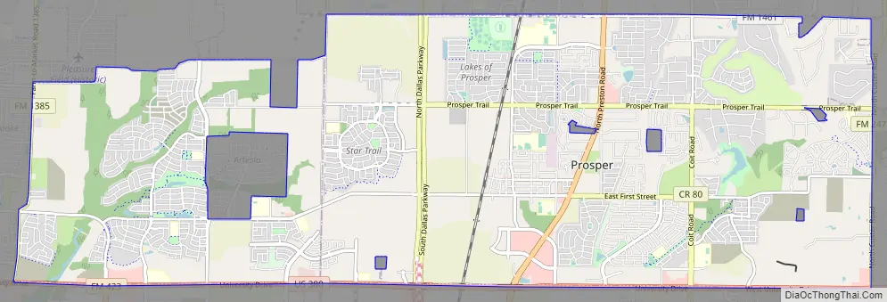
Prosper location map. Where is Prosper town?
History
The first settlers arrived in 1846 to farm cotton in the black fertile prairie soil. Between 1850 and 1902, two settlements existed – Rock Hill was two miles south of the present town and Richland was one mile north. The development of these small communities was expedited in 1876 when county courts ordered small tracts of land to be established for a quick sale. These tracts, each about 160 acres in size, were sold for $3.50 per acre. Dr. A. T. Bryant of McKinney purchased what later became the center of the present town.
The towns merged during the establishment of St. Louis & San Francisco Railroad in March 1902. For years, Prosper was the central stop for the railroad between Dallas and Sherman. When community officials applied for a post office with the name “Richland”, they were informed that the city name was already taken. Postmaster B.J. Naugle asked for an alternative name, and J.C. Slaughter suggested the name “Prosper” because crops that year had been very prosperous.
Prosper was incorporated in 1914 with a commission form of government and a population of 500. Uncas Norvell Clary was mayor and served in that position for the next 49 years. Prosper became a growing area with many new homes and communities being developed. The Prosper Community of Windsong Ranch features a man-made crystalline lagoon.
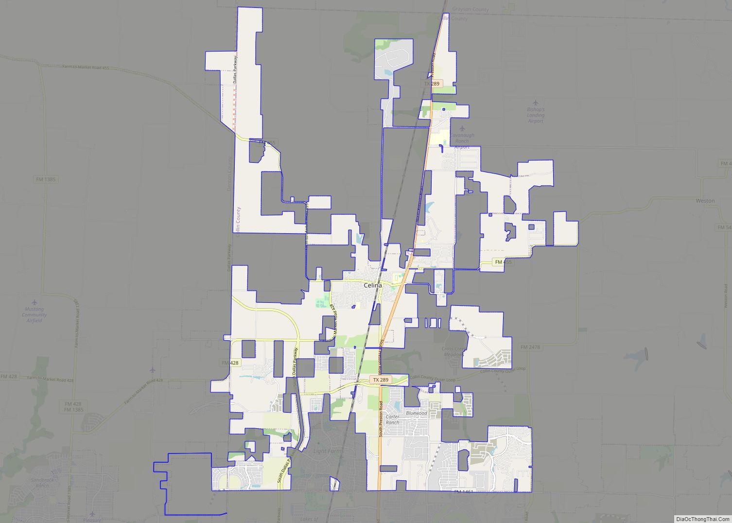
Prosper Road Map
Prosper city Satellite Map
Geography
Prosper is located in western Collin County and eastern Denton County at 33°14′18″N 96°47′27″W / 33.238295°N 96.790850°W / 33.238295; -96.790850. According to the United States Census Bureau, the town has a total area of 22.8 sq mi (59.1 km), of which 0.23 sq mi (0.6 km), or 1.09%, is covered by water.
See also
Map of Texas State and its subdivision:- Anderson
- Andrews
- Angelina
- Aransas
- Archer
- Armstrong
- Atascosa
- Austin
- Bailey
- Bandera
- Bastrop
- Baylor
- Bee
- Bell
- Bexar
- Blanco
- Borden
- Bosque
- Bowie
- Brazoria
- Brazos
- Brewster
- Briscoe
- Brooks
- Brown
- Burleson
- Burnet
- Caldwell
- Calhoun
- Callahan
- Cameron
- Camp
- Carson
- Cass
- Castro
- Chambers
- Cherokee
- Childress
- Clay
- Cochran
- Coke
- Coleman
- Collin
- Collingsworth
- Colorado
- Comal
- Comanche
- Concho
- Cooke
- Coryell
- Cottle
- Crane
- Crockett
- Crosby
- Culberson
- Dallam
- Dallas
- Dawson
- Deaf Smith
- Delta
- Denton
- Dewitt
- Dickens
- Dimmit
- Donley
- Duval
- Eastland
- Ector
- Edwards
- El Paso
- Ellis
- Erath
- Falls
- Fannin
- Fayette
- Fisher
- Floyd
- Foard
- Fort Bend
- Franklin
- Freestone
- Frio
- Gaines
- Galveston
- Garza
- Gillespie
- Glasscock
- Goliad
- Gonzales
- Gray
- Grayson
- Gregg
- Grimes
- Guadalupe
- Hale
- Hall
- Hamilton
- Hansford
- Hardeman
- Hardin
- Harris
- Harrison
- Hartley
- Haskell
- Hays
- Hemphill
- Henderson
- Hidalgo
- Hill
- Hockley
- Hood
- Hopkins
- Houston
- Howard
- Hudspeth
- Hunt
- Hutchinson
- Irion
- Jack
- Jackson
- Jasper
- Jeff Davis
- Jefferson
- Jim Hogg
- Jim Wells
- Johnson
- Jones
- Karnes
- Kaufman
- Kendall
- Kenedy
- Kent
- Kerr
- Kimble
- King
- Kinney
- Kleberg
- Knox
- La Salle
- Lamar
- Lamb
- Lampasas
- Lavaca
- Lee
- Leon
- Liberty
- Limestone
- Lipscomb
- Live Oak
- Llano
- Loving
- Lubbock
- Lynn
- Madison
- Marion
- Martin
- Mason
- Matagorda
- Maverick
- McCulloch
- McLennan
- McMullen
- Medina
- Menard
- Midland
- Milam
- Mills
- Mitchell
- Montague
- Montgomery
- Moore
- Morris
- Motley
- Nacogdoches
- Navarro
- Newton
- Nolan
- Nueces
- Ochiltree
- Oldham
- Orange
- Palo Pinto
- Panola
- Parker
- Parmer
- Pecos
- Polk
- Potter
- Presidio
- Rains
- Randall
- Reagan
- Real
- Red River
- Reeves
- Refugio
- Roberts
- Robertson
- Rockwall
- Runnels
- Rusk
- Sabine
- San Augustine
- San Jacinto
- San Patricio
- San Saba
- Schleicher
- Scurry
- Shackelford
- Shelby
- Sherman
- Smith
- Somervell
- Starr
- Stephens
- Sterling
- Stonewall
- Sutton
- Swisher
- Tarrant
- Taylor
- Terrell
- Terry
- Throckmorton
- Titus
- Tom Green
- Travis
- Trinity
- Tyler
- Upshur
- Upton
- Uvalde
- Val Verde
- Van Zandt
- Victoria
- Walker
- Waller
- Ward
- Washington
- Webb
- Wharton
- Wheeler
- Wichita
- Wilbarger
- Willacy
- Williamson
- Wilson
- Winkler
- Wise
- Wood
- Yoakum
- Young
- Zapata
- Zavala
- Alabama
- Alaska
- Arizona
- Arkansas
- California
- Colorado
- Connecticut
- Delaware
- District of Columbia
- Florida
- Georgia
- Hawaii
- Idaho
- Illinois
- Indiana
- Iowa
- Kansas
- Kentucky
- Louisiana
- Maine
- Maryland
- Massachusetts
- Michigan
- Minnesota
- Mississippi
- Missouri
- Montana
- Nebraska
- Nevada
- New Hampshire
- New Jersey
- New Mexico
- New York
- North Carolina
- North Dakota
- Ohio
- Oklahoma
- Oregon
- Pennsylvania
- Rhode Island
- South Carolina
- South Dakota
- Tennessee
- Texas
- Utah
- Vermont
- Virginia
- Washington
- West Virginia
- Wisconsin
- Wyoming


