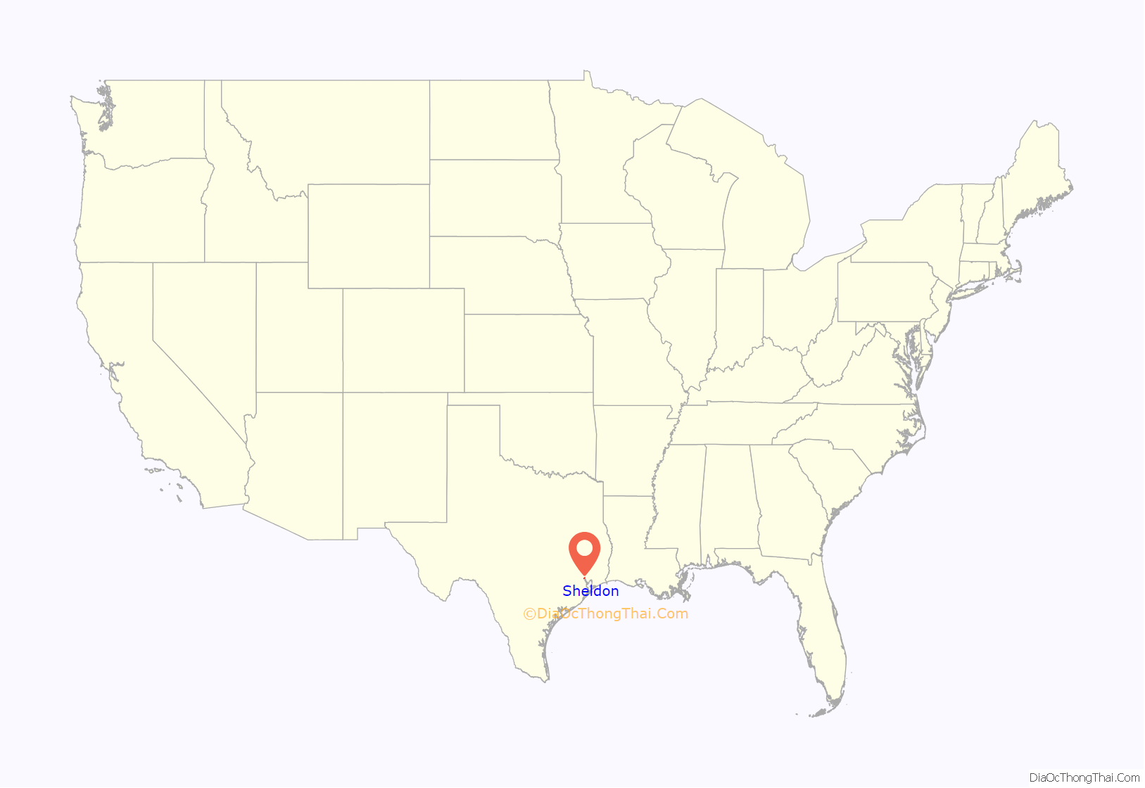
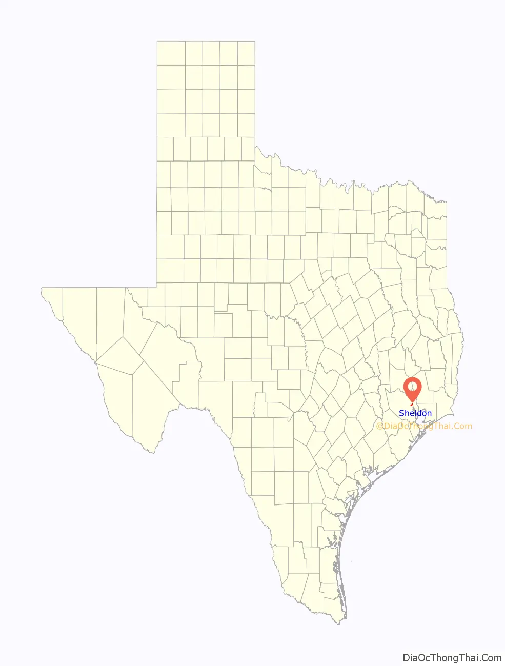
Sheldon is an unincorporated community and a census-designated place (CDP) in northeastern Harris County, Texas, United States located completely inside the extraterritorial jurisdiction of the City of Houston. The Sheldon area is located along Beltway 8 and US Highway 90 approximately twelve miles (19 km) northeast of Downtown Houston.
Since the 1950s, the population growth of Sheldon has grown to extend past the statistical census-designated place (CDP) boundary originally delineated by the United States Census Bureau. The local understanding of the area is that it corresponds to that of boundary of the Sheldon Independent School District.
Residential and commercial development in Sheldon has increased since the 2000s, gradually transforming the once rural area into one of the Houston area’s fast growing suburban communities by percentage.
The population for the area within the CDP was 2,361 at the 2020 census. Zip codes that correspond to the Sheldon area include 77049 and 77044.
| Name: | Sheldon CDP |
|---|---|
| LSAD Code: | 57 |
| LSAD Description: | CDP (suffix) |
| State: | Texas |
| County: | Harris County |
| Elevation: | 46 ft (14 m) |
| Total Area: | 2.6 sq mi (6.7 km²) |
| Land Area: | 2.6 sq mi (6.7 km²) |
| Water Area: | 0.0 sq mi (0.0 km²) |
| Total Population: | 2,361 |
| Population Density: | 910/sq mi (350/km²) |
| ZIP code: | 77044, 77049 |
| Area code: | 281, 713, 832, 346 |
| FIPS code: | 4867376 |
| GNISfeature ID: | 1380920 |
Online Interactive Map
Click on ![]() to view map in "full screen" mode.
to view map in "full screen" mode.
Sheldon location map. Where is Sheldon CDP?
History
Sheldon opened in the 1850s and served as a retail marketing point for agricultural goods and lumber from an area on the San Jacinto River. Its name originated from Henry K. Sheldon, who was a stockholder in a railroad company. In 1887 a post office opened. In 1896 Sheldon had 50 residents and a general store and a grocer. In 1905 it had a school. In the 1940s it had 150 residents and ten businesses. In the 1950s Sheldon had 200 residents. In 1955 the post office closed. In 1980 Sheldon had 1,665 residents. In 1990 it had 1,653 residents. In 2000 it had 1,831 residents.
In a 10-year period before 2011, the population increased by 46%.
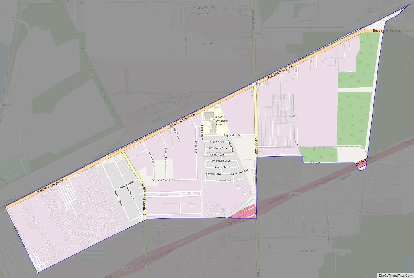
Sheldon Road Map
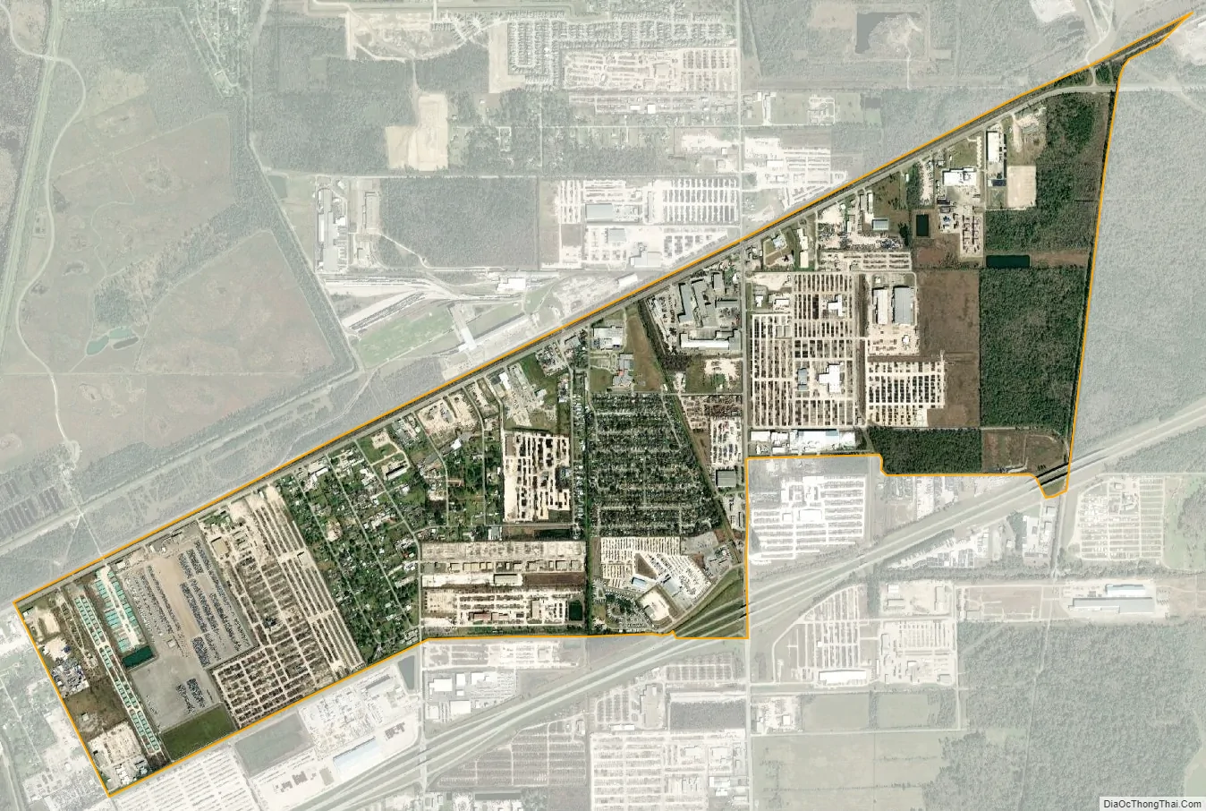
Sheldon city Satellite Map
Geography
Sheldon is located at 29°51′38″N 95°8′2″W / 29.86056°N 95.13389°W / 29.86056; -95.13389 (29.860569, -95.133801) in northeastern Harris County.
The area is within the watersheds of Greens Bayou, Carpenters Bayou, and San Jacinto River. The boundary is unofficially known as corresponding to that of Sheldon Independent School District which is geographically bound by Greens Bayou on the west and the San Jacinto River on the east. The northern border is the southern shore of Lake Houston and the south boundary runs about a mile south of the Crosby Freeway (US Hwy 90).
Sheldon has a mostly wooded geographic profile with some grassy prairies. The area is also home to Sheldon Lake State Park and Environmental Learning Center which has a variety of land and water fauna.
The majority of Sheldon falls under the jurisdiction of Harris County Commissioner Precinct 1 with a small portion in Precinct 2.
Major arteries in the area include Beltway 8 and US Highway 90.
See also
Map of Texas State and its subdivision:- Anderson
- Andrews
- Angelina
- Aransas
- Archer
- Armstrong
- Atascosa
- Austin
- Bailey
- Bandera
- Bastrop
- Baylor
- Bee
- Bell
- Bexar
- Blanco
- Borden
- Bosque
- Bowie
- Brazoria
- Brazos
- Brewster
- Briscoe
- Brooks
- Brown
- Burleson
- Burnet
- Caldwell
- Calhoun
- Callahan
- Cameron
- Camp
- Carson
- Cass
- Castro
- Chambers
- Cherokee
- Childress
- Clay
- Cochran
- Coke
- Coleman
- Collin
- Collingsworth
- Colorado
- Comal
- Comanche
- Concho
- Cooke
- Coryell
- Cottle
- Crane
- Crockett
- Crosby
- Culberson
- Dallam
- Dallas
- Dawson
- Deaf Smith
- Delta
- Denton
- Dewitt
- Dickens
- Dimmit
- Donley
- Duval
- Eastland
- Ector
- Edwards
- El Paso
- Ellis
- Erath
- Falls
- Fannin
- Fayette
- Fisher
- Floyd
- Foard
- Fort Bend
- Franklin
- Freestone
- Frio
- Gaines
- Galveston
- Garza
- Gillespie
- Glasscock
- Goliad
- Gonzales
- Gray
- Grayson
- Gregg
- Grimes
- Guadalupe
- Hale
- Hall
- Hamilton
- Hansford
- Hardeman
- Hardin
- Harris
- Harrison
- Hartley
- Haskell
- Hays
- Hemphill
- Henderson
- Hidalgo
- Hill
- Hockley
- Hood
- Hopkins
- Houston
- Howard
- Hudspeth
- Hunt
- Hutchinson
- Irion
- Jack
- Jackson
- Jasper
- Jeff Davis
- Jefferson
- Jim Hogg
- Jim Wells
- Johnson
- Jones
- Karnes
- Kaufman
- Kendall
- Kenedy
- Kent
- Kerr
- Kimble
- King
- Kinney
- Kleberg
- Knox
- La Salle
- Lamar
- Lamb
- Lampasas
- Lavaca
- Lee
- Leon
- Liberty
- Limestone
- Lipscomb
- Live Oak
- Llano
- Loving
- Lubbock
- Lynn
- Madison
- Marion
- Martin
- Mason
- Matagorda
- Maverick
- McCulloch
- McLennan
- McMullen
- Medina
- Menard
- Midland
- Milam
- Mills
- Mitchell
- Montague
- Montgomery
- Moore
- Morris
- Motley
- Nacogdoches
- Navarro
- Newton
- Nolan
- Nueces
- Ochiltree
- Oldham
- Orange
- Palo Pinto
- Panola
- Parker
- Parmer
- Pecos
- Polk
- Potter
- Presidio
- Rains
- Randall
- Reagan
- Real
- Red River
- Reeves
- Refugio
- Roberts
- Robertson
- Rockwall
- Runnels
- Rusk
- Sabine
- San Augustine
- San Jacinto
- San Patricio
- San Saba
- Schleicher
- Scurry
- Shackelford
- Shelby
- Sherman
- Smith
- Somervell
- Starr
- Stephens
- Sterling
- Stonewall
- Sutton
- Swisher
- Tarrant
- Taylor
- Terrell
- Terry
- Throckmorton
- Titus
- Tom Green
- Travis
- Trinity
- Tyler
- Upshur
- Upton
- Uvalde
- Val Verde
- Van Zandt
- Victoria
- Walker
- Waller
- Ward
- Washington
- Webb
- Wharton
- Wheeler
- Wichita
- Wilbarger
- Willacy
- Williamson
- Wilson
- Winkler
- Wise
- Wood
- Yoakum
- Young
- Zapata
- Zavala
- Alabama
- Alaska
- Arizona
- Arkansas
- California
- Colorado
- Connecticut
- Delaware
- District of Columbia
- Florida
- Georgia
- Hawaii
- Idaho
- Illinois
- Indiana
- Iowa
- Kansas
- Kentucky
- Louisiana
- Maine
- Maryland
- Massachusetts
- Michigan
- Minnesota
- Mississippi
- Missouri
- Montana
- Nebraska
- Nevada
- New Hampshire
- New Jersey
- New Mexico
- New York
- North Carolina
- North Dakota
- Ohio
- Oklahoma
- Oregon
- Pennsylvania
- Rhode Island
- South Carolina
- South Dakota
- Tennessee
- Texas
- Utah
- Vermont
- Virginia
- Washington
- West Virginia
- Wisconsin
- Wyoming


