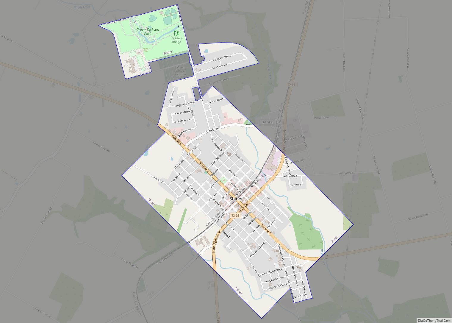
Shiner is a city in Lavaca County, Texas, United States. The town was named after Henry B. Shiner, who donated 250 acres (1.0 km) for a railroad right-of-way. As of the 2020 census, the city had a population of 2,127. Shiner was founded by German and Czech emigrants.
| Name: | Shiner city |
|---|---|
| LSAD Code: | 25 |
| LSAD Description: | city (suffix) |
| State: | Texas |
| County: | Lavaca County |
| Elevation: | 358 ft (109 m) |
| Total Area: | 2.48 sq mi (6.41 km²) |
| Land Area: | 2.47 sq mi (6.39 km²) |
| Water Area: | 0.01 sq mi (0.02 km²) |
| Total Population: | 2,127 |
| Population Density: | 876.01/sq mi (338.18/km²) |
| ZIP code: | 77984 |
| Area code: | 361 |
| FIPS code: | 4867640 |
| GNISfeature ID: | 1347067 |
| Website: | ShinerTexas.gov |
Online Interactive Map
Click on ![]() to view map in "full screen" mode.
to view map in "full screen" mode.
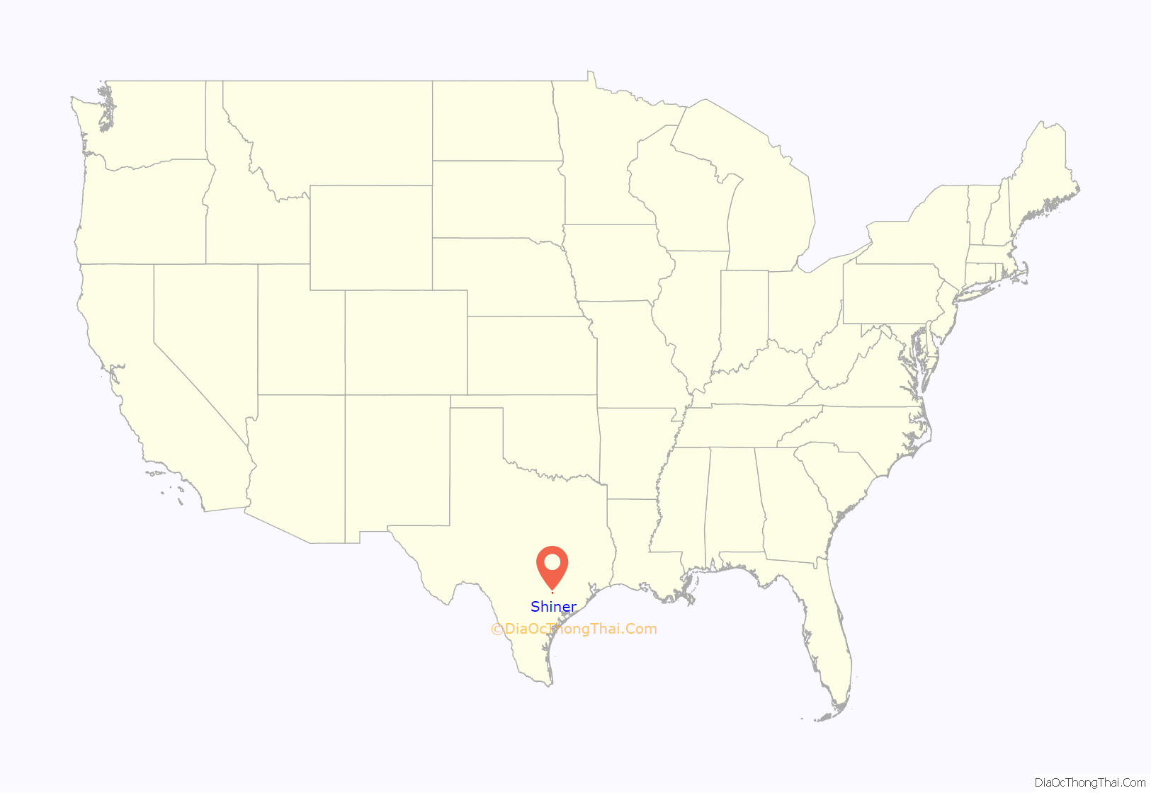
Shiner location map. Where is Shiner city?
History
In 1885, a post office called Half Moon was opened at a trading post near the present site of Shiner. In 1887, Henry B. Shiner donated 250 acres for a depot and right-of-way for the San Antonio and Aransas Pass Railway, which bypassed Half Moon and was built through Henry B. Shiner’s donated land. The town grew around these transportation facilities. The town initially called itself “New Half Moon”, but in 1888, the town’s name was changed to Shiner and the town was incorporated in 1890.
Czech and German immigrants soon became the dominant ethnic groups, and Shiner developed a cohesive Czech community that still heavily influences the town’s culture. Ranching was an important part of the town’s history.
Historically notable families of the area are the Wolters and Welhausen families, after whom the Edwin Wolters Memorial Museum and the Shiner Welhausen Park are named, respectively.
Shiner is the home of the Spoetzl Brewery, the oldest independent brewery in Texas. The brewery is most well known for producing Shiner Bock, a dark German/Czech-style beer that is now distributed in 49 states.
Shiner is also the home of the historic Kaspar Companies, one of the oldest continuously operating companies in America. Kaspar Companies is a holding company that currently consists of Ranch Hand Truck Accessories, Texas Precious Metals, and several other businesses.
Shiner Road Map
Shiner city Satellite Map
Geography
According to the United States Census Bureau, the city has a total area of 2.4 square miles (6.2 km), of which 0.41% is covered by water.
See also
Map of Texas State and its subdivision:- Anderson
- Andrews
- Angelina
- Aransas
- Archer
- Armstrong
- Atascosa
- Austin
- Bailey
- Bandera
- Bastrop
- Baylor
- Bee
- Bell
- Bexar
- Blanco
- Borden
- Bosque
- Bowie
- Brazoria
- Brazos
- Brewster
- Briscoe
- Brooks
- Brown
- Burleson
- Burnet
- Caldwell
- Calhoun
- Callahan
- Cameron
- Camp
- Carson
- Cass
- Castro
- Chambers
- Cherokee
- Childress
- Clay
- Cochran
- Coke
- Coleman
- Collin
- Collingsworth
- Colorado
- Comal
- Comanche
- Concho
- Cooke
- Coryell
- Cottle
- Crane
- Crockett
- Crosby
- Culberson
- Dallam
- Dallas
- Dawson
- Deaf Smith
- Delta
- Denton
- Dewitt
- Dickens
- Dimmit
- Donley
- Duval
- Eastland
- Ector
- Edwards
- El Paso
- Ellis
- Erath
- Falls
- Fannin
- Fayette
- Fisher
- Floyd
- Foard
- Fort Bend
- Franklin
- Freestone
- Frio
- Gaines
- Galveston
- Garza
- Gillespie
- Glasscock
- Goliad
- Gonzales
- Gray
- Grayson
- Gregg
- Grimes
- Guadalupe
- Hale
- Hall
- Hamilton
- Hansford
- Hardeman
- Hardin
- Harris
- Harrison
- Hartley
- Haskell
- Hays
- Hemphill
- Henderson
- Hidalgo
- Hill
- Hockley
- Hood
- Hopkins
- Houston
- Howard
- Hudspeth
- Hunt
- Hutchinson
- Irion
- Jack
- Jackson
- Jasper
- Jeff Davis
- Jefferson
- Jim Hogg
- Jim Wells
- Johnson
- Jones
- Karnes
- Kaufman
- Kendall
- Kenedy
- Kent
- Kerr
- Kimble
- King
- Kinney
- Kleberg
- Knox
- La Salle
- Lamar
- Lamb
- Lampasas
- Lavaca
- Lee
- Leon
- Liberty
- Limestone
- Lipscomb
- Live Oak
- Llano
- Loving
- Lubbock
- Lynn
- Madison
- Marion
- Martin
- Mason
- Matagorda
- Maverick
- McCulloch
- McLennan
- McMullen
- Medina
- Menard
- Midland
- Milam
- Mills
- Mitchell
- Montague
- Montgomery
- Moore
- Morris
- Motley
- Nacogdoches
- Navarro
- Newton
- Nolan
- Nueces
- Ochiltree
- Oldham
- Orange
- Palo Pinto
- Panola
- Parker
- Parmer
- Pecos
- Polk
- Potter
- Presidio
- Rains
- Randall
- Reagan
- Real
- Red River
- Reeves
- Refugio
- Roberts
- Robertson
- Rockwall
- Runnels
- Rusk
- Sabine
- San Augustine
- San Jacinto
- San Patricio
- San Saba
- Schleicher
- Scurry
- Shackelford
- Shelby
- Sherman
- Smith
- Somervell
- Starr
- Stephens
- Sterling
- Stonewall
- Sutton
- Swisher
- Tarrant
- Taylor
- Terrell
- Terry
- Throckmorton
- Titus
- Tom Green
- Travis
- Trinity
- Tyler
- Upshur
- Upton
- Uvalde
- Val Verde
- Van Zandt
- Victoria
- Walker
- Waller
- Ward
- Washington
- Webb
- Wharton
- Wheeler
- Wichita
- Wilbarger
- Willacy
- Williamson
- Wilson
- Winkler
- Wise
- Wood
- Yoakum
- Young
- Zapata
- Zavala
- Alabama
- Alaska
- Arizona
- Arkansas
- California
- Colorado
- Connecticut
- Delaware
- District of Columbia
- Florida
- Georgia
- Hawaii
- Idaho
- Illinois
- Indiana
- Iowa
- Kansas
- Kentucky
- Louisiana
- Maine
- Maryland
- Massachusetts
- Michigan
- Minnesota
- Mississippi
- Missouri
- Montana
- Nebraska
- Nevada
- New Hampshire
- New Jersey
- New Mexico
- New York
- North Carolina
- North Dakota
- Ohio
- Oklahoma
- Oregon
- Pennsylvania
- Rhode Island
- South Carolina
- South Dakota
- Tennessee
- Texas
- Utah
- Vermont
- Virginia
- Washington
- West Virginia
- Wisconsin
- Wyoming
