Southside Place is a city in west central Harris County, Texas, United States. The population was 1,835 at the 2020 census.
As of the 2000 census, Southside Place was the 13th wealthiest location in Texas by per capita income. It has since dropped to the 14th wealthiest location.
Southside Place functions as a bedroom community for upper-middle- and upper-class families. Many businesses are located in Southside Place; all are along Bellaire Boulevard.
The United States Postal Service uses “Houston” for all Southside Place addresses; “Southside Place, TX” is not an acceptable postal city name for mail addressed to locations in the city.
| Name: | Southside Place city |
|---|---|
| LSAD Code: | 25 |
| LSAD Description: | city (suffix) |
| State: | Texas |
| County: | Harris County |
| Elevation: | 49 ft (15 m) |
| Total Area: | 0.25 sq mi (0.65 km²) |
| Land Area: | 0.25 sq mi (0.65 km²) |
| Water Area: | 0.00 sq mi (0.00 km²) |
| Total Population: | 1,835 |
| Population Density: | 7,562.25/sq mi (2,917.00/km²) |
| ZIP code: | 77005 |
| Area code: | 281/346/713/832 |
| FIPS code: | 4869272 |
| GNISfeature ID: | 1347529 |
| Website: | http://www.ci.southside-place.tx.us/ |
Online Interactive Map
Click on ![]() to view map in "full screen" mode.
to view map in "full screen" mode.
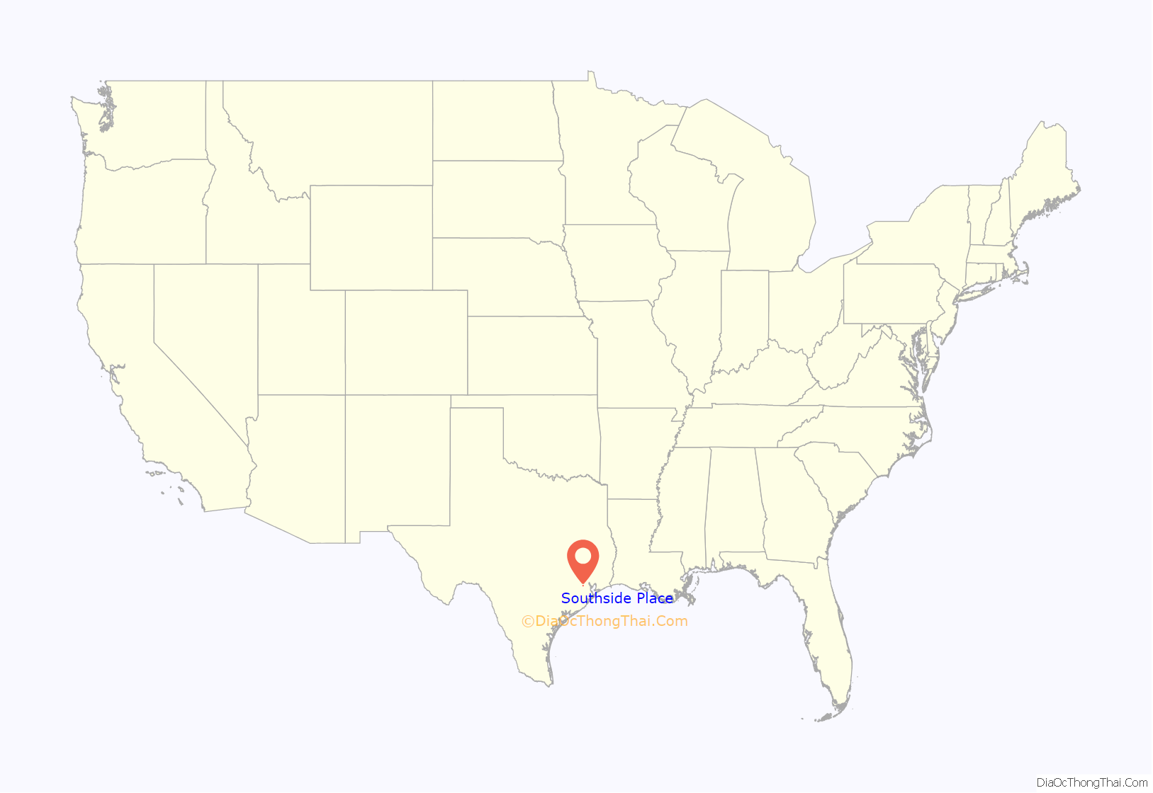
Southside Place location map. Where is Southside Place city?
History
Southside Place opened on Easter Day in 1925. Edlo L. Crain, the developer, placed a pool and a park in a subdivision to attract residents to the townsite. The first section to open was south of the park. It was in close proximity to Bellaire Boulevard and the streetcar line, which was nicknamed the “Toonerville Trolley”. In 1926, development of the second section of Southside Place, which spanned from Harper Street to University Boulevard, began. The Great Depression slowed development. The site of Southside Place previously housed the Harris County Poor Farm. The Haden and Austin company had purchased the poor farm and, after a period, sold it to the E. L. Crain and Company.
Southside Place incorporated in June 1931 with 600 residents. The city council first met on June 15 of that year. On August 3, 1934 the city council passed a resolution that declared Southside Place an incorporated city. Because of the incorporation, Houston did not incorporate Southside Place’s territory into its city limits, while Houston annexed surrounding areas that were unincorporated. A post office opened in 1940. Before World War II the population stabilized around 1,400. In the 1960s the city reached a high 1,500 residents. By 1979 the number of residents fell to 1,263. In 1988 the city had 1,560 residents. In 1990 the city had 1,384 residents.
In early 2009 Southside Place announced that it would demolish its previous municipal buildings and build a new multi-story municipal complex.
Glenn “Pat” Patterson is to serve as mayor until May 2021. There will be a mayoral election on May 1, 2021; Patterson will not seek reelection. Savvas T. Stefanides and Andy Chan are the candidates; the latter moved to Southside Place in 2004.
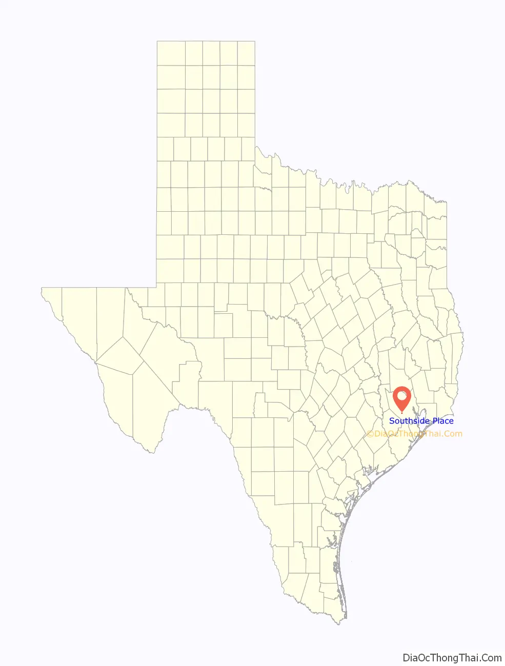
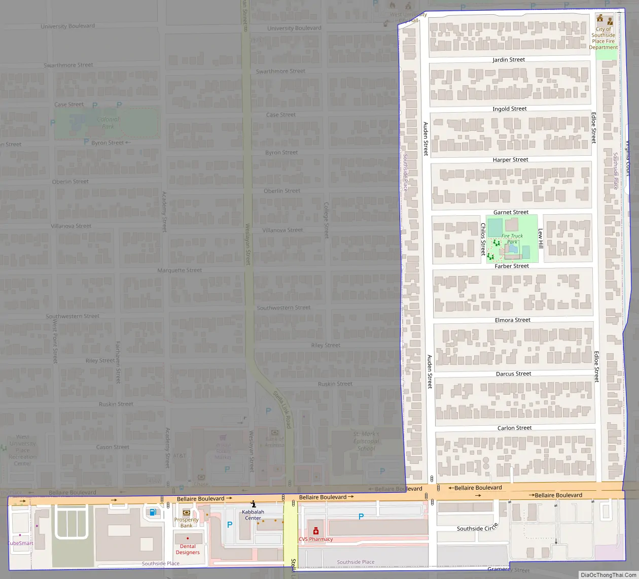
Southside Place Road Map
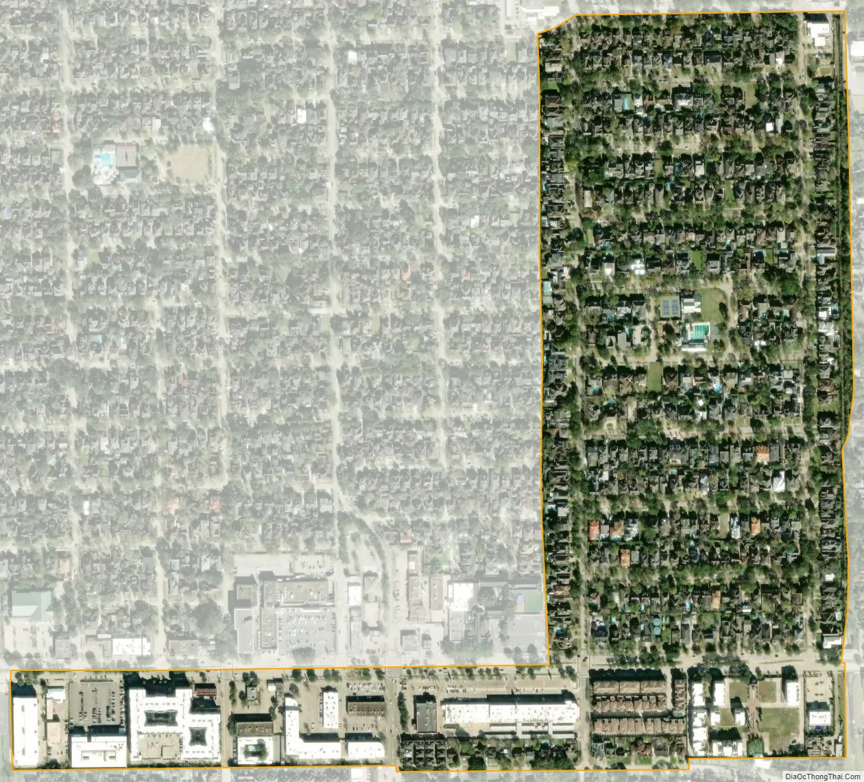
Southside Place city Satellite Map
Geography
Southside Place is located at 29°42′35″N 95°26′8″W / 29.70972°N 95.43556°W / 29.70972; -95.43556 (29.709629, –95.435442). According to the United States Census Bureau, the city has a total area of 0.2 square miles (0.6 km), all of it land. The city is surrounded by the cities of Bellaire, Houston, and West University Place.
The Blair House, a two-story, red-brick, 183-unit apartment complex, opened in 1963 and was on a 4.2-acre (1.7 ha) site. As the value of land rose in Southside Place, pressure came to redevelop the land. The complex close on September 11, 2015 and was bulldozed in November of that year. Trammell Crow Residential built the four-story, 269-unit Alexan Southside Place in its place.
A portion of Braeswood Place, Blocks 1 and 2 of Braes Heights Section 1, is in Southside Place. The rest is in the City of Houston.
See also
Map of Texas State and its subdivision:- Anderson
- Andrews
- Angelina
- Aransas
- Archer
- Armstrong
- Atascosa
- Austin
- Bailey
- Bandera
- Bastrop
- Baylor
- Bee
- Bell
- Bexar
- Blanco
- Borden
- Bosque
- Bowie
- Brazoria
- Brazos
- Brewster
- Briscoe
- Brooks
- Brown
- Burleson
- Burnet
- Caldwell
- Calhoun
- Callahan
- Cameron
- Camp
- Carson
- Cass
- Castro
- Chambers
- Cherokee
- Childress
- Clay
- Cochran
- Coke
- Coleman
- Collin
- Collingsworth
- Colorado
- Comal
- Comanche
- Concho
- Cooke
- Coryell
- Cottle
- Crane
- Crockett
- Crosby
- Culberson
- Dallam
- Dallas
- Dawson
- Deaf Smith
- Delta
- Denton
- Dewitt
- Dickens
- Dimmit
- Donley
- Duval
- Eastland
- Ector
- Edwards
- El Paso
- Ellis
- Erath
- Falls
- Fannin
- Fayette
- Fisher
- Floyd
- Foard
- Fort Bend
- Franklin
- Freestone
- Frio
- Gaines
- Galveston
- Garza
- Gillespie
- Glasscock
- Goliad
- Gonzales
- Gray
- Grayson
- Gregg
- Grimes
- Guadalupe
- Hale
- Hall
- Hamilton
- Hansford
- Hardeman
- Hardin
- Harris
- Harrison
- Hartley
- Haskell
- Hays
- Hemphill
- Henderson
- Hidalgo
- Hill
- Hockley
- Hood
- Hopkins
- Houston
- Howard
- Hudspeth
- Hunt
- Hutchinson
- Irion
- Jack
- Jackson
- Jasper
- Jeff Davis
- Jefferson
- Jim Hogg
- Jim Wells
- Johnson
- Jones
- Karnes
- Kaufman
- Kendall
- Kenedy
- Kent
- Kerr
- Kimble
- King
- Kinney
- Kleberg
- Knox
- La Salle
- Lamar
- Lamb
- Lampasas
- Lavaca
- Lee
- Leon
- Liberty
- Limestone
- Lipscomb
- Live Oak
- Llano
- Loving
- Lubbock
- Lynn
- Madison
- Marion
- Martin
- Mason
- Matagorda
- Maverick
- McCulloch
- McLennan
- McMullen
- Medina
- Menard
- Midland
- Milam
- Mills
- Mitchell
- Montague
- Montgomery
- Moore
- Morris
- Motley
- Nacogdoches
- Navarro
- Newton
- Nolan
- Nueces
- Ochiltree
- Oldham
- Orange
- Palo Pinto
- Panola
- Parker
- Parmer
- Pecos
- Polk
- Potter
- Presidio
- Rains
- Randall
- Reagan
- Real
- Red River
- Reeves
- Refugio
- Roberts
- Robertson
- Rockwall
- Runnels
- Rusk
- Sabine
- San Augustine
- San Jacinto
- San Patricio
- San Saba
- Schleicher
- Scurry
- Shackelford
- Shelby
- Sherman
- Smith
- Somervell
- Starr
- Stephens
- Sterling
- Stonewall
- Sutton
- Swisher
- Tarrant
- Taylor
- Terrell
- Terry
- Throckmorton
- Titus
- Tom Green
- Travis
- Trinity
- Tyler
- Upshur
- Upton
- Uvalde
- Val Verde
- Van Zandt
- Victoria
- Walker
- Waller
- Ward
- Washington
- Webb
- Wharton
- Wheeler
- Wichita
- Wilbarger
- Willacy
- Williamson
- Wilson
- Winkler
- Wise
- Wood
- Yoakum
- Young
- Zapata
- Zavala
- Alabama
- Alaska
- Arizona
- Arkansas
- California
- Colorado
- Connecticut
- Delaware
- District of Columbia
- Florida
- Georgia
- Hawaii
- Idaho
- Illinois
- Indiana
- Iowa
- Kansas
- Kentucky
- Louisiana
- Maine
- Maryland
- Massachusetts
- Michigan
- Minnesota
- Mississippi
- Missouri
- Montana
- Nebraska
- Nevada
- New Hampshire
- New Jersey
- New Mexico
- New York
- North Carolina
- North Dakota
- Ohio
- Oklahoma
- Oregon
- Pennsylvania
- Rhode Island
- South Carolina
- South Dakota
- Tennessee
- Texas
- Utah
- Vermont
- Virginia
- Washington
- West Virginia
- Wisconsin
- Wyoming


