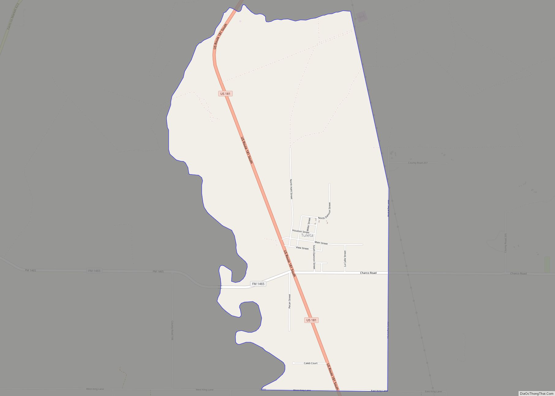
Tuleta is a census-designated place (CDP) in Bee County, Texas, United States. The population was 288 at the 2010 census.
| Name: | Tuleta CDP |
|---|---|
| LSAD Code: | 57 |
| LSAD Description: | CDP (suffix) |
| State: | Texas |
| County: | Bee County |
| Elevation: | 325 ft (99 m) |
| Total Area: | 4.5 sq mi (11.6 km²) |
| Land Area: | 4.5 sq mi (11.6 km²) |
| Water Area: | 0.0 sq mi (0.0 km²) |
| Total Population: | 288 |
| Population Density: | 64/sq mi (25/km²) |
| ZIP code: | 78162 |
| Area code: | 361 |
| FIPS code: | 4873856 |
| GNISfeature ID: | 1370198 |
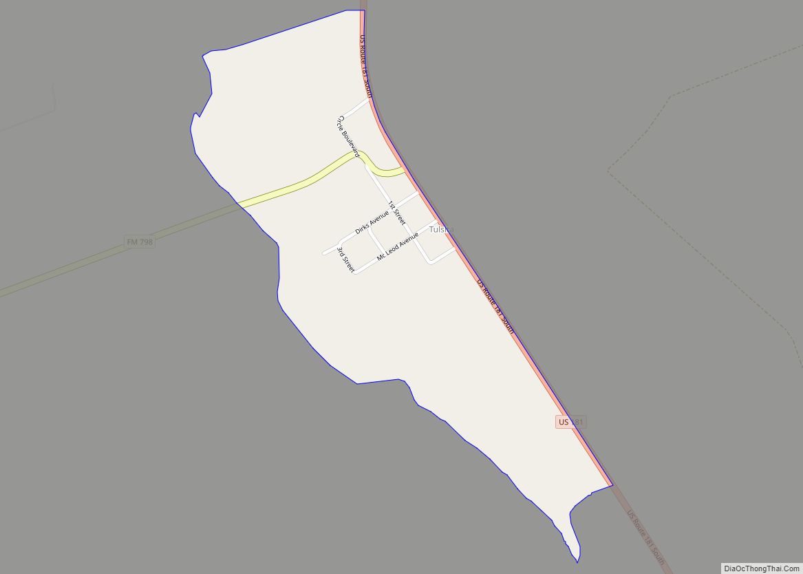
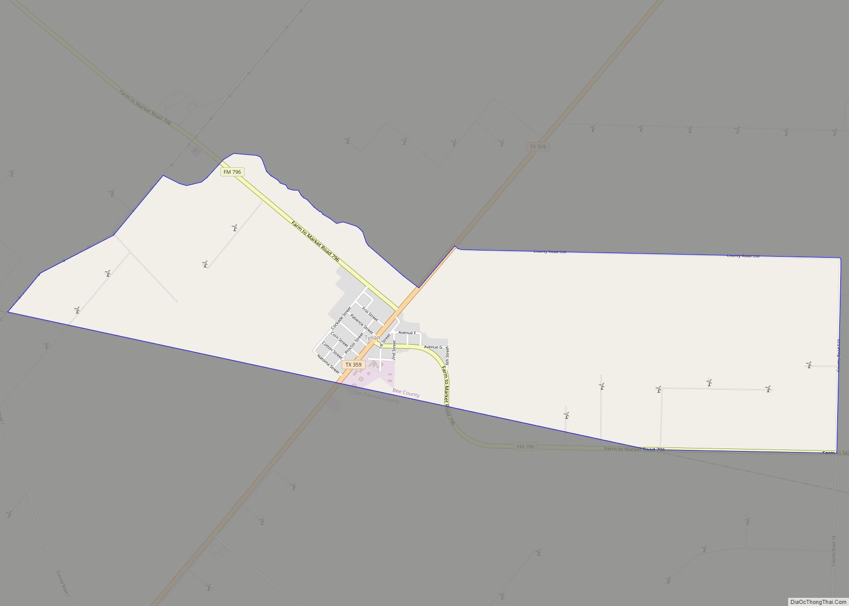
Online Interactive Map
Click on ![]() to view map in "full screen" mode.
to view map in "full screen" mode.
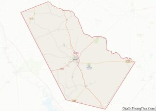
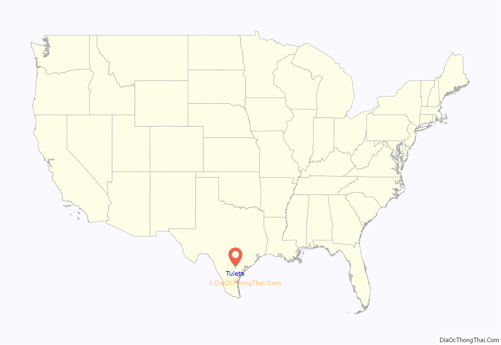
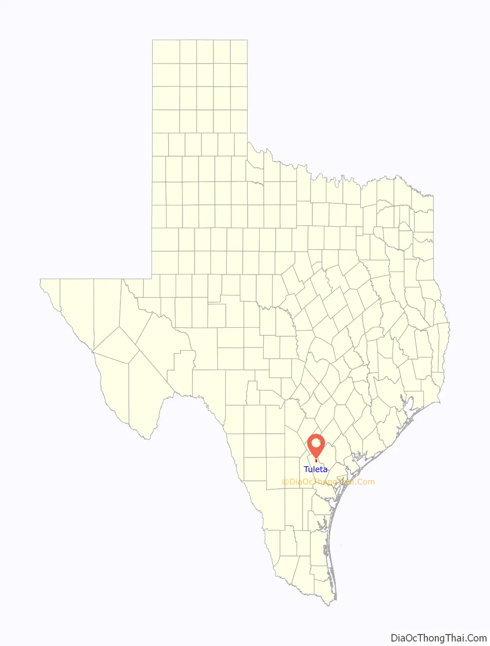
Tuleta location map. Where is Tuleta CDP?
History
Tuleta was founded by Peter Unzicker, a Mennonite minister, who brought a colony of Mennonites from Cullom, Illinois, in 1906. Unzicker, a German, purchased 54.5 acres (22.1 ha) of land from the Chittim-Miller ranch for the townsite, which was named for J. M. Chittim’s daughter. The San Antonio and Aransas Pass Railway was built across the ranch in 1881. The depot opened in Tuleta in 1906; the following year the post office opened. The Mennonite church, built that year, was used for school on weekdays. In 1910, Amanda Stoltzfus organized the Tuleta Agriculture High School, the first of its kind in Texas; its faculty came from such prestigious institutions as Smith College and the University of Wisconsin. Stoltzfus, the principal, offered instruction in sewing and cooking for girls and manual training and agriculture for boys. The school had dormitories for boarders.
Tuleta once had three churches-Mennonite, Presbyterian, and Baptist-of which only the Baptist remained in 1990. Among the early businesses were Stoltzfus Mercantile Company and Gin, Unzicker Grocery and Grist Mill, Dirks Brothers Lumber Yard and Garage, Speer’s Coffee Shop, the Rapp Hotel, and the Hall Hotel. Oil and gas were discovered west of Tuleta in 1929, when the population was 150. Several oil companies were still in operation in 1990, as were a grocery store, a water well service, and a community center. The community celebrates Tuleta Day on the second Saturday in August. In 1989, its population was 189. In 1990, it was 98. The population reached 292 in 2000.
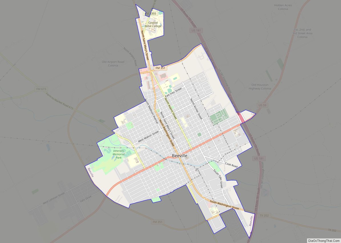
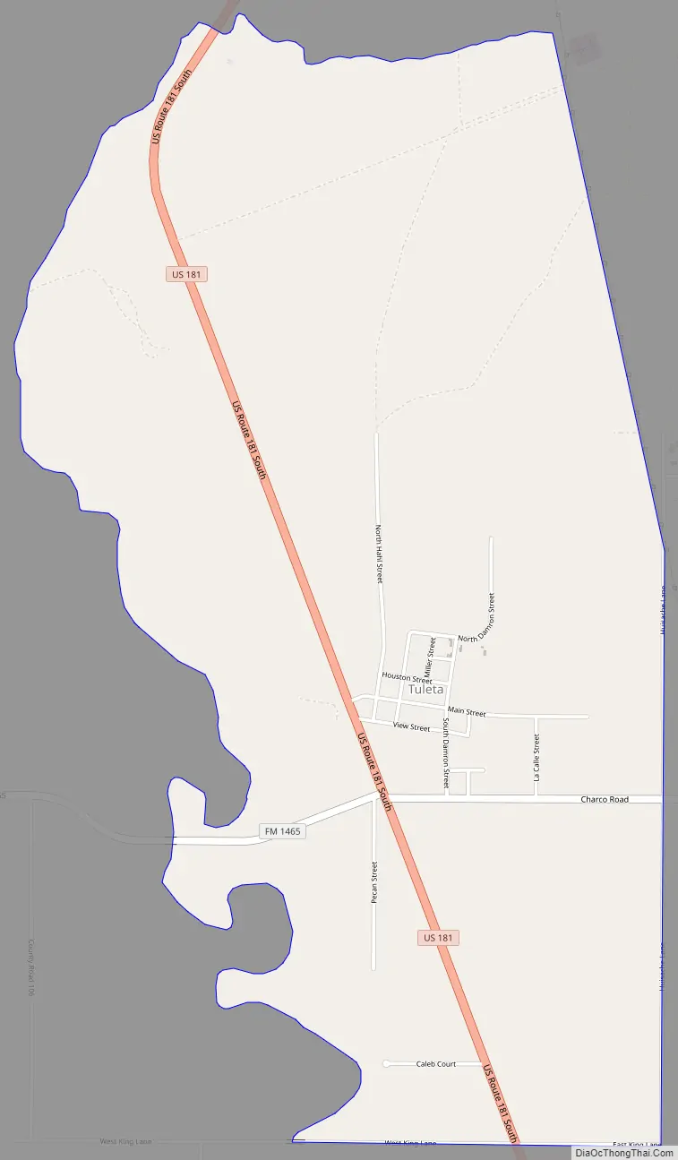
Tuleta Road Map
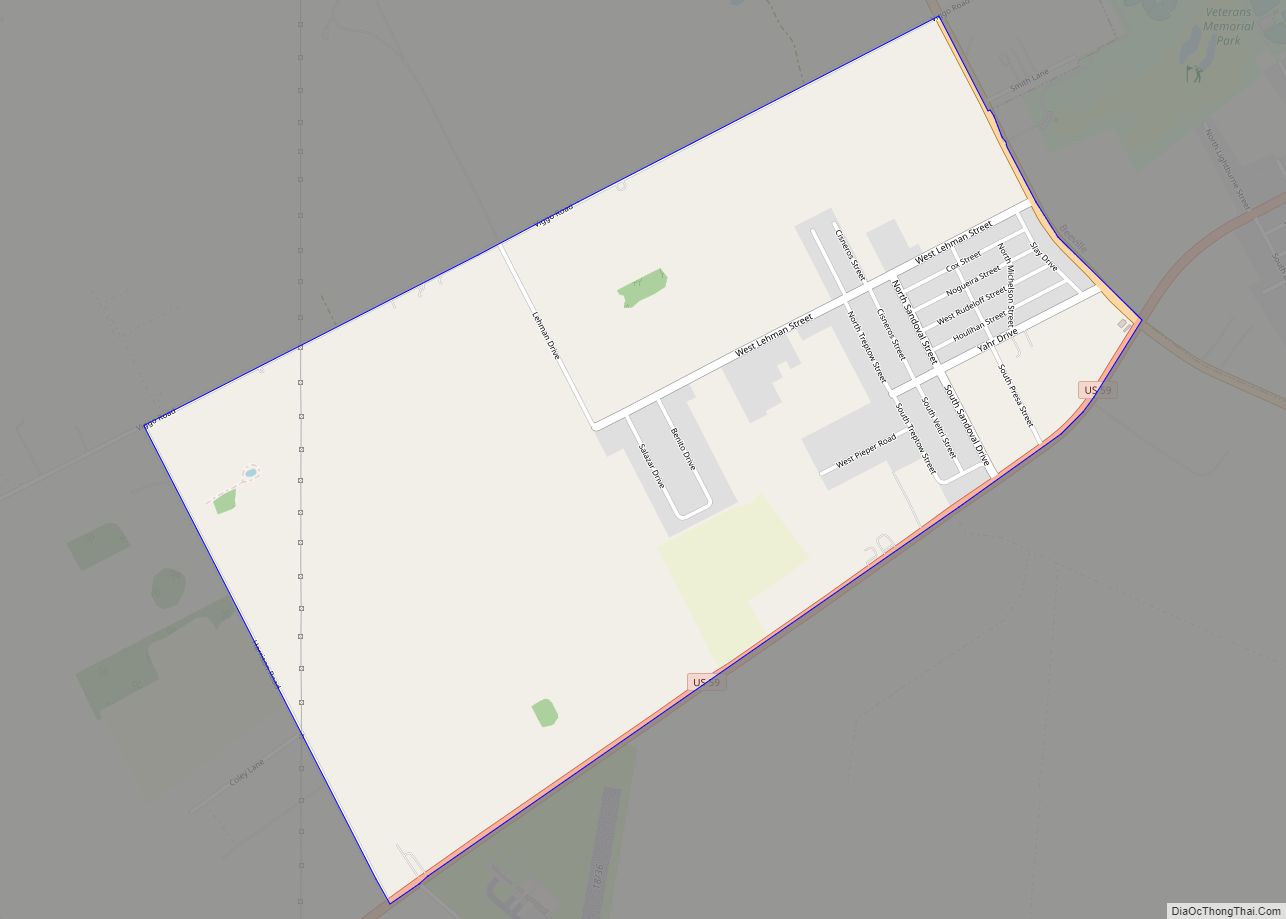
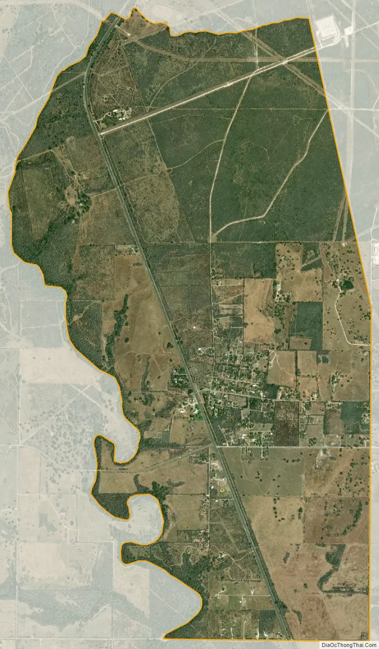
Tuleta city Satellite Map
Geography
Tuleta is located in northern Bee County at 28°34′22″N 97°47′48″W / 28.57278°N 97.79667°W / 28.57278; -97.79667 (28.572742, -97.796551). It is on U.S. Route 181 12 miles (19 km) north of Beeville, the county seat.
According to the United States Census Bureau, the CDP has a total area of 4.5 square miles (11.6 km), all of it land.
See also
Map of Texas State and its subdivision:- Anderson
- Andrews
- Angelina
- Aransas
- Archer
- Armstrong
- Atascosa
- Austin
- Bailey
- Bandera
- Bastrop
- Baylor
- Bee
- Bell
- Bexar
- Blanco
- Borden
- Bosque
- Bowie
- Brazoria
- Brazos
- Brewster
- Briscoe
- Brooks
- Brown
- Burleson
- Burnet
- Caldwell
- Calhoun
- Callahan
- Cameron
- Camp
- Carson
- Cass
- Castro
- Chambers
- Cherokee
- Childress
- Clay
- Cochran
- Coke
- Coleman
- Collin
- Collingsworth
- Colorado
- Comal
- Comanche
- Concho
- Cooke
- Coryell
- Cottle
- Crane
- Crockett
- Crosby
- Culberson
- Dallam
- Dallas
- Dawson
- Deaf Smith
- Delta
- Denton
- Dewitt
- Dickens
- Dimmit
- Donley
- Duval
- Eastland
- Ector
- Edwards
- El Paso
- Ellis
- Erath
- Falls
- Fannin
- Fayette
- Fisher
- Floyd
- Foard
- Fort Bend
- Franklin
- Freestone
- Frio
- Gaines
- Galveston
- Garza
- Gillespie
- Glasscock
- Goliad
- Gonzales
- Gray
- Grayson
- Gregg
- Grimes
- Guadalupe
- Hale
- Hall
- Hamilton
- Hansford
- Hardeman
- Hardin
- Harris
- Harrison
- Hartley
- Haskell
- Hays
- Hemphill
- Henderson
- Hidalgo
- Hill
- Hockley
- Hood
- Hopkins
- Houston
- Howard
- Hudspeth
- Hunt
- Hutchinson
- Irion
- Jack
- Jackson
- Jasper
- Jeff Davis
- Jefferson
- Jim Hogg
- Jim Wells
- Johnson
- Jones
- Karnes
- Kaufman
- Kendall
- Kenedy
- Kent
- Kerr
- Kimble
- King
- Kinney
- Kleberg
- Knox
- La Salle
- Lamar
- Lamb
- Lampasas
- Lavaca
- Lee
- Leon
- Liberty
- Limestone
- Lipscomb
- Live Oak
- Llano
- Loving
- Lubbock
- Lynn
- Madison
- Marion
- Martin
- Mason
- Matagorda
- Maverick
- McCulloch
- McLennan
- McMullen
- Medina
- Menard
- Midland
- Milam
- Mills
- Mitchell
- Montague
- Montgomery
- Moore
- Morris
- Motley
- Nacogdoches
- Navarro
- Newton
- Nolan
- Nueces
- Ochiltree
- Oldham
- Orange
- Palo Pinto
- Panola
- Parker
- Parmer
- Pecos
- Polk
- Potter
- Presidio
- Rains
- Randall
- Reagan
- Real
- Red River
- Reeves
- Refugio
- Roberts
- Robertson
- Rockwall
- Runnels
- Rusk
- Sabine
- San Augustine
- San Jacinto
- San Patricio
- San Saba
- Schleicher
- Scurry
- Shackelford
- Shelby
- Sherman
- Smith
- Somervell
- Starr
- Stephens
- Sterling
- Stonewall
- Sutton
- Swisher
- Tarrant
- Taylor
- Terrell
- Terry
- Throckmorton
- Titus
- Tom Green
- Travis
- Trinity
- Tyler
- Upshur
- Upton
- Uvalde
- Val Verde
- Van Zandt
- Victoria
- Walker
- Waller
- Ward
- Washington
- Webb
- Wharton
- Wheeler
- Wichita
- Wilbarger
- Willacy
- Williamson
- Wilson
- Winkler
- Wise
- Wood
- Yoakum
- Young
- Zapata
- Zavala
- Alabama
- Alaska
- Arizona
- Arkansas
- California
- Colorado
- Connecticut
- Delaware
- District of Columbia
- Florida
- Georgia
- Hawaii
- Idaho
- Illinois
- Indiana
- Iowa
- Kansas
- Kentucky
- Louisiana
- Maine
- Maryland
- Massachusetts
- Michigan
- Minnesota
- Mississippi
- Missouri
- Montana
- Nebraska
- Nevada
- New Hampshire
- New Jersey
- New Mexico
- New York
- North Carolina
- North Dakota
- Ohio
- Oklahoma
- Oregon
- Pennsylvania
- Rhode Island
- South Carolina
- South Dakota
- Tennessee
- Texas
- Utah
- Vermont
- Virginia
- Washington
- West Virginia
- Wisconsin
- Wyoming