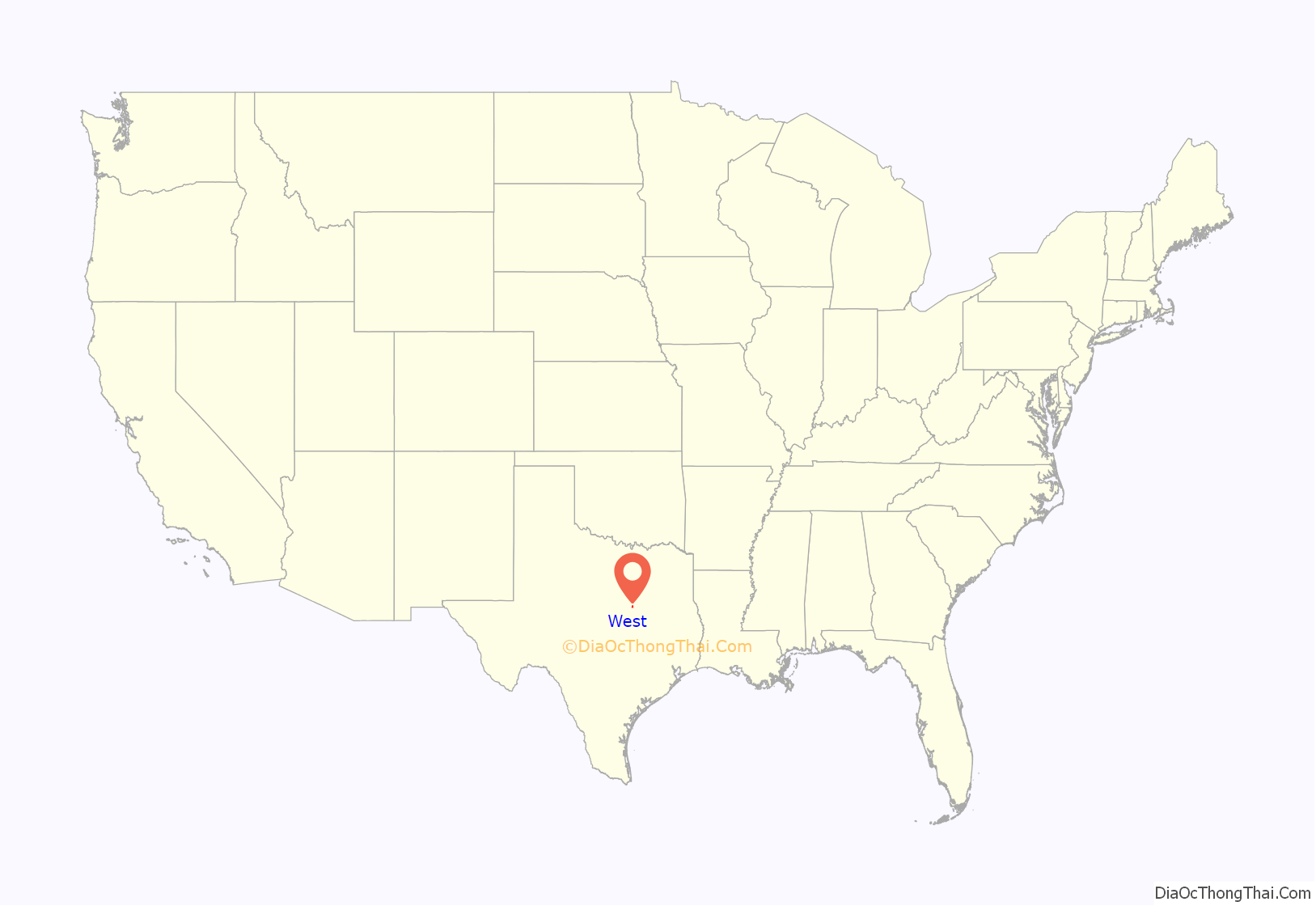
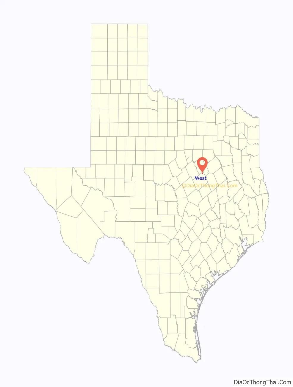
West is a city in McLennan County, Texas, United States. As of the 2020 census, the city population was 2,531. It is named after Thomas West, the first postmaster of the city. The city is located in the north-central part of Texas, approximately 70 miles (110 km) south of the Dallas-Fort Worth Metroplex, 20 miles north of Waco and 120 miles north of Austin, the state’s capital.
Despite its name, the city is not located within the region of West Texas; area residents sometimes call the community “West comma Texas” to avoid repetition.
As of 2012 it has one of the largest concentrations of Czech Texans of any city in the state.
| Name: | West city |
|---|---|
| LSAD Code: | 25 |
| LSAD Description: | city (suffix) |
| State: | Texas |
| County: | McLennan County |
| Incorporated: | 1892 |
| Elevation: | 650 ft (198 m) |
| Total Area: | 1.66 sq mi (4.30 km²) |
| Land Area: | 1.66 sq mi (4.30 km²) |
| Water Area: | 0.00 sq mi (0.00 km²) |
| Total Population: | 2,531 |
| Population Density: | 1,797.71/sq mi (694.12/km²) |
| ZIP code: | 76691 |
| Area code: | 254, exchange 826 |
| FIPS code: | 4877332 |
| GNISfeature ID: | 1349669 |
Online Interactive Map
Click on ![]() to view map in "full screen" mode.
to view map in "full screen" mode.
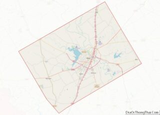
West location map. Where is West city?
History
The first settlers of northern McLennan County arrived in the 1840s. They were farm and ranch families drawn from the east by the rich lands made available by the government sale of land to build schools in Texas. The area farmers cultivated the land and grew cotton, wheat, and grain sorghum, and raised cattle. The farming community centered around a freshwater spring that became known as Bold Springs. In 1860, Bold Springs had a population of about 300 and provided services such as a blacksmith, churches, and a post office.
The Missouri–Kansas–Texas Railroad was laid between Hillsboro and Waco in the fall of 1881. The path of the railroad passed through land owned by Thomas West, who had moved to the area in 1859. He farmed land that he had purchased and served as postmaster of Bold Springs. A train depot and station was built on the land he sold to the railroad company and the land running beside the tracks was divided into small sections and sold to people wanting to start businesses. The new depot and station included a post office and since Mr. West served as postmaster the settlement became known as West’s Station, later West Station, and finally its current name West. Mr. West opened the first general store and became a successful businessman as he later owned a hotel, a furniture store, and a bank.
The railroad brought prosperity to the area during the 1880s. More businesses were opened and more surrounding land was purchased. Czech immigrants came to the area, purchasing the rich lands to farm and start a fresh life in the new world. They also opened businesses, sharing their European culture. By the 1890s, the Czech businesses flourished in West. On June 11, 1892, West was officially organized into a town. It had become the center of commerce for the area. There were cotton gins, grocery stores, churches, schools, and doctors’ offices.
The temporary city Crush, Texas, located just three miles (5 km) south of West, was the location of The Crash at Crush, a head-on collision between two locomotives that was staged on September 15, 1896, as a publicity stunt for the Missouri–Kansas–Texas Railroad. Over 30,000 spectators gathered at the crash site, named “crush” for MKT passenger agent William Crush, who conceived the idea. About 4 p.m. the trains were sent speeding toward each other. Contrary to mechanics’ predictions, the steam boilers exploded on impact, propelling pieces of metal into the crowd. Two people were killed and many others injured, including Jarvis Deane of Waco, who was photographing the event and lost an eye. Texas Historical Marker 5315, located on Interstate 35 northbound frontage road, between Mangrum and Wiggins Road, commemorates the event.
The turn of the century brought electricity, running water, and natural gas. The population of West and surrounding area grew. Many of the descendants of the original settlers continue to farm the lands and run the businesses today. Czech is still spoken by some of the older residents.
2013 explosion
On April 17, 2013, a fire broke out at West Fertilizer Co., a fertilizer plant on the north side of town that stored ammonium nitrate, a fertilizer that can be used as an explosive. The fire triggered two explosions milliseconds apart from one another. The massive blast killed 15 people, including 12 first responders, and injured at least 200. It destroyed nearby schools, an apartment complex, and a nursing home and damaged hundreds of homes in the surrounding area.
The explosion, which measured as a 2.1 magnitude earthquake, garnered much media attention. President Barack Obama and Texas Gov. Rick Perry attended the memorial for first responders.
A month-long investigation ruled the cause of the explosion undetermined because multiple possible causes could not be ruled out. The lingering possibilities include arson, an electrical glitch or a golf cart that overheated.
It was later concluded that the reason for the April 17, 2013 blast was a fire that accidentally ignited inside, causing the fertilizer plant to explode.
In 2016 the Bureau of Alcohol, Tobacco, Firearms and Explosives concluded that the fire that caused the explosion was set deliberately. However ATF never presented any evidence of arson. A comprehensive investigation by the U.S. Chemical Safety and Hazard Investigation Board (CSB) publicized in 2016 did not find any evidence of foul play. The causes of the explosion and recommendations for prevention can be found in www.CSB.gov under West Fertilizer Company (Completed Investigations).
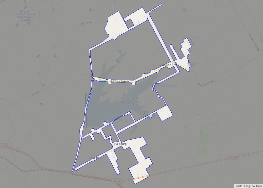
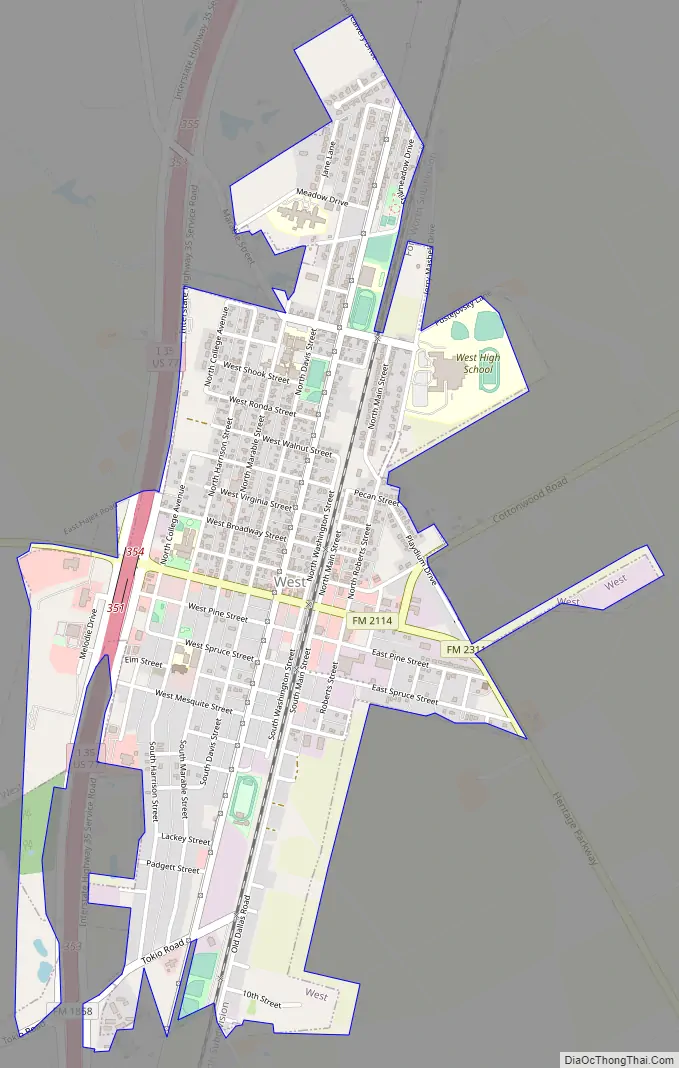
West Road Map
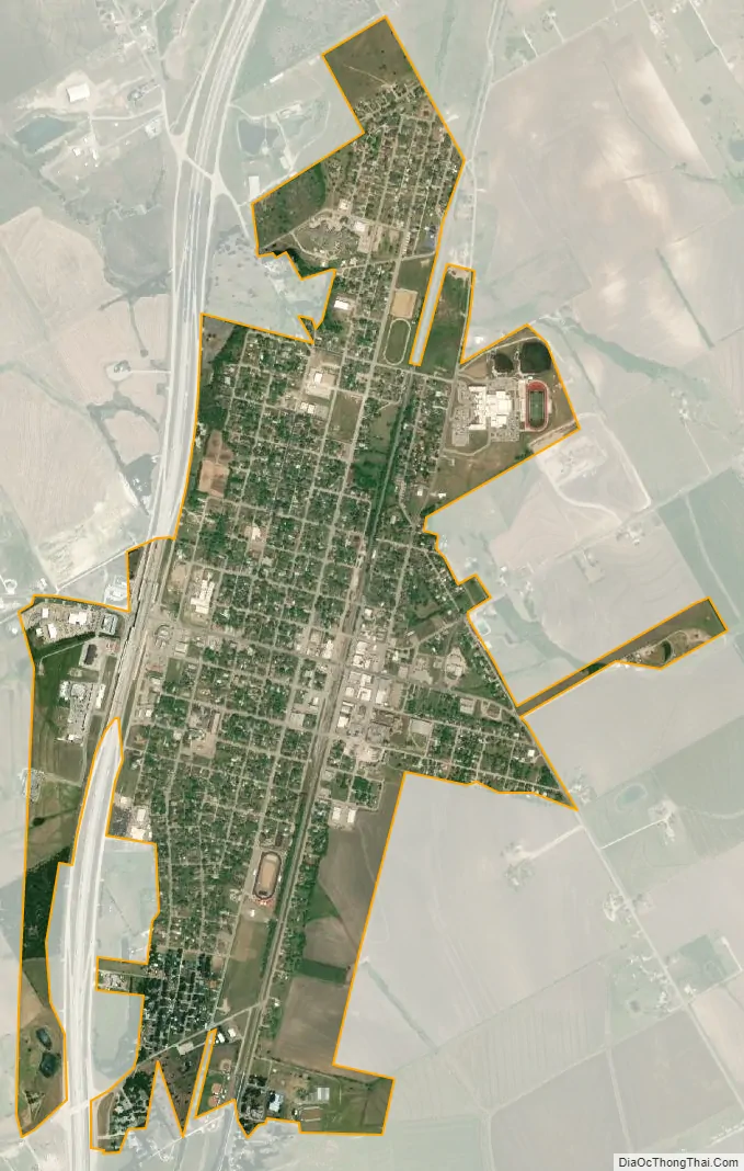
West city Satellite Map
Geography
West is located at 31°48′12″N 97°5′35″W / 31.80333°N 97.09306°W / 31.80333; -97.09306 (31.803369, –97.093106). According to the United States Census Bureau, the city has a total area of 4.0 sq mi (10 km), all land. Most of the city is located on the east side of Interstate 35.
Climate
The climate in this area is characterized by hot, humid summers and generally mild to cool winters. According to the Köppen Climate Classification system, West has a humid subtropical climate, abbreviated “Cfa” on climate maps.
See also
Map of Texas State and its subdivision:- Anderson
- Andrews
- Angelina
- Aransas
- Archer
- Armstrong
- Atascosa
- Austin
- Bailey
- Bandera
- Bastrop
- Baylor
- Bee
- Bell
- Bexar
- Blanco
- Borden
- Bosque
- Bowie
- Brazoria
- Brazos
- Brewster
- Briscoe
- Brooks
- Brown
- Burleson
- Burnet
- Caldwell
- Calhoun
- Callahan
- Cameron
- Camp
- Carson
- Cass
- Castro
- Chambers
- Cherokee
- Childress
- Clay
- Cochran
- Coke
- Coleman
- Collin
- Collingsworth
- Colorado
- Comal
- Comanche
- Concho
- Cooke
- Coryell
- Cottle
- Crane
- Crockett
- Crosby
- Culberson
- Dallam
- Dallas
- Dawson
- Deaf Smith
- Delta
- Denton
- Dewitt
- Dickens
- Dimmit
- Donley
- Duval
- Eastland
- Ector
- Edwards
- El Paso
- Ellis
- Erath
- Falls
- Fannin
- Fayette
- Fisher
- Floyd
- Foard
- Fort Bend
- Franklin
- Freestone
- Frio
- Gaines
- Galveston
- Garza
- Gillespie
- Glasscock
- Goliad
- Gonzales
- Gray
- Grayson
- Gregg
- Grimes
- Guadalupe
- Hale
- Hall
- Hamilton
- Hansford
- Hardeman
- Hardin
- Harris
- Harrison
- Hartley
- Haskell
- Hays
- Hemphill
- Henderson
- Hidalgo
- Hill
- Hockley
- Hood
- Hopkins
- Houston
- Howard
- Hudspeth
- Hunt
- Hutchinson
- Irion
- Jack
- Jackson
- Jasper
- Jeff Davis
- Jefferson
- Jim Hogg
- Jim Wells
- Johnson
- Jones
- Karnes
- Kaufman
- Kendall
- Kenedy
- Kent
- Kerr
- Kimble
- King
- Kinney
- Kleberg
- Knox
- La Salle
- Lamar
- Lamb
- Lampasas
- Lavaca
- Lee
- Leon
- Liberty
- Limestone
- Lipscomb
- Live Oak
- Llano
- Loving
- Lubbock
- Lynn
- Madison
- Marion
- Martin
- Mason
- Matagorda
- Maverick
- McCulloch
- McLennan
- McMullen
- Medina
- Menard
- Midland
- Milam
- Mills
- Mitchell
- Montague
- Montgomery
- Moore
- Morris
- Motley
- Nacogdoches
- Navarro
- Newton
- Nolan
- Nueces
- Ochiltree
- Oldham
- Orange
- Palo Pinto
- Panola
- Parker
- Parmer
- Pecos
- Polk
- Potter
- Presidio
- Rains
- Randall
- Reagan
- Real
- Red River
- Reeves
- Refugio
- Roberts
- Robertson
- Rockwall
- Runnels
- Rusk
- Sabine
- San Augustine
- San Jacinto
- San Patricio
- San Saba
- Schleicher
- Scurry
- Shackelford
- Shelby
- Sherman
- Smith
- Somervell
- Starr
- Stephens
- Sterling
- Stonewall
- Sutton
- Swisher
- Tarrant
- Taylor
- Terrell
- Terry
- Throckmorton
- Titus
- Tom Green
- Travis
- Trinity
- Tyler
- Upshur
- Upton
- Uvalde
- Val Verde
- Van Zandt
- Victoria
- Walker
- Waller
- Ward
- Washington
- Webb
- Wharton
- Wheeler
- Wichita
- Wilbarger
- Willacy
- Williamson
- Wilson
- Winkler
- Wise
- Wood
- Yoakum
- Young
- Zapata
- Zavala
- Alabama
- Alaska
- Arizona
- Arkansas
- California
- Colorado
- Connecticut
- Delaware
- District of Columbia
- Florida
- Georgia
- Hawaii
- Idaho
- Illinois
- Indiana
- Iowa
- Kansas
- Kentucky
- Louisiana
- Maine
- Maryland
- Massachusetts
- Michigan
- Minnesota
- Mississippi
- Missouri
- Montana
- Nebraska
- Nevada
- New Hampshire
- New Jersey
- New Mexico
- New York
- North Carolina
- North Dakota
- Ohio
- Oklahoma
- Oregon
- Pennsylvania
- Rhode Island
- South Carolina
- South Dakota
- Tennessee
- Texas
- Utah
- Vermont
- Virginia
- Washington
- West Virginia
- Wisconsin
- Wyoming