West University Place, often called West University or West U for short, is a city located in the U.S. state of Texas within the Houston–Sugar Land metropolitan area and southwestern Harris County. At the 2020 U.S. census, the population of the city was 14,955. It is nicknamed “The Neighborhood City” and is mainly a bedroom community for upper-class families.
West University Place is surrounded by the cities of Bellaire, Houston, and Southside Place. As of 2011, West University Place has the state’s fifth highest concentration of households with incomes $150,000 or greater.
| Name: | West University Place city |
|---|---|
| LSAD Code: | 25 |
| LSAD Description: | city (suffix) |
| State: | Texas |
| County: | Harris County |
| Elevation: | 49 ft (15 m) |
| Total Area: | 2.00 sq mi (5.19 km²) |
| Land Area: | 2.00 sq mi (5.19 km²) |
| Water Area: | 0.00 sq mi (0.00 km²) |
| Total Population: | 14,955 |
| Population Density: | 7,776.95/sq mi (3,002.58/km²) |
| ZIP code: | 77005 |
| Area code: | 281/346/713/832 |
| FIPS code: | 4877956 |
| GNISfeature ID: | 1349820 |
| Website: | http://westutx.gov/ |
Online Interactive Map
Click on ![]() to view map in "full screen" mode.
to view map in "full screen" mode.
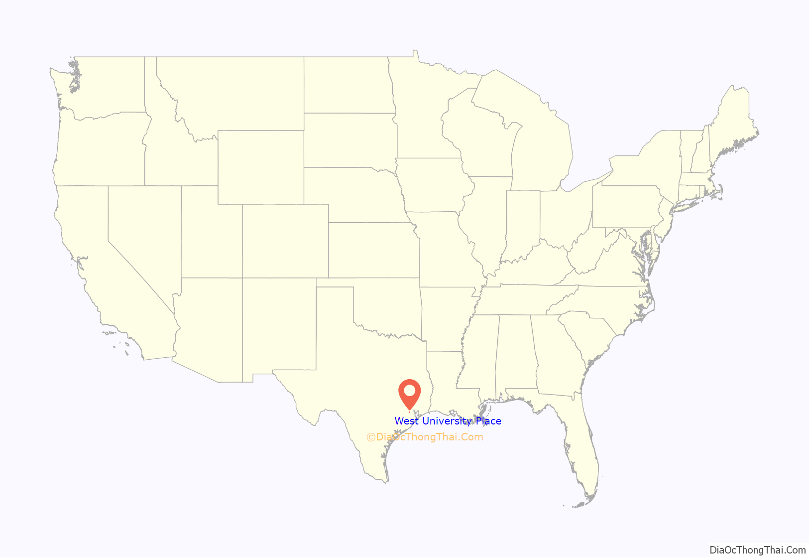
West University Place location map. Where is West University Place city?
History
The city was developed in 1917 by Ben Hooper, a former Tennessee governor. The name “West University Place” originated from its proximity to Rice Institute, now known as Rice University. The first lots in the community were sold in 1917. Portions of West University were previously within the Harris County Poor farm, which extended from an area between Bellaire Boulevard and Bissonnet Street, eastward to an area near the “poor farm ditch.”
In the 1920s, Lillian “Lilly” Nicholson, a Rice University English major, lived with a friend whose father was a city planner. The city planner asked Nicholson and her friend to name the streets of West University Place. Nicholson took names from her English literature book and gave them to the streets in West University Place. As a result, many West University streets are named after authors, such as Geoffrey Chaucer, John Dryden, and William Shakespeare. Cydney Mackey, a family friend of Nicholson, said in a Houston Chronicle article, “Aunt Lilly had always said she wanted to be an architect, unknown for women in that era, and this was her way of making a small but lasting mark on our city’s landscape.” One street, Weslayan Road, is a misspelling of “Wesleyan.”
The City of West University Place was declared incorporated by the County Judge of Harris County on January 2, 1924. The city incorporated because Houston was reluctant to extend power lines that far from the city center. West University Place, unlike Houston Heights, did not consolidate into the City of Houston. Because of the 1923 incorporation, Houston did not incorporate West University Place’s territory into its city limits, while Houston annexed surrounding areas that were unincorporated. In 1939, the municipality refused to consolidate, later adopting a formal city charter the following year. The city had around 15,000 residents in the 1960s and the 1970s. The city had 12,714 people in 1990.
Prior to 1992 West University Place liberalized its development rules. This allowed developers to build new houses within the city. Don Stowers of the Houston Post said that West University Place changed from an “aging middle-class neighborhood” consisting of mid-20th century bungalows and cottages to an increasingly wealthy community of “dare we say, young urban professionals in their austere red-brick Georgians.” As new houses appeared, property values increased and the city began to get more tax revenue. Eventually, West University Place ran out of available lots, and its construction peaked. Area home buyers began to consider nearby Bellaire because it had more inexpensive and larger lots, and amenities described by Stowers as “comparable” to West University Place’s amenities. In 2011 the group On Numbers ranked West U as the community in the Southern United States with the highest quality of life. it was later ranked number one in a comparison of regional winners. On October 22, 2018 24/7 Wall Street, which collaborates with USA Today, ranked West University Place the “best city to live in”.
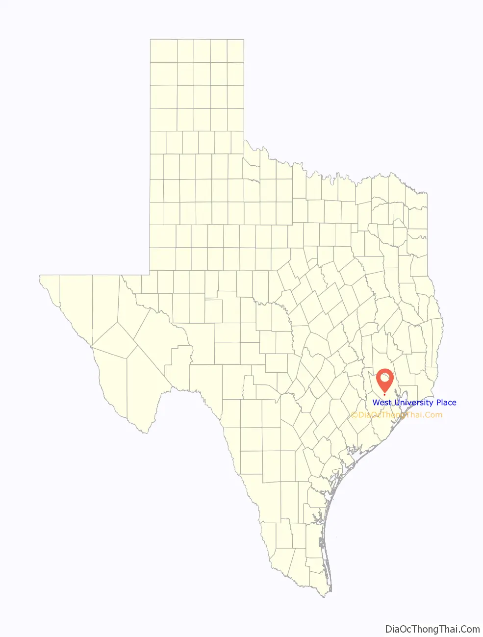
West University Place Road Map

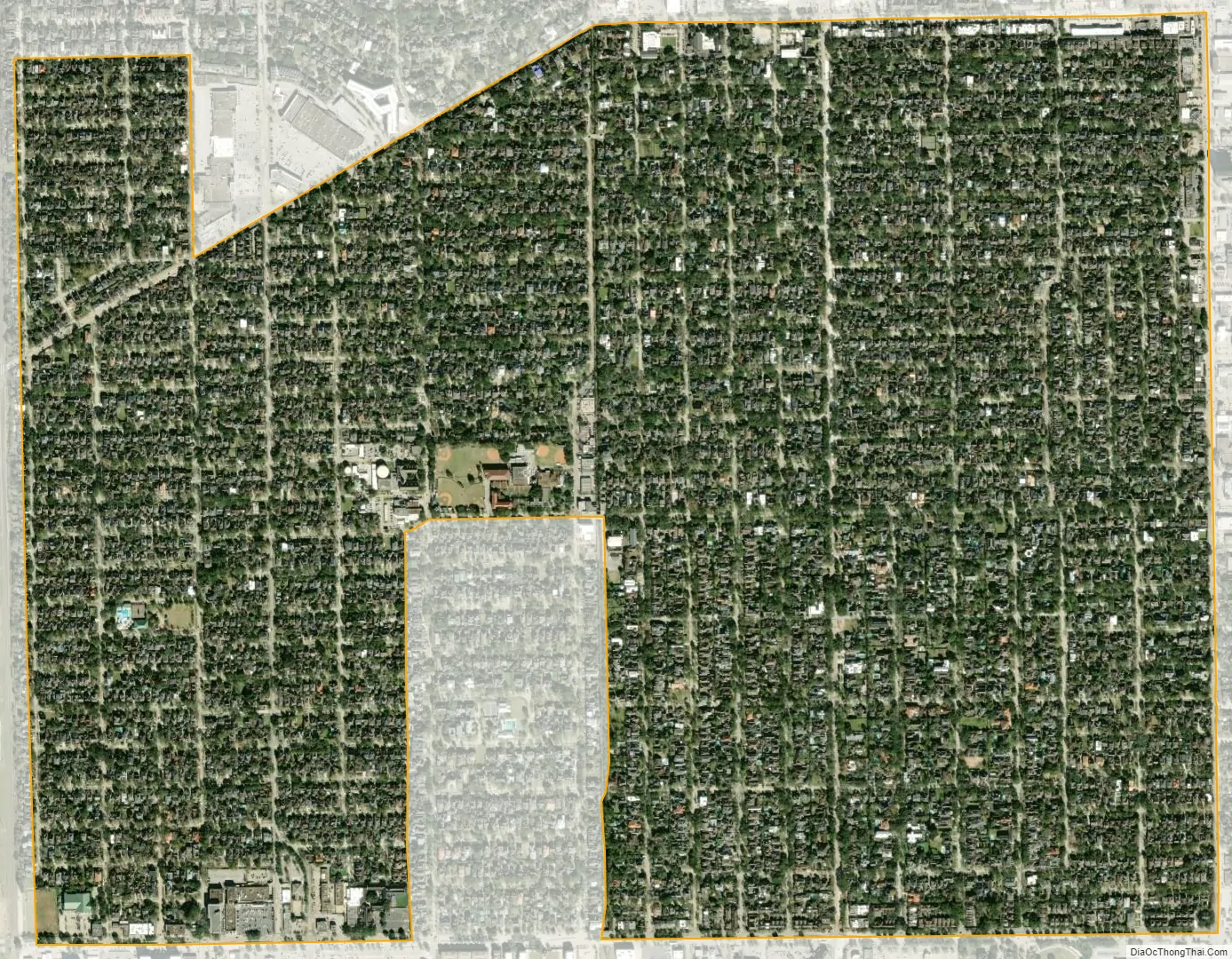
West University Place city Satellite Map
Geography
West University Place is located at 29°42′57″N 95°25′59″W / 29.71583°N 95.43306°W / 29.71583; -95.43306 (29.715929, −95.432992). According to the United States Census Bureau, the city has a total area of 2.0 square miles (5.2 km), all of it land. The city of Houston surrounds much of West University Place. The boundaries are roughly Bellaire Boulevard/Holcombe Boulevard, Kirby Drive, Bissonnet Road, and Community Drive. West University Place is 6 miles (9.7 km) from Downtown Houston.
The city’s boundaries are Kirby Drive to the east, Union Pacific St. Louis Southwestern Railway railroad track to the west, Bellaire Boulevard/West Holcombe Boulevard to the south, and Bissonnet and Law Streets to the north. Viewed on a map, the city shape resembles a little house, with a “chimney” to the west side, and since it surrounds the city of Southside Place, a “door” is formed on the map surrounding Southside Place. (See map)
The Poor Farm Ditch is a ditch that drains into the Brays Bayou that formerly belonged to the Harris County poor farm. In 1928 the ditch was dredged after significant flooding had occurred in the area. On occasions the ditch still flooded. The commissioners of the City of West University adjourned their meeting so they could dam streets in December 1935. The Harris County Flood Control District, in 1954, widened and deepened the ditch and added a concrete bottom and siding. During that year the district installed a chain link fence. To make the ditch more attractive, the Sunset Terrace Garden Club planted oleanders around the ditch; the oleanders obscure the view of the ditch from Edloe Street to the east. The West University Garden Club maintained the flowers. A 2001 Edloe Greenbelt proposal called for the removal of the flowers.
Cityscape
In 2018 Mimi Swartz of Texas Monthly described it as “an orderly quarter where older brick bungalows and modest two-story colonials reside in peace alongside grand—but not too grand—new construction.” The typical lot size in West University Place is 5,000 square feet (460 m).
The original housing stock of West University Place consisted of mid-20th century bungalows and cottages. Prior to 1992 the City of West University place liberalized its development rules, allowing for new houses to be built in the city. As lot sizes were typically about 50 feet (15 m) by 120 feet (37 m), the houses constructed were Georgian houses described by Don Stowers of the Houston Post as “lot hugging.” Because nearby Bellaire had larger, more inexpensive lots, many area home seekers began to consider Bellaire. In a 15-year period ending in 2002 around half of the existing houses in West University Place were torn down and replaced with newer houses. In 2001 Katherine Feser of the Houston Chronicle said that land lots selling for over $1 million ($1530351.44 in today’s money) were common in West University Place.
There are a total of 26 subdivisions within West University: West University Place (First and Second), Belle Court, Bissonnet Place, Cambridge Place, College Court (part), College View (1st through 4th), Colonial Terrace, Cunningham Terrace, Evanston, Fairview, Kent Place, Krenzler Court, Matthews Place, Monticello, Pemberton, Pershing Place, Preston Place, Quenby Court, Rice Court, Sunset Terrace (part), Tangley Place, and Virginia Court. Rice Court is located north of University Boulevard and east of Buffalo Speedway. Rice Court once was distinguished by blue tile markers; the markers began to disappear around the 1990s. Pemberton is an area south of University Drive and east of Wakeforest Street. People living in the area were fond of restoration of older houses, and it includes some of West U’s more expensive homes. Colonial Terrace is west of Weslayan Street and is near the railroad tracks. Originally it was the least developed part of West University Place. By 2000 this area was as built up and popular as other areas within West University Place.
See also
Map of Texas State and its subdivision:- Anderson
- Andrews
- Angelina
- Aransas
- Archer
- Armstrong
- Atascosa
- Austin
- Bailey
- Bandera
- Bastrop
- Baylor
- Bee
- Bell
- Bexar
- Blanco
- Borden
- Bosque
- Bowie
- Brazoria
- Brazos
- Brewster
- Briscoe
- Brooks
- Brown
- Burleson
- Burnet
- Caldwell
- Calhoun
- Callahan
- Cameron
- Camp
- Carson
- Cass
- Castro
- Chambers
- Cherokee
- Childress
- Clay
- Cochran
- Coke
- Coleman
- Collin
- Collingsworth
- Colorado
- Comal
- Comanche
- Concho
- Cooke
- Coryell
- Cottle
- Crane
- Crockett
- Crosby
- Culberson
- Dallam
- Dallas
- Dawson
- Deaf Smith
- Delta
- Denton
- Dewitt
- Dickens
- Dimmit
- Donley
- Duval
- Eastland
- Ector
- Edwards
- El Paso
- Ellis
- Erath
- Falls
- Fannin
- Fayette
- Fisher
- Floyd
- Foard
- Fort Bend
- Franklin
- Freestone
- Frio
- Gaines
- Galveston
- Garza
- Gillespie
- Glasscock
- Goliad
- Gonzales
- Gray
- Grayson
- Gregg
- Grimes
- Guadalupe
- Hale
- Hall
- Hamilton
- Hansford
- Hardeman
- Hardin
- Harris
- Harrison
- Hartley
- Haskell
- Hays
- Hemphill
- Henderson
- Hidalgo
- Hill
- Hockley
- Hood
- Hopkins
- Houston
- Howard
- Hudspeth
- Hunt
- Hutchinson
- Irion
- Jack
- Jackson
- Jasper
- Jeff Davis
- Jefferson
- Jim Hogg
- Jim Wells
- Johnson
- Jones
- Karnes
- Kaufman
- Kendall
- Kenedy
- Kent
- Kerr
- Kimble
- King
- Kinney
- Kleberg
- Knox
- La Salle
- Lamar
- Lamb
- Lampasas
- Lavaca
- Lee
- Leon
- Liberty
- Limestone
- Lipscomb
- Live Oak
- Llano
- Loving
- Lubbock
- Lynn
- Madison
- Marion
- Martin
- Mason
- Matagorda
- Maverick
- McCulloch
- McLennan
- McMullen
- Medina
- Menard
- Midland
- Milam
- Mills
- Mitchell
- Montague
- Montgomery
- Moore
- Morris
- Motley
- Nacogdoches
- Navarro
- Newton
- Nolan
- Nueces
- Ochiltree
- Oldham
- Orange
- Palo Pinto
- Panola
- Parker
- Parmer
- Pecos
- Polk
- Potter
- Presidio
- Rains
- Randall
- Reagan
- Real
- Red River
- Reeves
- Refugio
- Roberts
- Robertson
- Rockwall
- Runnels
- Rusk
- Sabine
- San Augustine
- San Jacinto
- San Patricio
- San Saba
- Schleicher
- Scurry
- Shackelford
- Shelby
- Sherman
- Smith
- Somervell
- Starr
- Stephens
- Sterling
- Stonewall
- Sutton
- Swisher
- Tarrant
- Taylor
- Terrell
- Terry
- Throckmorton
- Titus
- Tom Green
- Travis
- Trinity
- Tyler
- Upshur
- Upton
- Uvalde
- Val Verde
- Van Zandt
- Victoria
- Walker
- Waller
- Ward
- Washington
- Webb
- Wharton
- Wheeler
- Wichita
- Wilbarger
- Willacy
- Williamson
- Wilson
- Winkler
- Wise
- Wood
- Yoakum
- Young
- Zapata
- Zavala
- Alabama
- Alaska
- Arizona
- Arkansas
- California
- Colorado
- Connecticut
- Delaware
- District of Columbia
- Florida
- Georgia
- Hawaii
- Idaho
- Illinois
- Indiana
- Iowa
- Kansas
- Kentucky
- Louisiana
- Maine
- Maryland
- Massachusetts
- Michigan
- Minnesota
- Mississippi
- Missouri
- Montana
- Nebraska
- Nevada
- New Hampshire
- New Jersey
- New Mexico
- New York
- North Carolina
- North Dakota
- Ohio
- Oklahoma
- Oregon
- Pennsylvania
- Rhode Island
- South Carolina
- South Dakota
- Tennessee
- Texas
- Utah
- Vermont
- Virginia
- Washington
- West Virginia
- Wisconsin
- Wyoming


