Azle (/ˈeɪzəl/ AY-zəl) is a city west of Fort Worth in Parker and Tarrant Counties in the U.S. state of Texas. As of the 2010 census, the city population was 10,947.
Azle is the home of the Azle Marching Green Pride marching band and the Fighting Azle Hornets.
| Name: | Azle city |
|---|---|
| LSAD Code: | 25 |
| LSAD Description: | city (suffix) |
| State: | Texas |
| County: | Parker County, Tarrant County |
| Elevation: | 712 ft (217 m) |
| Total Area: | 8.81 sq mi (22.82 km²) |
| Land Area: | 8.79 sq mi (22.77 km²) |
| Water Area: | 0.02 sq mi (0.04 km²) 0.20% |
| Total Population: | 10,947 |
| Population Density: | 1,518.54/sq mi (586.29/km²) |
| ZIP code: | 76020 |
| FIPS code: | 4805168 |
| GNISfeature ID: | 1329893 |
| Website: | www.cityofazle.org |
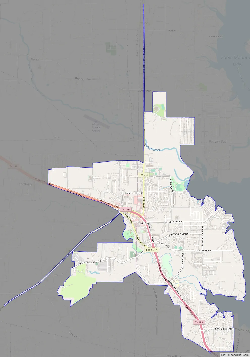
Online Interactive Map
Click on ![]() to view map in "full screen" mode.
to view map in "full screen" mode.
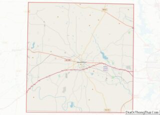
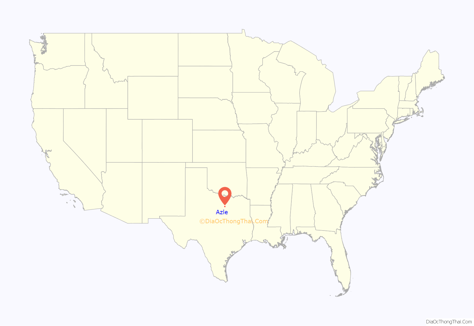
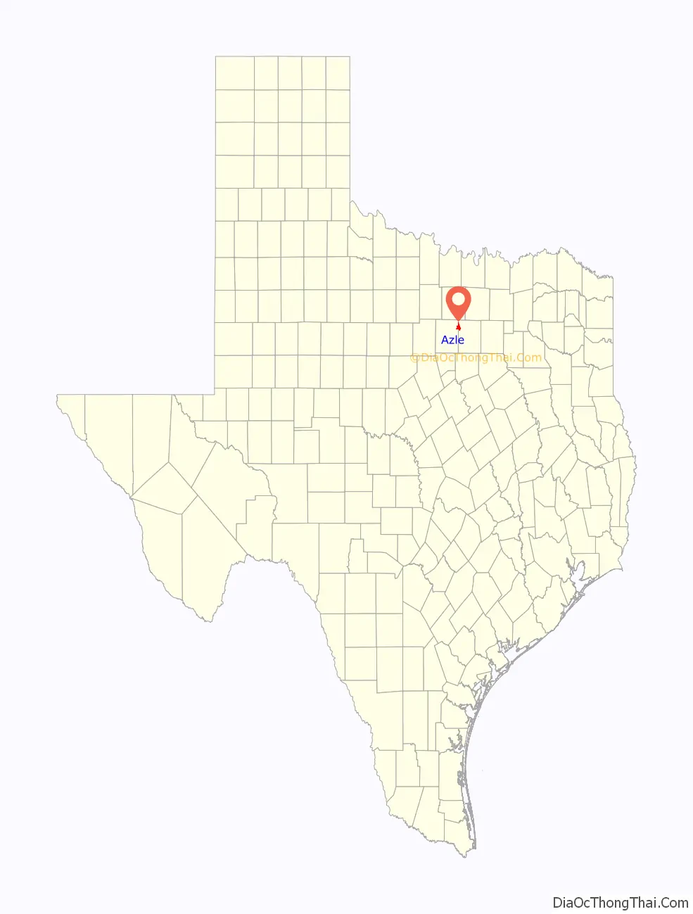
Azle location map. Where is Azle city?
History
The first recorded settlement at the site occurred in 1846, when James Azle Steward, a young doctor, moved into a log cabin built by a Dutchman named Rumsfeldt. Other settlers came and established themselves near the local streams, Ash Creek, Silver Creek, and Walnut Creek. Steward helped establish the first cemetery, Ash Creek. The oldest graves there are those of Dave Morrison (1849–1874) and W. P. Gregg (1833–1874). The first post office opened in 1881, and the town took the name of O’Bar, in honor of the man who obtained the postal service. A short time later in 1883, the name was changed to Azle at the request of Steward, who donated the land for a townsite. The community’s economy was based on agriculture. Several crops were grown, including wheat, corn, peanuts, sorghum, and cotton. Watermelons, cantaloupes, peaches, plums, and pears were also produced. Dairy farming became important in the early decades of the 20th century, when local milk products were sold to creameries in Fort Worth. Azle’s population grew steadily, and by 1920, the census recorded 150 residents. By 1933, State Highway 34 (later State Highway 199) had reached Azle from Fort Worth, greatly improving transportation between the town and the city. Also, Eagle Mountain Lake was formed by a dam on the Trinity River, east of Azle.
In the late 1930s, electricity was supplied to Azle and the surrounding countryside. The population grew between 1940 and 1960 from 800 to 2,696. It was 5,822 by 1980. After the 1930s, agriculture gradually declined; fields were converted from wheat and corn production to housing developments. Manufacturing increased, and in 1984, Azle had 26 businesses. In 1985, the population was estimated at more than 7,000. In 1990, the population was 8,868. It grew to 9,600 by 2000.
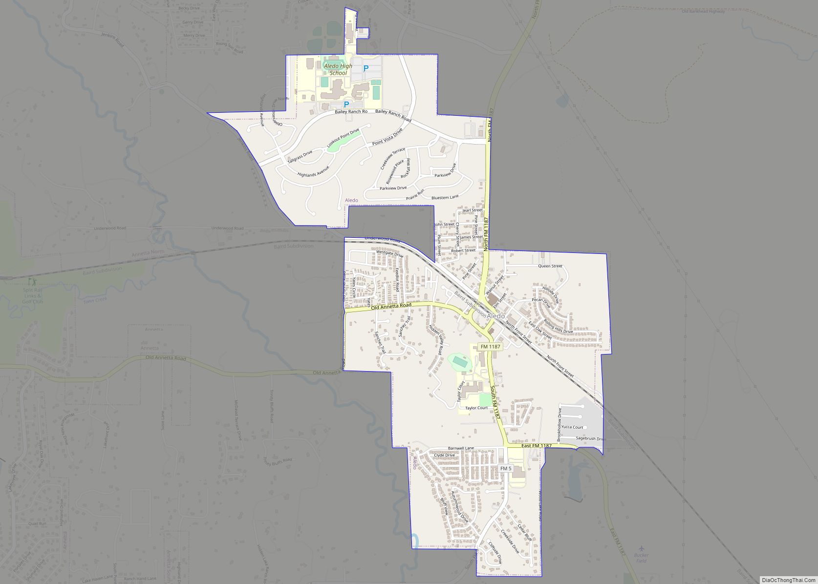
Azle Road Map
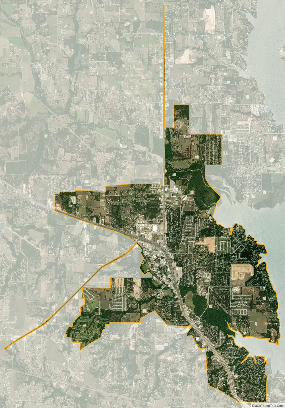
Azle city Satellite Map
Geography
Azle is on State Highway 199, 17 miles (27 km) northwest of downtown Fort Worth, in the northwest corner of Tarrant County; the town extends partly into Parker County.
According to the United States Census Bureau, the city has a total area of 8.8 square miles (22.9 km), of which 8.8 square miles (22.8 km) is land and 0.015 square miles (0.04 km), or 0.20%, is covered by water.
See also
Map of Texas State and its subdivision:- Anderson
- Andrews
- Angelina
- Aransas
- Archer
- Armstrong
- Atascosa
- Austin
- Bailey
- Bandera
- Bastrop
- Baylor
- Bee
- Bell
- Bexar
- Blanco
- Borden
- Bosque
- Bowie
- Brazoria
- Brazos
- Brewster
- Briscoe
- Brooks
- Brown
- Burleson
- Burnet
- Caldwell
- Calhoun
- Callahan
- Cameron
- Camp
- Carson
- Cass
- Castro
- Chambers
- Cherokee
- Childress
- Clay
- Cochran
- Coke
- Coleman
- Collin
- Collingsworth
- Colorado
- Comal
- Comanche
- Concho
- Cooke
- Coryell
- Cottle
- Crane
- Crockett
- Crosby
- Culberson
- Dallam
- Dallas
- Dawson
- Deaf Smith
- Delta
- Denton
- Dewitt
- Dickens
- Dimmit
- Donley
- Duval
- Eastland
- Ector
- Edwards
- El Paso
- Ellis
- Erath
- Falls
- Fannin
- Fayette
- Fisher
- Floyd
- Foard
- Fort Bend
- Franklin
- Freestone
- Frio
- Gaines
- Galveston
- Garza
- Gillespie
- Glasscock
- Goliad
- Gonzales
- Gray
- Grayson
- Gregg
- Grimes
- Guadalupe
- Hale
- Hall
- Hamilton
- Hansford
- Hardeman
- Hardin
- Harris
- Harrison
- Hartley
- Haskell
- Hays
- Hemphill
- Henderson
- Hidalgo
- Hill
- Hockley
- Hood
- Hopkins
- Houston
- Howard
- Hudspeth
- Hunt
- Hutchinson
- Irion
- Jack
- Jackson
- Jasper
- Jeff Davis
- Jefferson
- Jim Hogg
- Jim Wells
- Johnson
- Jones
- Karnes
- Kaufman
- Kendall
- Kenedy
- Kent
- Kerr
- Kimble
- King
- Kinney
- Kleberg
- Knox
- La Salle
- Lamar
- Lamb
- Lampasas
- Lavaca
- Lee
- Leon
- Liberty
- Limestone
- Lipscomb
- Live Oak
- Llano
- Loving
- Lubbock
- Lynn
- Madison
- Marion
- Martin
- Mason
- Matagorda
- Maverick
- McCulloch
- McLennan
- McMullen
- Medina
- Menard
- Midland
- Milam
- Mills
- Mitchell
- Montague
- Montgomery
- Moore
- Morris
- Motley
- Nacogdoches
- Navarro
- Newton
- Nolan
- Nueces
- Ochiltree
- Oldham
- Orange
- Palo Pinto
- Panola
- Parker
- Parmer
- Pecos
- Polk
- Potter
- Presidio
- Rains
- Randall
- Reagan
- Real
- Red River
- Reeves
- Refugio
- Roberts
- Robertson
- Rockwall
- Runnels
- Rusk
- Sabine
- San Augustine
- San Jacinto
- San Patricio
- San Saba
- Schleicher
- Scurry
- Shackelford
- Shelby
- Sherman
- Smith
- Somervell
- Starr
- Stephens
- Sterling
- Stonewall
- Sutton
- Swisher
- Tarrant
- Taylor
- Terrell
- Terry
- Throckmorton
- Titus
- Tom Green
- Travis
- Trinity
- Tyler
- Upshur
- Upton
- Uvalde
- Val Verde
- Van Zandt
- Victoria
- Walker
- Waller
- Ward
- Washington
- Webb
- Wharton
- Wheeler
- Wichita
- Wilbarger
- Willacy
- Williamson
- Wilson
- Winkler
- Wise
- Wood
- Yoakum
- Young
- Zapata
- Zavala
- Alabama
- Alaska
- Arizona
- Arkansas
- California
- Colorado
- Connecticut
- Delaware
- District of Columbia
- Florida
- Georgia
- Hawaii
- Idaho
- Illinois
- Indiana
- Iowa
- Kansas
- Kentucky
- Louisiana
- Maine
- Maryland
- Massachusetts
- Michigan
- Minnesota
- Mississippi
- Missouri
- Montana
- Nebraska
- Nevada
- New Hampshire
- New Jersey
- New Mexico
- New York
- North Carolina
- North Dakota
- Ohio
- Oklahoma
- Oregon
- Pennsylvania
- Rhode Island
- South Carolina
- South Dakota
- Tennessee
- Texas
- Utah
- Vermont
- Virginia
- Washington
- West Virginia
- Wisconsin
- Wyoming