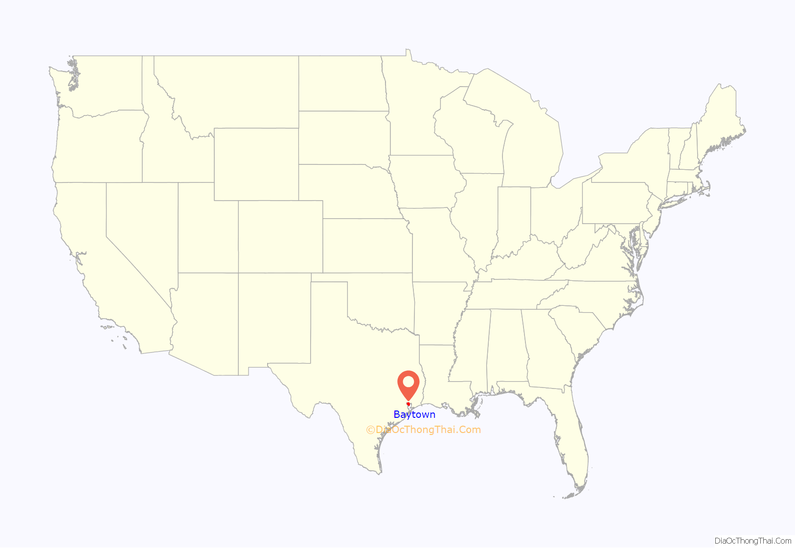
Baytown is a city in the U.S. state of Texas, within Harris and Chambers counties. Located in the Houston–The Woodlands–Sugar Land metropolitan statistical area, it lies on the northern side of the Galveston Bay complex near the outlets of the San Jacinto River and Buffalo Bayou. It is the sixth-largest city within this metropolitan area and seventh largest community (including The Woodlands CDP). Major highways serving the city include State Highway 146 and Interstate 10. At the 2020 U.S. census, Baytown had a population of 83,701, and it had an estimated population of 78,393 in 2021.
| Name: | Baytown city |
|---|---|
| LSAD Code: | 25 |
| LSAD Description: | city (suffix) |
| State: | Texas |
| County: | Chambers County, Harris County |
| Incorporated: | January 24, 1948 |
| Elevation: | 23 ft (7 m) |
| Total Area: | 37.99 sq mi (98.39 km²) |
| Land Area: | 36.91 sq mi (95.59 km²) |
| Water Area: | 1.08 sq mi (2.80 km²) |
| Total Population: | 83,701 |
| Population Density: | 2,091.58/sq mi (807.57/km²) |
| ZIP code: | 77520-77523 |
| Area code: | Area code 281 |
| FIPS code: | 4806128 |
| GNISfeature ID: | 1380966 |
| Website: | www.baytown.org |
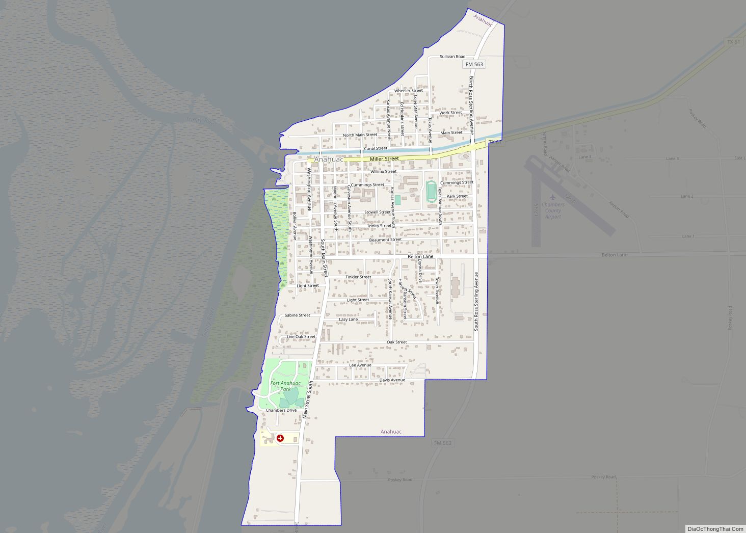
Online Interactive Map
Click on ![]() to view map in "full screen" mode.
to view map in "full screen" mode.
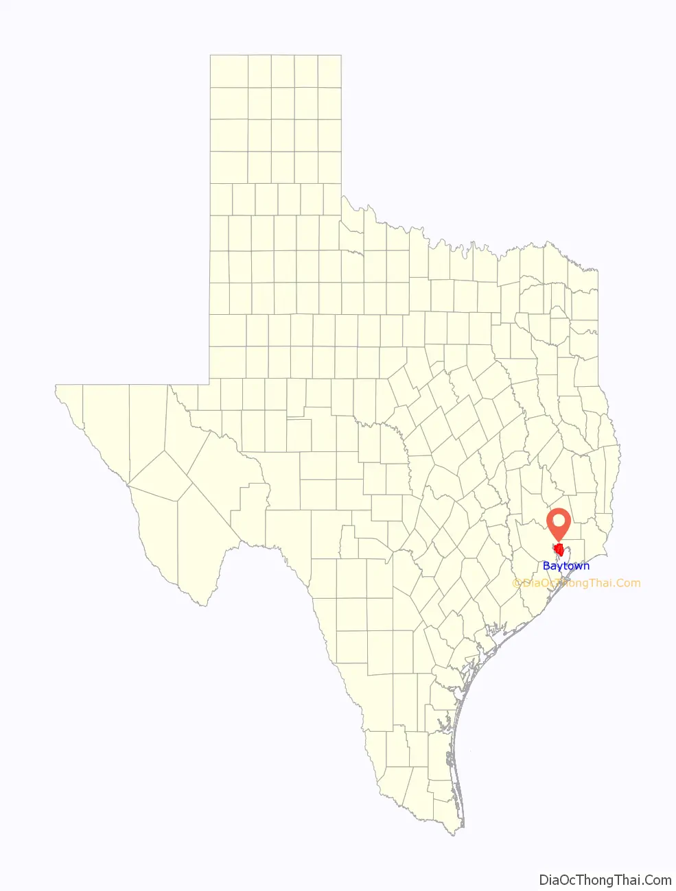
Baytown location map. Where is Baytown city?
History
White American settlers first arrived in the now-Baytown area in 1822. One of its earliest settlers was Nathaniel Lynch, who set up a ferry crossing at the junction of the San Jacinto River and Buffalo Bayou. The still-operating ferry service is known as the Lynchburg Ferry. Other early settlers of Baytown included William Scott, one of Stephen F. Austin’s Old Three Hundred, and Ashbel Smith, who owned a plantation in the area.
The city now known as Baytown was originally three separate towns. The first of these was Goose Creek, named for the bayou of the same name where Canada geese wintered and whose name is still reflected in the area’s Goose Creek school district, whose establishment dates back to before 1850. With the discovery of the Goose Creek Oil Field, the rival communities of Pelly in the late 1910s, and East Baytown in the early 1920s, developed as early boomtowns. The “East” in East Baytown was later dropped because it was west of Goose Creek.
Serious talk of merging the three cities began shortly after World War I, but the community of Baytown was opposed to this idea. However, in 1947, the three cities finally agreed to consolidate. The citizens settled on the name Baytown for the new combined city. Baytown as it is known today was officially founded January 24, 1948.
In 1916, the Humble Oil and Refining Company, founded by one-time Texas governor Ross S. Sterling and his associates, in developing the Goose Creek Oil Field, built the first offshore drilling operation in Texas and the second in the United States. The company later built the Baytown Refinery, which would become one of the largest Exxon refineries in the world. Since then, many other refineries have been built in the area. Exxon-Mobil is still one of the major employers in the city and now runs over 10 plants in the area including a newly announced 2 billion dollar expansion to its chemical facilities in 2019.
Following the discovery of oil nearby, the population of Baytown and the tri-cities boomed. Many immigrants arrived in Baytown, among them a number of Jewish families who founded a synagogue, K’nesseth Israel, in 1930.
Steel manufacturing in Baytown began in 1970 when United States Steel opened the Texas Works near the city. The plant was officially closed in July 1986, due to a poor economic climate and the decline of American steel in the 1980s. The mill was later purchased by Jindal Steel and now operates as JSW Steel USA, Inc.
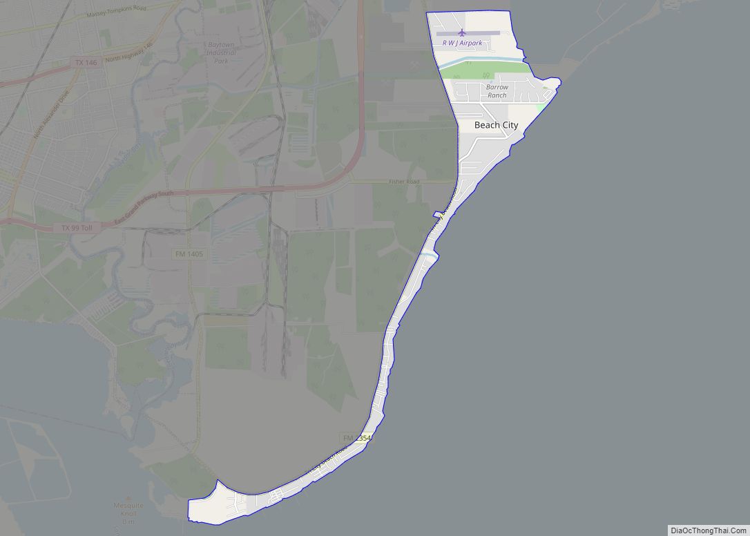
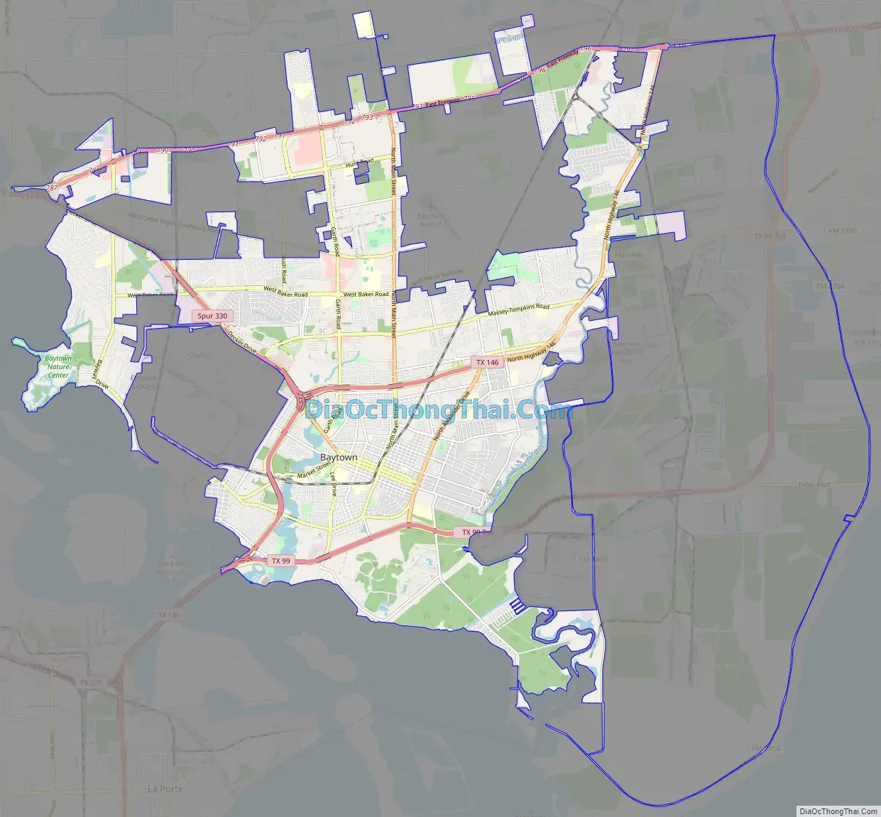
Baytown Road Map
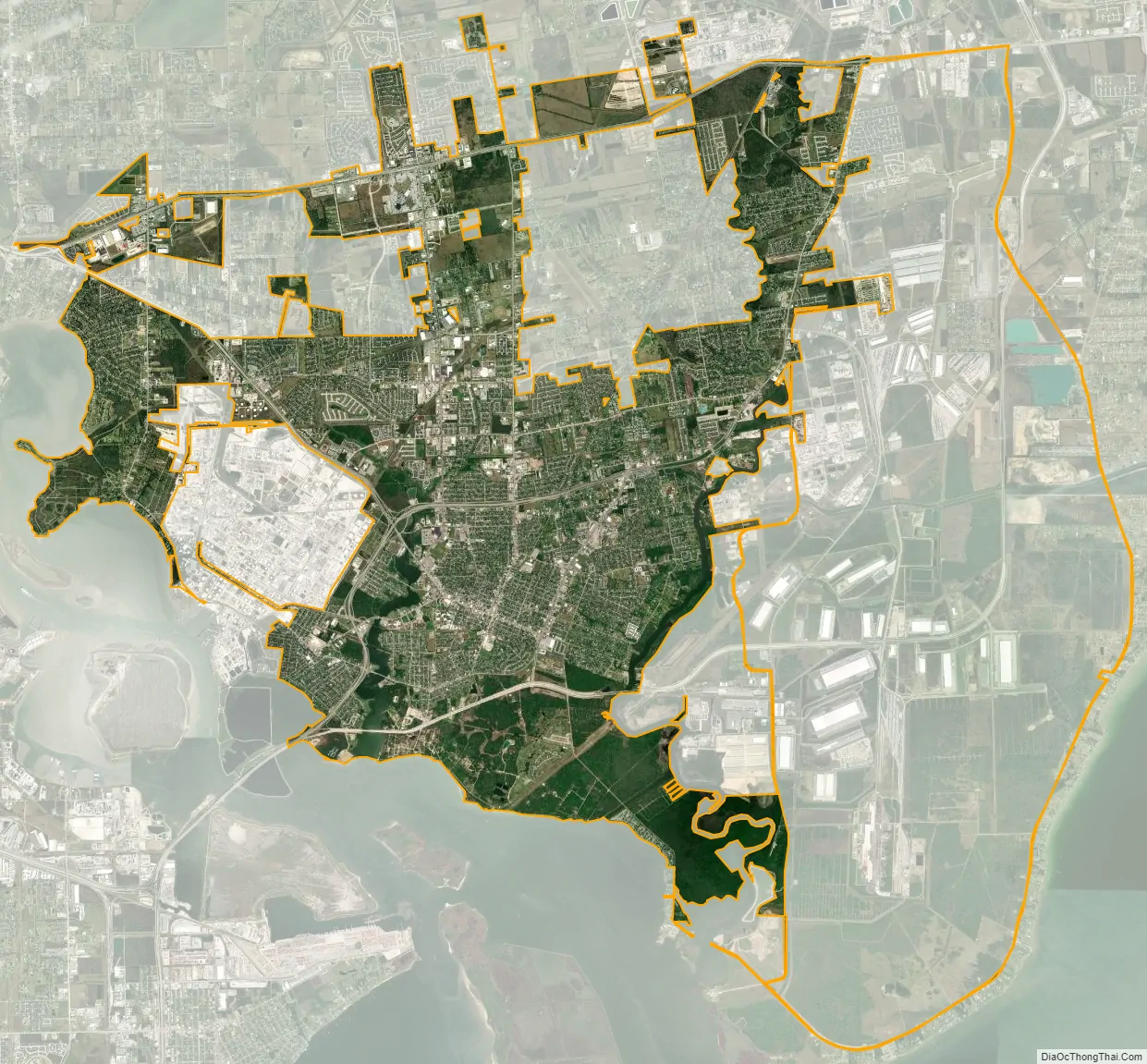
Baytown city Satellite Map
Geography
The city of Baytown is located at the mouth of the San Jacinto River on Galveston Bay, 26 miles (42 km) by road east of Houston. According to the United States Census Bureau, the city has a total area of 36.5 square miles (94.6 km), of which 35.4 square miles (91.8 km) is land and 1.1 square miles (2.8 km), 2.92%, is covered by water.
Baytown is located on the Gulf coastal plain, and its vegetation is classified as temperate grassland and marshes. The municipalities have been built on reclaimed marshes, swamps, and prairies, which are all still visible in undeveloped parts of the Galveston Bay area. Baytown is bordered by water on three sides. Along the south and west is Galveston Bay. On the east is Cedar Bayou. The city is roughly bordered along the north by Interstate 10. Portions of the city to the east of Cedar Bayou lie in Chambers County.
Flatness of the local terrain and proximity to the bay have made flooding a recurring problem for the area. Baytown and surrounding communities once relied on groundwater for its needs, but severe land subsidence has forced much the city to turn to ground-level water sources.
Geology
The land beneath Baytown consists of layers of sand and clay to great depths. These layers were created by millennia of river-borne sediments which gradually incorporated plant and animal matter, creating the petroleum deposits for which the Gulf Coast is now known.
The region around the city has numerous faults, many considered active, but none have produced significant earthquakes in recorded history. These faults tend to move at a smooth rate in what is termed “fault creep”, which reduces the risk of an earthquake. The one significant earthquake that has been reported in the area was the result of an underground water and petroleum extraction.
Climate
Baytown’s climate is classified as humid subtropical (Cfa in Köppen climate classification system). Spring supercell thunderstorms sometimes create tornadoes (but not to the extent found in tornado alley). Prevailing winds from the south and southeast bring heat from the deserts of Mexico and moisture from the Gulf of Mexico.
Summer temperatures typically have highs near 90 °F (32 °C) though higher temperatures are not uncommon. The city’s proximity to the bay and the winds that it generates moderate the area’s temperatures and ease the effects of the humidity, creating a more pleasant climate than inland communities like Houston. Winters in the area are temperate with typical January high of 61 °F (16 °C) and lows are near 42 °F (6 °C). Snowfall is rare. Annual rainfall averages are around or exceed 60 inches (150 cm).
Excessive ozone levels can occur due to industrial activities; nearby Houston is ranked among the most ozone-polluted cities in the United States. The industries located along the ship channel and the bay are a major cause of the pollution.
Hurricanes are a substantial concern during the fall season. Though Galveston Island and the Bolivar Peninsula provide some shielding, Baytown still faces more danger than Houston and other inland communities, particularly because of storm surge, as well as severe land subsidence in some low-lying areas of town due to excess pumping of groundwater in the 1960s (see Brownwood subdivision) by area refineries and municipalities. Hurricanes Carla (1961), Alicia (1983), Ike (2008), and Harvey (2017) were the four most damaging hurricanes to affect Baytown.
See also
Map of Texas State and its subdivision:- Anderson
- Andrews
- Angelina
- Aransas
- Archer
- Armstrong
- Atascosa
- Austin
- Bailey
- Bandera
- Bastrop
- Baylor
- Bee
- Bell
- Bexar
- Blanco
- Borden
- Bosque
- Bowie
- Brazoria
- Brazos
- Brewster
- Briscoe
- Brooks
- Brown
- Burleson
- Burnet
- Caldwell
- Calhoun
- Callahan
- Cameron
- Camp
- Carson
- Cass
- Castro
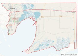
- Chambers
- Cherokee
- Childress
- Clay
- Cochran
- Coke
- Coleman
- Collin
- Collingsworth
- Colorado
- Comal
- Comanche
- Concho
- Cooke
- Coryell
- Cottle
- Crane
- Crockett
- Crosby
- Culberson
- Dallam
- Dallas
- Dawson
- Deaf Smith
- Delta
- Denton
- Dewitt
- Dickens
- Dimmit
- Donley
- Duval
- Eastland
- Ector
- Edwards
- El Paso
- Ellis
- Erath
- Falls
- Fannin
- Fayette
- Fisher
- Floyd
- Foard
- Fort Bend
- Franklin
- Freestone
- Frio
- Gaines
- Galveston
- Garza
- Gillespie
- Glasscock
- Goliad
- Gonzales
- Gray
- Grayson
- Gregg
- Grimes
- Guadalupe
- Hale
- Hall
- Hamilton
- Hansford
- Hardeman
- Hardin
- Harris
- Harrison
- Hartley
- Haskell
- Hays
- Hemphill
- Henderson
- Hidalgo
- Hill
- Hockley
- Hood
- Hopkins
- Houston
- Howard
- Hudspeth
- Hunt
- Hutchinson
- Irion
- Jack
- Jackson
- Jasper
- Jeff Davis
- Jefferson
- Jim Hogg
- Jim Wells
- Johnson
- Jones
- Karnes
- Kaufman
- Kendall
- Kenedy
- Kent
- Kerr
- Kimble
- King
- Kinney
- Kleberg
- Knox
- La Salle
- Lamar
- Lamb
- Lampasas
- Lavaca
- Lee
- Leon
- Liberty
- Limestone
- Lipscomb
- Live Oak
- Llano
- Loving
- Lubbock
- Lynn
- Madison
- Marion
- Martin
- Mason
- Matagorda
- Maverick
- McCulloch
- McLennan
- McMullen
- Medina
- Menard
- Midland
- Milam
- Mills
- Mitchell
- Montague
- Montgomery
- Moore
- Morris
- Motley
- Nacogdoches
- Navarro
- Newton
- Nolan
- Nueces
- Ochiltree
- Oldham
- Orange
- Palo Pinto
- Panola
- Parker
- Parmer
- Pecos
- Polk
- Potter
- Presidio
- Rains
- Randall
- Reagan
- Real
- Red River
- Reeves
- Refugio
- Roberts
- Robertson
- Rockwall
- Runnels
- Rusk
- Sabine
- San Augustine
- San Jacinto
- San Patricio
- San Saba
- Schleicher
- Scurry
- Shackelford
- Shelby
- Sherman
- Smith
- Somervell
- Starr
- Stephens
- Sterling
- Stonewall
- Sutton
- Swisher
- Tarrant
- Taylor
- Terrell
- Terry
- Throckmorton
- Titus
- Tom Green
- Travis
- Trinity
- Tyler
- Upshur
- Upton
- Uvalde
- Val Verde
- Van Zandt
- Victoria
- Walker
- Waller
- Ward
- Washington
- Webb
- Wharton
- Wheeler
- Wichita
- Wilbarger
- Willacy
- Williamson
- Wilson
- Winkler
- Wise
- Wood
- Yoakum
- Young
- Zapata
- Zavala
- Alabama
- Alaska
- Arizona
- Arkansas
- California
- Colorado
- Connecticut
- Delaware
- District of Columbia
- Florida
- Georgia
- Hawaii
- Idaho
- Illinois
- Indiana
- Iowa
- Kansas
- Kentucky
- Louisiana
- Maine
- Maryland
- Massachusetts
- Michigan
- Minnesota
- Mississippi
- Missouri
- Montana
- Nebraska
- Nevada
- New Hampshire
- New Jersey
- New Mexico
- New York
- North Carolina
- North Dakota
- Ohio
- Oklahoma
- Oregon
- Pennsylvania
- Rhode Island
- South Carolina
- South Dakota
- Tennessee
- Texas
- Utah
- Vermont
- Virginia
- Washington
- West Virginia
- Wisconsin
- Wyoming