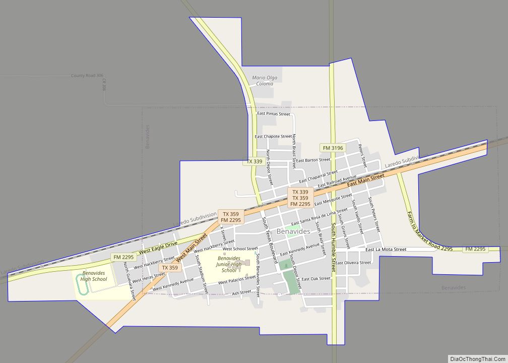
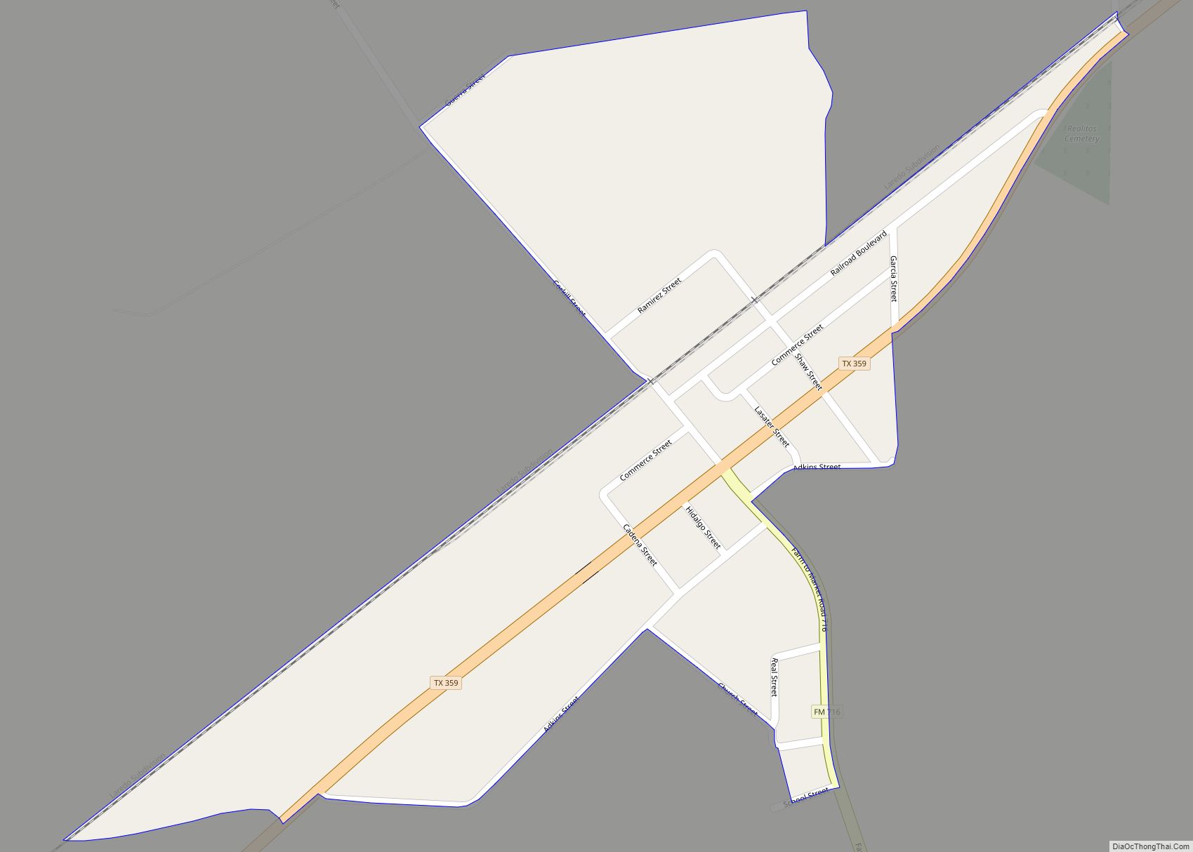
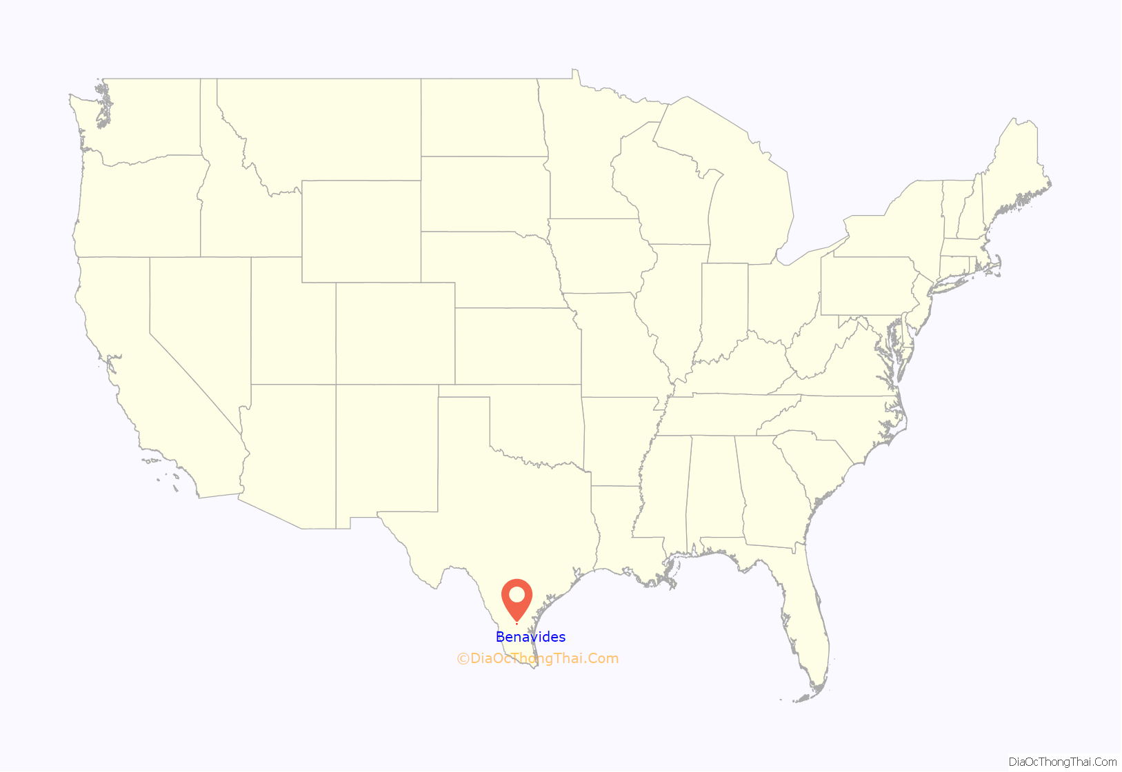
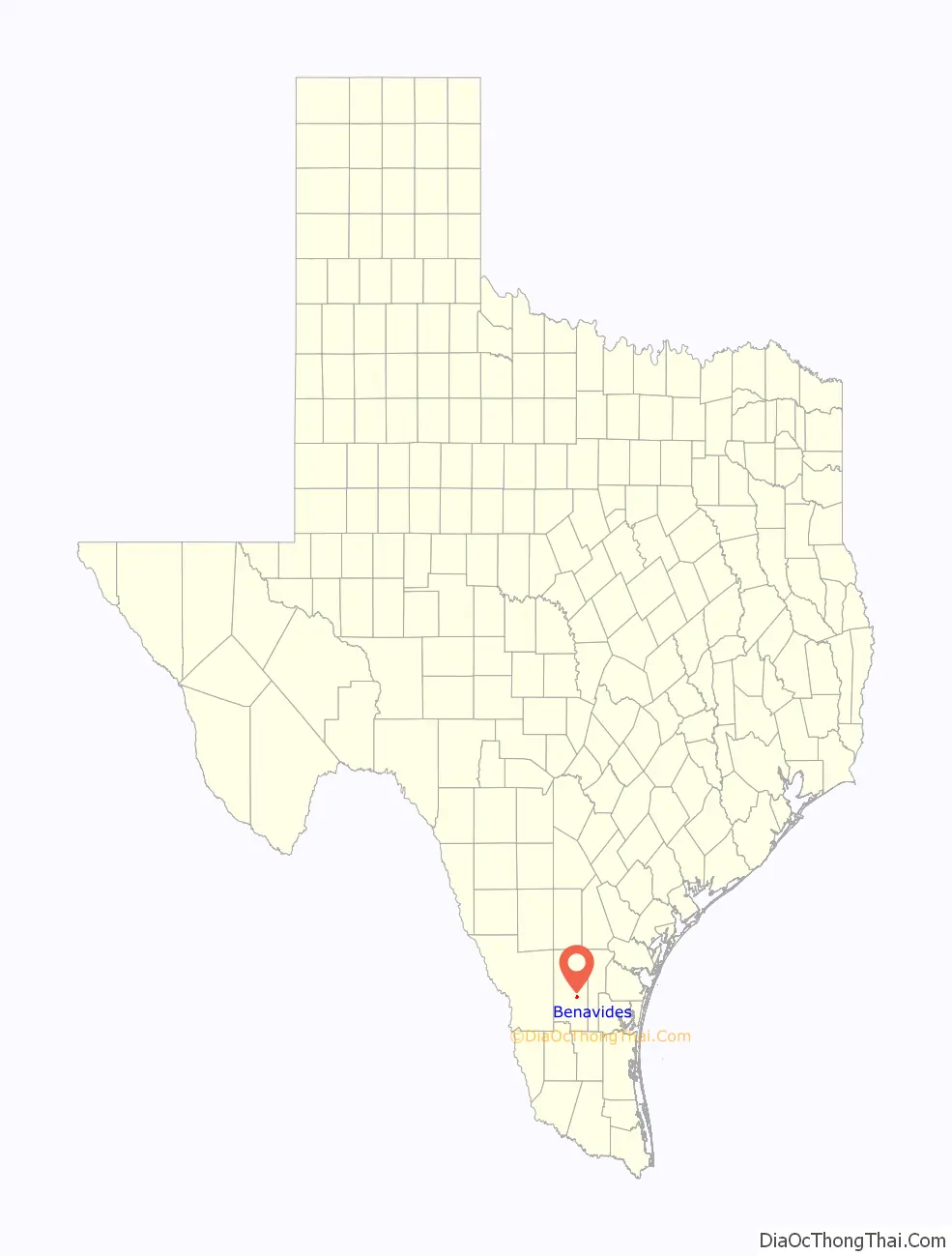
Benavides (/ˌbɛnəˈviːdəs/ BEN-ə-VEE-dəs) is a city in Duval County, Texas, United States. The population was 1,362 at the 2010 census, down from 1,686 at the 2000 census.
| Name: | Benavides city |
|---|---|
| LSAD Code: | 25 |
| LSAD Description: | city (suffix) |
| State: | Texas |
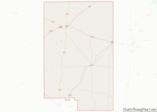
| County: | Duval County |
| Elevation: | 374 ft (114 m) |
| Total Area: | 1.77 sq mi (4.59 km²) |
| Land Area: | 1.77 sq mi (4.59 km²) |
| Water Area: | 0.00 sq mi (0.00 km²) |
| Total Population: | 1,362 |
| Population Density: | 793.90/sq mi (306.58/km²) |
| ZIP code: | 78341 |
| Area code: | 361 |
| FIPS code: | 4807528 |
| GNISfeature ID: | 1330408 |
Online Interactive Map
Click on ![]() to view map in "full screen" mode.
to view map in "full screen" mode.
History
The town is named after Plácido Benavides (1837–1919), namesake nephew of Plácido Benavides (1810–1837), Tejano 1832 alcalde of Victoria, who served under Stephen F. Austin with Juan Seguin, in the Siege of Béxar.
Plácido Benavides whom the town is named after served in the Confederate States Army. After the war, he built his “Rancho Palo Alto” into one of the largest ranches in Duval County. In 1880, he agreed to let the county locate a railroad station on his property. In 1881, he donated 80 acres (32 ha) to establish the community that grew up around the station on the Texas Mexican Railway.
In 1882 Archie Parr arrived to manage the Sweden Ranch for the Lott & Nielson Pasture Company. The former schoolteacher and ranch hand was later a rancher, Texas state senator, and the first “Duke of Duval”, political boss of the county. His middle son, George Berham Parr, succeeded him as El Patrón and Duke of Duval. Other descendants of Archie also figured prominently in county politics. In 1911, Archie campaigned unsuccessfully to move the county courthouse from San Diego to Benavides.
Geography
Benavides is located southeast of the center of Duval County at 27°35′48″N 98°24′43″W / 27.59667°N 98.41194°W / 27.59667; -98.41194 (27.596677, –98.411884), in the valley of Santa Gertrudis Creek. Texas State Highway 359 runs through the city, leading northeast 15 miles (24 km) to San Diego, the county seat, and southwest 27 miles (43 km) to Hebbronville. Texas State Highway 339 also passes through Benavides, leading northwest 24 miles (39 km) to Freer, and south 25 miles (40 km) to its end at TX 285.
According to the United States Census Bureau, Benavides has a total area of 1.8 square miles (4.7 km), all of it land.
See also
Map of Texas State and its subdivision:- Anderson
- Andrews
- Angelina
- Aransas
- Archer
- Armstrong
- Atascosa
- Austin
- Bailey
- Bandera
- Bastrop
- Baylor
- Bee
- Bell
- Bexar
- Blanco
- Borden
- Bosque
- Bowie
- Brazoria
- Brazos
- Brewster
- Briscoe
- Brooks
- Brown
- Burleson
- Burnet
- Caldwell
- Calhoun
- Callahan
- Cameron
- Camp
- Carson
- Cass
- Castro
- Chambers
- Cherokee
- Childress
- Clay
- Cochran
- Coke
- Coleman
- Collin
- Collingsworth
- Colorado
- Comal
- Comanche
- Concho
- Cooke
- Coryell
- Cottle
- Crane
- Crockett
- Crosby
- Culberson
- Dallam
- Dallas
- Dawson
- Deaf Smith
- Delta
- Denton
- Dewitt
- Dickens
- Dimmit
- Donley
- Duval
- Eastland
- Ector
- Edwards
- El Paso
- Ellis
- Erath
- Falls
- Fannin
- Fayette
- Fisher
- Floyd
- Foard
- Fort Bend
- Franklin
- Freestone
- Frio
- Gaines
- Galveston
- Garza
- Gillespie
- Glasscock
- Goliad
- Gonzales
- Gray
- Grayson
- Gregg
- Grimes
- Guadalupe
- Hale
- Hall
- Hamilton
- Hansford
- Hardeman
- Hardin
- Harris
- Harrison
- Hartley
- Haskell
- Hays
- Hemphill
- Henderson
- Hidalgo
- Hill
- Hockley
- Hood
- Hopkins
- Houston
- Howard
- Hudspeth
- Hunt
- Hutchinson
- Irion
- Jack
- Jackson
- Jasper
- Jeff Davis
- Jefferson
- Jim Hogg
- Jim Wells
- Johnson
- Jones
- Karnes
- Kaufman
- Kendall
- Kenedy
- Kent
- Kerr
- Kimble
- King
- Kinney
- Kleberg
- Knox
- La Salle
- Lamar
- Lamb
- Lampasas
- Lavaca
- Lee
- Leon
- Liberty
- Limestone
- Lipscomb
- Live Oak
- Llano
- Loving
- Lubbock
- Lynn
- Madison
- Marion
- Martin
- Mason
- Matagorda
- Maverick
- McCulloch
- McLennan
- McMullen
- Medina
- Menard
- Midland
- Milam
- Mills
- Mitchell
- Montague
- Montgomery
- Moore
- Morris
- Motley
- Nacogdoches
- Navarro
- Newton
- Nolan
- Nueces
- Ochiltree
- Oldham
- Orange
- Palo Pinto
- Panola
- Parker
- Parmer
- Pecos
- Polk
- Potter
- Presidio
- Rains
- Randall
- Reagan
- Real
- Red River
- Reeves
- Refugio
- Roberts
- Robertson
- Rockwall
- Runnels
- Rusk
- Sabine
- San Augustine
- San Jacinto
- San Patricio
- San Saba
- Schleicher
- Scurry
- Shackelford
- Shelby
- Sherman
- Smith
- Somervell
- Starr
- Stephens
- Sterling
- Stonewall
- Sutton
- Swisher
- Tarrant
- Taylor
- Terrell
- Terry
- Throckmorton
- Titus
- Tom Green
- Travis
- Trinity
- Tyler
- Upshur
- Upton
- Uvalde
- Val Verde
- Van Zandt
- Victoria
- Walker
- Waller
- Ward
- Washington
- Webb
- Wharton
- Wheeler
- Wichita
- Wilbarger
- Willacy
- Williamson
- Wilson
- Winkler
- Wise
- Wood
- Yoakum
- Young
- Zapata
- Zavala
- Alabama
- Alaska
- Arizona
- Arkansas
- California
- Colorado
- Connecticut
- Delaware
- District of Columbia
- Florida
- Georgia
- Hawaii
- Idaho
- Illinois
- Indiana
- Iowa
- Kansas
- Kentucky
- Louisiana
- Maine
- Maryland
- Massachusetts
- Michigan
- Minnesota
- Mississippi
- Missouri
- Montana
- Nebraska
- Nevada
- New Hampshire
- New Jersey
- New Mexico
- New York
- North Carolina
- North Dakota
- Ohio
- Oklahoma
- Oregon
- Pennsylvania
- Rhode Island
- South Carolina
- South Dakota
- Tennessee
- Texas
- Utah
- Vermont
- Virginia
- Washington
- West Virginia
- Wisconsin
- Wyoming