Brackettville is a city in Kinney County, Texas, United States. The population was 1,688 at the 2010 census, down from 1,876 at the 2000 census. It is the county seat of Kinney County.
| Name: | Brackettville city |
|---|---|
| LSAD Code: | 25 |
| LSAD Description: | city (suffix) |
| State: | Texas |
| County: | Kinney County |
| Elevation: | 1,106 ft (337 m) |
| Total Area: | 3.17 sq mi (8.21 km²) |
| Land Area: | 3.17 sq mi (8.21 km²) |
| Water Area: | 0.00 sq mi (0.00 km²) |
| Total Population: | 1,688 |
| Population Density: | 532.03/sq mi (205.42/km²) |
| ZIP code: | 78832 |
| Area code: | 830 |
| FIPS code: | 4809868 |
| GNISfeature ID: | 1352804 |
| Website: | www.thecityofbrackettville.com |
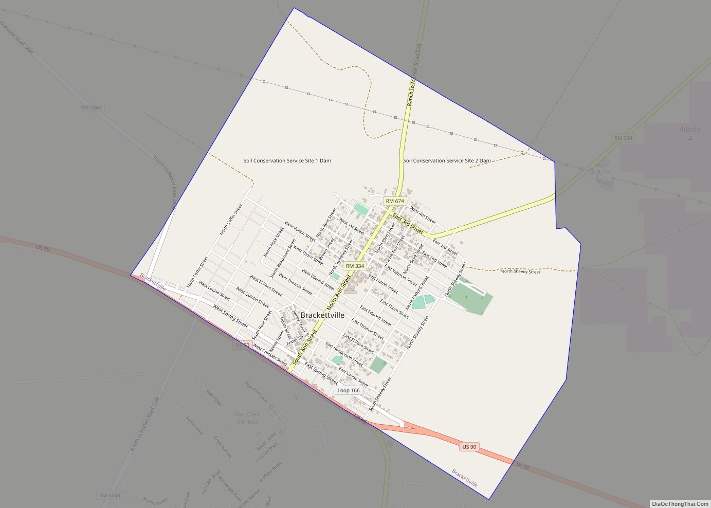
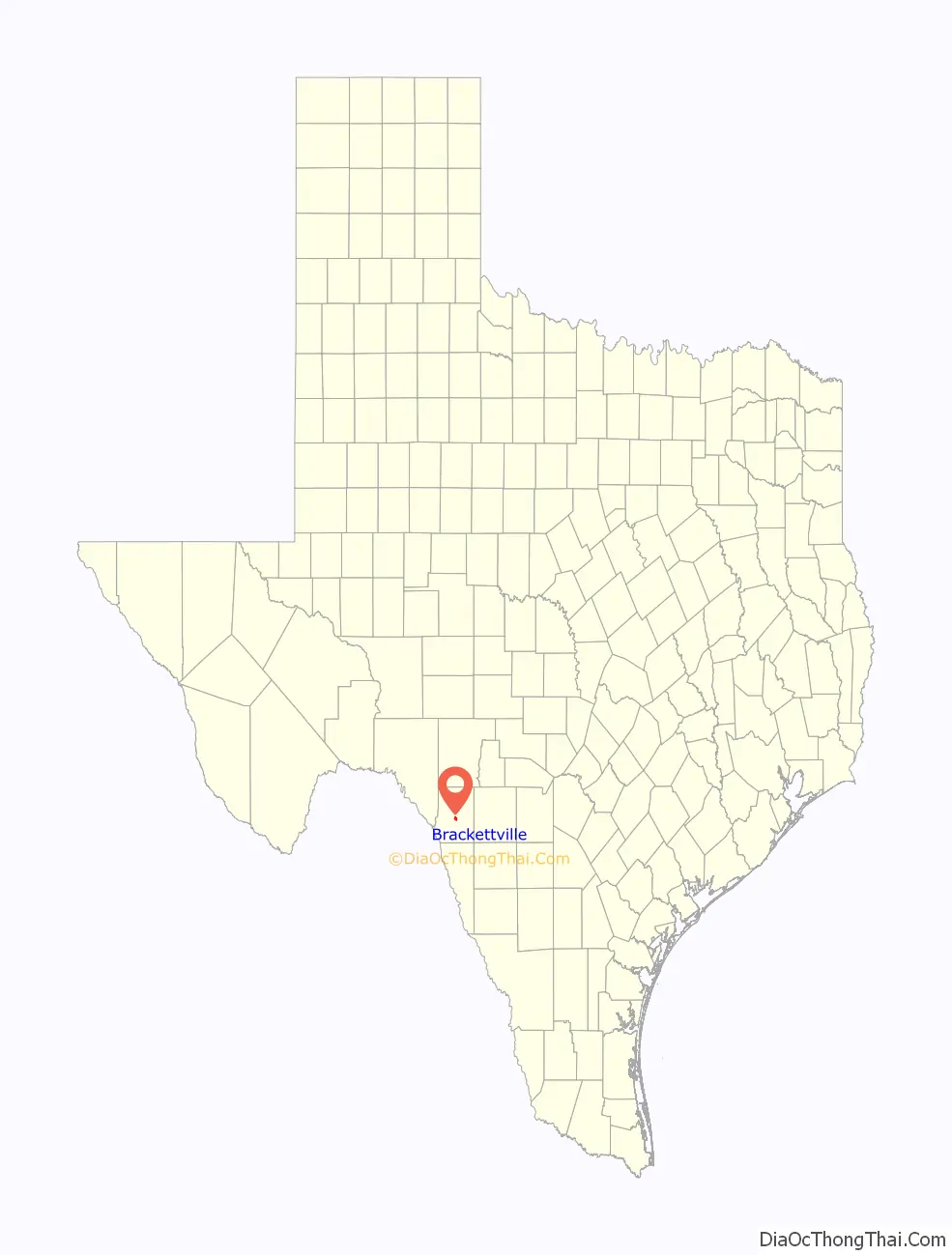
Online Interactive Map
Click on ![]() to view map in "full screen" mode.
to view map in "full screen" mode.
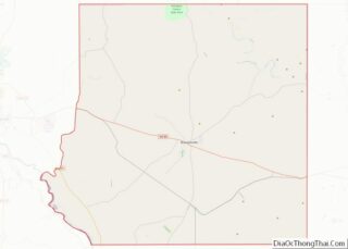
Brackettville location map. Where is Brackettville city?

History
Founded in 1852 as “Las Moras” (the name of a nearby spring and the creek it feeds), the town initially was a supply stop on the old San Antonio-El Paso road and a supply depot for the U.S. Army’s Fort Clark (the fort was established the same year). Later the town was named “Brackett” after Oscar B. Brackett, the owner of the first dry goods store in the area. In 1873, when a post office was awarded, “ville” was appended to the name to differentiate it from another town.
The town grew quickly through the 19th century with the expansion of the garrison at Fort Clark for the Indian Wars. The town’s fortunes were tied to the fort. For many years, it was the base of the famous Buffalo Soldiers, made up of African Americans. Demographically, Brackettville had a larger proportion of Black Seminoles ( African American escaped slaves who had lived alongside Seminole native Americans prior to the 2nd Seminole War 1835-1842) during the S with their families in the town. During the slavery years, they had been living in a settlement in northern Mexico to escape US conditions. Their language developed in Florida, Afro-Seminole, is still spoken by some in Brackettville.
After the Buffalo Soldiers moved out of Fort Clark with the waning of the Indian Wars, it was used as a cavalry post. The Seminole Negro Indian Scouts were finally disbanded as a unit in 1914. Virtually every cavalry unit in the U.S. Army was stationed at or trained at Fort Clark at one time or another.
In 1943 during World War II, the U.S. Army activated the Second Cavalry Division, which was to be the Army’s last horse-mounted unit. By 1944, even the Second had been mechanized. Fort Clark, so long a center of mounted cavalry, was targeted for closure. Before its closure, the fort was used as a German prisoner-of-war camp.
Because of the families of soldiers at the fort and African-American veterans and descendants who had settled here, during the war, the US government funded construction of a high school for black students, which opened in April 1944, so the children of veterans could be educated. The state of Texas was still racially segregated; it had essentially disenfranchised blacks since the early 20th century by its voter registration and electoral requirements, and the white legislature consistently underfunded black education and services. Officially classified as a four-year high school, it is believed to have been the only one of its kind between San Antonio and El Paso at that time.
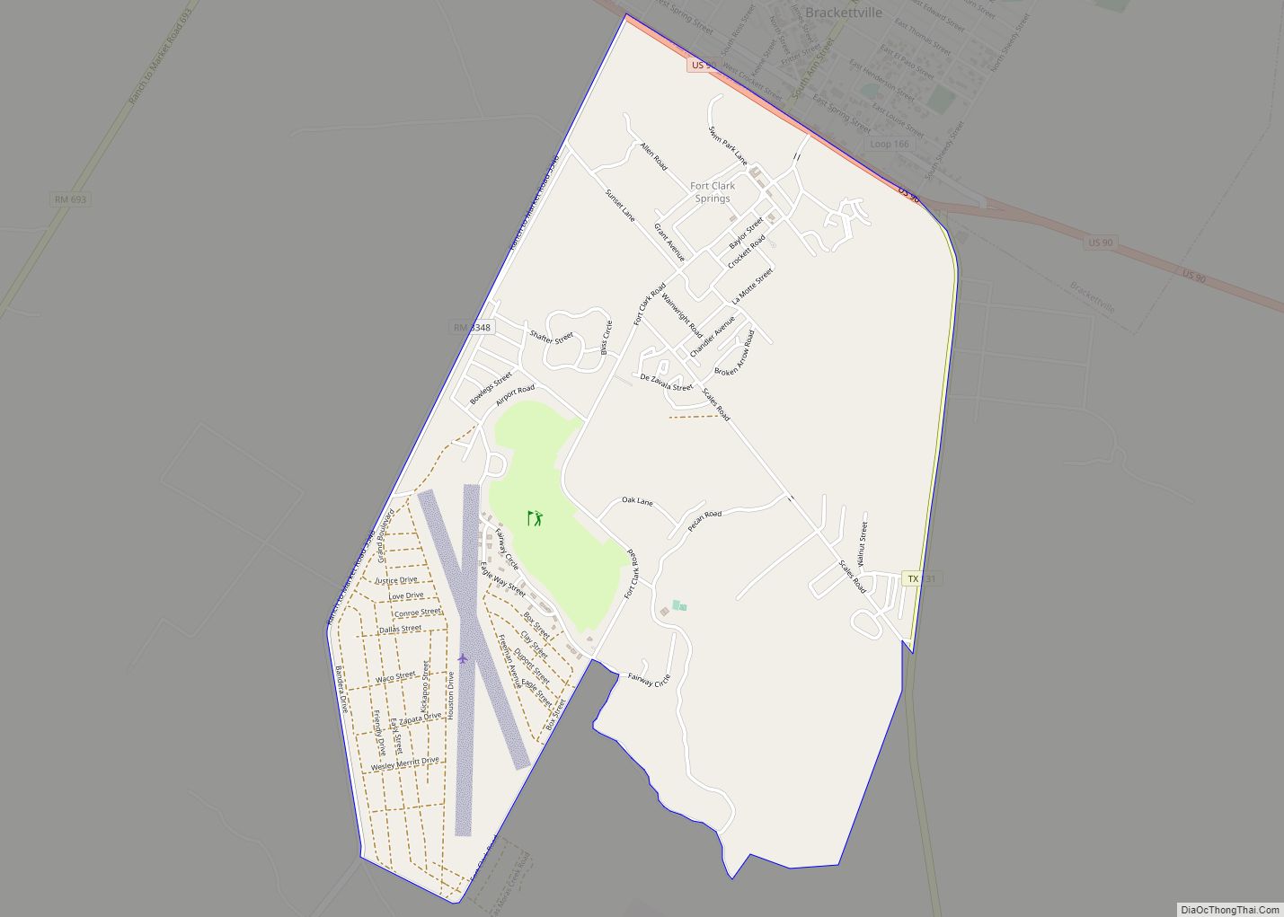
After the fort officially closed in 1946, it had a variety of uses. In 1971 it was converted and adapted as a resort/retirement center. The historic district of the fort is listed on the National Register of Historic Places. The resort is not the economic engine the fort once was, and Brackettville has shrunk from its peak population during the war years.
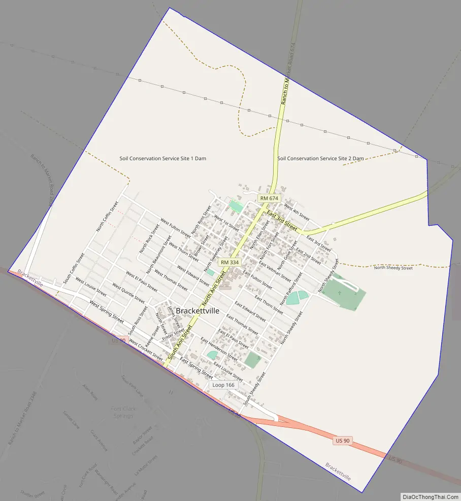
Brackettville Road Map
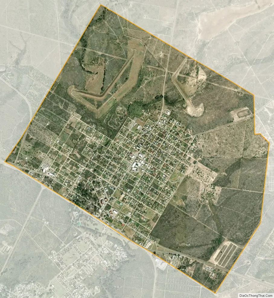
Brackettville city Satellite Map
Geography
Brackettville is located near the center of Kinney County at 29°18′55″N 100°24′54″W / 29.31528°N 100.41500°W / 29.31528; -100.41500 (29.315349, –100.415120). It is bordered to the south by Fort Clark Springs, an unincorporated community on the site of the former Fort Clark. U.S. Route 90 runs along the southern edge of Brackettville, leading east 39 miles (63 km) to Uvalde and west 30 miles (48 km) to Del Rio. Texas State Highway 131 runs south from Brackettville 45 miles (72 km) to Eagle Pass.
The closest airport with commercial airline service is Del Rio International Airport, on the west side of Del Rio, 32 miles (51 km) from Brackettville.
According to the United States Census Bureau, Brackettville has a total area of 3.2 square miles (8.2 km), of which 2.8 square miles (7.3 km) are land and 0.3 square miles (0.9 km), or 10.97%, are water.
Climate
Brackettville has a humid subtropical climate (Köppen Cfa) bordering on a hot semi-arid climate (Köppen BSh) with hot summers, mild winters, and variable but moderate rainfall.
See also
Map of Texas State and its subdivision:- Anderson
- Andrews
- Angelina
- Aransas
- Archer
- Armstrong
- Atascosa
- Austin
- Bailey
- Bandera
- Bastrop
- Baylor
- Bee
- Bell
- Bexar
- Blanco
- Borden
- Bosque
- Bowie
- Brazoria
- Brazos
- Brewster
- Briscoe
- Brooks
- Brown
- Burleson
- Burnet
- Caldwell
- Calhoun
- Callahan
- Cameron
- Camp
- Carson
- Cass
- Castro
- Chambers
- Cherokee
- Childress
- Clay
- Cochran
- Coke
- Coleman
- Collin
- Collingsworth
- Colorado
- Comal
- Comanche
- Concho
- Cooke
- Coryell
- Cottle
- Crane
- Crockett
- Crosby
- Culberson
- Dallam
- Dallas
- Dawson
- Deaf Smith
- Delta
- Denton
- Dewitt
- Dickens
- Dimmit
- Donley
- Duval
- Eastland
- Ector
- Edwards
- El Paso
- Ellis
- Erath
- Falls
- Fannin
- Fayette
- Fisher
- Floyd
- Foard
- Fort Bend
- Franklin
- Freestone
- Frio
- Gaines
- Galveston
- Garza
- Gillespie
- Glasscock
- Goliad
- Gonzales
- Gray
- Grayson
- Gregg
- Grimes
- Guadalupe
- Hale
- Hall
- Hamilton
- Hansford
- Hardeman
- Hardin
- Harris
- Harrison
- Hartley
- Haskell
- Hays
- Hemphill
- Henderson
- Hidalgo
- Hill
- Hockley
- Hood
- Hopkins
- Houston
- Howard
- Hudspeth
- Hunt
- Hutchinson
- Irion
- Jack
- Jackson
- Jasper
- Jeff Davis
- Jefferson
- Jim Hogg
- Jim Wells
- Johnson
- Jones
- Karnes
- Kaufman
- Kendall
- Kenedy
- Kent
- Kerr
- Kimble
- King
- Kinney
- Kleberg
- Knox
- La Salle
- Lamar
- Lamb
- Lampasas
- Lavaca
- Lee
- Leon
- Liberty
- Limestone
- Lipscomb
- Live Oak
- Llano
- Loving
- Lubbock
- Lynn
- Madison
- Marion
- Martin
- Mason
- Matagorda
- Maverick
- McCulloch
- McLennan
- McMullen
- Medina
- Menard
- Midland
- Milam
- Mills
- Mitchell
- Montague
- Montgomery
- Moore
- Morris
- Motley
- Nacogdoches
- Navarro
- Newton
- Nolan
- Nueces
- Ochiltree
- Oldham
- Orange
- Palo Pinto
- Panola
- Parker
- Parmer
- Pecos
- Polk
- Potter
- Presidio
- Rains
- Randall
- Reagan
- Real
- Red River
- Reeves
- Refugio
- Roberts
- Robertson
- Rockwall
- Runnels
- Rusk
- Sabine
- San Augustine
- San Jacinto
- San Patricio
- San Saba
- Schleicher
- Scurry
- Shackelford
- Shelby
- Sherman
- Smith
- Somervell
- Starr
- Stephens
- Sterling
- Stonewall
- Sutton
- Swisher
- Tarrant
- Taylor
- Terrell
- Terry
- Throckmorton
- Titus
- Tom Green
- Travis
- Trinity
- Tyler
- Upshur
- Upton
- Uvalde
- Val Verde
- Van Zandt
- Victoria
- Walker
- Waller
- Ward
- Washington
- Webb
- Wharton
- Wheeler
- Wichita
- Wilbarger
- Willacy
- Williamson
- Wilson
- Winkler
- Wise
- Wood
- Yoakum
- Young
- Zapata
- Zavala
- Alabama
- Alaska
- Arizona
- Arkansas
- California
- Colorado
- Connecticut
- Delaware
- District of Columbia
- Florida
- Georgia
- Hawaii
- Idaho
- Illinois
- Indiana
- Iowa
- Kansas
- Kentucky
- Louisiana
- Maine
- Maryland
- Massachusetts
- Michigan
- Minnesota
- Mississippi
- Missouri
- Montana
- Nebraska
- Nevada
- New Hampshire
- New Jersey
- New Mexico
- New York
- North Carolina
- North Dakota
- Ohio
- Oklahoma
- Oregon
- Pennsylvania
- Rhode Island
- South Carolina
- South Dakota
- Tennessee
- Texas
- Utah
- Vermont
- Virginia
- Washington
- West Virginia
- Wisconsin
- Wyoming