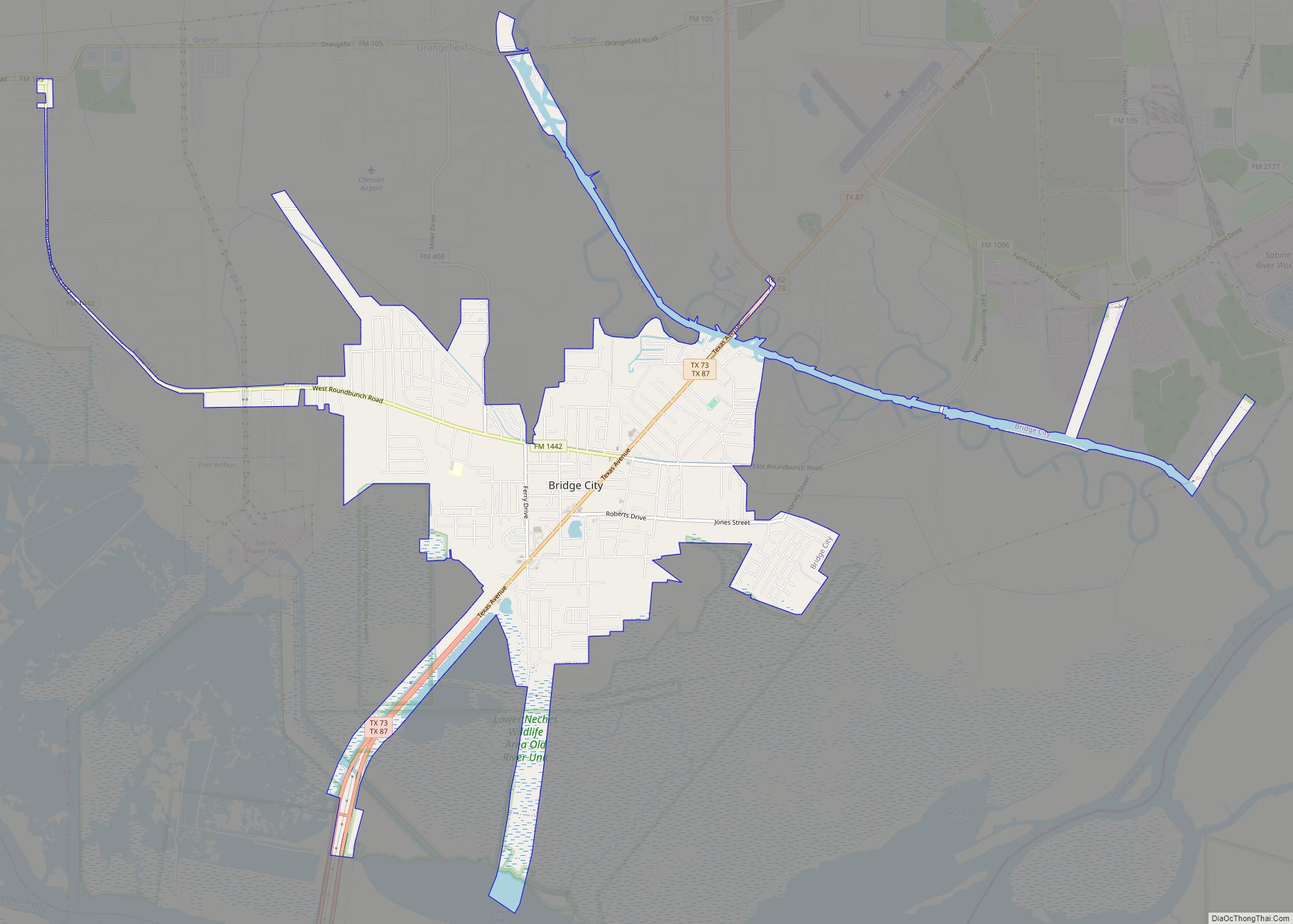
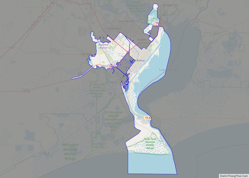
Bridge City is a city in Orange County, Texas, United States. It is 100 miles east of Houston, near the Gulf of Mexico. The population was 9,546 at the 2020 Census. The town borders the Neches River and Cow Bayou. It is part of the Beaumont–Port Arthur Metropolitan Statistical Area. The area is mostly known for its association with the petroleum products (oil) industry.
| Name: | Bridge City city |
|---|---|
| LSAD Code: | 25 |
| LSAD Description: | city (suffix) |
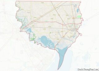
| State: | Texas |
| County: | Orange County |
| Elevation: | 10 ft (3 m) |
| Total Area: | 7.14 sq mi (18.50 km²) |
| Land Area: | 6.44 sq mi (16.67 km²) |
| Water Area: | 0.71 sq mi (1.83 km²) |
| Total Population: | 9,546 |
| Population Density: | 1,221.38/sq mi (471.55/km²) |
| ZIP code: | 77611 |
| Area code: | 409 |
| FIPS code: | 4810252 |
| GNISfeature ID: | 1331256 |
| Website: | www.bridgecitytex.com |
Online Interactive Map
Click on ![]() to view map in "full screen" mode.
to view map in "full screen" mode.
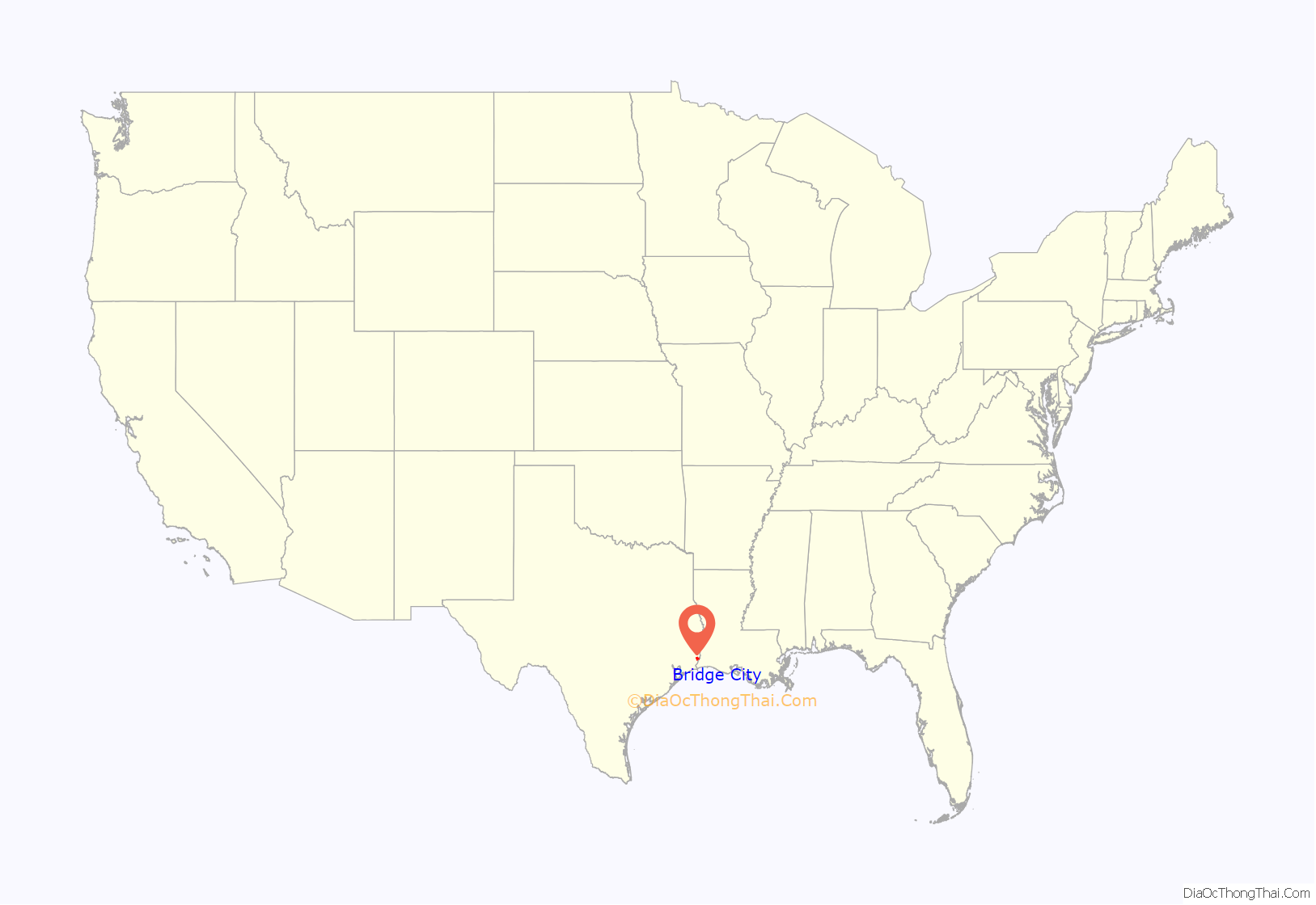
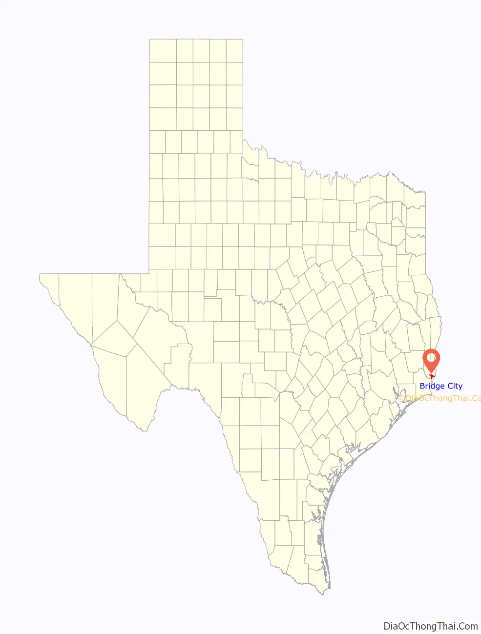
Bridge City location map. Where is Bridge City city?
History
The city was originally named Prairie View, as it was located on the coastal grasslands of the upper Texas coastline. But in 1938, the Port Arthur-Orange Bridge (now known as the Rainbow Bridge) was built, and the unincorporated area took on the name “Bridge City”. Despite several previous attempts, the city did not incorporate until 1970.
Bridge City got its name from the fact that one has to cross a bridge to enter the city. All three major roads that enter Bridge City—Chemical Road, SH 87, and F.M. 1442—cross a body of water. SH 87 crosses the Neches River and Cow Bayou—Cow Bayou on the Orange side and the Neches River on the Port Arthur side. Chemical Road crosses a branch off of the Sabine River and Cow Bayou. F.M. 1442 crosses a small creek off Cow Bayou between F.M. 105 and the Bridge City City limits. F.M. 1442 also crosses Cow Bayou just north of Orangefield and south of Interstate 10.
In 1990, Bridge City became the first city in Texas to install “leaning” streetlights because of the tall electrical lines near the roadway.
In 2008, the storm surge generated by Hurricane Ike caused nearly complete flooding of Bridge City. Mayor Kirk Roccaforte estimated that only 14 homes in the city were unaffected by the surge. The piles of debris and waterlogged furniture placed outside homes by residents beginning to clean up led the mayor to say “The whole city looks like a flea market.”
Bridge City Road Map
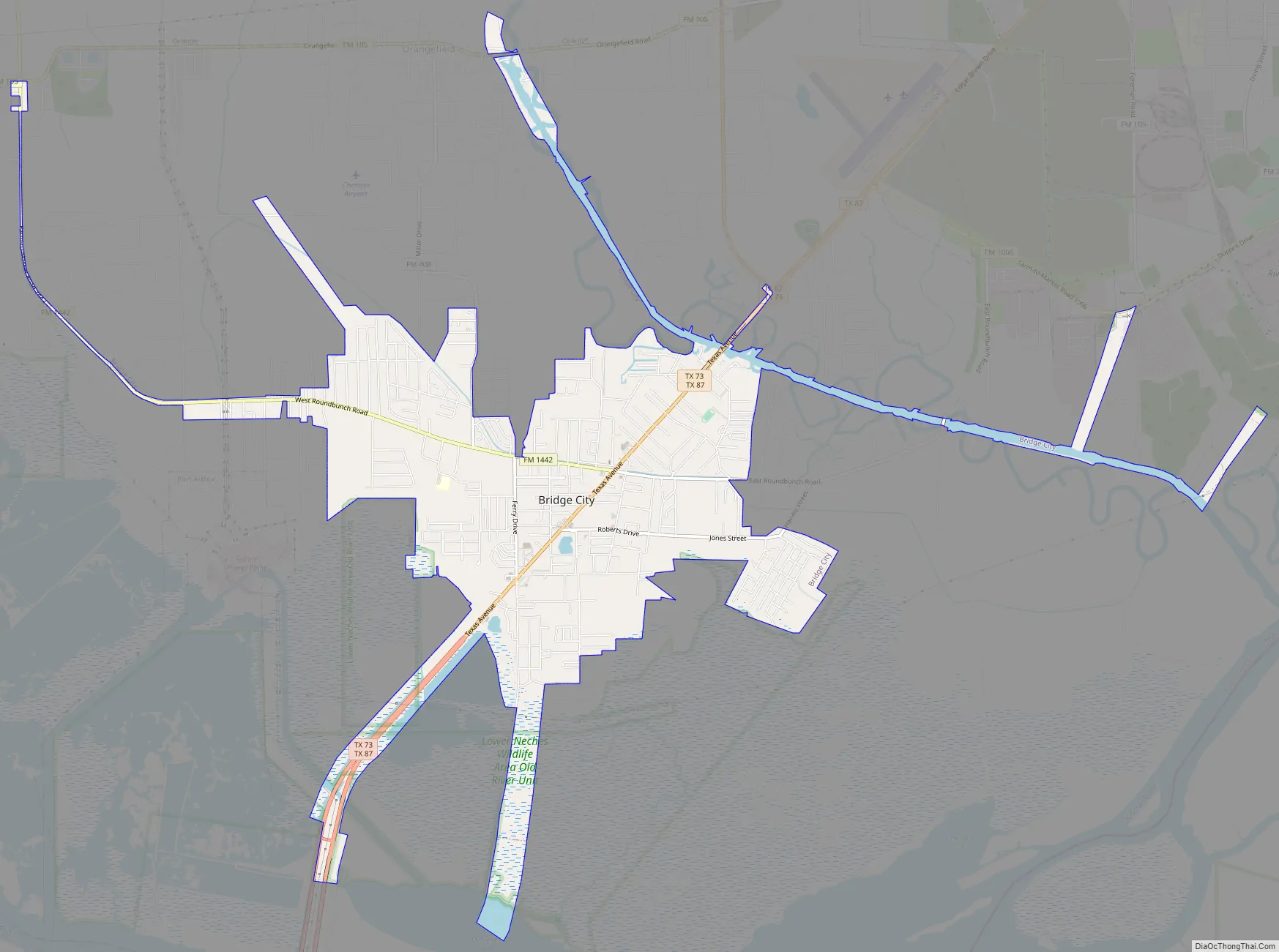
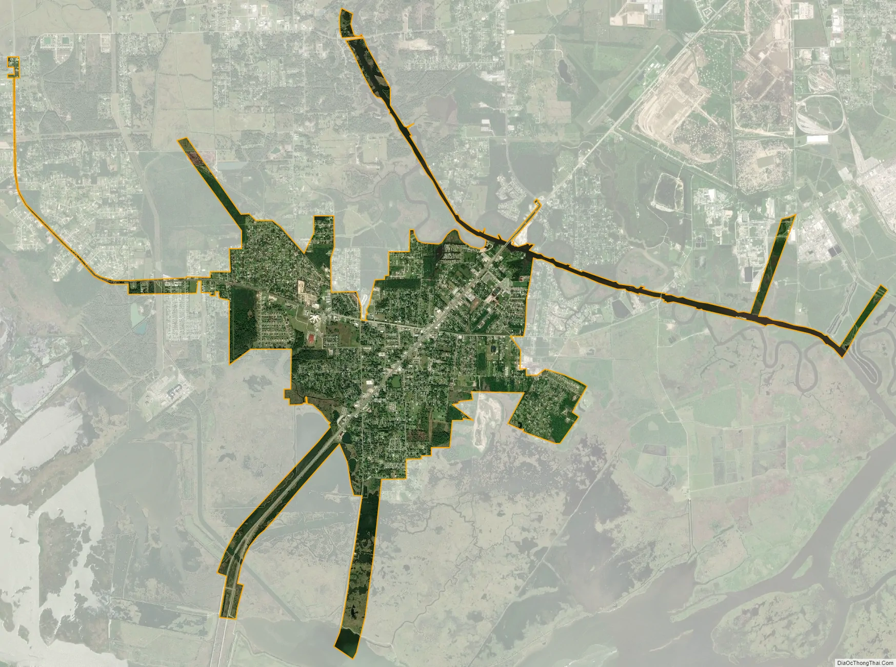
Bridge City city Satellite Map
Geography
Bridge City is located at 30°2′3″N 93°50′34″W / 30.03417°N 93.84278°W / 30.03417; -93.84278 (30.034211, –93.842836). According to the United States Census Bureau, the city has a total area of 5.4 square miles (14 km), of which, 5.1 square miles (13 km) of it is land and 0.2 square miles (0.52 km) of it (4.63%) is water.
See also
Map of Texas State and its subdivision:- Anderson
- Andrews
- Angelina
- Aransas
- Archer
- Armstrong
- Atascosa
- Austin
- Bailey
- Bandera
- Bastrop
- Baylor
- Bee
- Bell
- Bexar
- Blanco
- Borden
- Bosque
- Bowie
- Brazoria
- Brazos
- Brewster
- Briscoe
- Brooks
- Brown
- Burleson
- Burnet
- Caldwell
- Calhoun
- Callahan
- Cameron
- Camp
- Carson
- Cass
- Castro
- Chambers
- Cherokee
- Childress
- Clay
- Cochran
- Coke
- Coleman
- Collin
- Collingsworth
- Colorado
- Comal
- Comanche
- Concho
- Cooke
- Coryell
- Cottle
- Crane
- Crockett
- Crosby
- Culberson
- Dallam
- Dallas
- Dawson
- Deaf Smith
- Delta
- Denton
- Dewitt
- Dickens
- Dimmit
- Donley
- Duval
- Eastland
- Ector
- Edwards
- El Paso
- Ellis
- Erath
- Falls
- Fannin
- Fayette
- Fisher
- Floyd
- Foard
- Fort Bend
- Franklin
- Freestone
- Frio
- Gaines
- Galveston
- Garza
- Gillespie
- Glasscock
- Goliad
- Gonzales
- Gray
- Grayson
- Gregg
- Grimes
- Guadalupe
- Hale
- Hall
- Hamilton
- Hansford
- Hardeman
- Hardin
- Harris
- Harrison
- Hartley
- Haskell
- Hays
- Hemphill
- Henderson
- Hidalgo
- Hill
- Hockley
- Hood
- Hopkins
- Houston
- Howard
- Hudspeth
- Hunt
- Hutchinson
- Irion
- Jack
- Jackson
- Jasper
- Jeff Davis
- Jefferson
- Jim Hogg
- Jim Wells
- Johnson
- Jones
- Karnes
- Kaufman
- Kendall
- Kenedy
- Kent
- Kerr
- Kimble
- King
- Kinney
- Kleberg
- Knox
- La Salle
- Lamar
- Lamb
- Lampasas
- Lavaca
- Lee
- Leon
- Liberty
- Limestone
- Lipscomb
- Live Oak
- Llano
- Loving
- Lubbock
- Lynn
- Madison
- Marion
- Martin
- Mason
- Matagorda
- Maverick
- McCulloch
- McLennan
- McMullen
- Medina
- Menard
- Midland
- Milam
- Mills
- Mitchell
- Montague
- Montgomery
- Moore
- Morris
- Motley
- Nacogdoches
- Navarro
- Newton
- Nolan
- Nueces
- Ochiltree
- Oldham
- Orange
- Palo Pinto
- Panola
- Parker
- Parmer
- Pecos
- Polk
- Potter
- Presidio
- Rains
- Randall
- Reagan
- Real
- Red River
- Reeves
- Refugio
- Roberts
- Robertson
- Rockwall
- Runnels
- Rusk
- Sabine
- San Augustine
- San Jacinto
- San Patricio
- San Saba
- Schleicher
- Scurry
- Shackelford
- Shelby
- Sherman
- Smith
- Somervell
- Starr
- Stephens
- Sterling
- Stonewall
- Sutton
- Swisher
- Tarrant
- Taylor
- Terrell
- Terry
- Throckmorton
- Titus
- Tom Green
- Travis
- Trinity
- Tyler
- Upshur
- Upton
- Uvalde
- Val Verde
- Van Zandt
- Victoria
- Walker
- Waller
- Ward
- Washington
- Webb
- Wharton
- Wheeler
- Wichita
- Wilbarger
- Willacy
- Williamson
- Wilson
- Winkler
- Wise
- Wood
- Yoakum
- Young
- Zapata
- Zavala
- Alabama
- Alaska
- Arizona
- Arkansas
- California
- Colorado
- Connecticut
- Delaware
- District of Columbia
- Florida
- Georgia
- Hawaii
- Idaho
- Illinois
- Indiana
- Iowa
- Kansas
- Kentucky
- Louisiana
- Maine
- Maryland
- Massachusetts
- Michigan
- Minnesota
- Mississippi
- Missouri
- Montana
- Nebraska
- Nevada
- New Hampshire
- New Jersey
- New Mexico
- New York
- North Carolina
- North Dakota
- Ohio
- Oklahoma
- Oregon
- Pennsylvania
- Rhode Island
- South Carolina
- South Dakota
- Tennessee
- Texas
- Utah
- Vermont
- Virginia
- Washington
- West Virginia
- Wisconsin
- Wyoming