Bryson is a city in Jack County, Texas, United States. As of the 2010 census, its population was 539.
| Name: | Bryson city |
|---|---|
| LSAD Code: | 25 |
| LSAD Description: | city (suffix) |
| State: | Texas |
| County: | Jack County |
| Elevation: | 1,247 ft (380 m) |
| Total Area: | 1.43 sq mi (3.69 km²) |
| Land Area: | 1.32 sq mi (3.41 km²) |
| Water Area: | 0.11 sq mi (0.28 km²) |
| Total Population: | 539 |
| Population Density: | 407.29/sq mi (157.30/km²) |
| ZIP code: | 76427 |
| Area code: | 940 |
| FIPS code: | 4810960 |
| GNISfeature ID: | 1331472 |
| Website: | cityofbrysontexas.com |
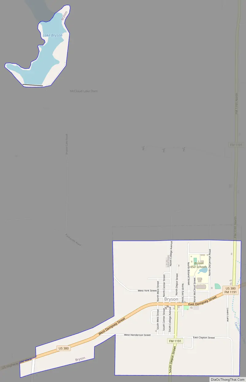
Online Interactive Map
Click on ![]() to view map in "full screen" mode.
to view map in "full screen" mode.
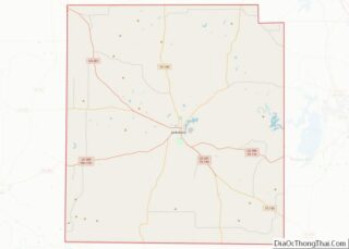
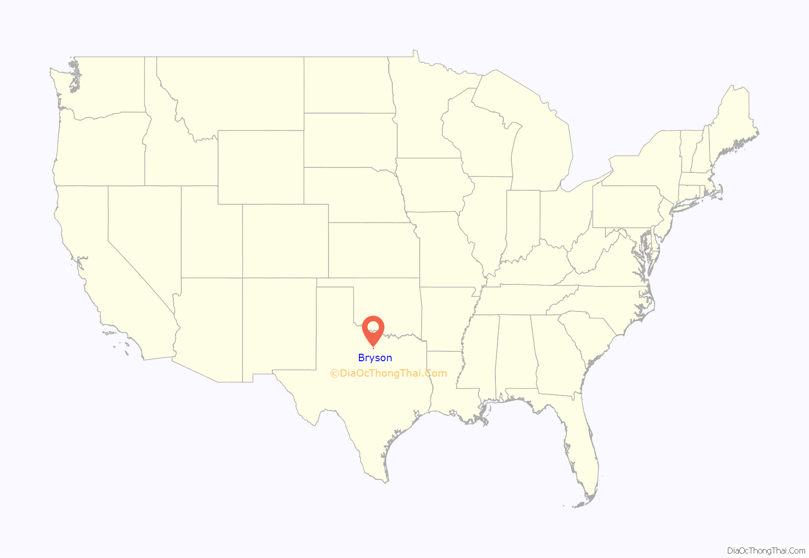
Bryson location map. Where is Bryson city?
History
The community was first settled in the late 19th century. Originally known as “Mount Hecla”, a post office opened under that name in 1878. Henry Bryson built the area’s first residence, a log cabin, that same year. The community was later renamed after him. This change was officially recognized in 1884, when the local post office took the name “Bryson”. Mr. Bryson went on to serve as County Commissioner. Early pioneer family names of Bryson were Blount, Chambers, Clayton, Cook, Crumpton, Cullers, Enlow, Epperson, Henderson, Keyser, Kuykendall, McCloud, Moore, Raley, Shanafelt and Vanhooser.
The Chicago, Rock Island and Texas Railway, a subsidiary of the Chicago, Rock Island and Pacific Railroad, reached Bryson in the fall of 1902. Although oil had been discovered in Jack County as early as 1898, it wasn’t until the mid-1920s that Bryson became an oil processing center for local producers. The resulting population boom led to the community being known as Jack County’s “second city” (after Jacksboro).
On June 6, 1929, the town incorporated a mayor-council form of government. Men who served there include B.B. Bryson, Sam Cullers, L.O. Moore, J.R. Clayton, Willis Williams, and Williard Schlitter. The town had a population of 641 in the 1930 census. A 1938 oil boom in Bryson hepled the population explode, with many people forced to live in tents. In 1940, the census dropped back to 806. As oil production declined, so did the population. The low point occurred in 1970, when only 455 people lived within the city limits. During the latter half of the 20th century, Bryson slowly grew to over 500 residents. In 1988, seven businesses were serving the community. Reportedly, 22 businesses were in Bryson as of 2004.
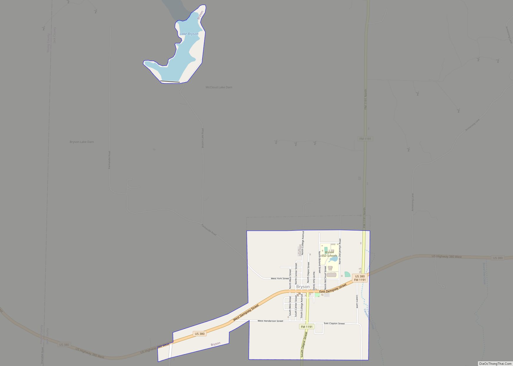
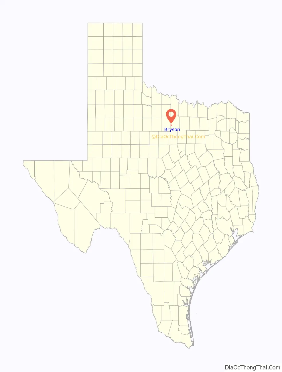
Bryson Road Map
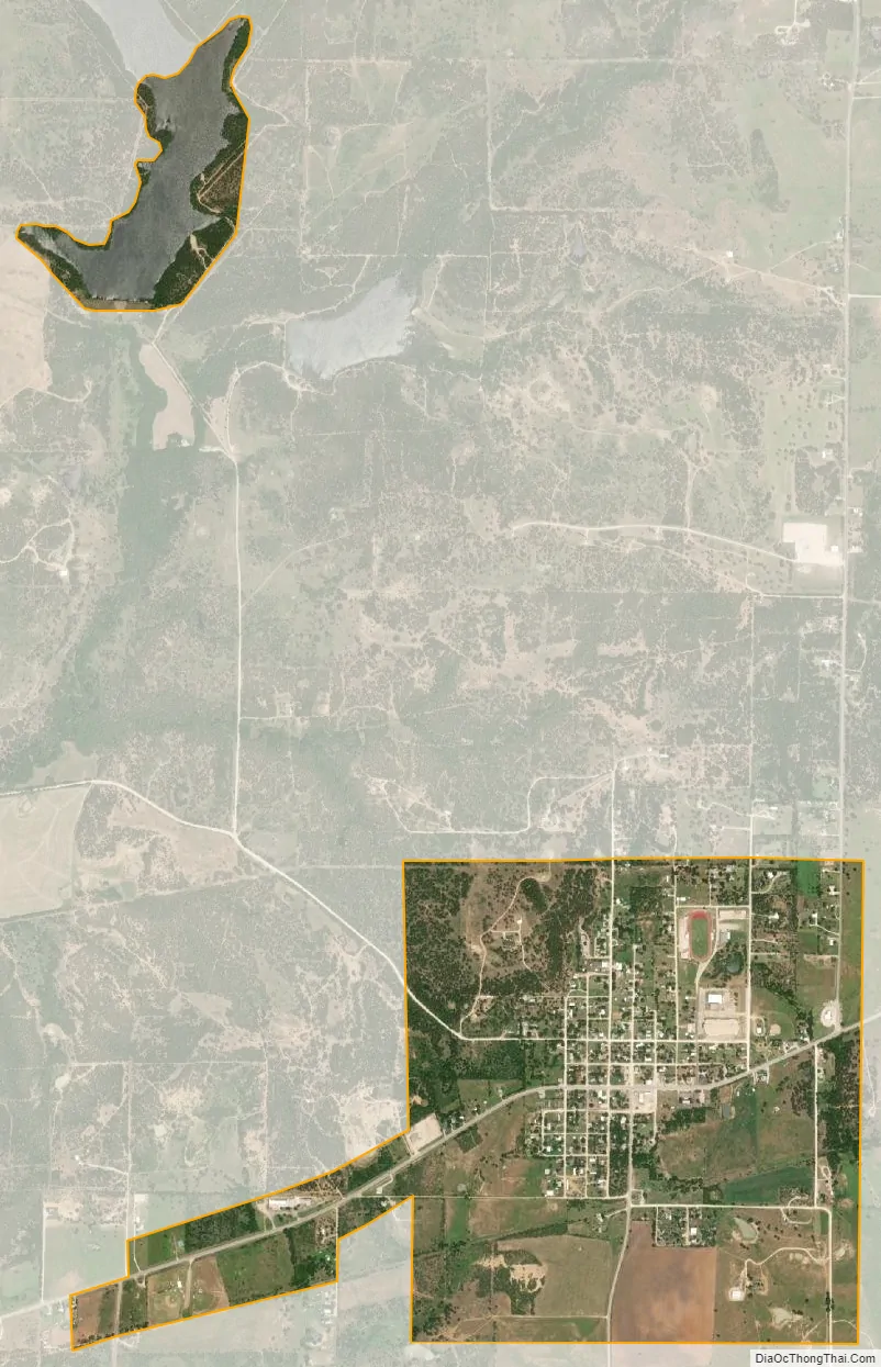
Bryson city Satellite Map
Geography
Bryson is located in western Jack County at 33°9′38″N 98°23′16″W / 33.16056°N 98.38778°W / 33.16056; -98.38778 (33.160523, –98.387805). It is situated 14 miles (23 km) southwest of Jacksboro, the county seat, along U.S. Highway 380. US 380 continues southwest 13 miles (21 km) to Graham, the county seat of Young County.
According to the United States Census Bureau, Bryson has a total area of 9,100 acres (3,700 ha), of which 8,400 acres (3,400 ha) are land and 300 ha (741.3 acres), or 7.64%, are water. The water area encompasses Lake Bryson, a reservoir 2.5 miles (4.0 km) northwest of the city. Bryson is in the Rock Creek watershed, flowing south to the Brazos River.
See also
Map of Texas State and its subdivision:- Anderson
- Andrews
- Angelina
- Aransas
- Archer
- Armstrong
- Atascosa
- Austin
- Bailey
- Bandera
- Bastrop
- Baylor
- Bee
- Bell
- Bexar
- Blanco
- Borden
- Bosque
- Bowie
- Brazoria
- Brazos
- Brewster
- Briscoe
- Brooks
- Brown
- Burleson
- Burnet
- Caldwell
- Calhoun
- Callahan
- Cameron
- Camp
- Carson
- Cass
- Castro
- Chambers
- Cherokee
- Childress
- Clay
- Cochran
- Coke
- Coleman
- Collin
- Collingsworth
- Colorado
- Comal
- Comanche
- Concho
- Cooke
- Coryell
- Cottle
- Crane
- Crockett
- Crosby
- Culberson
- Dallam
- Dallas
- Dawson
- Deaf Smith
- Delta
- Denton
- Dewitt
- Dickens
- Dimmit
- Donley
- Duval
- Eastland
- Ector
- Edwards
- El Paso
- Ellis
- Erath
- Falls
- Fannin
- Fayette
- Fisher
- Floyd
- Foard
- Fort Bend
- Franklin
- Freestone
- Frio
- Gaines
- Galveston
- Garza
- Gillespie
- Glasscock
- Goliad
- Gonzales
- Gray
- Grayson
- Gregg
- Grimes
- Guadalupe
- Hale
- Hall
- Hamilton
- Hansford
- Hardeman
- Hardin
- Harris
- Harrison
- Hartley
- Haskell
- Hays
- Hemphill
- Henderson
- Hidalgo
- Hill
- Hockley
- Hood
- Hopkins
- Houston
- Howard
- Hudspeth
- Hunt
- Hutchinson
- Irion
- Jack
- Jackson
- Jasper
- Jeff Davis
- Jefferson
- Jim Hogg
- Jim Wells
- Johnson
- Jones
- Karnes
- Kaufman
- Kendall
- Kenedy
- Kent
- Kerr
- Kimble
- King
- Kinney
- Kleberg
- Knox
- La Salle
- Lamar
- Lamb
- Lampasas
- Lavaca
- Lee
- Leon
- Liberty
- Limestone
- Lipscomb
- Live Oak
- Llano
- Loving
- Lubbock
- Lynn
- Madison
- Marion
- Martin
- Mason
- Matagorda
- Maverick
- McCulloch
- McLennan
- McMullen
- Medina
- Menard
- Midland
- Milam
- Mills
- Mitchell
- Montague
- Montgomery
- Moore
- Morris
- Motley
- Nacogdoches
- Navarro
- Newton
- Nolan
- Nueces
- Ochiltree
- Oldham
- Orange
- Palo Pinto
- Panola
- Parker
- Parmer
- Pecos
- Polk
- Potter
- Presidio
- Rains
- Randall
- Reagan
- Real
- Red River
- Reeves
- Refugio
- Roberts
- Robertson
- Rockwall
- Runnels
- Rusk
- Sabine
- San Augustine
- San Jacinto
- San Patricio
- San Saba
- Schleicher
- Scurry
- Shackelford
- Shelby
- Sherman
- Smith
- Somervell
- Starr
- Stephens
- Sterling
- Stonewall
- Sutton
- Swisher
- Tarrant
- Taylor
- Terrell
- Terry
- Throckmorton
- Titus
- Tom Green
- Travis
- Trinity
- Tyler
- Upshur
- Upton
- Uvalde
- Val Verde
- Van Zandt
- Victoria
- Walker
- Waller
- Ward
- Washington
- Webb
- Wharton
- Wheeler
- Wichita
- Wilbarger
- Willacy
- Williamson
- Wilson
- Winkler
- Wise
- Wood
- Yoakum
- Young
- Zapata
- Zavala
- Alabama
- Alaska
- Arizona
- Arkansas
- California
- Colorado
- Connecticut
- Delaware
- District of Columbia
- Florida
- Georgia
- Hawaii
- Idaho
- Illinois
- Indiana
- Iowa
- Kansas
- Kentucky
- Louisiana
- Maine
- Maryland
- Massachusetts
- Michigan
- Minnesota
- Mississippi
- Missouri
- Montana
- Nebraska
- Nevada
- New Hampshire
- New Jersey
- New Mexico
- New York
- North Carolina
- North Dakota
- Ohio
- Oklahoma
- Oregon
- Pennsylvania
- Rhode Island
- South Carolina
- South Dakota
- Tennessee
- Texas
- Utah
- Vermont
- Virginia
- Washington
- West Virginia
- Wisconsin
- Wyoming