Bulverde (/bʊlˈvɜːrdi/ buul-VUR-dee) is a city in Comal County, Texas, United States. Bulverde is known for its small-town, slow pace of life, coupled with the German emigrant history of the town’s founders. Bulverde was originally named Piepers Settlement after a prominent German pioneer. Its population was 5,692 at the 2020 census, up from 4,630 at the 2010 census. It is part of the San Antonio metropolitan statistical area.
| Name: | Bulverde city |
|---|---|
| LSAD Code: | 25 |
| LSAD Description: | city (suffix) |
| State: | Texas |
| County: | Comal County |
| Elevation: | 1,093 ft (333 m) |
| Total Area: | 15.83 sq mi (41.01 km²) |
| Land Area: | 15.82 sq mi (40.97 km²) |
| Water Area: | 0.02 sq mi (0.04 km²) |
| Total Population: | 5,692 |
| Population Density: | 335.06/sq mi (129.37/km²) |
| ZIP code: | 78163 |
| Area code: | 830 |
| FIPS code: | 4811224 |
| GNISfeature ID: | 1378070 |
| Website: | bulverdetx.gov |
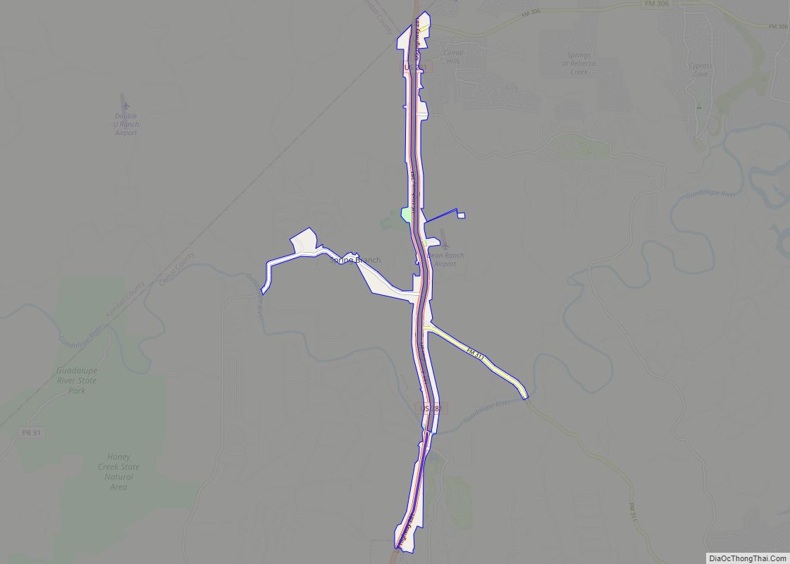
Online Interactive Map
Click on ![]() to view map in "full screen" mode.
to view map in "full screen" mode.
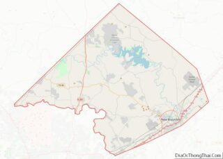
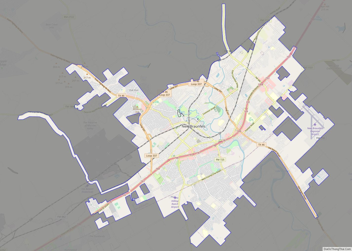
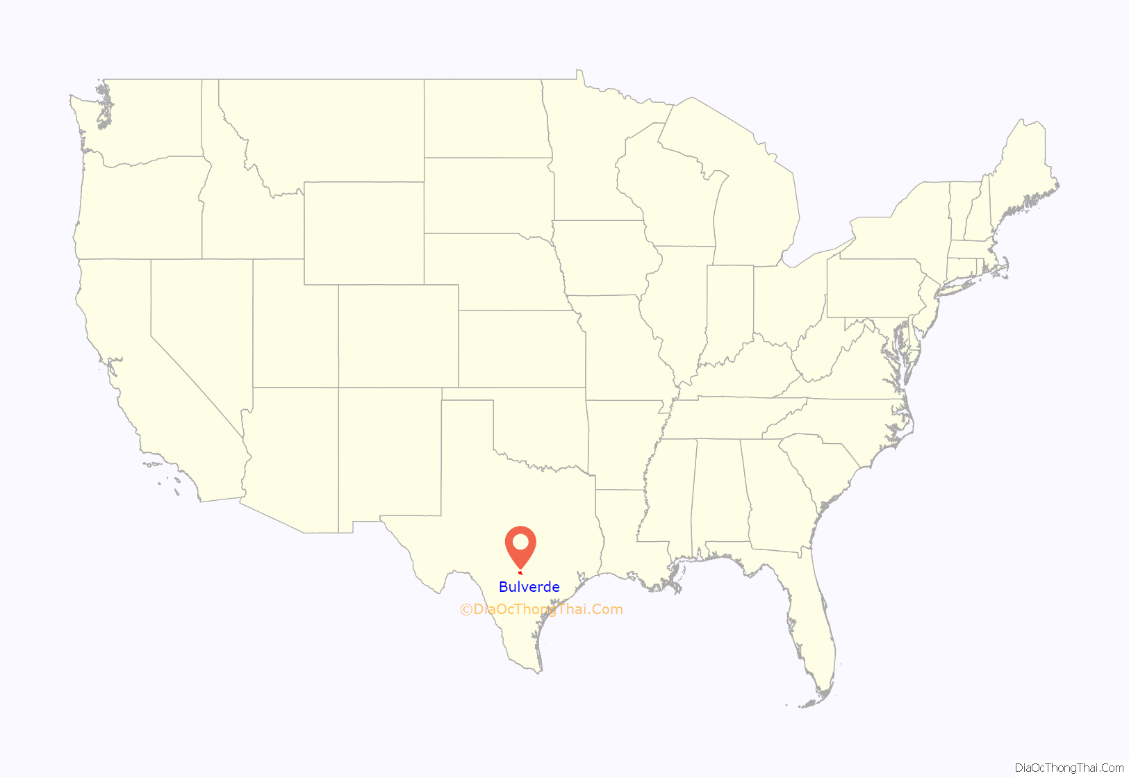
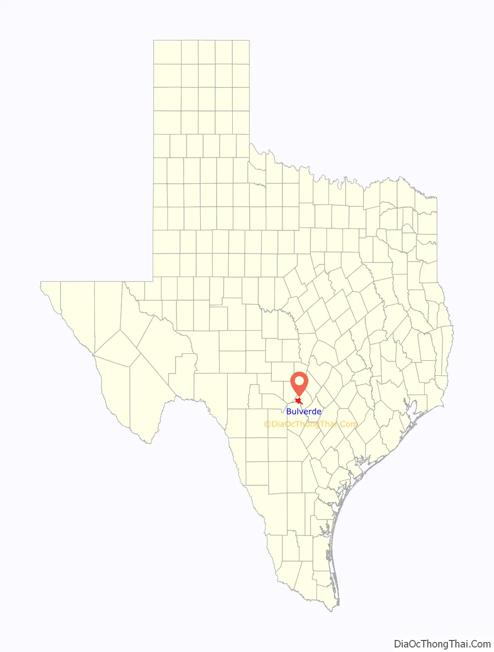
Bulverde location map. Where is Bulverde city?
History
Bulverde’s first people were Native Americans. A type of arrowhead known as the Bulverde Point is named after the style of arrowhead made by Native Americans who lived in the area during the period 2,500 to 600 BCE.
Sometimes called the “Front Porch of the Texas Hill Country”, Bulverde was settled in 1850 and called Pieper Settlement after Anton Pieper. It was mainly settled by German immigrants similar to nearby New Braunfels. For many years, the closest post office was at Smithson Valley, and mail was delivered once a week to the house of Carl Koch in Bulverde. A local post office that operated from 1879 to 1919 was named for Luciano Bulverdo, an early area landowner.
Between 1996 and 1999, five separate municipalities were incorporated and combined in the Bulverde area to form the current City of Bulverde. This process required 22 separate elections. In May 2015, the people of Bulverde voted to adopt a home-rule charter to have more control over development.
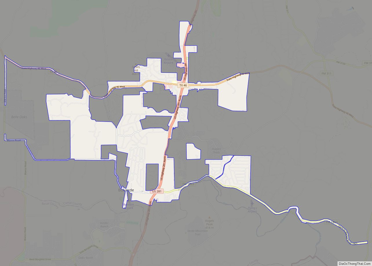
Bulverde Road Map

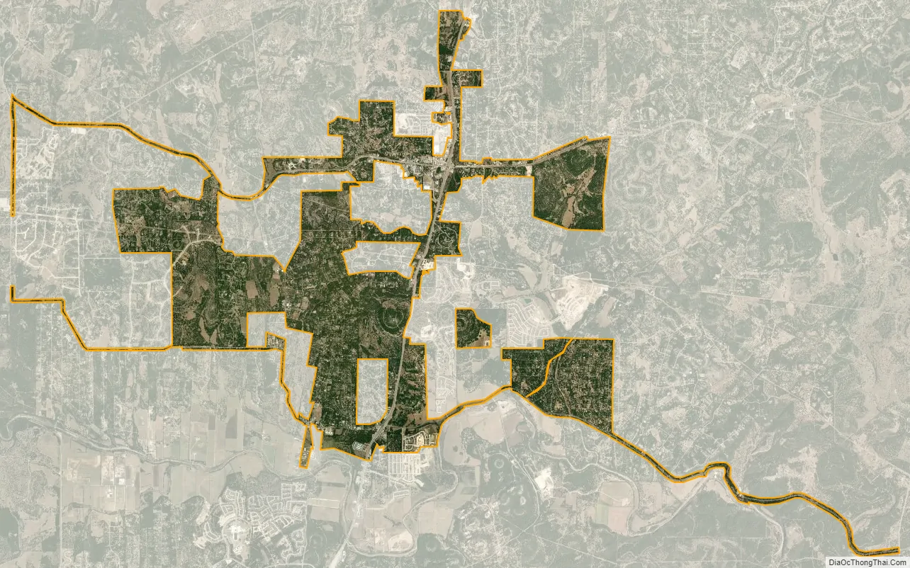
Bulverde city Satellite Map
Geography
Bulverde is located in western Comal County at 29°44′55″N 98°24′48″W / 29.748486°N 98.413238°W / 29.748486; -98.413238, about 26 miles (42 km) north of downtown San Antonio. U.S. Route 281 passes through the east side of Bulverde, leading south to San Antonio and north 25 miles (40 km) to Blanco. Cibolo Creek, which forms the Comal County/Bexar County line, runs just south of Bulverde.
According to the United States Census Bureau, the city has a total area of 9.7 square miles (25.2 km), of which 0.01 square miles (0.02 km), or 0.09%, is covered by water.
See also
Map of Texas State and its subdivision:- Anderson
- Andrews
- Angelina
- Aransas
- Archer
- Armstrong
- Atascosa
- Austin
- Bailey
- Bandera
- Bastrop
- Baylor
- Bee
- Bell
- Bexar
- Blanco
- Borden
- Bosque
- Bowie
- Brazoria
- Brazos
- Brewster
- Briscoe
- Brooks
- Brown
- Burleson
- Burnet
- Caldwell
- Calhoun
- Callahan
- Cameron
- Camp
- Carson
- Cass
- Castro
- Chambers
- Cherokee
- Childress
- Clay
- Cochran
- Coke
- Coleman
- Collin
- Collingsworth
- Colorado
- Comal
- Comanche
- Concho
- Cooke
- Coryell
- Cottle
- Crane
- Crockett
- Crosby
- Culberson
- Dallam
- Dallas
- Dawson
- Deaf Smith
- Delta
- Denton
- Dewitt
- Dickens
- Dimmit
- Donley
- Duval
- Eastland
- Ector
- Edwards
- El Paso
- Ellis
- Erath
- Falls
- Fannin
- Fayette
- Fisher
- Floyd
- Foard
- Fort Bend
- Franklin
- Freestone
- Frio
- Gaines
- Galveston
- Garza
- Gillespie
- Glasscock
- Goliad
- Gonzales
- Gray
- Grayson
- Gregg
- Grimes
- Guadalupe
- Hale
- Hall
- Hamilton
- Hansford
- Hardeman
- Hardin
- Harris
- Harrison
- Hartley
- Haskell
- Hays
- Hemphill
- Henderson
- Hidalgo
- Hill
- Hockley
- Hood
- Hopkins
- Houston
- Howard
- Hudspeth
- Hunt
- Hutchinson
- Irion
- Jack
- Jackson
- Jasper
- Jeff Davis
- Jefferson
- Jim Hogg
- Jim Wells
- Johnson
- Jones
- Karnes
- Kaufman
- Kendall
- Kenedy
- Kent
- Kerr
- Kimble
- King
- Kinney
- Kleberg
- Knox
- La Salle
- Lamar
- Lamb
- Lampasas
- Lavaca
- Lee
- Leon
- Liberty
- Limestone
- Lipscomb
- Live Oak
- Llano
- Loving
- Lubbock
- Lynn
- Madison
- Marion
- Martin
- Mason
- Matagorda
- Maverick
- McCulloch
- McLennan
- McMullen
- Medina
- Menard
- Midland
- Milam
- Mills
- Mitchell
- Montague
- Montgomery
- Moore
- Morris
- Motley
- Nacogdoches
- Navarro
- Newton
- Nolan
- Nueces
- Ochiltree
- Oldham
- Orange
- Palo Pinto
- Panola
- Parker
- Parmer
- Pecos
- Polk
- Potter
- Presidio
- Rains
- Randall
- Reagan
- Real
- Red River
- Reeves
- Refugio
- Roberts
- Robertson
- Rockwall
- Runnels
- Rusk
- Sabine
- San Augustine
- San Jacinto
- San Patricio
- San Saba
- Schleicher
- Scurry
- Shackelford
- Shelby
- Sherman
- Smith
- Somervell
- Starr
- Stephens
- Sterling
- Stonewall
- Sutton
- Swisher
- Tarrant
- Taylor
- Terrell
- Terry
- Throckmorton
- Titus
- Tom Green
- Travis
- Trinity
- Tyler
- Upshur
- Upton
- Uvalde
- Val Verde
- Van Zandt
- Victoria
- Walker
- Waller
- Ward
- Washington
- Webb
- Wharton
- Wheeler
- Wichita
- Wilbarger
- Willacy
- Williamson
- Wilson
- Winkler
- Wise
- Wood
- Yoakum
- Young
- Zapata
- Zavala
- Alabama
- Alaska
- Arizona
- Arkansas
- California
- Colorado
- Connecticut
- Delaware
- District of Columbia
- Florida
- Georgia
- Hawaii
- Idaho
- Illinois
- Indiana
- Iowa
- Kansas
- Kentucky
- Louisiana
- Maine
- Maryland
- Massachusetts
- Michigan
- Minnesota
- Mississippi
- Missouri
- Montana
- Nebraska
- Nevada
- New Hampshire
- New Jersey
- New Mexico
- New York
- North Carolina
- North Dakota
- Ohio
- Oklahoma
- Oregon
- Pennsylvania
- Rhode Island
- South Carolina
- South Dakota
- Tennessee
- Texas
- Utah
- Vermont
- Virginia
- Washington
- West Virginia
- Wisconsin
- Wyoming