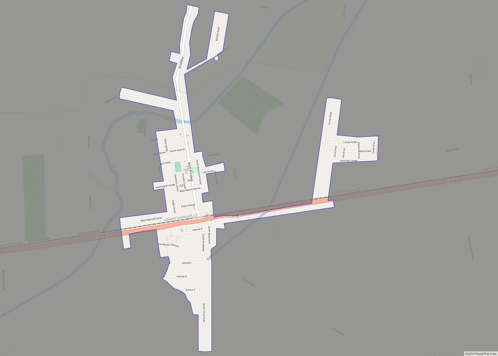
China is a city in Jefferson County, Texas, United States. The population was 1,260 at the 2020 census. It is part of the Beaumont–Port Arthur Metropolitan Statistical Area.
| Name: | China city |
|---|---|
| LSAD Code: | 25 |
| LSAD Description: | city (suffix) |
| State: | Texas |
| County: | Jefferson County |
| Elevation: | 39 ft (12 m) |
| Total Area: | 1.29 sq mi (3.34 km²) |
| Land Area: | 1.28 sq mi (3.32 km²) |
| Water Area: | 0.01 sq mi (0.02 km²) |
| Total Population: | 1,260 |
| Population Density: | 941.45/sq mi (363.40/km²) |
| ZIP code: | 77613 |
| Area code: | 409 |
| FIPS code: | 4814704 |
| GNISfeature ID: | 1332764 |
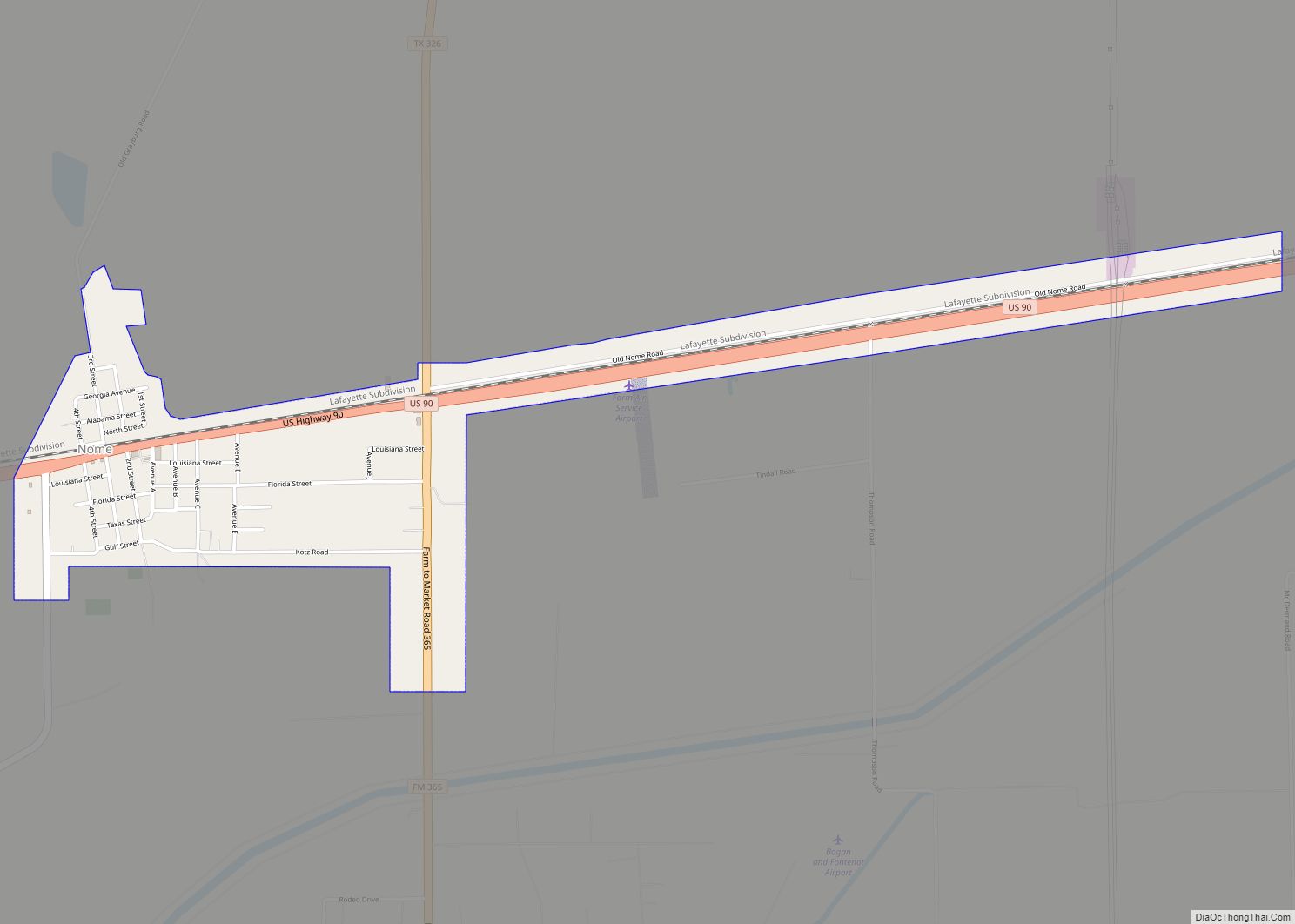
Online Interactive Map
Click on ![]() to view map in "full screen" mode.
to view map in "full screen" mode.
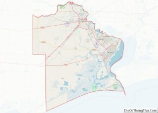
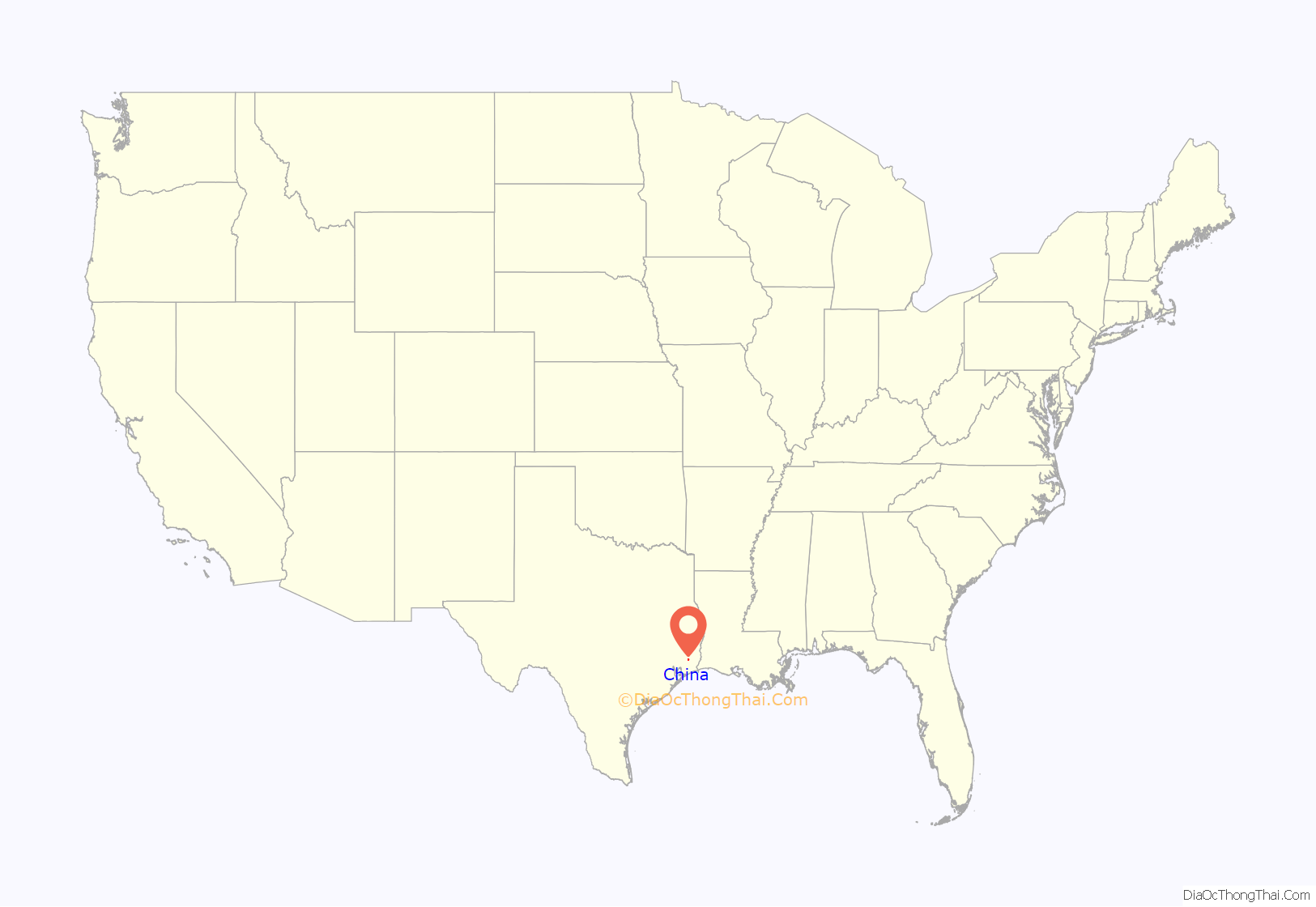
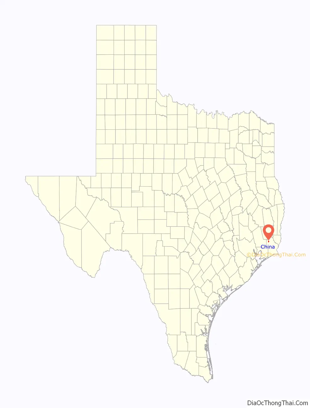
China location map. Where is China city?
History
China was first known as “China Grove”, for a water stop for the Texas and New Orleans Railroad that sat amidst a grove of chinaberry trees. In the 1860s a small community grew around the water stop, and another a few miles away named Nashland. A post office with the name “China” was established there in 1893. When fire destroyed the China Grove depot in 1906, the railroad rebuilt in the larger Nashland area, but retained the established name “China” as the name of the depot. The Nashland post office changed its name to China shortly afterward. It wasn’t until 1971 that the (now-merged) community voted to incorporate as the city of China, Texas.
During World War II, a small branch camp was built for German prisoners of war who were detailed to China from the larger Camp Huntsville in Walker County, Texas (now a part of Sam Houston State University). These prisoners helped to maintain rice fields while local farmers were serving in the military.
The chinaberry trees that gave the community its name are rare in the area today. In fact, two trees that were transplanted to the front lawn of the city’s civic complex in the mid 1990s are some of the only remaining examples. However, several local China and Meeker natives have taken to cultivating and nurturing new and transplanted chinaberry trees.
In 1999, Walt Disney Home Video celebrated the video release of Mulan in China. They built a miniature version of the Great Wall of China on what used to be Henderson Middle School (now China Elementary School) football field.
For years, China Elementary hosted an annual Chinaberry Festival, to celebrate the city’s people and history. The festival featured a parade, local country musicians, and many booths fielded by local vendors and church groups. However the elementary school has not hosted the festival since the destruction of Hurricane Rita in 2005. Instead the City of China has attempted somewhat unsuccessfully to reinstate the festival.
In 2004, former Mayor Hermann Edwards pleaded guilty to tampering with governmental records and was sentenced to a year of probation.
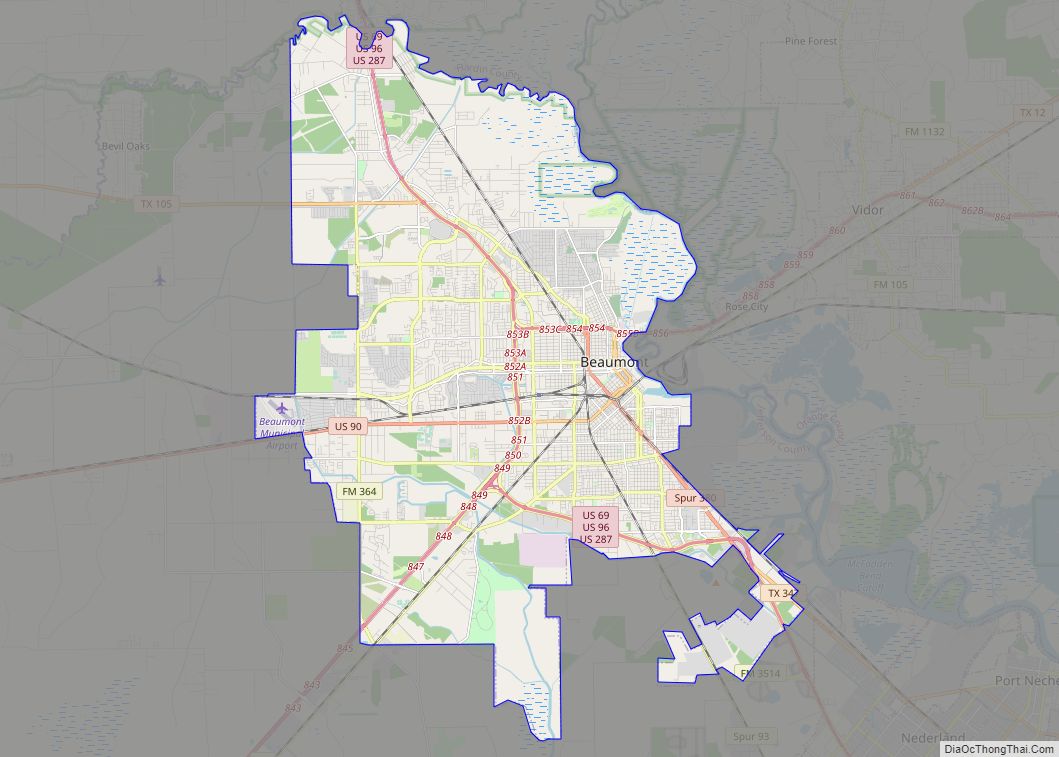
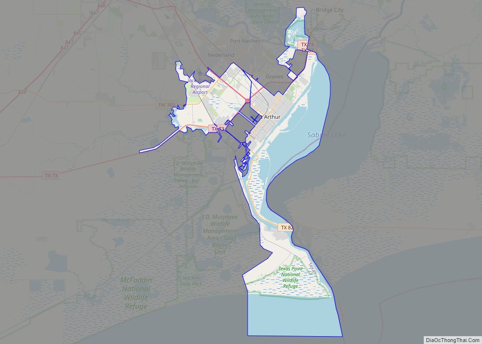
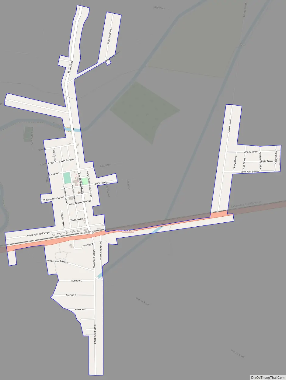
China Road Map
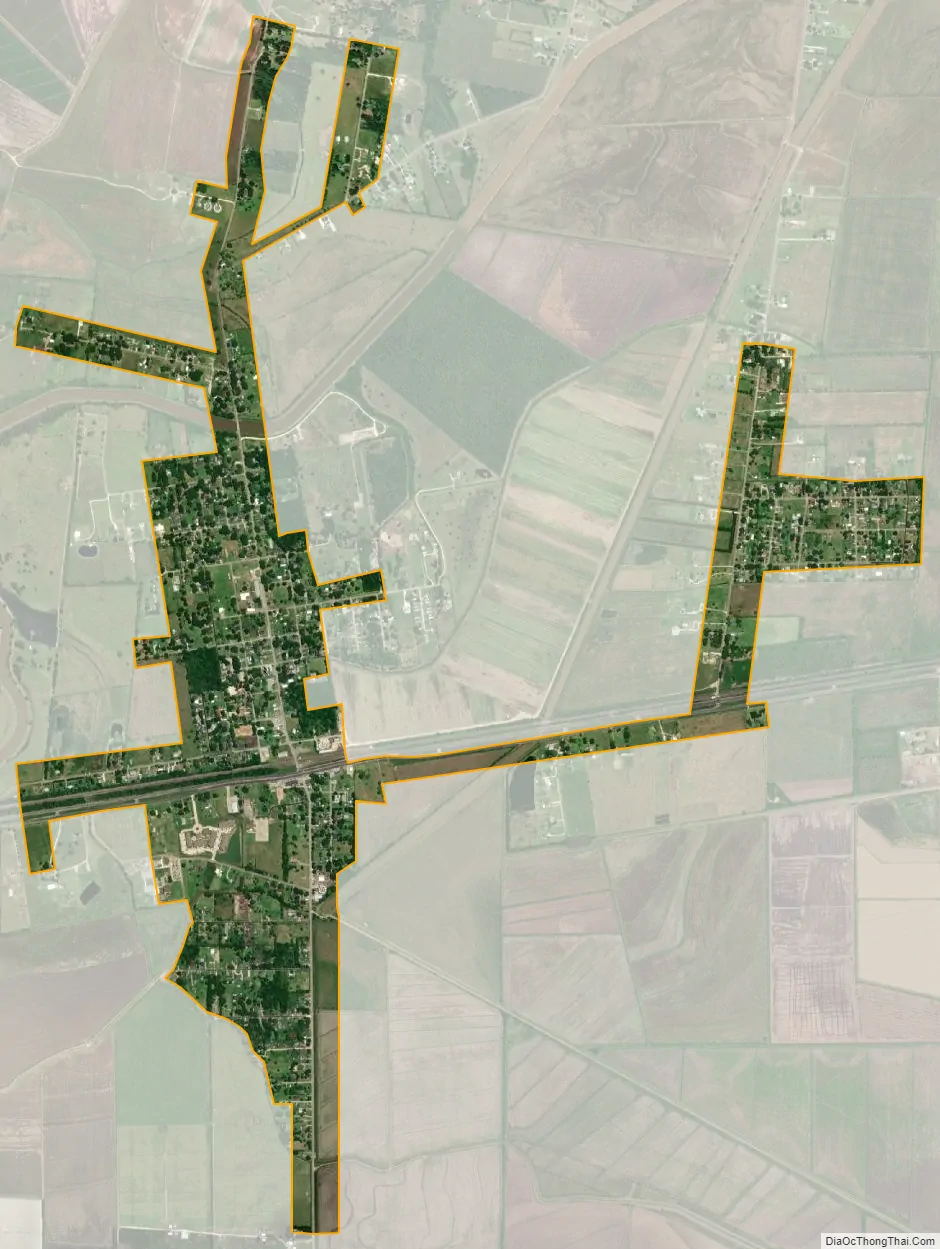
China city Satellite Map
Geography
China is located at 30°3′15″N 94°19′55″W / 30.05417°N 94.33194°W / 30.05417; -94.33194 (30.054259, –94.331882). According to the United States Census Bureau, the city has a total area of 1.3 square miles (3.4 km), of which, 1.3 square miles (3.4 km) of it is land and 0.77% is water.
See also
Map of Texas State and its subdivision:- Anderson
- Andrews
- Angelina
- Aransas
- Archer
- Armstrong
- Atascosa
- Austin
- Bailey
- Bandera
- Bastrop
- Baylor
- Bee
- Bell
- Bexar
- Blanco
- Borden
- Bosque
- Bowie
- Brazoria
- Brazos
- Brewster
- Briscoe
- Brooks
- Brown
- Burleson
- Burnet
- Caldwell
- Calhoun
- Callahan
- Cameron
- Camp
- Carson
- Cass
- Castro
- Chambers
- Cherokee
- Childress
- Clay
- Cochran
- Coke
- Coleman
- Collin
- Collingsworth
- Colorado
- Comal
- Comanche
- Concho
- Cooke
- Coryell
- Cottle
- Crane
- Crockett
- Crosby
- Culberson
- Dallam
- Dallas
- Dawson
- Deaf Smith
- Delta
- Denton
- Dewitt
- Dickens
- Dimmit
- Donley
- Duval
- Eastland
- Ector
- Edwards
- El Paso
- Ellis
- Erath
- Falls
- Fannin
- Fayette
- Fisher
- Floyd
- Foard
- Fort Bend
- Franklin
- Freestone
- Frio
- Gaines
- Galveston
- Garza
- Gillespie
- Glasscock
- Goliad
- Gonzales
- Gray
- Grayson
- Gregg
- Grimes
- Guadalupe
- Hale
- Hall
- Hamilton
- Hansford
- Hardeman
- Hardin
- Harris
- Harrison
- Hartley
- Haskell
- Hays
- Hemphill
- Henderson
- Hidalgo
- Hill
- Hockley
- Hood
- Hopkins
- Houston
- Howard
- Hudspeth
- Hunt
- Hutchinson
- Irion
- Jack
- Jackson
- Jasper
- Jeff Davis
- Jefferson
- Jim Hogg
- Jim Wells
- Johnson
- Jones
- Karnes
- Kaufman
- Kendall
- Kenedy
- Kent
- Kerr
- Kimble
- King
- Kinney
- Kleberg
- Knox
- La Salle
- Lamar
- Lamb
- Lampasas
- Lavaca
- Lee
- Leon
- Liberty
- Limestone
- Lipscomb
- Live Oak
- Llano
- Loving
- Lubbock
- Lynn
- Madison
- Marion
- Martin
- Mason
- Matagorda
- Maverick
- McCulloch
- McLennan
- McMullen
- Medina
- Menard
- Midland
- Milam
- Mills
- Mitchell
- Montague
- Montgomery
- Moore
- Morris
- Motley
- Nacogdoches
- Navarro
- Newton
- Nolan
- Nueces
- Ochiltree
- Oldham
- Orange
- Palo Pinto
- Panola
- Parker
- Parmer
- Pecos
- Polk
- Potter
- Presidio
- Rains
- Randall
- Reagan
- Real
- Red River
- Reeves
- Refugio
- Roberts
- Robertson
- Rockwall
- Runnels
- Rusk
- Sabine
- San Augustine
- San Jacinto
- San Patricio
- San Saba
- Schleicher
- Scurry
- Shackelford
- Shelby
- Sherman
- Smith
- Somervell
- Starr
- Stephens
- Sterling
- Stonewall
- Sutton
- Swisher
- Tarrant
- Taylor
- Terrell
- Terry
- Throckmorton
- Titus
- Tom Green
- Travis
- Trinity
- Tyler
- Upshur
- Upton
- Uvalde
- Val Verde
- Van Zandt
- Victoria
- Walker
- Waller
- Ward
- Washington
- Webb
- Wharton
- Wheeler
- Wichita
- Wilbarger
- Willacy
- Williamson
- Wilson
- Winkler
- Wise
- Wood
- Yoakum
- Young
- Zapata
- Zavala
- Alabama
- Alaska
- Arizona
- Arkansas
- California
- Colorado
- Connecticut
- Delaware
- District of Columbia
- Florida
- Georgia
- Hawaii
- Idaho
- Illinois
- Indiana
- Iowa
- Kansas
- Kentucky
- Louisiana
- Maine
- Maryland
- Massachusetts
- Michigan
- Minnesota
- Mississippi
- Missouri
- Montana
- Nebraska
- Nevada
- New Hampshire
- New Jersey
- New Mexico
- New York
- North Carolina
- North Dakota
- Ohio
- Oklahoma
- Oregon
- Pennsylvania
- Rhode Island
- South Carolina
- South Dakota
- Tennessee
- Texas
- Utah
- Vermont
- Virginia
- Washington
- West Virginia
- Wisconsin
- Wyoming