Clarksville is a city and county seat of Red River County, Texas, in the United States in the northernmost part of the Piney Woods region of East Texas. As of the 2020 census, the city population was 2,857.
| Name: | Clarksville city |
|---|---|
| LSAD Code: | 25 |
| LSAD Description: | city (suffix) |
| State: | Texas |
| County: | Red River County |
| Elevation: | 410 ft (125 m) |
| Total Area: | 3.06 sq mi (7.93 km²) |
| Land Area: | 3.06 sq mi (7.93 km²) |
| Water Area: | 0.00 sq mi (0.00 km²) |
| Total Population: | 2,857 |
| Population Density: | 1,003.59/sq mi (387.48/km²) |
| ZIP code: | 75426 |
| Area code: | 903 |
| FIPS code: | 4815160 |
| GNISfeature ID: | 1354578 |
| Website: | clarksvilletx.com |
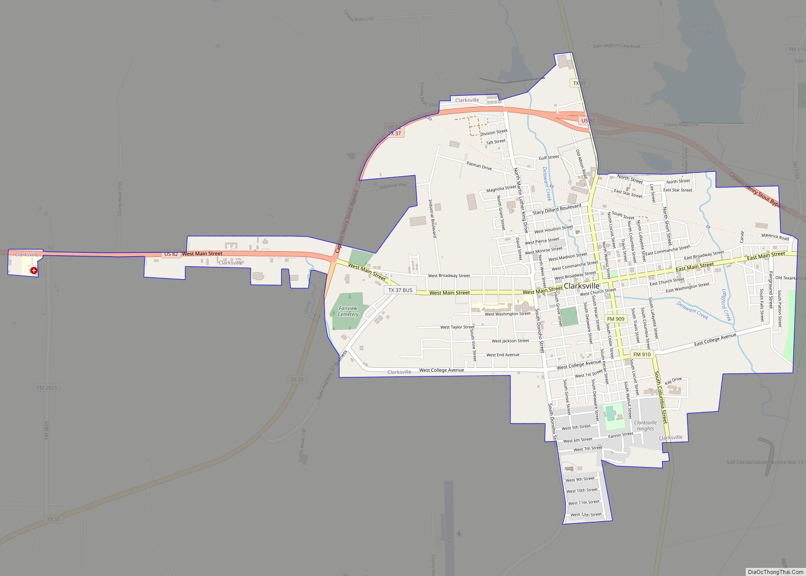
Online Interactive Map
Click on ![]() to view map in "full screen" mode.
to view map in "full screen" mode.
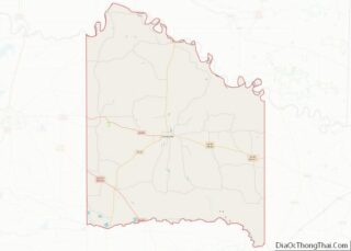
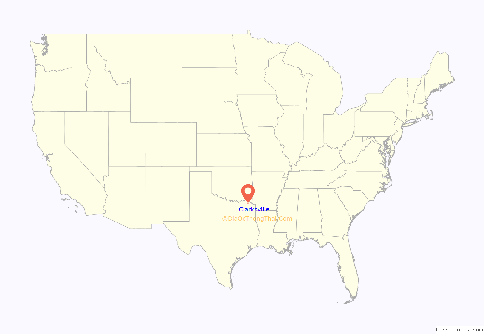
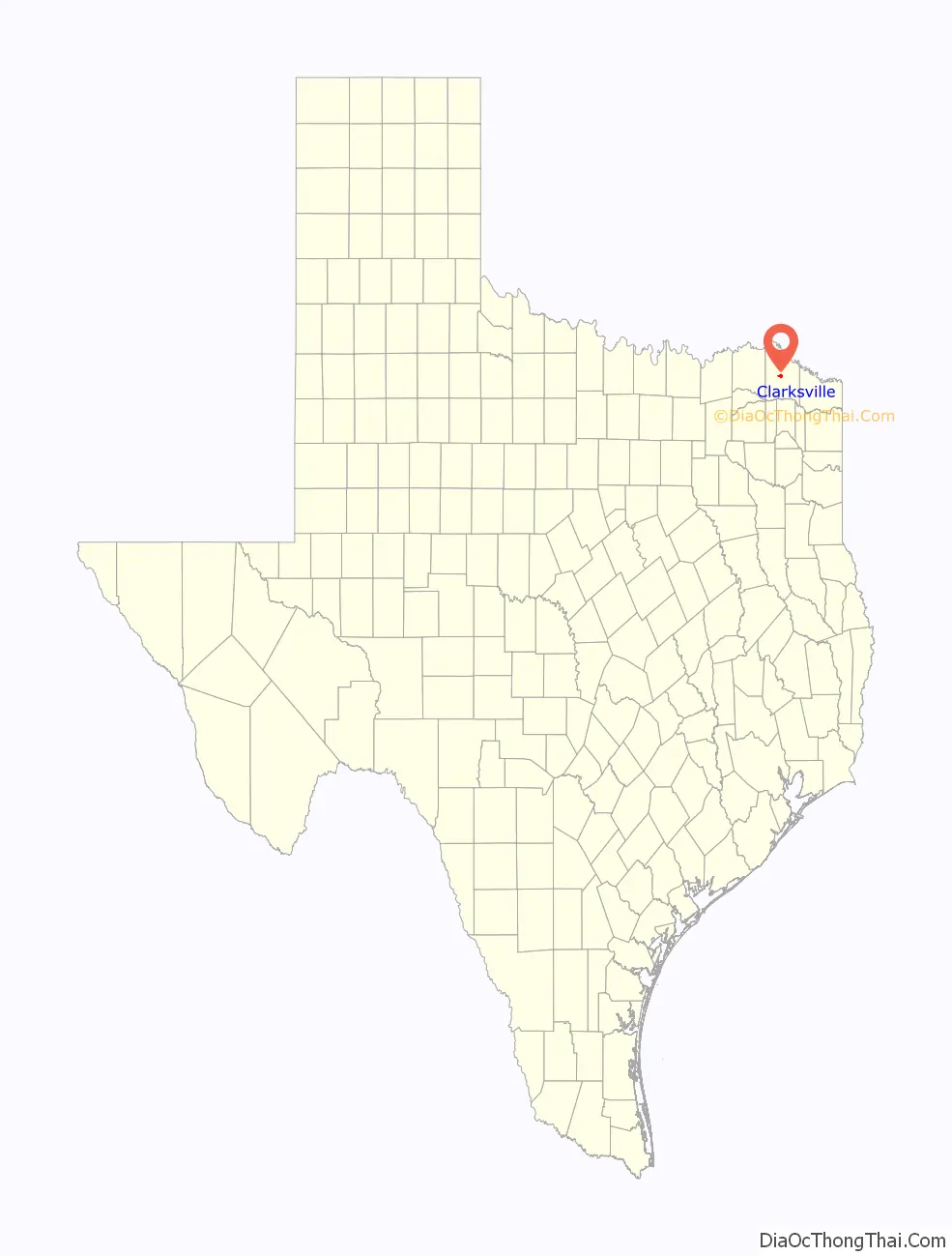
Clarksville location map. Where is Clarksville city?
History
Clarksville was established by James Clark, who moved to the area in 1833 and laid out a town site. When Red River County was organized in 1835, Clarksville was chosen as the county seat, beating out the community of La Grange (later named Madras). Isaac Smathers built one of the first houses, which was later owned by Charles DeMorse. The town was incorporated by an act of the Texas Congress in 1837, and within a few years it became an educational and agricultural center.
In 1841, John W.P. McKenzie, a Methodist minister, retired from serving as a missionary and moved to a former plantation about 3 miles (4.8 km) SSW of Clarksville. Naming his new home Itinerant’s Retreat, he soon began offering classes for boys who lived in the surrounding area. During that same year, 16 boys enrolled in classes in his home. There was more demand than he could accommodate in his home, so he had a log cabin to the plantation to serve as a more conventional school. As the enrollment grew, he added 3 large wooden buildings to serve as dormitories and opened the school to girls and boarding students. By 1854, McKenzie College had 300 students and 9 faculty members participating in a 10-month school year.
Before the American Civil War began, Rev. McKenzie’s school was the largest institution of higher education in Texas during the 1850s, and trained almost all of the new Methodist ministers in the state. Although the school was always considered a Methodist institution, it actually continued to be owned by McKenzie. He tried to turn it over to the local Methodist Conference in 1855 and 1860, but each time the Conference declined to accept certain unspecified conditions, so the official transfer never occurred.
By the fall of 1861, most of the male students had already enlisted in the Confederate Army. In 1863, the school had only 33 students. The average number rose to 74 during the years 1864–1867. Unable to obtain sufficient financing to continue, Rev. McKenzie closed the school permanently on June 25, 1868.
In 1844, Clarksville Female Academy opened, after moving from Pine Creek, where it was originally founded in 1840. A Clarksville post office opened in 1846, and by 1838 there was semiweekly mail service between Clarksville and Natchitoches, Louisiana.
A frame courthouse was built in 1840, and replaced with a brick structure on the main square in 1850. A brick jail was built nearby in 1852. The First Presbyterian Church was organized in Shiloh, Gregg County, Texas in 1838, but relocated to Clarksville in 1844. The Texas State Historical Society says this is “…among the oldest continually operating Protestant churches in the state.”
The Texas State Historical Society also reports that Clarksville was the most important commercial center in this part of Texas from the late 1830s until the Civil War. Once the Red River proved navigable by steamboats, goods could be shipped directly from New Orleans to Rowland’s Landing, 15 miles (24 km) north of Clarksville, then hauled overland by wagon. By the time the war broke out, the city had a population of about 900.
Economic recovery from the Civil War was stimulated when the Texas and Pacific Railway reached Clarksville in 1872, bringing new settlers and new businesses. The 1870 census showed a population of 613. By 1885, the population had grown to about 1,200. The city could then boast of a new limestone courthouse, five white and two black churches, a Catholic convent, three schools, two banks, two flour mills, and a weekly newspaper, the Clarksville Times.
In 1914, the city had 3,000 residents and had added a waterworks, two newspapers, an ice plant, and an electric power plant. After that, outside events such as two world wars, the Great Depression, and increased competition from other cities (e.g., Dallas, Paris, Bonham, and Texarkana) had begun to slow Clarksville’s growth. As shown by the census table, the population in 2000 was very near to that in 1920.
On November 4, 2022, a tornado outbreak occurred in Texas and Oklahoma, which produced a violent EF4 tornado near Clarksville.
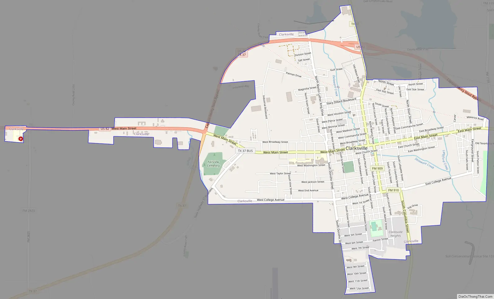
Clarksville Road Map
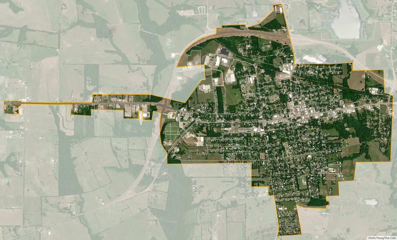
Clarksville city Satellite Map
Geography
Clarksville is located at 33°36′40″N 95°3′9″W / 33.61111°N 95.05250°W / 33.61111; -95.05250 (33.611086, –95.052448).
Located 58 miles (93 km) northwest of Texarkana near the center of the county, it is at the junctions of U.S. Highway 82, State Highway 37, and Farm roads 114, 412, 909, 910, and 1159.
According to the United States Census Bureau, the city has a total area of 3.0 square miles (7.8 km), all land.
See also
Map of Texas State and its subdivision:- Anderson
- Andrews
- Angelina
- Aransas
- Archer
- Armstrong
- Atascosa
- Austin
- Bailey
- Bandera
- Bastrop
- Baylor
- Bee
- Bell
- Bexar
- Blanco
- Borden
- Bosque
- Bowie
- Brazoria
- Brazos
- Brewster
- Briscoe
- Brooks
- Brown
- Burleson
- Burnet
- Caldwell
- Calhoun
- Callahan
- Cameron
- Camp
- Carson
- Cass
- Castro
- Chambers
- Cherokee
- Childress
- Clay
- Cochran
- Coke
- Coleman
- Collin
- Collingsworth
- Colorado
- Comal
- Comanche
- Concho
- Cooke
- Coryell
- Cottle
- Crane
- Crockett
- Crosby
- Culberson
- Dallam
- Dallas
- Dawson
- Deaf Smith
- Delta
- Denton
- Dewitt
- Dickens
- Dimmit
- Donley
- Duval
- Eastland
- Ector
- Edwards
- El Paso
- Ellis
- Erath
- Falls
- Fannin
- Fayette
- Fisher
- Floyd
- Foard
- Fort Bend
- Franklin
- Freestone
- Frio
- Gaines
- Galveston
- Garza
- Gillespie
- Glasscock
- Goliad
- Gonzales
- Gray
- Grayson
- Gregg
- Grimes
- Guadalupe
- Hale
- Hall
- Hamilton
- Hansford
- Hardeman
- Hardin
- Harris
- Harrison
- Hartley
- Haskell
- Hays
- Hemphill
- Henderson
- Hidalgo
- Hill
- Hockley
- Hood
- Hopkins
- Houston
- Howard
- Hudspeth
- Hunt
- Hutchinson
- Irion
- Jack
- Jackson
- Jasper
- Jeff Davis
- Jefferson
- Jim Hogg
- Jim Wells
- Johnson
- Jones
- Karnes
- Kaufman
- Kendall
- Kenedy
- Kent
- Kerr
- Kimble
- King
- Kinney
- Kleberg
- Knox
- La Salle
- Lamar
- Lamb
- Lampasas
- Lavaca
- Lee
- Leon
- Liberty
- Limestone
- Lipscomb
- Live Oak
- Llano
- Loving
- Lubbock
- Lynn
- Madison
- Marion
- Martin
- Mason
- Matagorda
- Maverick
- McCulloch
- McLennan
- McMullen
- Medina
- Menard
- Midland
- Milam
- Mills
- Mitchell
- Montague
- Montgomery
- Moore
- Morris
- Motley
- Nacogdoches
- Navarro
- Newton
- Nolan
- Nueces
- Ochiltree
- Oldham
- Orange
- Palo Pinto
- Panola
- Parker
- Parmer
- Pecos
- Polk
- Potter
- Presidio
- Rains
- Randall
- Reagan
- Real
- Red River
- Reeves
- Refugio
- Roberts
- Robertson
- Rockwall
- Runnels
- Rusk
- Sabine
- San Augustine
- San Jacinto
- San Patricio
- San Saba
- Schleicher
- Scurry
- Shackelford
- Shelby
- Sherman
- Smith
- Somervell
- Starr
- Stephens
- Sterling
- Stonewall
- Sutton
- Swisher
- Tarrant
- Taylor
- Terrell
- Terry
- Throckmorton
- Titus
- Tom Green
- Travis
- Trinity
- Tyler
- Upshur
- Upton
- Uvalde
- Val Verde
- Van Zandt
- Victoria
- Walker
- Waller
- Ward
- Washington
- Webb
- Wharton
- Wheeler
- Wichita
- Wilbarger
- Willacy
- Williamson
- Wilson
- Winkler
- Wise
- Wood
- Yoakum
- Young
- Zapata
- Zavala
- Alabama
- Alaska
- Arizona
- Arkansas
- California
- Colorado
- Connecticut
- Delaware
- District of Columbia
- Florida
- Georgia
- Hawaii
- Idaho
- Illinois
- Indiana
- Iowa
- Kansas
- Kentucky
- Louisiana
- Maine
- Maryland
- Massachusetts
- Michigan
- Minnesota
- Mississippi
- Missouri
- Montana
- Nebraska
- Nevada
- New Hampshire
- New Jersey
- New Mexico
- New York
- North Carolina
- North Dakota
- Ohio
- Oklahoma
- Oregon
- Pennsylvania
- Rhode Island
- South Carolina
- South Dakota
- Tennessee
- Texas
- Utah
- Vermont
- Virginia
- Washington
- West Virginia
- Wisconsin
- Wyoming