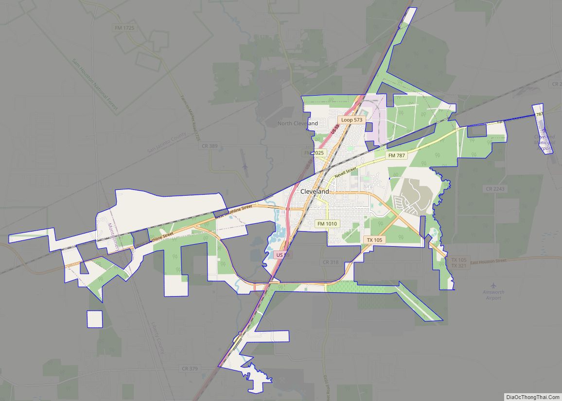
Cleveland is a city in the U.S. state of Texas, within Greater Houston metropolitan area and Liberty County. The population was 7,471 at the 2020 census.
| Name: | Cleveland city |
|---|---|
| LSAD Code: | 25 |
| LSAD Description: | city (suffix) |
| State: | Texas |
| County: | Liberty County, Montgomery County |
| Incorporated: | 1935 |
| Elevation: | 150 ft (45.7 m) |
| Total Area: | 18.99 sq mi (49.19 km²) |
| Land Area: | 18.98 sq mi (49.16 km²) |
| Water Area: | 0.01 sq mi (0.03 km²) |
| Total Population: | 7,471 |
| Population Density: | 434.01/sq mi (167.57/km²) |
| ZIP code: | 77327-77328 |
| Area code: | 281/346/713/832 |
| FIPS code: | 4815436 |
| GNISfeature ID: | 1381199 |
| Website: | www.clevelandtexas.com |
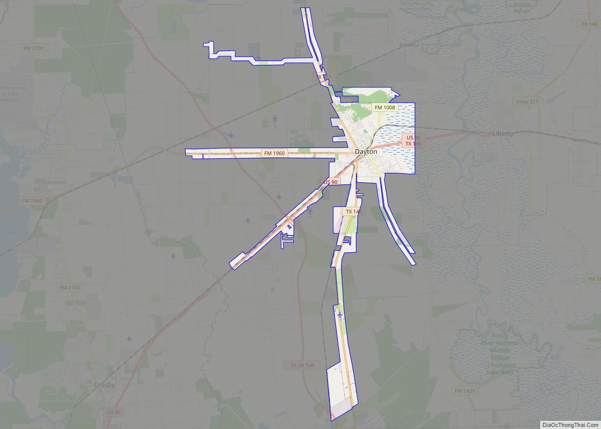
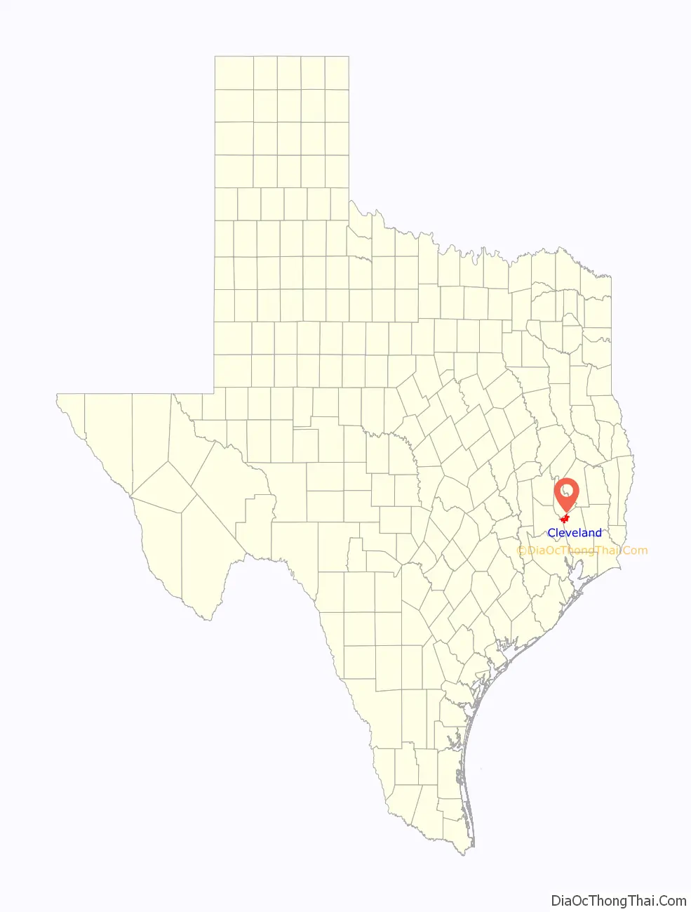
Online Interactive Map
Click on ![]() to view map in "full screen" mode.
to view map in "full screen" mode.
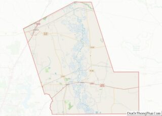
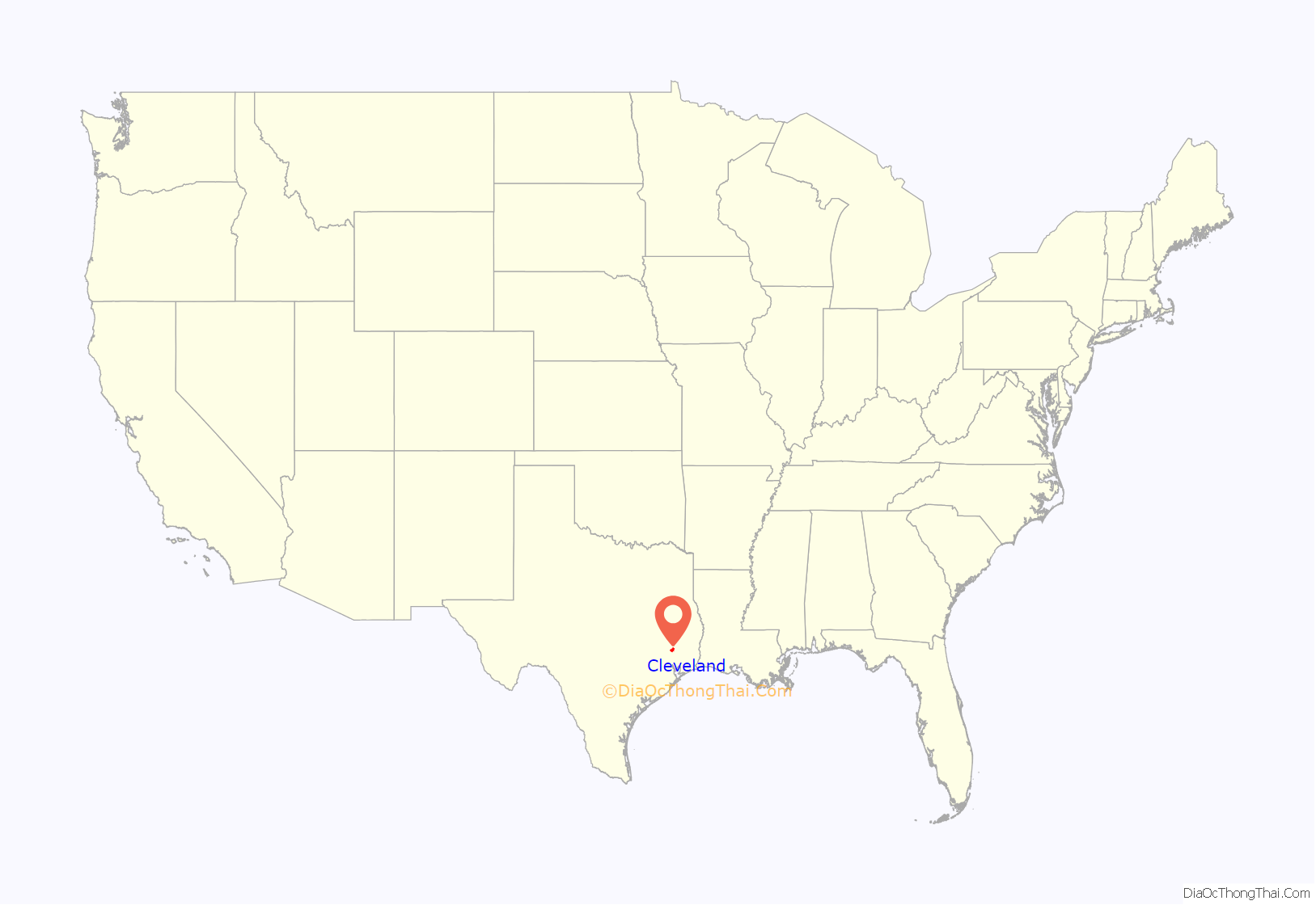
Cleveland location map. Where is Cleveland city?
History
In 1854, a church and convent were built by Father Peter La Cour near the town’s present site. The town began forming in 1878 when Charles Lander Cleveland, a local judge, donated 63.6 acres (257,000 m) of land to the Houston East & West Texas Railway (now part of the Union Pacific Railroad) for use as a stop, requesting that the town be named for him. Since 1900 Cleveland has served as the junction of this line and the Gulf, Colorado and Santa Fe (now the BNSF Railway). The town was not incorporated until 1935.
The forests around Cleveland, including Sam Houston National Forest, which is located just to its north, are a resort for many inhabitants of the Houston area, who come to camp, hike, hunt, and fish. Cleveland has several historic sites and public recreational facilities, including two parks. The Austin Memorial Library Center offers a wide range of services to the community, and the Texan Theater and the annual livestock show and rodeo, Dairy Days, provide entertainment. Commercially, Cleveland has been a shipping point for timber, lumber, and lumber byproducts since the 1870s. A large medical community, oil, gas, cattle, farm products, and sand and gravel are important to the town’s economy. The general trend toward urbanization of the entire area is reflected by the fact that in 1965 Liberty County was added to the Houston Standard Metropolitan Statistical Area. The population of Cleveland grew from 1,200 in 1930 to 7,605 according to the census of 2000.
In 2011, 19 young men and teens from Cleveland were arrested for gang rapes of an 11-year-old girl. Ultimately, 21 persons either pleaded guilty to or were found guilty of crimes connected to the rapes and received punishments ranging from life in prison to probation.
On April 28, 2023, five people including an 8-year-old were killed in a mass shooting outside the town.
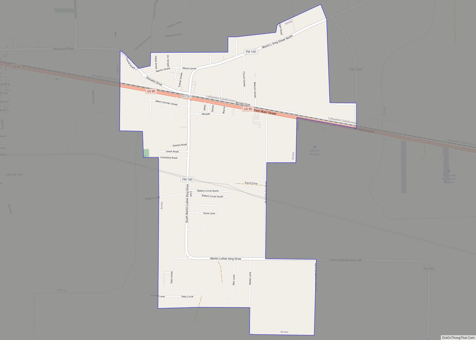
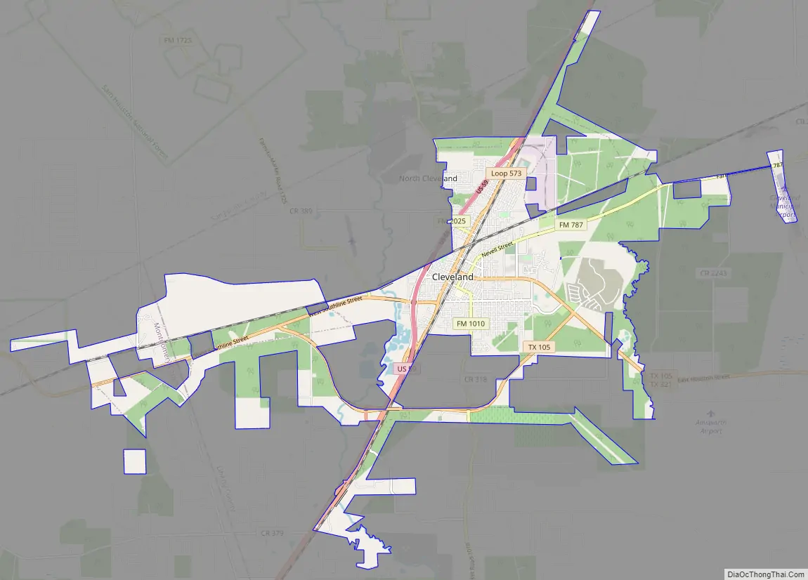
Cleveland Road Map
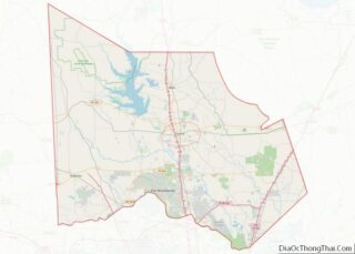
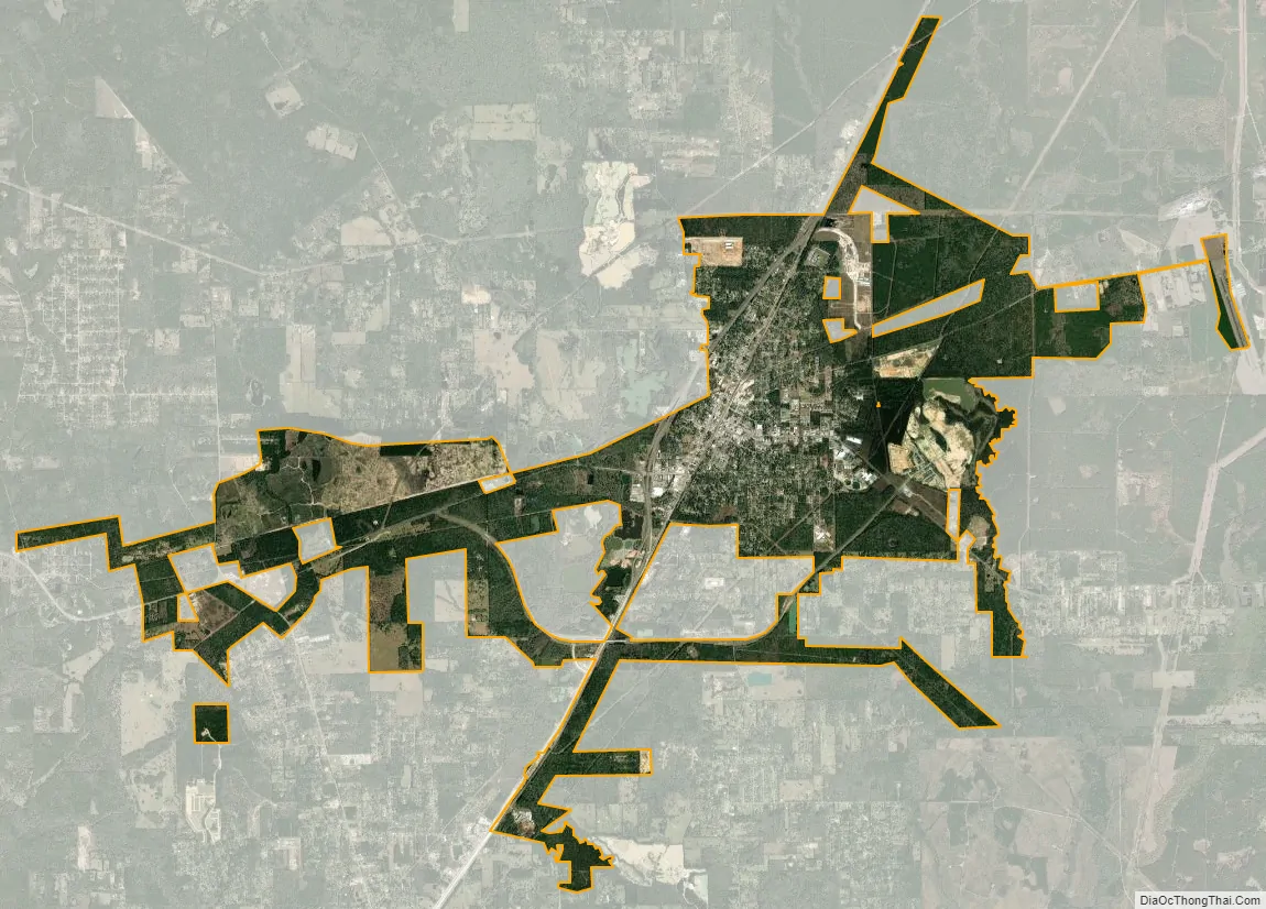
Cleveland city Satellite Map
Geography
According to the United States Census Bureau, the city has a total area of 4.8 square miles (12 km), all land. Cleveland’s northern boundary is made by the Sam Houston National Forest. The climate is characterized by hot, humid summers and generally mild to cool winters. According to the Köppen climate classification system, Cleveland has a humid subtropical climate, Cfa on climate maps.
See also
Map of Texas State and its subdivision:- Anderson
- Andrews
- Angelina
- Aransas
- Archer
- Armstrong
- Atascosa
- Austin
- Bailey
- Bandera
- Bastrop
- Baylor
- Bee
- Bell
- Bexar
- Blanco
- Borden
- Bosque
- Bowie
- Brazoria
- Brazos
- Brewster
- Briscoe
- Brooks
- Brown
- Burleson
- Burnet
- Caldwell
- Calhoun
- Callahan
- Cameron
- Camp
- Carson
- Cass
- Castro
- Chambers
- Cherokee
- Childress
- Clay
- Cochran
- Coke
- Coleman
- Collin
- Collingsworth
- Colorado
- Comal
- Comanche
- Concho
- Cooke
- Coryell
- Cottle
- Crane
- Crockett
- Crosby
- Culberson
- Dallam
- Dallas
- Dawson
- Deaf Smith
- Delta
- Denton
- Dewitt
- Dickens
- Dimmit
- Donley
- Duval
- Eastland
- Ector
- Edwards
- El Paso
- Ellis
- Erath
- Falls
- Fannin
- Fayette
- Fisher
- Floyd
- Foard
- Fort Bend
- Franklin
- Freestone
- Frio
- Gaines
- Galveston
- Garza
- Gillespie
- Glasscock
- Goliad
- Gonzales
- Gray
- Grayson
- Gregg
- Grimes
- Guadalupe
- Hale
- Hall
- Hamilton
- Hansford
- Hardeman
- Hardin
- Harris
- Harrison
- Hartley
- Haskell
- Hays
- Hemphill
- Henderson
- Hidalgo
- Hill
- Hockley
- Hood
- Hopkins
- Houston
- Howard
- Hudspeth
- Hunt
- Hutchinson
- Irion
- Jack
- Jackson
- Jasper
- Jeff Davis
- Jefferson
- Jim Hogg
- Jim Wells
- Johnson
- Jones
- Karnes
- Kaufman
- Kendall
- Kenedy
- Kent
- Kerr
- Kimble
- King
- Kinney
- Kleberg
- Knox
- La Salle
- Lamar
- Lamb
- Lampasas
- Lavaca
- Lee
- Leon
- Liberty
- Limestone
- Lipscomb
- Live Oak
- Llano
- Loving
- Lubbock
- Lynn
- Madison
- Marion
- Martin
- Mason
- Matagorda
- Maverick
- McCulloch
- McLennan
- McMullen
- Medina
- Menard
- Midland
- Milam
- Mills
- Mitchell
- Montague
- Montgomery
- Moore
- Morris
- Motley
- Nacogdoches
- Navarro
- Newton
- Nolan
- Nueces
- Ochiltree
- Oldham
- Orange
- Palo Pinto
- Panola
- Parker
- Parmer
- Pecos
- Polk
- Potter
- Presidio
- Rains
- Randall
- Reagan
- Real
- Red River
- Reeves
- Refugio
- Roberts
- Robertson
- Rockwall
- Runnels
- Rusk
- Sabine
- San Augustine
- San Jacinto
- San Patricio
- San Saba
- Schleicher
- Scurry
- Shackelford
- Shelby
- Sherman
- Smith
- Somervell
- Starr
- Stephens
- Sterling
- Stonewall
- Sutton
- Swisher
- Tarrant
- Taylor
- Terrell
- Terry
- Throckmorton
- Titus
- Tom Green
- Travis
- Trinity
- Tyler
- Upshur
- Upton
- Uvalde
- Val Verde
- Van Zandt
- Victoria
- Walker
- Waller
- Ward
- Washington
- Webb
- Wharton
- Wheeler
- Wichita
- Wilbarger
- Willacy
- Williamson
- Wilson
- Winkler
- Wise
- Wood
- Yoakum
- Young
- Zapata
- Zavala
- Alabama
- Alaska
- Arizona
- Arkansas
- California
- Colorado
- Connecticut
- Delaware
- District of Columbia
- Florida
- Georgia
- Hawaii
- Idaho
- Illinois
- Indiana
- Iowa
- Kansas
- Kentucky
- Louisiana
- Maine
- Maryland
- Massachusetts
- Michigan
- Minnesota
- Mississippi
- Missouri
- Montana
- Nebraska
- Nevada
- New Hampshire
- New Jersey
- New Mexico
- New York
- North Carolina
- North Dakota
- Ohio
- Oklahoma
- Oregon
- Pennsylvania
- Rhode Island
- South Carolina
- South Dakota
- Tennessee
- Texas
- Utah
- Vermont
- Virginia
- Washington
- West Virginia
- Wisconsin
- Wyoming