Conroe is a city in and the county seat of Montgomery County, Texas, United States, about 40 miles (64 km) north of Houston. It is a principal city in the Houston–The Woodlands–Sugar Land metropolitan area.
As of 2021, the population was 98,081, up from 56,207 in 2010. Since 2007, the city has increased in size (and population) by annexation, with the city territory expanding from 52.8 to 74.4 square miles. Some communities have attempted to fight such annexation. According to the Census Bureau, Conroe was the fastest-growing large city in the United States between July 1, 2015, and July 1, 2016.
| Name: | Conroe city |
|---|---|
| LSAD Code: | 25 |
| LSAD Description: | city (suffix) |
| State: | Texas |
| County: | Montgomery County |
| Incorporated: | 1904 |
| Elevation: | 205 ft (62.5 m) |
| Total Area: | 72.77 sq mi (188.48 km²) |
| Land Area: | 71.97 sq mi (186.41 km²) |
| Water Area: | 0.80 sq mi (2.07 km²) |
| Total Population: | 89,956 |
| Population Density: | 1,265.44/sq mi (488.59/km²) |
| Area code: | 936 |
| FIPS code: | 4816432 |
| GNISfeature ID: | 1333238 |
| Website: | www.cityofconroe.org |
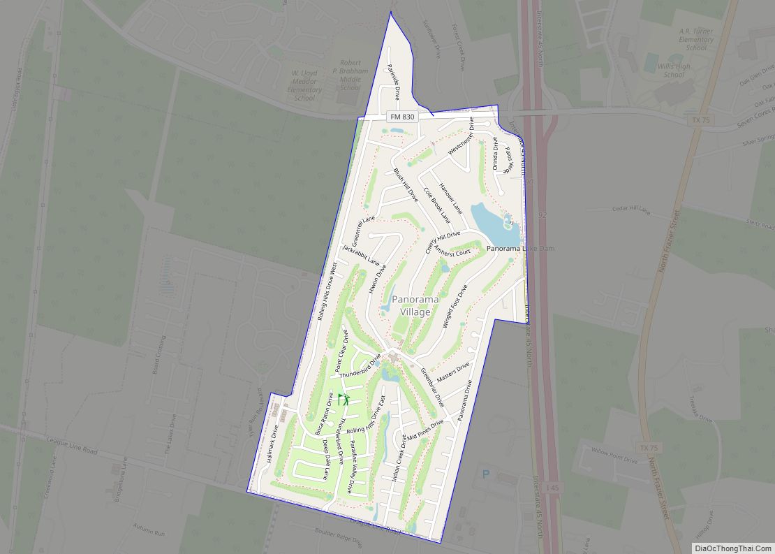
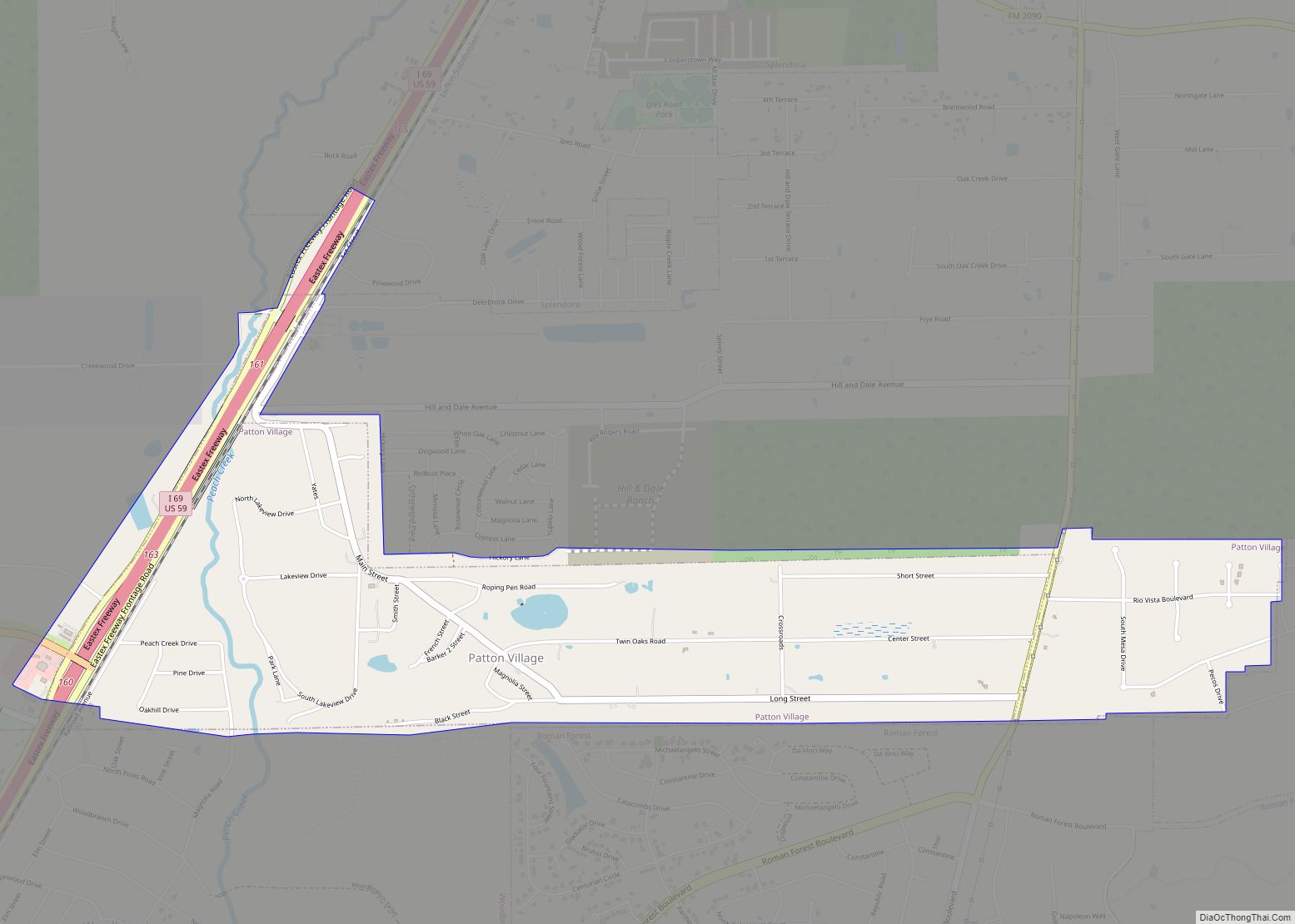
Online Interactive Map
Click on ![]() to view map in "full screen" mode.
to view map in "full screen" mode.
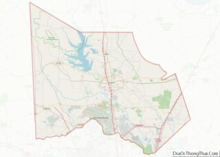
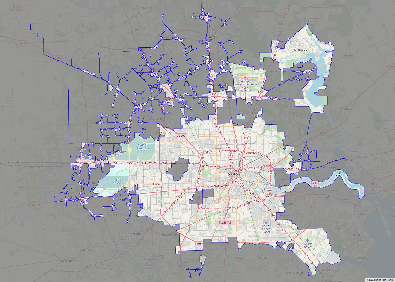
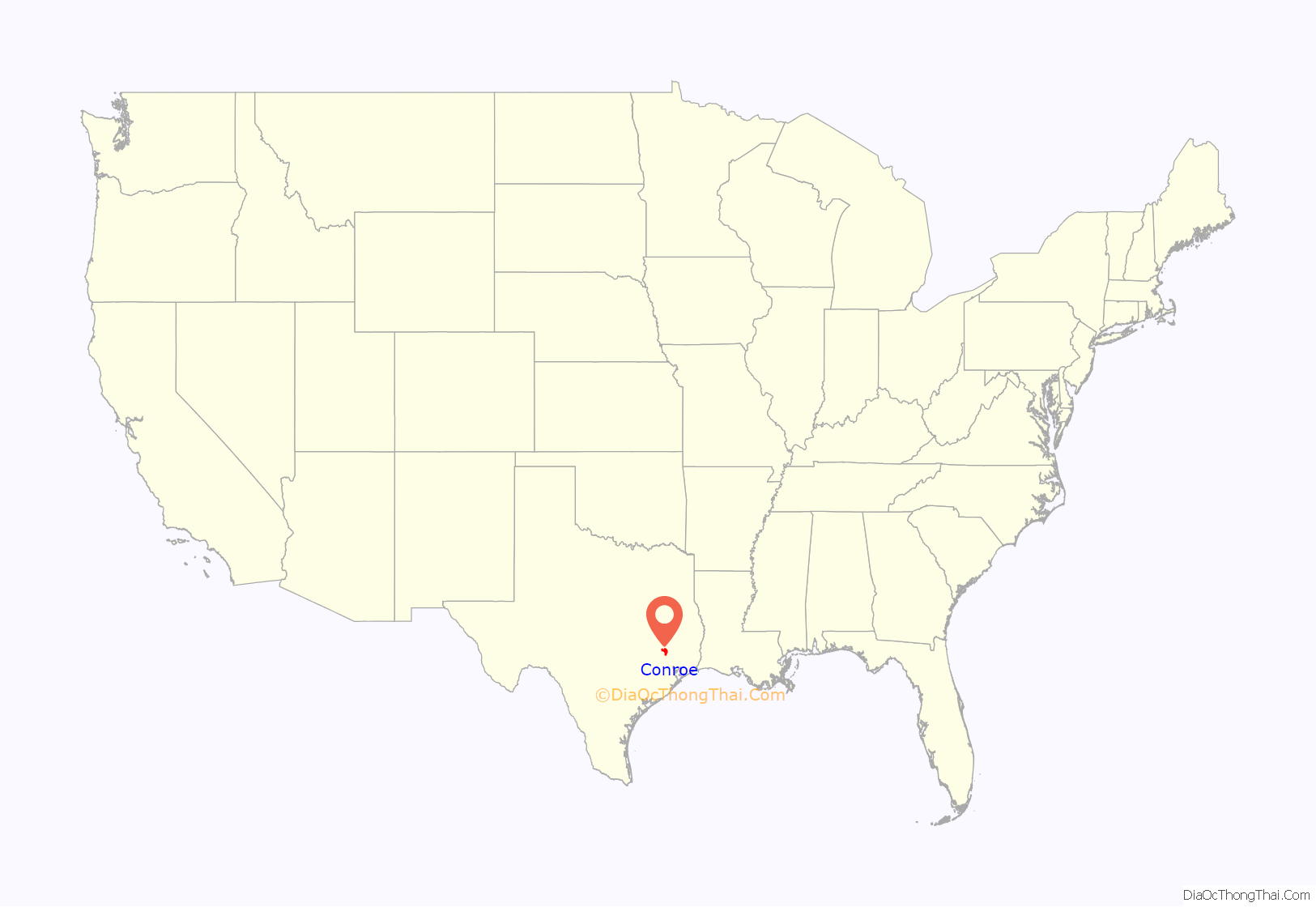
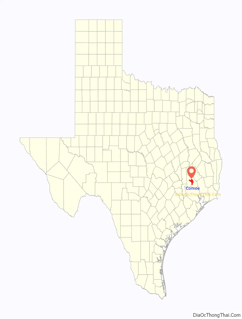
Conroe location map. Where is Conroe city?
History
The city is named after Isaac Conroe. Born in the North, he served as a Union Cavalry officer and settled in Houston after the Civil War. There he became a lumberman. Conroe founded a sawmill in this area in 1881. The community built its early economy and wealth on the lumber industry. Originally named “Conroe’s Switch”, the community received an influx of workers and residents in the late 19th century who were attracted to the growth of the lumber industry, which harvested the local piney wood forest.
In 1886, Conroe Mill School was established in the expanding town. Conroe Normal and Industrial College, a school for African Americans, served the area.
Six lynchings were recorded in Montgomery County around the turn of the century, and some suspects were lynched at the courthouse in Conroe. In 1922, a young black man named Joe Winters was lynched, burned alive on the courthouse square for allegedly attacking a young white woman. Within the black community, it was known he was in a consensual relationship with the woman, who denied it when they were discovered.
In 1941 Bob White was shot to death in the courthouse, during his third trial. The African-American man was arrested in 1936 on charges of assaulting a white woman in Livingston, Texas. (Alternative accounts in the black community said they had a standing consensual relationship.) He was first tried there, before an all-white jury. They convicted him. The case was appealed with the help of the NAACP in Houston because he had not been given a lawyer or been able to contact family, and he was tortured in interrogation. The second trial was held in Conroe for a change of venue. Another all-white jury convicted White again. The case reached the United States Supreme Court on appeal, which had just ruled that coerced confessions were unconstitutional and remanded the case to the lower court for trial. During the proceedings in the courtroom, in front of the judge and numerous witnesses, the husband of the alleged victim shot White in the back of the head and immediately killed him. The husband was arrested and tried the following week, and was acquitted.
In 1931 George W. Strake discovered the Conroe Oil Field. Distillate and natural gas were produced from the Cockfield Formation at a depth of about 5,000 feet (1,500 m). cA second well in 1932 produced 1200 BOPD. By 1935, the field had produced 40 million barrels of oil.
During the 1930s, because of oil profits, the city briefly boasted more millionaires per capita than any other U.S. city. After the construction of Interstate 45 in the postwar period improved automobile access, many Houstonians began to follow the highway to new suburban communities that developed around Conroe.
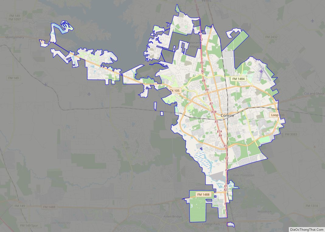
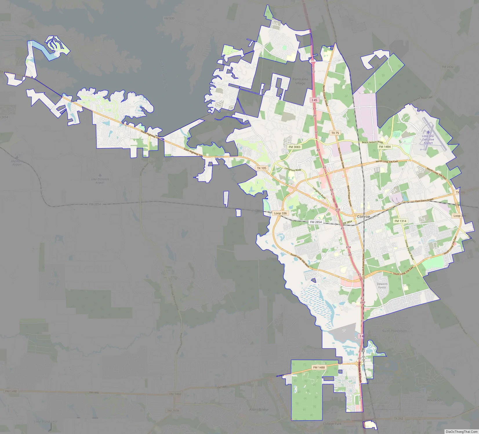
Conroe Road Map
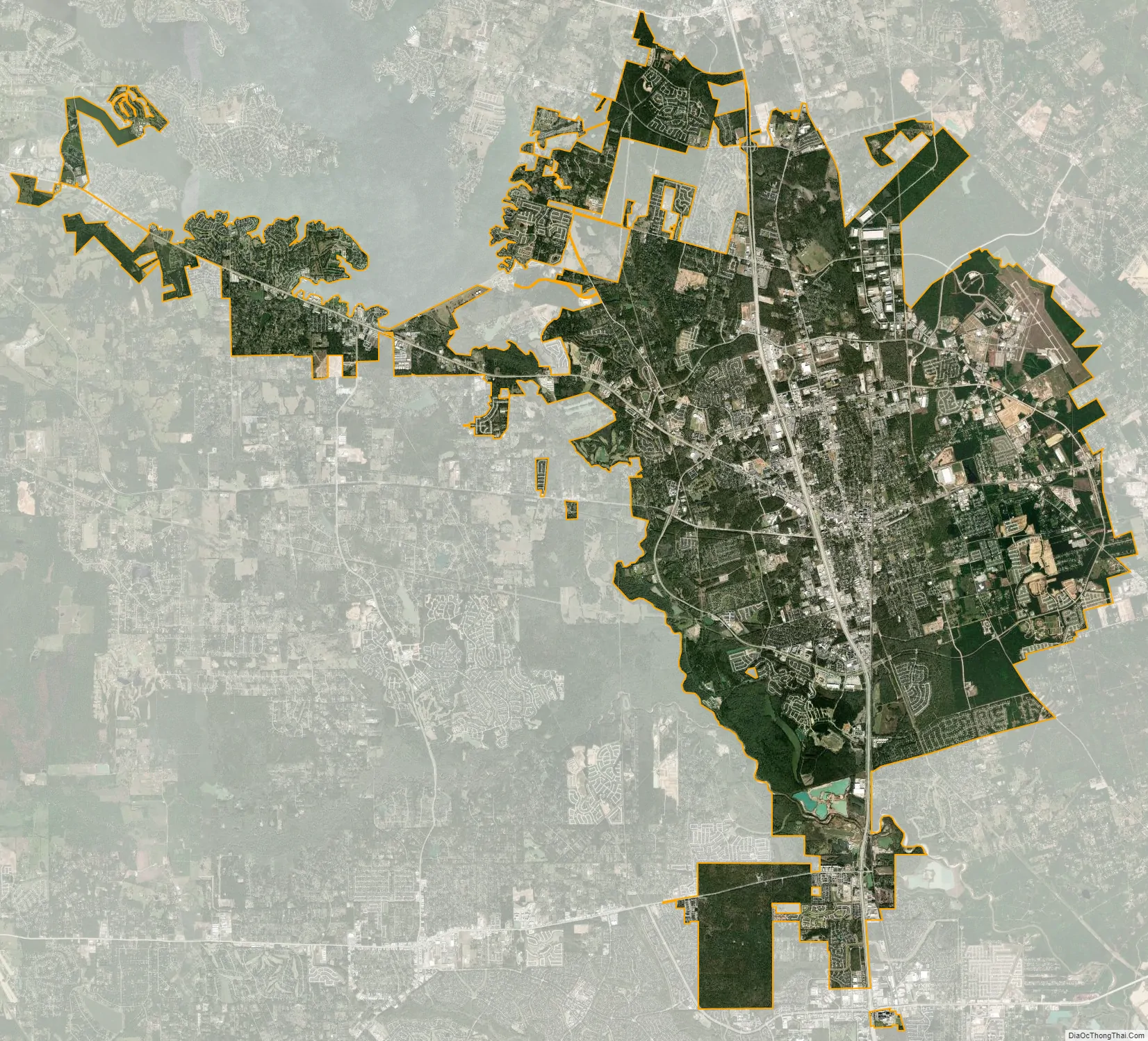
Conroe city Satellite Map
Geography
The Office of Management and Budget classifies Conroe as a principal city within the Houston–The Woodlands–Sugar Land metropolitan area. The city is about 40 miles (64 km) north of Houston.
Annexation
When Conroe incorporated in 1904, the city limits encompassed a 5.44 square mile area. From 1970 to 2000, the city limits expanded from 7.15 square miles to 42.35 square miles. Beginning in 2007, the city outlined a plan to continue expanding its city limits through annexation. According to Chapter 43 of the Texas Local Government Code, home rule municipalities like Conroe may annex territory that is adjacent to the city’s current boundaries, with certain restrictions. The city’s 2007 plan projected doubling its size through a combination of voluntary and involuntary annexations. As of 2022, the city has annexed territory every year since 2007, increasing the city limits from 52.8 to 77.5 square miles.
In April 2015, residents of the gated community of April Sound filed a lawsuit against Conroe after their community was annexed on January 1, 2015. The lawsuit was dismissed in March 2017. Involuntary annexations were a major issue in the 2016 mayoral election, the first after April Sound residents were incorporated into the city. Proponents of annexation contended that it was a useful tool to “promote and facilitate growth and progress,” while those in opposition were concerned about whether annexed territories receive a “fair shake” in the negotiations. In 2017, the city council voted in favor of additional involuntary annexations.
Ecosystem
Conroe is in the southwest corner of the East Texas Piney Woods. The Piney Woods consist of pine trees and hardwood forests. The most common type of tree in the southwest Piney Woods is the loblolly pine. Shortleaf pine are also abundant. Pockets of blackland prairie vegetation are also present, but are disappearing due to urbanization.
In 1926, the Texas A&M Forest Service purchased 1700 acres of Piney Woods to establish W. Goodrich Jones State Forest. The forest serves as a research and demonstration area for sustainable forestry techniques. The forest also preserves the habitat of the red-cockaded woodpecker, a species classified in the early 21st century as Near Threatened by the IUCN.
In 2017, Texas A&M asked Conroe state senator Brandon Creighton to author a bill setting aside 10 percent of the forest for educational and research-related development. The bill also opened the possibility of commercial development on the land. Public concern over the bill persuaded Creighton to revise it. The final version, which passed the Senate unanimously, protected the entire forest from development.
Water resources
The West Fork of the San Jacinto River flows through the western edge of Conroe. The entire city is within the river’s watershed. The river flows southeast from Lake Conroe, a 19,640 surface acre lake created by a dam in 1973 to establish an alternative source of drinking water for Houston.
Conroe developed over several geologic layers of underground aquifers, which supply the city with fresh drinking water. Due to rapid development in this area, and the increased population of Conroe and the surrounding area, the groundwater supply is being withdrawn faster than it can be replenished. As a result, the Lone Star Groundwater Conservation District, which oversees groundwater usage in Montgomery County, mandated that Conroe reduce its groundwater usage by 30 percent of 2009 amounts by January 1, 2016. As part of the groundwater usage reduction plan, the San Jacinto River Authority began in September 2015 to supplement Conroe’s groundwater supply with surface water pumped from Lake Conroe. The SJRA charges the city usage fees to cover the cost of pumping and treating the water.
On August 27, 2015, the City of Conroe filed a lawsuit against the Lone Star Groundwater Conservation District, claiming that the LSGCD did not have the authority to limit the city’s groundwater usage. The city also refused to pay SJRA water usage fee increases in 2016, resulting in a separate lawsuit filed by the SJRA against the city. The LSGCD and Conroe reached a settlement agreement in January 2019. The SJRA case was dismissed in June 2020.
Parts of Conroe surrounding the West Fork of the San Jacinto River are in a floodplain. Significant flooding occurs along the floodplain when rainfall exceeds nine inches in a 48-hour period. The Conroe area has approximately a 10 percent chance of receiving this much rainfall in any given year. Urban development in Conroe and the surrounding area has also exacerbated the risk of flooding. Montgomery County had 500-year floods in three successive years, in May 2015, April 2016, and August 2017. A 500-year flood has a 0.2 percent chance of occurring in a year. In addition, a fourth major flood occurred in May 2016, resulting in two major floods in two months.
The flooding in August 2017 took place during Hurricane Harvey, when nearly 32 inches of rain fell on the city. To protect the integrity of the dam, San Jacinto River Authority officials released 79,100 cubic feet per second of water from Lake Conroe downstream into the West Fork of the San Jacinto River, exacerbating flooding already taking place in the floodplain. Conroe city officials ordered a mandatory evacuation of McDade Estates, a neighborhood on the banks of the river. As a response to the flooding, Montgomery County commissioners in October 2017 requested $1.25 million from the federal government for a flood mitigation study, along with an additional $95.5 million to implement various flood mitigation projects.
See also
Map of Texas State and its subdivision:- Anderson
- Andrews
- Angelina
- Aransas
- Archer
- Armstrong
- Atascosa
- Austin
- Bailey
- Bandera
- Bastrop
- Baylor
- Bee
- Bell
- Bexar
- Blanco
- Borden
- Bosque
- Bowie
- Brazoria
- Brazos
- Brewster
- Briscoe
- Brooks
- Brown
- Burleson
- Burnet
- Caldwell
- Calhoun
- Callahan
- Cameron
- Camp
- Carson
- Cass
- Castro
- Chambers
- Cherokee
- Childress
- Clay
- Cochran
- Coke
- Coleman
- Collin
- Collingsworth
- Colorado
- Comal
- Comanche
- Concho
- Cooke
- Coryell
- Cottle
- Crane
- Crockett
- Crosby
- Culberson
- Dallam
- Dallas
- Dawson
- Deaf Smith
- Delta
- Denton
- Dewitt
- Dickens
- Dimmit
- Donley
- Duval
- Eastland
- Ector
- Edwards
- El Paso
- Ellis
- Erath
- Falls
- Fannin
- Fayette
- Fisher
- Floyd
- Foard
- Fort Bend
- Franklin
- Freestone
- Frio
- Gaines
- Galveston
- Garza
- Gillespie
- Glasscock
- Goliad
- Gonzales
- Gray
- Grayson
- Gregg
- Grimes
- Guadalupe
- Hale
- Hall
- Hamilton
- Hansford
- Hardeman
- Hardin
- Harris
- Harrison
- Hartley
- Haskell
- Hays
- Hemphill
- Henderson
- Hidalgo
- Hill
- Hockley
- Hood
- Hopkins
- Houston
- Howard
- Hudspeth
- Hunt
- Hutchinson
- Irion
- Jack
- Jackson
- Jasper
- Jeff Davis
- Jefferson
- Jim Hogg
- Jim Wells
- Johnson
- Jones
- Karnes
- Kaufman
- Kendall
- Kenedy
- Kent
- Kerr
- Kimble
- King
- Kinney
- Kleberg
- Knox
- La Salle
- Lamar
- Lamb
- Lampasas
- Lavaca
- Lee
- Leon
- Liberty
- Limestone
- Lipscomb
- Live Oak
- Llano
- Loving
- Lubbock
- Lynn
- Madison
- Marion
- Martin
- Mason
- Matagorda
- Maverick
- McCulloch
- McLennan
- McMullen
- Medina
- Menard
- Midland
- Milam
- Mills
- Mitchell
- Montague
- Montgomery
- Moore
- Morris
- Motley
- Nacogdoches
- Navarro
- Newton
- Nolan
- Nueces
- Ochiltree
- Oldham
- Orange
- Palo Pinto
- Panola
- Parker
- Parmer
- Pecos
- Polk
- Potter
- Presidio
- Rains
- Randall
- Reagan
- Real
- Red River
- Reeves
- Refugio
- Roberts
- Robertson
- Rockwall
- Runnels
- Rusk
- Sabine
- San Augustine
- San Jacinto
- San Patricio
- San Saba
- Schleicher
- Scurry
- Shackelford
- Shelby
- Sherman
- Smith
- Somervell
- Starr
- Stephens
- Sterling
- Stonewall
- Sutton
- Swisher
- Tarrant
- Taylor
- Terrell
- Terry
- Throckmorton
- Titus
- Tom Green
- Travis
- Trinity
- Tyler
- Upshur
- Upton
- Uvalde
- Val Verde
- Van Zandt
- Victoria
- Walker
- Waller
- Ward
- Washington
- Webb
- Wharton
- Wheeler
- Wichita
- Wilbarger
- Willacy
- Williamson
- Wilson
- Winkler
- Wise
- Wood
- Yoakum
- Young
- Zapata
- Zavala
- Alabama
- Alaska
- Arizona
- Arkansas
- California
- Colorado
- Connecticut
- Delaware
- District of Columbia
- Florida
- Georgia
- Hawaii
- Idaho
- Illinois
- Indiana
- Iowa
- Kansas
- Kentucky
- Louisiana
- Maine
- Maryland
- Massachusetts
- Michigan
- Minnesota
- Mississippi
- Missouri
- Montana
- Nebraska
- Nevada
- New Hampshire
- New Jersey
- New Mexico
- New York
- North Carolina
- North Dakota
- Ohio
- Oklahoma
- Oregon
- Pennsylvania
- Rhode Island
- South Carolina
- South Dakota
- Tennessee
- Texas
- Utah
- Vermont
- Virginia
- Washington
- West Virginia
- Wisconsin
- Wyoming