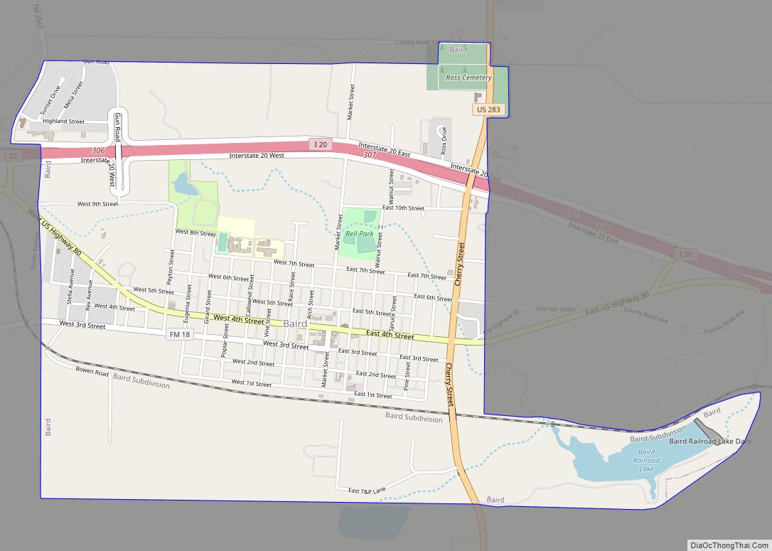
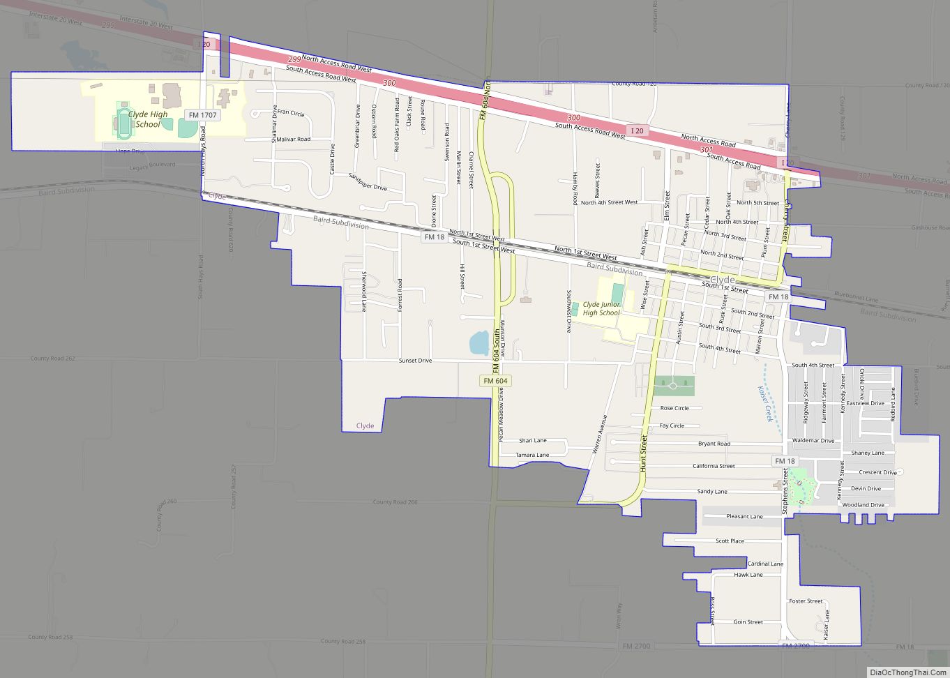
Clyde is a city in Callahan County, Texas, United States. The population was 3,713 at the 2010 census, up from 3,345 at the 2000 census. It is part of the Abilene metropolitan statistical area.
| Name: | Clyde city |
|---|---|
| LSAD Code: | 25 |
| LSAD Description: | city (suffix) |
| State: | Texas |
| County: | Callahan County |
| Elevation: | 2,001 ft (610 m) |
| Total Area: | 3.28 sq mi (8.50 km²) |
| Land Area: | 3.28 sq mi (8.50 km²) |
| Water Area: | 0.00 sq mi (0.00 km²) |
| Total Population: | 3,713 |
| Population Density: | 1,164.13/sq mi (449.52/km²) |
| ZIP code: | 79510 |
| Area code: | 325 |
| FIPS code: | 4815676 |
| GNISfeature ID: | 2409491 |
| Website: | clydetexas.us |
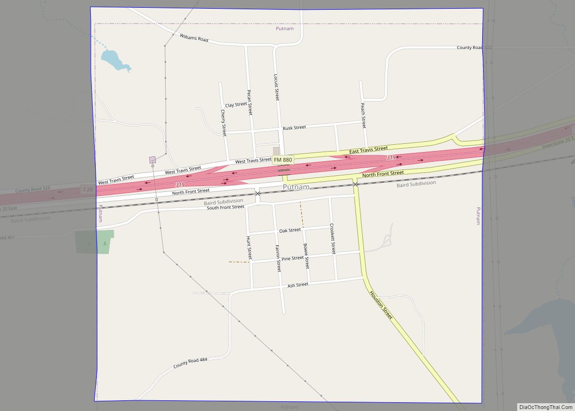
Online Interactive Map
Click on ![]() to view map in "full screen" mode.
to view map in "full screen" mode.
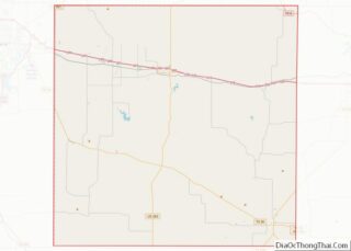
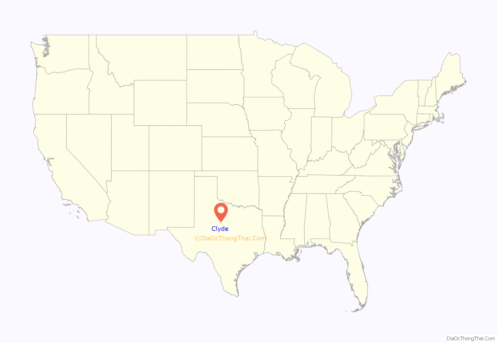
Clyde location map. Where is Clyde city?
History
The first settlers came to Clyde around 1876. Mr. Shephard built a log cabin, the first residence, around this time. Many others soon followed. Among the first settlers were people such as R. J. Estes who came all the way from Fort Worth. When he first came, he didn’t plan on staying. Mrs. Estes and he had stopped only to rest, but soon decided to stay. In their quick decision to stay, they simply left their belongings under a tree while they traveled to get the rest of their belongings for their new home. All their belongings were still as they had left them when they returned a few months later.
The railroad was prominent in Clyde. It started with only a boxcar, then later a station was added. Along with the railroad came more settlers, homes, and work. Soon a school was needed.
The actual origin of the name “Clyde” is not known. Many believe it was named after a crew foreman. The man worked for the Texas and Pacific Railway Company. The company had a tent for the employees to get supplies. They would say, “Let’s go up to Clyde’s,” not talking about the town, only the supply tent. Soon the railroad company would call their boxcar location “Clyde”.
The first post office soon followed. The first postmaster, Jesse L. Miller, was appointed June 27, 1881.
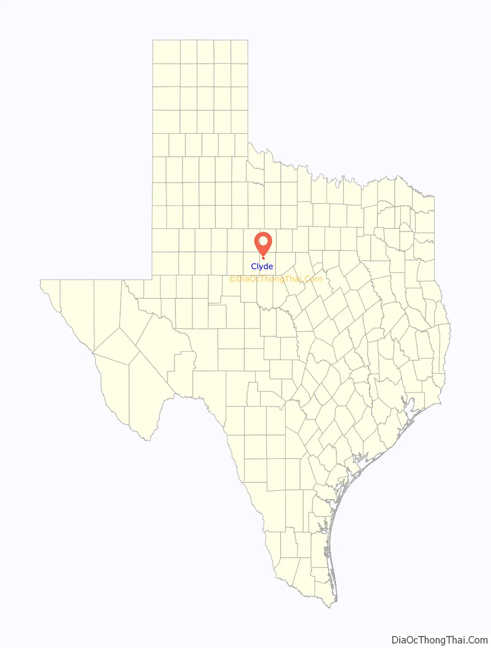
Clyde Road Map
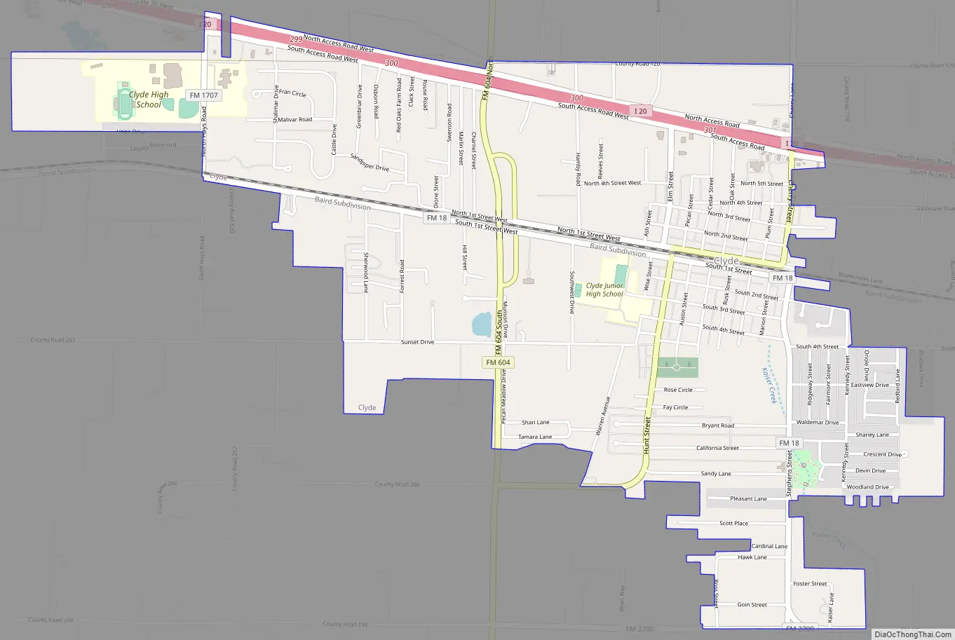
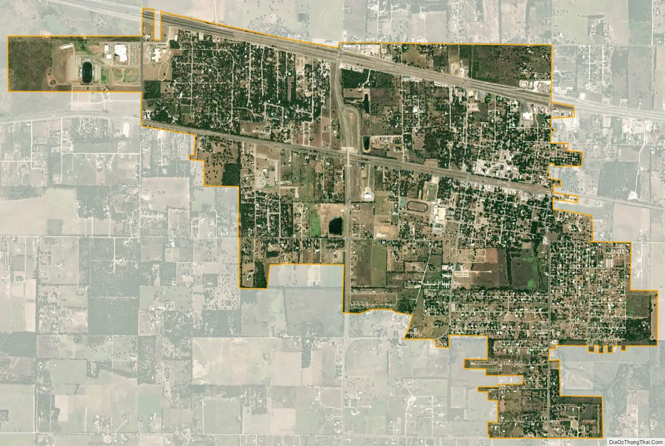
Clyde city Satellite Map
Geography
Clyde is located in northwestern Callahan County at 32°24′N 99°30′W / 32.400°N 99.500°W / 32.400; -99.500 (32.4044, –99.4982). Interstate 20 passes through the northern side of the city, leading east 6 miles (10 km) to Baird, the county seat, and west 14 miles (23 km) to Abilene.
According to the United States Census Bureau, the city has a total area of 3.3 square miles (8.5 km), all of it land.
See also
Map of Texas State and its subdivision:- Anderson
- Andrews
- Angelina
- Aransas
- Archer
- Armstrong
- Atascosa
- Austin
- Bailey
- Bandera
- Bastrop
- Baylor
- Bee
- Bell
- Bexar
- Blanco
- Borden
- Bosque
- Bowie
- Brazoria
- Brazos
- Brewster
- Briscoe
- Brooks
- Brown
- Burleson
- Burnet
- Caldwell
- Calhoun
- Callahan
- Cameron
- Camp
- Carson
- Cass
- Castro
- Chambers
- Cherokee
- Childress
- Clay
- Cochran
- Coke
- Coleman
- Collin
- Collingsworth
- Colorado
- Comal
- Comanche
- Concho
- Cooke
- Coryell
- Cottle
- Crane
- Crockett
- Crosby
- Culberson
- Dallam
- Dallas
- Dawson
- Deaf Smith
- Delta
- Denton
- Dewitt
- Dickens
- Dimmit
- Donley
- Duval
- Eastland
- Ector
- Edwards
- El Paso
- Ellis
- Erath
- Falls
- Fannin
- Fayette
- Fisher
- Floyd
- Foard
- Fort Bend
- Franklin
- Freestone
- Frio
- Gaines
- Galveston
- Garza
- Gillespie
- Glasscock
- Goliad
- Gonzales
- Gray
- Grayson
- Gregg
- Grimes
- Guadalupe
- Hale
- Hall
- Hamilton
- Hansford
- Hardeman
- Hardin
- Harris
- Harrison
- Hartley
- Haskell
- Hays
- Hemphill
- Henderson
- Hidalgo
- Hill
- Hockley
- Hood
- Hopkins
- Houston
- Howard
- Hudspeth
- Hunt
- Hutchinson
- Irion
- Jack
- Jackson
- Jasper
- Jeff Davis
- Jefferson
- Jim Hogg
- Jim Wells
- Johnson
- Jones
- Karnes
- Kaufman
- Kendall
- Kenedy
- Kent
- Kerr
- Kimble
- King
- Kinney
- Kleberg
- Knox
- La Salle
- Lamar
- Lamb
- Lampasas
- Lavaca
- Lee
- Leon
- Liberty
- Limestone
- Lipscomb
- Live Oak
- Llano
- Loving
- Lubbock
- Lynn
- Madison
- Marion
- Martin
- Mason
- Matagorda
- Maverick
- McCulloch
- McLennan
- McMullen
- Medina
- Menard
- Midland
- Milam
- Mills
- Mitchell
- Montague
- Montgomery
- Moore
- Morris
- Motley
- Nacogdoches
- Navarro
- Newton
- Nolan
- Nueces
- Ochiltree
- Oldham
- Orange
- Palo Pinto
- Panola
- Parker
- Parmer
- Pecos
- Polk
- Potter
- Presidio
- Rains
- Randall
- Reagan
- Real
- Red River
- Reeves
- Refugio
- Roberts
- Robertson
- Rockwall
- Runnels
- Rusk
- Sabine
- San Augustine
- San Jacinto
- San Patricio
- San Saba
- Schleicher
- Scurry
- Shackelford
- Shelby
- Sherman
- Smith
- Somervell
- Starr
- Stephens
- Sterling
- Stonewall
- Sutton
- Swisher
- Tarrant
- Taylor
- Terrell
- Terry
- Throckmorton
- Titus
- Tom Green
- Travis
- Trinity
- Tyler
- Upshur
- Upton
- Uvalde
- Val Verde
- Van Zandt
- Victoria
- Walker
- Waller
- Ward
- Washington
- Webb
- Wharton
- Wheeler
- Wichita
- Wilbarger
- Willacy
- Williamson
- Wilson
- Winkler
- Wise
- Wood
- Yoakum
- Young
- Zapata
- Zavala
- Alabama
- Alaska
- Arizona
- Arkansas
- California
- Colorado
- Connecticut
- Delaware
- District of Columbia
- Florida
- Georgia
- Hawaii
- Idaho
- Illinois
- Indiana
- Iowa
- Kansas
- Kentucky
- Louisiana
- Maine
- Maryland
- Massachusetts
- Michigan
- Minnesota
- Mississippi
- Missouri
- Montana
- Nebraska
- Nevada
- New Hampshire
- New Jersey
- New Mexico
- New York
- North Carolina
- North Dakota
- Ohio
- Oklahoma
- Oregon
- Pennsylvania
- Rhode Island
- South Carolina
- South Dakota
- Tennessee
- Texas
- Utah
- Vermont
- Virginia
- Washington
- West Virginia
- Wisconsin
- Wyoming