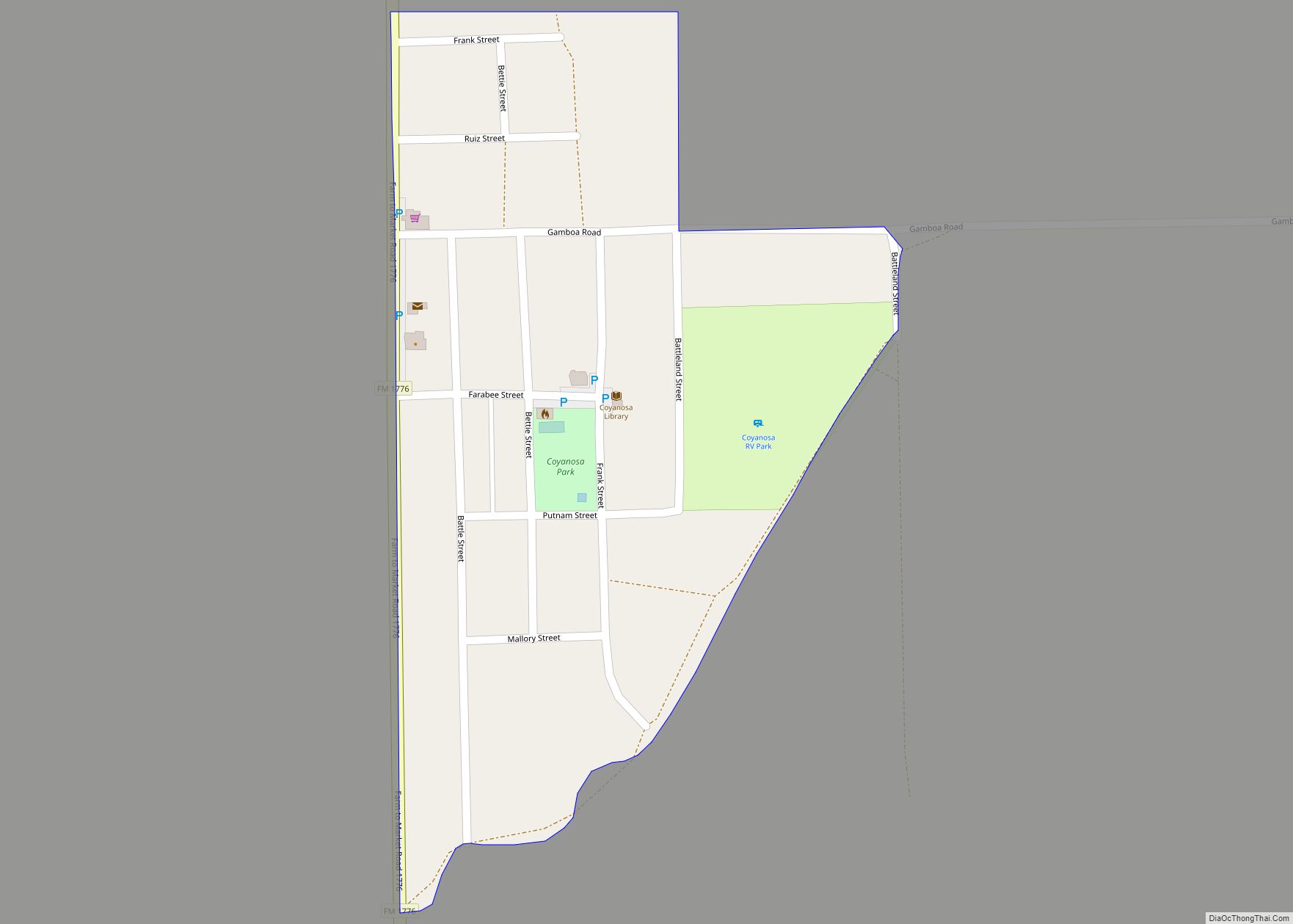
Coyanosa is an unincorporated desert village in Pecos County, Texas, located in the Permian Basin in West Texas, United States. Its population was 163 at the 2010 census. Part of the Coyanosa Draw runs adjacent to the town, 2.2 miles to the west. There is a food store, two Mexican restaurants, a public library, an RV park and a post office at Coyanosa by way of businesses and services.
Coyanosa is mentioned as the hometown of the main character in the book “The man from Coyanosa” (1998) by Lauran Paine.
People from Coyanosa are called Coyanosans.
Coyanosa is the dominant portion of a same-named census-designated place (CDP).
| Name: | Coyanosa CDP |
|---|---|
| LSAD Code: | 57 |
| LSAD Description: | CDP (suffix) |
| State: | Texas |
| County: | Pecos County |
| Elevation: | 2,608 ft (795 m) |
| Total Area: | 0.2 sq mi (0.5 km²) |
| Land Area: | 0.2 sq mi (0.5 km²) |
| Water Area: | 0.0 sq mi (0.0 km²) |
| Total Population: | 163 |
| Population Density: | 820/sq mi (330/km²) |
| ZIP code: | 79730 |
| Area code: | 432 |
| FIPS code: | 4817408 |
| GNISfeature ID: | 1355271 |
Online Interactive Map
Click on ![]() to view map in "full screen" mode.
to view map in "full screen" mode.
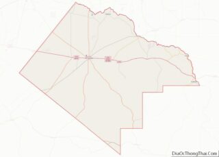
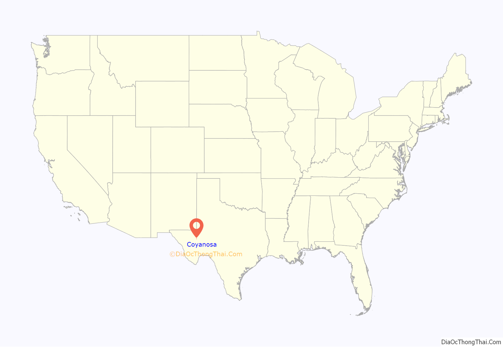
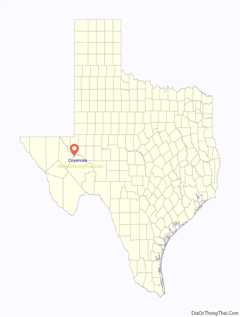
Coyanosa location map. Where is Coyanosa CDP?
History
Coyanosa was originally settled as a ranching community in the early 1900s. A post office was established in 1908, but was discontinued 10 years later. Further development of the community resumed in the 1950s, as numerous water wells were drilled in the area to irrigate nearby cotton farms. By 1958, around 200 people lived in Coyanosa. The post office reopened, and by the early 1960s, the population had risen to 600. Increasing fuel prices in the mid-1970s made irrigation unprofitable and forced many area cotton farms out of business. A decline in the number of inhabitants soon followed. By 1990, Coyanosa had around 270 people. That figure had fallen to 138 by 2000.
Coyanosa Road Map
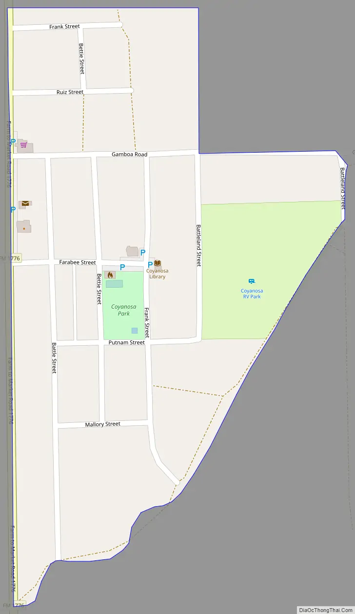
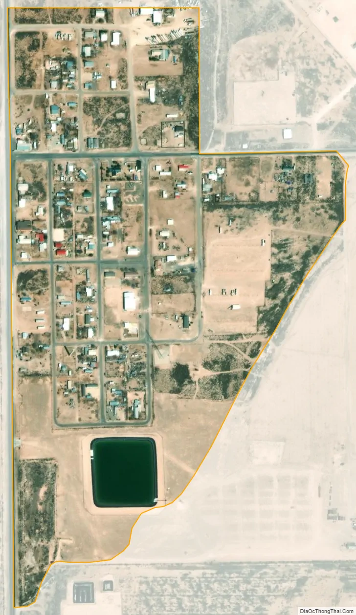
Coyanosa city Satellite Map
Geography
Coyanosa is located at 31°14′26″N 103°03′58″W / 31.240532°N 103.066121°W / 31.240532; -103.066121 (31.240532, -103.066121). It is situated south of the intersection of Farm Roads 1776 and 1450, approximately 26 miles northwest of Fort Stockton in northwestern Pecos County.
According to the United States Census Bureau in 2000, the CDP has a total area of 0.1 square miles (0.26 km), all of it land. By the 2010 census, the CDP had increased in size to 0.2 square miles (0.52 km), all land.
See also
Map of Texas State and its subdivision:- Anderson
- Andrews
- Angelina
- Aransas
- Archer
- Armstrong
- Atascosa
- Austin
- Bailey
- Bandera
- Bastrop
- Baylor
- Bee
- Bell
- Bexar
- Blanco
- Borden
- Bosque
- Bowie
- Brazoria
- Brazos
- Brewster
- Briscoe
- Brooks
- Brown
- Burleson
- Burnet
- Caldwell
- Calhoun
- Callahan
- Cameron
- Camp
- Carson
- Cass
- Castro
- Chambers
- Cherokee
- Childress
- Clay
- Cochran
- Coke
- Coleman
- Collin
- Collingsworth
- Colorado
- Comal
- Comanche
- Concho
- Cooke
- Coryell
- Cottle
- Crane
- Crockett
- Crosby
- Culberson
- Dallam
- Dallas
- Dawson
- Deaf Smith
- Delta
- Denton
- Dewitt
- Dickens
- Dimmit
- Donley
- Duval
- Eastland
- Ector
- Edwards
- El Paso
- Ellis
- Erath
- Falls
- Fannin
- Fayette
- Fisher
- Floyd
- Foard
- Fort Bend
- Franklin
- Freestone
- Frio
- Gaines
- Galveston
- Garza
- Gillespie
- Glasscock
- Goliad
- Gonzales
- Gray
- Grayson
- Gregg
- Grimes
- Guadalupe
- Hale
- Hall
- Hamilton
- Hansford
- Hardeman
- Hardin
- Harris
- Harrison
- Hartley
- Haskell
- Hays
- Hemphill
- Henderson
- Hidalgo
- Hill
- Hockley
- Hood
- Hopkins
- Houston
- Howard
- Hudspeth
- Hunt
- Hutchinson
- Irion
- Jack
- Jackson
- Jasper
- Jeff Davis
- Jefferson
- Jim Hogg
- Jim Wells
- Johnson
- Jones
- Karnes
- Kaufman
- Kendall
- Kenedy
- Kent
- Kerr
- Kimble
- King
- Kinney
- Kleberg
- Knox
- La Salle
- Lamar
- Lamb
- Lampasas
- Lavaca
- Lee
- Leon
- Liberty
- Limestone
- Lipscomb
- Live Oak
- Llano
- Loving
- Lubbock
- Lynn
- Madison
- Marion
- Martin
- Mason
- Matagorda
- Maverick
- McCulloch
- McLennan
- McMullen
- Medina
- Menard
- Midland
- Milam
- Mills
- Mitchell
- Montague
- Montgomery
- Moore
- Morris
- Motley
- Nacogdoches
- Navarro
- Newton
- Nolan
- Nueces
- Ochiltree
- Oldham
- Orange
- Palo Pinto
- Panola
- Parker
- Parmer
- Pecos
- Polk
- Potter
- Presidio
- Rains
- Randall
- Reagan
- Real
- Red River
- Reeves
- Refugio
- Roberts
- Robertson
- Rockwall
- Runnels
- Rusk
- Sabine
- San Augustine
- San Jacinto
- San Patricio
- San Saba
- Schleicher
- Scurry
- Shackelford
- Shelby
- Sherman
- Smith
- Somervell
- Starr
- Stephens
- Sterling
- Stonewall
- Sutton
- Swisher
- Tarrant
- Taylor
- Terrell
- Terry
- Throckmorton
- Titus
- Tom Green
- Travis
- Trinity
- Tyler
- Upshur
- Upton
- Uvalde
- Val Verde
- Van Zandt
- Victoria
- Walker
- Waller
- Ward
- Washington
- Webb
- Wharton
- Wheeler
- Wichita
- Wilbarger
- Willacy
- Williamson
- Wilson
- Winkler
- Wise
- Wood
- Yoakum
- Young
- Zapata
- Zavala
- Alabama
- Alaska
- Arizona
- Arkansas
- California
- Colorado
- Connecticut
- Delaware
- District of Columbia
- Florida
- Georgia
- Hawaii
- Idaho
- Illinois
- Indiana
- Iowa
- Kansas
- Kentucky
- Louisiana
- Maine
- Maryland
- Massachusetts
- Michigan
- Minnesota
- Mississippi
- Missouri
- Montana
- Nebraska
- Nevada
- New Hampshire
- New Jersey
- New Mexico
- New York
- North Carolina
- North Dakota
- Ohio
- Oklahoma
- Oregon
- Pennsylvania
- Rhode Island
- South Carolina
- South Dakota
- Tennessee
- Texas
- Utah
- Vermont
- Virginia
- Washington
- West Virginia
- Wisconsin
- Wyoming