Cranfills Gap is a city located in Bosque County in central Texas, United States. It was founded by Norwegian Emigrants and to this day most residents can trace their lineage to those Norwegian Founders. The population was 281 at the 2010 census.
| Name: | Cranfills Gap city |
|---|---|
| LSAD Code: | 25 |
| LSAD Description: | city (suffix) |
| State: | Texas |
| County: | Bosque County |
| Elevation: | 968 ft (295 m) |
| Total Area: | 0.73 sq mi (1.88 km²) |
| Land Area: | 0.73 sq mi (1.88 km²) |
| Water Area: | 0.00 sq mi (0.00 km²) |
| Total Population: | 281 |
| Population Density: | 388.43/sq mi (150.01/km²) |
| ZIP code: | 76637 |
| Area code: | 254 |
| FIPS code: | 4817540 |
| GNISfeature ID: | 1333628 |
| Website: | www.cranfillsgaptexas.com |
Online Interactive Map
Click on ![]() to view map in "full screen" mode.
to view map in "full screen" mode.
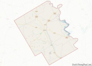
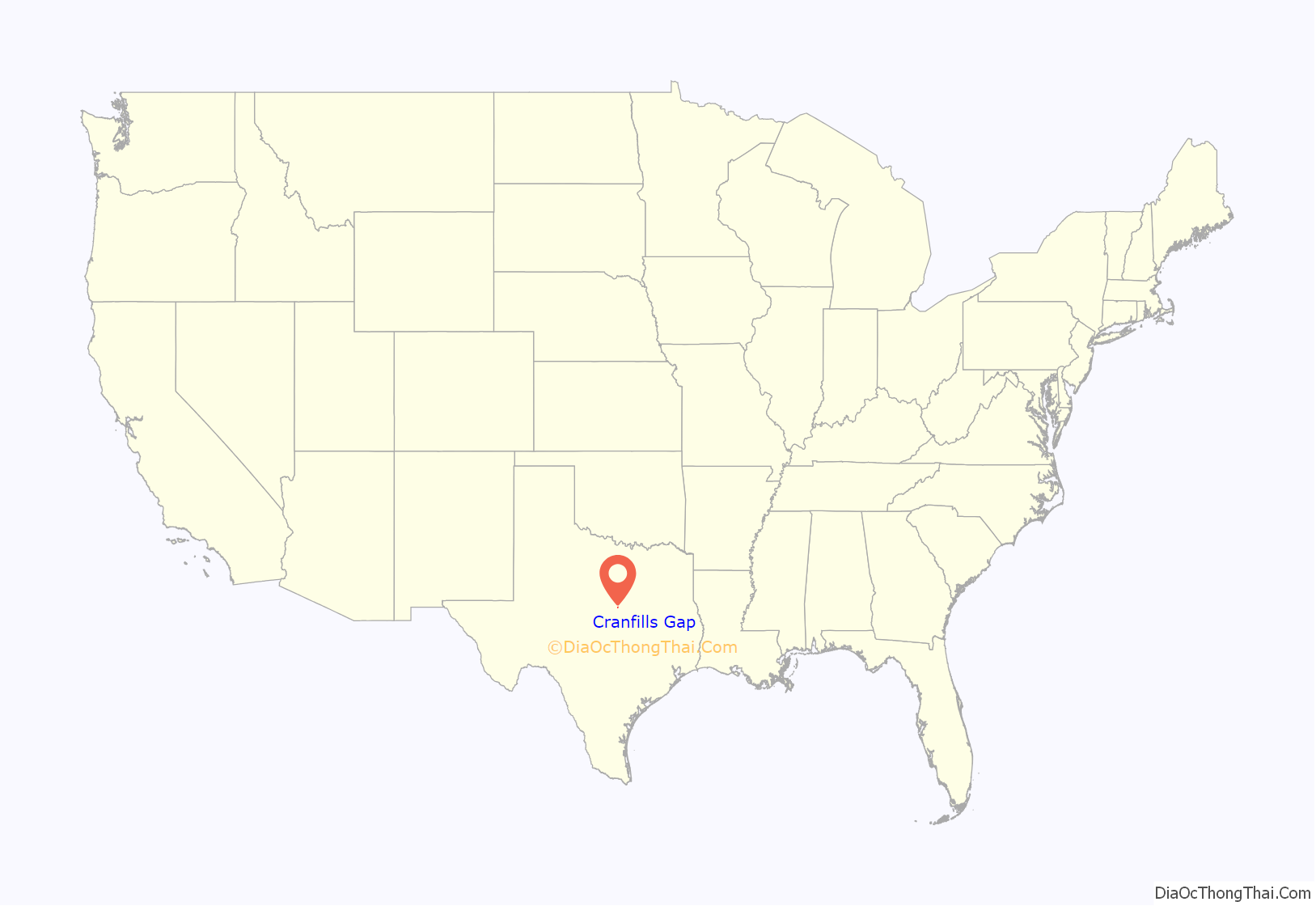
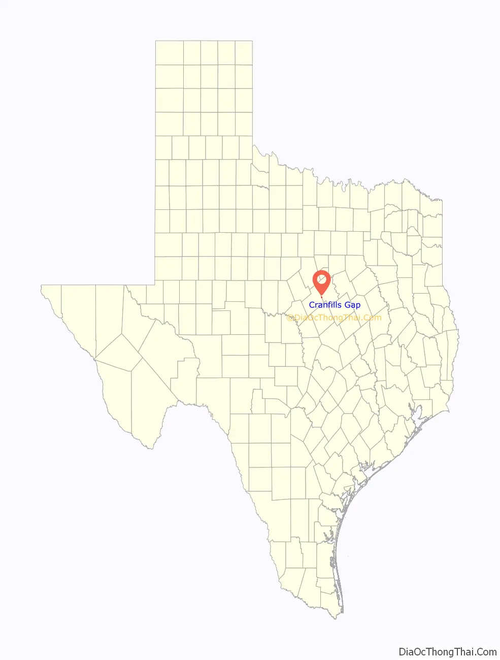
Cranfills Gap location map. Where is Cranfills Gap city?
History
The area in which Cranfills Gap is located was originally settled by and named for George Eaton Cranfill in 1851.
Norwegian settlers in and around the community, who were mostly Lutheran, built St. Olaf Kirke (kirke is Norwegian for “church”) in a rural area just outside Cranfills Gap. St. Olaf Kirke, commonly referred to as The Rock Church, is a small Lutheran church located in the unincorporated rural community of Norse, Texas. Among the pioneers in Norse was Cleng Peerson. The founder of Norse was Ole Canuteson (Ole Knudsen) from the Stavanger region of Norway. In 1917, as the congregation of that church began to grow, a new church was built for the congregation inside the city.
The city slowly grew to its peak population of 600 in 1940. During World War II, Cranfills Gap was the first city to sell more than its quota of war bonds for the Fourth War Loan Drive. While as many as 25 businesses operated within “the gap”, as locals commonly refer to it, the population and the business activity slowly dwindled to roughly nine businesses in 1980 and a population of 269 in 1990.
On December 3, 2008, KXXV-TV in nearby Waco reported on its website that Cranfills Gap had been selected for participation in an advertising campaign for the Las Vegas Convention and Visitors Authority. The selection process compared hundreds of rural communities from across the USA seeking “the most unique all-American town in all of the 50 states.” Cranfills Gap was first contacted by the LVCVA in October 2008 when the town was placed on the list of ten candidate communities. A film crew and LVCVA representative visited the town for a few days and interviewed residents about the town, their impressions of and experience with Las Vegas, and their opinions about the ongoing selection process. In November 2008, Cranfills Gap Chamber of Commerce members were notified that the LVCVA had shortened the list to two finalists including their town. Another LVCVA delegation was dispatched to Cranfills Gap for a closer look. The visitors stayed for about a week and conducted a fresh set of interviews and observed the community at work and play. Although the LVCVA had initially intended to send 150 residents from the winning locality to Sin City, the Cranfills Gap Chamber of Commerce and elected officials struck a feasible compromise with their visitors: if selected, Cranfills Gap would make every effort to provide one hundred adult men and women for the LVCVA’s project. During the first week of December 2008, Cranfills Gap and local media were notified by LVCVA that the town had won the nationwide search and 100 of its residents would be sent on a free trip to Las Vegas during the weekend of December 5–7, 2008. Cranfills Gap City Council member Ron Hubbard told the press that he sincerely hoped Cranfills Gap would reap benefits from the ad campaign beyond just plane tickets and memories. “With that national recognition, maybe people will come visit, see what we’re all about,” said Hubbard.
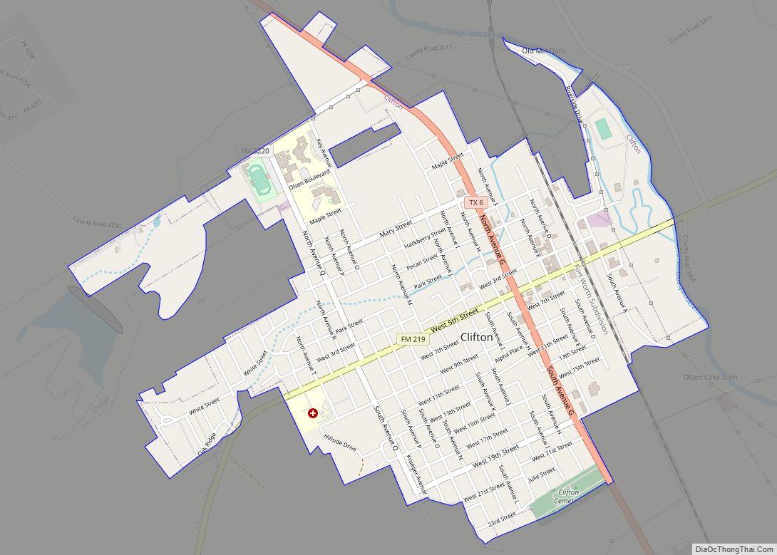
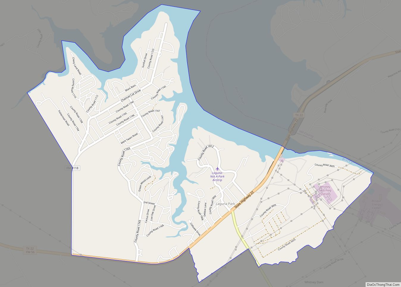
Cranfills Gap Road Map
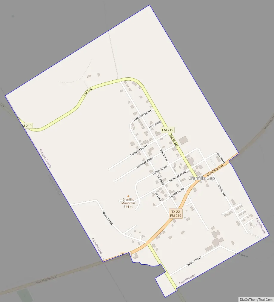
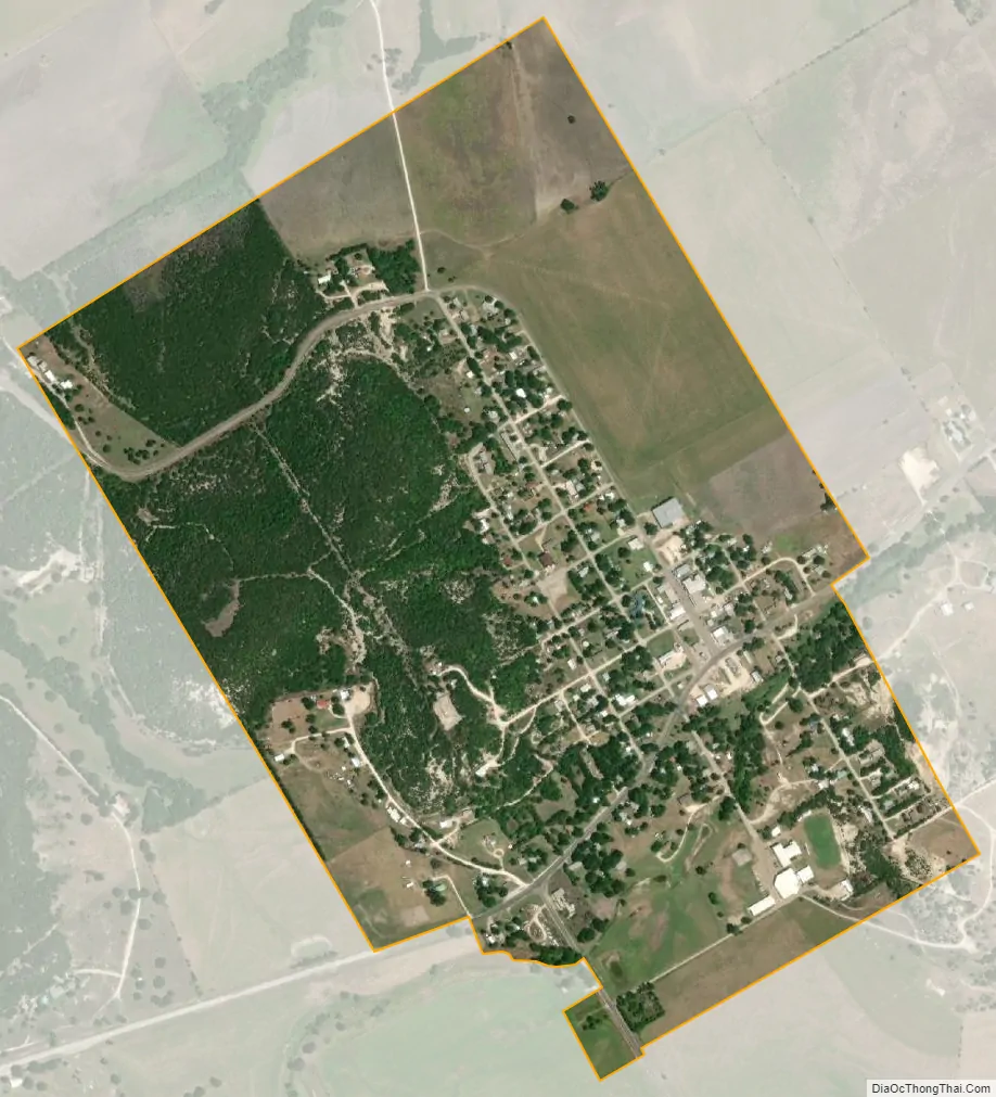
Cranfills Gap city Satellite Map
Geography
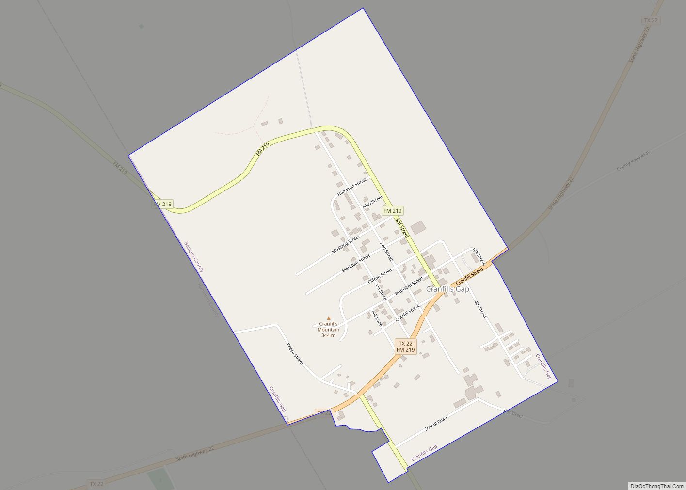
Cranfills Gap is located in western Bosque County at 31°46′25″N 97°49′42″W / 31.77361°N 97.82833°W / 31.77361; -97.82833 (31.773727, –97.828335). Its western border is the Hamilton County line. Texas State Highway 22 passes through the city, leading northeast 14 miles (23 km) to Meridian, the Bosque county seat, and west 18 miles (29 km) to Hamilton.
1,164-foot (355 m) Cranfills Mountain is in the western part of the city, rising 180 feet (55 m) above the city center.
According to the United States Census Bureau, the city has a total area of 0.7 square miles (1.8 km), all of it land.
See also
Map of Texas State and its subdivision:- Anderson
- Andrews
- Angelina
- Aransas
- Archer
- Armstrong
- Atascosa
- Austin
- Bailey
- Bandera
- Bastrop
- Baylor
- Bee
- Bell
- Bexar
- Blanco
- Borden
- Bosque
- Bowie
- Brazoria
- Brazos
- Brewster
- Briscoe
- Brooks
- Brown
- Burleson
- Burnet
- Caldwell
- Calhoun
- Callahan
- Cameron
- Camp
- Carson
- Cass
- Castro
- Chambers
- Cherokee
- Childress
- Clay
- Cochran
- Coke
- Coleman
- Collin
- Collingsworth
- Colorado
- Comal
- Comanche
- Concho
- Cooke
- Coryell
- Cottle
- Crane
- Crockett
- Crosby
- Culberson
- Dallam
- Dallas
- Dawson
- Deaf Smith
- Delta
- Denton
- Dewitt
- Dickens
- Dimmit
- Donley
- Duval
- Eastland
- Ector
- Edwards
- El Paso
- Ellis
- Erath
- Falls
- Fannin
- Fayette
- Fisher
- Floyd
- Foard
- Fort Bend
- Franklin
- Freestone
- Frio
- Gaines
- Galveston
- Garza
- Gillespie
- Glasscock
- Goliad
- Gonzales
- Gray
- Grayson
- Gregg
- Grimes
- Guadalupe
- Hale
- Hall
- Hamilton
- Hansford
- Hardeman
- Hardin
- Harris
- Harrison
- Hartley
- Haskell
- Hays
- Hemphill
- Henderson
- Hidalgo
- Hill
- Hockley
- Hood
- Hopkins
- Houston
- Howard
- Hudspeth
- Hunt
- Hutchinson
- Irion
- Jack
- Jackson
- Jasper
- Jeff Davis
- Jefferson
- Jim Hogg
- Jim Wells
- Johnson
- Jones
- Karnes
- Kaufman
- Kendall
- Kenedy
- Kent
- Kerr
- Kimble
- King
- Kinney
- Kleberg
- Knox
- La Salle
- Lamar
- Lamb
- Lampasas
- Lavaca
- Lee
- Leon
- Liberty
- Limestone
- Lipscomb
- Live Oak
- Llano
- Loving
- Lubbock
- Lynn
- Madison
- Marion
- Martin
- Mason
- Matagorda
- Maverick
- McCulloch
- McLennan
- McMullen
- Medina
- Menard
- Midland
- Milam
- Mills
- Mitchell
- Montague
- Montgomery
- Moore
- Morris
- Motley
- Nacogdoches
- Navarro
- Newton
- Nolan
- Nueces
- Ochiltree
- Oldham
- Orange
- Palo Pinto
- Panola
- Parker
- Parmer
- Pecos
- Polk
- Potter
- Presidio
- Rains
- Randall
- Reagan
- Real
- Red River
- Reeves
- Refugio
- Roberts
- Robertson
- Rockwall
- Runnels
- Rusk
- Sabine
- San Augustine
- San Jacinto
- San Patricio
- San Saba
- Schleicher
- Scurry
- Shackelford
- Shelby
- Sherman
- Smith
- Somervell
- Starr
- Stephens
- Sterling
- Stonewall
- Sutton
- Swisher
- Tarrant
- Taylor
- Terrell
- Terry
- Throckmorton
- Titus
- Tom Green
- Travis
- Trinity
- Tyler
- Upshur
- Upton
- Uvalde
- Val Verde
- Van Zandt
- Victoria
- Walker
- Waller
- Ward
- Washington
- Webb
- Wharton
- Wheeler
- Wichita
- Wilbarger
- Willacy
- Williamson
- Wilson
- Winkler
- Wise
- Wood
- Yoakum
- Young
- Zapata
- Zavala
- Alabama
- Alaska
- Arizona
- Arkansas
- California
- Colorado
- Connecticut
- Delaware
- District of Columbia
- Florida
- Georgia
- Hawaii
- Idaho
- Illinois
- Indiana
- Iowa
- Kansas
- Kentucky
- Louisiana
- Maine
- Maryland
- Massachusetts
- Michigan
- Minnesota
- Mississippi
- Missouri
- Montana
- Nebraska
- Nevada
- New Hampshire
- New Jersey
- New Mexico
- New York
- North Carolina
- North Dakota
- Ohio
- Oklahoma
- Oregon
- Pennsylvania
- Rhode Island
- South Carolina
- South Dakota
- Tennessee
- Texas
- Utah
- Vermont
- Virginia
- Washington
- West Virginia
- Wisconsin
- Wyoming