Dodson is a town in Collingsworth County, Texas, United States. The population was 109 at the 2010 census.
| Name: | Dodson town |
|---|---|
| LSAD Code: | 43 |
| LSAD Description: | town (suffix) |
| State: | Texas |
| County: | Collingsworth County |
| Elevation: | 1,791 ft (546 m) |
| Total Area: | 0.61 sq mi (1.58 km²) |
| Land Area: | 0.61 sq mi (1.58 km²) |
| Water Area: | 0.00 sq mi (0.00 km²) |
| Total Population: | 109 |
| Population Density: | 175.41/sq mi (67.74/km²) |
| ZIP code: | 79230 |
| Area code: | 806 |
| FIPS code: | 4820716 |
| GNISfeature ID: | 1356104 |
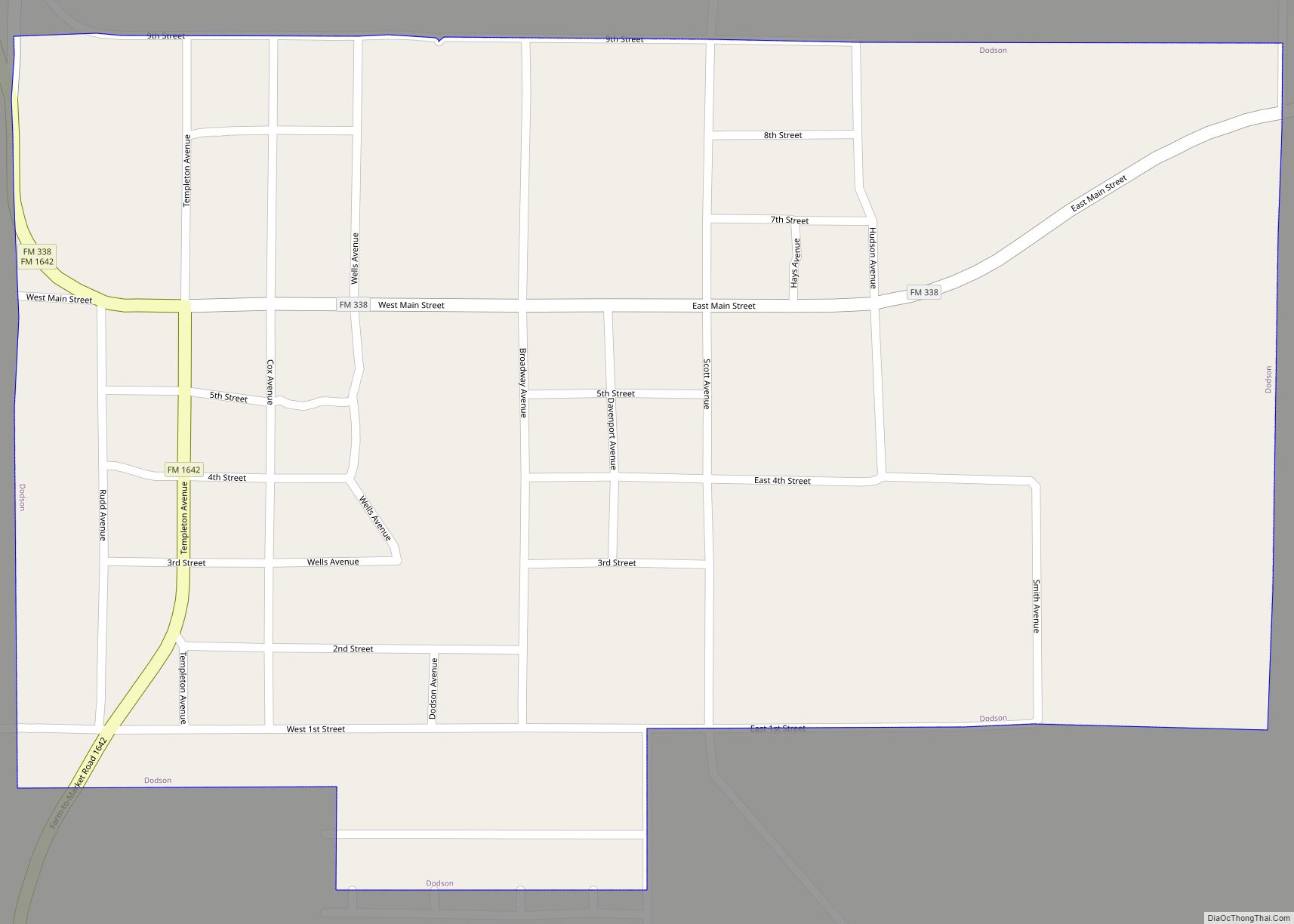
Online Interactive Map
Click on ![]() to view map in "full screen" mode.
to view map in "full screen" mode.
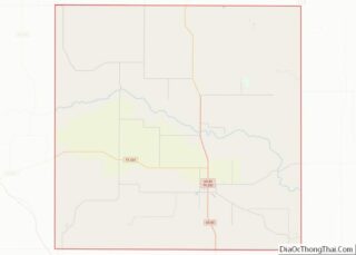
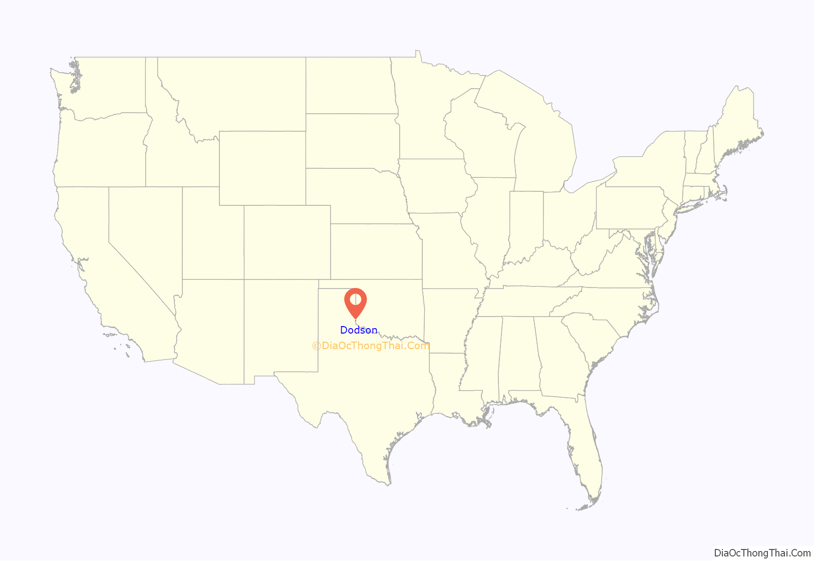
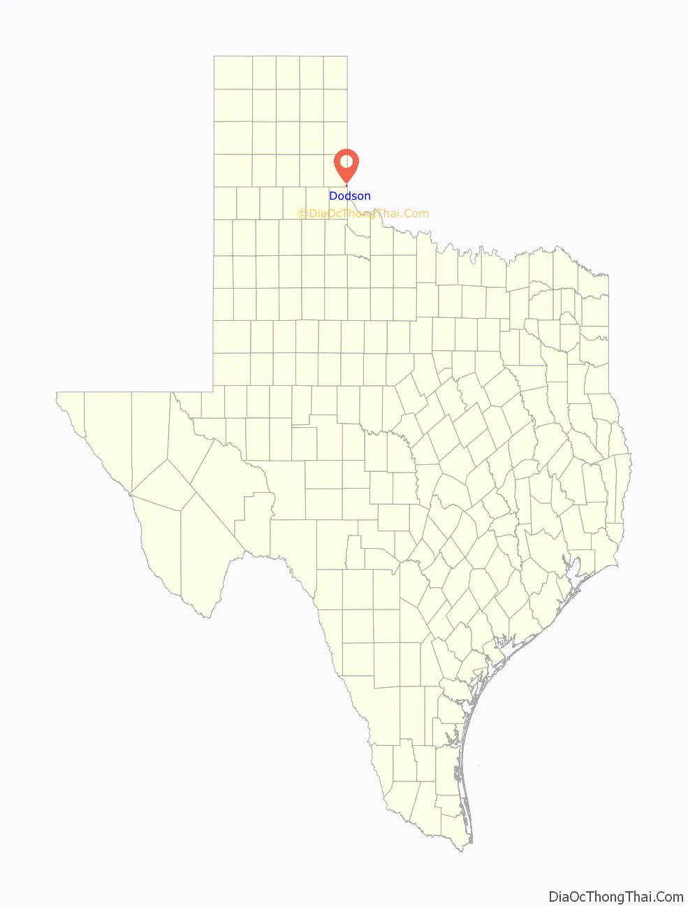
Dodson location map. Where is Dodson town?
History
The city of Dodsonville was founded on July 1, 1910, by Frank Kell of Wichita Falls. The wealthy entrepreneur Kell was an important figure in promotion of the Wichita Falls and Northwestern Railway, and the city was established as a stop on the Wellington Branch of the railroad. Elmore Dodson, a local pioneer and rancher, donated the 200-acre (0.81 km) town site to ensure the railroad’s passing through the southeastern part of the county. Other town sites had been proposed, including the community of Arlie located 5 miles (8 km) southwest of Dodson, but the grant given by Mr. Dodson sealed the railroad’s passage through southeastern Collingsworth County. In return, the new city was named for Dodson. A celebration was held on August 29, 1910, to commemorate the town’s establishment. The gala celebration, complete with a picnic, marked the town’s formal opening, and was attended by a trainload of people from Oklahoma.
N. L. Jones built the first residence and opened a cotton gin. The first store was operated by William T. McDowell, who was also the first postmaster. R. H. Miller established a hotel, and the town added a bank, a telephone exchange, and two churches. Three newspapers, all called the Dodsonville News, were published intermittently by three different men between January 1911 and December 1915. A fourth paper, the Dodsonville Messenger, was printed from 1928 until 1930. School was sometimes held in the churches until a permanent schoolhouse was completed in the fall of 1912; the previous school was located 3 miles (5 km) northwest of town.
Dodson was incorporated in the 1920s and by 1930 had 25 businesses and a population of 426. Public Works Administration appropriations enabled the town to install a $52,000 water system during the 1930s, and a volunteer fire department was organized. In 1947 a new consolidated high school served neighboring communities in Oklahoma as well as Dodson. The population dropped to 357 in 1940; this decline, attributed to decreased agricultural activity and a renewed interest in cattle raising, continued into the 1990s. In 1984 Dodson remained the county’s second largest town, with a population of 185, one business, and four churches. In 1990 the population was 113, and in 2000 it was 115.
The city’s name was officially changed from “Dodsonville” to “Dodson” on July 1, 1937.
Dodson’s first permanent school building was completed in 1912. This school was used until 1947 when a new school was constructed. Dodson High School continued to educated students until 1969 when the school board voted to consolidate the Dodson School District with that of Wellington. The elementary and junior high schools continued to operate until 1972. The Dodson School was destroyed in the late 1980s or early 1990s.
Dodson Road Map
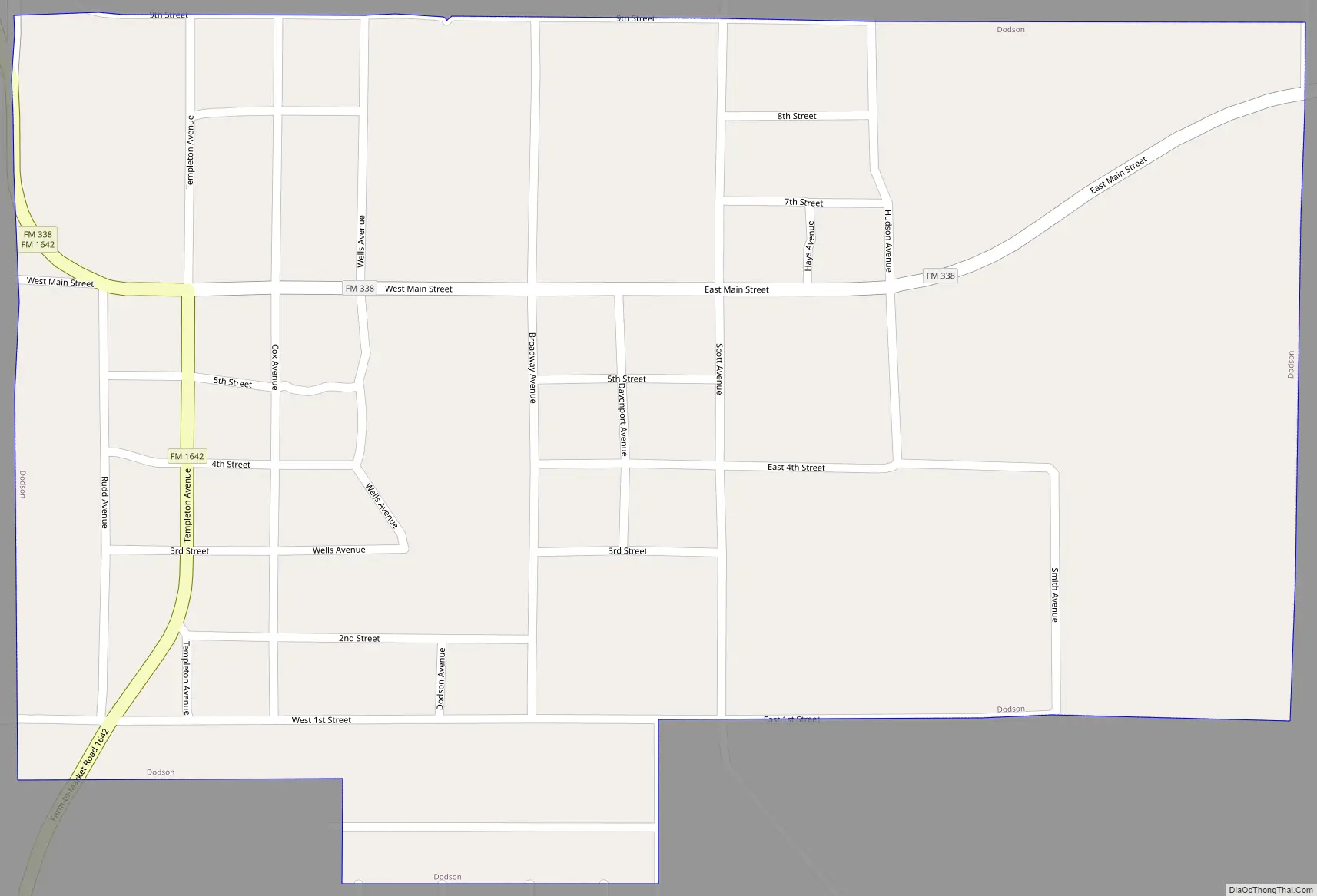
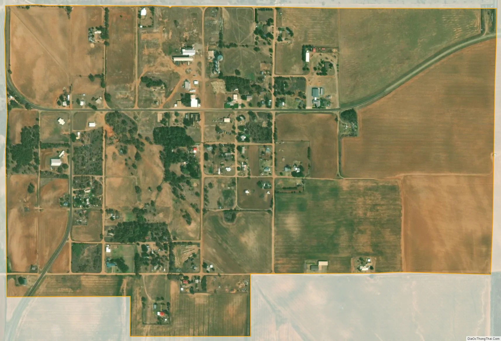
Dodson city Satellite Map
Geography
Dodson is located near the southeastern corner of Collingsworth County at 34°45′54″N 100°1′17″W / 34.76500°N 100.02139°W / 34.76500; -100.02139 (34.765054, –100.021259). Dodson is 1.25 miles (2.01 km) west of the 100th meridian west (the Texas-Oklahoma border), one mile (1.6 km) north of the Childress County line, 13 miles (21 km) southeast of Wellington, Texas, and 12 miles (19 km) northwest of Hollis, Oklahoma.
According to the U.S. Census Bureau, Dodson has a total area of 0.62 square miles (1.6 km), all of it land.
See also
Map of Texas State and its subdivision:- Anderson
- Andrews
- Angelina
- Aransas
- Archer
- Armstrong
- Atascosa
- Austin
- Bailey
- Bandera
- Bastrop
- Baylor
- Bee
- Bell
- Bexar
- Blanco
- Borden
- Bosque
- Bowie
- Brazoria
- Brazos
- Brewster
- Briscoe
- Brooks
- Brown
- Burleson
- Burnet
- Caldwell
- Calhoun
- Callahan
- Cameron
- Camp
- Carson
- Cass
- Castro
- Chambers
- Cherokee
- Childress
- Clay
- Cochran
- Coke
- Coleman
- Collin
- Collingsworth
- Colorado
- Comal
- Comanche
- Concho
- Cooke
- Coryell
- Cottle
- Crane
- Crockett
- Crosby
- Culberson
- Dallam
- Dallas
- Dawson
- Deaf Smith
- Delta
- Denton
- Dewitt
- Dickens
- Dimmit
- Donley
- Duval
- Eastland
- Ector
- Edwards
- El Paso
- Ellis
- Erath
- Falls
- Fannin
- Fayette
- Fisher
- Floyd
- Foard
- Fort Bend
- Franklin
- Freestone
- Frio
- Gaines
- Galveston
- Garza
- Gillespie
- Glasscock
- Goliad
- Gonzales
- Gray
- Grayson
- Gregg
- Grimes
- Guadalupe
- Hale
- Hall
- Hamilton
- Hansford
- Hardeman
- Hardin
- Harris
- Harrison
- Hartley
- Haskell
- Hays
- Hemphill
- Henderson
- Hidalgo
- Hill
- Hockley
- Hood
- Hopkins
- Houston
- Howard
- Hudspeth
- Hunt
- Hutchinson
- Irion
- Jack
- Jackson
- Jasper
- Jeff Davis
- Jefferson
- Jim Hogg
- Jim Wells
- Johnson
- Jones
- Karnes
- Kaufman
- Kendall
- Kenedy
- Kent
- Kerr
- Kimble
- King
- Kinney
- Kleberg
- Knox
- La Salle
- Lamar
- Lamb
- Lampasas
- Lavaca
- Lee
- Leon
- Liberty
- Limestone
- Lipscomb
- Live Oak
- Llano
- Loving
- Lubbock
- Lynn
- Madison
- Marion
- Martin
- Mason
- Matagorda
- Maverick
- McCulloch
- McLennan
- McMullen
- Medina
- Menard
- Midland
- Milam
- Mills
- Mitchell
- Montague
- Montgomery
- Moore
- Morris
- Motley
- Nacogdoches
- Navarro
- Newton
- Nolan
- Nueces
- Ochiltree
- Oldham
- Orange
- Palo Pinto
- Panola
- Parker
- Parmer
- Pecos
- Polk
- Potter
- Presidio
- Rains
- Randall
- Reagan
- Real
- Red River
- Reeves
- Refugio
- Roberts
- Robertson
- Rockwall
- Runnels
- Rusk
- Sabine
- San Augustine
- San Jacinto
- San Patricio
- San Saba
- Schleicher
- Scurry
- Shackelford
- Shelby
- Sherman
- Smith
- Somervell
- Starr
- Stephens
- Sterling
- Stonewall
- Sutton
- Swisher
- Tarrant
- Taylor
- Terrell
- Terry
- Throckmorton
- Titus
- Tom Green
- Travis
- Trinity
- Tyler
- Upshur
- Upton
- Uvalde
- Val Verde
- Van Zandt
- Victoria
- Walker
- Waller
- Ward
- Washington
- Webb
- Wharton
- Wheeler
- Wichita
- Wilbarger
- Willacy
- Williamson
- Wilson
- Winkler
- Wise
- Wood
- Yoakum
- Young
- Zapata
- Zavala
- Alabama
- Alaska
- Arizona
- Arkansas
- California
- Colorado
- Connecticut
- Delaware
- District of Columbia
- Florida
- Georgia
- Hawaii
- Idaho
- Illinois
- Indiana
- Iowa
- Kansas
- Kentucky
- Louisiana
- Maine
- Maryland
- Massachusetts
- Michigan
- Minnesota
- Mississippi
- Missouri
- Montana
- Nebraska
- Nevada
- New Hampshire
- New Jersey
- New Mexico
- New York
- North Carolina
- North Dakota
- Ohio
- Oklahoma
- Oregon
- Pennsylvania
- Rhode Island
- South Carolina
- South Dakota
- Tennessee
- Texas
- Utah
- Vermont
- Virginia
- Washington
- West Virginia
- Wisconsin
- Wyoming