Estelline is a town located in Hall County, Texas, United States. The population in 2010 was 145. The population was estimated at 141 in 2013. In 2012, Estelline was ranked #1 in a National Motorists Association listing of its “Worst Speed Trap Cities” in North America (with a population of less than 50,000). Estelline often refers to itself as the “Town of Estelline”, with a “Town Hall” and a “Town Council”, rather than the customary “city” label. However, under Texas law, all incorporated municipalities are considered to be cities.
| Name: | Estelline town |
|---|---|
| LSAD Code: | 43 |
| LSAD Description: | town (suffix) |
| State: | Texas |
| County: | Hall County |
| Incorporated: | 1912 |
| Elevation: | 1,834 ft (559 m) |
| Total Area: | 0.73 sq mi (1.90 km²) |
| Land Area: | 0.73 sq mi (1.90 km²) |
| Water Area: | 0.00 sq mi (0.00 km²) |
| Total Population: | 145 |
| Population Density: | 175.99/sq mi (67.94/km²) |
| ZIP code: | 79233 |
| Area code: | 806 |
| FIPS code: | 4824636 |
Online Interactive Map
Click on ![]() to view map in "full screen" mode.
to view map in "full screen" mode.
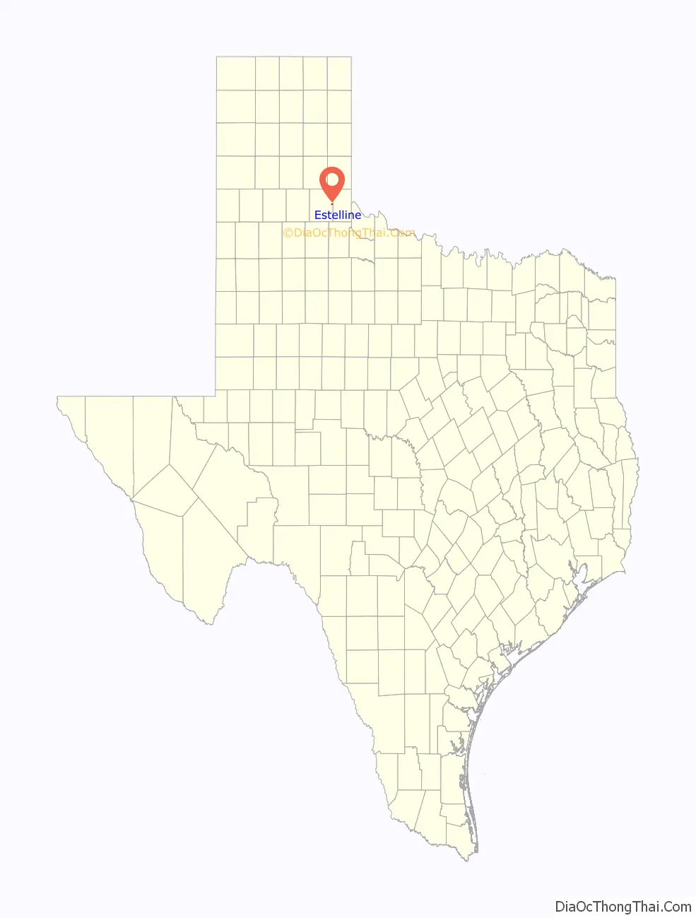
Estelline location map. Where is Estelline town?
History
Estelline was established in 1892 by the brothers Elam and Math Wright. It was on the Fort Worth and Denver City Railway and was named for Estelle de Shields, daughter of an early settler. The area was originally part of the Diamond Tail Ranch. The Mill Iron range lay nearby, and after 1896 the Continental Land and Cattle Company moved its headquarters to a nearby bluff overlooking the Red River. A post office was opened in May 1892, and by 1894 Estelline had two hotels, a Methodist church, a cotton gin, a livery stable, and a one-room schoolhouse. Tom Macy opened the first store, and soon afterward T. R. Garrott established the Estelline Supply Company. In 1894 Math Wright obtained a depot and sidetrack for his town, and throughout the remainder of the decade Estelline was an important shipping point on the Fort Worth and Denver City line. Cattle from nearby Silverton and Paducah were driven there for shipment. In 1896 the Mill Iron Ranch bought the Estelline Supply Company and opened a large general merchandise store and lumberyard with R. L. Biggerstaff as manager. Two years later Biggerstaff established a private bank, which became the Estelline State Bank in 1905. The town had two newspapers, the Estelline Star (1894–1896) and the Estelline News (1907–1910). A two-story school was built in 1909. In 1912 the citizens of Estelline elected to incorporate with a mayor, a city marshal, and five aldermen. By then the town had attained a population of over 1,000.
The 1920s saw the erection of permanent brick school facilities, the emergence of a champion basketball team, and the organization of a town band conducted by Paul James. In 1927 the railroad began construction of a branch line out of Estelline to Plainview in Hale County. However, the Great Depression led to the closing of the bank and a decline in the population to 603 by 1940. That year two fires destroyed several businesses. Subsequent improvements in highway transportation led to an overall decline in Estelline’s importance as a railroad junction town. The number of businesses dropped from fifteen in 1947 to four by 1980, when the population was 258. The town was still incorporated, and the post office remained open.
In 1983, Estelline citizens voted to allow the sale of alcohol beverages. Estelline is the only seller of alcohol beverages within ‘dry’ Hall County. Estelline has a reputation for being a prominent Texas speed trap and relies on speeders to pay its bills. The Estelline Independent School District was declared dormant in 1987 and students were sent to Memphis schools. Estelline was home to 194 residents in 1990, 168 in 2000 and 145 in 2010. In 2012, the Town Hall was mysteriously gutted by fire. Texas Rangers and the State Fire Marshal have both described the incident as arson. A highly publicized 2013 civil rights case revealed that 89 percent of Estellines 2012 gross revenue came from asset forfeiture and traffic fine revenue.
2013 Civil Rights Case
In September 2013, a federal suit was filed by Laura Dutton, alleging that the cities of Estelline and Memphis, former Officer Jayson Fry and Memphis Police Chief Chris Jolly violated her Fourth Amendment rights against illegal search and seizure when she was arrested Nov. 28, 2012, in Estelline on a felony money laundering charge, seizing more than $29,000 from her pickup and keeping $1,400 of her cash. The city maintained no written records of past searches or seizures, yet traffic fines and forfeitures made up more than 89 percent of its gross revenues in fiscal year 2012. The cities and the officers denied her claims, but in July 2014, the city of Estelline and City of Memphis authorities settled with Dutton for $77,500.
2015 Police Chief Arrest
Estelline Chief of Police Duwayne Marcolesco surrendered his peace officer license after being charged with official oppression, stemming from an incident on February 9, 2015. Duwayne Marcolesco was arrested after stopping a car while off duty in his personal car in Childress County. The two women in the car that was stopped made an official complaint, and through an investigation the Childress County Sheriff says they discovered Marcolesco was threatening and terrorizing the women. Marcolesco surrendered his peace officer licenses meaning he can no longer work as a peace officer in Texas, and no longer is the Chief of Police in Estelline.
2017 Police Chief Arrest
On the night of June 1, 2017, Estelline Police Chief Leigh Weiser was arrested for alleged sexual activity with a person in custody, according to the Texas Department of Public Safety. The case was handled by the Texas Rangers. Weiser was arraigned on a charge of violation of civil rights of person in custody, by improper sexual activity, as defined by the Article 39.04 Texas Penal Code. Weiser was indicted by Childress County in November 2017 and his peace officer status was revoked in June, 2018.
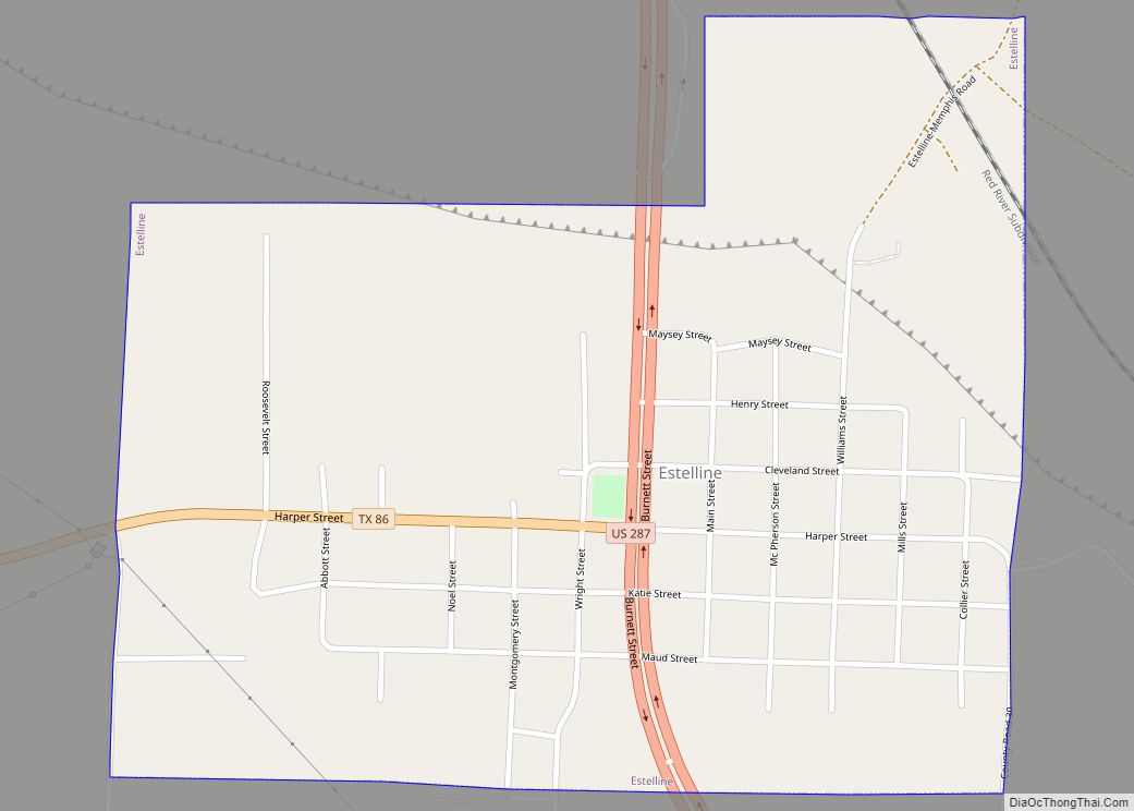
Estelline Road Map
Estelline city Satellite Map
Geography
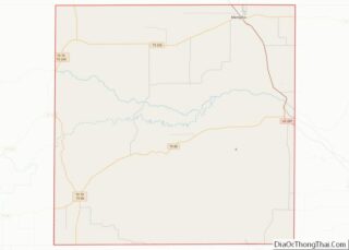
Estelline is located at the junction of U.S. Highway 287 and State Highway 86 in east central Hall County, approximately 14 miles southeast of Memphis and 15 miles northwest of Childress. The nearest major city is Amarillo, located 102 miles northwest of Estelline. According to the United States Census Bureau, the town has a total area of 0.7 square miles (1.8 km), all land.
See also
Map of Texas State and its subdivision:- Anderson
- Andrews
- Angelina
- Aransas
- Archer
- Armstrong
- Atascosa
- Austin
- Bailey
- Bandera
- Bastrop
- Baylor
- Bee
- Bell
- Bexar
- Blanco
- Borden
- Bosque
- Bowie
- Brazoria
- Brazos
- Brewster
- Briscoe
- Brooks
- Brown
- Burleson
- Burnet
- Caldwell
- Calhoun
- Callahan
- Cameron
- Camp
- Carson
- Cass
- Castro
- Chambers
- Cherokee
- Childress
- Clay
- Cochran
- Coke
- Coleman
- Collin
- Collingsworth
- Colorado
- Comal
- Comanche
- Concho
- Cooke
- Coryell
- Cottle
- Crane
- Crockett
- Crosby
- Culberson
- Dallam
- Dallas
- Dawson
- Deaf Smith
- Delta
- Denton
- Dewitt
- Dickens
- Dimmit
- Donley
- Duval
- Eastland
- Ector
- Edwards
- El Paso
- Ellis
- Erath
- Falls
- Fannin
- Fayette
- Fisher
- Floyd
- Foard
- Fort Bend
- Franklin
- Freestone
- Frio
- Gaines
- Galveston
- Garza
- Gillespie
- Glasscock
- Goliad
- Gonzales
- Gray
- Grayson
- Gregg
- Grimes
- Guadalupe
- Hale
- Hall
- Hamilton
- Hansford
- Hardeman
- Hardin
- Harris
- Harrison
- Hartley
- Haskell
- Hays
- Hemphill
- Henderson
- Hidalgo
- Hill
- Hockley
- Hood
- Hopkins
- Houston
- Howard
- Hudspeth
- Hunt
- Hutchinson
- Irion
- Jack
- Jackson
- Jasper
- Jeff Davis
- Jefferson
- Jim Hogg
- Jim Wells
- Johnson
- Jones
- Karnes
- Kaufman
- Kendall
- Kenedy
- Kent
- Kerr
- Kimble
- King
- Kinney
- Kleberg
- Knox
- La Salle
- Lamar
- Lamb
- Lampasas
- Lavaca
- Lee
- Leon
- Liberty
- Limestone
- Lipscomb
- Live Oak
- Llano
- Loving
- Lubbock
- Lynn
- Madison
- Marion
- Martin
- Mason
- Matagorda
- Maverick
- McCulloch
- McLennan
- McMullen
- Medina
- Menard
- Midland
- Milam
- Mills
- Mitchell
- Montague
- Montgomery
- Moore
- Morris
- Motley
- Nacogdoches
- Navarro
- Newton
- Nolan
- Nueces
- Ochiltree
- Oldham
- Orange
- Palo Pinto
- Panola
- Parker
- Parmer
- Pecos
- Polk
- Potter
- Presidio
- Rains
- Randall
- Reagan
- Real
- Red River
- Reeves
- Refugio
- Roberts
- Robertson
- Rockwall
- Runnels
- Rusk
- Sabine
- San Augustine
- San Jacinto
- San Patricio
- San Saba
- Schleicher
- Scurry
- Shackelford
- Shelby
- Sherman
- Smith
- Somervell
- Starr
- Stephens
- Sterling
- Stonewall
- Sutton
- Swisher
- Tarrant
- Taylor
- Terrell
- Terry
- Throckmorton
- Titus
- Tom Green
- Travis
- Trinity
- Tyler
- Upshur
- Upton
- Uvalde
- Val Verde
- Van Zandt
- Victoria
- Walker
- Waller
- Ward
- Washington
- Webb
- Wharton
- Wheeler
- Wichita
- Wilbarger
- Willacy
- Williamson
- Wilson
- Winkler
- Wise
- Wood
- Yoakum
- Young
- Zapata
- Zavala
- Alabama
- Alaska
- Arizona
- Arkansas
- California
- Colorado
- Connecticut
- Delaware
- District of Columbia
- Florida
- Georgia
- Hawaii
- Idaho
- Illinois
- Indiana
- Iowa
- Kansas
- Kentucky
- Louisiana
- Maine
- Maryland
- Massachusetts
- Michigan
- Minnesota
- Mississippi
- Missouri
- Montana
- Nebraska
- Nevada
- New Hampshire
- New Jersey
- New Mexico
- New York
- North Carolina
- North Dakota
- Ohio
- Oklahoma
- Oregon
- Pennsylvania
- Rhode Island
- South Carolina
- South Dakota
- Tennessee
- Texas
- Utah
- Vermont
- Virginia
- Washington
- West Virginia
- Wisconsin
- Wyoming


