Gail is an unincorporated community in Borden County, Texas, United States. Located at the junction of U.S. Highway 180 and Farm to Market Road 669, it is the county seat of Borden County. As of the 2010 Census, the population was 231.
The town and county are named for Gail Borden, Jr., the inventor of condensed milk.
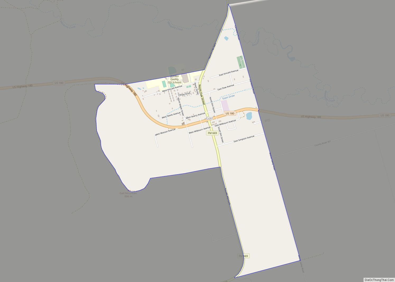
Gail Mountain is located on the southwest edge of town. The 20th annual Christmas lighting of the star atop Gail Mountain was held on November 29, 2013.
Mushaway Peak, a small but conspicuous butte, is located 4 miles (6 km) southeast.
| Name: | Gail CDP |
|---|---|
| LSAD Code: | 57 |
| LSAD Description: | CDP (suffix) |
| State: | Texas |
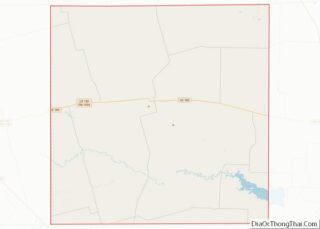
| County: | Borden County |
| Elevation: | 2,556 ft (779 m) |
| Total Area: | 2.02 sq mi (5.23 km²) |
| Land Area: | 2.01 sq mi (5.21 km²) |
| Water Area: | 0.008 sq mi (0.02 km²) |
| Total Population: | 231 |
| Population Density: | 115/sq mi (44.3/km²) |
| ZIP code: | 79738 |
| Area code: | 806 |
| FIPS code: | 4827972 |
Online Interactive Map
Click on ![]() to view map in "full screen" mode.
to view map in "full screen" mode.
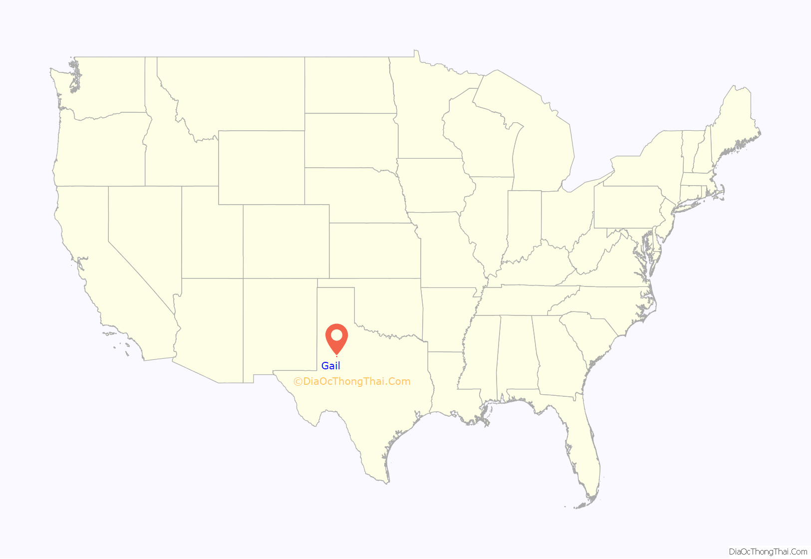
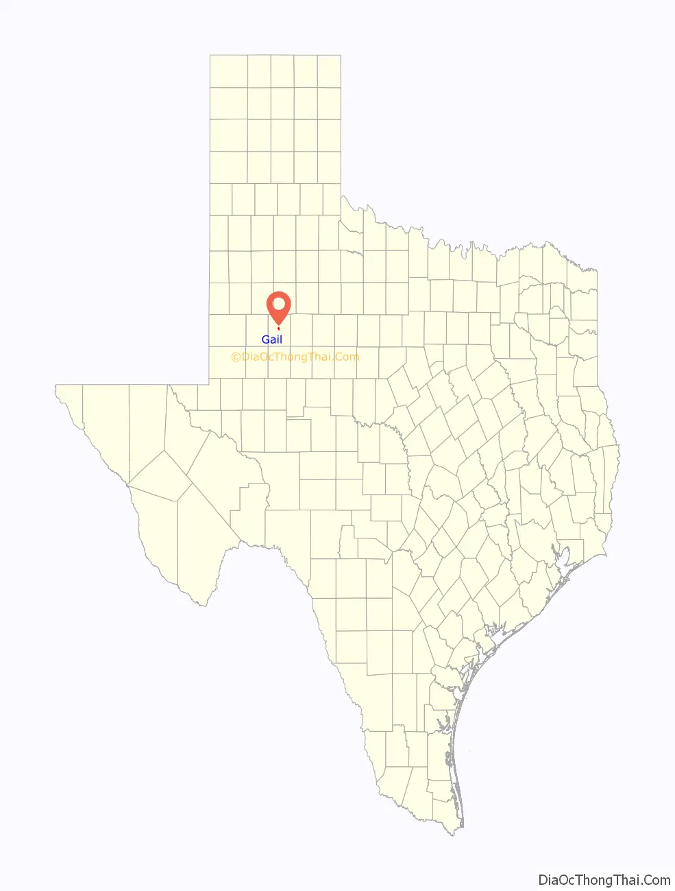
Gail location map. Where is Gail CDP?
History
Founded in 1891 to coincide with the organization of Borden County, Gail has served as county seat for the duration of its existence. Borden County had remained quite sparsely populated until 1903, when the locally famed “War of Ribbons”, inspired by a state-sanctioned land grab, took place. The conflict took its name from the practice of established ranchers displaying their affiliation and identity by way of a blue ribbon on their sleeves, whereas new settlers to the area designated theirs with a similarly placed red ribbon. By 1910, Gail was home to more than 700 residents, and though this would fall to 600 by 1912, the community remained the economic and administrative hub of Borden County. Changes in agricultural practices and patterns, coupled with the impact of the Great Depression, hindered the town and county’s prosperity. By 1936, Gail’s population had dwindled to 250 residents, and by 1980, it had fallen to around 190. The census of 2010 counted 231 residents in Gail.
The Borden County Jail opened in 1896. Built at a cost of $4,500 by the Diebold Safe and Lock Company, it had 2-foot-thick (0.61 m) outside walls made of stone from Gail Mountain, and 0.3-foot (0.091 m) hardened steel plates in the cell walls and floor. In 1956, two prisoners objected to Sheriff Sid Reeder’s attempt to place them into one of the jail’s cells when they noticed a rattlesnake sleeping inside. A historic marker was placed outside the jail in 1967.
John R. “Rich” Anderson, owner of the 64,000-acre (26,000 ha) Muleshoe Ranch near Gail, won the 1992 National Cattleman’s Association Environmental Stewardship Award. His achievement was also recognized by the Texas House of Representatives.
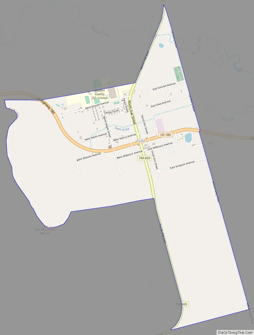
Gail Road Map
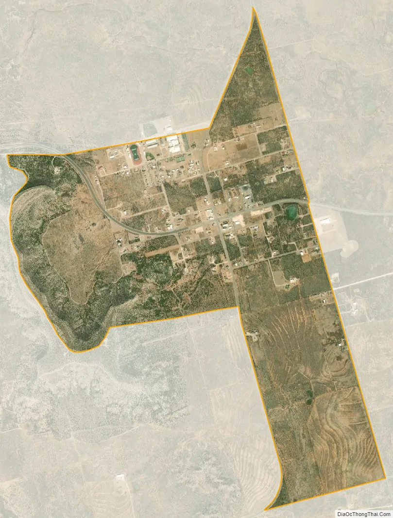
Gail city Satellite Map
Geography
Gail is located near the center of Borden County. U.S. Route 180 runs through the town, leading east 31 miles (50 km) to Snyder and west 31 miles to Lamesa. Big Spring along FM 669 is 40 miles (64 km) to the south, and Lubbock is 72 miles (116 km) to the north.
According to the U.S. Census Bureau, Gail has an area of 2.0 square miles (5.2 km), of which 0.008 square miles (0.02 km), or 0.38%, is covered by water.
Climate
Climate type occurs primarily on the periphery of the true deserts in low-latitude semiarid steppe regions. The Köppen climate classification subtype for this climate is BSk (tropical and subtropical steppe climate).
See also
Map of Texas State and its subdivision:- Anderson
- Andrews
- Angelina
- Aransas
- Archer
- Armstrong
- Atascosa
- Austin
- Bailey
- Bandera
- Bastrop
- Baylor
- Bee
- Bell
- Bexar
- Blanco
- Borden
- Bosque
- Bowie
- Brazoria
- Brazos
- Brewster
- Briscoe
- Brooks
- Brown
- Burleson
- Burnet
- Caldwell
- Calhoun
- Callahan
- Cameron
- Camp
- Carson
- Cass
- Castro
- Chambers
- Cherokee
- Childress
- Clay
- Cochran
- Coke
- Coleman
- Collin
- Collingsworth
- Colorado
- Comal
- Comanche
- Concho
- Cooke
- Coryell
- Cottle
- Crane
- Crockett
- Crosby
- Culberson
- Dallam
- Dallas
- Dawson
- Deaf Smith
- Delta
- Denton
- Dewitt
- Dickens
- Dimmit
- Donley
- Duval
- Eastland
- Ector
- Edwards
- El Paso
- Ellis
- Erath
- Falls
- Fannin
- Fayette
- Fisher
- Floyd
- Foard
- Fort Bend
- Franklin
- Freestone
- Frio
- Gaines
- Galveston
- Garza
- Gillespie
- Glasscock
- Goliad
- Gonzales
- Gray
- Grayson
- Gregg
- Grimes
- Guadalupe
- Hale
- Hall
- Hamilton
- Hansford
- Hardeman
- Hardin
- Harris
- Harrison
- Hartley
- Haskell
- Hays
- Hemphill
- Henderson
- Hidalgo
- Hill
- Hockley
- Hood
- Hopkins
- Houston
- Howard
- Hudspeth
- Hunt
- Hutchinson
- Irion
- Jack
- Jackson
- Jasper
- Jeff Davis
- Jefferson
- Jim Hogg
- Jim Wells
- Johnson
- Jones
- Karnes
- Kaufman
- Kendall
- Kenedy
- Kent
- Kerr
- Kimble
- King
- Kinney
- Kleberg
- Knox
- La Salle
- Lamar
- Lamb
- Lampasas
- Lavaca
- Lee
- Leon
- Liberty
- Limestone
- Lipscomb
- Live Oak
- Llano
- Loving
- Lubbock
- Lynn
- Madison
- Marion
- Martin
- Mason
- Matagorda
- Maverick
- McCulloch
- McLennan
- McMullen
- Medina
- Menard
- Midland
- Milam
- Mills
- Mitchell
- Montague
- Montgomery
- Moore
- Morris
- Motley
- Nacogdoches
- Navarro
- Newton
- Nolan
- Nueces
- Ochiltree
- Oldham
- Orange
- Palo Pinto
- Panola
- Parker
- Parmer
- Pecos
- Polk
- Potter
- Presidio
- Rains
- Randall
- Reagan
- Real
- Red River
- Reeves
- Refugio
- Roberts
- Robertson
- Rockwall
- Runnels
- Rusk
- Sabine
- San Augustine
- San Jacinto
- San Patricio
- San Saba
- Schleicher
- Scurry
- Shackelford
- Shelby
- Sherman
- Smith
- Somervell
- Starr
- Stephens
- Sterling
- Stonewall
- Sutton
- Swisher
- Tarrant
- Taylor
- Terrell
- Terry
- Throckmorton
- Titus
- Tom Green
- Travis
- Trinity
- Tyler
- Upshur
- Upton
- Uvalde
- Val Verde
- Van Zandt
- Victoria
- Walker
- Waller
- Ward
- Washington
- Webb
- Wharton
- Wheeler
- Wichita
- Wilbarger
- Willacy
- Williamson
- Wilson
- Winkler
- Wise
- Wood
- Yoakum
- Young
- Zapata
- Zavala
- Alabama
- Alaska
- Arizona
- Arkansas
- California
- Colorado
- Connecticut
- Delaware
- District of Columbia
- Florida
- Georgia
- Hawaii
- Idaho
- Illinois
- Indiana
- Iowa
- Kansas
- Kentucky
- Louisiana
- Maine
- Maryland
- Massachusetts
- Michigan
- Minnesota
- Mississippi
- Missouri
- Montana
- Nebraska
- Nevada
- New Hampshire
- New Jersey
- New Mexico
- New York
- North Carolina
- North Dakota
- Ohio
- Oklahoma
- Oregon
- Pennsylvania
- Rhode Island
- South Carolina
- South Dakota
- Tennessee
- Texas
- Utah
- Vermont
- Virginia
- Washington
- West Virginia
- Wisconsin
- Wyoming