Georgetown is a city in Texas and the county seat of Williamson County, Texas, United States. The population was 67,176 at the 2020 census. It is 30 miles (48 km) north of Austin.
Founded in 1875 from four existing colleges, the oldest of which had been founded 35 years earlier, Southwestern University is the oldest university in Texas. It is in Georgetown about one-half mile from the historic square.
Georgetown has a notable range of Victorian commercial and residential architecture. In 1976, a local historic ordinance was passed to recognize and protect the significance of the historic central business district. In 1977, the Williamson County Courthouse Historical District, containing some 46 contributing structures, was listed on the National Register of Historic Places. Georgetown is also known as the “Red Poppy” Capital of Texas for the red poppy (Papaver rhoeas) wildflowers planted throughout the city. Georgetown’s Red Poppy Festival, which attracts tens of thousands of visitors annually, is held in April each year on the historic square.
| Name: | Georgetown city |
|---|---|
| LSAD Code: | 25 |
| LSAD Description: | city (suffix) |
| State: | Texas |
| County: | Williamson County |
| Incorporated: | 1848 |
| Elevation: | 755 ft (230 m) |
| Total Area: | 59.63 sq mi (154.44 km²) |
| Land Area: | 57.33 sq mi (148.49 km²) |
| Water Area: | 2.30 sq mi (5.95 km²) |
| Total Population: | 67,176 |
| Population Density: | 1,388.47/sq mi (536.09/km²) |
| ZIP code: | 78626, 78627, 78628, 78633 |
| Area code: | 512 and 737 |
| FIPS code: | 4829336 |
| GNISfeature ID: | 1357960 |
| Website: | georgetown.org |
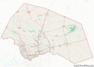
Online Interactive Map
Click on ![]() to view map in "full screen" mode.
to view map in "full screen" mode.
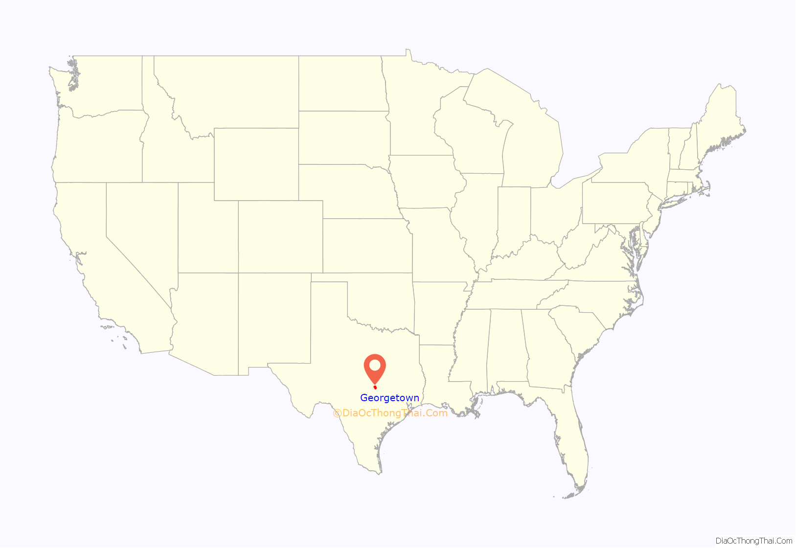
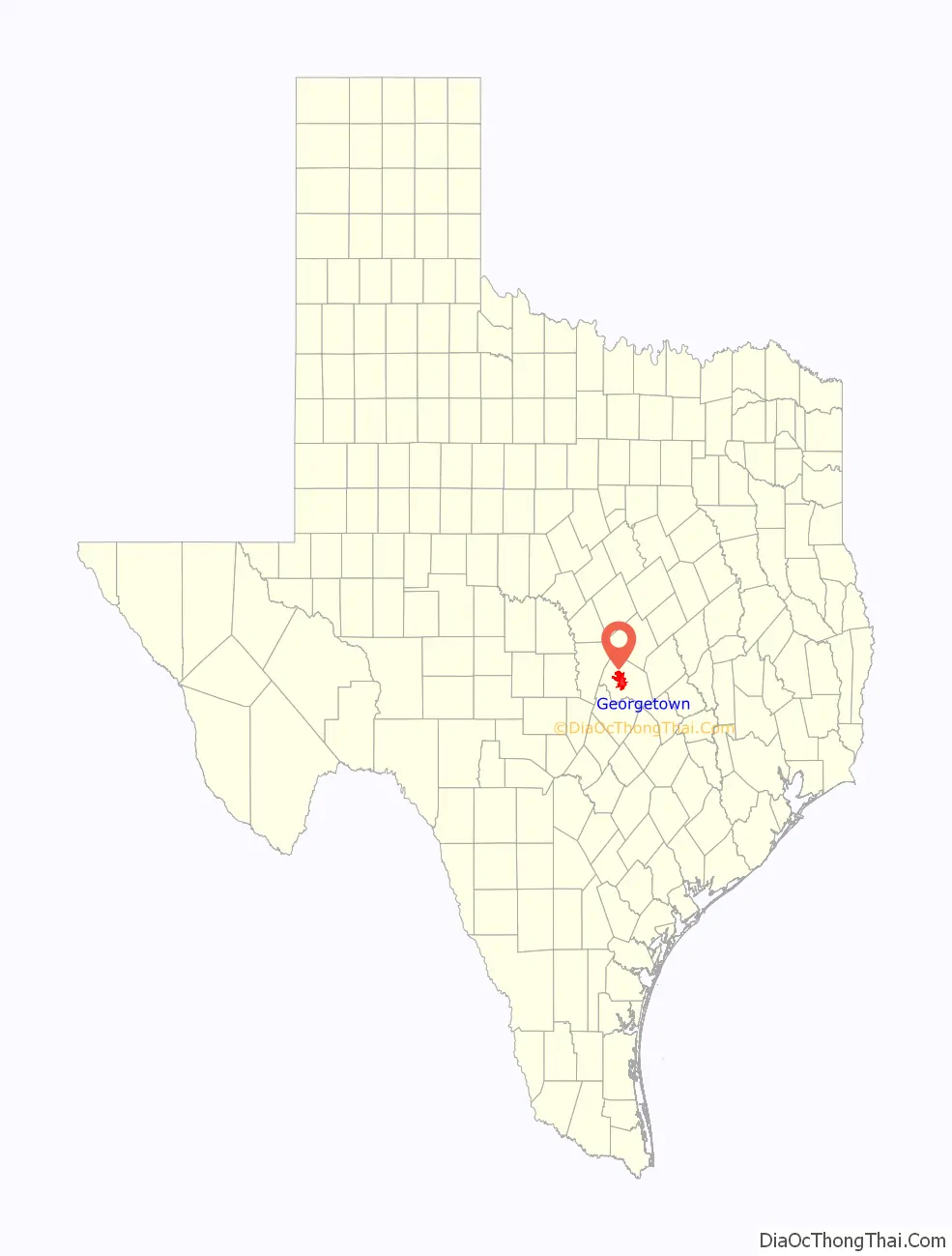
Georgetown location map. Where is Georgetown city?
History
Prehistoric era
Georgetown has been the site of human habitation since at least 9,000 B.C., and possibly considerably before that. The earliest-known inhabitants of the county, during the late Pleistocene (Ice Age), can be linked to the Clovis culture, a Paleo-Indian culture characterized by the manufacture of distinctive “Clovis points” for weapons. It first appeared around 9200 B.C., and possibly as early as 11,500 B.C., at the end of the last glacial period.
One of the most important discoveries in recent times is that of the ancient skeletal remains dubbed the “Leanderthal Lady”, because of its age and proximity to a nearby community Leander, Texas. The site is immediately southwest of Georgetown and was discovered by accident by Texas Department of Transportation workers while core samples for a new highway were being drilled. The site has been extensively studied for many years, and samples carbon date the findings to the Pleistocene period, about 10,500 years ago (8500 B.C.). Archeological dig sites showing much greater evidence of Archaic period inhabitants have been found in burned rock middens at several sites along the San Gabriel River, which have since been inundated by the manmade Granger Lake, and at the confluence of the North and South San Gabriel rivers in Georgetown.
Early history
The earliest known historical occupants of the county, the Tonkawa, were a flint-working, hunting people who followed buffalo on foot and periodically set fire to the prairie to aid them in their hunts. During the 18th century, they made the transition to a horse culture and used firearms to a limited extent. Also, small numbers of Kiowa, Yojuane, Tawakoni, and Mayeye Indians apparently were living in the county at the time of the earliest Anglo settlements. As these native populations thinned under pressure from non-indigenous settlements, the Comanche continued to raid native peoples’ settlements in the county until the 1860s.
Modern history
Georgetown was named for George Washington Glasscock, who donated the land for the new town. Early American and Swedish pioneers were attracted to the area’s abundance of timber and good, clear water. In addition, the land was inexpensive and fertile. Georgetown is the county seat of Williamson County, which was formed on March 13, 1848, after the early settlers petitioned the state legislature to create it from a portion of Milam County. The county was originally to have been named San Gabriel County, but was instead named after Robert McAlpin Williamson (known as “Three-legged Willie”), a Texas statesman and judge at the time.
Georgetown was an agrarian community for most of the 19th and early 20th centuries. The Shawnee Trail, a cattle trail that led from Texas to the rail centers in Kansas and Missouri, crossed through Georgetown. The establishment of Southwestern University in 1873 and construction of a railroad in 1878 contributed to the town’s growth and importance. A stable economy developed, based largely on agricultural activity. Cotton was the dominant crop in the area between the 1880s and the 1920s. In this period, Williamson County was once the top producer of cotton in Texas.
At one time, Georgetown was served by two national railroads, the International-Great Northern Railroad, which eventually was merged into the Missouri Pacific, and the Missouri–Kansas–Texas Railroad. Both supported the transport of commodities to market: beef cattle and cotton. The regional Georgetown and Granger Railroad (GGR) was completed to Austin in 1904. Georgetown is served today by the Georgetown Railroad, a ‘short line’ railroad that uses portions of the former M-K-T and the I-GN to connect with the Union Pacific Railroad at Round Rock and at Granger.
Georgetown was home to minor league baseball. The 1914 Georgetown Collegians began play as charter members of the Class D level Middle Texas League.
In 1921 a low-pressure system from a hurricane settled in over Williamson County and brought more than 23 inches of rain in Taylor and more than 18 inches of rain in Georgetown. The flooding resulted in the deaths of 156 persons, many of them farm laborers. There was also extensive property damage, and Georgetown residents sought to begin flood control.
The U.S. Army Corps of Engineers completed construction of a dam more than 50 years later, on the north fork of the San Gabriel River, to create and impound Lake Georgetown, which opened officially on October 5, 1979. Both Georgetown and Round Rock own water rights to Lake Georgetown for municipal water use.
Population growth and industrial expansion continued modestly in the 20th century until about 1960, when residential, commercial, and industrial development, due to major growth and urban expansion of nearby Austin, greatly accelerated. In 2008, Fortune Small Business magazine ranked Georgetown as the second-best city in the nation to “live and launch” a new business.
In March 2015, Georgetown announced that their municipal-owned utility, Georgetown Utility Systems, would begin buying 100% of power for its customers from wind and solar farms by 2017, effectively making the city 100% green-powered.
Burkland-Frisk House
A densely overgrown, 1908–1910 Victorian house was found in Round Rock, Texas. (The site was later redeveloped for the La Frontera project.) The historic house was cut into pieces, and moved to Georgetown in 2006. There it was restored by Don Martin and Bill Smalling (1953–2008). It is located on San Gabriel Village Blvd, prominently overlooking the South San Gabriel River, and is now used as an office. It is known locally as the Burkland-Frisk House, as it was built by Leonard Frisk, an early settler in Williamson County, and was later owned by Tony Burkland, a relative.
In Round Rock, this house was originally across the street from an identical house, built in the same era. The latter was used in the filming of The Texas Chain Saw Massacre. The houses were known as “pattern book” houses, ordered from a catalog and assembled on site from a package of materials brought by wagon from a local lumber company. They were likely built between 1908 and 1910. Later the filmed house was cut and relocated to Kingsland, Texas. There it was redeveloped as part of the Antlers Hotel.
Historic neighborhoods
In the 1970s, Georgetown’s downtown was bleak and featureless. In an effort to modernize and compete with suburban retail development, building owners in the 1950s and 1960s had obscured some of their historical retail buildings. The Texas-Victorian streetscape was plastered with stucco, aluminum covers, brick, and multiple layers of white paint. Community leaders began to reassess this retail stock, and work with the Main Street program of the National Trust for Historic Preservation to enhance the architectural heritage of the city.
In this period, economics also began to favor the reuse of historic buildings, as the cost of borrowing money was soaring. In Georgetown, every bank offered significantly lower interest loans for the renewal of the town’s grand Victorian buildings and facades. Rehabilitation tax credit programs in the 1980s made investing in historic property more profitable. By 1984, 40 rehabilitations were complete. Two years after Georgetown initiated its Main Street program, more than half the Main Street district had undergone some kind of positive transition.
The city was recently named one of the best places to purchase a historic house. Today, Georgetown is home to one of the best-preserved Victorian and pre-WW1 downtown historic districts, with the Beaux-Arts Williamson County Courthouse (1911) as its centerpiece. Due to its successful preservation efforts, Georgetown was named a national Main Street City in 1997, the first Texas city so designated. Georgetown has three National Register Historic Districts:
- Williamson County Courthouse Historic District
- Belford National District
- The University Avenue/Elm Street District
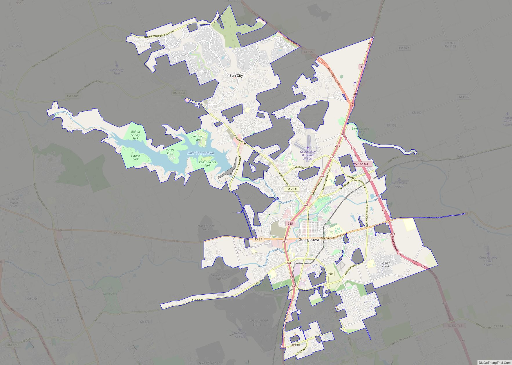
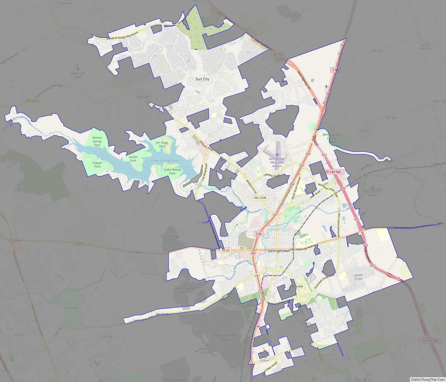
Georgetown Road Map
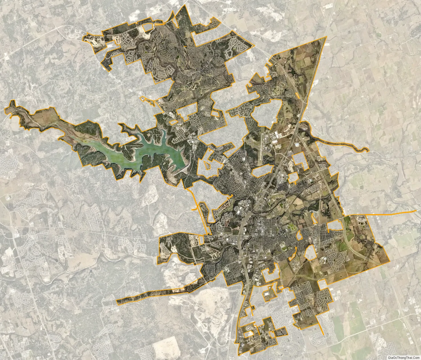
Georgetown city Satellite Map
Geography
Georgetown is located at 30°39′04″N 97°40′53″W / 30.651187°N 97.681333°W / 30.651187; -97.681333 (30.651187, −97.681333), 26 miles (42 km) north of Austin‘s central business district. According to the United States Census Bureau, the city has a total area of 24.9 square miles (64.6 km), of which 22.8 square miles (59.1 km) are land and 2.1 square miles (5.4 km) (8.42%) are covered by water.
Prior to the 2010 census, the city annexed part of the Serenada CDP, increasing its total area to 54.3 square miles (141 km), of which, 52.1 square miles (135 km) of it is land and 2.3 square miles (6.0 km) is water-covered.
The city is located on the northeastern edge of Texas Hill Country. Portions of Georgetown are located on either side of the Balcones Escarpment, a fault line in which the areas roughly east of IH-35 are flat and characterized by having black, fertile soils of the Blackland Prairie, and the west side of the escarpment which consists mostly of hilly, karst-like terrain with little topsoil and higher elevations and which is part of the Texas Hill Country. Inner Space Cavern, a large cave, is a major tourist attraction found on the south side of the city, just west of Interstate 35, and is a large-scale example of limestone karst formations.
The North and Middle Forks of the San Gabriel River both run through the city. More than 30 miles of hike and bike trails, several parks, and recreation for both residents and visitors are provided along their banks.
- Interstate 35
- State Highway 29
- State Highway 195
- State Highway 130 (Toll Road)
Endangered species
Georgetown is home to five endangered species. Two are songbirds protected by the Balcones Canyonlands Preserve in Travis and Williamson Counties. Invertebrate species found only in Williamson County live in the cave-like fissures on the west side of Georgetown. Karst topography is the name for the honeycomb-type limestone formations (including caves, sinkholes, and fissures) that are typical in the county’s limestone geology west of I-35.
In the 1990s, a small group of concerned landowners and developers formed the Northern Edwards Aquifer Resource Council. Their goal was to identify and preserve a sufficient number of caves with endangered species to ensure survival of the species. Ultimately they wanted to obtain a United States Fish and Wildlife Service 10-A permit (known as an Incidental Take Permit) for the entire county by such actions. By gaining the permit, these species would be preserved through voluntary donations of land rather than by the county or state requiring setbacks and other involuntary means. The group documented their successful work in an environmental impact statement to the county in 2002, and a county-wide 10-A permit was obtained in October 2008.
Climate
According to the Köppen climate classification system, Georgetown has a humid subtropical climate, Cfa on climate maps.
Georgetown, like much of Central Texas, is characterized by its long, hot summers and cooler, mild winters. The average summer temperature typically reaches 100 °F for several days during July and August. It is common for highs to be near 90 °F well into October, but by this time, the nights are noticeably cooler.
Winters in Georgetown have highs in the 50s and 60s, with a few days dropping near freezing, causing one or two ice storms per season. A few days reach well above the average. The region may have temperatures in the 80s well into December and 70s in January.
Fall, winter, and spring all average about two to three inches of rain per month, while July and August are the driest, averaging only one to two inches and sometimes no precipitation at all. Most of what rain does fall during the long summer comes from the outflow of Gulf storms that are often pushed away from the region by a large summer high-pressure system.
Georgetown has more than 225 days classified as mostly sunny to sunny, among a total of more than 300 days of at least partly cloudy skies per year.
See also
Map of Texas State and its subdivision:- Anderson
- Andrews
- Angelina
- Aransas
- Archer
- Armstrong
- Atascosa
- Austin
- Bailey
- Bandera
- Bastrop
- Baylor
- Bee
- Bell
- Bexar
- Blanco
- Borden
- Bosque
- Bowie
- Brazoria
- Brazos
- Brewster
- Briscoe
- Brooks
- Brown
- Burleson
- Burnet
- Caldwell
- Calhoun
- Callahan
- Cameron
- Camp
- Carson
- Cass
- Castro
- Chambers
- Cherokee
- Childress
- Clay
- Cochran
- Coke
- Coleman
- Collin
- Collingsworth
- Colorado
- Comal
- Comanche
- Concho
- Cooke
- Coryell
- Cottle
- Crane
- Crockett
- Crosby
- Culberson
- Dallam
- Dallas
- Dawson
- Deaf Smith
- Delta
- Denton
- Dewitt
- Dickens
- Dimmit
- Donley
- Duval
- Eastland
- Ector
- Edwards
- El Paso
- Ellis
- Erath
- Falls
- Fannin
- Fayette
- Fisher
- Floyd
- Foard
- Fort Bend
- Franklin
- Freestone
- Frio
- Gaines
- Galveston
- Garza
- Gillespie
- Glasscock
- Goliad
- Gonzales
- Gray
- Grayson
- Gregg
- Grimes
- Guadalupe
- Hale
- Hall
- Hamilton
- Hansford
- Hardeman
- Hardin
- Harris
- Harrison
- Hartley
- Haskell
- Hays
- Hemphill
- Henderson
- Hidalgo
- Hill
- Hockley
- Hood
- Hopkins
- Houston
- Howard
- Hudspeth
- Hunt
- Hutchinson
- Irion
- Jack
- Jackson
- Jasper
- Jeff Davis
- Jefferson
- Jim Hogg
- Jim Wells
- Johnson
- Jones
- Karnes
- Kaufman
- Kendall
- Kenedy
- Kent
- Kerr
- Kimble
- King
- Kinney
- Kleberg
- Knox
- La Salle
- Lamar
- Lamb
- Lampasas
- Lavaca
- Lee
- Leon
- Liberty
- Limestone
- Lipscomb
- Live Oak
- Llano
- Loving
- Lubbock
- Lynn
- Madison
- Marion
- Martin
- Mason
- Matagorda
- Maverick
- McCulloch
- McLennan
- McMullen
- Medina
- Menard
- Midland
- Milam
- Mills
- Mitchell
- Montague
- Montgomery
- Moore
- Morris
- Motley
- Nacogdoches
- Navarro
- Newton
- Nolan
- Nueces
- Ochiltree
- Oldham
- Orange
- Palo Pinto
- Panola
- Parker
- Parmer
- Pecos
- Polk
- Potter
- Presidio
- Rains
- Randall
- Reagan
- Real
- Red River
- Reeves
- Refugio
- Roberts
- Robertson
- Rockwall
- Runnels
- Rusk
- Sabine
- San Augustine
- San Jacinto
- San Patricio
- San Saba
- Schleicher
- Scurry
- Shackelford
- Shelby
- Sherman
- Smith
- Somervell
- Starr
- Stephens
- Sterling
- Stonewall
- Sutton
- Swisher
- Tarrant
- Taylor
- Terrell
- Terry
- Throckmorton
- Titus
- Tom Green
- Travis
- Trinity
- Tyler
- Upshur
- Upton
- Uvalde
- Val Verde
- Van Zandt
- Victoria
- Walker
- Waller
- Ward
- Washington
- Webb
- Wharton
- Wheeler
- Wichita
- Wilbarger
- Willacy
- Williamson
- Wilson
- Winkler
- Wise
- Wood
- Yoakum
- Young
- Zapata
- Zavala
- Alabama
- Alaska
- Arizona
- Arkansas
- California
- Colorado
- Connecticut
- Delaware
- District of Columbia
- Florida
- Georgia
- Hawaii
- Idaho
- Illinois
- Indiana
- Iowa
- Kansas
- Kentucky
- Louisiana
- Maine
- Maryland
- Massachusetts
- Michigan
- Minnesota
- Mississippi
- Missouri
- Montana
- Nebraska
- Nevada
- New Hampshire
- New Jersey
- New Mexico
- New York
- North Carolina
- North Dakota
- Ohio
- Oklahoma
- Oregon
- Pennsylvania
- Rhode Island
- South Carolina
- South Dakota
- Tennessee
- Texas
- Utah
- Vermont
- Virginia
- Washington
- West Virginia
- Wisconsin
- Wyoming