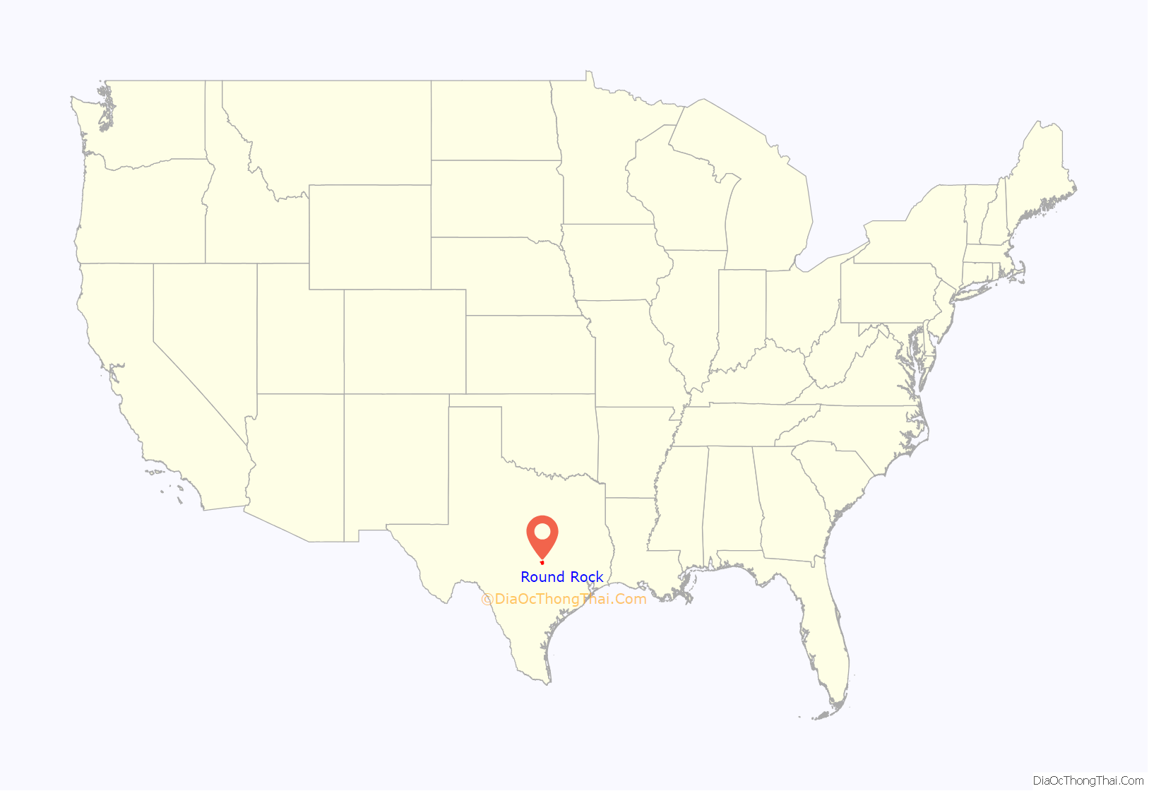
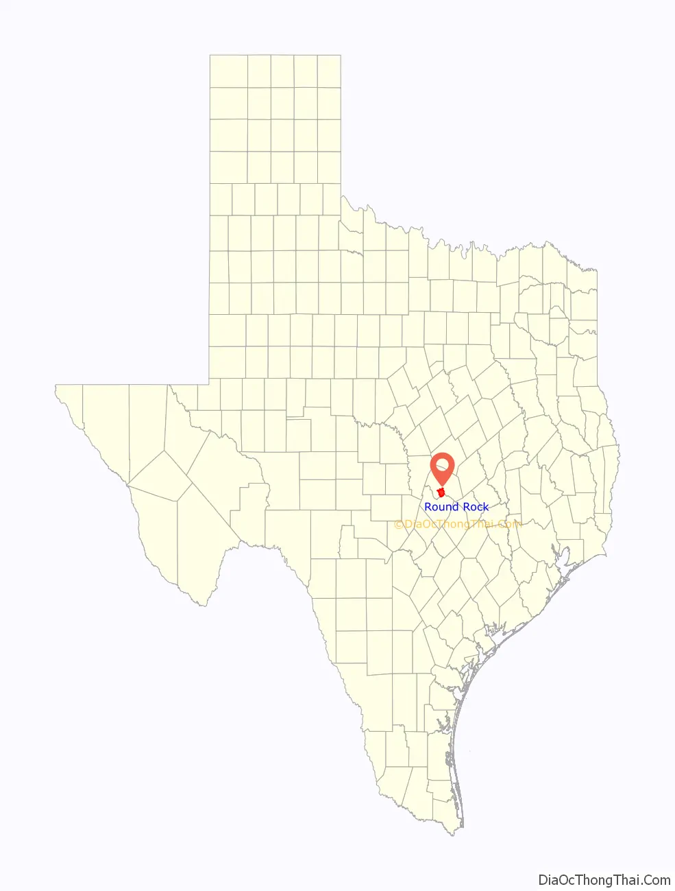
Round Rock is a city in the U.S. state of Texas, in Williamson County (with a small part in Travis County), which is a part of the Greater Austin metropolitan area. Its population is 119,468 as of the 2020 census.
The city straddles the Balcones Escarpment, a fault line in which the areas roughly east of Interstate 35 are flat and characterized by having black, fertile soils of the Blackland Prairie, and the west side of the Escarpment, which consists mostly of hilly, karst-like terrain with little topsoil and higher elevations and which is part of the Texas Hill Country. Located about 20 miles (32 km) north of downtown Austin, Round Rock shares a common border with Austin at Texas State Highway 45.
In August 2008, Money named Round Rock as the seventh-best American small city in which to live. Round Rock was the only Texas city to make the Top 10. In a CNN article dated July 1, 2009, Round Rock was listed as the second-fastest-growing city in the country, with a population growth of 8.2% in the preceding year.
According to the 2008 ratings from the Texas Education Agency, the Round Rock Independent School District ranks among the best in the state. Of 42 schools within it, 12 were rated exemplary and 11 were recognized.
Round Rock is perhaps best known as the international headquarters of Dell, which employs about 16,000 people at its Round Rock facilities. The presence of Dell along with other major employers, an economic development program, major retailers such as IKEA, a Premium Outlet Mall, and the mixed-use La Frontera center, have changed Round Rock from a sleepy bedroom community into its own self-contained “super suburb”.
| Name: | Round Rock city |
|---|---|
| LSAD Code: | 25 |
| LSAD Description: | city (suffix) |
| State: | Texas |
| County: | Travis County, Williamson County |
| Elevation: | 735 ft (224 m) |
| Total Area: | 38.00 sq mi (98.41 km²) |
| Land Area: | 37.64 sq mi (97.48 km²) |
| Water Area: | 0.36 sq mi (0.93 km²) |
| Total Population: | 119,468 |
| Population Density: | 3,174/sq mi (1,225.6/km²) |
| Area code: | 512 & 737 |
| FIPS code: | 4863500 |
| GNISfeature ID: | 1366966 |
| Website: | www.roundrocktexas.gov |
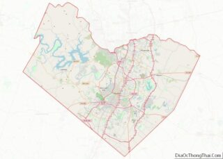
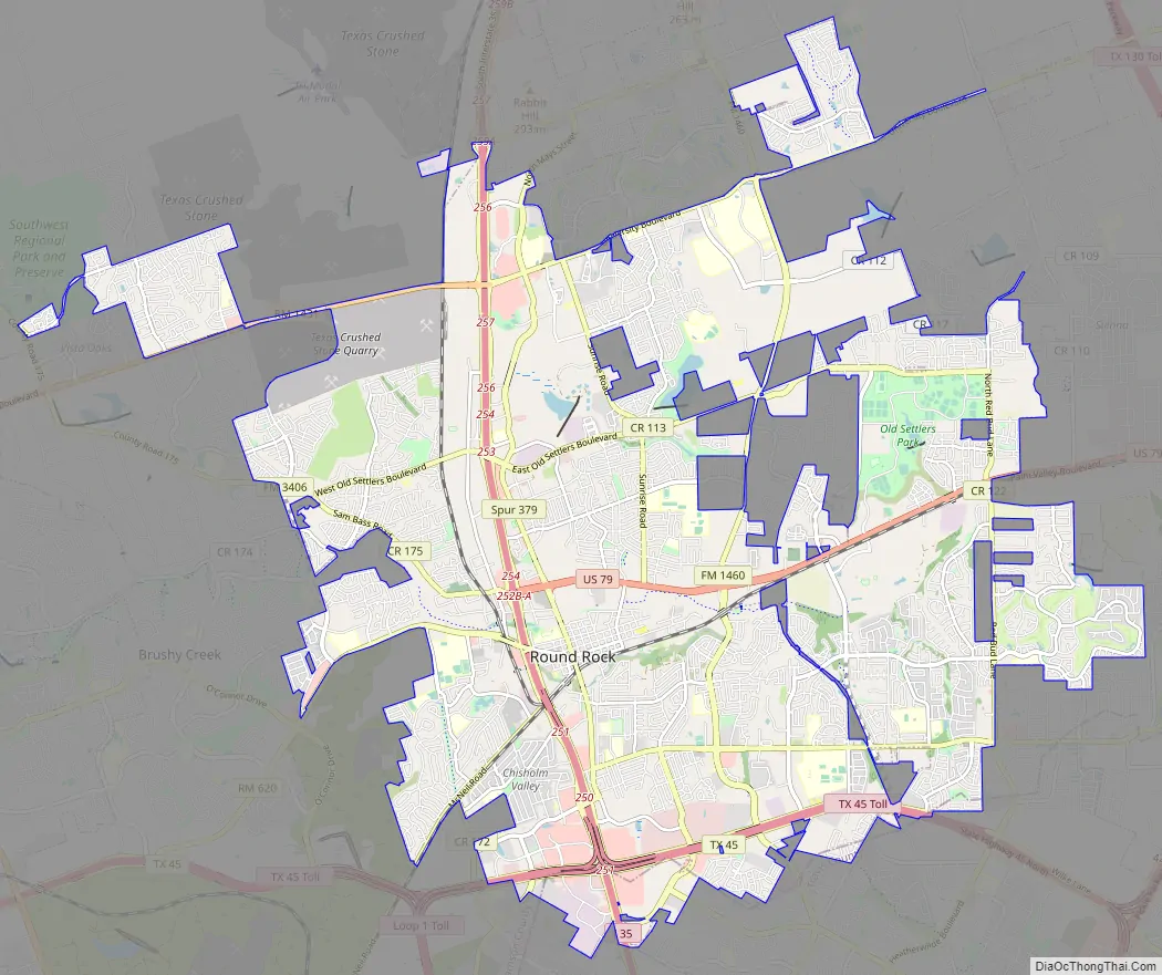
Online Interactive Map
Click on ![]() to view map in "full screen" mode.
to view map in "full screen" mode.
Round Rock location map. Where is Round Rock city?
History
Prehistoric Round Rock
Round Rock and Williamson County have been the site of human habitation since at least 9,200 BCE. The area’s earliest known inhabitants lived during the late Pleistocene (Ice Age), and are linked to the Clovis culture around 9,200 BCE based on evidence found at the much-studied Gault Site, midway between Georgetown and Fort Hood. One of the most important discoveries in recent times is the ancient skeletal remains dubbed “the Leanderthal Lady” because of its age and proximity to Leander, Texas. The site is 4 miles (6 km) west of Round Rock and was discovered by accident by Texas Department of Transportation workers while drilling core samples for a new highway. The site has been studied for many years and samples carbon date to this particular Pleistocene period around 10,500 years ago.
Prehistoric and Archaic period “open occupation” campsites are also found throughout the county along streams and other water sources, including Brushy Creek in Round Rock and the San Gabriel River in Georgetown, 10 mi (16 km) north. These archeology dig sites show a much greater volume United States evidence of Archaic period inhabitants based on relics and flint tools recovered from burned rock middens. The earliest known “historical” Native American occupants, the Tonkawa, were a flint-working, hunting people who followed the buffalo on foot and periodically set fire to the prairie to aid them in their hunts.
Post-Archaic Native American History
During the 18th century, the Tonkawa made the transition to a horse culture and used firearms to a limited extent. Apparently, small numbers of Kiowa, Yojuane, Tawakoni, and Mayeye Native-Americans lived in the county at the time of the earliest Anglo settlements. After they were crowded out by white settlement, the Comanches raided settlements in the county until the 1860s. In the late 19th century, Native Americans were being pushed out of Central Texas.
As the area developed into a rural Anglo community, some of the modern paved roads followed the original Native-American pathways. One famous immigration route passed through Round Rock and is called the “Double File Trail” because the path was wide enough for two horsemen to ride side-by-side. It is part of a longer trail from North Texas that crossed the San Gabriel River in Georgetown, Brushy Creek in Round Rock, and the Colorado River in Austin. An elementary school in the Round Rock school district is named for the trail, Double File Trail Elementary School.
19th-century history
In 1851, a small community was formed on the banks of Brushy Creek, near a large round and anvil-shaped rock in the middle of the creek. This round rock marked a convenient low-water crossing for wagons, horses, and cattle. The first postmaster called the community “Brushy”, and the creek was called “Brushy Creek”, but in 1854, at the suggestion of the postmaster, the small settlement was renamed Round Rock in honor of this now famous rock. After the Civil War, Jesse Chisholm began moving cattle from South Texas through Round Rock on the way to Abilene, Kansas. The route he established, which crossed Brushy Creek at the round rock, became known as the Chisholm Trail. Most of the old buildings, including the old Saint Charles Hotel, have been preserved. This historic area is now called “Old Town”.
Downtown Round Rock was the site of a historic gunfight and subsequent capture (and death) of the 19th-century American train robber Sam Bass, by the Texas Ranger Division on July 19, 1878. The Rangers followed Bass and his gang after they robbed the Fort Worth-to-Cleburne train. Bass was tracked to Round Rock, and as he attempted to flee, Bass was shot and killed in a gun battle by Ranger George Herold and Ranger Sergeant Richard Ware. Sheriff’s Deputy A.W. Grimes was killed in the shootout. Near Ware was Soapy Smith, a noted con man, and his cousin Edwin, who witnessed Ware’s shot. Soapy exclaimed, “I think you got him.” The event is known locally as the “Sam Bass Shootout”. This shootout is recreated each year at the July 4 Frontier Days Celebration in Old Settlers Park. Bass is buried in Round Rock Cemetery, northwest of “Old Town” on Sam Bass Road. His original headstone can be found on display at the Round Rock Public Library.
20th-century history
In the first half of the 20th century, the county’s wealth came from the cotton fields. Cotton, row crops, grapes, and truck farming were the predominant subsistence east of Interstate 35. West of the Balcones divide, ranchers raised cattle, sheep, and to a lesser extent, goats. Due to Round Rock’s favorable geographic location over the rich, fertile “blackland prairie” soils also known locally as the “black waxy” (due to the soil’s high clay content), cotton was the largest economic driver at that time. Because of the soil and climate, this ecoregion is ideally suited to crop agriculture. Nearby Taylor, Texas, east of Round Rock, was the primary cotton center where the crop was hauled for ginning (its seeds mechanically removed) at the cotton gin, compressed into bales, and shipped by train. Austin was also a cotton center for a time once the railroad arrived there in the 1870s. Cotton production and cattle raising, on a much smaller scale, continues today, although primarily east of Round Rock.
To preserve the heritage of the famous crossing, a Chisholm Trail Crossing Park was developed to provide visitors with a simulated scene of Round Rock’s historical role in the Chisholm cattle drive. Commemorative plaques in the park tell of the history of Round Rock. The bronze sculptures of four steers and pioneer woman Hattie Cluck and her son, Emmitt, were commissioned by the city through donations from Round Rock residents. The sculptures depict Round Rock’s history as a crossing location along the Chisholm Trail. The project plans include 18 to 20 additional bronze statues over time.
Following the end of the American Civil War, a group of Confederate veterans held a reunion in Georgetown on August 27, 1904, for the old settlers of Williamson County and their descendants. The invitation promised “good music, plenty to eat, and above all a warm welcome.” The event was well-attended, and reunions—now called Old Settlers Association (OSA) reunions—have been held annually ever since. After the initial one, the event was moved to Round Rock and eventually a structure was built (along with three restored log cabins) in the Palm Valley area of Round Rock, in front of Old Settlers Park, just off Highway 79 in east Round Rock. All members of the organization are descendants of Williamson County residents prior to 1904. OSA has about 50 active members and 300 members in all. The Old Settlers Association today is a social and educational group, with the purpose of facilitating social activities, as well as collecting and preserving important historical information and facts. The facilities are rented for meetings, arts and craft and collectable shows, events, parties, weddings and rehearsal dinners.
In the 1950s, planners of the new Interstate Highway System proposed to route Interstate 35 through Taylor, whose population and cotton industry made it the county’s economic powerhouse. Highway Commissioner DeWitt Greer called for the “interregional” highway to go through Taylor on its way from Dallas to Austin, but some Taylor leaders and other citizens fought the idea, worried about the possibility of cutting farmers off from all or part of their fields, traffic noise, damage to country life, loss of farmland, and unwanted right-of-way acquisition—it was proposed to be an astounding 300 feet (90 m) wide, unheard of before this time. No one even knew what an “Interregional Highway” would look like, unless they had traveled to Germany to see the Autobahn or the Merritt Parkway in Connecticut. Instead, they wanted improvements to the farm-to-market roads and a straight route to Austin.
Meanwhile, Round Rock leaders sought the highway and its potential economic benefits. Mayor Louis Henna lobbied the Highway Commission. In June 1956, the 15-year debate over the form, funding, and route of the Interstate was resolved. Due to the heavy lobbying, and not wanting to antagonize Taylor, the highway was built along the edge of the Balcones Fault line, running through Round Rock. The precise route was not without opposition, however, as the new road cut off “Old Town” to the west from what had become the more recent “downtown” area east of Interstate 35. The Interstate eventually made Round Rock into a viable and vibrant commercial center, while Taylor withered with the decline of the cotton industry. Today, it is a minor, modest town with a smaller population, while Round Rock has thrived and rapidly grown into the largest city in the county, attracting Dell Computer and major retail centers. The transformation of Round Rock is detailed in a book by Linda Scarborough (publisher of the Williamson County Sun newspaper) titled Road, River and Ol’ Boy Politics: A Texas County’s Path from Farm to Supersuburb published by Texas State Historical Press.
By the 1990s, Round Rock was primarily a bedroom community with the majority of its employed residents working in Austin and then returning home after work to places such as Round Rock and Georgetown, where housing and land were less expensive. In the 1990s, Round Rock had few major employers and jobs other than local retail and other services, or ranching and farming. In the late 1990s, though, that began to change as economic development became a major focus of the city and the Chamber of Commerce. Dell Corporation moved its headquarters to Round Rock, which has provided a significant number of jobs with 16,000 employees at its Round Rock headquarters.(See also the Business and economic development section in this article.)
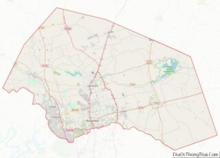
Round Rock Road Map
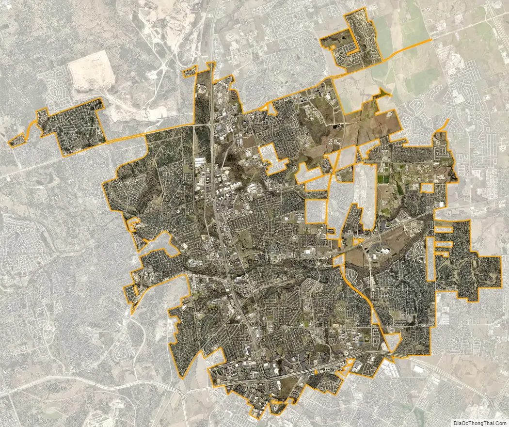
Round Rock city Satellite Map
Geography
Round Rock is 17 miles (27 kilometers) north of downtown Austin, and 10 mi (16 km) south of Georgetown. Its elevation is 709 ft (216 m). According to the US Census Bureau, the city has an area of 26.3 square miles (68.0 km), of which 26.1 square miles (67.7 km) are land and 0.1 square mile (0.3 km) (0.50%) is covered by water. Prior to the 2010 census, the city annexed part of the Brushy Creek CDP, increasing its area to 35.9 square miles (93 km), of which, 35.6 square miles (92 km) of it is land and 0.3 square miles (0.78 km) is water.
Climate
The climate in this area is characterized by generally hot, humid summers and mild, cool winters. According to the Köppen climate classification, Round Rock has a humid subtropical climate, Cfa on climate maps.
The city was heavily damaged by a high-end EF2 tornado on March 21, 2022. The tornado continued well northeast of the city afterwards, causing additional damage before dissipating. Sixteen people were injured.
See also
Map of Texas State and its subdivision:- Anderson
- Andrews
- Angelina
- Aransas
- Archer
- Armstrong
- Atascosa
- Austin
- Bailey
- Bandera
- Bastrop
- Baylor
- Bee
- Bell
- Bexar
- Blanco
- Borden
- Bosque
- Bowie
- Brazoria
- Brazos
- Brewster
- Briscoe
- Brooks
- Brown
- Burleson
- Burnet
- Caldwell
- Calhoun
- Callahan
- Cameron
- Camp
- Carson
- Cass
- Castro
- Chambers
- Cherokee
- Childress
- Clay
- Cochran
- Coke
- Coleman
- Collin
- Collingsworth
- Colorado
- Comal
- Comanche
- Concho
- Cooke
- Coryell
- Cottle
- Crane
- Crockett
- Crosby
- Culberson
- Dallam
- Dallas
- Dawson
- Deaf Smith
- Delta
- Denton
- Dewitt
- Dickens
- Dimmit
- Donley
- Duval
- Eastland
- Ector
- Edwards
- El Paso
- Ellis
- Erath
- Falls
- Fannin
- Fayette
- Fisher
- Floyd
- Foard
- Fort Bend
- Franklin
- Freestone
- Frio
- Gaines
- Galveston
- Garza
- Gillespie
- Glasscock
- Goliad
- Gonzales
- Gray
- Grayson
- Gregg
- Grimes
- Guadalupe
- Hale
- Hall
- Hamilton
- Hansford
- Hardeman
- Hardin
- Harris
- Harrison
- Hartley
- Haskell
- Hays
- Hemphill
- Henderson
- Hidalgo
- Hill
- Hockley
- Hood
- Hopkins
- Houston
- Howard
- Hudspeth
- Hunt
- Hutchinson
- Irion
- Jack
- Jackson
- Jasper
- Jeff Davis
- Jefferson
- Jim Hogg
- Jim Wells
- Johnson
- Jones
- Karnes
- Kaufman
- Kendall
- Kenedy
- Kent
- Kerr
- Kimble
- King
- Kinney
- Kleberg
- Knox
- La Salle
- Lamar
- Lamb
- Lampasas
- Lavaca
- Lee
- Leon
- Liberty
- Limestone
- Lipscomb
- Live Oak
- Llano
- Loving
- Lubbock
- Lynn
- Madison
- Marion
- Martin
- Mason
- Matagorda
- Maverick
- McCulloch
- McLennan
- McMullen
- Medina
- Menard
- Midland
- Milam
- Mills
- Mitchell
- Montague
- Montgomery
- Moore
- Morris
- Motley
- Nacogdoches
- Navarro
- Newton
- Nolan
- Nueces
- Ochiltree
- Oldham
- Orange
- Palo Pinto
- Panola
- Parker
- Parmer
- Pecos
- Polk
- Potter
- Presidio
- Rains
- Randall
- Reagan
- Real
- Red River
- Reeves
- Refugio
- Roberts
- Robertson
- Rockwall
- Runnels
- Rusk
- Sabine
- San Augustine
- San Jacinto
- San Patricio
- San Saba
- Schleicher
- Scurry
- Shackelford
- Shelby
- Sherman
- Smith
- Somervell
- Starr
- Stephens
- Sterling
- Stonewall
- Sutton
- Swisher
- Tarrant
- Taylor
- Terrell
- Terry
- Throckmorton
- Titus
- Tom Green
- Travis
- Trinity
- Tyler
- Upshur
- Upton
- Uvalde
- Val Verde
- Van Zandt
- Victoria
- Walker
- Waller
- Ward
- Washington
- Webb
- Wharton
- Wheeler
- Wichita
- Wilbarger
- Willacy
- Williamson
- Wilson
- Winkler
- Wise
- Wood
- Yoakum
- Young
- Zapata
- Zavala
- Alabama
- Alaska
- Arizona
- Arkansas
- California
- Colorado
- Connecticut
- Delaware
- District of Columbia
- Florida
- Georgia
- Hawaii
- Idaho
- Illinois
- Indiana
- Iowa
- Kansas
- Kentucky
- Louisiana
- Maine
- Maryland
- Massachusetts
- Michigan
- Minnesota
- Mississippi
- Missouri
- Montana
- Nebraska
- Nevada
- New Hampshire
- New Jersey
- New Mexico
- New York
- North Carolina
- North Dakota
- Ohio
- Oklahoma
- Oregon
- Pennsylvania
- Rhode Island
- South Carolina
- South Dakota
- Tennessee
- Texas
- Utah
- Vermont
- Virginia
- Washington
- West Virginia
- Wisconsin
- Wyoming