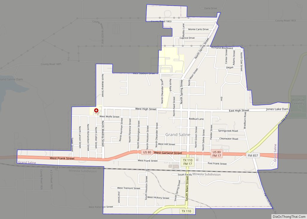
Grand Saline is a city in Van Zandt County, Texas, United States, located in East Texas. The population was 3,107 as of 2020, making Grand Saline the third-largest city in Van Zandt County. The city is located roughly 75 miles (120 km) east of Dallas and 35 miles (56 km) northwest of Tyler, the two nearest metropolitan areas, and is part of the greater Tyler/Longview area.
The town derives its name from the large salt deposits located southeast of the city, the majority of which are owned by Morton Salt.
| Name: | Grand Saline city |
|---|---|
| LSAD Code: | 25 |
| LSAD Description: | city (suffix) |
| State: | Texas |
| County: | Van Zandt County |
| Elevation: | 400 ft (122 m) |
| Total Area: | 2.12 sq mi (5.48 km²) |
| Land Area: | 2.10 sq mi (5.43 km²) |
| Water Area: | 0.02 sq mi (0.05 km²) |
| Total Population: | 3,107 |
| Population Density: | 1,500/sq mi (570/km²) |
| ZIP code: | 75140 |
| Area code: | 903 Phone prefix: 962|913 |
| FIPS code: | 4830476 |
| GNISfeature ID: | 1336803 |
| Website: | grandsalinetx.gov |
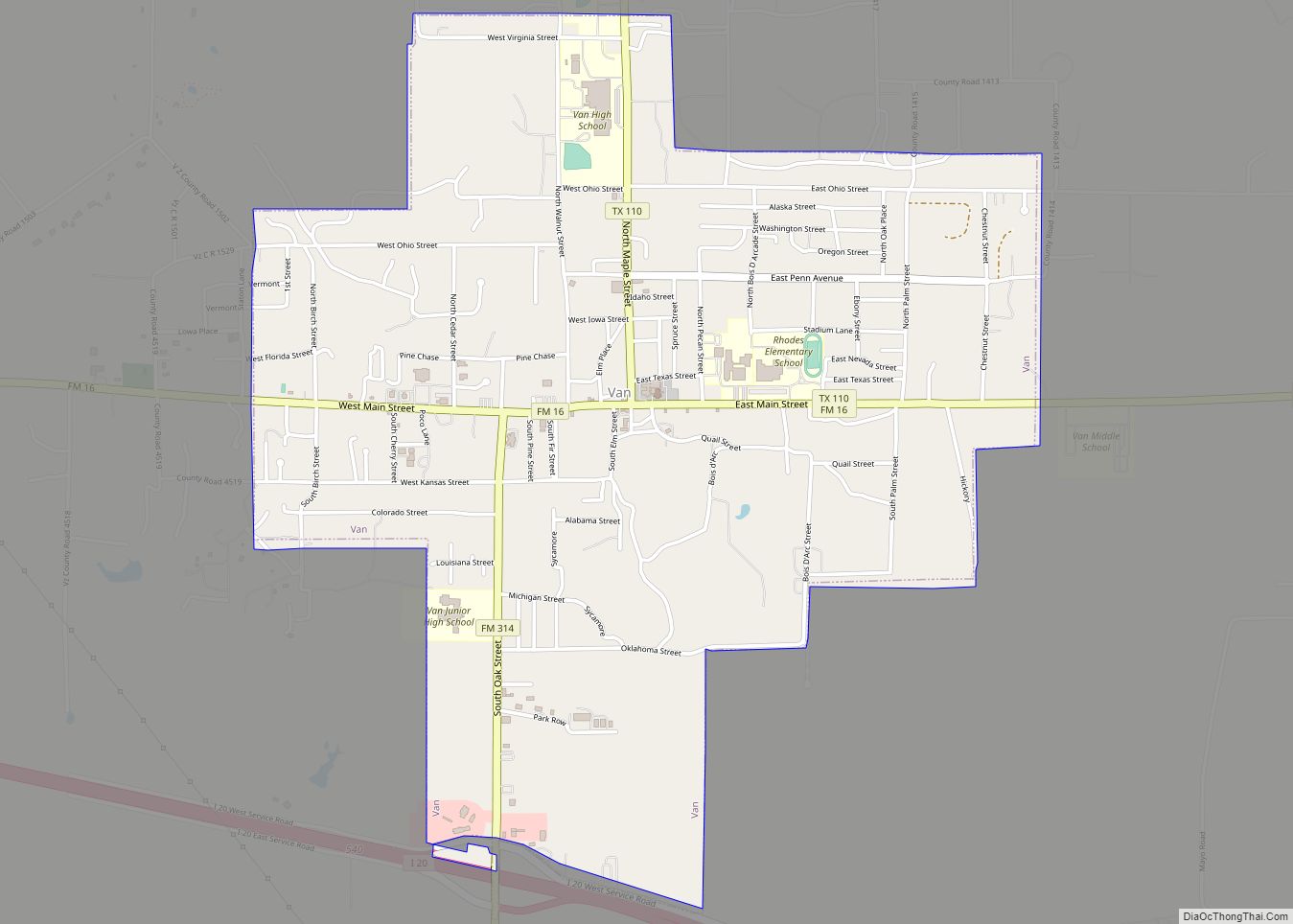
Online Interactive Map
Click on ![]() to view map in "full screen" mode.
to view map in "full screen" mode.
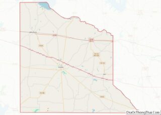
Grand Saline location map. Where is Grand Saline city?


History
Grand Saline’s first settlers were the ancient Caddo and Cherokee Indian tribes, who discovered and made use of a large salt prairie south of the town. The Native Americans used evaporated salt, from the brine stream that flows over the flats, as a commodity they traded for other needed goods. In the mid-nineteenth century, the tribes moved southeast, having been forced out of the area by Mirabeau B. Lamar, second president of the Republic of Texas, and by general anti-Indian sentiment. Only a few years after the Indians left the salt prairie behind, a new group of settlers arrived. A settler named John Jordan and other newcomers brought their families and set up a primitive salt works. The community named Jordan’s Saline quickly became the center of Van Zandt County and was, for a while, the county seat.
The salt produced here was used in the process of tanning leather and preserving food stuffs. Following the American Civil War the Texas and Pacific Railroad was extended from Marshall to Dallas. A parcel of land was donated to the railroad; a depot was built and the stop was named Grand Saline. The City of Grand Saline was incorporated in 1895 and the community of Jordan’s Saline faded into history as its residents moved north to the bustling new city.
There were formerly numerous salt companies in Grand Saline, including the Richardson Salt works, which had drilled the first salt well; the Lone Star Salt Company; Kleer Salt Works, the first steam-powered salt plant; and the Grand Saline Salt Company, which later became part of the Morton Salt Company. During the late 1920s, the discovery of the nearby Van oil field brought companies that provided needed supplies. In the 1930s Grand Saline had twelve petroleum supply companies and five lumber companies. In the Depression years, local sewing rooms made garments for the poor. During World War II, a workers’ strike at Morton Salt led the town to form the Grand Saline Industrial Foundation to attract new business to town. Their efforts produced clothing manufacturers, sulfur processing and meat packing companies. Grand Saline was also known for its Lone Star Hotel, which was, for a brief time, the home of Hollywood starlet Louise Fazenda, the wife of Warner Brothers executive Hal Wallis. Agriculture, farming and ranching have long been a major part of the economic life in Grand Saline. Crops have included sweet potatoes and other truck crops. A cotton gin built south of town in 1890 marked the beginning of many years of cotton production. Poultry, livestock, dairy products, lumber and an ice house all played a role in the formation and history of the town.
Grand Saline Road Map

Grand Saline city Satellite Map

Geography
Grand Saline is located at 32°40′40″N 95°42′41″W / 32.67778°N 95.71139°W / 32.67778; -95.71139 (32.677662, –95.711521), in the northeastern area of Van Zandt County, at the intersection of Texas State Highway 110 and U.S. Route 80 in western East Texas. According to the United States Census Bureau, the city has a total area of 2.0 square miles (5.2 km), of which 2.0 square miles (5.2 km) is land and 0.50% is water.
See also
Map of Texas State and its subdivision:- Anderson
- Andrews
- Angelina
- Aransas
- Archer
- Armstrong
- Atascosa
- Austin
- Bailey
- Bandera
- Bastrop
- Baylor
- Bee
- Bell
- Bexar
- Blanco
- Borden
- Bosque
- Bowie
- Brazoria
- Brazos
- Brewster
- Briscoe
- Brooks
- Brown
- Burleson
- Burnet
- Caldwell
- Calhoun
- Callahan
- Cameron
- Camp
- Carson
- Cass
- Castro
- Chambers
- Cherokee
- Childress
- Clay
- Cochran
- Coke
- Coleman
- Collin
- Collingsworth
- Colorado
- Comal
- Comanche
- Concho
- Cooke
- Coryell
- Cottle
- Crane
- Crockett
- Crosby
- Culberson
- Dallam
- Dallas
- Dawson
- Deaf Smith
- Delta
- Denton
- Dewitt
- Dickens
- Dimmit
- Donley
- Duval
- Eastland
- Ector
- Edwards
- El Paso
- Ellis
- Erath
- Falls
- Fannin
- Fayette
- Fisher
- Floyd
- Foard
- Fort Bend
- Franklin
- Freestone
- Frio
- Gaines
- Galveston
- Garza
- Gillespie
- Glasscock
- Goliad
- Gonzales
- Gray
- Grayson
- Gregg
- Grimes
- Guadalupe
- Hale
- Hall
- Hamilton
- Hansford
- Hardeman
- Hardin
- Harris
- Harrison
- Hartley
- Haskell
- Hays
- Hemphill
- Henderson
- Hidalgo
- Hill
- Hockley
- Hood
- Hopkins
- Houston
- Howard
- Hudspeth
- Hunt
- Hutchinson
- Irion
- Jack
- Jackson
- Jasper
- Jeff Davis
- Jefferson
- Jim Hogg
- Jim Wells
- Johnson
- Jones
- Karnes
- Kaufman
- Kendall
- Kenedy
- Kent
- Kerr
- Kimble
- King
- Kinney
- Kleberg
- Knox
- La Salle
- Lamar
- Lamb
- Lampasas
- Lavaca
- Lee
- Leon
- Liberty
- Limestone
- Lipscomb
- Live Oak
- Llano
- Loving
- Lubbock
- Lynn
- Madison
- Marion
- Martin
- Mason
- Matagorda
- Maverick
- McCulloch
- McLennan
- McMullen
- Medina
- Menard
- Midland
- Milam
- Mills
- Mitchell
- Montague
- Montgomery
- Moore
- Morris
- Motley
- Nacogdoches
- Navarro
- Newton
- Nolan
- Nueces
- Ochiltree
- Oldham
- Orange
- Palo Pinto
- Panola
- Parker
- Parmer
- Pecos
- Polk
- Potter
- Presidio
- Rains
- Randall
- Reagan
- Real
- Red River
- Reeves
- Refugio
- Roberts
- Robertson
- Rockwall
- Runnels
- Rusk
- Sabine
- San Augustine
- San Jacinto
- San Patricio
- San Saba
- Schleicher
- Scurry
- Shackelford
- Shelby
- Sherman
- Smith
- Somervell
- Starr
- Stephens
- Sterling
- Stonewall
- Sutton
- Swisher
- Tarrant
- Taylor
- Terrell
- Terry
- Throckmorton
- Titus
- Tom Green
- Travis
- Trinity
- Tyler
- Upshur
- Upton
- Uvalde
- Val Verde
- Van Zandt
- Victoria
- Walker
- Waller
- Ward
- Washington
- Webb
- Wharton
- Wheeler
- Wichita
- Wilbarger
- Willacy
- Williamson
- Wilson
- Winkler
- Wise
- Wood
- Yoakum
- Young
- Zapata
- Zavala
- Alabama
- Alaska
- Arizona
- Arkansas
- California
- Colorado
- Connecticut
- Delaware
- District of Columbia
- Florida
- Georgia
- Hawaii
- Idaho
- Illinois
- Indiana
- Iowa
- Kansas
- Kentucky
- Louisiana
- Maine
- Maryland
- Massachusetts
- Michigan
- Minnesota
- Mississippi
- Missouri
- Montana
- Nebraska
- Nevada
- New Hampshire
- New Jersey
- New Mexico
- New York
- North Carolina
- North Dakota
- Ohio
- Oklahoma
- Oregon
- Pennsylvania
- Rhode Island
- South Carolina
- South Dakota
- Tennessee
- Texas
- Utah
- Vermont
- Virginia
- Washington
- West Virginia
- Wisconsin
- Wyoming