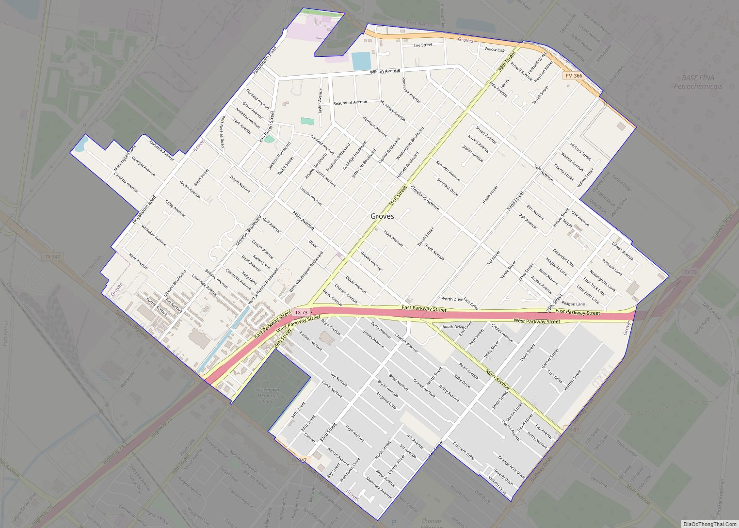
Groves is a city in Jefferson County, Texas, United States. The population was 17,335 at the 2020 census. It is part of the Beaumont–Port Arthur Metropolitan Statistical Area.
| Name: | Groves city |
|---|---|
| LSAD Code: | 25 |
| LSAD Description: | city (suffix) |
| State: | Texas |
| County: | Jefferson County |
| Elevation: | 13 ft (4 m) |
| Total Area: | 5.19 sq mi (13.44 km²) |
| Land Area: | 5.17 sq mi (13.40 km²) |
| Water Area: | 0.01 sq mi (0.04 km²) |
| Total Population: | 17,335 |
| Population Density: | 2,992.46/sq mi (1,155.29/km²) |
| ZIP code: | 77619 |
| Area code: | 409 |
| FIPS code: | 4831328 |
| GNISfeature ID: | 1358473 |
| Website: | www.cigrovestx.com |
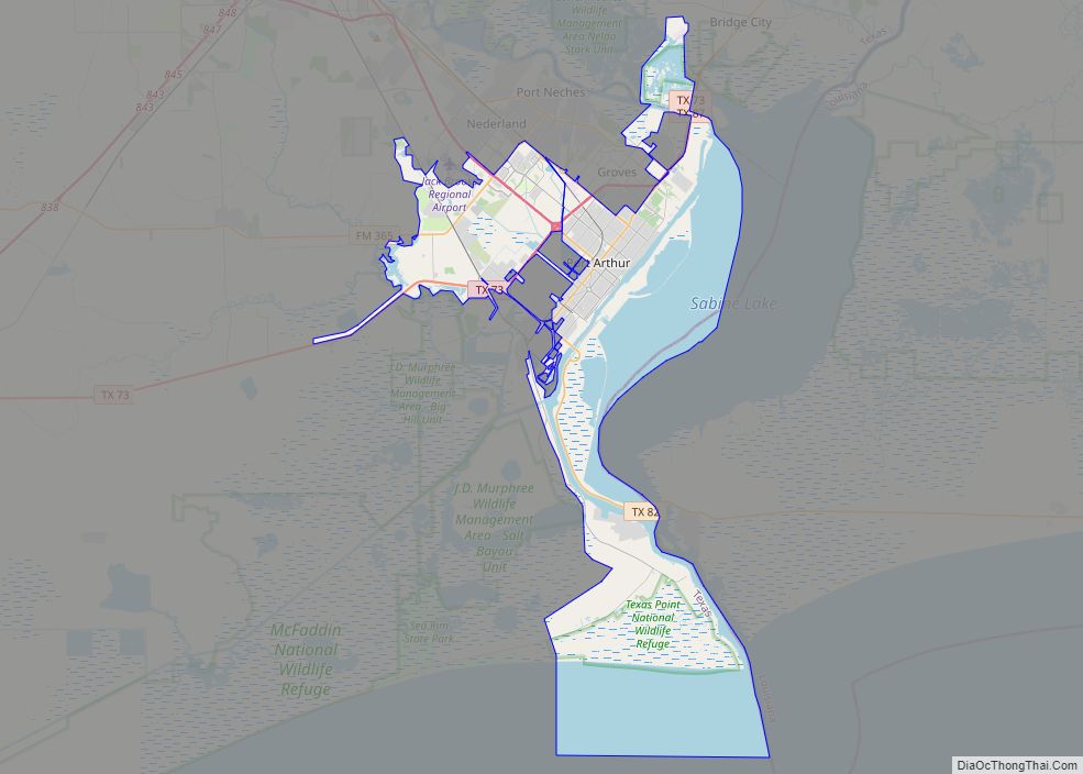
Online Interactive Map
Click on ![]() to view map in "full screen" mode.
to view map in "full screen" mode.
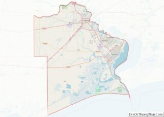
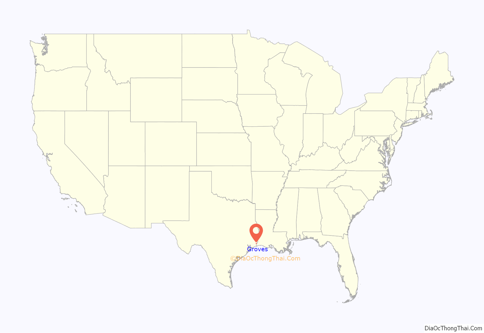
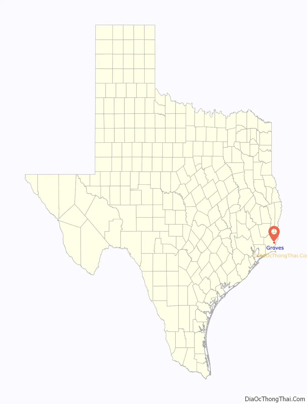
Groves location map. Where is Groves city?
History
In 1886, Sam Courville moved his family from a Sabine Lake settlement in Port Arthur to a new home on 640 acres (2.6 km) of land. It was in that same general area around 1911 that John Warne Gates purchased additional tracts of land. The land was conveyed to the Griffing brothers of Port Arthur in 1916, and three years later Griffing Brothers Nursery employee Wiley Choate supervised the planting of several thousand pecan trees on a 385-acre (1.56 km) tract. In 1921, the Port Arthur Land Development Company took control of the site and divided the land into a residential subdivision known as “Pecan Grove”. The name was later changed to “Groves”, after development representative and pioneer Port Arthurian Asa Groves.
A post office was established in 1927 and a school opened in 1929. A public library opened the following year. The community rapidly developed as a stop on the Kansas City Southern Railway. The Atlantic Refinery began operating in 1936. In 1940, a public water system was installed in the community. Several civic organizations, including the Lions Club, Chamber of Commerce, and Volunteer Fire Department, were formed during the 1940s. By the early 1950s, Groves had an estimated population of 1,300. In 1952, residents of the community voted 1,079–262 in favor of incorporating Groves as a city. Rapid population growth followed, surpassing 17,000 in the 1960 census and reaching 18,067 by 1970. During the remainder of the 20th century, the population slowly declined. In 2000, Groves was the fourth-largest city in Jefferson County, after Beaumont, Port Arthur, and Nederland.
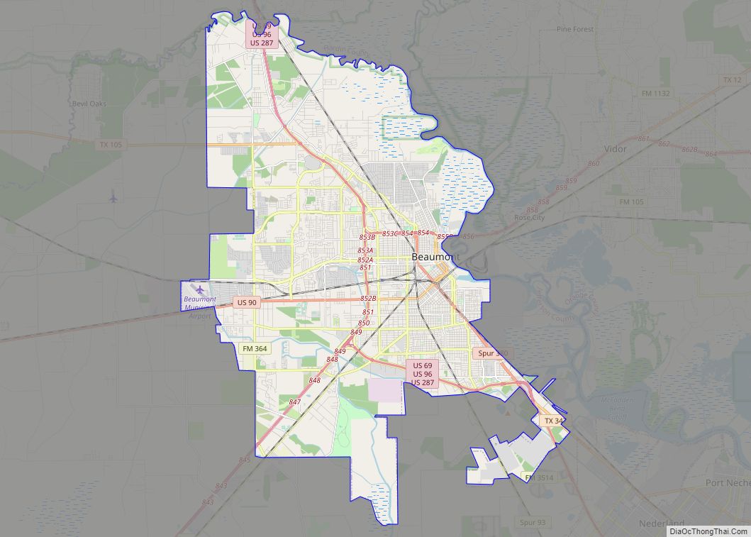
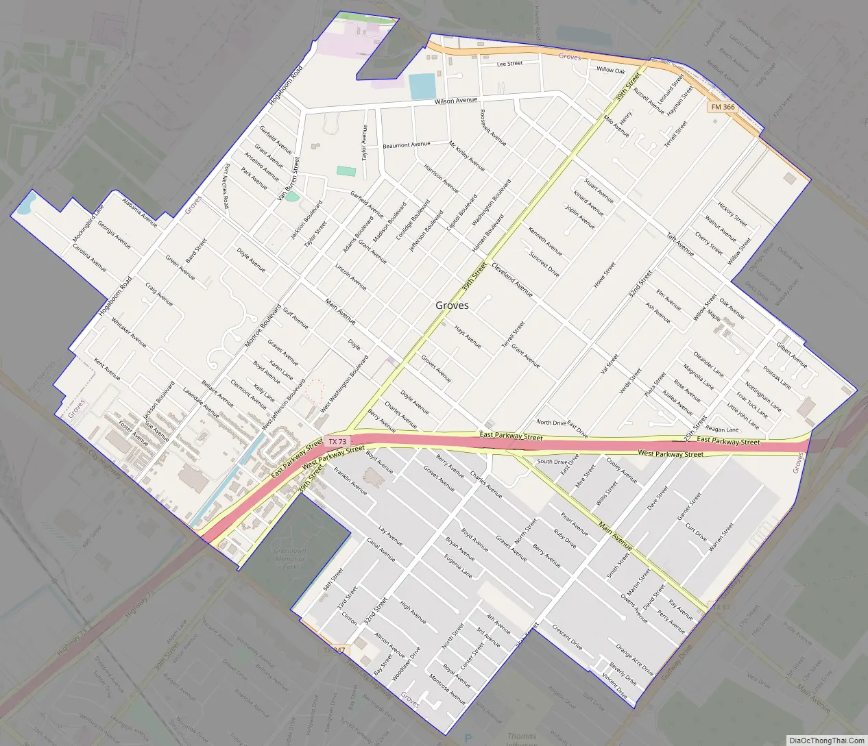
Groves Road Map
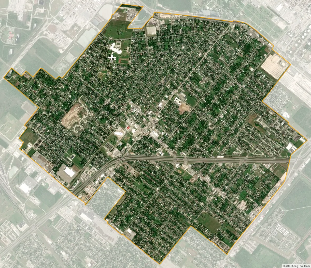
Groves city Satellite Map
Geography
Groves is located in eastern Jefferson County at 29°56′50″N 93°54′57″W / 29.947113°N 93.915829°W / 29.947113; -93.915829 (29.947113, –93.915829). It is 16 miles (26 km) southeast of downtown Beaumont in eastern Jefferson County. The city of Port Arthur borders Groves on three sides (southeast, southwest, and northeast), while Port Neches lies to the northwest. Three State Highways – 73, 87, and 347 – pass through or near the city. Sabine Lake, an estuary of the Gulf of Mexico, is 3 miles (5 km) to the southeast.
According to the United States Census Bureau, the city of Groves has a total area of 5.2 square miles (13.4 km), of which 0.015 square miles (0.04 km), or 0.28%, are water. Most of the city sits at an elevation of 5 to 15 feet (1.5 to 4.6 m) above sea level.
See also
Map of Texas State and its subdivision:- Anderson
- Andrews
- Angelina
- Aransas
- Archer
- Armstrong
- Atascosa
- Austin
- Bailey
- Bandera
- Bastrop
- Baylor
- Bee
- Bell
- Bexar
- Blanco
- Borden
- Bosque
- Bowie
- Brazoria
- Brazos
- Brewster
- Briscoe
- Brooks
- Brown
- Burleson
- Burnet
- Caldwell
- Calhoun
- Callahan
- Cameron
- Camp
- Carson
- Cass
- Castro
- Chambers
- Cherokee
- Childress
- Clay
- Cochran
- Coke
- Coleman
- Collin
- Collingsworth
- Colorado
- Comal
- Comanche
- Concho
- Cooke
- Coryell
- Cottle
- Crane
- Crockett
- Crosby
- Culberson
- Dallam
- Dallas
- Dawson
- Deaf Smith
- Delta
- Denton
- Dewitt
- Dickens
- Dimmit
- Donley
- Duval
- Eastland
- Ector
- Edwards
- El Paso
- Ellis
- Erath
- Falls
- Fannin
- Fayette
- Fisher
- Floyd
- Foard
- Fort Bend
- Franklin
- Freestone
- Frio
- Gaines
- Galveston
- Garza
- Gillespie
- Glasscock
- Goliad
- Gonzales
- Gray
- Grayson
- Gregg
- Grimes
- Guadalupe
- Hale
- Hall
- Hamilton
- Hansford
- Hardeman
- Hardin
- Harris
- Harrison
- Hartley
- Haskell
- Hays
- Hemphill
- Henderson
- Hidalgo
- Hill
- Hockley
- Hood
- Hopkins
- Houston
- Howard
- Hudspeth
- Hunt
- Hutchinson
- Irion
- Jack
- Jackson
- Jasper
- Jeff Davis
- Jefferson
- Jim Hogg
- Jim Wells
- Johnson
- Jones
- Karnes
- Kaufman
- Kendall
- Kenedy
- Kent
- Kerr
- Kimble
- King
- Kinney
- Kleberg
- Knox
- La Salle
- Lamar
- Lamb
- Lampasas
- Lavaca
- Lee
- Leon
- Liberty
- Limestone
- Lipscomb
- Live Oak
- Llano
- Loving
- Lubbock
- Lynn
- Madison
- Marion
- Martin
- Mason
- Matagorda
- Maverick
- McCulloch
- McLennan
- McMullen
- Medina
- Menard
- Midland
- Milam
- Mills
- Mitchell
- Montague
- Montgomery
- Moore
- Morris
- Motley
- Nacogdoches
- Navarro
- Newton
- Nolan
- Nueces
- Ochiltree
- Oldham
- Orange
- Palo Pinto
- Panola
- Parker
- Parmer
- Pecos
- Polk
- Potter
- Presidio
- Rains
- Randall
- Reagan
- Real
- Red River
- Reeves
- Refugio
- Roberts
- Robertson
- Rockwall
- Runnels
- Rusk
- Sabine
- San Augustine
- San Jacinto
- San Patricio
- San Saba
- Schleicher
- Scurry
- Shackelford
- Shelby
- Sherman
- Smith
- Somervell
- Starr
- Stephens
- Sterling
- Stonewall
- Sutton
- Swisher
- Tarrant
- Taylor
- Terrell
- Terry
- Throckmorton
- Titus
- Tom Green
- Travis
- Trinity
- Tyler
- Upshur
- Upton
- Uvalde
- Val Verde
- Van Zandt
- Victoria
- Walker
- Waller
- Ward
- Washington
- Webb
- Wharton
- Wheeler
- Wichita
- Wilbarger
- Willacy
- Williamson
- Wilson
- Winkler
- Wise
- Wood
- Yoakum
- Young
- Zapata
- Zavala
- Alabama
- Alaska
- Arizona
- Arkansas
- California
- Colorado
- Connecticut
- Delaware
- District of Columbia
- Florida
- Georgia
- Hawaii
- Idaho
- Illinois
- Indiana
- Iowa
- Kansas
- Kentucky
- Louisiana
- Maine
- Maryland
- Massachusetts
- Michigan
- Minnesota
- Mississippi
- Missouri
- Montana
- Nebraska
- Nevada
- New Hampshire
- New Jersey
- New Mexico
- New York
- North Carolina
- North Dakota
- Ohio
- Oklahoma
- Oregon
- Pennsylvania
- Rhode Island
- South Carolina
- South Dakota
- Tennessee
- Texas
- Utah
- Vermont
- Virginia
- Washington
- West Virginia
- Wisconsin
- Wyoming