Hitchcock is a city in Galveston County, Texas, United States. The population was 6,961 at the 2010 census.
| Name: | Hitchcock city |
|---|---|
| LSAD Code: | 25 |
| LSAD Description: | city (suffix) |
| State: | Texas |
| County: | Galveston County |
| Incorporated: | January 30, 1960 |
| Elevation: | 16 ft (4.9 m) |
| Total Area: | 91.48 sq mi (236.94 km²) |
| Land Area: | 60.43 sq mi (156.51 km²) |
| Water Area: | 31.05 sq mi (80.43 km²) |
| Total Population: | 6,961 |
| Population Density: | 130.96/sq mi (50.56/km²) |
| ZIP code: | 77563 |
| Area code: | 409 |
| FIPS code: | 4834220 |
| GNISfeature ID: | 1359310 |
| Website: | http://www.cityofhitchcock.org/ |
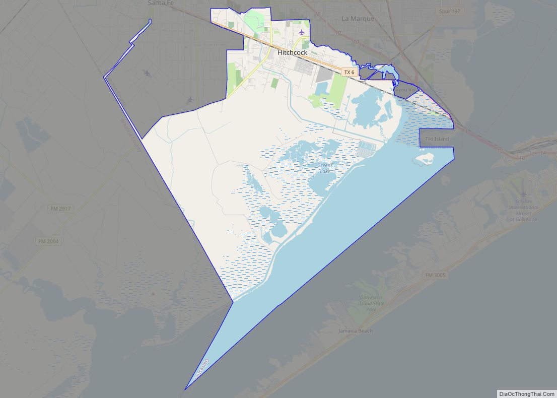
Online Interactive Map
Click on ![]() to view map in "full screen" mode.
to view map in "full screen" mode.
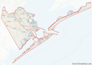
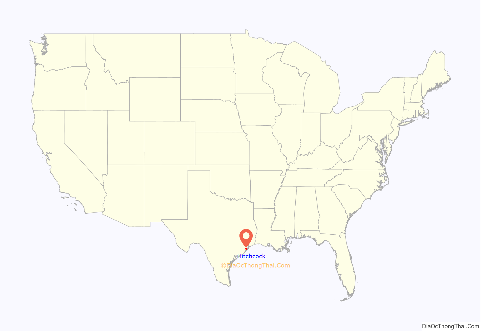
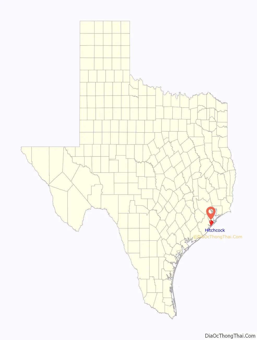
Hitchcock location map. Where is Hitchcock city?
History
Hitchcock was created as a station of the railroad between Galveston and Houston in 1873 and around the turn of the 20th century, became a vegetable shipping center. The settlement’s economy crashed in the 1930s after insect plagues in the surrounding areas, and the area stayed impoverished until the establishment of the Camp Wallace anti-aircraft training base and the Naval Air Station Hitchcock at the beginning of World War II. After the end of the war, the bases were used as discharge centers, and some former soldiers settled in the area. Hitchcock was established in 1960 as the area’s population boomed, topping out at nearly 7,000 by the end of the 1960s. Today, the town serves as a suburb of Galveston and houses workers from the Johnson Space Center.
Since 1984, Hitchcock has been home to the Galveston County Fair & Rodeo. The Galveston County Fair & Rodeo began in 1938 and was held at facilities in Runge Park in Arcadia. In the early 1980s, the County Fair had reached its limits of growth at Runge Park, and plans began for a move to Jack Brooks Park in Hitchcock. The move to Jack Brooks Park was completed in time for the 1984 fair.
Hitchcock was affected by Hurricane Harvey in 2017. The director of community development, D. Joe Wood, stated that bankruptcy was a possibility in the post-Hurricane environment.
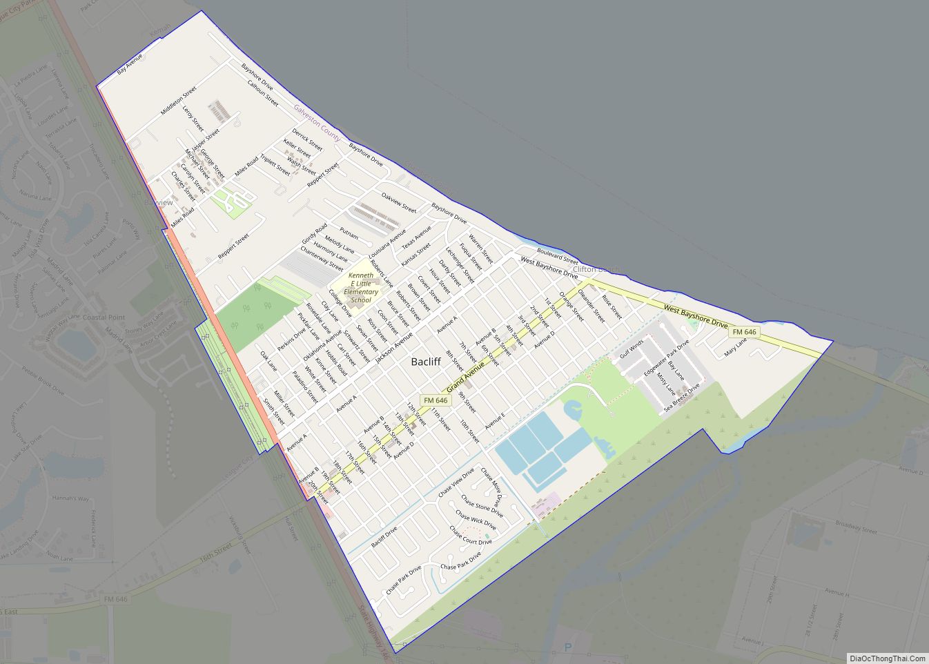
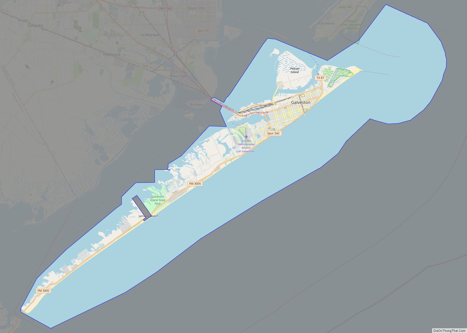
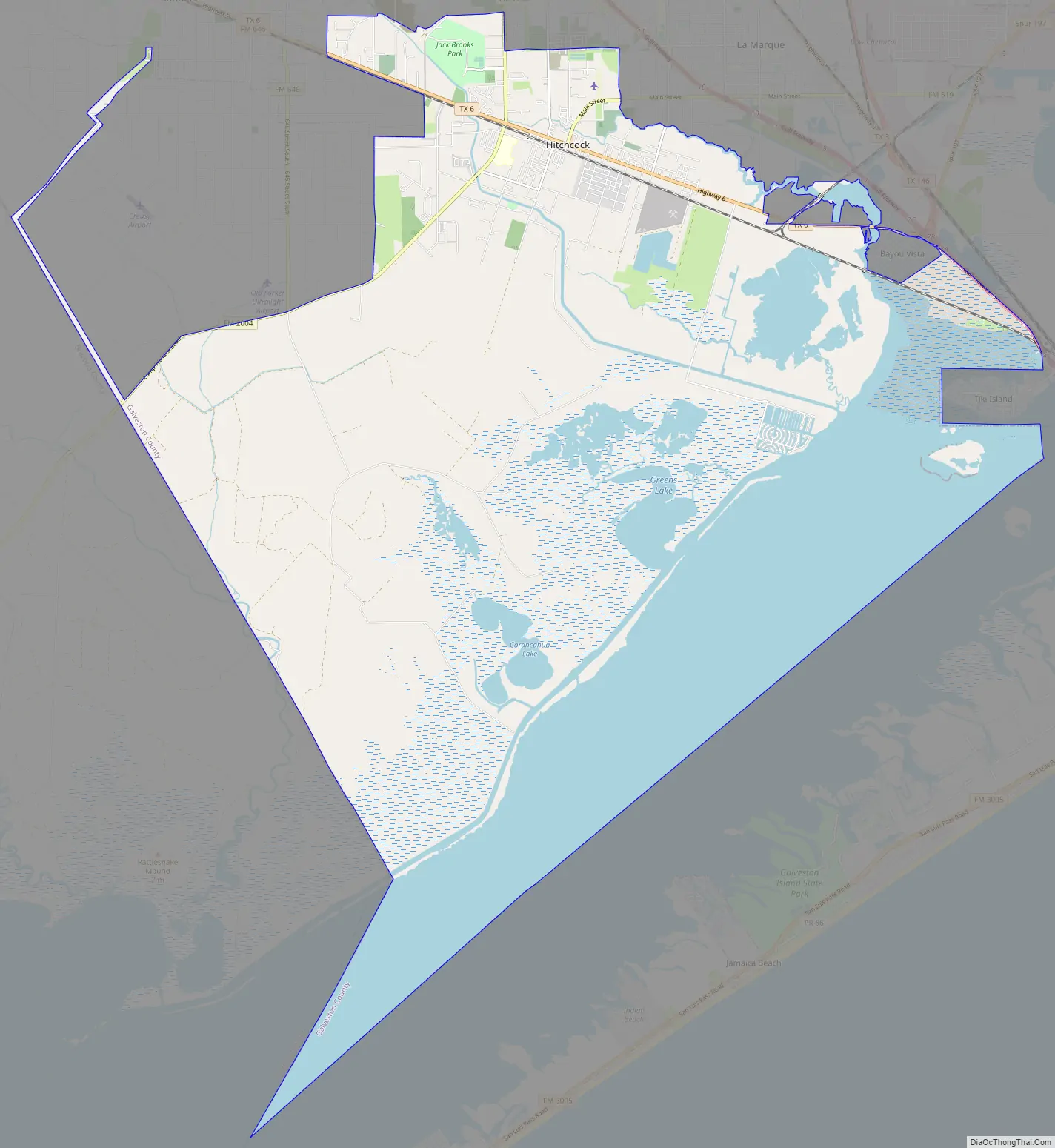
Hitchcock Road Map
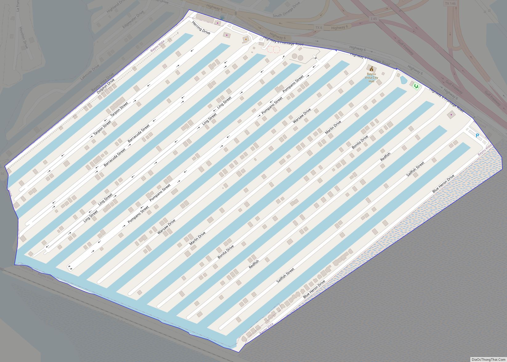
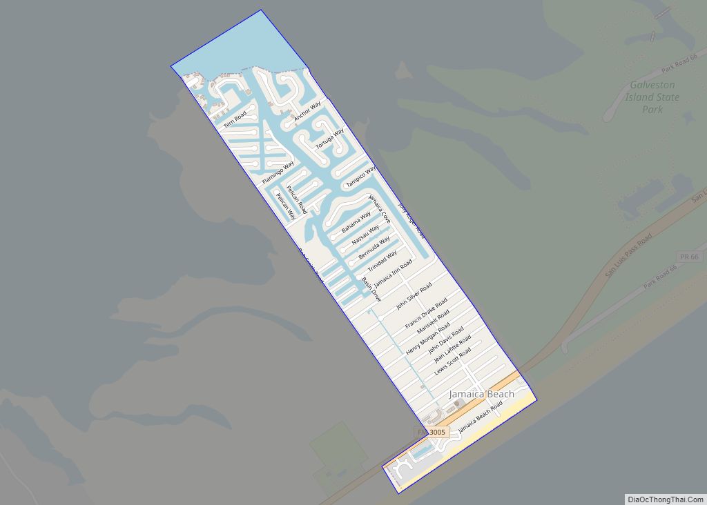
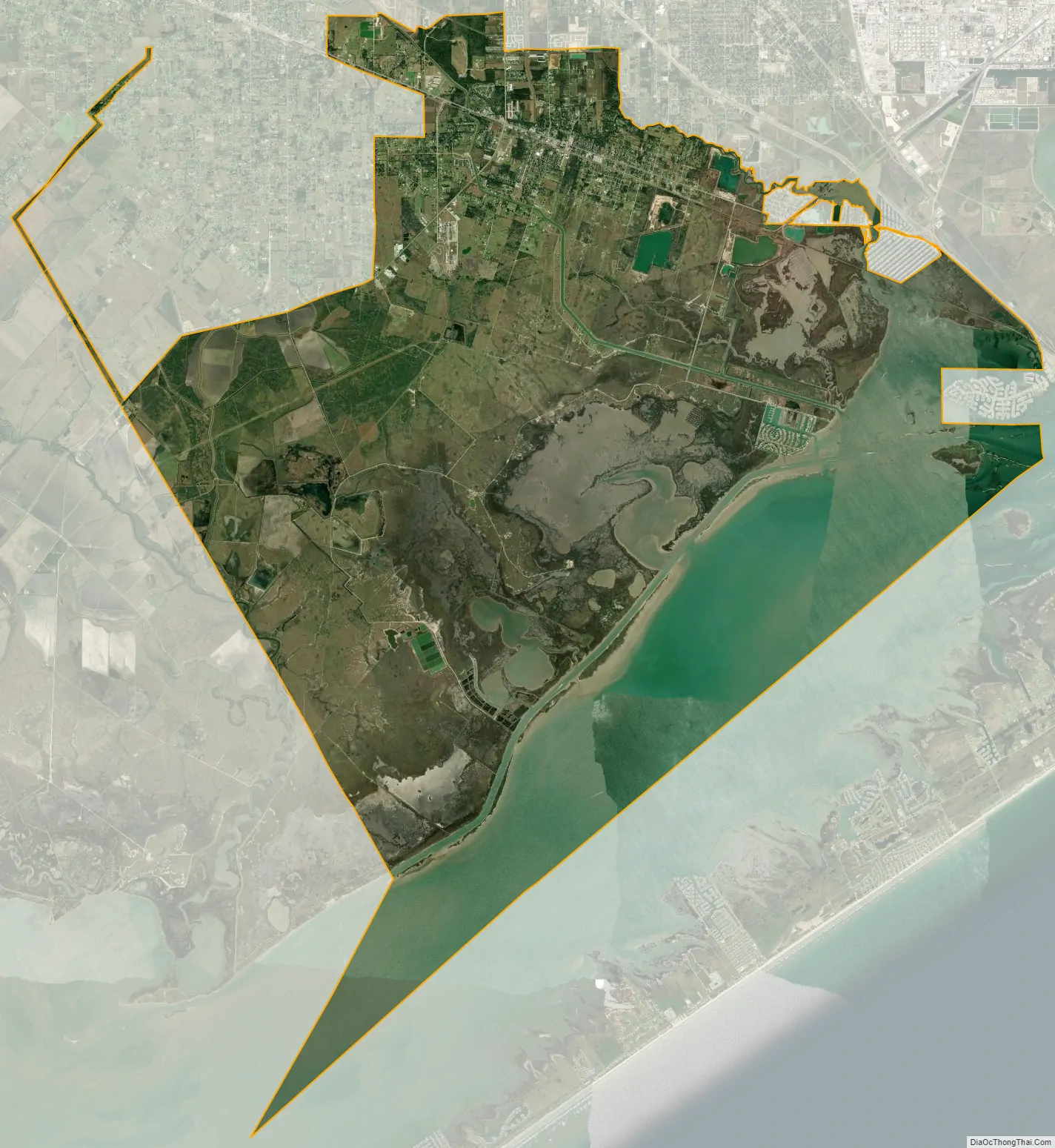
Hitchcock city Satellite Map
Geography
Hitchcock is located at 29°20′19″N 95°0′39″W / 29.33861°N 95.01083°W / 29.33861; -95.01083 (29.338715, –95.010861).
According to the United States Census Bureau, the city has a total area of 92.1 square miles (238.5 km), of which 60.5 square miles (156.6 km) is land and 31.6 square miles (81.9 km), or 34.35%, is water.
See also
Map of Texas State and its subdivision:- Anderson
- Andrews
- Angelina
- Aransas
- Archer
- Armstrong
- Atascosa
- Austin
- Bailey
- Bandera
- Bastrop
- Baylor
- Bee
- Bell
- Bexar
- Blanco
- Borden
- Bosque
- Bowie
- Brazoria
- Brazos
- Brewster
- Briscoe
- Brooks
- Brown
- Burleson
- Burnet
- Caldwell
- Calhoun
- Callahan
- Cameron
- Camp
- Carson
- Cass
- Castro
- Chambers
- Cherokee
- Childress
- Clay
- Cochran
- Coke
- Coleman
- Collin
- Collingsworth
- Colorado
- Comal
- Comanche
- Concho
- Cooke
- Coryell
- Cottle
- Crane
- Crockett
- Crosby
- Culberson
- Dallam
- Dallas
- Dawson
- Deaf Smith
- Delta
- Denton
- Dewitt
- Dickens
- Dimmit
- Donley
- Duval
- Eastland
- Ector
- Edwards
- El Paso
- Ellis
- Erath
- Falls
- Fannin
- Fayette
- Fisher
- Floyd
- Foard
- Fort Bend
- Franklin
- Freestone
- Frio
- Gaines
- Galveston
- Garza
- Gillespie
- Glasscock
- Goliad
- Gonzales
- Gray
- Grayson
- Gregg
- Grimes
- Guadalupe
- Hale
- Hall
- Hamilton
- Hansford
- Hardeman
- Hardin
- Harris
- Harrison
- Hartley
- Haskell
- Hays
- Hemphill
- Henderson
- Hidalgo
- Hill
- Hockley
- Hood
- Hopkins
- Houston
- Howard
- Hudspeth
- Hunt
- Hutchinson
- Irion
- Jack
- Jackson
- Jasper
- Jeff Davis
- Jefferson
- Jim Hogg
- Jim Wells
- Johnson
- Jones
- Karnes
- Kaufman
- Kendall
- Kenedy
- Kent
- Kerr
- Kimble
- King
- Kinney
- Kleberg
- Knox
- La Salle
- Lamar
- Lamb
- Lampasas
- Lavaca
- Lee
- Leon
- Liberty
- Limestone
- Lipscomb
- Live Oak
- Llano
- Loving
- Lubbock
- Lynn
- Madison
- Marion
- Martin
- Mason
- Matagorda
- Maverick
- McCulloch
- McLennan
- McMullen
- Medina
- Menard
- Midland
- Milam
- Mills
- Mitchell
- Montague
- Montgomery
- Moore
- Morris
- Motley
- Nacogdoches
- Navarro
- Newton
- Nolan
- Nueces
- Ochiltree
- Oldham
- Orange
- Palo Pinto
- Panola
- Parker
- Parmer
- Pecos
- Polk
- Potter
- Presidio
- Rains
- Randall
- Reagan
- Real
- Red River
- Reeves
- Refugio
- Roberts
- Robertson
- Rockwall
- Runnels
- Rusk
- Sabine
- San Augustine
- San Jacinto
- San Patricio
- San Saba
- Schleicher
- Scurry
- Shackelford
- Shelby
- Sherman
- Smith
- Somervell
- Starr
- Stephens
- Sterling
- Stonewall
- Sutton
- Swisher
- Tarrant
- Taylor
- Terrell
- Terry
- Throckmorton
- Titus
- Tom Green
- Travis
- Trinity
- Tyler
- Upshur
- Upton
- Uvalde
- Val Verde
- Van Zandt
- Victoria
- Walker
- Waller
- Ward
- Washington
- Webb
- Wharton
- Wheeler
- Wichita
- Wilbarger
- Willacy
- Williamson
- Wilson
- Winkler
- Wise
- Wood
- Yoakum
- Young
- Zapata
- Zavala
- Alabama
- Alaska
- Arizona
- Arkansas
- California
- Colorado
- Connecticut
- Delaware
- District of Columbia
- Florida
- Georgia
- Hawaii
- Idaho
- Illinois
- Indiana
- Iowa
- Kansas
- Kentucky
- Louisiana
- Maine
- Maryland
- Massachusetts
- Michigan
- Minnesota
- Mississippi
- Missouri
- Montana
- Nebraska
- Nevada
- New Hampshire
- New Jersey
- New Mexico
- New York
- North Carolina
- North Dakota
- Ohio
- Oklahoma
- Oregon
- Pennsylvania
- Rhode Island
- South Carolina
- South Dakota
- Tennessee
- Texas
- Utah
- Vermont
- Virginia
- Washington
- West Virginia
- Wisconsin
- Wyoming